Threatened Species Management Plan for Kinglake National Park
Threatened Species Management Plan for Kinglake National Park
Threatened Species Management Plan for Kinglake National Park

You also want an ePaper? Increase the reach of your titles
YUMPU automatically turns print PDFs into web optimized ePapers that Google loves.
<strong>Threatened</strong> <strong>Species</strong> <strong>Management</strong> <strong>Plan</strong> <strong>for</strong><br />
<strong>Kinglake</strong> <strong>National</strong> <strong>Park</strong><br />
Prepared <strong>for</strong> <strong>Park</strong>s Victoria<br />
Karl Just & Cam Beardsell<br />
Report 0971, Version 1.2, September 2011
<strong>Threatened</strong> <strong>Species</strong> <strong>Management</strong> <strong>Plan</strong> <strong>for</strong> <strong>Kinglake</strong> <strong>National</strong> <strong>Park</strong>, – V 1.0, September 2001<br />
Acknowledgments<br />
The authors gratefully acknowledge the assistance and contributions of the following people during the<br />
preparation of this management plan:<br />
Tony Fitzgerald and Natalie Brida (<strong>Park</strong>s Victoria): <strong>for</strong> coordinating the project and providing<br />
assistance and support.<br />
Doug Frood (Pathways): <strong>for</strong> providing advice on vegetation classification and assisting with field work.<br />
Josh Revell and Cathy Willis: <strong>for</strong> providing assistance in the field and contributing species records.<br />
Richard Francis (ABZECO): <strong>for</strong> providing guidance and assisting with organization.<br />
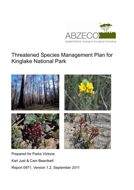
Cover images, clockwise from top left: Fire-affected Mountain Ash <strong>for</strong>est in the Wallaby Creek<br />
Catchment, Swamp Bush Pea, Re-shooting Horny Cone-bush, & Creeping Grevillea.<br />
2
<strong>Threatened</strong> <strong>Species</strong> <strong>Management</strong> <strong>Plan</strong> <strong>for</strong> <strong>Kinglake</strong> <strong>National</strong> <strong>Park</strong>, – V 1.0, September 2001<br />
Table of Contents<br />
1 Summary .........................................................................................................................................6<br />
2 Introduction ......................................................................................................................................8<br />
3 Background .....................................................................................................................................9<br />
3.1 Study area ...............................................................................................................................9<br />
3.1.1 Physiography ..................................................................................................................9<br />
3.1.2 Land<strong>for</strong>ms ......................................................................................................................10<br />
3.2 February 2009 bushfire .......................................................................................................12<br />
Figure 1 – Extent of Study Area and location of monitoring points .............................13<br />
4 Methodology ..................................................................................................................................14<br />
4.1 <strong>Threatened</strong> species and community monitoring .............................................................14<br />
4.2 Flora survey & analysis .......................................................................................................14<br />
5 Key findings ...................................................................................................................................16<br />
5.1 Flora .......................................................................................................................................16<br />
5.2 Fauna .....................................................................................................................................18<br />
6 <strong>Management</strong> guidelines ..............................................................................................................20<br />
6.1 Additional flora and fauna survey ......................................................................................20<br />
6.1.1 Additional flora surveys – conduct flora surveys .....................................................20<br />
6.1.2 Small mammal trapping – conduct mammal surveys .............................................20<br />
6.1.3 Targeted survey <strong>for</strong> Dunnart species – place concrete pavers at selected<br />
sites across the <strong>Park</strong> ...................................................................................................21<br />
6.1.4 Targeted survey <strong>for</strong> arboreal mammals – conduct spot-lighting surveys<br />
across the <strong>Park</strong> .............................................................................................................21<br />
6.1.5 Targeted survey <strong>for</strong> Brush-tailed Phascogale – increase survey ef<strong>for</strong>ts .............21<br />
6.1.6 Pitfall Trapping – establish pitfall lines to allow survey <strong>for</strong> small mammals<br />
and reptiles ....................................................................................................................22<br />
6.1.7 Targeted butterfly surveys – conduct survey <strong>for</strong> butterfly species in 2012 .........22<br />
6.1.8 Targeted bat surveys – survey the <strong>Park</strong> <strong>for</strong> bat species and potential habitat<br />
in 2010 ...........................................................................................................................23<br />
6.1.9 Motion sensor camera surveys – survey <strong>for</strong> fauna across the <strong>Park</strong> using<br />
remote sensor cameras...............................................................................................23<br />
6.2 Biodiversity management and land protection ................................................................23<br />
6.2.1 Pest plant management – engage experienced bushland managers to<br />
control weeds across the <strong>Park</strong>. ..................................................................................23<br />
6.2.2 Biodiversity fences – construct fences around threatened flora populations .....24<br />
6.2.3 Pest animal management – prepare a pest animal strategy and continue to<br />
control feral fauna ........................................................................................................24<br />
6.2.4 Erosion control – continue to monitor and prevent erosion throughout the<br />
<strong>Park</strong> ................................................................................................................................25<br />
6.2.5 Cinnamon Fungus – continue to prevent Cinnamon Fungus from spreading<br />
throughout the <strong>Park</strong> .....................................................................................................25<br />
6.2.6 Nestboxes – install nestboxes throughout the <strong>Park</strong> in areas supporting rare<br />
hollow-dependant fauna ..............................................................................................25<br />
3
<strong>Threatened</strong> <strong>Species</strong> <strong>Management</strong> <strong>Plan</strong> <strong>for</strong> <strong>Kinglake</strong> <strong>National</strong> <strong>Park</strong>, – V 1.0, September 2001<br />
6.2.7 Water quality assessments - conduct water quality assessments throughout<br />
the <strong>Park</strong> ..........................................................................................................................26<br />
6.2.8 <strong>Management</strong> of threatened flora ................................................................................26<br />
6.3 Research guidelines ............................................................................................................26<br />
6.3.1 Investigation of perched watertables and their effect on vegetation<br />
composition ...................................................................................................................26<br />
6.3.2 Wet Forest – vegetation dynamics ............................................................................27<br />
6.3.3 <strong>Threatened</strong> species taxonomy and ecology ............................................................27<br />
6.3.4 The geology of <strong>Kinglake</strong> <strong>National</strong> <strong>Park</strong> ....................................................................27<br />
6.3.5 Fire recruitment study of species of the Proteaceae family ..................................27<br />
6.3.6 The effect of fire intensity on <strong>for</strong>est structure and age class .................................27<br />
6.3.7 The effect of post-fire grazing on vegetation composition .....................................28<br />
7 References ....................................................................................................................................29<br />
Appendix 1. CHANGES & ADDITIONS TO ECOLOGICAL VEGETATION CLASS (EVC)<br />
CLASSIFICATION OF KINGLAKE NATIONAL PARK ...................................................................30<br />
Appendix 1. CHANGES & ADDITIONS TO ECOLOGICAL VEGETATION CLASS (EVC)<br />
CLASSIFICATION OF KINGLAKE NATIONAL PARK ...................................................................30<br />
Appendix 2. ANNOTATION OF SIGNIFICANT VASCULAR FLORA SPECIES OF KINGLAKE<br />
NATIONAL PARK.................................................................................................................................35<br />
Appendix 3. VASCULAR FLORA SPECIES RECORDED IN KINGLAKE NATIONAL PARK 76<br />
Appendix 4. SITES OF BOTANICAL SIGNIFICANCE IN KINGLAKE NATIONAL PARK .......95<br />
1 Wallaby Creek Catchment ..........................................................................................................97<br />
1.1 Mount Disappointment Reference Area ...........................................................................97<br />
1.2 Toorourrong Reservoir ......................................................................................................100<br />
1.3 Wallaby Creek – Poley Creek ..........................................................................................102<br />
1.4 Joey Creek Reference Area .............................................................................................104<br />
1.5 Jack Creek Cascades ........................................................................................................106<br />
1.6 Silver Creek .........................................................................................................................107<br />
1.7 Stony Creek Reference Area ...........................................................................................108<br />
2 SUGARLOAF BLOCK ...............................................................................................................110<br />
2.1 Masons Falls/Running Creek Headwaters .....................................................................110<br />
2.2 Arthurs Creek - Chadds Creek Headwaters ..................................................................112<br />
3 EVERARD BLOCK.....................................................................................................................114<br />
3.1 Broad Gully ..........................................................................................................................114<br />
3.2 Stuart’s Spur – Castella sub-block ..................................................................................117<br />
3.3 Reedy Creek Catchment ...................................................................................................119<br />
3.4 Watsons Creek Headwaters .............................................................................................120<br />
3.5 Heidelberg – <strong>Kinglake</strong> Road .............................................................................................122<br />
3.6 Southern Everard Spur - Black Calf Creek and Wild Dog Creek ...............................124<br />
3.7 Old <strong>Kinglake</strong> Road .............................................................................................................126<br />
3.8 Jehosaphat Gully ................................................................................................................128<br />
3.9 Mt Slide Road – Full and Plenty Creek ...........................................................................129<br />
3.10 Mt Slide – Brocks Spur ......................................................................................................131<br />
4
<strong>Threatened</strong> <strong>Species</strong> <strong>Management</strong> <strong>Plan</strong> <strong>for</strong> <strong>Kinglake</strong> <strong>National</strong> <strong>Park</strong>, – V 1.0, September 2001<br />
3.11 Diamond Creek Headwaters ............................................................................................132<br />
4 WOMBELANO BLOCK .............................................................................................................134<br />
4.1 Captains Creek ...................................................................................................................134<br />
4.2 Yea River .............................................................................................................................136<br />
4.3 Burgan Track.......................................................................................................................137<br />
4.4 Andrews Hill – Island Creek .............................................................................................138<br />
4.5 Hirts Creek – Wombelano Falls .......................................................................................140<br />
5
<strong>Threatened</strong> <strong>Species</strong> <strong>Management</strong> <strong>Plan</strong> <strong>for</strong> <strong>Kinglake</strong> <strong>National</strong> <strong>Park</strong>, – V 1.0, September 2001<br />
1 Summary<br />
The authors were engaged by <strong>Park</strong>s Victoria (PV) to assist with vegetation monitoring and recovery<br />
management in <strong>Kinglake</strong> <strong>National</strong> <strong>Park</strong> following the February 2009 bushfire. The project included<br />
the establishment of vegetation monitoring sites, targeted and random flora survey and assessment<br />
of bushfire impacts. It also included documentation of sites of botanical significance, newly recorded<br />
Ecological Vegetation Classes (EVC’s) and an annotation of significant flora species.<br />
<strong>Kinglake</strong> <strong>National</strong> <strong>Park</strong> occurs in the far western section of the Great Dividing Range and is situated<br />
approximately 60-70 kilometres north-east of Melbourne. The park includes a wide range of<br />
vegetation and habitat types including tall wet <strong>for</strong>ests, rain<strong>for</strong>est, heathy <strong>for</strong>ests and woodland,<br />
extensive dry <strong>for</strong>ests and riparian <strong>for</strong>est. These habitats support an exceptional diversity of flora and<br />
fauna species including many that are rare or threatened in Victoria and Australia.<br />
On the 9 th of February 2009 approximately 90% of the <strong>Park</strong> was burnt in the ‘Black Saturday’<br />
bushfires. Most of the park was burned at extreme intensities, causing severe impacts to many<br />
significant stands of vegetation.<br />
Vegetation monitoring<br />
The vegetation monitoring program conducted during this project documented the immediate<br />
impacts of the bushfire. Seventy two monitoring points were established between March and April,<br />
2009, incorporating the majority of the park’s most significant stands of vegetation. Later in 2009<br />
these sites were re-surveyed during spring and summer to record additional flora species and<br />
ecological changes. A total of nineteen new sites were also established in significant stands of<br />
vegetation that were encountered during surveys in December 2009 and January 2010.<br />
Flora<br />
Floristic data was collected throughout the park between 2009-2011. Survey was concentrated around<br />
monitoring points and in areas that had previously received minimal survey (e.g. Captains Creek,<br />
Yea River and Andrews Hill). During these searches a large number of significant flora records were<br />
collected and an additional 66 species were added to the <strong>Park</strong> flora list. Several rare or unique<br />
vegetation communities were also recorded within the study area <strong>for</strong> the first time. This report also<br />
collates over twenty years of floristic data collected by Cam Beardsell that has previously remained<br />
unpublished.<br />
All flora species of local to national significance or interest (298 species) are discussed in Appendix 2,<br />
including notes on distribution, ecology and management. An updated flora list <strong>for</strong> the <strong>Park</strong> is<br />
provided in Appendix 3. Several newly documented Ecological Vegetation Classes <strong>for</strong> the study<br />
area are described in detail in Appendix 1.<br />
Flora surveys were also undertaken within several of the unburnt reserves in the Goulburn Valley<br />
that are managed out of <strong>Kinglake</strong>. These included Mt Piper, Coolabah (Hughes Creek), Homewood,<br />
Mangalore and Horseshoe Billabong (north & south). During survey of these areas a substantial<br />
number of significant flora species were recorded. Flora species lists <strong>for</strong> each reserve is presented in<br />
Appendix 6 (on disk accompanying this report).<br />
Sites of significance<br />
Sites of botanical significance within the study area have been developed using the methodology of<br />
the Biosites project (NRE 2002). Using this criteria it was found that the study area supports four sites<br />
of <strong>National</strong> significance and twelve sites of State significance. The remaining sites are at least of<br />
regional significance, as they <strong>for</strong>m part of an extensive system of mountain <strong>for</strong>est communities. Key<br />
6
<strong>Threatened</strong> <strong>Species</strong> <strong>Management</strong> <strong>Plan</strong> <strong>for</strong> <strong>Kinglake</strong> <strong>National</strong> <strong>Park</strong>, – V 1.0, September 2001<br />
sites of significance within the study area include Broad Gully, Mt Disappointment Reference Area,<br />
Captains Creek, Yea River and Stuart’s Spur.<br />
<strong>Management</strong> guidelines<br />
In late 2009, a comprehensive set of management guidelines was <strong>for</strong>mulated to aid in post-fire<br />
recovery management.<br />
These guidelines fall into three broad categories:<br />
1. Additional biodiversity survey, including a particular emphasis on fauna to determine the impact<br />
of the fire on threatened species such as Broad-tooth Rat, Spot-tail Quoll, Greater Glider, Yellowbellied<br />
Glider, Dunnart species, Southern-brown Bandicoot and Lace Monitor. It is also<br />
recommended that targeted surveys are undertaken <strong>for</strong> butterflies, arboreal mammals, Eastern<br />
Pygmy Possums and bat species. Further flora surveys are also recommended.<br />
2. Biodiversity management and land protection, including guidelines <strong>for</strong> pest plant management,<br />
biodiversity fencing, pest animal control, enrichment planting, erosion control, controlling the spread<br />
of Cinnamon Fungus, installation of nestboxes, water quality assessments and threatened species<br />
management.<br />
3. Research guidelines, including a range of suggested research projects that would greatly assist in<br />
park management, to be undertaken by tertiary education groups.<br />
7
<strong>Threatened</strong> <strong>Species</strong> <strong>Management</strong> <strong>Plan</strong> <strong>for</strong> <strong>Kinglake</strong> <strong>National</strong> <strong>Park</strong>, – V 1.0, September 2001<br />
2 Introduction<br />
In December 2009, <strong>Park</strong>s Victoria established a post-fire monitoring program across <strong>Kinglake</strong><br />
<strong>National</strong> <strong>Park</strong> (the <strong>Park</strong>) and the Joey Creek, Stony Creek and Mt Disappointment Reference Areas<br />
(the study area). These areas were all variously affected by the February 2009 bushfire. Later in 2009<br />
<strong>Park</strong>s Victoria requested that ABZECO assist with the project by re-assessing monitoring points,<br />
establishing new sites, undertaking flora survey and providing a set of management guidelines.<br />
These works were all undertaken in partnership with and under the guidance of members of <strong>Park</strong>s<br />
Victoria.<br />
This report provides a comprehensive assessment of the botanical values of the study area. It<br />
contains:<br />
Description of geology and land<strong>for</strong>ms.<br />
Analysis of all flora species of local to national significance or interest (298 species).<br />
Sites of significance, including detailed discussion on all sites of state and national<br />
significance.<br />
<strong>Management</strong> guidelines to aid in post-fire recovery.<br />
An updated flora species list, including those recorded by the authors during the current<br />
survey period, previous records of the authors and records from other sources.<br />
Description of several new EVC’s recorded during the current survey period.<br />
The report also includes the results of flora surveys undertaken in the unburnt sections of the <strong>Park</strong> in<br />
the Goulburn Valley, where many significant species were recorded.<br />
8
<strong>Threatened</strong> <strong>Species</strong> <strong>Management</strong> <strong>Plan</strong> <strong>for</strong> <strong>Kinglake</strong> <strong>National</strong> <strong>Park</strong>, – V 1.0, September 2001<br />
3 Background<br />
3.1 Study area<br />
The study area encompasses <strong>Kinglake</strong> <strong>National</strong> <strong>Park</strong> (21 600 ha) and three reference areas, including<br />
the Mt. Disappointment Reference Area (1090 ha), Stony Creek Reference Area (420 ha) and Joey<br />
Creek Reference Area (250 ha). These reserves occur between 60-70 kilometres to the north-east of<br />
Melbourne. The <strong>National</strong> <strong>Park</strong> is divided into three management units, including the Everard Block<br />
in the south-east, the Wombelano Block in the north and the Sugarloaf Block in the west. The<br />
management authority of these lands is <strong>Park</strong>s Victoria. The reference areas are managed by <strong>Park</strong>s<br />
Victoria in partnership with Melbourne Water.<br />
The <strong>Park</strong> boundary is an irregular shape and contains a high perimetre area ratio. It is surrounded by<br />
agricultural and residential lands and State <strong>for</strong>est (including Mt. Robertson State Forest to the north<br />
and Toolangi State Forest to the east).<br />
The study area occurs within two bioregions, with land on the southern side of the Divide occurring<br />
in the Highlands Southern Fall bioregion and land on the northern side occurring within the<br />
Highlands Northern Fall bioregion. The study area occurs within two Catchment <strong>Management</strong><br />
Authority (CMA) regions, with land on the southern side of the Divide (Yarra River catchment)<br />
occurring within the Port Phillip CMA and land on the northern side (Goulburn River catchment)<br />
occurring within the Goulburn Broken CMA.<br />
The geographic positioning of <strong>Kinglake</strong> <strong>National</strong> <strong>Park</strong> at the western end of the Great Divide in<br />
south-central Victoria has created a significant juxtaposition of flora and fauna species. It is one of the<br />
few <strong>National</strong> <strong>Park</strong>s in the State to support elements of north, east, west and southern Victoria.<br />
The study area is depicted in Figure 1.<br />
3.1.1 Physiography<br />
The <strong>Park</strong> occupies four major geological <strong>for</strong>mations. These include Silurian mudstone/siltstone,<br />
Lower Devonian mudstone/siltstone, Devonian granodiorite and Quaternary recent stream alluvium.<br />
These <strong>for</strong>mations are discussed below.<br />
Lower Devonian siltstone<br />
The land surface of the <strong>Park</strong> <strong>for</strong>med part of a marine sedimentary basin during the Devonian and<br />
Silurian periods, between 446 and 367 million years BP (Be<strong>for</strong>e Present). This surface was uplifted<br />
during the Cretaceous period (140-65 million years BP), which over time led to the <strong>for</strong>mation of the<br />
current topography and drainage systems. Throughout most of the <strong>Park</strong> area the Silurian <strong>for</strong>mation<br />
is overlain by the Devonian, except in parts of the Everard Block, Wombelano Blocks and at Mt.<br />
Disappointment. The Devonian surface includes a range of soil and vegetation types that vary in<br />
relation to aspect and rainfall.<br />
Silurian mudstone/siltstone<br />
Erosion of the overlying Devonian layers has led to exposure of older Silurian mudstone/siltstone in<br />
two narrow fingers running north-south through the Everard Block and a small section of the<br />
Wombelano Block. The first finger to the west extends from St. Andrews and runs directly one<br />
kilometre each side of the Heidelberg-<strong>Kinglake</strong> Road. The second finger to the east is approximately<br />
three kilometres wide and extends west of the township of Steels Creek to just north of Mountain<br />
Creek. This <strong>for</strong>mation supports flora species and vegetation communities that are not found<br />
9
<strong>Threatened</strong> <strong>Species</strong> <strong>Management</strong> <strong>Plan</strong> <strong>for</strong> <strong>Kinglake</strong> <strong>National</strong> <strong>Park</strong>, – V 1.0, September 2001<br />
elsewhere within the <strong>Park</strong>, including Wine-lip Spider Orchid, Blue Fairies, Black’s Goodenia, Red<br />
Ironbark, Tussock Sedge, Grey Everlasting, Sweet Hound’s Tongue, Lightwood and Red Box. Valley<br />
slopes dominated by Yellow Box and Candlebark are also restricted to this <strong>for</strong>mation in the far south.<br />
The Silurian <strong>for</strong>mations within the <strong>Park</strong> support biota that have affinities with the Silurian foothills<br />
between Christmas Hills and Eltham.<br />
Devonian granodiorite<br />
Devonian granodiorite is restricted to the Mt Disappointment Reference area and comprises the<br />
summit and slopes of Mt. Disappointment. This <strong>for</strong>mation has intruded Lower Devonian and<br />
Silurian marine sediments and is the only one of its type within the area. Granodiorite supports tall<br />
Mountain Ash <strong>for</strong>ests on the plateau, Myrtle Beech-Sassafras rain<strong>for</strong>ests along sheltered gullies and<br />
Woolly Tea-tree scrub along several creeks. The lower slopes support tall Messmate <strong>for</strong>ests. Rocky<br />
outcrops are relatively common. Granitic sediments have been eroded from the <strong>for</strong>mation and<br />
deposited downstream by the Plenty River and Jack Creek.<br />
Quaternary recent stream alluvium<br />
Recent stream alluvium is distributed along upper and lower terraces of riparian systems within the<br />
<strong>Park</strong>. The greatest development occurs along the lower, flatter sections of primary rivers, including<br />
the Yea River adjacent to the Melba Highway and the lower Plenty River. The <strong>for</strong>mation is less<br />
developed along creeks at higher elevations due to the steepness of the terrain and resulting higher<br />
stream energy. The terraces are <strong>for</strong>med by the deposition of silt, sand and gravel from higher land<br />
surfaces between 10,000 years ago to the present. The Plenty River system includes deposition of<br />
granite sediments originating from Mt. Disappointment, which has likely influenced the<br />
development of several rare vegetation communities.<br />
The terraces support riparian <strong>for</strong>est alliances that are dominated by Manna Gum in lower, exposed<br />
sections (Plenty River) and Mountain Grey Gum-Manna Gum at higher elevations (Yea River). The<br />
terraces along the Plenty and Yea Rivers are dissected by numerous floodways and <strong>for</strong>mer channels<br />
which support rare sedgeland swamp communities.<br />
3.1.2 Land<strong>for</strong>ms<br />
The <strong>Park</strong> is situated in the mountains and foothills of the western section of the Great Dividing<br />
Range. The most prominent land<strong>for</strong>m features are the <strong>Kinglake</strong> Plateau in the eastern section and the<br />
Mt Disappointment Plateau in the western section. The plateaus are uplifted sections of ancient<br />
coastal plains that have been eroded to relatively flat land surfaces. Dissected foothills extend to the<br />
north and south. The Melbourne sunklands occurs to the south whilst the Goulburn Valley occurs to<br />
the north. The land<strong>for</strong>m features of each section of the <strong>Park</strong> are described below.<br />
Everard Block<br />
The Everard Block is dominated by rocky mountain spurs and ridges dissected by numerous<br />
drainage systems. The entire block, excepting the far north-east corner, occurs on the southern fall of<br />
the Great Divide.<br />
The northern section of the block occurs on the southern section of the <strong>Kinglake</strong> Plateau, which<br />
contains the headwaters of several creeks that flow to the south. These include the Dry Creek,<br />
Pinchgut Creek, Full & Plenty Creek and Jehosaphat Creek. The headwaters of these creeks are very<br />
steep, face due south and support fern gullies and localised stands of Mountain Ash. The southern<br />
section of the <strong>Park</strong> contains the twin headwaters of the Watson’s Creek which begin on the eastern<br />
side of Mt Everard. A small section of the Wild Dog Creek is contained within the far south-west<br />
corner of the <strong>Park</strong>.<br />
10
<strong>Threatened</strong> <strong>Species</strong> <strong>Management</strong> <strong>Plan</strong> <strong>for</strong> <strong>Kinglake</strong> <strong>National</strong> <strong>Park</strong>, – V 1.0, September 2001<br />
The Everard Block contains several prominent hills that include Mt Everard (450m), Mt Jerusalem,<br />
Mt Slide (450m) and Mt Beggary (490m). These hills have skeletal rocky soils which support dry<br />
heathy <strong>for</strong>ests. The sheltered sides of hills and spurs support more mesic <strong>for</strong>est types and there is<br />
often a sharp transition from dry <strong>for</strong>ests on exposed slopes to Bracken-shrub dominated sheltered<br />
hill slopes.<br />
At Broad Gully, run-off and groundwater seepage from the surrounding steep spurs and hills drains<br />
poorly due to the flat valley <strong>for</strong>mation and an underlying clay pan. A similar effect has occurred at<br />
Stuart’s Spur in the far northern-eastern section of the block, where an underlying clay pan has<br />
created a perched watertable. At both sites these drainage characteristics has led to the development<br />
of rare damp heathy woodland and <strong>for</strong>ests, which support a range of rare and disjunct biota.<br />
Wombelano Block<br />
The entire Wombelano Block occurs on the northern fall of the Great Divide. The dominant feature of<br />
the eastern Wombelano Block is Andrew’s Hill, which contains the headwaters of numerous gullies<br />
that meet the Yea River to the east and the Island Creek to the west. Sheltered gullies on the southern<br />
face support wet <strong>for</strong>est gullies and small stands of Mountain Ash.<br />
The Yea River runs from south to north in the far eastern portion of the Block. This river is perennial<br />
and contains rocky runs, riffles and glides. Extensive alluvial terraces occur adjacent to the river.<br />
These are dissected by numerous floodways, <strong>for</strong>mer channels and swampy depressions.<br />
The headwaters of the Captain’s Creek occur in the western section of the block. This creek runs from<br />
east-west and has carved a prominent valley. The northern slopes above the creek are very steep<br />
whilst the southern slopes grade abruptly from steep hills down onto extensive gentle slopes. The<br />
steep slopes feed run-off and groundwater seepage onto the gentle slopes below, which has led to the<br />
development of rare damp heathy <strong>for</strong>est <strong>for</strong>mations.<br />
The Hirts Creek is the next drainage system to the south, which eventually flows into the Island<br />
Creek. The Wombelano Falls occur along the western section of the creek, which is a steep twenty<br />
metre high waterfall that includes rocky outcrops and small escarpments. Wet <strong>for</strong>est vegetation has<br />
developed at the protected base of the falls, partly influenced by the splash zone.<br />
Other features of the Wombelano Block include the rocky ridgelines and spurs in the northern<br />
section. The highest point in this section is Beales Hill, in the far north-east of the <strong>Park</strong>.<br />
Mt Disappointment Block<br />
The Mt Disappointment Block is dominated by a large granitic intrusion which reaches its highest<br />
point on the summit of Mt Disappointment (750 m), just west of the <strong>Park</strong> boundary. The plateau<br />
area supports extensive Mountain Ash Forests while the lower, exposed slopes are dominated by<br />
Messmate, Mountain Grey Gum and Peppermints. The majority of the Block occurs on the northern<br />
fall of the Great Divide and includes the headwaters of several tributaries of the King Parrot Creek.<br />
These include the Silver, Wallaby and Poley Creeks. The headwaters of the Wallaby Creek support<br />
rain<strong>for</strong>est communities dominated by Sassafras. The remainder of the Block falls to the south and<br />
includes the twin headwaters of the Plenty River. The headwaters are deeply incised, and prior to the<br />
2009 bushfire supported the oldest and best developed rain<strong>for</strong>est in the <strong>Park</strong>.<br />
Sugarloaf Block<br />
The northern boundary of the Sugarloaf Block runs along the southern fall of the <strong>Kinglake</strong> Plateau.<br />
This encompasses the headwaters of several streams including the Running Creek in the far west and<br />
the Arthur’s and Diamond Creeks to the east. The Running Creek has carved deep gorges into<br />
Devonian sediments, creating Mason’s Falls and the most extensive escarpments and cliffs within the<br />
<strong>Park</strong>. This has exposed fossil bearing sediments which contain Graptolites. The upper sections of the<br />
11
<strong>Threatened</strong> <strong>Species</strong> <strong>Management</strong> <strong>Plan</strong> <strong>for</strong> <strong>Kinglake</strong> <strong>National</strong> <strong>Park</strong>, – V 1.0, September 2001<br />
Diamond and Arthur’s Creek support fern gullies and wet <strong>for</strong>est vegetation. The Block contains Mt<br />
Sugarloaf (570m), a prominent spur that can be seen from parts of the inner city of Melbourne.<br />
3.2 February 2009 bushfire<br />
In February 2009, prolonged dry conditions and an extensive heat wave accumulated in one of the<br />
most severe bushfire events in Victorian history, since referred to as ‘Black Saturday’. The largest and<br />
most devastating of these bushfires was the Kilmore East Fire Complex, which burnt over 330,000<br />
hectares of land to the north and east of Melbourne. This included approximately 90% of <strong>Kinglake</strong><br />
<strong>National</strong> <strong>Park</strong> (the <strong>Park</strong>) and the entire Mt Disappointment Reference Area, Stony Creek Reference<br />
Area and Joey Creek Reference Area.<br />
The bushfire first entered the <strong>Park</strong> north-west of Toorourrong Reservoir, from a spot-over from fires<br />
in the Kilmore area. Driven by north-westerly winds the fire headed towards the town of St Andrews<br />
be<strong>for</strong>e a strong south-westerly change turned the flank of the fire towards the north-east. This<br />
created a massive fire front that swept through large parts of the <strong>Park</strong> and reference areas within<br />
several hours, impacting numerous stands of significant vegetation.<br />
12
<strong>Threatened</strong> <strong>Species</strong> <strong>Management</strong> <strong>Plan</strong> <strong>for</strong> <strong>Kinglake</strong> <strong>National</strong> <strong>Park</strong>, – V 1.0, September 2001<br />
Figure 1 – Extent of Study Area and location of monitoring points<br />
13
<strong>Threatened</strong> <strong>Species</strong> <strong>Management</strong> <strong>Plan</strong> <strong>for</strong> <strong>Kinglake</strong> <strong>National</strong> <strong>Park</strong>, – V 1.0, September 2001<br />
4 Methodology<br />
4.1 <strong>Threatened</strong> species and community monitoring<br />
Vegetation monitoring points were established throughout the <strong>Park</strong> in March 2009 with the aim of<br />
assessing bushfire impacts on threatened plant species and communities. A total of 91 sites were<br />
established across the <strong>Park</strong>, including all known sites of biological significance and representations of<br />
every Ecological Vegetation Class.<br />
Site selection was in<strong>for</strong>med by extensive survey that has been undertaken throughout the <strong>Park</strong> over<br />
several decades. Data from previous studies (Biosites, Neroc Report) was analyzed to aid in site<br />
selection. Sites were chosen if they were known to contain significant biological values such as<br />
threatened flora species populations, rare or threatened vegetation communities or habitat <strong>for</strong> rare<br />
flora or fauna. In addition, at least one site was selected in each Ecological Vegetation Class occurring<br />
within the <strong>Park</strong> to provide a comprehensive assessment of habitat types. Some sites were selected if<br />
they demonstrated particular burning patterns, which may prove important <strong>for</strong> monitoring and<br />
understanding the effect of fire intensity or behavior on vegetation stands in future.<br />
The area of each site varied depending on its characteristics. In general a site encompassed the<br />
entirety of a significant species population or community stand, or an area large enough to represent<br />
this value. On average, most sites were approximately one hectare in size.<br />
The data collected within each site was primarily related to flora/habitat values and fire behavior.<br />
Botanical data collected included the dominant canopy species, significant flora species and<br />
recruitment/regeneration observations. Fire behavior data collected included fire intensity (gauged<br />
by observing the flame height and intactness of tree crown), observations of how much of the site<br />
had been burnt, the direction that the fire had burned from and the approximate time of day that the<br />
site was burnt. Fire behavior data became difficult to collect during the latter assessments in late 2009<br />
and early 2010, as the traces of the fire were partly obscured by rapidly recovering vegetation.<br />
Consequently, data collected <strong>for</strong> these sites was less detailed, and mostly included a rough estimate<br />
of fire intensity.<br />
Seventy two of the sites were established between March and April, 2009. The majority of the most<br />
significant of these sites were then re-visited during spring 2009 and summer 2009/10 to document<br />
changes and survey <strong>for</strong> rare flora. An additional nineteen sites were established during December<br />
2009 and January 2010.<br />
The location of all monitoring points is presented in Figure 1.<br />
All data was entered from field sheets into an Excel spreadsheet, which is contained within<br />
Appendix 5 of this report (supplied on CD).<br />
4.2 Flora survey & analysis<br />
Flora surveys were conducted by the authors prior to the current study, in a period ranging from the<br />
late 1980’s to the present (mostly C.B) In addition, a large number of additional records were<br />
obtained during the current study period either incidentally while assessing monitoring sites or<br />
during targeted surveys. Targeted surveys were conducted in specific areas of the <strong>Park</strong> which were<br />
known to support species-rich vegetation (e.g. Captains Creek). This involved searching microhabitats<br />
within sites and recording any species of significance.<br />
14
<strong>Threatened</strong> <strong>Species</strong> <strong>Management</strong> <strong>Plan</strong> <strong>for</strong> <strong>Kinglake</strong> <strong>National</strong> <strong>Park</strong>, – V 1.0, September 2001<br />
All flora species of regional to <strong>National</strong> significance (and some local) were analyzed based on the<br />
results of surveys (298 taxa). The analysis includes notes on distribution, ecology and management.<br />
15
<strong>Threatened</strong> <strong>Species</strong> <strong>Management</strong> <strong>Plan</strong> <strong>for</strong> <strong>Kinglake</strong> <strong>National</strong> <strong>Park</strong>, – V 1.0, September 2001<br />
5 Key findings<br />
The current study investigated the extent of bushfire impacts and documented a range of flora<br />
species and communities previously unrecorded within the <strong>Park</strong>. The key findings are discussed<br />
below.<br />
5.1 Flora<br />
Bushfire impacts<br />
Preliminary findings suggest that the bushfire had a severe impact on some stands of vegetation<br />
while benefiting others. Considering that most of the <strong>Park</strong> had not been affected by fire <strong>for</strong> many<br />
decades, in many areas the occurrence of fire stimulated a high level of recruitment, growth and<br />
flowering. Many rare flora species recruited vigorously and have reached some of their largest<br />
population numbers in decades.<br />
However, the extreme intensity and lack of ‘patchiness’ that characterized most of the fire event<br />
caused detrimental impacts to many stands of significant vegetation. The most devastated areas were<br />
those that burned during the most intense period of the fire following the south-west wind change.<br />
During this time, the bushfire burned the entire Everard Block, Sugarloaf Block and Joey Creek<br />
Reference Area within two hours, where intense heat and wind combined with the hilly topography<br />
created severe fire storms. In many cases the fire was so severe on the ridges and hills that many<br />
eucalypt trees were killed or the fruit of trees was consumed (Mt Sugarloaf, Mt Everard, Mt<br />
Beggary). The fire tunneled up gullies at extreme intensities and had a serious impact on many<br />
riparian corridors. Very few areas were unaffected by the fire, leaving minimal refuge <strong>for</strong> flora and<br />
fauna.<br />
In the Mt Disappointment Reference Area, nearly all stands of rain<strong>for</strong>est and wet <strong>for</strong>est vegetation<br />
were burnt at high intensity, a rare and devastating event. This severely affected ancient Myrtle<br />
Beech groves in the Plenty River Headwaters that had probably not been affected by fire <strong>for</strong> over<br />
three hundred years. It killed most stands of Mountain Ash trees on the Mt Disappointment plateau<br />
(including some of the oldest and tallest Mountain Ash in Australia) and up to 90% of the population<br />
of Southern Sassafras Atherosperma moschatum, a key rain<strong>for</strong>est canopy species. The burning of all<br />
rain<strong>for</strong>est within the study area has very likely temporarily eliminated many mesic-dependant flora<br />
species from the <strong>Park</strong>, particularly rare ferns such as Slender Tree Fern, Small Fork-fern, Oval Forkfern,<br />
Weeping Spleenwort, Gypsy Fern and Narrow Filmy-fern. It also greatly modified rain<strong>for</strong>est<br />
habitat by removing deep humous layers and canopy cover, so that it is unlikely that many<br />
rain<strong>for</strong>est-dependant flora will re-colonise in the near future. The post-fire conditions are likely to<br />
favour wet sclerophyll <strong>for</strong>est species over rain<strong>for</strong>est flora, exerting additional pressures on the latter<br />
group over the coming years. The early succession vegetation is also likely to be more fire-prone than<br />
the pre-fire stands (due to increased abundance of flammable species), increasing the likelihood of<br />
further fires over the next century.<br />
The fire burnt other sections of the <strong>Park</strong> later in the evening when temperatures and wind speeds<br />
had reduced and consequently burnt at much lower intensity. This included large parts of the<br />
Wombelano Block (including areas that had burnt in 2006) and the Stony Creek Reference Area.<br />
Some of these areas burned at lower intensity due to the effect of recent (last three years) prescribed<br />
burning, which had reduced fuel loads.<br />
Survey results<br />
16
<strong>Threatened</strong> <strong>Species</strong> <strong>Management</strong> <strong>Plan</strong> <strong>for</strong> <strong>Kinglake</strong> <strong>National</strong> <strong>Park</strong>, – V 1.0, September 2001<br />
During the survey period, a high diversity of significant flora species were added to the <strong>Park</strong> flora<br />
list, including a range of rare and/or disjunct species. A total of 64 additional flora species were<br />
recorded during the survey period and an additional 58 species were added to the <strong>Park</strong> list from<br />
previous records of the authors (mostly CB) and from records collected by Beauglehole (1983).<br />
Several rare or unique floristic assemblages were also recorded within the study area <strong>for</strong> the first<br />
time.<br />
A key finding of the study was the documentation of unique expressions of wetland vegetation that<br />
surround Toorourrong Reservoir. These areas were found to support an exceptional diversity of<br />
significant flora species, including Swamp Millet (largest population in region, only known from<br />
several other sites regionally), Globe Kyllinga (only record south of the Seymour area), Short Waterstarwort<br />
(probably the largest population in Victoria of this vulnerable species), Showy Willow-herb<br />
(one of the largest populations in the region, only population in north-east Melbourne), Austral<br />
Ladies Tresses (one of the largest populations in Victoria), Slender Spike-sedge (only known<br />
population in north-east Melbourne), Branching Rush , Varied Water-milfoil, Running Marsh-flower,<br />
Wing Pennywort and Small River Buttercup. The reservoir and lower Plenty River support several<br />
distinct wetland assemblages, including the fringing vegetation which appears to be a modified<br />
expression of the vegetation that would have occurred at the site prior to the building of the reservoir<br />
in the late 1800’s. These stands are most attributable to EVC Swampy Woodland/Swampy Riparian<br />
Woodland, but could probably be considered unique variants (no comparable examples known). A<br />
treeless swamp occurring just upstream of the junction of the Toorourrong Reservoir is most<br />
attributable to EVC Wet Verge Sedgeland and has strong affinities with EVC Forest Creekline Sedge<br />
Swamp of the eastern highlands. This floristic community of Wet Verge Sedgeland is very rare and is<br />
currently not known from any other examples. The lower sections of the Plenty River support rare<br />
variants of EVC Riparian Forest Wetland.<br />
The entire Toorourrong section of the <strong>Park</strong> was burnt during the 2009 bushfire. Although the<br />
wetland vegetation initially responded positively with increased growth, germination and flowering,<br />
several large rain events in the first year after the fire eroded large quantities of silt from the<br />
surrounding ranges into the reservoir, partly blanketing the fringing wetland vegetation. The extent<br />
of impacts of this process is yet to be determined, but it is likely to stress some plant species and<br />
encourage the growth of weeds. Aquatic vegetation (particularly Eel Grass) has been greatly<br />
impacted, with <strong>for</strong>mer meadows now buried under tonnes of ash and silt.<br />
The Yea River and its floodplain were found to support highly significant vegetation stands (all of<br />
which were burned in the 2009 bushfire). These included along the river and its banks where there<br />
are scattered small patches of Forest Sedge (rare and disjunct from montane <strong>for</strong>est to the east) as well<br />
as Short Water-starwort (large populations of this vulnerable species), Braided Water-ribbons (major<br />
disjunction from eastern Victoria) and Butterfly Willow-herb (disjunct from montane and sub-alpine<br />
habitats). Some outstanding examples of sedgeland communities occur in association with<br />
abandoned channels of the river along the floodplain, which are most attributable to the rare EVC<br />
Riparian Forest Wetland. These sedgelands support a range of significant flora including Short Bentgrass<br />
(disjunct from sub-alpine habitats), Southern Swamp Wallaby Grass, Square Twig-sedge and<br />
Glandular Brooklime (all of which are very rare in the study area).<br />
Other significant flora species that were recorded <strong>for</strong> the first time within the study area include<br />
Blue-spike Milkwort at Broad Gully (disjunct from near-coastal habitats), Tufted Lobelia from Road<br />
15 (not previously recorded in the hills north of Melbourne), Tall Shaggy-pea from Stuart’s Spur<br />
(disjunct from montane habitats to the east), Hill Xanthosia from above Captains Creek (disjunct<br />
from near-coastal habitats) as well as Narrow-leaf Logania (disjunct from west Gippsland),<br />
Grampians Dwarf Boronia (disjunct from the Grampians area), Sickle Greenhood, Sharp Greenhood,<br />
17
<strong>Threatened</strong> <strong>Species</strong> <strong>Management</strong> <strong>Plan</strong> <strong>for</strong> <strong>Kinglake</strong> <strong>National</strong> <strong>Park</strong>, – V 1.0, September 2001<br />
Thyme Spurge, Curved Rice Flower (Pimelea curviflora var. aff. subglabrata), Long-style Bitter-cress,<br />
Forest Bitter-cress, Gunyang, Swamp Mazus, Grey Guinea-flower, Graceful Fescue and Forest<br />
Blown-grass.<br />
During spring surveys in 2010 and 2011, a range of additional flora species and vegetation stands<br />
were recorded throughout the <strong>Park</strong>. This included unburnt, extensive and intact examples of several<br />
vegetation communities in the far south of the <strong>Park</strong>, between Reedy Creek and Buttermans Track.<br />
These unburnt sites provide a reference <strong>for</strong> vegetation condition prior to the 2009 bushfire which will<br />
be important <strong>for</strong> future vegetation monitoring.<br />
The impact of the bushfire on significant sites within the study area is discussed in detail <strong>for</strong> each of<br />
the vegetation monitoring points in Appendix 5.<br />
5.2 Fauna<br />
Bushfire impacts<br />
There can be no doubt that the 2009 bushfire event had a significant impact on many fauna species,<br />
as in most cases the fire spread extremely rapidly and left very minimal areas of refuge. The species<br />
that are likely to have been most impacted are those that were already of localised occurrence prior<br />
the event such as Spot-tail Quoll and Yellow-bellied Glider. If localised populations of these species<br />
were eliminated then it may be many years be<strong>for</strong>e they are able to re-colonise from other areas of<br />
suitable habitat. The fire consumed many large-old trees and ground habitat, which is likely to have<br />
impacted fauna species such as Brush-tailed Phascogale, Greater Glider and <strong>for</strong>est owls (particularly<br />
Sooty Owl). Even if these species survived the initial fire event, there was minimal area of unburnt<br />
refuge available and so some animals would have struggled to find food or shelter in the following<br />
months. Targeted surveys are required to determine the extent of impacts on fauna species.<br />
There is particular concern that the Brush-tailed Phascogale has declined substantially within the<br />
study area since the 2009 bushfire. It is recommended that further trapping sites be established<br />
within <strong>Kinglake</strong> <strong>National</strong> <strong>Park</strong> in burnt and unburnt sections, to monitor population recovery. This<br />
would also allow research to be undertaken to gain a greater understating on the effect of fire on this<br />
threatened species.<br />
Survey results<br />
Although no fauna survey was undertaken during this study, some significant incidental<br />
observations were recorded. The extensive tracts of recently burnt <strong>for</strong>est attracted several regionally<br />
rare bird species that are normally of sparse occurrence within the study area. This included:<br />
large congregations of White-browed and Masked Woodswallows, which roosted and nested<br />
within the study area <strong>for</strong> several months over spring and summer.<br />
Rufous Song-larks were very common throughout some areas of the study area, particularly<br />
around Toorourrong Reservoir and along the <strong>Kinglake</strong> Plateau.<br />
Blue-winged Parrots were observed nesting in the vicinity of Toorourrong Reservoir, a<br />
species that is very rare in north-east Melbourne.<br />
A Spotted Quail-thrush was observed on one occasion at Broad Gully, an encouraging sign<br />
that these rare birds have not been too severely impacted by the fire event.<br />
Mass flowering of Grass Tree species (Xanthorrhoea minor and Xanthorrhoea australis) attracted<br />
many nectar feeding birds, including the regionally rare Tawny-crowned Honeyeater and<br />
Purple-crowned Lorikeet.<br />
18
<strong>Threatened</strong> <strong>Species</strong> <strong>Management</strong> <strong>Plan</strong> <strong>for</strong> <strong>Kinglake</strong> <strong>National</strong> <strong>Park</strong>, – V 1.0, September 2001<br />
On one occasion a nesting White-throated Nightjar was observed below the Captains Creek<br />
Road, in an area that was burnt in 2006.<br />
An unexpected find were several sightings of Red-necked Wallaby along Road 14 in the Mt<br />
Disappointment Reference Area, a species that is very rare in the Melbourne area.<br />
In spring 2010, a Bright Copper Butterfly was recorded in lowland <strong>for</strong>est south of Reedy<br />
Creek. This species is probably of rare occurrence within the park. A Red-capped Robin was<br />
recorded at Broad Gully, the first record of this regionally rare bird <strong>for</strong> the <strong>Park</strong>.<br />
19
<strong>Threatened</strong> <strong>Species</strong> <strong>Management</strong> <strong>Plan</strong> <strong>for</strong> <strong>Kinglake</strong> <strong>National</strong> <strong>Park</strong>, – V 1.0, September 2001<br />
6 <strong>Management</strong> guidelines<br />
<strong>Management</strong> guidelines have been <strong>for</strong>mulated following extensive survey of the <strong>Park</strong> area over<br />
many years. The guidelines fall into three broad categories: additional biodiversity surveys;<br />
biodiversity management and land protection; and research guidelines.<br />
6.1 Additional flora and fauna survey<br />
There is currently uncertainty regarding the post-fire distribution of many rare fauna and flora<br />
species within the <strong>Park</strong>. Further surveys should be undertaken to establish core areas <strong>for</strong><br />
management. These should include targeted survey <strong>for</strong> fauna and additional spring surveys <strong>for</strong> flora.<br />
Some of the surveys could be implemented by TAFE or university groups with assistance from <strong>Park</strong>s<br />
Victoria staff and regional experts, while other surveys will require the assistance of professional<br />
ecologists.<br />
6.1.1 Additional flora surveys – conduct flora surveys<br />
Further surveys should be undertaken throughout the <strong>Park</strong> to search <strong>for</strong> significant plant species.<br />
Surveys should include particular ef<strong>for</strong>t in areas of high plant diversity such as at Broad Gully,<br />
Stuart’s Spur, Yea River, Mason’s Falls and Captains Creek. They should include targeted searches<br />
<strong>for</strong> taxa that have previously been recorded within the <strong>Park</strong> but that were not located during the<br />
current survey, including the Green Leek-orchid, Tangled Pseudanthus, Cockspur Flower, Fairy<br />
Lanterns, Summer Spider-orchid, Purple Eyebright, Slender Beard-orchid, Dainty Bird-orchid,<br />
Midget Greenhood and Tree Geebung. These species may be at risk from grazing pressure,<br />
competition with weeds and other factors, and must be located so they can be subject to recovery<br />
management if required.<br />
Although the recently burnt areas of the <strong>Park</strong> are currently the highest priority, several of the<br />
unburnt reserves managed by <strong>Park</strong>s Victoria have received only limited survey and would greatly<br />
benefit from further study. Many of these reserves were assessed during the current project, but<br />
mostly during summer when many plant species are not detectable. The unburnt reserves of highest<br />
priority include the Coolabah, Mt Piper and Mangalore Reserves. It is likely that one day spent<br />
within each reserve would be sufficient to add a variety of significant species to the current park list.<br />
Experienced botanists should be engaged to complete these works.<br />
6.1.2 Small mammal trapping<br />
Small mammal trapping should be conducted throughout the <strong>Park</strong> to determine the impacts of the<br />
fire on several rare fauna species, including the Broad-tooth Rat, Southern Brown Bandicoot and<br />
Dusky Antechinus. The early to mid succession stages offer a valuable opportunity to conduct fauna<br />
survey, as some fauna species reach their highest population numbers during this time.<br />
One individual Broad-tooth Rat was recorded in the Mt Disappointment Reference Area by <strong>Park</strong>s<br />
Victoria staff in the early 2000’s. This is the only sighting of this threatened species within the <strong>Park</strong>,<br />
and further survey <strong>for</strong> this species is of high priority. The survey should include up to a week of<br />
trapping using steel Elliot Traps at several locations throughout the <strong>Park</strong>. These locations should<br />
include sites on Road 3 where the previous animal was recorded, in sedgelands adjacent to the Yea<br />
River and at the Poley Creek Tea-tree Swamp on Road 4.<br />
20
<strong>Threatened</strong> <strong>Species</strong> <strong>Management</strong> <strong>Plan</strong> <strong>for</strong> <strong>Kinglake</strong> <strong>National</strong> <strong>Park</strong>, – V 1.0, September 2001<br />
The Swamp Rat was previously recorded in the <strong>Park</strong> in the 1990’s in sedgelands along the Plenty<br />
River upstream of Toorourrong Resevoir. Trapping shoud be conducted within this area to<br />
determine the post-fire status of this species.<br />
Trapping should also be conducted at Broad Gully where the White-footed Dunnart and Southern<br />
Brown Bandicoot have previously been recorded and at Captain’s Creek where the Southern Brown<br />
Bandicoot has been recorded.<br />
The results of any trapping are likely to be critical <strong>for</strong> determining post-fire refuges and core areas <strong>for</strong><br />
these threatened species within the <strong>Park</strong>. This project could possibly be undertaken by an<br />
educational group with assistance from <strong>Park</strong>s Victoria staff and regional experts.<br />
6.1.3 Targeted survey <strong>for</strong> Dunnart species<br />
The White-footed Dunnart has previously been recorded within the <strong>Park</strong> at Broad Gully. The<br />
Common Dunnart has not been recorded from the <strong>Park</strong> but is predicted to occur in areas of Grassy<br />
Dry Forest in the southern section of the Everard block.<br />
During 2009, grids of concrete pavers were set out at several locations to provide habitat and allow<br />
survey <strong>for</strong> Dunnart species. This included in Damp Heathy Woodland at Broad Gully and in Grassy<br />
Dry Forest near the Watsons Creek Track. In 2010, an additional paver grid was set out in Grassy Dry<br />
Forest off Dinsdale Road in the far southern section of the <strong>Park</strong> by <strong>Park</strong>s Victoria staff.<br />
Continued monitoring of these paver grids should be undertaken to search <strong>for</strong> Dunnart species.<br />
6.1.4 Targeted survey <strong>for</strong> arboreal mammals – conduct spot-lighting surveys<br />
across the <strong>Park</strong><br />
Prior to the 2009 fire, the Greater Glider was widespread and relatively common within the <strong>Park</strong>. The<br />
Yellow-bellied Glider was rare and in recent years had only been recorded once in the Mt<br />
Disappointment Reference area and occasionally along the Island Creek. Feed trees were also<br />
observed in the 1990’s along the Hirt’s and Captains Creek.<br />
Both of these arboreal species were probably badly affected by the 2009 bushfire. The fire left<br />
minimal refuge areas and burnt out many hollow bearing trees. If animals did survive the immediate<br />
fire event, there is likely to have been a high mortality in following months due to lack of refugia and<br />
food resources. Beside some recent sightings of Greater Glider in the <strong>Kinglake</strong> East reserve and<br />
elsewhere, there is no firm data to determine what kind of impact the fire has had on these species.<br />
A spotlighting survey should be undertaken throughout the <strong>Park</strong> targeting arboreal species. The<br />
Captains, Hirts and Island Creeks and Yea River should be targeted <strong>for</strong> Yellow-bellied Glider whilst<br />
suitable tall <strong>for</strong>est should be targeted <strong>for</strong> Greater Glider. The project should involve several weeks of<br />
survey time and the results should be presented to <strong>Park</strong>s Victoria upon completion.<br />
This project could possibly be undertaken by an educational group with assistance from <strong>Park</strong>s<br />
Victoria staff and regional experts.<br />
6.1.5 Targeted survey <strong>for</strong> Brush-tailed Phascogale – increase survey ef<strong>for</strong>ts<br />
There is particular concern that the Brush-tailed Phascogale has declined substantially within the<br />
study area since the 2009 bushfire. During trapping surveys conducted within the Everard Block by<br />
DSE and <strong>Park</strong>s Victoria since that time, no individuals have been recorded. This is likely due to the<br />
intensity of the fire (which could have killed many animals) and the reduction in habitat values that<br />
has occurred. Many of the few hollow-bearing trees remaining were consumed by the fire, severely<br />
reducing habitat. In combination with reduction in cover, this has made animals more vulnerable to<br />
21
<strong>Threatened</strong> <strong>Species</strong> <strong>Management</strong> <strong>Plan</strong> <strong>for</strong> <strong>Kinglake</strong> <strong>National</strong> <strong>Park</strong>, – V 1.0, September 2001<br />
predation (particularly by foxes). Invertebrate food resources are also likely to be greatly reduced <strong>for</strong><br />
several years due to reduction of old, peeling bark and rotting tree stumps.<br />
The Brush-tailed Phascogale has also declined at the One Tree Hill and Rifle Range Reserves<br />
(Northern Reserves) to the south since fuel reduction burns were conducted there in 2005-06<br />
(reduction in trapping rates of up to 80%). These findings suggest that the species is extremely fire<br />
sensitive. Considering that the Northern Reserves and <strong>Kinglake</strong> <strong>National</strong> <strong>Park</strong> support up to 30% of<br />
the north-east Melbourne population (the most genetically diverse population in Victoria), the<br />
species is likely to have been greatly impacted across its range.<br />
It is recommended that further trapping sites be established within <strong>Kinglake</strong> <strong>National</strong> <strong>Park</strong> in burnt<br />
and unburnt sections, to monitor population recovery. This would also allow research to be<br />
undertaken to gain a greater understanding on the effect of fire on the species. Further trapping sites<br />
should be established in the southern Everard Block, in areas that were not burned in 2009.<br />
This project should be undertaken by <strong>Park</strong>s Victoria and DSE staff.<br />
6.1.6 Pitfall Trapping – establish pitfall lines to allow survey <strong>for</strong> small mammals<br />
and reptiles<br />
Several pitfall lines should be established throughout the <strong>Park</strong> to allow continual survey and<br />
monitoring of small mammals and reptiles. Pitfall lines would be particularly effective <strong>for</strong> surveying<br />
<strong>for</strong> Eastern Pygmy Possum, a species that is of localised occurrence within the <strong>Park</strong>. The 2006 and<br />
2009 fire burnt much of the known habitat of this species and a survey to determine its current<br />
distribution is greatly needed. The Hairpin Banksia, which is a key component of their habitat, was<br />
greatly depleted by the fires.<br />
The surveys should follow-up and build on previous pitfall surveys that have been undertaken<br />
within the <strong>Park</strong> (such as at Broad Gully and around Candlebark Track) by establishing new lines at<br />
these locations. Other sites that could be established should include along Captains Creek Road and<br />
Ninks Road (two sites from where the Eastern Pygmy Possum has been recorded) and at Stuart’s<br />
Spur.<br />
This project could possibly be undertaken by an educational group with assistance from <strong>Park</strong>s<br />
Victoria staff and regional experts.<br />
6.1.7 Targeted butterfly surveys – conduct survey <strong>for</strong> butterfly species in 2012<br />
The <strong>Park</strong> supports a high diversity of rare butterfly species, including the nationally threatened<br />
Small and Large Ant Blue Butterflies. Some butterfly species were possibly badly impacted by the<br />
2009 fire. The key food plant of the Macleay’s Swallow Tail, Southern Sassafras, was killed<br />
throughout most of its range, whilst the known sites <strong>for</strong> the Small and Large Ant Blue Butterflies<br />
were burnt at extreme intensities. However the fire may also have a positive effect on some species,<br />
and the early succession stages offer a rare opportunity to undertake a comprehensive assessment of<br />
butterfly populations within the <strong>Park</strong>. Broad Gully supports ideal habitat <strong>for</strong> the rare Chaostola<br />
Skipper, a species that is often conspicuous in the early years following a fire event.<br />
A detailed butterfly survey should be conducted in 2012 after the vegetation has recovered<br />
sufficiently. The survey should include particular focus at Broad Gully (a known butterfly hotspot)<br />
and in other areas of the <strong>Park</strong> considered to support suitable habitat. The study should have<br />
particular focus on Sedge skipper butterflies (that breed on Gahnia sp.) and should target rare species<br />
that have previously been recorded within the <strong>Park</strong> (see Beardsell 1997)<br />
22
<strong>Threatened</strong> <strong>Species</strong> <strong>Management</strong> <strong>Plan</strong> <strong>for</strong> <strong>Kinglake</strong> <strong>National</strong> <strong>Park</strong>, – V 1.0, September 2001<br />
This project would only be suitable <strong>for</strong> a professional ecologist, as butterfly survey requires extensive<br />
experience and knowledge.<br />
6.1.8 Targeted bat surveys – survey the <strong>Park</strong> <strong>for</strong> bat species and potential<br />
habitat<br />
Many rare bat species have been recorded in the <strong>Park</strong>, including the Eastern Horseshoe Bat and<br />
Common Bent-wing Bat from old mineshafts at Full and Plenty Creek and the Large-footed Myotis at<br />
Toorourrong Reservoir. Since the 2009 fire, bat surveys have been conducted at Toorourrong<br />
Reservoir and there are plans to conduct additional surveys around old mine shafts in the Mt Slide<br />
area. This project should include both research of old title records and active searching to assist in<br />
locating old mine shafts. As collapse of mine shafts is one of the greatest threats to rare bat species<br />
within the <strong>Park</strong>, the condition of all known shafts should be assessed to determine if rehabilitation<br />
works are required (such as replacement of old shoring). Ongoing monitoring of mine shafts and bat<br />
populations should be implemented to ensure that bat colonies are not being disturbed by humans or<br />
that shafts are not in danger of collapse.<br />
6.1.9 Motion sensor camera surveys – survey <strong>for</strong> fauna across the <strong>Park</strong> using<br />
remote sensor cameras<br />
Motion sensor cameras are an effective and low-cost method <strong>for</strong> surveying <strong>for</strong> fauna species.<br />
Cameras should be set up throughout the <strong>Park</strong> to assist in monitoring fauna species in the post-fire<br />
period. Cameras could be set up randomly or could be carefully placed to target particular species.<br />
Target species could include Spot-tailed Quoll, Lace Monitor, Broad-tooth Rat, Bandicoot species and<br />
Dunnart species.<br />
There have been sightings of Spot-tailed Quoll in the Mt Disappointment Reference area and in<br />
gullies east and west of Bowden Spur Road. There have been post-fire sightings of Lace Monitor in<br />
the southern section of the Everard block. Cameras should be installed at these locations to allow<br />
survey <strong>for</strong> these species.<br />
An effective method when targeting Spot-tailed Quoll or Lace Monitor is to set the camera aimed at a<br />
horizontal log and to spray tuna oil on the log <strong>for</strong> attraction. When targeting smaller species it is<br />
effective to set up a small sand pad with bait secured to the pad (such as a tea filter filled with oats<br />
and honey). The camera should then be installed on a star picket facing downwards, so that the<br />
silhouette of the animal can be photographed. If the camera is faced horizontally it may be difficult to<br />
identify smaller animals due to the lack of profile and blurring with surrounding vegetation. This<br />
method has recently been trialed successfully in the Grampians <strong>National</strong> <strong>Park</strong>, where Common<br />
Dunnart and Heath Mouse have been confidently identified from images.<br />
This project could be undertaken by <strong>Park</strong>s Victoria staff.<br />
6.2 Biodiversity management and land protection<br />
Biodiversity management must be undertaken throughout the <strong>Park</strong> to prevent decline of habitat and<br />
threatened flora and fauna species.<br />
6.2.1 Pest plant management – engage experienced bushland managers to<br />
control weeds across the <strong>Park</strong>.<br />
The 2009 bushfire appears to have reduced the populations of many high threat weeds across the<br />
<strong>Park</strong>, providing a rare opportunity to eliminate these species from selected sites. Other high threat<br />
23
<strong>Threatened</strong> <strong>Species</strong> <strong>Management</strong> <strong>Plan</strong> <strong>for</strong> <strong>Kinglake</strong> <strong>National</strong> <strong>Park</strong>, – V 1.0, September 2001<br />
weeds will begin to thrive in the post-fire period due to reduced competition <strong>for</strong> light and space and<br />
elevated soil nutrients.<br />
A systematic weed control program should be immediately undertaken across the <strong>Park</strong>. Priority<br />
should be focused on the most significant stands of native vegetation within the <strong>Park</strong> and <strong>for</strong> control<br />
of localised occurrences of high threat species. Roadsides, drains or other entry points <strong>for</strong> weeds that<br />
occur in close proximity to significant vegetation stands should also be managed, to prevent weeds<br />
from re-invading from these sites.<br />
The weed control program should include control of:<br />
Tutsan at Wombelano Falls and the upper Arthur’s Creek,<br />
Seaside Daisy at Masons Falls,<br />
Blackberry species along the Yea River, at Toorourrong and within other high quality gullies<br />
and drainage systems.<br />
Spear Thistle and Yorkshire Fog *Holcus lanatus in stands of Swampy Woodland and Wet<br />
Verge Sedgeland at Toorourrong Reservoir,<br />
English Broom at the fenced Round-leaf Pomaderris site, and<br />
Grey Willow at Toorourrong Reservoir and at other identified infestations of this species.<br />
A thorough assessment of the weed flora of <strong>Kinglake</strong> is currently being undertaken, which will fully<br />
in<strong>for</strong>m the priority <strong>for</strong> works. Ongoing monitoring will be required to identify emerging threats, as<br />
some weed species will only begin to proliferate in the latter succession of the fire. These include<br />
species such as White Sallow Wattle and Sweet Pittosporum in the Reedy Creek block and Holly,<br />
English Broom, Blackberry, Montpellier Broom, Cape Ivy, Needle Grass, English Ivy, Blue<br />
Periwinkle, Bulbil Watsonia, Monbretia, Boneseed and Elegant Poison-berry throughout the <strong>Park</strong>.<br />
Works should only be undertaken by experienced bushland managers to ensure that work is<br />
achieved to a high standard and to prevent off-target damage.<br />
6.2.2 Biodiversity fences – construct fences around threatened flora<br />
populations<br />
Many flora species are of restricted occurrence in the <strong>Park</strong> and should be fenced to prevent grazing<br />
impacts. This will also create areas <strong>for</strong> threatened species to be replanted into secure sites.<br />
Four fences have currently been constructed at Broad Gully to protect seedling plants of the Swamp<br />
Bush Pea. Other fencing that will be required include around the Wine-lip Spider Orchid and Blue<br />
Fairies Orchid off Dinsdale Road and possibly around populations of Round-leaf Pomaderris and the<br />
recently discovered Tall Shaggy Pea on Stuart’s Spur. If additional populations of rare orchid species<br />
are discovered during further surveys, these will also require caging or fencing.<br />
6.2.3 Pest animal management – prepare a pest animal strategy and continue<br />
to control feral fauna<br />
Most feral animals appear to have been only lightly impacted by the 2009 fire and the <strong>Park</strong> still<br />
supports infestations of deer, rabbits, goats and foxes. Abundant fox tracks have been observed<br />
throughout the <strong>Park</strong> and this species will be adding further pressures on native fauna populations.<br />
Sambar Deer have been sighted on numerous occasions and appear to be still relatively abundant<br />
within the <strong>Park</strong>. Rabbit impacts are relatively minor in most areas of the <strong>Park</strong>, however the fire has<br />
enabled the rabbit to advance into areas such as Broad Gully where it has previously not occurred.<br />
24
<strong>Threatened</strong> <strong>Species</strong> <strong>Management</strong> <strong>Plan</strong> <strong>for</strong> <strong>Kinglake</strong> <strong>National</strong> <strong>Park</strong>, – V 1.0, September 2001<br />
<strong>Park</strong>s Victoria is currently implementing control programs <strong>for</strong> goats and foxes throughout the <strong>Park</strong>.<br />
It is hoped that goats will eventually be eliminated from the <strong>Park</strong>, but control of foxes will be<br />
ongoing. Control of foxes in areas that support (or are likely to support) significant fauna species<br />
should be of high priority, such as at Broad Gully, Captains Creek, Dinsdale Road, Watsons Creek<br />
Track and Road 3 in the Mt Disappointment Reference Area. Eliminating foxes from these areas will<br />
allow species such as Bandicoots and Dunnarts to increase in the post-fire period.<br />
It is recommended that a feral animal strategy be prepared <strong>for</strong> the <strong>Park</strong>. This should include<br />
documenting current distribution and estimated population levels <strong>for</strong> each feral species, chosen<br />
strategies and methods <strong>for</strong> control and a work plan <strong>for</strong> the next five years.<br />
6.2.4 Erosion control – continue to monitor and prevent erosion throughout the<br />
<strong>Park</strong><br />
Silt traps have been installed throughout the <strong>Park</strong> in an ef<strong>for</strong>t to slow the massive amount of sheet<br />
and gully erosion that has occurred since the fires. Monitoring of erosion should be continued to<br />
identify hotspots and further works that may be required. Erosion appears to be decreasing in many<br />
areas in response to the recovery of the vegetation, which has greatly reduced soil exposure.<br />
6.2.5 Cinnamon Fungus – continue to prevent Cinnamon Fungus from<br />
spreading throughout the <strong>Park</strong><br />
Specialist researchers have indicated that the 2009 fire may have temporarily burnt out infestations of<br />
Cinnamon Fungus from the top soil layers, but that the fungus will likely return to pre-fire<br />
conditions within several years (Tony Fitzgerald pers. comm.).<br />
<strong>Park</strong> rangers and contractors should continue to prevent the spread of the fungus throughout the<br />
<strong>Park</strong>. Any machinery used within the study area should be washed down when considered<br />
necessary and it should be compulsory that workers scrub shoes with Phyoclean be<strong>for</strong>e and after<br />
entering a new site. Signage should be re-installed throughout the <strong>Park</strong> to alert and educate<br />
bushwalkers and visitors about the effects and prevention of Cinnamon Fungus. Cleaning tools<br />
(brushes, shoe baths) could be installed at the beginning of popular walks, as has been implemented<br />
in other national parks and reserves.<br />
6.2.6 Nestboxes – install nestboxes throughout the <strong>Park</strong> in areas supporting<br />
rare hollow-dependant fauna<br />
The 2009 and 2006 fires burnt out old trees throughout the <strong>Park</strong>, further reducing the already limited<br />
availability of hollow-bearing trees. This reduction in habitat will exert further pressure on hollowdependant<br />
species such as <strong>for</strong>est owls, Brush-tailed Phascogale, Sugar Glider, Greater Glider,<br />
Yellow-bellied Glider, Eastern Pygmy Possum and Feather-tail Glider (the latter two also nest in<br />
dreys but prefer hollows). In the absence of suitable hollows these species are likely to resort to less<br />
suitable habitat such as small stumps or logs, making them more vulnerable to predation by foxes<br />
and other predators.<br />
Nestboxes should be installed throughout the <strong>Park</strong> to provide supplementary habitat <strong>for</strong> fauna.<br />
Boxes should be scattered along the Everard and Watson’s Creek Track in areas that are known to<br />
support the Brush-tailed Phascogale. Boxes should also be installed in hotspot areas <strong>for</strong> Eastern<br />
Pygmy Possum such as in the vicinity of Captain’s Creek Track and Ninks Road.<br />
Once spotlighting surveys <strong>for</strong> arboreal mammals and <strong>for</strong>est owls has been undertaken, it should be<br />
determined if species such as Yellow-bellied Glider, Greater Glider, Sooty Owl or Powerful Owl<br />
25
<strong>Threatened</strong> <strong>Species</strong> <strong>Management</strong> <strong>Plan</strong> <strong>for</strong> <strong>Kinglake</strong> <strong>National</strong> <strong>Park</strong>, – V 1.0, September 2001<br />
require additional habitat. If this is the case then the possibility of commissioning the construction of<br />
specialized nestboxes should be investigated.<br />
6.2.7 Water quality assessments - conduct water quality assessments<br />
throughout the <strong>Park</strong><br />
The burning of entire catchments has had a dramatic affect on the <strong>Park</strong>s waterways. Tonnes of ash<br />
and silt have been washed into streams, sharply elevating nutrient levels and leading to proliferation<br />
of algal blooms. This is likely to be greatly affecting aquatic fauna communities.<br />
Water quality assessments should be conducted throughout the <strong>Park</strong> to enable long-term monitoring.<br />
Water quality assessments could be undertaken by supervised education or community groups in<br />
conjunction with Melbourne Water, and the relevant Catchment <strong>Management</strong> Authorities.<br />
6.2.8 <strong>Management</strong> of threatened flora<br />
Many flora species were badly affected by the 2009 bushfire and require recovery management.<br />
Other species have so far responded well in the post-fire period but may soon require management<br />
to prevent grazing and weed impacts. Flora species that require management include Cliff Cudweed,<br />
Butterfly Orchid, Myrtle Beech, Southern Sassafras, Hairpin Banksia, Green Scentbark, Swamp Bush<br />
Pea, Round-leaf Pomaderris, Creeping Grevillea, Globe Kyllinga and Showy Willow-herb. See<br />
Appendix 2 <strong>for</strong> species specific management guidelines.<br />
<strong>Threatened</strong> flora species management works should only be undertaken by experienced bushland<br />
managers to ensure that work is achieved to a high standard.<br />
6.3 Research guidelines<br />
It is likely that research groups will seek <strong>Park</strong>s Victoria guidance in determining suitable research<br />
projects within the <strong>Park</strong>. There are many research projects that could be undertaken within the <strong>Park</strong><br />
which would assist in the management and understanding of its biodiversity. Studies that are<br />
currently being undertaken include:<br />
An investigation into the effects of landscape mosaic burning on faunal composition (Deakin<br />
and La Trobe University).<br />
Survey of <strong>for</strong>est owl species (ARI).<br />
Freshwater fish survey (ARI).<br />
Targeted survey <strong>for</strong> the Brush-tailed Phascogale (DSE and <strong>Park</strong>s Victoria).<br />
Survey of water quality and freshwater invertebrates (Melbourne Water).<br />
Post-fire bird surveys (volunteers).<br />
Some further suggested studies are discussed below.<br />
6.3.1 Investigation of perched watertables and their effect on vegetation<br />
composition<br />
Stuart’s Spur supports a rare assemblage of disjunct plant species that are characteristic of montane,<br />
damp heath and coastal heath communities. The occurrence of this assemblage is possibly due the<br />
presence of a perched watertable <strong>for</strong>med by an impeding clay layer. Perched watertables and<br />
underground springs often provide refuge <strong>for</strong> plant species that would otherwise have retreated<br />
from an area due to climatic changes. Any further study into this subject would be of value. It could<br />
26
<strong>Threatened</strong> <strong>Species</strong> <strong>Management</strong> <strong>Plan</strong> <strong>for</strong> <strong>Kinglake</strong> <strong>National</strong> <strong>Park</strong>, – V 1.0, September 2001<br />
also include study of similar perched systems occurring at Broad Gully and Captains Creek which<br />
also support many disjunct species.<br />
6.3.2 Wet Forest – vegetation dynamics<br />
The Mt Disappointment Reference area is the most intensely studied area of the <strong>Park</strong>, having been<br />
the long-term study site of Dr. David Ashton. There is there<strong>for</strong>e a large quantity of data spanning<br />
over <strong>for</strong>ty years available <strong>for</strong> these sites. The burning of the entire reference area, some of which had<br />
not been burnt <strong>for</strong> over 250 years, provides a unique opportunity <strong>for</strong> further study into the ecology<br />
of these systems.<br />
6.3.3 <strong>Threatened</strong> species taxonomy and ecology<br />
Several of the threatened species occurring within the <strong>Park</strong> have been subject to detailed studies,<br />
including the Creeping Grevillea and Swamp Bush Pea. The <strong>Park</strong> supports many other species<br />
worthy of detailed study, particularly the Round-leaf Pomaderris. A study into the taxonomy and<br />
ecology of the Pomaderris would be of value to ecologists and bushland managers. There is currently<br />
some uncertainty regarding the taxonomic relationship of populations of the species occurring in<br />
<strong>Kinglake</strong> that may require DNA analysis to resolve. The study could include all known populations<br />
of the species and investigate threats (i.e. grazing pressure) and recruitment, pollination and<br />
dispersal ecology.<br />
6.3.4 The geology of <strong>Kinglake</strong> <strong>National</strong> <strong>Park</strong><br />
Many areas of the <strong>Park</strong> appear to have a complex series of rock and soil types that has not been<br />
properly documented. A study into the geology and soil types of the <strong>Park</strong> would be of great value<br />
and would provide insight into vegetation patterns and fauna habitat.<br />
6.3.5 Fire recruitment study of species of the Proteaceae family<br />
The 2006 and 2009 bushfires as well as prescribed burning appear to have impacted some species of<br />
the Proteaceae family. Many Protaceae species are sensitive to the frequency and intensity of fire<br />
events. If the fire is too frequent then plants may be killed be<strong>for</strong>e replenishing seed banks and if too<br />
infrequent seed may rot in cones or on the ground. If the fire is not hot enough seed may fail to be<br />
stimulated into germination and if it is too hot seeds may be killed.<br />
A study into the recruitment ecology of these species would be of great value <strong>for</strong> managing<br />
populations within the <strong>Park</strong>. There is some evidence that Bushy Needlewood and Hairpin Banksia<br />
have declined in some parts of the <strong>Park</strong> due to inappropriate fire conditions. The <strong>for</strong>mulation of a set<br />
of guidelines <strong>for</strong> genera and species would allow managers to stage ecological burns at the right<br />
season and frequency, there<strong>for</strong>e preventing adverse impacts and increasing recruitment potential.<br />
6.3.6 The effect of fire intensity on <strong>for</strong>est structure and age class<br />
The 2009 fire had varying effects on the <strong>Park</strong>’s Eucalypt <strong>for</strong>ests. In some instances the fire intensity<br />
was so hot that fruit was burned off trees. Fire intensity also appears to have influenced the density<br />
of tree death and epicormic and lignotuber re-growth. Some old growth stands of Mountain Ash<br />
have also recently been observed re-shooting from epicormic shoots, a phenomenon that was<br />
unexpected. The 2009 fire will likely be a dominant influence on <strong>for</strong>est structure <strong>for</strong> the next century<br />
and study into this subject would be of great value.<br />
27
<strong>Threatened</strong> <strong>Species</strong> <strong>Management</strong> <strong>Plan</strong> <strong>for</strong> <strong>Kinglake</strong> <strong>National</strong> <strong>Park</strong>, – V 1.0, September 2001<br />
6.3.7 The effect of post-fire grazing on vegetation composition<br />
Exclusion plots could be set-up throughout the <strong>Park</strong> in different vegetation types to monitor the<br />
effects of grazing in the post-fire period. This would need to be undertaken be<strong>for</strong>e burnt vegetation<br />
enters the latter succession period.<br />
28
<strong>Threatened</strong> <strong>Species</strong> <strong>Management</strong> <strong>Plan</strong> <strong>for</strong> <strong>Kinglake</strong> <strong>National</strong> <strong>Park</strong>, – V 1.0, September 2001<br />
7 References<br />
Beardsell, C (unpublished) Vegetation of Yarra Valley <strong>Park</strong>lands, prepared <strong>for</strong> <strong>Park</strong>s Victoria.<br />
Beauglehole, C (1983) The Distribution and Conservation of Vascular <strong>Plan</strong>ts in the Melbourne area, Victoria.<br />
Western Victoria Field Naturalists Clubs Association, Portland Victoria.<br />
Cross et. al. (2001) Victorian Flora <strong>Species</strong> Index, Including Vascular and non-Vascular Taxa. Department<br />
of Natural Resources and Environment, Heidelberg.<br />
Frood et. al. (2001) Mapping and description of Ecological Vegetation Classes, <strong>Kinglake</strong> <strong>National</strong> <strong>Park</strong>.<br />
Prepared <strong>for</strong> <strong>Park</strong>s Victoria.<br />
Ross J.H, & Walsh, N.G (2007) A Census of the Vascular <strong>Plan</strong>ts of Victoria, Seventh Edition, Royal<br />
Botanic Gardens, Melbourne.<br />
Walsh, N.G. & Entwistle, T.J. (1994) Flora of Victoria. Volume 2, Ferns and Allied <strong>Plan</strong>ts, Conifers and<br />
Monocotyledons. Inkata Press, Chatswood, New South Wales.<br />
Walsh, N.G. & Entwistle, T.J. (1996) Flora of Victoria. Volume 3, Dicotyledons Winteraceae to Myrtaceae.<br />
Inkata Press, Melbourne.<br />
Walsh, N.G. & Entwistle, T.J. (1999) Flora of Victoria. Volume 4, Dicotyledons Cornaceae to Asteraceae.<br />
Inkata Press, Melbourne.<br />
29
<strong>Threatened</strong> <strong>Species</strong> <strong>Management</strong> <strong>Plan</strong> <strong>for</strong> <strong>Kinglake</strong> <strong>National</strong> <strong>Park</strong>, – V 1.0, September 2001<br />
Appendix 1. CHANGES & ADDITIONS TO ECOLOGICAL<br />
VEGETATION CLASS (EVC) CLASSIFICATION OF KINGLAKE<br />
NATIONAL PARK<br />
Changes<br />
Two of the EVC’s mapped by Frood (2001) have been reclassified following further discussion with<br />
that author. These are:<br />
Riparian Scrub – changed to Riparian Thicket (Upper Silver and Poley Creeks). Riparian Scrub is<br />
probably more applicable to lowland gully <strong>for</strong>mations. The stands along the Silver and Poley Creeks<br />
occur above 500m elevation and support a range of highland flora (Forest Mint, Forest Bent,<br />
Mountain Club-sedge). Riparian Thicket could be considered the ecological bridge between lowland<br />
and highland scrub EVC’s.<br />
Grassy Dry Forest-Heathy Woodland Complex - changed to Heathy Dry Forest-Heathy Woodland<br />
Complex (above Ninks Road). Upon further consultation it has been determined that this vegetation<br />
is more closely allied with Heathy Dry Forest than Grassy Dry Forest.<br />
Additions<br />
The vegetation of <strong>Kinglake</strong> <strong>National</strong> <strong>Park</strong> was classified into Ecological Vegetation Classes (EVC’s)<br />
by Frood et. al. (2001). During that study the entire <strong>Park</strong> area was mapped following analysis of<br />
existing quadrat data, interpretation of aerial photography and limited field ground-truthing.<br />
Flora survey undertaken throughout the <strong>Park</strong> during the current survey period has revealed the<br />
maps to be mostly very accurate. However several additional EVC’s have been identified within the<br />
<strong>Park</strong>, most of which are rare and localised. All additions are described in the following pages. Small<br />
scattered examples of EVC Aquatic Sedgeland and EVC Tall Marsh have been observed within the<br />
<strong>Park</strong>, but these are mostly derived, species-poor examples and so are not discussed in this analysis.<br />
30
<strong>Threatened</strong> <strong>Species</strong> <strong>Management</strong> <strong>Plan</strong> <strong>for</strong> <strong>Kinglake</strong> <strong>National</strong> <strong>Park</strong>, – V 1.0, September 2001<br />
Wet Verge Sedgeland (EVC 932)<br />
Distribution: restricted to one natural stand within the <strong>Park</strong> along the lower reaches of the Plenty<br />
River, just upstream from the junction with the Toorourrong Reservoir. The entire site is<br />
approximately one hectare.<br />
Status: The community of Wet Verge Sedgeland along the Plenty River is not known from anywhere<br />
else within the State. The entire site was burnt in the 2009 bushfire.<br />
Description: The EVC occupies swampy terraces that are divided by a braided section of the Plenty<br />
River. The vegetation is mostly treeless and is dominated by dense sedge-fern thickets on terraces<br />
and semi-aquatic herbs and rushes along river channels. Leafy Flat Sedge, Tassel Sedge and Tall<br />
Sedge dominate most of the site. There is a component of open mudflat that is occupied by small<br />
herbs (White Purslane, Small Mudmat, Matted St. John’s Wort, Small River Buttercup and Swamp<br />
Isotome) and small sedges and rushes (Leafy Bog-sedge, Swamp Club-sedge, Broad-leaf Rush and<br />
Slender Spike-sedge). Shrubs are restricted to scattered Woolly Tea-tree and Hop Goodenia, with<br />
other species occurring on terrestrial verges. Furrowed Pondweed and Austral Brooklime grow in<br />
flowing water sections.<br />
The site supports a high diversity of very rare to uncommon species, many of which are shared with<br />
stands of EVC Swampy Woodland that fringe the reservoir. These include Austral Ladies Tresses<br />
(one of the largest populations in Victoria), Showy Willow-herb (only population in the northern<br />
region of Melbourne), Short Water-starwort (vulnerable in Victoria), Purple Loosestrife, Slender<br />
Spike-sedge, Branching Rush, Varied Water-milfoil, Running Marsh-flower, Wing Pennywort and<br />
Small River Buttercup. Several of these are the only known populations in the <strong>Park</strong>.<br />
Context: Most stands of Wet Verge Sedgeland in the region are small and relatively species-poor. The<br />
stand along the Plenty River is one of the most extensive and species-rich examples in the Greater<br />
Melbourne area and there are no comparable floristic assemblages known. It has some floristic and<br />
structural affinity with the rare EVC Forest Creekline Sedge Swamp of the Eastern Highlands.<br />
Floristics:<br />
Grasses: Sword Tussock-grass, Wetland Blown-grass, Common Reed, Australian Sweet-grass.<br />
Sedges: Leafy Flat Sedge, Tassel Sedge, Tall Sedge, Fen Sedge, Leafy Bog-sedge. Rushes: Yellow<br />
Rush, Joint-leaved Rush, Branching Rush, Green Rush, Broad-leaf Rush, Swamp Club-sedge. Herbs:<br />
Austral Brooklime, Showy Willow-herb, Matted St. John’s Wort, Small Mudmat, Furrowed<br />
Pondweed, Swamp Crassula, Short Water-starwort, White Purslane, Creeping Crantzia, Purple<br />
Loosestrife, Austral Ladies Tresses, Wing Pennywort, Small River Buttercup, Streaked Arrow Grass,<br />
Swamp Isotome. Ferns: Fishbone Water-fern, Rough Tree-fern, Soft Water-fern. Shrubs: Prickly<br />
Moses, Woolly Tea-tree, Spotted Knotweed.<br />
31
<strong>Threatened</strong> <strong>Species</strong> <strong>Management</strong> <strong>Plan</strong> <strong>for</strong> <strong>Kinglake</strong> <strong>National</strong> <strong>Park</strong>, – V 1.0, September 2001<br />
Riparian Forest Wetland (EVC 800)<br />
Distribution: Scattered and localised along the eastern alluvial terraces of the Yea River, from<br />
upstream of Gordon’s Bridge Road to West Bridge Road. Also very localised on alluvial terraces of<br />
the Plenty River, between the junction of the Plenty River East and West branches and a stand of<br />
EVC Wet Verge Sedgeland.<br />
Status: Riparian Forest Wetland has not been assigned a bioregional conservation status. However it<br />
is considered to be very rare. Lowland remnants are often degraded and fragmented. All stands were<br />
burned in the 2009 bushfire.<br />
Description:<br />
Yea River: Riparian Forest Wetland occurs on a small scale within abandoned river channels and<br />
floodways of the Yea River, mostly within 50 metres of the current river course. Most stands are<br />
characterised by dense swards of rushes, sedges and grasses (Tall Sedge, Broad-leaf Rush, Swamp<br />
Club-sedge, Austral Sweet-grass, Slender Tussock-grass, Forest Wire-grass, Southern Swamp<br />
Wallaby-grass, Square Twig-sedge and Thatch Saw-sedge) with small herbs occupying open<br />
mudflats. The channels are typically lined by Mountain Swamp Gum and scattered Mountain Teatree.<br />
Shrub cover is variable and appears dependant on moisture gradients, with cover increasing<br />
with site dryness (Prickly Moses, Wiry Bauera, Hop Goodenia and Small-leaf Pomaderris).<br />
Consequently shrubs are often restricted to the drier verges of channels with the inner channels<br />
dominated by sedgeland-rushland. There is a prominent fern component that includes scattered<br />
Rough Tree-fern and Fishbone Water-fern throughout channels.<br />
Riparian Forest Wetland supports a range of significant flora species that include Short Waterstarwort<br />
(vulnerable in Victoria), Forest Mint, Deyeuxia brachyathera (disjunct from montane and subalpine<br />
environments) and Long-style Bitter-cress. It also includes uncommon species that are not<br />
known from any other sites within the <strong>Park</strong> such as Floating Club-sedge, Southern Swamp Wallabygrass,<br />
Square Twig-sedge and Glandular Brooklime.<br />
Plenty River: Small stands of Riparian Forest Wetland occur along floodways, abandoned channels<br />
and swampy depressions within EVC Riparian Forest of the lower Plenty River. The channel<br />
examples are very similar to Yea River stands and are mostly dominated by dense sedge-rush<br />
swards. More extensive stands occur along swampy depressions that share some structural and<br />
floristic affinity with (and grade into) Wet Verge Sedgeland further downstream. In these examples<br />
Leafy Flat-sedge is often prominent (absent from Yea River sites). Small patches of the rare Swamp<br />
Mazus were recorded at these sites.<br />
Context: Riparian Forest Wetland is very rare in the region. The examples along the Plenty and Yea<br />
Rivers are extensive and highly intact.<br />
Floristics:<br />
Grasses: Slender Tussock-grass, Southern Swamp Wallaby-grass, Forest Wire-grass, Australian<br />
Sweet Grass. Sedges: Leafy Flat-sedge, Tassel Sedge, Tall Sedge, Fen Sedge, Leafy Bog-sedge, Tall<br />
Sword-sedge. Rushes: Joint-leaf Rush, Branching Rush, Green Rush, Broad-leaf Rush, Swamp Clubsedge,<br />
Floating Club-rush. Herbs: Water Starwort, Glandular Brooklime, Shining Pennywort, Wing<br />
Pennywort, Lanky Goodenia, Forest Groundsel, Creeping Crantzia, Waterwort, Elatine Sneezeweed,<br />
Purple Loosestrife. Ferns: Fishbone Water-fern, Rough Tree-fern. Shrubs: Prickly Moses, Small-leaf<br />
Pomaderris, Mountain Tea-tree, Spotted Knotweed.<br />
32
<strong>Threatened</strong> <strong>Species</strong> <strong>Management</strong> <strong>Plan</strong> <strong>for</strong> <strong>Kinglake</strong> <strong>National</strong> <strong>Park</strong>, – V 1.0, September 2001<br />
Damp Heathy Woodland/Heathy Dry Forest Complex<br />
Distribution: highly localised on the hill crests and slopes of Stuart’s Spur in the far north-eastern<br />
section of the Everard Block.<br />
Status: Damp Heathy Woodland/Heathy Dry Forest Complex is a very rare, undescribed complex.<br />
Only one other localised stand to the west of Warburton is known to occur. The entire stand at<br />
<strong>Kinglake</strong> was burned in the 2009 bushfire.<br />
Description: Damp Heathy Woodland/Heathy Dry Forest Complex is an alliance of disjunct damp<br />
heathy, coastal heath and montane species which has <strong>for</strong>med on hill crests and slopes influenced by a<br />
perched water table. It supports a range of disjunct and rare plant species that include a large<br />
population of Tufted Lily (a near coastal heath species), Tortuous Rapier-sedge, Slender Bog-sedge<br />
and a small population of Tall Oxylobium that germinated after the fire (montane species). It is<br />
possible that some of these plant species may be relict from past climatic periods and have survived<br />
at the site due to the refuge and specialized habitat niches af<strong>for</strong>ded by the perched water table. The<br />
canopy is dominated by Narrow-leaf Peppermint, Broad-leaved Peppermint, Red Stringybark and<br />
several Swamp Gums. The understorey is species-rich and includes Common Trigger-plant, Tasman<br />
Flax-lily, Common Heath, Broom Spurge, Golden Bush-pea, Rosy Baeckea, Common Bird-orchid,<br />
Karalla, Milkmaids and Eastern Bronze Caladenia. Seepage areas support moisture-dependant ferns,<br />
herbs and sedges including Screw Fern, Cut-leaf Xanthosia, Tortuous Rapier-sedge and thickets of<br />
Pouched Coral-fern. Localised thickets of Yarra Burgan are scattered throughout the site – these have<br />
a mostly species-poor ground flora. Prior to the 2009 fire, Silver Banksia was rare and localised and<br />
senescent Bushy Needlewood were scattered throughout the site. It is probable that the floristics and<br />
structure of the vegetation prior to 2009 were largely influenced by the long-term absence of fire, as<br />
the site had not been burnt since 1939.<br />
Context: The stand of Damp Heathy Woodland-Heathy Dry Forest Complex at Stuart’s Spur is of<br />
high scientific as well as floristic value. It demonstrates the complex interactions between perched<br />
water tables and vegetation communities and is worthy of further study.<br />
Floristics:<br />
Trees: Broad-leaved Peppermint, Narrow-leaf Peppermint, Swamp Gum, Red Stringybark. Grasses:<br />
Slender Tussock-grass, Silvertop Wallaby-grass, Forest Wire Grass, Velvet Tussock-grass. Sedges:<br />
Tortuous Rapier-sedge, Tiny Club-rush, Slender Bog-sedge. Rushes: Many-flowered Mat-rush,<br />
Spiny-headed Mat-rush, Wattle Mat-rush Herbs: Tufted Lily, Dianella laevis var. aspera, Milkmaids,<br />
Broom Spurge, Tasman Flax Lily, Cut-leaf Xanthosia, Ivy-leaf Violet, Common Bird Orchid, Eastern<br />
Bronze Caladenia, Tall Sundew, Scented Sundew. Ferns: Screw Fern, Pouched Coral-fern, Rough<br />
Tree Fern. Shrubs: Bushy Needlewood, Narrow-leaf Wattle, Prickly Currant-bush, Trailing Groundberry,<br />
Honey-pots, Elderberry Panax, Slender Rice-flower, Prickly Tea-tree, Silver Banksia, Yarra<br />
Burgan, Karalla, Rosy Baeckea.<br />
33
<strong>Threatened</strong> <strong>Species</strong> <strong>Management</strong> <strong>Plan</strong> <strong>for</strong> <strong>Kinglake</strong> <strong>National</strong> <strong>Park</strong>, – V 1.0, September 2001<br />
Lowland Forest/Heathy Dry Forest Complex<br />
Distribution: restricted to slopes above and below the Captains Creek Track, 100 metres east of the<br />
Wombelano Falls car park and west of the Boggy Creek Track. It occurs on yellow-red silty loam<br />
soils of the Devonian siltstone <strong>for</strong>mation.<br />
Status: Lowland Forest/Heathy Dry Forest Complex is an undescribed complex that is probably rare.<br />
The stands at Captains Creek have a variable burn history, with some areas burnt in 2006, some areas<br />
burned in 2009 and some areas burnt during both fire events.<br />
Description: Lowland Forest/Heathy Dry Forest Complex occurs along most of the southern slopes<br />
of the Captains Creek valley. The floristics and structure of the vegetation are influenced by the<br />
sharp transition apparent along the gully profile, where the steep north facing slopes (supporting<br />
Heathy Dry Forest) grade suddenly into extensive gentle slopes. Lowland Forest-Heathy Dry Forest<br />
Complex begins at the break-of-slope and is likely influenced by run-off and groundwater seepage.<br />
The canopy stratum is dominated by Broad-leaved Peppermint with scattered Narrow-leaf<br />
Peppermint, which varies in height from medium <strong>for</strong>est on the upper slopes to tall <strong>for</strong>est on the<br />
lower slopes near gullies. The understorey is very diverse and includes heathy shrub species such as<br />
Hairpin Banksia, Bushy Needlewood, Golden Bush-pea, Creeping Grevillea, Dwarf Geebung and<br />
Furze Hakea. Forest Wire-grass and Bordered Panic scramble through the field layer. The complex<br />
includes a variety of very rare and disjunct plant species that are not known from elsewhere within<br />
the <strong>Park</strong>. These include Shiny Buttons, Hidden Violet, Dwarf Boronia, Narrow Lobelia, Narrow-leaf<br />
Logania (disjunct from south-east Victoria) and Pimelea curviflora var. subglabrata (probably an<br />
undescribed taxon, recorded from scattered localities across Victoria e.g. Licola, Brisbane Ranges,<br />
Little Desert, Cann River). One of the largest populations in the <strong>Park</strong> of Creeping Grevillea also<br />
occurs within the complex.<br />
Context: Lowland Forest-Heathy Dry Forest Complex is probably very rare. Other examples likely<br />
occur in heathy <strong>for</strong>est areas of the western uplands (around Wombat Forest) and in the eastern<br />
highlands.<br />
Floristics:<br />
Trees: Broad-leaved Peppermint, Narrow-leaf Peppermint. Grasses: Silvertop Wallaby-grass, Forest<br />
Wire Grass, Bordered Panic. Rushes: Wattle Mat-rush. Herbs: Narrow Lobelia, Tall Lobelia, Rough<br />
Flax-lily, Milkmaids, Cut-leaf Xanthosia, Hidden Violet, Shiny Buttons, Ivy-leaf Violet. Ferns: Screw<br />
Fern. Shrubs: Creeping Grevillea, Bushy Needlewood, Pimelea curviflora var. aff. subglabrata, Trailing<br />
Ground-berry, Honey-pots, Slender Rice-flower, Prickly Tea-tree, Hairpin Banksia, Silver Banksia,<br />
Yarra Burgan, Rosy Baeckea.<br />
34
<strong>Threatened</strong> <strong>Species</strong> <strong>Management</strong> <strong>Plan</strong> <strong>for</strong> <strong>Kinglake</strong> <strong>National</strong> <strong>Park</strong>, – V 1.0, September 2001<br />
Appendix 2. ANNOTATION OF SIGNIFICANT VASCULAR FLORA<br />
SPECIES OF KINGLAKE NATIONAL PARK<br />
The following analysis includes <strong>Kinglake</strong> <strong>National</strong> <strong>Park</strong>, Mount Disappointment Reference Area,<br />
Joey Creek Reference Area, Stony Creek Reference Area and Toorourrong Reservoir. It discusses all<br />
species that are either uncommon in the <strong>Park</strong>, uncommon in the region or of scientific interest.<br />
Summary of botanical values<br />
Total extant indigenous flora taxa (including subspecies, varieties, and recognised <strong>for</strong>ms): 603<br />
VROT flora: 38 species<br />
Regionally <strong>Threatened</strong> flora: 154 species<br />
Flora threatened within the study area: 225 species<br />
Definitions<br />
EPBC: species listed as threatened taxon under the Federal Environment Protection and Biodiversity<br />
Conservation Act 1999.<br />
FFG: species listed as threatened taxon under the State Flora and Fauna Guarantee Act 1988.<br />
VROTs: species listed as rare or threatened in Victoria (DSE 2003). The latter provides detailed<br />
discussion on definitions.<br />
<strong>Threatened</strong> in Region: species considered to be threatened in the Yarra River Catchment (<strong>for</strong> all<br />
occurrences south of the Great Divide) or in the Goulburn River Catchment (<strong>for</strong> all<br />
occurrences north of the Great Divide).<br />
<strong>Threatened</strong> in <strong>Kinglake</strong> <strong>National</strong> <strong>Park</strong> (KNP): species considered to be threatened in <strong>Kinglake</strong><br />
<strong>National</strong> <strong>Park</strong> and the Mount Disappointment Reference Areas. Some species (particularly<br />
ferns) were previously localised within the <strong>Park</strong> but may now have been temporarily<br />
eliminated by the 2009 bushfire.<br />
Notes: includes discussion on distribution, taxonomy and ecology. Distribution mainly refers to<br />
abundance prior to the 2009 bushfire. Changes to distribution since the bushfire are<br />
discussed if known.<br />
For the distribution of species, the following terminology is adopted:<br />
widespread = more than 25 populations known in the <strong>Park</strong><br />
scattered = between 10-24 populations known in the <strong>Park</strong><br />
localised = between 3-9 populations known in the <strong>Park</strong><br />
highly localised = less than two populations known in the <strong>Park</strong><br />
disjunct = isolated population at distance from nearest occurrence<br />
For the abundance of species, the following terminology is adopted:<br />
common = large populations (exceeding 300 plants)<br />
uncommon = moderate population (50-299 plants)<br />
rare =<br />
small population (10-49 plants)<br />
very rare = very small numbers of individuals (9 or fewer plants)<br />
35
<strong>Threatened</strong> <strong>Species</strong> <strong>Management</strong> <strong>Plan</strong> <strong>for</strong> <strong>Kinglake</strong> <strong>National</strong> <strong>Park</strong>, – V 1.0, September 2001<br />
Key place names discussed in the analysis<br />
Andrews Hill<br />
eastern section of the Wombelano Block.<br />
Boggy Creek<br />
far northern section of the Wombelano Block.<br />
Broad Gully<br />
an area occurring west of the Everard Track that supports rare heathy<br />
<strong>for</strong>est <strong>for</strong>mations.<br />
Burgan Track<br />
far northern section of the Wombelano Block.<br />
Captains Creek<br />
flows roughly east-west through the northern Wombelano Block.<br />
Captains Creek Track runs adjacent on the southern side of Captains Creek.<br />
(The) Cascades is a section of the Wallaby Aqueduct that is accessed from Road 10.<br />
Everard Track<br />
runs roughly north-south through the Everard Block.<br />
Jehosaphat Gully occurs in the northern part of the Everard Block off the Healseville-<br />
<strong>Kinglake</strong> Road.<br />
Jehosaphat Picnic Area occurs in the eastern section of the Everard Block near Steels Creek.<br />
Masons Falls<br />
situated in the Sugarloaf Block along the Running Creek.<br />
Mt Beggary<br />
occurs along the Everard Track in the Everard Block.<br />
Mt Everard<br />
occurs along the Everard Track in the Everard Block.<br />
Plenty River<br />
begins in the Mt Disappointment Reference Area and flows into<br />
Toorourrong Reservoir. Road 14 runs through the headwaters.<br />
Poley Creek<br />
occurs in the central section of the Mt Disappointment Reference Area.<br />
Poley Creek Tea Tree<br />
Swamp<br />
situated at the junction of the creek with Road 4. It is a swampy section of<br />
the creek that supports a significant stand of Woolly Tea Tree (western<br />
variant) and swampland flora.<br />
Reedy Creek<br />
runs through the far southern section of the Everard Block.<br />
Rifle Range Reserve situated directly south of the Everard Block.<br />
Road 3, Road 4, Road 7, all occur within the Mt Disappointment Reference Area.<br />
Road 10, Road 14, Road<br />
15 and Road 54<br />
Silver Creek<br />
occurs in the northern portion of the Mt Disappointment Reference Area.<br />
It is a tributary of the King Parrot Creek.<br />
Stuarts Spur<br />
situated in the far north-west of the Everard Block, north of the<br />
Healseville-<strong>Kinglake</strong> Road and west of the Melba Highway.<br />
Toorourrong Reservoir situated south of Mt Disappointment and is accessed from Road 15.<br />
Wallaby Creek<br />
occurs in the central portion of the Mt Disappointment Reference Area. It<br />
is a tributary of the King Parrot Creek that has been diverted into<br />
Toorourrong Reservoir.<br />
Wallaby Creek runs along Road 10 in the Mount Disappointment Reference Area. It<br />
aqueduct<br />
carries water diverted from Wallaby Creek into Toorourrong Reservoir.<br />
Wallaby Weir<br />
occurs along the Wallaby Creek aqueduct. The road cuttings near the<br />
weir support several rare flora species.<br />
Watson’s Creek Track runs east-west in the southern Everard Block.<br />
Watsons Creek<br />
begins on the east face of Mt Everard and runs through the Everard<br />
Block.<br />
Wild Dog Creek occurs in the southern section of the Everard Block.<br />
Wombelano Falls situated in the western section of the Wombelano Block along the Hirts<br />
Creek.<br />
Yea River<br />
flows roughly north-south along the eastern border of the Wombelano<br />
Block.<br />
36
<strong>Threatened</strong> <strong>Species</strong> <strong>Management</strong> <strong>Plan</strong> <strong>for</strong> <strong>Kinglake</strong> <strong>National</strong> <strong>Park</strong>, – V 1.0, September 2001<br />
FERNS and FERN ALLIES<br />
ADIANTACEAE<br />
Anogramma leptophylla Annual Fern (<strong>Threatened</strong> in Region)<br />
Notes: localised and rare along shaded under-cut banks of the Yea River. Likely to occur on sheltered<br />
cliffs at Masons Falls.<br />
Cheilanthes sieberi Narrow Rock Fern (<strong>Threatened</strong> in KNP)<br />
Notes: localised and rare along Old <strong>Kinglake</strong> Road west of Girraween. Possibly occurs along exposed<br />
cliffs at Masons Falls.<br />
Pellaea falcata var. nana Dwarf Sickle-fern (<strong>Threatened</strong> in Region & KNP)<br />
Notes: disjunct and common on north side of observation deck at Masons Falls.<br />
2011 observation: this species has not been located since the 2009 wildifire and has possibly been<br />
impacted.<br />
ASPLENICEAE<br />
Asplenium flaccidum ssp. flaccidum Weeping Spleenwort (<strong>Threatened</strong> in Region & KNP)<br />
Notes: highly localised and very rare (single plant c. 1988) in rain<strong>for</strong>est of the Plenty River<br />
headwaters. Previously recorded within the catchment by David Ashton. Weeping Spleenwort<br />
prefers old-growth rain<strong>for</strong>est and was likely temporarily eliminated by the 2009 bushfire.<br />
ATHYRIACEAE<br />
Diplazium australis Austral Lady Fern (<strong>Threatened</strong> in KNP)<br />
Notes: scattered and rare along streams of <strong>Kinglake</strong> and Mt. Disappointment Plateaus.<br />
BLECHNACEAE<br />
Blechnum chambersii Lance Water-fern (<strong>Threatened</strong> in KNP)<br />
Notes: localised and rare in Plenty River headwaters above Road 14.<br />
Blechnum fluviatile Ray Water-fern (<strong>Threatened</strong> in KNP)<br />
Notes: highly localised and rare in Plenty River and Chadds Creek headwaters.<br />
Blechnum minus Soft Water-fern (<strong>Threatened</strong> in KNP)<br />
Notes: localised and rare along Yea River. Normally occurs at lower elevations.<br />
Blechnum patersonii Strap Water-fern (<strong>Threatened</strong> in Region & KNP)<br />
Notes: highly localised and very rare (single plant c. 1988) in rain<strong>for</strong>est of the Plenty River<br />
headwaters. Also recorded in the early 1970’s by Jim Willis along upper Jehosaphat Creek.<br />
CYATHEACEAE<br />
Cyathea cunninghamii Slender Tree Fern (VROT: Rare, FFG listed, <strong>Threatened</strong> in Region & KNP)<br />
Notes: one old plant <strong>for</strong>merly occurred in rain<strong>for</strong>est of the Plenty River headwaters but was<br />
eliminated by the fire.<br />
DENSTAEDTIACEAE<br />
Hypolepis glandulifera Downy Ground-fern (<strong>Threatened</strong> in KNP)<br />
Notes: scattered along Plenty River from Road 14 to below Road 54. Also recorded in the early 1970’s<br />
by Jim Willis along upper Jehosaphat Creek.<br />
Hypolepis muelleri Harsh Ground-fern (<strong>Threatened</strong> in KNP)<br />
37
<strong>Threatened</strong> <strong>Species</strong> <strong>Management</strong> <strong>Plan</strong> <strong>for</strong> <strong>Kinglake</strong> <strong>National</strong> <strong>Park</strong>, – V 1.0, September 2001<br />
Notes: recorded by one of the authors (CB) from an area of disturbance near the junction of Road 3<br />
and Track 12 (c. 1988).<br />
DRYOPTERIDACEAE<br />
Lastreopsis acuminata Shiny Shield-fern (<strong>Threatened</strong> in KNP)<br />
Notes: recorded by one of the authors (CB) in the late 1980’s from the upper Jehosaphat Creek and<br />
Plenty River headwaters. Likely occurs elsewhere along streams of <strong>Kinglake</strong> and Mt.<br />
Disappointment Plateaus.<br />
Lastreopsis hispida Bristly Shield-fern (VROT: rare, <strong>Threatened</strong> in Region & KNP)<br />
Notes: highly localised at Plenty River headwaters above Road 14 (c. 1988). Disjunct from Upper<br />
Yarra.<br />
GLEICHENIACEAE<br />
Gleichenia dicarpa Pouched Coral-fern (<strong>Threatened</strong> in KNP)<br />
Notes: known only from several patches on southern slopes of Stuart’s Spur.<br />
Sticherus lobatus Spreading Fan-fern (<strong>Threatened</strong> in Region & KNP)<br />
Notes: highly localised at Plenty River headwaters above Road 14 (c. 1988). Disjunct from Upper<br />
Yarra.<br />
GRAMMITIDACEAE<br />
Ctenopteris heterophylla Gypsy Fern (<strong>Threatened</strong> in Region & KNP)<br />
Notes: highly localised epiphyte on Sassafras at Plenty River headwaters above Road 14 (c. 1988).<br />
Also recorded in the early 1970’s by Jim Willis along upper Jehosaphat Creek.<br />
HYMENOPHYLLACEAE<br />
Hymenophyllum australe Austral Filmy Fern (<strong>Threatened</strong> in KNP)<br />
Notes: scattered along rain<strong>for</strong>est gullies, including Road 14. The 2009 bushfire has likely greatly<br />
depleted this and other Filmy Ferns.<br />
Hymenophyllum flabellatum Shiny Filmy Fern (<strong>Threatened</strong> in KNP)<br />
Notes: scattered and rare along rain<strong>for</strong>est gullies.<br />
Hymenophyllum rarum Narrow Filmy Fern (<strong>Threatened</strong> in Region & KNP)<br />
Notes: highly localised epiphyte at Plenty River headwaters above Road 14 (c. 1988-CB).<br />
LYCOPODIACEAE<br />
Lycopodium deuterodensum Bushy Club-moss<br />
Notes: recorded by Cliff Beauglehole in 1982 from Andrews Hill Track and by one of the authors<br />
(CB) in 1990 at Broad Gully. Likely to be more widespread.<br />
Phylloglossum drummondii Pigmy Club-moss (<strong>Threatened</strong> in Region & KNP)<br />
Notes: discovered by Phil O’Connor and Cliff Beauglehole in 1982 in spring-soaks at Broad Gully.<br />
Observed by one of the authors (CB) on several occasions between 1988 to 1993 above an old vehicle<br />
track. Not observed since the 1998-2009 drought.<br />
Case study – threatened spring soak flora<br />
Pigmy Club-moss is part of an alliance of spring-soak species that have declined severely due to<br />
prolonged drought conditions. The alliance includes Yellow Sebaea, Spoon Cudweed, Spreading<br />
Rope-rush, Hairy Rice-grass, Grey Beard-grass, Small Wrinklewort, Scarlet Sundew, Tiny Sundew,<br />
38
<strong>Threatened</strong> <strong>Species</strong> <strong>Management</strong> <strong>Plan</strong> <strong>for</strong> <strong>Kinglake</strong> <strong>National</strong> <strong>Park</strong>, – V 1.0, September 2001<br />
Creeping Raspwort, Swamp Selaginella, One-flower Early Nancy, Sheath Star, Brown Beaks, Elbow<br />
Orchid and Large Tongue Orchid. These species all grow in damp soaks developed in areas of<br />
impeded drainage. The occurrence can be very localised as a micro-assemblage within drier<br />
communities (particularly in moss beds) or extensive such as at Broad Gully and Stuart’s Spur.<br />
During the drought conditions that continued up until 2010, there has been an obvious decline in<br />
most of these species, particularly observed at Broad Gully. At this site the drying of the substrate<br />
has been accompanied by elevated grazing and digging pressure by Wombats, Wallabies, Deer and<br />
Goat, which has furthered the decline of the alliance. Several of the taxa have not been observed <strong>for</strong><br />
many years (One-flower Early Nancy, Scarlet Sundew, Pygmy Club-moss) and there is concern that<br />
localised extinctions may have occurred. Predicted global climate change will further the decline of<br />
these species across their respective ranges.<br />
OPHIOGLOSSACEAE<br />
Ophioglossum lusitanicum Austral Adder’s Tongue<br />
Notes: highly localised and rare above gully near Dinsdale Road (approximately 30 plants), where<br />
located in spring 2010. Austral Adder’s Tongue is a member of an ancient genus of plants that has its<br />
origins in the Jurassic era. It is very rare in the region where it grows in spring-soaks.<br />
OSMUNDACEAE<br />
Todea barbara Austral King Fern (<strong>Threatened</strong> in Region & KNP)<br />
Notes: previously known from only one or two sites, Austral King Fern was recorded during the<br />
current survey period along several creeks and gullies including Captains Creek, Hirts Creek, Poley<br />
Creek and Silver Creek. The species has been observed to re-shoot vigorously even after relatively<br />
hot fire.<br />
PSILOTACEAE<br />
Tmesipteris ovata Oval Fork-fern (VROT: Rare, <strong>Threatened</strong> in Region & KNP)<br />
Notes: recorded in the early 1970’s by Jim Willis along upper Jehosaphat Creek. Very rare and<br />
vulnerable throughout its range, the next nearest occurrence is in the Healesville-Gembrook area.<br />
Tmesipteris parva Small Fork-fern (<strong>Threatened</strong> in Region & KNP)<br />
Notes: highly localised epiphyte at Plenty River headwaters above Road 14 (c. 1988-CB). The next<br />
nearest occurrence is in the Healesville-Gembrook area.<br />
PTERIDACEAE<br />
Pteris comans Netted Brake (VROT: Rare, <strong>Threatened</strong> in Region & KNP)<br />
Notes: very rare in wet fern gullies in headwaters of the Jehosaphat Creek and Plenty River.<br />
Previously recorded within the catchment by David Ashton. Netted Brake prefers old rain<strong>for</strong>est and<br />
has likely been temporarily eliminated from the <strong>Park</strong>.<br />
Pteris tremula Tender Brake (<strong>Threatened</strong> in Region & KNP)<br />
Notes: observed only as a single plant in 1988 by Plenty River near Toorourrong Reservoir. Likely to<br />
be rare and localised.<br />
SELAGINELLACEAE<br />
Selaginella uliginosa Swamp Selaginella (<strong>Threatened</strong> in Region & KNP)<br />
Notes: discovered by Cliff Beauglehole in 1982 in spring-soaks at Broad Gully. Observed on one<br />
occasion by one of the authors (CB) between 1988 to 1993 on the lower slopes of Broad Gully above<br />
39
<strong>Threatened</strong> <strong>Species</strong> <strong>Management</strong> <strong>Plan</strong> <strong>for</strong> <strong>Kinglake</strong> <strong>National</strong> <strong>Park</strong>, – V 1.0, September 2001<br />
the Broad Gully Creek. Not observed since the 1998-2009 drought. <strong>Threatened</strong> member of the springsoak<br />
alliance (<strong>for</strong> further discussion see case study <strong>for</strong> spring-soak flora).<br />
40
<strong>Threatened</strong> <strong>Species</strong> <strong>Management</strong> <strong>Plan</strong> <strong>for</strong> <strong>Kinglake</strong> <strong>National</strong> <strong>Park</strong>, – V 1.0, September 2001<br />
GYMNOSPERMS<br />
CUPRESSACEAE<br />
Callitris rhomboidea Oyster Bay Pine (<strong>Threatened</strong> in Region & KNP)<br />
Notes: scattered and very rare at several locations in the Everard Block, including two trees above<br />
the Heidelberg-<strong>Kinglake</strong> Road, two stands of 15-20 below the Old <strong>Kinglake</strong> Road and single trees<br />
along Jerusalem Track and Steels Creek-Mt Slide Road. All plants were killed by the 2009 bushfire.<br />
Oyster Bay Pine is disjunct from the Grampians and granite <strong>for</strong>mations in the far east. It has been<br />
suggested that the <strong>Kinglake</strong> plants were planted in the 1960’s (Walsh & Entwisle 1992), however old<br />
plants were observed by one of the authors (CB) in the early 1970’s, disproving that all trees were<br />
planted around this time. Cypress Pine species are very slow growing and these older plants are<br />
likely to have established prior to 1900. Without further evidence, at least some of the plants are<br />
considered to be indigenous in this analysis.<br />
2011 observation: over 50 seedlings have been located around the base of one of the old plants along<br />
the Old Kinglkae Road. Cuttings have been struck from several of the seedlings to allow<br />
reinstatement to other <strong>for</strong>mer sites within the <strong>Park</strong>.<br />
41
<strong>Threatened</strong> <strong>Species</strong> <strong>Management</strong> <strong>Plan</strong> <strong>for</strong> <strong>Kinglake</strong> <strong>National</strong> <strong>Park</strong>, – V 1.0, September 2001<br />
MONOCOTYLEDONS<br />
ALISMATACEAE<br />
Alisma plantago-aqutica<br />
Notes: restricted to the fringes of Toorourrong Reservoir. Common in wetlands elsewhere<br />
throughout the region.<br />
BURMANNIACEAE<br />
Thismia rodwayi Fairy Lanterns (VROT: Vulnerable; <strong>Threatened</strong> in Region & KNP)<br />
Notes: known from only one location in Mountain Ash wet <strong>for</strong>est, south-east of the corner of Road 3<br />
and Track 13. Last observed by one of the authors (KJ) in 2007. Fairy Lanterns grows in association<br />
with Musk Daisy Bush and a particular species of truffle. The plant is unique as it completes all of its<br />
life cycle beneath the humous layer, including flowering. It is probably more widespread than<br />
current records suggest as plants cannot be located without sifting lightly through leaf and organic<br />
matter. The 2009 bushfire has likely had a temporary or possibly permanent impact on populations,<br />
by consuming all ground litter and killing old Musk Daisy Bush trees.<br />
<strong>Management</strong>: annual monitoring of the site should be undertaken in an attempt to relocate plants.<br />
These may require fencing to prevent excessive disturbance by native and feral animals.<br />
2011 observation: the Fairy Laterns site is currently dominated by exteremly thick regrowth of<br />
Mountain Ash and wet <strong>for</strong>est shrub species. It is predicted that it could take many decades until<br />
sutiable habitat conditions redevelop <strong>for</strong> this species.<br />
CENTROLEPIDACEAE<br />
Centrolepis strigosa ssp. strigosa Hairy Centrolepis<br />
Notes: localised and uncommon in spring soaks at Broad Gully, Wild Dog Hill, Road 54 and south of<br />
Reedy Creek (adjacent to Buttermans Track and below Red Ironbark stand).<br />
COLCHICACEAE<br />
Wurmbea uniflora One-flower Early Nancy (VROT: Rare, <strong>Threatened</strong> in Region & KNP)<br />
Notes: observed on one occasion by one of the authors (CB) in spring of 1988 in spring-soaks at<br />
Broad Gully. <strong>Plan</strong>ts occurred along old vehicle track amongst Swamp Bush-pea. Not observed since<br />
the 1998-2009 drought. One-flower Early Nancy is scattered and very rare throughout Victoria in<br />
lowland heathy sites. It is extremely rare in the region and is a threatened member of the spring-soak<br />
alliance (see case study on spring-soak flora).<br />
A small population was recently recorded by a local resident on private property off the <strong>Kinglake</strong>-<br />
Glenburn Road. At this site two patches have been found growing on the lower slopes of a cleared<br />
valley, in seasonanly wet areas of a grassy paddock. The plants appear to be confined to small bare<br />
areas where there is minimal competition with more robust grasses and herbs.<br />
2011 observation: No plants of One-flower Early Nancy have been observed at Broad Gully despite<br />
repeated searches. The site where plants were <strong>for</strong>merly recorded is still very dry and unsuitable <strong>for</strong><br />
the species.<br />
CYPERACEAE<br />
Baumea acuta Pale Twig-sedge (<strong>Threatened</strong> in KNP)<br />
Notes: recorded by Cliff Beauglehole (1983), location unknown. Likely to be very rare. Disjunct<br />
coastal sand-swamp species.<br />
Baumea rubiginosa Soft Twig-sedge (<strong>Threatened</strong> in KNP)<br />
42
<strong>Threatened</strong> <strong>Species</strong> <strong>Management</strong> <strong>Plan</strong> <strong>for</strong> <strong>Kinglake</strong> <strong>National</strong> <strong>Park</strong>, – V 1.0, September 2001<br />
Notes: recorded by Cliff Beauglehole (1983), location unknown. Not located after extensive survey by<br />
authors. Potentially occurs at Toorourrong Reservoir.<br />
Baumea tetragona Square Twig-sedge (<strong>Threatened</strong> in KNP)<br />
Notes: known from one location in a wetland depression on the east side of the Yea River (occurring<br />
with Floating Club-sedge and Southern Swamp Wallaby Grass). Also recorded by Cliff Beauglehole<br />
(1983), possibly from the same location. Very rare in the region where the main distribution is in<br />
near-coastal heathy swamps.<br />
Carex alsophila Forest Sedge (VROT: Rare, <strong>Threatened</strong> in Region)<br />
Notes: scattered and uncommon along small shady sections of the Yea River. This population <strong>for</strong>ms<br />
the western range limit of the species. Forest Sedge is endemic to a limited area of the Eastern<br />
Highlands where it is often locally common. It is one of several rare and disjunct plant species<br />
occurring along the Yea River (e.g. Braided Water-ribbons, Short Bent-grass, Square Twig-sedge).<br />
Carex fascicularis Tassel Sedge<br />
Notes: restricted to sedgeland on the north side of Toorourrong Reservoir.<br />
Carex gaudichaudiana Fen Sedge<br />
Notes: restricted to sedgeland on the north side of Toorourrong Reservoir.<br />
Carex incomitata Hillside Sedge (<strong>Threatened</strong> in Region)<br />
Notes: localised and rare in gully woodland along a tributary of Reedy Creek. Also of rare<br />
occurrence south of the study site in Rifle Range Reserve.<br />
Carex iynx Tussock Sedge (<strong>Threatened</strong> in KNP)<br />
Notes: restricted to far southern section of the Everard Block in gullies of Wild Dog Creek.<br />
Cyperus lucidus Leafy Flat-sedge (<strong>Threatened</strong> in Region)<br />
Notes: restricted to sedgeland on the north side of Toorourrong Reservoir where co-dominant with<br />
other sedge species and very rare along the Yea River. Leafy Flat-sedge is a key grazing response<br />
species which is targeted by Deer and Swamp Wallabies.<br />
Cyperus sphaeroideus Globe Kyllinga (<strong>Threatened</strong> in Region & KNP)<br />
Notes: disjunct and localised to the fringes of Toorourrong Reservoir, including a single clump north<br />
of the junction with Jack Creek and a population spanning 30 metres on the western shore. Several<br />
seedlings were observed along the outer eastern fringe in February 2010. There are no other records<br />
of Globe Kyllinga in the Greater Melbourne area. The species is disjunct from central Victoria where<br />
it grows along streams and in valley soaks. The species was originally recorded at Toorourrong<br />
Reservoir by Baron Von Mueller but this was not accepted due to the disjunction of the record and<br />
lack of a voucher specimen. Globe Kyllinga would be impacted if the water level of the reservoir is<br />
raised.<br />
<strong>Management</strong>: the clump north of the Jack Creek was being smothered by swards of the weed Hairy<br />
Bird’s-foot Trefoil. Hand weeding has been undertaken around the plant which will need to be<br />
continued. A division was obtained off the plant which is currently being grown at the Yarra Valley<br />
<strong>Park</strong>lands nursery. A seedling was also salvaged from drying mudflats due to fears that it would not<br />
survive the dry conditions.<br />
Eleocharis gracilis Slender Spike-sedge (<strong>Threatened</strong> in Region)<br />
43
<strong>Threatened</strong> <strong>Species</strong> <strong>Management</strong> <strong>Plan</strong> <strong>for</strong> <strong>Kinglake</strong> <strong>National</strong> <strong>Park</strong>, – V 1.0, September 2001<br />
Notes: restricted to swampy woodland on the eastern fringes of Toorourrong Reservoir, several<br />
small patches along the banks of the Yea River and along swampy tributaries of Island Creek beneath<br />
the transmission lines (Wombelano Block).<br />
2011 observation: The wetland vegetation around Toorourrong Reservoir has been severely<br />
impacted by Deer and this species has not been relocated at the site since late 2009.<br />
Eleocharis pusilla Small Spike-sedge (<strong>Threatened</strong> in KNP)<br />
Notes: recorded from one very small patch close to the waters edge near the junction of the Plenty<br />
River with Toorourrong Reservoir. Lowland plains grassy wetland species.<br />
Isolepis fluitans Floating Club-sedge (<strong>Threatened</strong> in KNP)<br />
Notes: localised and rare in soaks under Woolly Tea Tree at Burgan Track and in a wetland<br />
depression on the east side of the Yea River (occurring with Square Twig-sedge and Southern<br />
Swamp Wallaby Grass).<br />
Isolepis hookeriana Tufted Club-sedge<br />
Notes: several plants observed in ephemeral soak depressions at Toorourrong Reservoir. Also<br />
recorded elsewhere in <strong>Kinglake</strong> N.P by Cliff Beauglehole (1983).<br />
Lepidosperma fili<strong>for</strong>me Common Rapier-sedge (<strong>Threatened</strong> in KNP)<br />
Notes: several plants recorded above Captains Creek Track, west of Boggy Creek Track. Also<br />
recorded by Cliff Beauglehole (1983). Common Rapier-sedge prefers damp heathy <strong>for</strong>mations and is<br />
likely scattered at other locations in the <strong>Park</strong>.<br />
Lepidosperma tortuosum Tortuous Rapier-sedge (<strong>Threatened</strong> in Region)<br />
Notes: restricted to Broad Gully (where common) and localised with Slender Bog-sedge at Stuart’s<br />
Spur. Damp heathy <strong>for</strong>est species.<br />
Schoenus lepidosperma Slender Bog-sedge (<strong>Threatened</strong> in Region)<br />
Notes: restricted to Broad Gully (where common) and localised with Tortuous Rapier-sedge at<br />
Stuart’s Spur. Damp heathy <strong>for</strong>est species.<br />
Schoenus tesquorum Soft Bog-sedge (<strong>Threatened</strong> in KNP)<br />
Notes: recorded by Cliff Beauglehole (1983), location unknown. Possibly occurs at Toorourrong<br />
Reservoir.<br />
Tetraria capillaris Hair Sedge (<strong>Threatened</strong> in Region & KNP)<br />
Notes: highly localised at Broad Gully. Also recorded by Cliff Beauglehole (1983). Occurs in damp<br />
heathy <strong>for</strong>mations.<br />
Uncinia tenella Delicate Hook-sedge (<strong>Threatened</strong> in KNP)<br />
Notes: observed by one of the authors (CB) around the bases of Soft Tree Fern in the headwaters of<br />
the Plenty River above Road 14 in 1989. Likely to occur elsewhere along streams on Mt<br />
Disappointment Plateau e.g. Wallaby Creek.<br />
HEMEROCALLIDACEAE<br />
Dianella laevis Pale Flax-lily (<strong>Threatened</strong> in KNP)<br />
Notes: Localised and rare in gully woodland south of Reedy Creek and at Dinsdale Road. Pale Flaxlily<br />
is scattered and uncommon throughout the lowland foothills of north-east Melbourne. It reaches<br />
its distributional limit in the southern area of the Everard Block.<br />
44
<strong>Threatened</strong> <strong>Species</strong> <strong>Management</strong> <strong>Plan</strong> <strong>for</strong> <strong>Kinglake</strong> <strong>National</strong> <strong>Park</strong>, – V 1.0, September 2001<br />
Dianella laevis var. aspera Rough Flax-lily<br />
Notes: recently described taxon, <strong>for</strong>merly referred to as Dianella caerulea. Common and widespread<br />
in heathy <strong>for</strong>mations on spurs and slopes, east of the Plenty River.<br />
Dianella sp. aff. revoluta (montane) Montane Flax-lily<br />
Notes: currently in manuscript. Scattered and uncommon in heathy <strong>for</strong>mations on spurs and slopes,<br />
east of the Plenty River. Often occurring with Dianella laevis var. aspera.<br />
HYDROCHARITACEAE<br />
Ottelia ovalifolia Swamp Lily<br />
Notes: localised and rare in the far southern section of the <strong>Park</strong> in several small dams of the Reedy<br />
Creek headwaters.<br />
Vallisneria americana Eel Grass<br />
Notes: restricted to Toorourrong Reservoir where an important habitat and feeding plant <strong>for</strong><br />
waterbirds and Southern Pigmy-perch. The population has been drastically reduced post-fire due to<br />
deposition of tonnes of silt from the surrounding ranges.<br />
HYPOXIDACEAE<br />
Hypoxis hygrometrica var. villosisepala Golden Weather-glass (<strong>Threatened</strong> in KNP)<br />
Notes: restricted to the far southern section of the <strong>Park</strong> in gullies of Wild Dog Creek and Reedy<br />
Creek.<br />
Hypoxis vaginata Sheath Star (<strong>Threatened</strong> in KNP)<br />
Notes: highly localised and rare in soaks under Woolly Tea Tree at Burgan Track.<br />
IRIDACEAE<br />
Patersonia fragilis Short Purple-flag (<strong>Threatened</strong> in KNP)<br />
Notes: recorded by Cliff Beauglehole (1983), location unknown. Possibly occurs at Broad Gully.<br />
Occurs in damp heathy situations.<br />
JUNCACEAE<br />
Juncus flavidus Yellow Rush<br />
Notes: restricted to the fringes of Toorourrong Reservoir.<br />
Juncus pauciflorus Loose-flower Rush<br />
Notes: Several plants recorded at the tea tree swamp along the Poley Creek in 2011. Likely to occur<br />
elsewhere within the park along stream banks.<br />
Juncus phaeanthus Dark-flower Rush (VROT: Rare; ?<strong>Threatened</strong> in Region)<br />
Notes: The source of this record is unknown and requires confirmation. Dark-flower Rush is a rare<br />
species normally found in montane and alpine habitats.<br />
Juncus prismatocarpus Branching Rush (<strong>Threatened</strong> in Region)<br />
Notes: restricted to the verges of the Toorourrong Reservoir and in swampy sedgelands along the<br />
lower Plenty River. Branching Rush is rare in the Melbourne area, with the main distribution<br />
centered along the Yarra River and its floodplain. The population at Toorourrong is the largest in the<br />
Melbourne area.<br />
JUNCAGINACEAE<br />
Triglochin microtuberosum (VROT: Rare; <strong>Threatened</strong> in Region & KNP)<br />
45
<strong>Threatened</strong> <strong>Species</strong> <strong>Management</strong> <strong>Plan</strong> <strong>for</strong> <strong>Kinglake</strong> <strong>National</strong> <strong>Park</strong>, – V 1.0, September 2001<br />
Notes: restricted to a single population in a pool of the Watsons’ Creek on the southern border of the<br />
<strong>Park</strong>. The status of this population since the commencement of the long-term drought and 2009<br />
bushfire should be considered tenuous.<br />
Triglochin rheophilum Braided Water-ribbons (<strong>Threatened</strong> in Region)<br />
Notes: restricted to instream habitat of the Yea River. Until recently there were no confirmed records<br />
of this species west of the Mitchell River. It has since been observed in King Parrot Creek and Chum<br />
Creek north of Healesville.<br />
LEMNACEAE<br />
Wolffia australiana Small Duckweed<br />
Notes: observed by one of the authors (CB) in the shallows of the Toorourrong Reservoir on the east<br />
side of Jack Creek in 1988. Scattered and rare throughout the region.<br />
LUZURIAGACEAE<br />
Drymophila cyanocarpa Turquoise Berry (<strong>Threatened</strong> in KNP)<br />
Notes: recorded by Cliff Beauglehole (1983), location unknown. Considered to be a plausible record,<br />
probably occurring in taller <strong>for</strong>est <strong>for</strong>mations.<br />
ORCHIDACEAE<br />
Arthrochilus huntianus ssp. huntianus Elbow Orchid (<strong>Threatened</strong> in Region & KNP)<br />
Notes: several populations observed in early summer by one of the authors (CB) at Broad Gully in<br />
1988 and 1993. Also observed on the spur of Mt Sugarloaf, opposite the Running Creek walking<br />
track. Elbow Orchid is likely to occur elsewhere in the <strong>Park</strong> in Gahnia heath. It is a saprophytic<br />
species that may take several years to re-establish due to the removal of organic litter by the fire.<br />
Caladenia catenata White Caladenia (<strong>Threatened</strong> in Region & KNP)<br />
Notes: Recorded in spring 2011 by Josh Revell in lowland <strong>for</strong>est south of Reedy Creek C. catenata also<br />
occurs in lowland <strong>for</strong>est immediately south of the <strong>Park</strong> at Rifle Range Reserve.<br />
Caladenia catenata x gracilis Hybrid Caladenia (?VROT, <strong>Threatened</strong> in Region & KNP)<br />
Notes: two plants recorded in lowland <strong>for</strong>est south of Reedy Creek in 2010 by Josh Revell and Cathy<br />
Willis. Likely to be a rare hybrid across the State.<br />
Caladenia clavigera Plain-lip Spider Orchid (<strong>Threatened</strong> in Region & KNP)<br />
Notes: rare and localised including 15 plants off Dinsdale Road (twenty metres from gate, on left side<br />
of track), 26 plants adjacent to Buttermans Track in block east of Marshalls Road and very rare at<br />
Wild Dog Hill (not relocated since 1998) and the corner of Watson’s Creek Track and Everard Track<br />
(not relocated since 2005).<br />
<strong>Management</strong>: establishment of a small fence around these sites is required to prevent grazing<br />
impacts.<br />
Caladenia congesta Black-tongue Caladenia (<strong>Threatened</strong> in Region & KNP)<br />
Notes: observed by one of the authors (CB) at Broad Gully in December 1993. Also recorded by Phil<br />
O’Connor and Cliff Beauglehole in 1982, presumably from the same locality. The next known<br />
occurrence of Black-tongue Caladenia is in the Healesville area.<br />
Caladenia flavovirens Summer Spider Orchid (VROT: Rare; <strong>Threatened</strong> in Region & KNP)<br />
Notes: recorded by the author (CB) on the north-west slopes of Mt Beggary in December 1993. The<br />
plant was grazed several days after being first observed in flower.<br />
46
<strong>Threatened</strong> <strong>Species</strong> <strong>Management</strong> <strong>Plan</strong> <strong>for</strong> <strong>Kinglake</strong> <strong>National</strong> <strong>Park</strong>, – V 1.0, September 2001<br />
<strong>Management</strong>: establishing a small fence around the site is recommended. Further targeted surveys in<br />
summer 2010 should be undertaken.<br />
Caladenia oenochila Wine-lip Spider Orchid (VROT: Vulnerable ; <strong>Threatened</strong> in Region & KNP)<br />
Notes: 20-30 plants discovered by Stuart Judd in grassy dry <strong>for</strong>est on the corner of Dinsdale Road in<br />
2002. The area was not affected in the 2009 bushfire but was subject to a fuel reduction burn in April<br />
2010. All plants were grazed prior to flowering.<br />
A single tall red flowering <strong>for</strong>m of Wine-lip Spider-orchid was shown to one of the authors (CB) by<br />
Jenny Barnett along the lower Bundy Track in 1987. The plant was protected by a tree guard but the<br />
flower was grazed off.<br />
<strong>Management</strong>: protection of the Dinsdale Road population is required to prevent grazing impacts.<br />
The site should be fenced or caged.<br />
2011 observation: No leaves of Wine-lip Spider-orchid could be located during mid-August. It is<br />
unknown if the species survives within the <strong>Park</strong>.<br />
Caladenia parva/phaeoclavia Green-comb Spider-orchid (<strong>Threatened</strong> in KNP)<br />
Notes: small populations of an orchid that is either C. parva or C. phaeoclavia have been observed at<br />
Bundy Track and Dinsdale Road, near both populations of Wine-lip Spider Orchid. C. parva is<br />
relatively common in the foothills between Christmas Hills and Eltham and is mostly replaced by C.<br />
phaeoclavia at higher elevations.<br />
Caladenia pusilla Tiny Caladenia<br />
Notes: scattered and uncommon throughout the Everard Block, including south of Reedy Creek, off<br />
DinsdaleRoad and off Everard Track.<br />
Caladenia transitoria Eastern Bronze Caladenia (<strong>Threatened</strong> in Region)<br />
Notes: locally common in lowland <strong>for</strong>est at Reedy Creek (largest population in the region), scattered<br />
and rare in other parts of the southern Everard Block.<br />
Calochilus gracillimus Slender Beard-orchid (VROT: Rare; <strong>Threatened</strong> in Region & KNP)<br />
Notes: localised and very rare on rocky spur North-east of Full and Plenty Creek (12 plants observed<br />
by Dean Rouse in December 2000). There is also a record on the FIS database of unknown origin from<br />
Beale Avenue. Current records suggest that Slender Beard-orchid is scattered and rare across most of<br />
Victoria. It is possibly over-looked due to its resemblance to the widespread C. robertsonii.<br />
Calochilus herbaceous Leafless Beard-orchid (VROT: Rare; <strong>Threatened</strong> in Region & KNP)<br />
Notes: very rare and localised to the eastern section of Broad Gully (single plant in October 1993, two<br />
plants in October 1994). Identity confirmed by Jeff Jeanes. Leafless Beard-orchid is very rare<br />
throughout the region and is also known from Baluk Willam (recorded after fire in 1983), Green’s<br />
Bush and Boomers Reserve.<br />
Chiloglottis reflexa Autumn Bird-orchid (<strong>Threatened</strong> in Region & KNP)<br />
Notes: very rare and localised to upper Bald Spur Road (Five plants recorded adjacent to Karma<br />
Hastwell’s property in March 1994 (Dini Shepherd pers. comm.).<br />
Corybas diemenicus Veined Helmet-orchid (?<strong>Threatened</strong> in KNP)<br />
Notes: scattered and rare. Recorded from Bundy Track and Watsons Creek Track (near Marshalls<br />
Road end). Likely to be more widespread. Veined Helmet-orchid flowers in late winter and spring<br />
and often occurs in shady sites amongst leaf litter.<br />
47
<strong>Threatened</strong> <strong>Species</strong> <strong>Management</strong> <strong>Plan</strong> <strong>for</strong> <strong>Kinglake</strong> <strong>National</strong> <strong>Park</strong>, – V 1.0, September 2001<br />
Corybas sp. aff. diemenicus 4 Mountain Helmet-orchid (?<strong>Threatened</strong> in KNP)<br />
Notes: observed by one of the authors (CB) as an epiphyte on tree ferns in the headwaters of the<br />
Plenty River, above Road 14. Likely occurs elsewhere in wetter <strong>for</strong>est.<br />
Corunastylis archeri Variable Midge-orchid (<strong>Threatened</strong> in Region & KNP)<br />
Notes: very rare and localised to Broad Gully (single plant in 1993). Also observed adjacent to the<br />
<strong>Park</strong> at Brennan Avenue (20-30 plants in the early 1980’s). Variable Midge-orchid is very rare<br />
throughout the region and has declined substantially (extinct at Heathmont and the Dandenong’s).<br />
Usually found in valley heathy <strong>for</strong>est, often occurring with C. morrisii and C. despectans.<br />
Corunastylis morrisii Bearded Midge-orchid (<strong>Threatened</strong> in Region & KNP)<br />
Notes: scattered and rare at Road 54, Road 15, Watsons Creek Track, lower Bundy Track and at<br />
Broad Gully. Observed flowering at Broad Gully in April 2009 two months after the bushfire.<br />
Cryptostylis leptochila Small Tongue-orchid (<strong>Threatened</strong> in Region & KNP)<br />
Notes: restricted to Broad Gully where reasonably common (prior to 2009) and several plants on the<br />
spur of Mt Sugarloaf (growing with Elbow Orchid). Also observed along Road 54 in herb-rich<br />
foothill <strong>for</strong>est. No plants were observed at either location in spring of 2009. Small Tongue-orchid is<br />
possibly impacted by high intensity fires. One plant was located on Mt Slide during field work in<br />
early 2010 in an area that had burnt at moderate intensity. The flowering bud was grazed off prior to<br />
flowering.<br />
Cryptostylis subulata Large Tongue-orchid (<strong>Threatened</strong> in Region & KNP)<br />
Notes: widespread and rare including small populations in lowland <strong>for</strong>est and valley heathy <strong>for</strong>est at<br />
Reedy Creek where observed in 2008 and 2010 and Black Calf Creek where observed in the early<br />
1990’s (both around 10 plants). Several thousand were observed by one of the authors (CB) at Broad<br />
Gully between 1988-1993. This population declined drastically during the drought and no plants<br />
were observed following the 2009 bushfire.<br />
Cyrtostylis reni<strong>for</strong>mis Small Gnat-orchid (<strong>Threatened</strong> in Region & ?KNP)<br />
Notes: recorded by Cliff Beauglehole (1983). This species is usually confined to lowland sites and the<br />
reliability of this record is uncertain. The common names ‘gnat orchid’ and ‘mosquito orchid’ have<br />
been used interchangeably in the past and the record possibly refers to Acianthus pusillus.<br />
Diuris orientis Wallflower Orchid (<strong>Threatened</strong> in KNP)<br />
Notes: scattered and rare in the southern section of the Everard Block, where observed off Watsons<br />
Creek Track and Everard Track in 2009 and 2010. Wallflower Orchid is a key fire-response species<br />
that has been observed to flower profusely following ecological burns.<br />
Lyperanthus suaveolens Brown-beaks (<strong>Threatened</strong> in Region & KNP)<br />
Notes: very rare and localised (one colony of 10 plants observed at Broad Gully between 1988 and<br />
1993 in heathy dry <strong>for</strong>est). Also recorded by Cliff Beauglehole (1983), location unknown.<br />
Microtis arenaria Notched Onion-orchid<br />
Notes: localised and rare in lowland <strong>for</strong>est south of Reedy Creek. Likely to occur elsewhere.<br />
Pheladenia de<strong>for</strong>mis Blue Fairies (<strong>Threatened</strong> in Region & KNP)<br />
Notes: very rare and localised in grassy dry <strong>for</strong>est adjacent to Dinsdale Road (3-4 plants observed by<br />
the authors in September 2007). The plants were grazed-off following a fuel reduction burn in April<br />
2010.<br />
48
<strong>Threatened</strong> <strong>Species</strong> <strong>Management</strong> <strong>Plan</strong> <strong>for</strong> <strong>Kinglake</strong> <strong>National</strong> <strong>Park</strong>, – V 1.0, September 2001<br />
<strong>Management</strong>: the plants were protected with tree guards after discovery, but these were removed<br />
prior to the fuel reduction burn. These plants must be caged or fenced to prevent grazing impacts.<br />
2011 observation: No leaves of Blue Faries could be located during mid-August. The plants have<br />
either gone dormant of have been eliminated by grazing.<br />
Prasophyllum flavum Yellow Leek-orchid (<strong>Threatened</strong> in Region & KNP)<br />
Notes: very rare and localised where observed by one of the author’s (CB) in Messmate <strong>for</strong>est at<br />
Jehosaphat Gully in the 1980’s and in wet <strong>for</strong>est along Road 14 in Mt Disappointment Reference<br />
Area. Yellow Leek-orchid is very rare in the region. The next nearest records are in the Dandenong<br />
Ranges.<br />
Prasophyllum brevilabre Short-lip Leek-orchid<br />
Notes: scattered and uncommon throughout heathy <strong>for</strong>mations (Broad Gully, Road 10, Everard<br />
Track, Reedy Creek). Most populations are between 5-10 plants. Short-lip Leek-orchid is a key fireresponse<br />
species that flowered profusely throughout burnt areas of the <strong>Park</strong> in spring 2009. The <strong>Park</strong><br />
supports the largest population of this species in the region.<br />
Prasophyllum lindleyanum Green Leek-orchid (VROT: Vulnerable; <strong>Threatened</strong> in Region & KNP)<br />
Notes: discovered by park ranger Phil O’Connor in the spring of 1981 in the eastern section of Broad<br />
Gully. The site had been subject to an ecological burn in autumn of that year. A specimen was<br />
vouchered to the Melbourne herbarium. The site was searched by one of the author’s (CB) every<br />
spring between 1987 -1993 and five times between 1993 and 2008 but no plants were observed.<br />
Limited targeted surveys were undertaken in early summer of 2009 and no plants were located.<br />
Green Leek-orchid is very rare throughout Victoria where it is found in damp heathy <strong>for</strong>mations. It<br />
flowers profusely in the first and second year after fire but becomes dormant by the third year. Green<br />
Leek-orchid has possibly declined to extinction at Broad Gully due to the effects of long-term<br />
drought and grazing pressure.<br />
Prasophyllum odoratum Scented Leek-orchid (<strong>Threatened</strong> in Region & KNP)<br />
Notes: localised and rare in heathy <strong>for</strong>ests at Broad Gully, Steels Creek Road - south of Full and<br />
Plenty Creek and along overview ridge on Road 15.<br />
Pterostylis atrans Dark-tip Greenhood (<strong>Threatened</strong> in Region & KNP)<br />
Notes: localised and rare along Bundy Track and Watsons Creek Track 150 metres from the<br />
Marshalls Road gate. Possibly more widespread and over-looked.<br />
Pterostylis decurva Summer Greenhood (<strong>Threatened</strong> in Region & KNP)<br />
Notes: single plant seen in late 1980’s along Road 14, 500 metres south of Road 3 in Mt<br />
Disappointment Reference Area. Also recorded immediately adjacent to the <strong>Park</strong> by one of the<br />
authors (CB) on the summit of Mt Disappointment. The plants were growing amongst granite<br />
boulders. Summer Greenhood is a wet <strong>for</strong>est species that prefers open sites.<br />
Pterostylis foliata Slender Greenhood (<strong>Threatened</strong> in Region & KNP)<br />
Notes: recorded by Cliff Beauglehole (1983) from Jehosaphat Gully. The next known population<br />
occurs at Rifle Range Reserve. Could potentially occur on the northern side of Mt Disappointment<br />
amongst granite.<br />
Pterostylis falcata Large Sickle Greenhood (<strong>Threatened</strong> in Region & KNP)<br />
Notes: localised and very rare in two western tributaries of Reedy Creek including 11 plants at one<br />
site where growing with the rare hybrid Pterostylis x ingens and another site of over one hundred<br />
49
<strong>Threatened</strong> <strong>Species</strong> <strong>Management</strong> <strong>Plan</strong> <strong>for</strong> <strong>Kinglake</strong> <strong>National</strong> <strong>Park</strong>, – V 1.0, September 2001<br />
plants. Also very rare in the headwaters of Reedy Creek (5 plants). Sickle Greenhood also occurs to<br />
the south of the study site in One Tree Hill NCR.<br />
<strong>Management</strong>: Blackberry and Spear Thistle should be controlled along the gully system.<br />
Pterostylis x ingens Sharp Greenhood (VROT: rare, <strong>Threatened</strong> in Region & KNP)<br />
Notes: highly localised and very rare in gully woodland south of Reedy Creek, where growing with<br />
the parent species Large Sickle Greenhood and Nodding Greenhood. Sharp Greenhood is very rare<br />
in the region where known from a small colony in a gully at One Tree Hill NCR.<br />
Pterostylis mutica Midget Greenhood (<strong>Threatened</strong> in Region & KNP)<br />
Notes: recorded immediately adjacent to the <strong>Park</strong> on Beale Avenue in the early 1980’s (Joe Shepherd<br />
pers. comm.). The area was searched by one of the author’s (CB) in late 1980’s but the species was not<br />
located. Midget Greenhood is of sporadic occurrence throughout Victoria and occurs in a wide range<br />
of habitats, from mallee to the high plains.<br />
Pterostylis sp. aff. parviflora Red-tip Greenhood (VROT: Poorly Known; <strong>Threatened</strong> in Region)<br />
Notes: scattered and locally common, including several thousand north and south of Reedy Creek<br />
(possibly one of the largest populations in Victoria), over fifty plants at the Everard Track FRB site,<br />
several plants off Watson’s Creek track, at least fifty plants at Broad Gully and rare along Road 54.<br />
Red-tip Greenhood is a key fire-response species. It was one of the few orchids to flower at Broad<br />
Gully after the 2009 bushfire. The <strong>Park</strong> probably supports more plants of this species than any other<br />
reserve in Victoria.<br />
Pterostylis pedoglossa Prawn Greenhood (VROT: Vulnerable)<br />
Notes: recorded from Jehosaphat Gully, source unknown. Prawn Greenhood grows in near coastal<br />
heath communities and this record is probably erroneous.<br />
Pterostylis squamata Rustyhood (<strong>Threatened</strong> in KNP)<br />
Notes: localised and rare at Wild Dog Hill where growing with Caladenia clavigera (impacted by<br />
grazing pressure) and lower Bundy Track. Rustyhood is relatively uncommon in box ironbark <strong>for</strong>est<br />
of central Victoria. Its main area of occurrence is between Christmas Hills and Eltham.<br />
Sarcochilus australis Butterfly Orchid (<strong>Threatened</strong> in Region & KNP)<br />
Notes: previously very localised in wet <strong>for</strong>est and rain<strong>for</strong>est gullies at a few scattered localities<br />
including several thousand plants growing on Musk Daisy Bush along Full and Plenty Creek, on<br />
Prickly Current Bush in an old quarry off the Mt Slide Road, along the upper Arthur’s Creek and<br />
along Plenty River East Branch. Also observed adjacent to the <strong>Park</strong> by Phil O’Connor in the early<br />
1980’s. All sites were burnt by the 2009 bushfire. Butterfly Orchid is one of the few epiphytic species<br />
indigenous to Victoria. It grows on the branches of wet <strong>for</strong>est shrub species such as Musk Daisy<br />
Bush, Prickly Current-bush, Austral Mulberry and Blanket Leaf. It is extremely fire sensitive and was<br />
very likely eliminated from the <strong>Park</strong> by the 2009 bushfire.<br />
<strong>Management</strong>: a division was taken from plants along the Full and Plenty Creek by the Australian<br />
Native Orchid Society (ANOS) prior to the bushfire. The division is currently being grown on a<br />
Blackwood tree in a nursery in <strong>Kinglake</strong> West. The society plans to reinstate a population to the <strong>Park</strong>,<br />
but it is proving difficult to grow the division.<br />
Spiranthes australis Austral Ladies Tresses (<strong>Threatened</strong> in Region)<br />
Notes: between 20-30 plants were discovered by Stuart Judd near the Jacks Creek confluence with<br />
Toorourrong Reservoir in the early 2000’s. The population expanded greatly following the 2009<br />
50
<strong>Threatened</strong> <strong>Species</strong> <strong>Management</strong> <strong>Plan</strong> <strong>for</strong> <strong>Kinglake</strong> <strong>National</strong> <strong>Park</strong>, – V 1.0, September 2001<br />
bushfire and over 500 flowering plants were observed by the authors in early 2010. This is probably<br />
one of the largest populations in central Victoria.<br />
2011 observation: The site supporting the Austral Ladies Tresses has been severely trampled by deer.<br />
This has degraded indigenous vegetation and aided the growth of weeds.<br />
Thelymitra antennifera Rabbit-ears<br />
Notes: highly localised and rare (5-10 plants observed in the eastern section of Broad Gully in<br />
October 2000). Also recorded by Cliff Beauglehole (1983), presumably from the same location. The<br />
species was not relocated in subsequent years, likely due to long-term absence of fire. Further<br />
surveys should be undertaken at Broad Gully to search <strong>for</strong> this species.<br />
Thelymitra carnea Pink Sun-orchid (<strong>Threatened</strong> in Region & KNP)<br />
Notes: rare and localised (5-10 plants at Broad Gully in 1995 and October 2000. Identity confirmed by<br />
Jeff Jeanes). Not located in recent years, likely due to long-term absence of fire. Further surveys<br />
should be undertaken at Broad Gully to search <strong>for</strong> this species.<br />
Thelymitra flexuosa Twisted Sun-orchid (<strong>Threatened</strong> in Region & KNP)<br />
Notes: locally common at Broad Gully. Also observed between Bundy Track and Girraween Picnic<br />
Area, along Road 15 north of Road 54 and beneath the transmission lines in the Wombelano Block.<br />
Likely to occur elsewhere in heathy <strong>for</strong>ests.<br />
Thelymitra x irregularis Crested Sun-orchid (<strong>Threatened</strong> in Region & KNP)<br />
Notes: one plant observed by Jenny Barnett on lower Bundy Track in October 1990.<br />
PHORMIACEAE<br />
Thelionema caespitosa Tufted Lily (<strong>Threatened</strong> in Region & KNP)<br />
Notes: disjunct and localised on the crests and slopes of Stuart’s Spur north of the <strong>Kinglake</strong>-<br />
Healesville Road. Prior to the 2009 bushfire the species dominated the groundflora of a rare dampheathy<br />
<strong>for</strong>mation. The population covered over a hectare and numbered over 500 plants. <strong>Plan</strong>ts did<br />
not begin to shoot back until at least July 2009 and it is currently uncertain if the population has been<br />
impacted. Tufted Lily is mainly distributed throughout near coastal heathy woodlands with<br />
occasional inland occurrences.<br />
POACEAE<br />
Amphibromus neesii Southern Swamp Wallaby-grass (<strong>Threatened</strong> in KNP)<br />
Notes: highly localised and very rare in a swampy depression along the Yea River (several plants<br />
located by the authors in 2010).<br />
Agrostis sp. aff. hiemalis Forest Bent-grass<br />
Notes: restricted to several mountain streams where relatively common, including along the Yea<br />
River, Silver Creek, Poley Creek and Wallaby Creek. Flowered profusely following the 2009 bushfire.<br />
Amphipogon strictus var. setifer Grey-beard Grass (<strong>Threatened</strong> in Region & KNP)<br />
Notes: highly localised to Broad Gully where discovered by Phil O’Connor in the 1980’s. Grey-beard<br />
Grass grows in damp heathy <strong>for</strong>mations and has declined during the current drought (see case study<br />
<strong>for</strong> spring-soak flora). A few plants were observed in the western Swamp Bush-pea fence in spring<br />
2010.<br />
Austrofestuca hookeriana Hooker Fescue (<strong>Threatened</strong> in Region & KNP)<br />
51
<strong>Threatened</strong> <strong>Species</strong> <strong>Management</strong> <strong>Plan</strong> <strong>for</strong> <strong>Kinglake</strong> <strong>National</strong> <strong>Park</strong>, – V 1.0, September 2001<br />
Notes: recorded by Cliff Beauglehole (1983), location unknown. Located in gully woodland in<br />
tributary of Reedy Creek in spring 2010. Also likely to occur along Yea and Plenty River.<br />
Austrostipa muelleri Wiry Spear-grass<br />
Notes: restricted to Broad Gully where dominant in the understorey. Disjunct from populations to<br />
the east between Healesville and Bunyip.<br />
Deyeuxia brachyathera Short Bent-grass (<strong>Threatened</strong> in Region & KNP)<br />
Notes: localised and rare in swampy depressions along the Yea River (5 separate patches with 10-20<br />
plants). Disjunct from montane and sub-alpine habitats.<br />
Deyeuxia frigida Forest Bent-grass (<strong>Threatened</strong> in Region & ?KNP)<br />
Notes: recorded at Stuart’s Spur and above Road 54. Likely to be uncommon elsewhere within the<br />
<strong>Park</strong>.<br />
Dichelachne hirtella Hairy Plume-grass (<strong>Threatened</strong> in Region & KNP)<br />
Notes: restricted to several hundred plants above the Heidelberg Road north of Ninks Road and on<br />
dry spurs between Broad Gully and Mt Everard. Restricted in the region to auriferous ridges and<br />
hill-crests such as One Tree Hill where locally common. The next nearest sites occur up to 100<br />
kilometres east of Melbourne in dry rain-shadow hills (Licola, Mansfield, Jameson etc.).<br />
Entolasia marginata Bordered Panic (<strong>Threatened</strong> in Region & KNP)<br />
Notes: non-flowering plants located by the authors on heathy slopes above the Captains Creek and<br />
on lower slopes of Andrews Hill were tentatively identified as Bordered Panic. A plant has been<br />
salvaged and is currently being grown to allow confident identification once it flowers. Bordered<br />
Panic occurs in the Healesville area and at Frankston.<br />
Festuca asperula Graceful Fescue (<strong>Threatened</strong> in Region & ?KNP)<br />
Notes: recorded on the lower slopes of Stuart’s Spur off the track leading from the Healesville-<br />
<strong>Kinglake</strong> Road. Also possibly recorded above Road 54 (identity not confirmed). Likely to be scattered<br />
and rare throughout the <strong>Park</strong>.<br />
Isachne globosa Swamp Millet (<strong>Threatened</strong> in Region)<br />
Notes: localised to several large patches at Toorourrong Reservoir. Swamp Millet is only known from<br />
two to three other populations in Greater Melbourne (one plant along the Yarra River at Eltham, rare<br />
at Yering Swamp). The population at Toorourrong is by far the largest in the region. Swamp Millet<br />
would likely be impacted if the water level of the reservoir is raised.<br />
2011 observation: The site supporting the Austral Ladies Tresses has been severely trampled by deer.<br />
This has greatly reduced the extent of Swamp Millet and degraded its habitat.<br />
Lachnagrostis fili<strong>for</strong>mis var. 2 Wetland Blown-grass<br />
Notes: restricted to the fringes of Toorourrong Reservoir. Lachnagrostis fili<strong>for</strong>mis var. 2 is a recently<br />
described taxon that was <strong>for</strong>merly a member of the Lachnagrostis avenacea complex. It is a perennial<br />
species that is less common than Lachnagrostis fili<strong>for</strong>mis var. 1, which is widespread and common<br />
throughout wetland <strong>for</strong>mations.<br />
Notodanthonia semiannularis Wetland Wallaby-grass (<strong>Threatened</strong> in ?KNP)<br />
Notes: occurs on the <strong>Park</strong> list, source unknown. Potentially occurs in creekline herb-rich woodland<br />
or around dams in the north of the <strong>Park</strong> (Burgan Track).<br />
Poa helmsii Tall Mountain Tussock-grass (<strong>Threatened</strong> in KNP)<br />
52
<strong>Threatened</strong> <strong>Species</strong> <strong>Management</strong> <strong>Plan</strong> <strong>for</strong> <strong>Kinglake</strong> <strong>National</strong> <strong>Park</strong>, – V 1.0, September 2001<br />
Notes: one plant recorded in 2011 along Track 13 near the junction of Track 53. Probably scattered<br />
and rare throughout the Mt Disappointment reference area. Tall Mountain Tussock-grass is normally<br />
found within sub-alpine grasslands. The next nearest records are at Lake Mountain.<br />
Tetrarrhena distichophylla Hairy Rice-grass (<strong>Threatened</strong> in Region & KNP)<br />
Notes: highly localised in valley heathy <strong>for</strong>est at Broad Gully where uncommon. Rare along Road 54<br />
west of Road 15 and at Ninks Road. Possibly occurs in other damp heathy sites (Captains Creek<br />
area).<br />
POTOMOGETONACEAE<br />
Potamogeton ochreatus Blunt Pondweed (<strong>Threatened</strong> in KNP)<br />
Notes: observed in shallow aquatic sections of Toorourrong Reservoir where growing with Eel Grass<br />
and in dams in upper Reedy Creek. Possibly occurs elsewhere in dams.<br />
Potamogeton tepperi Furrowed Pondweed (<strong>Threatened</strong> in KNP)<br />
Notes: highly localised and rare along the lower Plenty River in treeless sedge swamp (several<br />
patches). Formerly included as a <strong>for</strong>m of P. tricarinatus.<br />
RESTIONACEAE<br />
Empodisma minus Spreading Rope-rush (<strong>Threatened</strong> in KNP)<br />
Notes: highly localised and very rare in granitic soak off Road 54 and in damp heathy woodland at<br />
Broad Gully. Spreading Rope-rush has declined at Broad Gully during the current drought (see case<br />
study <strong>for</strong> spring-soak flora). Also recorded by Cliff Beauglehole (1983), source unknown.<br />
XANTHORRHOEACEAE<br />
Lomandra multiflora ssp. multiflora Many-flowered Mat-rush (<strong>Threatened</strong> in Region)<br />
Notes: scattered and uncommon throughout the <strong>Park</strong>. A rare species in the foothills of North-east<br />
Melbourne, it is much more frequent in mountain <strong>for</strong>ests to the north and east. Substantial<br />
populations are present in the <strong>Park</strong>.<br />
Xanthorrhoea australis Austral Grass-tree (<strong>Threatened</strong> in KNP)<br />
Notes: scattered and uncommon on dry ridges and spurs, mainly in the Everard Block (along the<br />
Everard Track at 5-10 locations, rare on high side of cuttings above the Healesville Road and on<br />
Brocks Spur) and localised sections of Joey Creek Reference Area. Austral Grass-tree has been greatly<br />
impacted by Cinnamon Fungus, particularly around Mt Everard, Masons Falls and Road 10. It is also<br />
vulnerable to frequent fire events. The spectacular flowering event on Mt Everard in October 2009<br />
attracted a number of nectar-feeding birds not normally found in <strong>Kinglake</strong> <strong>National</strong> <strong>Park</strong> (Purplecrowned<br />
Lorikeet and Tawny-crowned Honeyeater).<br />
53
<strong>Threatened</strong> <strong>Species</strong> <strong>Management</strong> <strong>Plan</strong> <strong>for</strong> <strong>Kinglake</strong> <strong>National</strong> <strong>Park</strong>, – V 1.0, September 2001<br />
DICOTYLEDONS<br />
APIACEAE<br />
Eryngium vesiculosum Prickfoot (<strong>Threatened</strong> in KNP)<br />
Notes: rare and localised at Burgan Track along tributary of Boggy Creek. Part of the population was<br />
eliminated by a bulldozer track which also impacted other rare plant species. Motor bikes have also<br />
been impacting the site.<br />
<strong>Management</strong>: plants should be salvaged or grown from seed to provide a back-up population. These<br />
could be planted into a more secure site.<br />
Hydrocotyle pterocarpa Winged Pennywort<br />
Notes: large population in herbfield around Toorourrong Reservoir (100+ plants) and very rare in a<br />
sedge swale along the Yea River. Winged Pennywort is restricted in the region to permanent<br />
waterbodies. Until recently it was only known from few locations, but after discovery of several new<br />
sites the authors consider it to be secure in the region. Winged Pennywort would likely be impacted<br />
if the water level of the reservoir is raised.<br />
Lilaeopsis polyantha Creeping Crantzia<br />
Notes: localised and uncommon in herbfield around Toorourrong Reservoir, rare at Burgan Track<br />
and in sedge swales along Yea River.<br />
Oreomyrrhis eriopoda Australian Caraway (<strong>Threatened</strong> in Region & KNP)<br />
Notes: observed by one of the authors (CB) in 1980’s with Cliff Cudweed on the sheltered cliffs of<br />
Masons Falls.<br />
Xanthosia tridentata Hill Xanthosia (<strong>Threatened</strong> in Region & KNP)<br />
Notes: disjunct and very rare on upper slopes above Captains Creek (10 plants observed). Also<br />
recorded on private property between <strong>Kinglake</strong> and Glenburn. Hill Xanthosia is disjunct from near<br />
coastal heathy <strong>for</strong>mations.<br />
<strong>Management</strong>: cuttings are being grown in the Yarra Valley <strong>Park</strong>lands nursery to provide a backup<br />
population.<br />
ARALIACEAE<br />
Astrotricha asperifolia ssp. 1 Rough Star-hair (<strong>Threatened</strong> in Region & KNP)<br />
Notes: localised and uncommon at the Cascades where numerous young plants were recorded in<br />
February 2010 by Doug Frood. Rough Star-hair was also recorded at the site by Jim Willis in the<br />
1960’s.<br />
ASTERACEAE<br />
Allitia uliginosa Small Swamp-daisy (<strong>Threatened</strong> in Region)<br />
Notes: scattered but locally common at Broad Gully, Reedy Creek and at Wild Dog Creek in valley<br />
grassy <strong>for</strong>est. Broad Gully supports the most extensive population in the region.<br />
Argentipallium obtusifolium Blunt Everlasting<br />
Notes: occurs on the <strong>Park</strong> flora list. There are no other records <strong>for</strong> the region and this is likely to be a<br />
misdetermination of Satin Everlasting.<br />
Brachyscome aculeata Branching Daisy<br />
Notes: occurs on the <strong>Park</strong> flora list. Branching Daisy is an East Gippsland species. The record from<br />
the <strong>Park</strong> is likely erroneous.<br />
54
<strong>Threatened</strong> <strong>Species</strong> <strong>Management</strong> <strong>Plan</strong> <strong>for</strong> <strong>Kinglake</strong> <strong>National</strong> <strong>Park</strong>, – V 1.0, September 2001<br />
Brachyscome diversifolia Tall Daisy (<strong>Threatened</strong> in Region & KNP)<br />
Notes: highly localised and rare (two plants observed post-fire at Mason’s Falls and large population<br />
on escarpments of Silver Creek falls below Road 7). Tall Daisy is a member of the rocky cliff-face<br />
alliance.<br />
Brachyscome multifida Cut-leaf Daisy<br />
Notes: relatively common around Masons Falls and in the northern section of Wallaby Creek<br />
Reference area. Rare elsewhere (e.g. Bowden Spur Road). The <strong>Park</strong> supports one of the most secure<br />
populations in the region.<br />
Centipeda elatinoides Elatine Sneezeweed<br />
Notes: locally common at Toorourrong Reservoir. Localised in sedge swales along the Yea River,<br />
along Broad Gully Creek and in soaks at Burgan Track. Formerly known as Centipeda sp. 1, it appears<br />
in earlier reports (Beauglehole 1983) as C. minima.<br />
Chrysocephalum apiculatum Common Everlasting (<strong>Threatened</strong> in Region & ?KNP)<br />
Notes: occurs on the <strong>Park</strong> flora list. Not observed by the authors and considered unlikely to occur.<br />
Chrysocephalum semipapposum (goldfields <strong>for</strong>m) Clustered Everlasting (<strong>Threatened</strong> in Region & KNP)<br />
Notes: localised and very rare on exposed cuttings above Road 7. The main distribution of Goldfields<br />
Form is in dry <strong>for</strong>ests of central Victoria. It is only known from several disjunct populations south of<br />
the Divide (Boomers Reserve, Caledonia Reserve).<br />
Chrysocephalum semipapposum (mountain <strong>for</strong>m) Clustered Everlasting (<strong>Threatened</strong> in Region & KNP)<br />
Notes: localised and rare on cutting above the Heidelberg-<strong>Kinglake</strong> Road below Mt Beggary and<br />
uncommon along Road 10. The Heidelberg-<strong>Kinglake</strong> Road population has reduced greatly in size<br />
since the 2009 bushfire. Possibly occurs elsewhere.<br />
Craspedia variabilis Common Billy-buttons (<strong>Threatened</strong> in Region & KNP)<br />
Notes: scattered and rare along the Mt Slide Road, above the Heidelberg-<strong>Kinglake</strong> Road, north of the<br />
Change of Cuttings, along the Everard Track between Mt Everard and Mt Beggary, along Bowden<br />
Spur Road and at Road 10 above the aqueduct. Common Billy-buttons has become rare in the<br />
foothills to the south due to grazing pressure, weed invasion and land development.<br />
Euchiton umbricola Cliff Cudweed (VROT: Rare; <strong>Threatened</strong> in Region & KNP)<br />
Notes: 50-100 plants discovered by Phil O’Connor on the sheltered cliffs of Masons Falls in the late<br />
1970’s. The site was burnt severely in the 2009 bushfire, killing most of the population. During a postfire<br />
survey by the authors only two small plants could be found. Cliff Cudweed is disjunct from<br />
populations further east, and is usually found above 1000m elevation.<br />
<strong>Management</strong>: the population should be monitored. Seed should be collected from the site, or plants<br />
could be salvaged to allow ex-situ seed collection and propagation. <strong>Plan</strong>ts could then be planted at<br />
the site to enhance the population.<br />
Gnaphalium indutum Tiny Cudweed (<strong>Threatened</strong> in KNP)<br />
Notes: localised and rare in damp moss beds adjacent to Buttermans Track, east of Marshalls Road.<br />
Tiny Cudweed is common in the foothills to the south. The population occurs on the edge of its local<br />
range and is possibly at threat from extended drought.<br />
Helichrysum leucopsideum Satin Everlasting (<strong>Threatened</strong> in Region)<br />
55
<strong>Threatened</strong> <strong>Species</strong> <strong>Management</strong> <strong>Plan</strong> <strong>for</strong> <strong>Kinglake</strong> <strong>National</strong> <strong>Park</strong>, – V 1.0, September 2001<br />
Notes: locally common in the King Parrot Creek catchment 500-1000 plants, including along Road 10<br />
and Road 7. <strong>Plan</strong>ts mainly grow on road cuttings and along slash-breaks. Rare in Valley Heathy<br />
Forest at Ninks Road (7 plants). Very rare elsewhere in the region.<br />
Helichrysum sp. aff. rutidolepis (foothill <strong>for</strong>m) Pale Swamp Everlasting (VROT: Vulnerable;<br />
<strong>Threatened</strong> in Region & KNP)<br />
Notes: discovered by Randall Robinson along the road culvert of the Heidelberg-<strong>Kinglake</strong> Road<br />
below Mt Beggary. The population originally spanned at least fifteen square metres. Most of the<br />
population was destroyed during road works after the 2009 bushfire. Currently all that remains is a<br />
small patch above the culvert.<br />
<strong>Management</strong>: a small patch was salvaged prior to the fire which is currently held in the Yarra Valley<br />
<strong>Park</strong>lands nursery. A division should be kept in cultivation and the remainder planted at a more<br />
secure site near the original location.<br />
Leptinella filicula Forest Cotula<br />
Notes: scattered in wet <strong>for</strong>est of the Mt Disappointment Reference Area, often along track edges.<br />
Observed near Poley Creek, Wallaby Creek and Road 14.<br />
Leptorhynchos nitidulus Shiny Buttons (<strong>Threatened</strong> in Region)<br />
Notes: disjunct and rare in damp heathy <strong>for</strong>mations including two patches at Broad Gully, one patch<br />
above the Heidelberg-<strong>Kinglake</strong> Road and several patches above and below the Captains Creek Track.<br />
The largest patch in the region (over 30 metres long) occurs in a gully south of Reedy Creek. Shiny<br />
Buttons is only known from one other site in the Melbourne Area at Boomers Reserve. The next<br />
nearest records are from Lerderderg Gorge, Anglesea and near Erica. It is a key fire-response species<br />
that flowers profusely in the first year following fire.<br />
Leptorhynchos squamatus Scaly Buttons (<strong>Threatened</strong> in KNP)<br />
Notes: recorded by Cliff Beauglehole (1983), location unknown. Possibly occurs in valley grassy<br />
<strong>for</strong>est around Wild Dog Creek Road and on the cliffs at Masons Falls.<br />
Leucochrysum albicans Hoary Sunray (<strong>Threatened</strong> in KNP)<br />
Notes: very localised at Masons Falls (
<strong>Threatened</strong> <strong>Species</strong> <strong>Management</strong> <strong>Plan</strong> <strong>for</strong> <strong>Kinglake</strong> <strong>National</strong> <strong>Park</strong>, – V 1.0, September 2001<br />
Olearia speciosa Netted Daisy-bush (<strong>Threatened</strong> in Region & KNP)<br />
Notes: localised and rare along the Wallaby Aqueduct north of Wallaby Weir, where located by<br />
Doug Frood in 2010. There are also records of Netted Daisy-bush along upper Bald Spur Road. The<br />
authors searched this location with Doug Frood but only located numerous plants of the similar<br />
looking Olearia argophylla x erubescens.<br />
Ozothamnus obcordatus Grey Everlasting (<strong>Threatened</strong> in KNP)<br />
Notes: highly localised to the western slopes of Mt Beggary above Heidelberg - <strong>Kinglake</strong> Road (
<strong>Threatened</strong> <strong>Species</strong> <strong>Management</strong> <strong>Plan</strong> <strong>for</strong> <strong>Kinglake</strong> <strong>National</strong> <strong>Park</strong>, – V 1.0, September 2001<br />
Notes: localised and rare in valley grassy <strong>for</strong>est by Wild Dog Creek Road where growing with<br />
Austral Bugle and Tussock Sedge and in valley heathy <strong>for</strong>est and lowland <strong>for</strong>est south of Reedy<br />
Creek. Possibly occurs elsewhere in the southern section of the Everard Block.<br />
Solenogyne gunnii Hairy Solenogyne<br />
Notes: recorded by Beauglehole (1983), location unknown. Likely to be rare and localised.<br />
Stuartina muelleri Spoon Cudweed<br />
Notes: scattered and rare in spring-soaks.<br />
Triptilodiscus pygmaeus Common Sunray (<strong>Threatened</strong> in KNP)<br />
Notes: highly localised and rare at Masons Falls on exposed cliffs.<br />
Vittadinia cuneata Fuzzy New Holland Daisy (<strong>Threatened</strong> in Region & KNP)<br />
Notes: localised and rare at Masons Falls one exposed cliffs (
<strong>Threatened</strong> <strong>Species</strong> <strong>Management</strong> <strong>Plan</strong> <strong>for</strong> <strong>Kinglake</strong> <strong>National</strong> <strong>Park</strong>, – V 1.0, September 2001<br />
Rorippa gigantea Large Forest Bitter-cress<br />
Notes: not recorded from the <strong>Park</strong> prior to the fire, Large Forest Bitter-cress was recorded at<br />
scattered locations after the fire including several populations in the Mount Disappointment<br />
Reference Area, two plants along Captains Creek and several plants in a tributary gully of the<br />
Mountain Creek. The next nearest records are in wet <strong>for</strong>ests at Healesville and Noojee.<br />
2011 observation: The wet <strong>for</strong>ests have become dominated by thickets of regenerating Mountain Ash<br />
and understorey shrubs, and Large Forest Bitter-cress has once again become very rare. It will likely<br />
decline to very low numbers until the next fire event.<br />
CALLITRICHACEAE<br />
Callitriche brachycarpa Short Water-starwort (VROT: Vulnerable, <strong>Threatened</strong> in Region & KNP)<br />
Notes: localised and uncommon around the fringes of Toorourrong Reservoir, in braided sections of<br />
the lower Plenty River, on stream banks of the Yea River; rare on muddy banks at the Wallaby Weir.<br />
Toorourrong Reservoir is the TYPE location <strong>for</strong> Short Water-starwort where recorded by Baron Von<br />
Mueller in the 1890’s. Short Water-starwort is threatened in Victoria where only known from several<br />
scattered populations north of Melbourne and in the Otway Ranges around Apollo Bay. The<br />
populations around Toorourrong Reservoir and Yea River are the largest recorded in Greater<br />
Melbourne. Most populations in the region have been eliminated by habitat alteration, weed<br />
invasion and long-term drought (Yarra River, Merri Creek). The <strong>Park</strong> contains the most viable<br />
populations in the region and possibly in Victoria. Short Water-starwort would be likely to be<br />
impacted if the water level of the Toorourrong Reservoir is raised.<br />
Callitriche muelleri Round Water-starwort (<strong>Threatened</strong> in KNP)<br />
Notes: localised and rare along the Plenty River side of Toorourrong Reservoir, along banks and<br />
sedge swales of Yea River and along Plenty River above Road 14; uncommon in the lower reaches of<br />
the Watsons Creek.<br />
CAMPANULACEAE<br />
Isotoma fluviatilis ssp. australis Swamp Isotome<br />
Notes: localised and rare around fringes of Toorourong Reservoir and in gully systems in the south<br />
of the <strong>Park</strong> (Reedy Creek and tributaries). Likely to occur in other seasonally damp sites.<br />
Lobelia gibbosa Tall Lobelia (<strong>Threatened</strong> in Region & KNP)<br />
Notes: scattered and rare including in heathy <strong>for</strong>est at Andrews Hill, along Watsons Creek Track,<br />
above Captains Creek and off Road 15 and Road 10 above the aqueduct. Usually growing with L.<br />
simplicicaulis.<br />
Lobelia simplicicaulis (<strong>Threatened</strong> in Region & KNP)<br />
Notes: scattered and rare in heathy <strong>for</strong>est including at Andrews Hill, along Watsons Creek Track,<br />
above Captains Creek and off Road 15 and Road 10. Key fire-response annual that appears <strong>for</strong> one or<br />
two years after a fire.<br />
Lobelia rhombifolia Branched Lobelia (<strong>Threatened</strong> in Region & KNP)<br />
Notes: disjunct and rare in heathy dry <strong>for</strong>est at Road 15 and in Gahnia heath on the lower slopes of<br />
Andrews Hill above the Glenburn Road. Branched Lobelia is a fire-responsive annual that flowers <strong>for</strong><br />
one or two seasons following a fire. The next nearest records are from the west face of the<br />
Dandenong Ranges and in the Wombat State Forest.<br />
CASUARINACEAE<br />
59
<strong>Threatened</strong> <strong>Species</strong> <strong>Management</strong> <strong>Plan</strong> <strong>for</strong> <strong>Kinglake</strong> <strong>National</strong> <strong>Park</strong>, – V 1.0, September 2001<br />
Allocasuarina paludosa Scrub Sheoke (<strong>Threatened</strong> in KNP)<br />
Notes: highly localised and uncommon (
<strong>Threatened</strong> <strong>Species</strong> <strong>Management</strong> <strong>Plan</strong> <strong>for</strong> <strong>Kinglake</strong> <strong>National</strong> <strong>Park</strong>, – V 1.0, September 2001<br />
Bundy Track. All plants at Broad Gully (and likely at other sites) were killed by the fire but adequate<br />
recruitment has been observed.<br />
Leucopogon ericoides Pink Beard-heath (<strong>Threatened</strong> in KNP)<br />
Notes: localised and rare including on upper slopes at Broad Gully (10 plants) where growing with<br />
Daphne Heath, on the high side of road cutting east of Mt Slide along the Healesville–<strong>Kinglake</strong> Road<br />
and at the Everard 2008 Fuel Reduction Burn site. Pink Beard-heath has previously been confused<br />
with Daphne Heath, Prickly Broom-heath and Common Beard-heath.<br />
EUPHORBIACEAE<br />
Pseudanthus divaricatissimus Tangled Pseudanthus (VROT: Rare, <strong>Threatened</strong> in Region & KNP)<br />
Notes: discovered by Phil O’Connor on exposed cliffs below the Masons Falls lookout where shown<br />
to one of the authors (CB) in 1983. A targeted survey was undertaken in 2007 (KJ) throughout large<br />
sections of the gorge but no plants were found. Tangled Pseudanthus is very rare in the region. The<br />
next nearest populations occur in gorges to the west of Melbourne (Lerderderg Gorge, Werribee<br />
Gorge, Brisbane Ranges). The species is part of a rocky cliff-face alliance that includes Variable<br />
Groundsel, Tall Daisy, Cut-leaf Daisy, Golden Everlasting, Forest Germander, Sweet Forget-me-not<br />
and Cockspur Flower. These species are all disjunct from river gorges of the western and eastern<br />
highlands.<br />
FABACEAE<br />
Acacia aculeatissima Thin-leaf Wattle (<strong>Threatened</strong> in KNP)<br />
Notes: localised and rare near the junction of Candlebark Track and Burgan Track (
<strong>Threatened</strong> <strong>Species</strong> <strong>Management</strong> <strong>Plan</strong> <strong>for</strong> <strong>Kinglake</strong> <strong>National</strong> <strong>Park</strong>, – V 1.0, September 2001<br />
Notes: scattered and rare in the Wombelano Block including foothill <strong>for</strong>est along Yea River and on<br />
road cuttings along the Glenburn Road. Common in heathy <strong>for</strong>ests east of Melbourne.<br />
Acacia oxycedrus Spike Wattle (<strong>Threatened</strong> in KNP)<br />
Notes: several plants located by Stuart Judd near Wallaby Weir in the early 2000’s. The population<br />
was burnt in 2009 and several hundred young plants were observed along Road 10 in 2010 (Doug<br />
Frood pers. comm.). Disjunct from heathy <strong>for</strong>ests further to the south-east. Spike Wattle occasionally<br />
hybridizes with Narrow-leaf Wattle Acacia mucronata.<br />
Acacia ulicifolia Juniper Wattle (<strong>Threatened</strong> in Region & ?KNP)<br />
Notes: occurs on the <strong>Park</strong> flora list, location unknown. Occurs in lowland <strong>for</strong>ests immediately<br />
adjacent to the <strong>Park</strong> at Rifle Range Reserve.<br />
Almaleea subumbellata Wiry Bush-pea (<strong>Threatened</strong> in Region & KNP)<br />
Notes: recorded by Beauglehole (1983), location unknown. Approximately 20 non-flowering plants<br />
were located on Stuart’s Spur during surveys in spring 2010. These possibly recruited after the<br />
bushfire. The species may also occur in damp heathy <strong>for</strong>mations at Broad Gully and south of<br />
Captains Creek.<br />
Bossiaea cordigera Wiry Bossiaea (VROT: Rare, <strong>Threatened</strong> in Region & KNP)<br />
Notes: highly localised and rare. A small population was recorded by one of the authors (CB) along<br />
Road 54 in herb-rich foothill <strong>for</strong>est in 1988.<br />
Daviesia mimosoides Blunt-leaf Bitter-pea<br />
Notes: recorded by Cliff Beauglehole (1983). Blunt-leaf Bitter-pea is an eastern Victorian species and<br />
this record probably refers to D. latifolia, which would be a significant record <strong>for</strong> the <strong>Park</strong>.<br />
Desmodium varians Slender Tick-trefoil (VROT: Poorly Known; <strong>Threatened</strong> in ?KNP)<br />
Notes: occurs on the <strong>Park</strong> flora list, source unknown. Possibly an erroneous record or confused with<br />
the widespread D. gunnii. .<br />
Dillwynia glaberrima Smooth Parrot-pea (<strong>Threatened</strong> in KNP)<br />
Notes: highly localised to Broad Gully were common be<strong>for</strong>e the 2009 bushfire. Some recruitment was<br />
observed during post-fire surveys.<br />
Dillwynia juniperina Prickly Parrot-pea (<strong>Threatened</strong> in ?KNP)<br />
Notes: occurs on the <strong>Park</strong> flora list. This record is possibly erroneous due to confusion with name<br />
changes. The nearest known locations are at Tallarook State Forest and in the Strathbogie Ranges.<br />
Goodia lotifolia var. pubescens Silky Golden-tip (VROT: Rare)<br />
Notes: scattered and locally common including throughout the Mount Disappointment-Wallaby<br />
Creek Reference Area, along Island Creek, Captains Creek and at Beale Avenue. Abundant<br />
recruitment occurred after the 2009 bushfire. The <strong>Park</strong> probably supports one of the largest<br />
populations of this species in Victoria.<br />
Oxylobium arborescens Tall Shaggy-pea (<strong>Threatened</strong> in Region & KNP)<br />
Notes: highly localised to a small area at Stuart’s Spur where 100 seedlings were observed during<br />
post-fire surveys in early 2010. These seedlings likely originated from a single plant. Tall Shaggy-pea<br />
is disjunct from montane habitats to the east (usually occurring above 800m).<br />
Podolobium procumbens Trailing Podolobium (<strong>Threatened</strong> in Region & KNP)<br />
62
<strong>Threatened</strong> <strong>Species</strong> <strong>Management</strong> <strong>Plan</strong> <strong>for</strong> <strong>Kinglake</strong> <strong>National</strong> <strong>Park</strong>, – V 1.0, September 2001<br />
Notes: localised and rare along the Everard Track south of the Change of Cuttings, at the overview<br />
ridge heathland along Track 15 and along the Old <strong>Kinglake</strong> Road below the 2008 Fuel Reduction<br />
Burn site. Trailing Podolobium is mainly distributed throughout drier rocky areas of the midlands<br />
and eastern highlands and is very rare in the region.<br />
Pultenaea <strong>for</strong>sythiana Eastern Prickly Bush-pea (<strong>Threatened</strong> in ? KNP)<br />
Notes: observed in the 1990’s in the Wombelano Block along Captains Creek Road. Could possibly<br />
occur at Broad Gully. Eastern Prickly Bush-pea was previously referred to as P. juniperina. It occurs<br />
in heathy <strong>for</strong>est to the south-east of the study site (e.g. North Croydon, Gembrook).<br />
Pultenaea glabra Swamp Bush-pea Formerly known as Pultenaea weindorferi (VROT: Vulnerable;<br />
EPBC: vulnerable; <strong>Threatened</strong> in Region & KNP)<br />
Notes: highly localised at Broad Gully where several hundred plants occur in damp heathy<br />
woodland. Swamp Bush-pea is endemic to central Victoria where known from several scattered<br />
locations around Wombat State Forest and between Mount Evelyn and Tonimbuk. The species has<br />
been eliminated from many of its <strong>for</strong>mer occurrences around Dayles<strong>for</strong>d (by logging) and Montrose<br />
and Lilydale (by land development). Remaining populations are highly threatened by grazing by<br />
deer, goats and macropods. The Department of Sustainability and Environment recently used<br />
Swamp Bush-pea as a model species to list Sambar Deer as a threatening process under the Flora and<br />
Fauna Guarantee Act.<br />
The <strong>Kinglake</strong> population has been subject to management and study since the early 1980’s. Until<br />
recently most of the population at Broad Gully originated from ecological burns conducted in 1981<br />
and 1982. Between the period of 1998 -2008, most of the adult population had died of old age and<br />
there was observed to be a high impact by grazing (goats, deer, wallaby). Wombats had churned up<br />
the soil throughout the site, stimulated seedling germination which was then eliminated by grazing.<br />
Due to fears that the seed-bank would be depleted without successful establishment of adult plants,<br />
an ecological burn was planned <strong>for</strong> 2009 which was pre-empted by the bushfire.<br />
Observations post-February 2009: the first seedling recruitment occurred in April in low lying<br />
spring swales. A rain episode in June caused sheet erosion of the upper slopes, leading to deposition<br />
of silt onto seedlings which were killed. In August there was a second recruitment event and several<br />
thousand seedlings germinated. Four grazing exclusion fences were constructed to protect the<br />
seedlings from grazing.<br />
<strong>Management</strong>: control of goats will need to continue to prevent impacts to unprotected plants. The<br />
population should be burned every 15-20 years to maintain recruitment cycles.<br />
2011 observation: Several thousand plants have reached maturity at Broad Gully but grazing by<br />
goats is beginning to impact the population.<br />
FAGACEAE<br />
Nothofagus cunninghamii Myrtle Beech (<strong>Threatened</strong> in Region & KNP)<br />
Notes: highly localised and rare in the headwaters of the Plenty River below Road 14, where a small<br />
stand <strong>for</strong>ms the canopy of the largest rain<strong>for</strong>est patch in the <strong>Park</strong>. The population was first identified<br />
by David Ashton in the 1960’s but was not relocated until 2000 by Stuart Judd. The population<br />
consisted of approximately 50 trees of variable age that included a small number of very old<br />
individuals surrounded by smaller trees and root suckers.<br />
Observations post February 2009: the fire burned intensely in the gully and severely burned all<br />
trees. Initially 15-20 individuals re-sprouted in the first several months after the fire, however several<br />
of these died during summer due to exposure created by the fire. Browsing of shoots was also<br />
63
<strong>Threatened</strong> <strong>Species</strong> <strong>Management</strong> <strong>Plan</strong> <strong>for</strong> <strong>Kinglake</strong> <strong>National</strong> <strong>Park</strong>, – V 1.0, September 2001<br />
observed. At the time of writing only 10-15 trees survive and no seedlings have been recorded. It will<br />
take another 12 months of monitoring to verify mortality rates.<br />
<strong>Management</strong>: cuttings have been taken from several trees, which should be reinstated in several<br />
years time when vegetation cover has increased sufficiently to minimise desiccation.<br />
Rain<strong>for</strong>est case study<br />
Cool Temperate Rain<strong>for</strong>est (CTR) is listed as a threatened community under the Flora and Fauna<br />
Guarantee Act. The community supports an alliance of fern, herb and shrub species that demonstrate<br />
a continuous link to the ancient <strong>for</strong>ests of Gondwana. This alliance is threatened by a variety of interrelated<br />
processes that include global climate change, timber harvesting, increased fire regimes and<br />
the fungal pathogen Myrtle Wilt.<br />
At Mount Disappointment, several localised stands of rain<strong>for</strong>est occur along closed gully systems<br />
such as Wallaby Creek and Plenty River headwaters. These temperate rain<strong>for</strong>est stands are the most<br />
westerly occurrences along the Great Dividing Range on mainland Australia. Prior to 2009 they had<br />
not been affected by bushfire <strong>for</strong> several hundred years and had developed complex rain<strong>for</strong>est<br />
communities. All of these stands were burned severely by the February 2009 bushfire which not only<br />
eliminated many species, but greatly modified the habitat interactions that rain<strong>for</strong>est flora depend<br />
upon. Closed rain<strong>for</strong>est gullies have now been exposed to desiccating light and wet <strong>for</strong>est trees and<br />
shrubs have germinated en-masse, creating severe competition. The post-fire vegetation is now of<br />
more flammable composition (being dominated by sclerophyll species) and there is increased chance<br />
of further fires. The disturbance caused by the fire will also increase the likelihood that the fungal<br />
pathogen Myrtle Wilt will attack remaining Myrtle Beech trees as this pathogen often invades<br />
disturbed or damaged trees.<br />
Research: global climate change is pushing CTR to the edge of its ecological limit, and small disjunct<br />
stands such as at <strong>Kinglake</strong> are at greatest threat. The stand of CTR at Road 14 is of immense scientific<br />
importance and it is recommended that this stand in particular be monitored.<br />
GENTIANACEAE<br />
Chionogentias polysperes Early Forest-gentian (<strong>Threatened</strong> in Region & KNP)<br />
Notes: localised and rare including in damp <strong>for</strong>est dominated by Mountain Grey Gum along the Mt.<br />
Everard Track on western brow of Mt Beggary, and approximately 150 metres from the Marshalls<br />
Road gate along Watsons Creek Track. The <strong>for</strong>mer area was burnt very severely and these plants<br />
have yet to be relocated. Very rare on sheltered cliffs of Masons Falls where observed in the late<br />
1980’s. Possibly occurs elsewhere in the <strong>Park</strong>.<br />
Sebaea ovata Yellow Sebaea (<strong>Threatened</strong> in KNP)<br />
Notes: rare and uncommon at Broad Gully. Rare in spring-soaks above Heidelberg-<strong>Kinglake</strong> Road, at<br />
Wild Dog Hill, Dinsdale Road, adjacent to Buttermans Track, east of Marshalls Road and along pipe<br />
track south of Reedy Creek. Likely to occur in spring-soaks elsewhere. Yellow Sebaea is a tiny springsoak<br />
herb that is likely to have been depleted during the current drought period.<br />
GERANIACEAE<br />
Geranium sp. 5 (inundatum) Naked Crane’s-bill (<strong>Threatened</strong> in KNP)<br />
Notes: rare and localised in spring-soaks along Burgan Track. Naked Crane’s-bill is more common<br />
on the lowland plains.<br />
GOODENIACEAE<br />
Goodenia elongata Lanky Goodenia<br />
64
<strong>Threatened</strong> <strong>Species</strong> <strong>Management</strong> <strong>Plan</strong> <strong>for</strong> <strong>Kinglake</strong> <strong>National</strong> <strong>Park</strong>, – V 1.0, September 2001<br />
Notes: scattered and rare by Road 54 near Road 2, above Broad Gully Creek and in gullies of<br />
Captains Creek, Reedy Creek and Boggy Creek.<br />
Goodenia geniculata Bent Goodenia<br />
Notes: occurs on the <strong>Park</strong>s flora list, location unknown. Possibly occurs locally in valley heathy<br />
<strong>for</strong>est. Occurs to the south of the study area at Rifle Range Reserve.<br />
Velleia paradoxa Spur Velleia (<strong>Threatened</strong> in ?KNP)<br />
Notes: occurs on the <strong>Park</strong>s flora list, location unknown. Spur Velleia could possibly occur in southern<br />
sections of the <strong>Park</strong>, but these records are likely to be misidentified Goodenia elongata.<br />
HALORAGACEAE<br />
Gonocarpus micranthus ssp. micranthus Creeping Raspwort (<strong>Threatened</strong> in ?KNP)<br />
Notes: recorded by Beauglehole (1983), location unknown. Possibly occurs in spring soaks at Broad<br />
Gully and Captains Creek.<br />
Myriophyllum variifolium Varied Milfoil (<strong>Threatened</strong> in Region & KNP)<br />
Notes: highly localised but reasonably common on northern fringe of Toorourrong Reservoir. Varied<br />
Milfoil is only known from 4-5 locations in the Melbourne region. The population at Toorourrong<br />
Reservoir is by far the largest in the region.<br />
LAMIACEAE<br />
Ajuga australis Austral Bugle (<strong>Threatened</strong> in KNP)<br />
Notes: localised and rare in valley grassy <strong>for</strong>est around Wild Dog Creek. Austral Bugle is relatively<br />
common around the Plenty River Gorge and Yarra River where it often grows under Yarra Burgan in<br />
association with Candlebark. It is probably rare in the <strong>Park</strong> but scattered elsewhere (e.g. Reedy<br />
Creek).<br />
Mentha laxiflora Forest Mint<br />
Notes: scattered and uncommon including along Poley Creek, Silver Creek, Mountain Creek and on<br />
shaded slopes of Andrews Hill. Rare along Road 14 and in sedge swales along the Yea River. Forest<br />
Mint is distributed throughout montane habitats and at lower elevations around streams and<br />
swamps.<br />
Lycopus australis Australian Gipsywort<br />
Notes: locally common around Toorourrong Reservoir and lower Plenty River. Restricted elsewhere<br />
in the region to riparian shrubland along Yarra River and its floodplain wetlands.<br />
Plectranthus parvifolius Cockspur Flower (<strong>Threatened</strong> in Region & KNP)<br />
Notes: single patch recorded in the 1990’s on a shaded ledge above the gully that runs into Masons<br />
Falls (Randall Robinson pers. comm.). Not relocated despite extensive searches. Next nearest records<br />
are from Buckley Falls at Geelong.<br />
Prostanthera hirtula Hairy Mint-bush (<strong>Threatened</strong> in Region & KNP)<br />
Notes: localised and very rare adjacent to Watsons Creek Track (two plants). Rare in the Mount<br />
Disappointment Reference Area along Road 10 at several locations and at the overview ridge<br />
heathland along Track 15 (all young plants recruited since the fire). One of the plants at Watsons<br />
Creek re-sprouted and only a couple of seedlings from this population have been observed since the<br />
fire. Hairy Mint-bush is scattered and rare across drier areas of the eastern highlands, with disjunct<br />
populations in the Grampians.<br />
65
<strong>Threatened</strong> <strong>Species</strong> <strong>Management</strong> <strong>Plan</strong> <strong>for</strong> <strong>Kinglake</strong> <strong>National</strong> <strong>Park</strong>, – V 1.0, September 2001<br />
Teucrium corymbosum Forest Germander (<strong>Threatened</strong> in Region & KNP)<br />
Notes: localised and rare on exposed cliffs at Masons Falls. Forest Germander is a member of the<br />
rocky cliff-face alliance.<br />
LINACEAE<br />
Linum marginale Native Flax (<strong>Threatened</strong> in KNP)<br />
Notes: localised and rare on road embankment above Old <strong>Kinglake</strong> Road, several hundred metres<br />
from the Beggary gate.<br />
LOGANIACEAE<br />
Logania albiflora Narrow-leaf Logania (<strong>Threatened</strong> in Region & KNP)<br />
Notes: disjunct and rare below Captains Creek Road (50 plants) and very rare on the lower slopes of<br />
Andrews Hill (single plant). Narrow-leaf Logania was first observed adjacent to the <strong>Park</strong> at Moore<br />
Court by Josh Revel. This was the first record <strong>for</strong> the region, with the next nearest records occurring<br />
around Tyers in Central Gippsland. A small population has since been observed on private property<br />
between Glenburn and <strong>Kinglake</strong>. The <strong>Kinglake</strong> plants have short, narrow leaves resembling<br />
populations around Bendigo, which have affinity with Logania sp. 1 of far eastern Victoria.<br />
<strong>Management</strong>: cuttings have been taken from the Captains Creek plants which are being grown in the<br />
Yarra Valley <strong>Park</strong>lands Nursery <strong>for</strong> enrichment plantings. A stock population of the Moore Court<br />
plants is currently growing at the Warrandyte State <strong>Park</strong> nursery.<br />
LORANTHACEAE<br />
Amyema quandang Grey Mistletoe (<strong>Threatened</strong> in KNP)<br />
Notes: recorded by Beauglehole (1983), location unknown. Grey Mistletoe is locally common on<br />
Silver Wattle adjacent to the <strong>Park</strong> on the floodplains of Steels Creek and Dixons Creek. It possibly<br />
occurs within the <strong>Park</strong> around this area.<br />
LYTHRACEAE<br />
Lythrum salicaria Purple Loosestrife (<strong>Threatened</strong> in Region & KNP)<br />
Notes: restricted to the fringes of Toorourrong Reservoir and lower braided sections of the Plenty<br />
River. Purple Loosestrife is only known from about a dozen locations in Greater Melbourne and is<br />
generally associated with perennial streams (Yering Backswamp, Greens Bush, Deep Creek).<br />
MALVACEAE<br />
Gynatrix pulchella Hemp Bush (<strong>Threatened</strong> in Region & ?KNP)<br />
Notes: occurs on the <strong>Park</strong> flora list, location unknown. Primarily a lowland species, potential habitat<br />
occurs along the lower Jehosaphat Creek.<br />
MENYANTHACEAE<br />
Villarsia reni<strong>for</strong>mis Running Marsh-flower (<strong>Threatened</strong> in Region & KNP)<br />
Notes: highly localised and very rare east of the Plenty River on the shoreline of Toorourrong<br />
Reservoir and along a drainage line on the park boundary on Burgan Track.<br />
MONIMIACEAE<br />
Atherosperma moschatum Southern Sassafras (<strong>Threatened</strong> in Region & KNP)<br />
Notes: localised and rare along small sections of several rain<strong>for</strong>est streams in the Disappointment<br />
Reference Area (tributaries of Wallaby Creek, Plenty River headwaters above and below Road 14)<br />
and very localised above Steels Creek-Mt Slide Road on the Full and Plenty Creek. All stands were<br />
burnt in 2009. Most plants in the Disappointment Reference Area and all plants on Full and Plenty<br />
66
<strong>Threatened</strong> <strong>Species</strong> <strong>Management</strong> <strong>Plan</strong> <strong>for</strong> <strong>Kinglake</strong> <strong>National</strong> <strong>Park</strong>, – V 1.0, September 2001<br />
Creek were killed. Possibly less than 5% of plants in the Reference Area have re-sprouted. A small<br />
amount of seedling germination has occurred at around 50% of the sites and substantial reductions in<br />
populations are expected. Southern Sassafras will continue to be threatened by post-fire alteration of<br />
habitat and global climate change (see rain<strong>for</strong>est case study above).<br />
<strong>Management</strong>: cuttings were taken from several populations but these failed to strike. Six seedlings<br />
have been salvaged and are currently being grown in the Yarra Valley <strong>Park</strong>lands nursery. These<br />
should be planted back into rain<strong>for</strong>est gullies (such as Full and Plenty Creek) in several years when<br />
conditions at the sites become more suitable.<br />
MYRSINACEAE<br />
Rapanea howittiana Muttonwood (<strong>Threatened</strong> in KNP)<br />
Notes: very rare and localised downstream of Masons Falls along the Running Creek (small stand of<br />
less than 50 plants) and two old plants in two separate gullies on the southern side of Andrews Hill.<br />
All plants at Masons Falls were killed by the intensity of the fire. Both plants survived at Andrews<br />
Hill where the fire was far less intense.<br />
MYRTACEAE<br />
Eucalyptus baxteri Brown Stringybark<br />
Notes: restricted to the upper slopes of Andrews Hill and Mt Slide where locally common. In the<br />
early 1990’s, a small flock of Red-tailed Black Cockatoo’s roosted in the north-east of Melbourne.<br />
During this time the birds were observed by one of the authors (CB) to roost at Broad Gully and to<br />
fly towards the Mt Slide area. It is very likely that they were feeding on the fruit of the Brown<br />
Stringybark, which is one of their favorite food plants.<br />
Eucalyptus camphora ssp. humeana Mountain Swamp Gum<br />
Notes: restricted to several gullies and tributaries of the Goulburn River (e.g. Mountain Creek, Boggy<br />
Creek, Captains Creek) in the northern Wombelano Block and in sedge swales along the Yea River.<br />
Eucalyptus camphora is distinguished from Eucalyptus ovata by the more rounded, duller adult leaves<br />
on longer petioles and fruits with more exerted valves.<br />
Eucalyptus fulgens Green Scentbark (VROT: Rare)<br />
Notes: restricted to a few localised stands including several hundred trees on slopes of the Reedy<br />
Creek headwaters (one of the largest populations in the Melbourne area) and along the western foot<br />
slopes of Andrews Hill adjacent to Glenburn Road. During a post-fire assessment of the Reedy Creek<br />
stand, less than 100 seedlings were recorded across a two hectare area, in comparison to many<br />
thousands of Messmate and Peppermint. This appears to indicate that Green Scentbark has low seed<br />
viability, which is likely to partly explain its rarity. Green Scentbark is a key species in the biolink<br />
revegetation program (linking Rifle Range Reserve and the <strong>Park</strong>). As part of the strengthening of the<br />
Brush-tailed Phascogale corridor, 130 trees were planted in 2008 (100 survived) and another 80 were<br />
planted in 2010. Historical records of E. aromaphloia and E. ignorabilis are now referable to E. fulgens.<br />
Eucalyptus globoidea White Stringybark<br />
Notes: occurs on the <strong>Park</strong> flora list. This record is possibly erroneous. The nearest known<br />
populations occur at Croydon North.<br />
Eucalyptus melliodora Yellow Stringybark (<strong>Threatened</strong> in KNP)<br />
Notes: restricted to a small number of trees along the northern boundary of the <strong>Park</strong> on a tributary of<br />
Boggy Creek at Burgan Track and along the southern boundary of the <strong>Park</strong> near Butterman Track<br />
and Wild Dog Creek Road. Common in the Silurian foothills to the south.<br />
67
<strong>Threatened</strong> <strong>Species</strong> <strong>Management</strong> <strong>Plan</strong> <strong>for</strong> <strong>Kinglake</strong> <strong>National</strong> <strong>Park</strong>, – V 1.0, September 2001<br />
Eucalyptus rubida Candlebark (<strong>Threatened</strong> in KNP)<br />
Notes: localised and rare along Candlebark Track and Burgan Track in the north and Wild Dog<br />
Creek Road in the south. Common in the Silurian foothills to the south.<br />
Eucalyptus yarraensis Yarra Gum (VROT: rare, <strong>Threatened</strong> in Region & ?KNP)<br />
Notes: verified specimen collected by Cliff Beauglehole in 1982, listed <strong>for</strong> Island Creek that may have<br />
been from farmland to the north of KNP near Captains Creek Road. It also grows south of KNP with<br />
Green Scentbark south of Steels Creek.<br />
Kunzea sp. (upright <strong>for</strong>m) Forest Burgan<br />
Notes: scattered and uncommon in damp heathy <strong>for</strong>mations (Captains Creek, Broad Gully and<br />
Healesville-<strong>Kinglake</strong> Road east of Mt Slide). Forest Burgan is a recently described member of the K.<br />
ericoides complex. It is a spreading shrub 2-4m tall (non-suckering) and has leaves with a eucalyptus<br />
fragrance. These are green-yellow and oblanceolate with fine hairs along the margin. The bark is<br />
fibrous and the fruit have long pedicels and are retained on the plant <strong>for</strong> at least a year or more<br />
(flowering December). Forest Burgan is widespread in eastern Victoria and the Yarra catchment<br />
<strong>for</strong>ms its western range limit. It flowers profusely during summer and is an important nectar plant<br />
<strong>for</strong> butterflies and beetles.<br />
The K. ericoides complex also includes Yarra Burgan Kunzea leptospermoides which is widespread<br />
throughout the Wombelano Block. This species readily suckers and <strong>for</strong>ms dense thickets often<br />
following bushfire or land clearance. It is likely that the widespread occurrence of this species in the<br />
Wombelano Block is due to past agricultural activities that occurred up until the 1970’s, prior to the<br />
addition of the block to the <strong>Park</strong>.<br />
Leptospermum lanigerum sens. strict. Woolly Tea-tree<br />
Notes: locally common along drainage lines off Burgan Track. Leptospermum lanigerum sens. strict. is<br />
distributed along lowland streams and has blue leaves which are woolly on both surfaces.<br />
Leptospermum aff. lanigerum (western variant) Woolly Tea-tree<br />
Notes: localised around the Toorourrong Reservoir and along the Poley and Silver Creek. Several<br />
undescribed taxa occur within the lanigerum complex, including ‘western variant’. This taxa is<br />
distinguished from the common lowland variant by its taller stature (grows up to 6m) and the green<br />
leaves which are glabrous on the upper surface. Western Variant has been frequently misidentified in<br />
the region and attributed to a variety of other species.<br />
Melaleuca ericifolia Swamp Paperbark (<strong>Threatened</strong> in KNP)<br />
Notes: highly localised and rare below picnic area on Jehosaphat Creek near Steels Creek.<br />
Melaleuca squarrosa Scented Paperbark (<strong>Threatened</strong> in KNP)<br />
Notes: recorded from riparian thickets along upper Silver Creek (Doug Frood pers. comm.).<br />
ONAGRACEAE<br />
Epilobium gunnianum Butterfly Willow-herb (<strong>Threatened</strong> in Region & KNP)<br />
Notes: highly localised and very rare (single plant observed on the stream banks of the Yea River).<br />
Prior to discovery along the Yarra at Yering Backswamp and Glynns Wetland, this species was<br />
presumed to be restricted to highland bogs. It is one of several disjunct mountain species occurring<br />
along the Yea River (Forest Sedge, Short Bent-grass).<br />
Epilobium pallidiflorum Showy Willow-herb (<strong>Threatened</strong> in Region & KNP)<br />
68
<strong>Threatened</strong> <strong>Species</strong> <strong>Management</strong> <strong>Plan</strong> <strong>for</strong> <strong>Kinglake</strong> <strong>National</strong> <strong>Park</strong>, – V 1.0, September 2001<br />
Notes: localised in swampland around the junction of the Plenty River with Toorourrong Reservoir,<br />
where there are several hundred plants. This is the largest population in the region. Showy Willowherb<br />
also occurs at Yellingbo, Green’s Bush, and Yering Backswamp (where a single plant was<br />
observed in the 1990’s). It has been depleted throughout its range by swamp drainage and land<br />
clearing.<br />
<strong>Management</strong>: plants have been grown from seed taken from the population and planted at Glynns<br />
Wetland along the Yarra River at Warrandyte. This has reinstated the species to the lowland foothills<br />
of north-east Melbourne and provided a back-up population.<br />
POLYGALACEAE<br />
Comesperma calymega Blue-spike Milkwort (<strong>Threatened</strong> in Region & KNP)<br />
Notes: disjunct and rare at Broad Gully where first located in November 2009. Blue-spike Milkwort is<br />
a key fire-response species. It was not observed during twenty years of survey at the site by several<br />
botanists, likely because it remains dormant several years after fire. The next nearest populations<br />
occur to the south-east of Melbourne.<br />
Comesperma ericinum Heath Milkwort (<strong>Threatened</strong> in Region)<br />
Notes: scattered and rare in heathy <strong>for</strong>mations. The <strong>Park</strong> contains a significant component of the<br />
central Victorian population.<br />
POLYGONACEAE<br />
Persicaria praetermissa Spotted Knotweed<br />
Notes: restricted to Toorourrong Reservoir where locally common. Widespread and common<br />
throughout the region.<br />
Persicaria hydropiper Water-pepper<br />
Notes: restricted to Toorourrong Reservoir where locally common. Widespread and common<br />
throughout the region.<br />
PORTULACEAE<br />
Neopaxia australasica White Purslane (<strong>Threatened</strong> in KNP)<br />
Notes: restricted the fringes of Toorourrong Reservoir and lower braided sections of Plenty River.<br />
PROTEACACEAE<br />
Banksia spinulosa var. cunninghamii Hairpin Banksia (<strong>Threatened</strong> in Region & KNP)<br />
Notes: scattered and rare throughout the Everard Block (Broad Gully and several other stands) and<br />
Wombelano Block. It is currently being determined if this taxa should be listed as VROT due to its<br />
inability to withstand intense and/or successive fires. Although the species is dependant on fire <strong>for</strong><br />
recruitment, the fire event must be of suitable frequency and intensity or detrimental impacts are<br />
likely. The species is also highly vulnerable in the post-fire period when the entire population may<br />
comprise of seedlings, which are at threat from grazing pressure.<br />
Populations at <strong>Kinglake</strong> have been examined during this study and it has been observed that most<br />
populations on the south side of the Everard Block have been eliminated. Most of the cones occurring<br />
on trees at Broad Gully were consumed by the fire. As a result seedlings were only found under two<br />
plants from a population of several hundred. Populations in the Wombelano Block where not<br />
affected by the 2009 fires and mostly survived the less intense fires of 2006. At these sites there has<br />
been ample seedling recruitment.<br />
<strong>Management</strong>: several populations should be fenced to protect from grazing. Fifty seedlings were<br />
grown from Broad Gully which were reinstated into the exclusion fences in 2010.<br />
69
<strong>Threatened</strong> <strong>Species</strong> <strong>Management</strong> <strong>Plan</strong> <strong>for</strong> <strong>Kinglake</strong> <strong>National</strong> <strong>Park</strong>, – V 1.0, September 2001<br />
2011 observation: 50 plants were reinstated within the Swamp Bush-pea fences in spring 2010. By<br />
spring 2011 only 20% had survived but these plants appeared healthy.<br />
Case study – threatened Proteaceae and their management<br />
<strong>Kinglake</strong> <strong>National</strong> <strong>Park</strong> supports a range of species of the Proteaceae family (Creeping Grevillea,<br />
Hairpin Banksia, Yellow Hakea, Dagger Hakea, Horny Cone-bush, Dwarf Geebung and Prickly<br />
Geebung). These species are all at threat from a variety of inter-related processes that include<br />
inappropriate fire regimes, grazing pressure and infection by Cinnamon Fungus. The relationship of<br />
Proteaceae species with fire is complex, <strong>for</strong> although dependant on fire <strong>for</strong> recruitment,<br />
inappropriate frequency, intensity or season can be detrimental. The 2009 bushfire was so severe in<br />
parts of <strong>Kinglake</strong> that fruit was often consumed from parent plants, leading to minimal or complete<br />
lack of recruitment. This has led to localised extinctions throughout the <strong>Park</strong>. At the other extreme, if<br />
the fire is not hot enough (such as may occur during spring fuel reduction burning) then it may fail<br />
to trigger the release of seed from cones or fruit.<br />
The adult plants of many Proteaceae and Fabaceae species such as Banksia, Hakea and Pultenaea glabra<br />
are killed by intense fires and replaced by recruitment in the post-fire period. This means that the<br />
entire population may be present only as seedlings at some point in the life-cycle. They are there<strong>for</strong>e<br />
highly vulnerable to grazing pressure or other disturbance, which could eliminate entire populations<br />
in the post-fire period. For small and localised populations, fencing is essential to avoid this<br />
eventuating.<br />
Grevillea repens Creeping Grevillea (Mt Slide <strong>for</strong>m) (VROT: Rare, <strong>Threatened</strong> in Region & KNP)<br />
Notes: scattered throughout heathy dry <strong>for</strong>est including around Masons Falls and Running Creek<br />
gorge, Boundary Track west of Toorourrong Reservoir, along upper and lower sections of Road 15, at<br />
Road 10 south of the cascades, along the Steels Creek-Mt Slide Road and in the Joey Creek Reference<br />
Area.<br />
Creeping Grevillea is endemic to Victoria where it occurs around Dayles<strong>for</strong>d and between Mt<br />
Disappointment and Healesville. The latter populations are distinct from western populations and<br />
have been referred to as ‘Mt Slide Form’. Prior to 2009, <strong>Kinglake</strong> supported one of the largest<br />
population densities in Victoria. Post-fire surveys have found that the species has been eliminated or<br />
reduced to very few plants in at least 50% of the sites, particularly at sites between Toorourrong<br />
Reservoir and Mount Beggary. The plants along Boundary Track were bulldozed in post-fire<br />
operations by Melbourne Water, while no plants have been located along Road 10 or lower Road 15<br />
despite extensive searching. This is likely due to the high intensity of the fire at these locations, which<br />
killed plants and soil-stored seed. Out of 50-100 plants along the Steels Creek Road, only about<br />
twenty have been observed re-sprouting. The remaining core population appears to be on northern<br />
slopes above Captains Creek, where over 50 plants have been recorded and a population of over 30<br />
plants at the overview ridge heathland on upper Road 15. Creeping Grevillea is highly sensitive to<br />
infection by Cinnamon Fungus, which had depleted some populations around Masons Falls and<br />
Road 10 prior to the fire.<br />
<strong>Management</strong>: plants from the Mt Slide Road are in propagation at the La Trobe Wildlife Sanctuary<br />
and plants from Captains Creek are in propagation in the Yarra Valley <strong>Park</strong>lands nursery.<br />
Monitoring of populations should be continued to determine the post-fire status of the species across<br />
the <strong>Park</strong>. <strong>Plan</strong>ts should be reinstated to heathy dry <strong>for</strong>est at Road 10 and 15 while depleted<br />
populations should be restored. Strict quarantine measures must be continued in the <strong>Park</strong> to prevent<br />
the spread of Cinnamon Fungus into populations (particularly at Captains Creek). Appropriate fuel<br />
reduction burning is crucial to prevent impact to the species.<br />
Hakea nodosa Yellow Hakea (<strong>Threatened</strong> in ?KNP)<br />
70
<strong>Threatened</strong> <strong>Species</strong> <strong>Management</strong> <strong>Plan</strong> <strong>for</strong> <strong>Kinglake</strong> <strong>National</strong> <strong>Park</strong>, – V 1.0, September 2001<br />
Notes: recorded by Beauglehole (1983), location unknown. Potentially occurs in damp heathy<br />
woodland and lowland <strong>for</strong>est <strong>for</strong>mations (Broad Gully, Andrews Hill, Captains Creek).<br />
Hakea teretifolia Dagger Hakea (<strong>Threatened</strong> in ?KNP)<br />
Notes: recorded by Beauglehole (1983), location unknown. Potentially occurs in damp heathy<br />
woodland and lowland <strong>for</strong>est <strong>for</strong>mations (Broad Gully, Andrews Hill, Captains Creek).<br />
Isopogon ceratophyllus Horny Cone-bush (<strong>Threatened</strong> in Region & KNP)<br />
Notes: restricted to the eastern section of Broad Gully where locally common. No seedlings or resprouting<br />
adult plants have been observed since the February 2009 bushfire.<br />
<strong>Management</strong>: Horny Cone-bush is very sensitive to Cinnamon Fungus. Strict quarantine measures<br />
must be maintained to prevent this pathogen being introduced to Broad Gully.<br />
Persoonia arborea Tree Geebung (VROT: Vulnerable, <strong>Threatened</strong> in Region & KNP)<br />
Notes: recorded in the vicinity of Jehosaphat Gully. Not observed by the authors. Occurs in similar<br />
habitat between Healesville and Warburton.<br />
Persoonia chamaepeuce Dwarf Geebung (<strong>Threatened</strong> in Region & KNP)<br />
Notes: rare on the slopes of Andrews Hill, along the Everard Track between Mt Beggary and Mt<br />
Everard, on cutting above the Heidelberg-<strong>Kinglake</strong> Road north of the Change of Cutting and in<br />
heathy <strong>for</strong>est adjacent to the Glenburn Road. Larger populations occur on the northern slopes above<br />
Captains Creek. Dwarf Geebung was possibly eliminated from sites in the Everard Block due to the<br />
extreme intensity of the 2009 fire. It appears to have regenerated well in the Wombelano Block which<br />
burnt at lower intensity in 2006. The species is highly sensitive to Cinnamon Fungus which<br />
eliminated plants from the Everard Track.<br />
Persoonia juniperina Prickly Geebung (<strong>Threatened</strong> in Region & KNP)<br />
Notes: localised and very rare including a single plant on exposed slopes above the Old <strong>Kinglake</strong><br />
Road, east of Girraween Picnic Area, below Everard Track 100m from the change of cuttings and 4-5<br />
plants in western section of Broad Gully. The plants at Broad Gully could not be relocated in 2009,<br />
possibly due to elimination by the fire. Prickly Geebung is very sensitive to Cinnamon Fungus. It is<br />
considered critically endangered in the <strong>Park</strong>.<br />
RANUNCULACEAE<br />
Ranunculus amphitrichus Small River Buttercup (<strong>Threatened</strong> in Region)<br />
Notes: restricted to several patches in sedgeland/herbfield around the fringes of Toorourrong<br />
Reservoir. Small River Buttercup is scattered and rare throughout the Melbourne area.<br />
Ranunculus pumilio Fern-leaf Buttercup<br />
Notes: confirmed from only two sites including along Full and Plenty Creek off the Steels Creek-Mt<br />
Slide Road and one plant 50 metres from the viewing deck along the track to Masons Falls. Probably<br />
overlooked and occurring in other sheltered sites.<br />
Ranunculus glabrifolius Shining Buttercup<br />
Notes: scattered and uncommon including along shaded gullies of Broad Gully Creek, Reedy Creek<br />
and tributaries, Captains Creek, Boggy Creek and Wild Dog Creek. The main distribution of Shining<br />
Buttercup in the Melbourne area is throughout the Diamond and Yarra Valleys. It is rare and<br />
localised on the basalt plains (e.g. Beveridge-Wallan railway).<br />
RHAMNACEAE<br />
Pomaderris elachophylla Small-leaf Pomaderris (<strong>Threatened</strong> in Region)<br />
71
<strong>Threatened</strong> <strong>Species</strong> <strong>Management</strong> <strong>Plan</strong> <strong>for</strong> <strong>Kinglake</strong> <strong>National</strong> <strong>Park</strong>, – V 1.0, September 2001<br />
Notes: scattered and rare in shrubby foothill <strong>for</strong>est and herb-rich foothill <strong>for</strong>est including on the<br />
corner of Melba Highway and <strong>Kinglake</strong>-Healesville Road and at Mount Slide on the <strong>Kinglake</strong>-<br />
Healesville Road.<br />
Pomaderris elachophylla x racemosa Hybrid Pomaderris<br />
Notes: recorded by David Cameron along the floodplain of the Yea River. Seedlings that were<br />
possibly this hybrid were observed in sedge swales adjacent to the Yea River in 2010. Extensive postfire<br />
seedling recruitment has occurred in terrace swales of the Yea River.<br />
Pomaderris racemosa Cluster Pomaderris (<strong>Threatened</strong> in ?KNP)<br />
Notes: one large plant that died after prolonged drought in 2008 along the walking track to Stuart’s<br />
Spur, 50m north of Healesville-<strong>Kinglake</strong> Road (see Round-leaf Pomaderris) occurs on the <strong>Park</strong> flora<br />
list, location unknown. Possibly occurs along streams, although these records could be<br />
misdetermined Small-leaf Pomaderris (see discussion below).<br />
Pomaderris vacciniifolia Round-leaf Pomaderris (VROT: Endangered, <strong>Threatened</strong> in Region & KNP)<br />
Notes: scattered and localised including over two hundred seedlings in February 2010 on cutting<br />
above the Wallaby Weir (largest known population), thirty plants south of the Healesville-<strong>Kinglake</strong><br />
Road west of Jehosophat Picnic Area (counted prior to the bushfire), over one hundred seedlings<br />
derived from one old plant in <strong>for</strong>est east of the Melba Highway and north of the Healesville-<br />
<strong>Kinglake</strong> Road and a small population along Gordon Bridge Road. Small populations also occur<br />
immediately adjacent to the <strong>Park</strong> on roadsides east of <strong>Kinglake</strong> and on private property off the<br />
Glenburn Road and <strong>Kinglake</strong>-Toolangi Road.<br />
<strong>Management</strong>: the population south of the Healesville-<strong>Kinglake</strong> Road was fenced in 2007 to prevent<br />
browsing by Deer. This fence was partly destroyed by the 2009 bushfire. Forty seedlings from<br />
Wallaby Weir that were in an area to be sprayed with herbicide by Melbourne Water were salvaged<br />
in February 2010. Over fifty cuttings have also been struck from these plants. They were reinstated in<br />
2010 to ‘The Gums’ picnic area.<br />
ROSACEAE<br />
Aphanes australiana Australian Piert (<strong>Threatened</strong> in Region & ?KNP)<br />
Notes: occurs on the <strong>Park</strong> flora list, source unknown. Tiny annual that is probably over-looked.<br />
RUBIACEAE<br />
Acaena agnipila Hairy Sheep’s Burr (<strong>Threatened</strong> in KNP)<br />
Notes: recorded only from valley grassy <strong>for</strong>est off Wild Dog Creek Road.<br />
Asperula euryphylla Broad-leaf Woodruff<br />
Notes: recorded prior to the 2009 bushfire along the Full and Plenty Creek (CB). Likely to be<br />
scattered elsewhere in wet <strong>for</strong>ests.<br />
Asperula gunnii Mountain Woodruff<br />
Notes: scattered and uncommon in wet <strong>for</strong>ests (Mt Disappointment).<br />
Coprosma reptans Dwarf Nertera (<strong>Threatened</strong> in Region & KNP)<br />
Notes: highly localised and rare in valley heathy <strong>for</strong>est above Broad Gully Creek. Possibly overlooked<br />
elsewhere.<br />
RUTACEAE<br />
Asterolasia asteriscophora Lemon-scented Star-bush (VROT: Rare, <strong>Threatened</strong> in Region & KNP))<br />
72
<strong>Threatened</strong> <strong>Species</strong> <strong>Management</strong> <strong>Plan</strong> <strong>for</strong> <strong>Kinglake</strong> <strong>National</strong> <strong>Park</strong>, – V 1.0, September 2001<br />
Notes: several hundred seedlings recorded in February 2009 at the Cascades by Doug Frood.<br />
Recorded from a nearby location by Jim Willis in the 1960’s.<br />
2011 observation: assessement of the population in September 2011 found that most of the post-fire<br />
seedlings had been out-competed by Hop Goodenia and other vigorous shrubs. Tree guards were<br />
placed around the remaining plants to protect from deer and wallabies and to allow monitoring.<br />
Surrounding shrubs were removed to reduce competetion. Lemon-scented Star-bush produces hardcoated<br />
long-lived seeds. It is critical that the young plants survive to maturity so that seedbanks are<br />
replenished.<br />
Boronia nana var. hyssopifolia Dwarf Boronia (<strong>Threatened</strong> in Region)<br />
Notes: localised and uncommon along the northern slopes above Captains Creek (
<strong>Threatened</strong> <strong>Species</strong> <strong>Management</strong> <strong>Plan</strong> <strong>for</strong> <strong>Kinglake</strong> <strong>National</strong> <strong>Park</strong>, – V 1.0, September 2001<br />
Notes: localised and rare along a few gullies and soaks in the Wombelano Block (along track by the<br />
<strong>Kinglake</strong>-Healesville Road below Stuart’s Spur, in gully east of Burgan Track and in gully by<br />
Captains Creek Road). Mountain Speedwell is of restricted occurrence in Victoria. It is similar to V.<br />
subtilis (sp. 2) but with occasional toothed leaves. It grows in damp soaks in tall <strong>for</strong>est but does not<br />
extend into montane wetlands like the <strong>for</strong>mer taxon.<br />
Veronica notabilis Forest Speedwell (<strong>Threatened</strong> in ?KNP)<br />
Notes: occurs on the <strong>Park</strong> flora list, location unknown. Also recorded by Beauglehole (1983) adjacent<br />
to the <strong>Park</strong>. A highland <strong>for</strong>est species that is likely to occur in the Mount Disappointment Reference<br />
Area.<br />
SOLANACEAE<br />
Solanum aviculare Kangaroo Apple<br />
Notes: mainly restricted to higher elevations, often occurring with S. vescum. Locally abundant after<br />
fire.<br />
Solanum laciniatum Large Kangaroo Apple<br />
Notes: scattered across the <strong>Park</strong> and locally abundant after fire. Generally occurs at lower elevations<br />
than S. aviculare, particularly in disturbed areas such as roadsides.<br />
Solanum vescum Gunyang<br />
Notes: abundant throughout the wet <strong>for</strong>ests of Mt Disappointment. Locally common in wet and<br />
damp <strong>for</strong>est across the <strong>Park</strong>. Previously unrecorded within the <strong>Park</strong>, it has proliferated in the postfire<br />
period.<br />
STYLIDEACEAE<br />
Levenhookia sonderi Slender Stylewort (VROT: Rare, <strong>Threatened</strong> in Region & KNP)<br />
Notes: localised and uncommon; occurs in spring-soaks on the upper slopes of Wild Dog Hill, at<br />
DinsdaleRoad and in lowland <strong>for</strong>est south of Reedy Creek. Likely to occur elsewhere within the<br />
southern part of Everard Block. Part of the threatened spring-soak alliance, <strong>Kinglake</strong> <strong>National</strong> <strong>Park</strong><br />
probably supports one of the largest populations in the region of this State rare species.<br />
Stylidium aff. graminifolium Trigger-plant (Provisional VROT: Rare)<br />
Notes: possibly an undescribed taxon that is relatively common on heathy dry spurs throughout the<br />
<strong>Park</strong>. A taxon of similar appearance has been observed in the Pyrete Range west of Melbourne. It has<br />
entire leaves and glandular hairs on the margins of the leaves, scape and flowers.<br />
THYMELAEACEAE<br />
Pimelea curviflora var. aff. subglabrata Curved Rice-flower (VROT: Rare, <strong>Threatened</strong> in Region)<br />
Notes: disjunct and uncommon along the northern slopes above Captains Creek and on the lower<br />
slopes of Andrews Hill. Curved Rice-flower is a sub-shrub with small sepals and alternate leaves<br />
with appressed hairs on undersides. It is probably a distinct taxon that should be raised to species<br />
level. It is scattered and rare across Victoria e.g. Little Desert, Bacchus Marsh, Brisbane Ranges,<br />
Licola and Cann River.<br />
Pimelea glauca Smooth Rice-flower (<strong>Threatened</strong> in Region)<br />
Notes: occurs on the <strong>Park</strong> list, probably misdetermined P. linifolia. Smooth Rice-flower is a lowland<br />
species of basalt and coastal grasslands. It is unlikely to occur within the study area.<br />
Pimelea ligustrina Tall Rice-flower (<strong>Threatened</strong> in KNP)<br />
74
<strong>Threatened</strong> <strong>Species</strong> <strong>Management</strong> <strong>Plan</strong> <strong>for</strong> <strong>Kinglake</strong> <strong>National</strong> <strong>Park</strong>, – V 1.0, September 2001<br />
Notes: recorded by one of the authors (CB) on granite soils adjacent to Road 10. Tall Rice-flower is<br />
common in the Upper Yarra catchment.<br />
Pimelea linifolia (Tasmanian <strong>for</strong>m) Slender Rice-flower (<strong>Threatened</strong> in Region)<br />
Notes: scattered and rare in heathy dry <strong>for</strong>est, mostly within the Everard Block.<br />
TREMANDRACEAE<br />
Tetratheca labillardierei Glandular Pink-bells (<strong>Threatened</strong> in Region & KNP)<br />
Notes: localised and very rare, growing in heathy dry <strong>for</strong>est at Bald Spur lookout and Beale Avenue.<br />
Last observed in the mid 1990’s.<br />
URTICACEAE<br />
Parietaria debilis Shade Pellitory (<strong>Threatened</strong> in KNP)<br />
Notes: localised and rare on sheltered cliffs at Masons Falls.<br />
VIOLACEAE<br />
Viola betonicifolia ssp. betonicifolia Showy Violet (<strong>Threatened</strong> in KNP)<br />
Notes: scattered and rare including by Road 54 near Road 2, on Mt Sugarloaf, at Broad Gully, near<br />
the junction of Candlebark Track and Burgan Track and south of Reedy Creek.<br />
Viola cleistogamoides Hidden Violet (<strong>Threatened</strong> in Region)<br />
Notes: localised and rare in heathy <strong>for</strong>est west of the junction of Captains Creek Track and Boggy<br />
Creek Track and at Broad Gully. Disjunct from near coastal heaths to the south-east.<br />
75
<strong>Threatened</strong> <strong>Species</strong> <strong>Management</strong> <strong>Plan</strong> <strong>for</strong> <strong>Kinglake</strong> <strong>National</strong> <strong>Park</strong>, – V 1.0, September 2001<br />
Appendix 3. VASCULAR FLORA SPECIES RECORDED IN KINGLAKE<br />
NATIONAL PARK<br />
The following is an updated flora species list <strong>for</strong> <strong>Kinglake</strong> <strong>National</strong> <strong>Park</strong> and Wallaby Creek Catchment Area.<br />
Some species occurring on the <strong>for</strong>mer park list have been removed due to misidentifications or other errors.<br />
One hundred and eight species have been added to the list from records collected during the current survey<br />
period (63 species), from previous records of the authors and from Beauglehole (1983) (45 species).<br />
<br />
plantation species<br />
* introduced species<br />
# native plant not indigenous to the local area<br />
> species added to the list from previous records of the authors (mostly CB) and from Beauglehole (1983)<br />
r<br />
v<br />
k<br />
R<br />
V<br />
K<br />
species considered rare within Victoria<br />
species considered vulnerable within Victoria<br />
species considered poorly known within Victoria<br />
species considered rare within Australia<br />
species considered vulnerable within Australia<br />
species considered poorly known within Australia<br />
<strong>Species</strong> listed in bold were recorded <strong>for</strong> the first time during the current survey period.<br />
FERNS AND FERN ALLIES<br />
ADIANTACEAE<br />
Adiantum aethiopicum<br />
Common Maidenhair<br />
Anogramma leptophylla<br />
Annual Fern<br />
Cheilanthes austrotenuifolia<br />
Green Rock-fern<br />
Cheilanthes sieberi ssp. sieberi<br />
Narrow Rock-fern<br />
Pellaea falcata s.l.<br />
Sickle Fern<br />
K > Pellaea falcata var. nana<br />
Dwarf Sickle Fern<br />
ASPLENIACEAE<br />
Asplenium bulbiferum ssp. gracillimum<br />
Mother Spleenwort<br />
Asplenium flabellifolium<br />
Necklace Fern<br />
> Asplenium flaccidum ssp. flaccidum Weeping Spleenwort<br />
ATHYRIACEAE<br />
Diplazium australis<br />
Austral Lady-fern<br />
BLECHNACEAE<br />
Blechnum cartilagineum<br />
Gristle Fern<br />
Blechnum chambersii<br />
Lance Water-fern<br />
Blechnum fluviatile<br />
Ray Water-fern<br />
Blechnum minus<br />
Soft Water-fern<br />
Blechnum nudum<br />
Fishbone Water-fern<br />
Blechnum patersonii ssp. patersonii<br />
Strap Water-fern<br />
Blechnum wattsii<br />
Hard Water-fern<br />
Doodia australis<br />
Common Rasp-fern<br />
Doodia caudata<br />
Small Rasp-fern<br />
76
<strong>Threatened</strong> <strong>Species</strong> <strong>Management</strong> <strong>Plan</strong> <strong>for</strong> <strong>Kinglake</strong> <strong>National</strong> <strong>Park</strong>, – V 1.0, September 2001<br />
CULCITACEAE<br />
Calochlaena dubia<br />
Common Ground-fern<br />
CYATHEACEAE<br />
Cyathea australis<br />
Rough Tree-fern<br />
R r Cyathea cunninghamii Slender Tree-fern<br />
DENNSTAEDTIACEAE<br />
Histiopteris incisa<br />
Bat's Wing Fern<br />
Hypolepis glandulifera<br />
Downy Ground-fern<br />
> Hypolepis muelleri Harsh Ground-fern<br />
Hypolepis rugosula<br />
Ruddy Ground-fern<br />
Pteridium esculentum<br />
Austral Bracken<br />
DICKSONIACEAE<br />
Dicksonia antarctica<br />
Soft Tree-fern<br />
DRYOPTERIDACEAE<br />
Lastreopsis acuminata<br />
Shiny Shield-fern<br />
r > Lastreopsis hispida<br />
Bristly Shield-fern<br />
Polystichum proliferum<br />
Mother Shield-fern<br />
Rumohra adianti<strong>for</strong>mis<br />
Leathery Shield-fern<br />
GLEICHENIACEAE<br />
Gleichenia dicarpa<br />
Pouched Coral-fern<br />
Gleichenia microphylla<br />
Scrambling Coral-fern<br />
> Sticherus lobatus Spreading Fan-fern<br />
Sticherus tener s.l.<br />
Silky Fan-fern<br />
GRAMMITIDACEAE<br />
Ctenopteris heterophylla<br />
Gipsy Fern<br />
Grammitis billardierei<br />
Common Finger-fern<br />
HYMENOPHYLLACEAE<br />
Crepidomanes venosum<br />
Veined Bristle-fern<br />
Hymenophyllum australe<br />
Austral Filmy Fern<br />
Hymenophyllum cupressi<strong>for</strong>me<br />
Common Filmy Fern<br />
Hymenophyllum flabellatum<br />
Shiny Filmy Fern<br />
> Hymenophyllum rarum Narrow Filmy Fern<br />
LINDSAEACEAE<br />
Lindsaea linearis<br />
Screw Fern<br />
LYCOPODIACEAE<br />
Lycopodium deuterodensum<br />
Bushy Club-moss<br />
Phylloglossum drummondii<br />
Pigmy Club-moss<br />
OPHIOGLOSSACEAE<br />
v Botrychium australe Austral Moonwort<br />
Ophioglossum lusitanicum<br />
Austral Adder’s Tongue<br />
OSMUNDACEAE<br />
Todea barbara<br />
Austral King-fern<br />
POLYPODIACEAE<br />
Microsorum pustulatum ssp. pustulatum<br />
Kangaroo Fern<br />
PSILOTACEAE<br />
Tmesipteris obliqua<br />
Long Fork-fern<br />
r Tmesipteris ovata Oval Fork-fern<br />
> Tmesipteris parva Small Fork-fern<br />
PTERIDACEAE<br />
r Pteris comans Netted Brake<br />
Pteris tremula<br />
Tender Brake<br />
77
<strong>Threatened</strong> <strong>Species</strong> <strong>Management</strong> <strong>Plan</strong> <strong>for</strong> <strong>Kinglake</strong> <strong>National</strong> <strong>Park</strong>, – V 1.0, September 2001<br />
> Selaginella uliginosa Swamp Selaginella<br />
CONIFERS<br />
CUPRESSACEAE<br />
Callitris rhomboidea<br />
PINACEAE<br />
<br />
* Pinus radiata<br />
<br />
* Pseudotsuga menziesii<br />
TAXOIDIACEAE<br />
<br />
* Sequoia sempervirens<br />
Oyster Bay Pine<br />
Radiata Pine<br />
Douglas Fir<br />
Redwood<br />
MONOCOTYLEDONS<br />
ALISMATACEAE<br />
Alisma plantago-aqutica<br />
Water <strong>Plan</strong>tain<br />
ALLIACEAE<br />
* Allium triquetrum Three-cornered Garlic<br />
* Allium vineale Crow Garlic<br />
ANTHERICACEAE<br />
Arthropodium milleflorum s.l.<br />
Pale Vanilla-lily<br />
Arthropodium strictum s.l.<br />
Chocolate Lily<br />
Chamaescilla corymbosa var. corymbosa<br />
Blue Stars<br />
Thysanotus patersonii<br />
Twining Fringe-lily<br />
Thysanotus tuberosus<br />
Common Fringe-lily<br />
ASPHODELACEAE<br />
Bulbine bulbosa<br />
Bulbine Lily<br />
BURMANNIACEAE<br />
V r Thismia rodwayi Fairy Lanterns<br />
CENTROLEPIDACEAE<br />
Centrolepis strigosa ssp. strigosa<br />
Hairy Centrolepis<br />
COLCHICACEAE<br />
Burchardia umbellata<br />
Milkmaids<br />
Wurmbea dioica<br />
Common Early Nancy<br />
Wurmbea uniflora<br />
One-flower Early Nancy<br />
COMMELINACEAE<br />
* Tradescantia fluminensis Wandering Jew<br />
CYPERACEAE<br />
Baumea acuta<br />
Pale Twig-sedge<br />
Baumea rubiginosa s.l.<br />
Soft Twig-rush<br />
Baumea tetragona<br />
Square Twig-sedge<br />
r Carex alsophila Forest Sedge<br />
Carex appressa<br />
Tall Sedge<br />
Carex incomitata<br />
Hillside Sedge<br />
Carex iynx<br />
Tussock Sedge<br />
Carex breviculmis<br />
Common Grass-sedge<br />
Carex fascicularis<br />
Tassel Sedge<br />
Carex gaudichaudiana<br />
Fen Sedge<br />
* Cyperus eragrostis Drain Flat-sedge<br />
Cyperus lucidus<br />
Leafy Flat-sedge<br />
Cyperus sphaeroideus<br />
Globe Kyllinga<br />
Eleocharis acuta<br />
Common Spike-sedge<br />
78
<strong>Threatened</strong> <strong>Species</strong> <strong>Management</strong> <strong>Plan</strong> <strong>for</strong> <strong>Kinglake</strong> <strong>National</strong> <strong>Park</strong>, – V 1.0, September 2001<br />
Eleocharis gracilis<br />
Slender Spike-sedge<br />
Eleocharis pusilla<br />
Small Spike-sedge<br />
Gahnia clarkei<br />
Tall Saw-sedge<br />
Gahnia radula<br />
Thatch Saw-sedge<br />
Gahnia sieberiana<br />
Red-fruit Saw-sedge<br />
Isolepis fluitans<br />
Floating Club-sedge<br />
Isolepis hookeriana<br />
Grassy Club-sedge<br />
Isolepis inundata<br />
Swamp Club-sedge<br />
> Isolepis marginata Little Club-sedge<br />
Isolepis subtilissima<br />
Mountain Club-sedge<br />
Lepidosperma ?curtisiae<br />
Little Sword-sedge<br />
Lepidosperma elatius<br />
Tall Sword-sedge<br />
Lepidosperma fili<strong>for</strong>me<br />
Common Rapier-sedge<br />
Lepidosperma gunnii<br />
Slender Sword-sedge<br />
Lepidosperma laterale var. laterale<br />
Variable Sword-sedge<br />
Lepidosperma semiteres<br />
Wire Rapier-sedge<br />
Lepidosperma tortuosum<br />
Tortuous Rapier-sedge<br />
Schoenus apogon<br />
Common Bog-sedge<br />
Schoenus lepidosperma<br />
Slender Bog-sedge<br />
Schoenus maschalinus<br />
Leafy Bog-sedge<br />
Schoenus tesquorum<br />
Soft Bog-sedge<br />
Tetraria capillaris<br />
Hair Sedge<br />
Uncinia tenella<br />
Delicate Hook-sedge<br />
HEMEROLALLIDACEAE<br />
Dianella admixta<br />
Black-anther Flax-lily<br />
Dianella laevis<br />
Pale Flax-lily<br />
Dianella laevis var. aspera<br />
Rough Flax-lily<br />
Dianella sp. aff. revoluta (montane)<br />
Dianella tasmanica<br />
Tasman Flax-lily<br />
HYDROCHARITACEAE<br />
Ottelia ovalifolia<br />
Swamp Lily<br />
Vallisneria americana<br />
Eel Grass<br />
HYPOXIDACEAE<br />
Hypoxis hygrometrica var. hygrometrica<br />
Golden Weather-glass<br />
Hypoxis vaginata var. vaginata<br />
Yellow Star<br />
IRIDACEAE<br />
* Crocosmia X crocosmiiflora Monbretia<br />
Patersonia fragilis<br />
Short Purple-flag<br />
* Romulea rosea Onion Grass<br />
* Watsonia meriana var. bulbillifera Bulbil Watsonia<br />
JUNCACEAE<br />
Juncus amabilis<br />
Hollow Rush<br />
Juncus bufonius<br />
Toad Rush<br />
Juncus holoschoenus<br />
Joint-leaf Rush<br />
Juncus flavidus<br />
Yellow Rush<br />
Juncus gregiflorus<br />
Green Rush<br />
Juncus pallidus<br />
Pale Rush<br />
Juncus pauciflorus<br />
Loose-flower Rush<br />
r Juncus phaeanthus Dark-flower Rush<br />
Juncus planifolius<br />
Broad-leaf Rush<br />
Juncus prismatocarpus<br />
Branching Rush<br />
79
<strong>Threatened</strong> <strong>Species</strong> <strong>Management</strong> <strong>Plan</strong> <strong>for</strong> <strong>Kinglake</strong> <strong>National</strong> <strong>Park</strong>, – V 1.0, September 2001<br />
Juncus procerus<br />
Tall Rush<br />
Juncus sarophorus<br />
Broom Rush<br />
Juncus subsecundus<br />
Finger Rush<br />
Luzula campestris spp. agg.<br />
Field Woodrush<br />
Luzula meridionalis<br />
Common Woodrush<br />
Luzula meridionalis var. densiflora<br />
Common Woodrush<br />
Luzula meridionalis var. flaccida<br />
Common Woodrush<br />
Luzula meridionalis var. meridionalis<br />
Common Woodrush<br />
JUNCAGINACEAE<br />
r > Triglochin microtuberosum<br />
Eastern Water-ribbons<br />
Triglochin procera (broad leaf variant)<br />
Upright Water-ribbons<br />
Triglochin rheophilum<br />
Braided Water-ribbons<br />
Triglochin striata<br />
Streaked Arrow-grass<br />
LEMNACEAE<br />
Lemna disperma<br />
Common Duckweed<br />
Wolffia australiana<br />
Tiny Duckweed<br />
LUZURIAGACEAE<br />
Drymophila cyanocarpa<br />
Turquoise Berry<br />
ORCHIDACEAE<br />
Acianthus pusillus<br />
Mosquito Orchid<br />
Caladenia carnea s.l.<br />
Pink Fingers<br />
Caladenia catenata<br />
Pink Fingers/White Caladenia<br />
Caladenia catenata x gracilis<br />
Hybrid Caladenia<br />
Caladenia clavigera<br />
Plain-lip Spider-orchid<br />
> Caladenia congesta Black-tongue Caladenia<br />
Caladenia gracilis<br />
Musky Caladenia<br />
r Caladenia flavovirens Summer Spider-orchid<br />
K v Caladenia oenochila Wine-lipped Spider-orchid<br />
> Caladenia parva Small Spider-orchid<br />
> Caladenia phaeoclavia Brown-clubbed Spider-orchid<br />
> Caladenia praecox Early Caladenia<br />
Caladenia transitoria<br />
Eastern Bronze Caladenia<br />
k Calochilus gracillimus Slender Beard-orchid<br />
Calochilus herbaceus<br />
Leafless Beard-orchid<br />
> Calochilus paludosus Red Beard-orchid<br />
Calochilus robertsonii<br />
Purplish Beard-orchid<br />
Chiloglottis cornuta<br />
Green Bird-orchid<br />
> Chiloglottis reflexa Autumn Bird-orchid<br />
Chiloglottis valida<br />
Common Bird-orchid<br />
> Corunastylis archeri Variable Midge-orchid<br />
> Corunastylis despectans Sharp Midge-orchid<br />
> Corunastylis morrisii Bearded Midge-orchid<br />
> Corybas diemenicus Veined Helmet-orchid<br />
> Corybas sp. aff. diemenicus 4 Mountain Helmet-orchid<br />
> Cyanicula caerulea Blue Caladenia<br />
Cryptostylis leptochila<br />
Small Tongue-orchid<br />
Cryptostylis subulata<br />
Large Tongue-orchid<br />
Cyrtostylis reni<strong>for</strong>mis<br />
Small Gnat-orchid<br />
Dipodium roseum<br />
Rosy Hyacinth-orchid<br />
Diuris orientis<br />
Wallflower Orchid<br />
Diuris pardina<br />
Leopard Orchid<br />
80
<strong>Threatened</strong> <strong>Species</strong> <strong>Management</strong> <strong>Plan</strong> <strong>for</strong> <strong>Kinglake</strong> <strong>National</strong> <strong>Park</strong>, – V 1.0, September 2001<br />
Diuris sulphurea<br />
Tiger Orchid<br />
Eriochilus cucullatus<br />
Parson's Bands<br />
Gastrodia procera<br />
Mountain Cinnamon Bells<br />
Gastrodia sesamoides<br />
Cinnamon Bells<br />
Glossodia major<br />
Wax-lip Orchid<br />
Leptoceras menziesii<br />
Hare Orchid<br />
Lyperanthus suaveolens<br />
Brown-beaks<br />
Microtis arenaria<br />
Notched Onion-orchid<br />
Microtis parviflora<br />
Slender Onion-orchid<br />
Microtis rara<br />
Notched Onion-orchid<br />
Microtis unifolia<br />
Common Onion-orchid<br />
> Pheladenia de<strong>for</strong>mis Blue Fairies<br />
Prasophyllum brevilabre<br />
Short-lip Leek-orchid<br />
> Prasophyllum flavum Yellow Leek-orchid<br />
v Prasophyllum lindleyanum Green Leek-orchid<br />
Prasophyllum odoratum<br />
Scented Leek-orchid<br />
Pterostylis alpina s.l.<br />
Mountain Greenhood<br />
Pterostylis atrans<br />
Dark-tip Greenhood<br />
Pterostylis curta<br />
Blunt Greenhood<br />
Pterostylis decurva<br />
Summer Greenhood<br />
Pterostylis foliata<br />
Slender Greenhood<br />
Pterostylis falcata<br />
Large Sickle Greenhood<br />
r Pterostylis x ingens Sharp Greenhood<br />
Pterostylis melagramma<br />
Tall Greenhood<br />
> Pterostylis mutica Midget Greenhood<br />
Pterostylis nutans<br />
Nodding Greenhood<br />
Pterostylis parviflora<br />
Tiny Greenhood<br />
r Pterostylis sp. aff. parviflora Red-tip Greenhood<br />
Pterostylis pedunculata<br />
Maroonhood<br />
> Pterostylis squamata Rustyhood<br />
Sarcochilus australis<br />
Butterfly Orchid<br />
Spiranthes australis<br />
Austral Ladies Tresses<br />
> Thelymitra antennifera Rabbit Ears<br />
> Thelymitra arenaria Forest Sun-orchid<br />
> Thelymitra brevifolia Pepper-top Sun-orchid<br />
Thelymitra carnea<br />
Pink Sun-orchid<br />
> Thelymitra flexuosa Twisted Sun-orchid<br />
Thelymitra ixioides<br />
Spotted Sun-orchid<br />
> Thelymitra juncifolia Rush-leaf Sun-orchid<br />
Thelymitra media s.l.<br />
Tall Sun-orchid<br />
Thelymitra pauciflora s.s.<br />
Slender Sun-orchid<br />
> Thelymitra paniculata Trim Sun-orchid<br />
> Thelymitra x irregularis Crested Sun-orchid<br />
> Thelymitra rubra Salmon Sun-orchid<br />
> Thelymitra x truncata Short Sun-orchid<br />
Thynninorchis huntianus ssp. huntianus<br />
Elbow Orchid<br />
PHORMIACEAE<br />
Caesia parviflora var. parviflora<br />
Pale Grass-lily<br />
> Thelionema caespitosa Tufted Lily<br />
> Tricoryne elatior Yellow Rush-lily<br />
POACEAE<br />
81
<strong>Threatened</strong> <strong>Species</strong> <strong>Management</strong> <strong>Plan</strong> <strong>for</strong> <strong>Kinglake</strong> <strong>National</strong> <strong>Park</strong>, – V 1.0, September 2001<br />
* Agrostis capillaris Brown-top Bent<br />
Agrostis sp. aff. hiemalis<br />
Forest Bent-grass<br />
* Aira caryophyllea Silvery Hair-grass<br />
* Aira cupaniana Quicksilver Grass<br />
Amphibromus neesii<br />
Southern Swamp Wallaby-grass<br />
Amphipogon strictus var. setifer<br />
Grey-beard Grass<br />
* Anthoxanthum odoratum Sweet Vernal-grass<br />
Austrodanthonia geniculata<br />
Kneed Wallaby-grass<br />
Austrodanthonia penicillata<br />
Slender Wallaby-grass<br />
Austrodanthonia pilosa<br />
Velvet Wallaby-grass<br />
Austrodanthonia racemosa<br />
Clustered Wallaby-grass<br />
Austrodanthonia setacea<br />
Bristly Wallaby-grass<br />
Austrodanthonia tenuir<br />
Purplish Wallaby-grass<br />
Austrofestuca hookeriana<br />
Hooker Fescue<br />
Austrostipa muelleri<br />
Wiry Spear-grass<br />
Austrostipa rudis ssp. rudis<br />
Veined Spear-grass<br />
* Avena fatua Wild Oat<br />
* Briza maxima Large Quaking-grass<br />
* Briza minor Lesser Quaking-grass<br />
* Bromus catharticus Prairie Grass<br />
* Bromus diandrus Great Brome<br />
* Bromus hordeaceus ssp. hordeaceus Soft Brome<br />
* Cynosurus echinatus Rough Dog's-tail<br />
* Dactylis glomerata Cocksfoot<br />
Deyeuxia brachyathera<br />
Short Bent-grass<br />
Deyeuxia frigida<br />
Forest Bent-grass<br />
Deyeuxia quadriseta<br />
Reed Bent-grass<br />
Deyeuxia rodwayi<br />
Tasman Bent-grass<br />
Dichelachne crinita<br />
Long-hair Plume-grass<br />
> Dichelachne hirtella Hairy Plume-grass<br />
Dichelachne rara<br />
Common Plume-grass<br />
Dichelachne sieberiana<br />
Rough Plume-grass<br />
Dryopoa dives<br />
Giant Mountain Grass<br />
Echinopogon ovatus<br />
Common Hedgehog-grass<br />
* Ehrharta erecta Panic Veldt Grass<br />
Elymus scaber var. scaber<br />
Common Wheat-grass<br />
?Entolasia marginata<br />
Bordered Panic<br />
Eragrostis brownii<br />
Common Love-grass<br />
* Festuca arundinacea Tall Fescue<br />
Festuca asperula<br />
Graceful Fescue<br />
* Festuca rubra Red Fescue<br />
Glyceria australis<br />
Australian Sweet-grass<br />
* Holcus lanatus Yorkshire Fog<br />
Isachne globosa<br />
Swamp Millet<br />
Joycea pallida<br />
Silvertop Wallaby-grass<br />
Lachnagrostis fili<strong>for</strong>mis var. 1<br />
Wetland Blown-grass<br />
Lachnagrostis fili<strong>for</strong>mis var. 2<br />
Wetland Blown-grass<br />
* Lolium perenne Perennial Rye-grass<br />
Microlaena stipoides var. stipoides<br />
Weeping Grass<br />
* Nassella leucotricha Texas Needle-grass<br />
* Nassella trichotoma Serrated Tussock<br />
82
<strong>Threatened</strong> <strong>Species</strong> <strong>Management</strong> <strong>Plan</strong> <strong>for</strong> <strong>Kinglake</strong> <strong>National</strong> <strong>Park</strong>, – V 1.0, September 2001<br />
Notodanthonia semiannularis<br />
Wetland Wallaby-grass<br />
* Paspalum dilatatum Paspalum<br />
Pentapogon quadrifidus<br />
Five-awned Spear-grass<br />
Phragmites australis<br />
Common Reed<br />
* Poa annua Annual Meadow-grass<br />
Poa ensi<strong>for</strong>mis<br />
Sword Tussock-grass<br />
Poa helmsii<br />
Tall Mountain Tussock-grass<br />
Poa labillardierei var. labillardierei<br />
Common Tussock-grass<br />
Poa morrisii<br />
Soft Tussock-grass<br />
Poa sieberiana var. hirtella<br />
Grey Tussock-grass<br />
Poa sieberiana var. sieberiana<br />
Grey Tussock-grass<br />
Poa tenera<br />
Slender Tussock-grass<br />
Tetrarrhena juncea<br />
Forest Wire-grass<br />
Tetrarrhena distichophylla<br />
Hairy Rice-grass<br />
Themeda triandra<br />
Kangaroo Grass<br />
* Vulpia bromoides Squirrel-tail Fescue<br />
POTAMOGETONACEAE<br />
Potamogeton ochreatus<br />
Blunt Pondweed<br />
Potamogeton tepperi<br />
Furrowed Pondweed<br />
RESTIONACEAE<br />
Empodisma minus<br />
Spreading Rope-rush<br />
TYPHACEAE<br />
Typha domingensis<br />
Narrow-leaf Cubungi<br />
Typha orientalis<br />
Broad-leaf Cubungi<br />
XANTHORRHOEACEAE<br />
Lomandra fili<strong>for</strong>mis ssp. coriacea<br />
Wattle Mat-rush<br />
Lomandra fili<strong>for</strong>mis ssp. fili<strong>for</strong>mis<br />
Wattle Mat-rush<br />
Lomandra longifolia ssp. exilis<br />
Cluster-headed Mat-rush<br />
Lomandra longifolia ssp. longifolia<br />
Spiny-headed Mat-rush<br />
Lomandra multiflora ssp. multiflora<br />
Many-flowered Mat-rush<br />
Xanthorrhoea australis<br />
Austral Grass-tree<br />
Xanthorrhoea minor ssp. lutea<br />
Small Grass-tree<br />
DICOTYLEDONS<br />
APIACEAE<br />
Centella cordifolia<br />
Centella<br />
Daucus glochidiatus<br />
Austral Carrot<br />
Eryngium vesiculosum<br />
Prickfoot<br />
Hydrocotyle callicarpa<br />
Small Pennywort<br />
Hydrocotyle foveolata<br />
Yellow Pennywort<br />
Hydrocotyle geraniifolia<br />
Forest Pennywort<br />
Hydrocotyle hirta<br />
Hairy Pennywort<br />
Hydrocotyle laxiflora<br />
Stinking Pennywort<br />
Hydrocotyle pterocarpa<br />
Wing Pennywort<br />
Hydrocotyle sibthorpioides<br />
Shining Pennywort<br />
Leptinella filicula<br />
Mountain Cotula<br />
Lilaeopsis polyantha<br />
Australian Lilaeopsis<br />
> Oreomyrrhis eriopoda Australian Caraway<br />
Xanthosia dissecta s.l.<br />
Cut-leaf Xanthosia<br />
Xanthosia tridentata<br />
Hill Xanthosia<br />
APOCYNACEAE<br />
83
<strong>Threatened</strong> <strong>Species</strong> <strong>Management</strong> <strong>Plan</strong> <strong>for</strong> <strong>Kinglake</strong> <strong>National</strong> <strong>Park</strong>, – V 1.0, September 2001<br />
Parsonsia brownii<br />
Twining Silkpod<br />
* Vinca major Blue Periwinkle<br />
AQUIFOLIACEAE<br />
* Ilex aquifolium Holly<br />
ARALIACEAE<br />
Astrotricha asperifolia ssp. 1<br />
Rough Star-hair<br />
* Hedera helix Ivy<br />
Polyscias sambucifolia ssp. 3<br />
Mountain Panax<br />
ASTERACEAE<br />
* Arctotheca calendula Cape Weed<br />
Allittia uliginosa<br />
Small Swamp-daisy<br />
Bed<strong>for</strong>dia arborescens<br />
Blanket-leaf<br />
Brachyscome diversifolia<br />
Tall Daisy<br />
Brachyscome multifida var. dilatata<br />
Cut-leaf Daisy<br />
Cassinia aculeata<br />
Common Cassinia<br />
Cassinia arcuata<br />
Drooping Cassinia<br />
Cassinia longifolia<br />
Shiny Cassinia<br />
Centipeda cunninghamii<br />
Common Sneezeweed<br />
Centipeda elatinoides<br />
Elatine Sneezeweed<br />
* Chrysanthemoides monilifera spp. monilifera African Boneseed<br />
Chrysocephalum apiculatum s.l.<br />
Common Everlasting<br />
Chrysocephalum semipapposum (goldfields <strong>for</strong>m)<br />
Clustered Everlasting<br />
Chrysocephalum semipapposum (gully <strong>for</strong>m)<br />
Clustered Everlasting<br />
Chrysocephalum semipapposum (mountain <strong>for</strong>m)<br />
Clustered Everlasting<br />
* Cirsium vulgare Spear Thistle<br />
* Conyza bonariensis Flax-leaf Fleabane<br />
Cotula australis<br />
Common Cotula<br />
Craspedia variabilis<br />
Common Billy-buttons<br />
Cymbonotus preissianus<br />
Austral Bear's-ears<br />
* Delairea odorata Cape Ivy<br />
Euchiton collinus s.s.<br />
Creeping Cudweed<br />
Euchiton involucratus s.s.<br />
Star Cudweed<br />
Euchiton sphaericus<br />
Annual Cudweed<br />
r Euchiton umbricola Cliff Cudweed<br />
* Gamochaeta purpurea s.l. Purple Cudweed<br />
Helichrysum leucopsideum<br />
Satin Everlasting<br />
v Helichrysum aff. rutidolepis (lowland swamps) Pale Swamp Everlasting<br />
Helichrysum scorpioides<br />
Button Everlasting<br />
* Hypochoeris radicata Cat's Ear<br />
Lagenophora gracilis<br />
Slender Bottle-daisy<br />
Lagenophora stipitata<br />
Common Bottle-daisy<br />
* Leontodon taraxacoides ssp. taraxacoides Hairy Hawkbit<br />
> Leptorhynchos nitidulus Shiny Buttons<br />
Leptorhynchos squamatus s.s.<br />
Scaly Buttons<br />
Leptorhynchos tenuifolius<br />
Wiry Buttons<br />
Leucochrysum albicans<br />
Hoary Sunray<br />
Microseris sp. 3<br />
Yam Daisy<br />
Myriocephalus rhizocephalus<br />
Woolly-heads<br />
Olearia argophylla<br />
Musk Daisy-bush<br />
Olearia argophylla x erubescens<br />
Hybrid Olearia<br />
Olearia erubescens<br />
Moth Daisy-bush<br />
84
<strong>Threatened</strong> <strong>Species</strong> <strong>Management</strong> <strong>Plan</strong> <strong>for</strong> <strong>Kinglake</strong> <strong>National</strong> <strong>Park</strong>, – V 1.0, September 2001<br />
Olearia lirata<br />
Snowy Daisy-bush<br />
Olearia megalophylla<br />
Large-leaf Daisy-bush<br />
Olearia myrsinoides<br />
Silky Daisy-bush<br />
Olearia phlogopappa<br />
Dusty Daisy-bush<br />
Olearia rugosa<br />
Wrinkled Daisy-bush<br />
Olearia speciosa<br />
Netted Daisy-bush<br />
Ozothamnus ferrugineus<br />
Tree Everlasting<br />
> Ozothamnus obcordatus Grey Everlasting<br />
Ozothamnus rosmarinifolius<br />
Rosemary Everlasting<br />
Podolepis jaceoides s.s.<br />
Showy Podolepis<br />
Pseudognaphalium luteoalbum<br />
Jersey Cudweed<br />
Senecio bathurstianus<br />
Fireweed<br />
Senecio glomeratus<br />
Annual Fireweed<br />
Senecio hispidulus var. hispidulus<br />
Rough Fireweed<br />
* Senecio jacobaea Ragwort<br />
Senecio linearifolius var. denticulatus<br />
Fireweed Groundsel<br />
Senecio minimus<br />
Shrubby Fireweed<br />
Senecio picridioides<br />
Purple-leaf Groundsel<br />
Senecio pinnatifolius var. pinnatifolius<br />
Variable Groundsel<br />
Senecio prenanthoides<br />
Fireweed<br />
Senecio quadridentatus<br />
Cotton Fireweed<br />
Senecio tenuiflorus<br />
Slender Fireweed<br />
Senecio vagus ssp. vagus<br />
Saw Groundsel<br />
Senecio velleioides<br />
Forest Groundsel<br />
Sigesbeckia orientalis ssp. orientalis<br />
Indian Weed<br />
> Siloxerus multiflorus Small Wrinklewort<br />
Solenogyne dominii<br />
Smooth Solenogyne<br />
Solenogyne gunnii<br />
Hairy Solenogyne<br />
* Soliva sessilis Jo Jo<br />
* Sonchus asper s.l. Rough Sow-thistle<br />
* Sonchus oleraceus Common Sow-thistle<br />
Stuartina muelleri<br />
Spoon Cudweed<br />
* Taraxacum officinale spp. agg. Garden Dandelion<br />
Triptilodiscus pygmaeus<br />
Common Sunray<br />
Vittadinia cuneata<br />
Fuzzy New Holland Daisy<br />
Xerochrysum bracteata<br />
Golden Everlasting<br />
BIGNONIACEAE<br />
Pandorea pandorana<br />
Wonga Vine<br />
BORAGINACEAE<br />
> Austrocynoglossum latifolium Forest Hound's-tongue<br />
Cynoglossum suaveolens<br />
Sweet Hound's-tongue<br />
* Echium plantagineum Paterson's Curse<br />
Myosotis australis<br />
Austral Forget-me-not<br />
> Myosotis exarrhena Sweet Forget-me-not<br />
* Myosotis sylvatica Wood Forget-me-not<br />
BRASSICACEAE<br />
* Cardamine hirsuta s.l. Common Bitter-cress<br />
Rorippa dictyosperma<br />
Forest Bitter-cress<br />
Rorippa gigantea<br />
Long-style Bitter-cress<br />
BRUNONIACEAE<br />
Brunonia australis<br />
Blue Pincushion<br />
85
<strong>Threatened</strong> <strong>Species</strong> <strong>Management</strong> <strong>Plan</strong> <strong>for</strong> <strong>Kinglake</strong> <strong>National</strong> <strong>Park</strong>, – V 1.0, September 2001<br />
CALLITRICHACEAE<br />
v Callitriche brachycarpa Short Water-starwort<br />
Callitriche muelleri<br />
Round Water-starwort<br />
* Callitriche stagnalis Common Starwort<br />
CAMPANULACEAE<br />
Isotoma fluviatilis ssp. australis<br />
Swamp Isotome<br />
Lobelia anceps<br />
Angled Lobelia<br />
Lobelia gibbosa s.l.<br />
Tall Lobelia<br />
Lobelia rhombifolia<br />
Branched Lobelia<br />
Lobelia simplicicaulis<br />
Narrow Lobelia<br />
Wahlenbergia gracilenta s.l.<br />
Annual Bluebell<br />
Wahlenbergia gracilis s.l.<br />
Sprawling Bluebell<br />
> Wahlenbergia graniticola Granite Bluebell<br />
Wahlenbergia stricta s.l.<br />
Tall Bluebell<br />
CAPRIFOLIACEAE<br />
Sambucus gaudichaudiana<br />
White Elderberry<br />
* Viburnum tinus Laurestinus<br />
CARYOPHYLLACEAE<br />
* Cerastium diffusum Sea Mouse-ear Chickweed<br />
* Cerastium glomeratum s.l. Common Mouse-ear Chickweed<br />
* Moenchia erecta Erect Chickweed<br />
* Sagina apetala Common Pearlwort<br />
Stellaria flaccida<br />
Forest Starwort<br />
* Stellaria media Chickweed<br />
* Stellaria pallida Lesser Chickweed<br />
Stellaria pungens<br />
Prickly Starwort<br />
CASUARINACEAE<br />
Allocasuarina paludosa<br />
Scrub Sheoak<br />
CHENOPODIACEAE<br />
* Atriplex prostrata Hastate Orache<br />
> Chenopodium pumilio Clammy Goosefoot<br />
Einadia nutans ssp. nutans<br />
Nodding Saltbush<br />
CLUSIACEAE<br />
* Hypericum androsaemum Tutsan<br />
Hypericum gramineum<br />
Small St John's Wort<br />
Hypericum japonicum<br />
Matted St John's Wort<br />
* Hypericum per<strong>for</strong>atum St John's Wort<br />
CONVOLVULACEAE<br />
Calystegia marginata<br />
Forest Bindweed<br />
Dichondra repens<br />
Kidney-weed<br />
CRASSULACEAE<br />
Crassula decumbens var. decumbens<br />
Spreading Crassula<br />
> Crassula helmsii Swamp Crassula<br />
> Crassula sieberiana var. sieberiana Austral Stonecrop<br />
> Crassula sieberiana var. tetramera Austral Stonecrop<br />
CUNONIACEAE<br />
Bauera rubioides<br />
Wiry Bauera<br />
DILLENIACEAE<br />
Hibbertia empetrifolia s.l.<br />
Tangled Guinea-flower<br />
> Hibbertia fasciculata ssp. prostrata Bundled Guinea-flower<br />
Hibbertia obtusifolia<br />
Grey Guinea-flower<br />
86
<strong>Threatened</strong> <strong>Species</strong> <strong>Management</strong> <strong>Plan</strong> <strong>for</strong> <strong>Kinglake</strong> <strong>National</strong> <strong>Park</strong>, – V 1.0, September 2001<br />
DROSERACEAE<br />
Drosera peltata ssp. auriculata<br />
Drosera peltata ssp. peltata<br />
Drosera pygmaea<br />
Drosera whittakeri ssp. aberrans<br />
ELATINACEAE<br />
Elatine gratioloides<br />
EPACRIDACEAE<br />
Acrotriche prostrata<br />
Acrotriche serrulata<br />
Astroloma humifusum<br />
Brachyloma daphnoides<br />
Epacris impressa<br />
Leucopogon ericoides<br />
Leucopogon virgatus<br />
Monotoca scoparia<br />
ERICACEAE<br />
Tall Sundew<br />
Pale Sundew<br />
Tiny Sundew<br />
Scented Sundew<br />
Waterwort<br />
Trailing Ground-berry<br />
Honey-pots<br />
Cranberry Heath<br />
Daphne Heath<br />
Common Heath<br />
Pink Beard-heath<br />
Common Beard-heath<br />
Prickly Broom-heath<br />
* Erica lusitanica Spanish Heath<br />
EUPHORBIACEAE<br />
Amperea xiphoclada var. xiphoclada<br />
Broom Spurge<br />
Phyllanthus hirtellus<br />
Thyme Spurge<br />
Poranthera microphylla<br />
Small Poranthera<br />
R r Pseudanthus divaricatissimus Tangled Pseudanthus<br />
FABACEAE<br />
Acacia aculeatissima<br />
Thin-leaf Wattle<br />
Acacia brownii<br />
Heath Wattle<br />
Acacia dealbata<br />
Silver Wattle<br />
* Acacia decurrens Early Black Wattle<br />
# Acacia floribunda White-sallow Wattle<br />
Acacia genistifolia<br />
Spreading Wattle<br />
Acacia gunnii<br />
Ploughshare Wattle<br />
# Acacia howittii Sticky Wattle<br />
Acacia implexa<br />
Lightwood<br />
Acacia lanigera var. whanii<br />
Woolly Wattle<br />
r Acacia leprosa var. graveolans Southern Varnish Wattle<br />
k Acacia leprosa var. uninervia Large-leaf Cinnamon Wattle<br />
Acacia mearnsii<br />
Black Wattle<br />
Acacia melanoxylon<br />
Blackwood<br />
Acacia mucronata var. longifolia<br />
Narrow-leaf Wattle<br />
Acacia myrtifolia<br />
Myrtle Wattle<br />
Acacia obliquinervia<br />
Mountain Hickory Wattle<br />
Acacia oxycedrus<br />
Spike Wattle<br />
Acacia paradoxa<br />
Hedge Wattle<br />
Acacia pycnantha<br />
Golden Wattle<br />
* Acacia saligna Golden Wreath Wattle<br />
Acacia stricta<br />
Hop Wattle<br />
Acacia ulicifolia<br />
Juniper Wattle<br />
Acacia verticillata var. verticillata<br />
Prickly Moses<br />
Almaleea subumbellata<br />
Wiry Bush-pea<br />
r > Bossiaea cordigera<br />
Wiry Bossiaea<br />
87
<strong>Threatened</strong> <strong>Species</strong> <strong>Management</strong> <strong>Plan</strong> <strong>for</strong> <strong>Kinglake</strong> <strong>National</strong> <strong>Park</strong>, – V 1.0, September 2001<br />
Bossiaea prostrata<br />
Creeping Bossiaea<br />
* Chamaecytisus palmensis Tree Lucerne<br />
* Cytisus scoparius English Broom<br />
Daviesia leptophylla<br />
Narrow-leaf Bitter-pea<br />
Daviesia ulicifolia<br />
Gorse Bitter-pea<br />
Desmodium gunnii<br />
Southern Tick-trefoil<br />
k Desmodium varians Slender Tick-trefoil<br />
Dillwynia cinerascens<br />
Grey Parrot-pea<br />
Dillwynia glaberrima<br />
Smooth Parrot-pea<br />
Dillwynia juniperina<br />
Prickly Parrot-pea<br />
Dillwynia phylicoides<br />
Small-leaf Parrot-pea<br />
Dillwynia sericea<br />
Showy Parrot-pea<br />
* Dipogon lignosus Dolichos Pea<br />
* Genista monspessulana Montpellier Broom<br />
Glycine clandestina<br />
Twining Glycine<br />
> Glycine microphylla Small-leaf Glycine<br />
Gompholobium huegelii<br />
Common Wedge-pea<br />
r Goodia lotifolia var. pubescens Silky Golden-tip<br />
Hardenbergia violacea<br />
Purple Coral-pea<br />
Hovea heterophylla<br />
Common Hovea<br />
Indigofera australis<br />
Austral Indigo<br />
Kennedia prostrata<br />
Running Postman<br />
* Lotus suaveolens Hairy Bird's-foot Trefoil<br />
* Lotus uliginosus Greater Bird's-foot Trefoil<br />
Oxylobium arborescens<br />
Tall Shaggy-pea<br />
* Medicago polymorpha Burr Medic<br />
Platylobium montanum ssp. montanum<br />
Handsome Flat-pea<br />
Platylobium montanum ssp. prostratum<br />
Handsome Flat-pea<br />
Podolobium procumbens<br />
Trailing Podolobium<br />
> Pultenaea daphnoides Large-leaf Bush-pea<br />
> Pultenaea <strong>for</strong>sythiana Eastern Prickly Bush-pea<br />
R v Pultenaea glabra Swamp Bush-pea<br />
Pultenaea gunnii ssp. gunnii<br />
Golden Bush-pea<br />
Pultenaea juniperina s.l.<br />
Prickly Bush-pea<br />
Pultenaea muelleri var. muelleri<br />
Mueller's Bush-pea<br />
Pultenaea scabra<br />
Rough Bush-pea<br />
* Trifolium campestre var. campestre Hop Clover<br />
* Trifolium dubium Suckling Clover<br />
* Trifolium repens var. repens White Clover<br />
* Trifolium subterraneum Subterranean Clover<br />
* Ulex europaeus Gorse<br />
* Vicia disperma French Tiny Vetch<br />
FAGACEAE<br />
Nothofagus cunninghamii<br />
Myrtle Beech<br />
* Quercus robur English Oak<br />
GENTIANACEAE<br />
* Centaurium erythraea Common Centaury<br />
* Centaurium tenuiflorum Branched Centaury<br />
Chionogentias polysperes<br />
Early Forest-gentian<br />
Sebaea ovata<br />
Yellow Sebaea<br />
GERANIACEAE<br />
88
<strong>Threatened</strong> <strong>Species</strong> <strong>Management</strong> <strong>Plan</strong> <strong>for</strong> <strong>Kinglake</strong> <strong>National</strong> <strong>Park</strong>, – V 1.0, September 2001<br />
Geranium trachycaule (sp. 4)<br />
Rough Crane’s-bill<br />
Geranium homeanum<br />
Northern Crane’s-bill<br />
Geranium potentilloides<br />
Cinquefoil Crane’s-bill<br />
Geranium ciliocarpum (sp. 2)<br />
Variable Crane’s-bill<br />
Geranium inundatum (sp. 5)<br />
Naked Crane’s-bill<br />
Pelargonium australe<br />
Austral Stork's-bill<br />
Pelargonium inodoram<br />
Kopata<br />
GOODENIACEAE<br />
Dampiera stricta<br />
Blue Dampiera<br />
Goodenia blackiana<br />
Black's Goodenia<br />
Goodenia elongata<br />
Lanky Goodenia<br />
Goodenia geniculata<br />
Bent Goodenia<br />
Goodenia lanata<br />
Trailing Goodenia<br />
Goodenia ovata<br />
Hop Goodenia<br />
Velleia paradoxa<br />
Spur Velleia<br />
HALORAGACEAE<br />
Gonocarpus humilis<br />
Shade Raspwort<br />
Gonocarpus micranthus ssp. micranthus<br />
Creeping Raspwort<br />
Gonocarpus tetragynus<br />
Common Raspwort<br />
Myriophyllum crispatum<br />
Upright Water-milfoil<br />
Myriophyllum variifolium<br />
Varied Water-milfoil<br />
LAMIACEAE<br />
Ajuga australis<br />
Austral Bugle<br />
Lycopus australis<br />
Australian Gipsywort<br />
Mentha laxiflora<br />
Forest Mint<br />
* Mentha pulegium Pennyroyal<br />
> Plectranthus parvifolius Cockspur Flower<br />
Prostanthera hirtula<br />
Hairy Mint-bush<br />
Prostanthera lasianthos<br />
Victorian Christmas-bush<br />
Prostanthera melissifolia<br />
Balm Mint-bush<br />
* Prunella vulgaris Self-heal<br />
Teucrium corymbosum<br />
Forest Germander<br />
LAURACEAE<br />
Cassytha glabella<br />
Slender Dodder-laurel<br />
Cassytha melantha<br />
Coarse Dodder-laurel<br />
Cassytha pubescens s.s.<br />
Downy Dodder-laurel<br />
LINACEAE<br />
> Linum marginale Native Flax<br />
LOGANIACEAE<br />
Logania albiflora<br />
Narrow-leaf Logania<br />
LORANTHACEAE<br />
> Amyema miquelii Box Mistletoe<br />
Amyema pendula<br />
Drooping Mistletoe<br />
> Amyema quandang Grey Mistletoe<br />
Muellerina eucalyptoides<br />
Creeping Mistletoe<br />
LYTHRACEAE<br />
Lythrum hyssopifolia<br />
Small Loosestrife<br />
Lythrum salicaria<br />
Purple Loosestrife<br />
MALVACEAE<br />
Gynatrix pulchella<br />
Hemp Bush<br />
* Modiola caroliniana Carolina Mallow<br />
89
<strong>Threatened</strong> <strong>Species</strong> <strong>Management</strong> <strong>Plan</strong> <strong>for</strong> <strong>Kinglake</strong> <strong>National</strong> <strong>Park</strong>, – V 1.0, September 2001<br />
MENYANTHACEAE<br />
Villarsia reni<strong>for</strong>mis<br />
Running Marsh-flower<br />
MONIMIACEAE<br />
Atherosperma moschatum<br />
Southern Sassafras<br />
Hedycarya angustifolia<br />
Austral Mulberry<br />
MYRSINACEAE<br />
Myrsine howittiana<br />
Muttonwood<br />
MYRTACEAE<br />
Baeckea ramosissima ssp. ramosissima<br />
Rosy Baeckea<br />
Eucalyptus baxteri s.l.<br />
Brown Stringybark<br />
Eucalyptus camphora ssp. humeana<br />
Mountain Swamp Gum<br />
Eucalyptus cephalocarpa s.s.<br />
Mealy Stringybark<br />
Eucalyptus cypellocarpa<br />
Mountain Grey-gum<br />
<br />
Eucalyptus delegatensis<br />
Alpine Ash<br />
Eucalyptus dives<br />
Broad-leaved Peppermint<br />
<br />
Eucalyptus fastigata<br />
Cut-tail<br />
r Eucalyptus fulgens Green Scentbark<br />
Eucalyptus globoidea<br />
White Stringybark<br />
<br />
Eucalyptus globulus ssp. globulus<br />
Southern Blue-gum<br />
Eucalyptus goniocalyx s.s.<br />
Bundy<br />
Eucalyptus macrorhyncha<br />
Red Stringybark<br />
Eucalyptus melliodora<br />
Yellow Box<br />
<br />
Eucalyptus nitens<br />
Shining Gum<br />
Eucalyptus obliqua<br />
Messmate Stringybark<br />
Eucalyptus ovata<br />
Swamp Gum<br />
Eucalyptus polyanthemos<br />
Red Box<br />
Eucalyptus radiata ssp. radiata<br />
Narrow-leaf Peppermint<br />
Eucalyptus regnans<br />
Mountain Ash<br />
Eucalyptus rubida<br />
Candlebark<br />
<br />
Eucalyptus stellulata<br />
Black Sallee<br />
><br />
Eucalyptus tricarpa Red Ironbark<br />
Eucalyptus viminalis ssp. viminalis<br />
Manna Gum<br />
R k Eucalyptus yarraensis Yarra Gum<br />
k Kunzea leptospermoides Yarra Burgan<br />
Kunzea peduncularis<br />
Forest Burgan<br />
Leptospermum continentale<br />
Prickly Tea-tree<br />
> Leptospermum grandifolium Mountain Tea-tree<br />
Leptospermum lanigerum<br />
Woolly Tea-tree<br />
Leptospermum aff. lanigerum (western variant)<br />
Woolly Tea-tree<br />
Leptospermum myrsinoides<br />
Heath Tea-tree<br />
Leptospermum aff. scoparium<br />
Black Tea-tree<br />
Melaleuca ericifolia<br />
Swamp Paperbark<br />
Melaleuca squarrosa<br />
Scented Paperbark<br />
OLEACEAE<br />
Notelaea ligustrina<br />
Privet Mock-olive<br />
ONAGRACEAE<br />
Epilobium billardierianum ssp. cinereum<br />
Grey Willow-herb<br />
Epilobium gunnianum<br />
Butterfly Willow-herb<br />
Epilobium hirtigerum<br />
Hairy Willow-herb<br />
Epilobium pallidiflorum<br />
Showy Willow-herb<br />
* Epilobium hirsutum Great Willow-herb<br />
90
<strong>Threatened</strong> <strong>Species</strong> <strong>Management</strong> <strong>Plan</strong> <strong>for</strong> <strong>Kinglake</strong> <strong>National</strong> <strong>Park</strong>, – V 1.0, September 2001<br />
OXALIDACEAE<br />
Oxalis corniculata s.l.<br />
Yellow Wood-sorrel<br />
Oxalis exilis<br />
Shady Wood-sorrel<br />
* Oxalis incarnata Pale-flowered Wood-sorrel<br />
Oxalis perennans<br />
Grassland Wood-sorrel<br />
PITTOSPORACEAE<br />
Billardiera longiflora var. longiflora<br />
Purple Apple-berry<br />
Billardiera mutabilis<br />
Common Apple-berry<br />
Bursaria spinosa ssp. spinosa<br />
Sweet Bursaria<br />
Pittosporum bicolor<br />
Banyalla<br />
# Pittosporum undulatum Sweet Pittosporum<br />
# Pittosporum bicolor x undulatum Hybrid Pittosporum<br />
Rhytidosporum procumbens<br />
White Merianth<br />
PLANTAGINACEAE<br />
* <strong>Plan</strong>tago coronopus Buck's-horn <strong>Plan</strong>tain<br />
<strong>Plan</strong>tago debilis<br />
Shade <strong>Plan</strong>tain<br />
* <strong>Plan</strong>tago lanceolata Ribwort<br />
<strong>Plan</strong>tago varia<br />
Variable <strong>Plan</strong>tain<br />
POLYGALACEAE<br />
Comesperma calymega<br />
Blue-spike Milkwort<br />
Comesperma ericinum<br />
Heath Milkwort<br />
Comesperma volubile<br />
Love Creeper<br />
POLYGONACEAE<br />
* Acetosella vulgaris Sheep Sorrel<br />
Persicaria decipiens<br />
Slender Knotweed<br />
Persicaria hydropiper<br />
Water Pepper<br />
Persicaria praetermissa<br />
Spotted Knotweed<br />
Rumex brownii<br />
Slender Dock<br />
* Rumex conglomeratus Clustered Dock<br />
* Rumex crispus Curled Dock<br />
* Rumex obtusifolius ssp. obtusifolius Broad-leaf Dock<br />
PORTULACACEAE<br />
Neopaxia australasica<br />
White Purslane<br />
PRIMULACEAE<br />
* Anagallis arvensis Pimpernel<br />
PROTEACEAE<br />
Banksia marginata<br />
Silver Banksia<br />
Banksia spinulosa var. cunninghamii<br />
Hairpin Banksia<br />
Grevillea alpina (southern hills <strong>for</strong>m)<br />
Mountain Grevillea<br />
R r Grevillea repens Creeping Grevillea<br />
Hakea decurrens ssp. physocarpa<br />
Bushy Needlewood<br />
Hakea nodosa<br />
Yellow Hakea<br />
Hakea ulicina<br />
Furze Hakea<br />
Isopogon ceratophyllus<br />
Horny Cone-bush<br />
Lomatia fraseri<br />
Tree Lomatia<br />
Lomatia ilicifolia<br />
Holly Lomatia<br />
v Persoonia arborea Tree Geebung<br />
Persoonia chamaepeuce<br />
Dwarf Geebung<br />
Persoonia juniperina<br />
Prickly Geebung<br />
RANUNCULACEAE<br />
Clematis aristata<br />
Mountain Clematis<br />
91
<strong>Threatened</strong> <strong>Species</strong> <strong>Management</strong> <strong>Plan</strong> <strong>for</strong> <strong>Kinglake</strong> <strong>National</strong> <strong>Park</strong>, – V 1.0, September 2001<br />
Clematis glycinoides var. glycinoides<br />
Forest Clematis<br />
Ranunculus amphitrichus<br />
Small River Buttercup<br />
Ranunculus glabrifolius<br />
Shining Buttercup<br />
Ranunculus lappaceus<br />
Australian Buttercup<br />
Ranunculus plebeius s.l.<br />
Forest/Hairy Buttercup<br />
Ranunculus pumilo var. pumilo<br />
Ferny Small-flower Buttercup<br />
Ranunculus sessiliflorus var. sessiliflorus<br />
Annual Buttercup<br />
RHAMNACEAE<br />
Pomaderris aspera<br />
Hazel Pomaderris<br />
Pomaderris elachophylla<br />
Small-leaf Pomaderris<br />
Pomaderris racemosa<br />
Cluster Pomaderris<br />
e Pomaderris vacciniifolia Round-leaf Pomaderris<br />
Spyridium parvifolium<br />
Dusty Miller<br />
ROSACEAE<br />
Acaena agnipila<br />
Hairy Sheep's Burr<br />
Acaena echinata<br />
Sheep's Burr<br />
Acaena novae-zelandiae<br />
Bidgee-widgee<br />
* Aphanes arvensis Parsley Piert<br />
Aphanes australiana<br />
Australian Piert<br />
* Cotoneaster pannosus Velvet Cotoneaster<br />
* Rubus erythrops Blackberry<br />
* Rubus fruticosus spp. agg. Blackberry<br />
* Rubus laciniatus Cut-leaf Bramble<br />
Rubus parvifolius<br />
Small-leaf Bramble<br />
* Rubus polyanthemus Blackberry<br />
* Rubus sp. aff. armeniacus Blackberry<br />
RUBIACEAE<br />
Asperula conferta<br />
Common Woodruff<br />
> Asperula euryphylla Broad-leaf Woodruff<br />
Asperula gunnii<br />
Mountain Woodruff<br />
Asperula scoparia<br />
Prickly Woodruff<br />
Coprosma hirtella<br />
Rough Coprosma<br />
Coprosma quadrifida<br />
Prickly Currant-bush<br />
Coprosma reptans<br />
Dwarf Nertera<br />
Galium binifolium<br />
Reflexed Bedstraw<br />
Galium gaudichaudii<br />
Rough Bedstraw<br />
Galium propinquum<br />
Maori Bedstraw<br />
Opercularia ovata<br />
Broad-leaf Stinkweed<br />
Opercularia varia<br />
Variable Stinkweed<br />
RUTACEAE<br />
r Asterolasia asteriscophora Lemon-scented Star-bush<br />
Boronia nana var. hyssopifolia<br />
Dwarf Boronia<br />
r Boronia nana var. pubescens Grampians Dwarf Boronia<br />
Correa lawrenceana var. latrobeana<br />
Mountain Correa<br />
Correa reflexa var. reflexa<br />
Common Correa<br />
Zieria arborescens<br />
Stinkwood<br />
SANTALACEAE<br />
Exocarpos cupressi<strong>for</strong>mis<br />
Cherry Ballart<br />
Exocarpos strictus<br />
Pale-fruit Ballart<br />
SAPINDACEAE<br />
Dodonaea viscosa ssp. cuneata<br />
Wedge-leaf Hop-bush<br />
92
<strong>Threatened</strong> <strong>Species</strong> <strong>Management</strong> <strong>Plan</strong> <strong>for</strong> <strong>Kinglake</strong> <strong>National</strong> <strong>Park</strong>, – V 1.0, September 2001<br />
SCROPHULARIACEAE<br />
Derwentia derwentiana<br />
Derwent Speedwell<br />
* Digitalis purpurea Foxglove<br />
r Euphrasia collina ssp. ?trichocalycina Purple Eyebright<br />
Glossostigma elatinoides<br />
Small Mudmat<br />
Gratiola peruviana<br />
Austral Brooklime<br />
Gratiola pubescens<br />
Glandular Brooklime<br />
Mazus pumilo<br />
Swamp Mazus<br />
* Verbascum virgatum Twiggy Mullein<br />
Veronica calycina<br />
Hairy Speedwell<br />
Veronica gracilis<br />
Slender Speedwell<br />
> Veronica aff. gracilis Mountain Speedwell<br />
Veronica notabilis<br />
Forest Speedwell<br />
Veronica plebeia<br />
Trailing Speedwell<br />
SOLANACEAE<br />
Solanum aviculare<br />
Kangaroo Apple<br />
Solanum laciniatum<br />
Large Kangaroo Apple<br />
* Solanum physalifolium var. nitidibaccatum Cherry Nightshade<br />
> Solanum prinophyllum Forest Nightshade<br />
Solanum vescum<br />
Gunyang<br />
STRACKHOUSIACEAE<br />
Stackhousia monogyna<br />
Creamy Stackhousia<br />
STYLIDIACEAE<br />
r Levenhookia sonderi Slender Stylewort<br />
> Stylidium armeria Common Trigger-plant<br />
r Stylidium aff. graminifolium . Trigger-plant<br />
THYMELAEACEAE<br />
Pimelea axiflora ssp. axiflora<br />
Bootlace Bush<br />
r Pimelea curviflora aff. var. subglabrata Curved Rice-flower<br />
Pimelea glauca<br />
Smooth Rice-flower<br />
Pimelea humilis<br />
Common Rice-flower<br />
> Pimelea ligustrina ssp. ligustrina Tall Rice-flower<br />
Pimelea linifolia ssp. linifolia<br />
Slender Rice-flower<br />
Pimelea linifolia ssp. linifolia (Tasmanian <strong>for</strong>m)<br />
Slender Rice-flower<br />
TREMANDRACEAE<br />
Tetratheca bauerifolia<br />
Heath Pink-bells<br />
> Tetratheca labillardierei Glandular Pink-bells<br />
Tetratheca ciliata<br />
Pink-bells<br />
URTICACEAE<br />
Australina pusilla ssp. muelleri<br />
Shade Nettle<br />
Parietaria debilis s.l.<br />
Shade Pellitory<br />
Urtica incisa<br />
Scrub Nettle<br />
VIOLACEAE<br />
Melicytus dentatus<br />
Tree Violet<br />
Viola betonicifolia ssp. betonicifolia<br />
Showy Violet<br />
Viola cleistogamoides<br />
Hidden Violet<br />
Viola hederacea s.s.<br />
Ivy-leaf Violet<br />
* Viola odorata Common Violet-<br />
WINTERACEAE<br />
> Tasmannia lanceolata Mountain Pepper<br />
93
<strong>Threatened</strong> <strong>Species</strong> <strong>Management</strong> <strong>Plan</strong> <strong>for</strong> <strong>Kinglake</strong> <strong>National</strong> <strong>Park</strong>, – V 1.0, September 2001<br />
94
<strong>Threatened</strong> <strong>Species</strong> <strong>Management</strong> <strong>Plan</strong> <strong>for</strong> <strong>Kinglake</strong> <strong>National</strong> <strong>Park</strong>, – V 1.0, September 2001<br />
Appendix 4. SITES OF BOTANICAL SIGNIFICANCE IN KINGLAKE<br />
NATIONAL PARK<br />
Most of the <strong>National</strong> <strong>Park</strong> and reference areas have received a moderate to high level of survey by<br />
the authors, allowing stratification of the <strong>Park</strong> into ‘sites’ of botanical significance. Sites of botanical<br />
significance within the study area have been developed using the methodology of the Biosites project<br />
(NRE 2002). Using this criteria it was found that the study area supports four sites of <strong>National</strong><br />
significance and twelve sites of State significance. The remaining sites are at least of regional<br />
significance, as they are an integral component of an extensive system of mountain <strong>for</strong>est<br />
communities. Key sites of significance within the study area include Broad Gully, Mt<br />
Disappointment Reference Area, Captains Creek, Yea River and Stuart’s Spur.<br />
The locations of all sites of botanical significance are shown in figures 2 – 5.<br />
Explanation of terms<br />
Botanical significance<br />
There are five categories that are assessed under botanical significance. These are each ranked either<br />
as N=<strong>National</strong>, S=State or R=Regional.<br />
The five categories are:<br />
EI&V = Ecological Integrity & Viability. This describes condition and extent of vegetation or size of<br />
populations.<br />
R&D = Richness and Diversity. This quantifies relative numbers of species in comparison to<br />
analogous stands of vegetation (where known).<br />
R&C = Rarity & Conservation. This summarises values that are considered rare at a <strong>National</strong>, State<br />
or Regional level. For example, Victorian Rare or <strong>Threatened</strong> <strong>Species</strong> (VROT’s) and regionally<br />
threatened species. It also describes communities and/or EVC’s listed as rare or threatened in the<br />
State. We have adhered to published DSE reports and followed their rankings.<br />
RoT = Representative of Type. This is the sum of the above three criteria. A unique stand of<br />
vegetation will also be rated under this category.<br />
S&EV = Scientific & Educational Value. This is a more subjective criterion that rates the value of the<br />
site <strong>for</strong> scientific and educational purposes. These may include long-term species monitoring sites,<br />
rare natural features, demonstration of ecological processes, cultural values and other natural assets.<br />
For an example, reference areas are all listed as of State significance under this criterion.<br />
Other Assets - Flora <strong>Species</strong> & Significant Vegetation Communities<br />
The number listed <strong>for</strong> each EVC refers to DSE classification.<br />
Condition and Extent are rated from highest to lowest from 1-4. They refer to a stand of vegetation,<br />
usually an EVC or occasionally a community. These are normally assessed at the time prior to the<br />
February 2009 bushfire because it will be several years be<strong>for</strong>e the impact of this event can be fully<br />
quantified.<br />
Condition:<br />
1 = pristine and intact or the best stand known within the study area. Very little human impact.<br />
95
<strong>Threatened</strong> <strong>Species</strong> <strong>Management</strong> <strong>Plan</strong> <strong>for</strong> <strong>Kinglake</strong> <strong>National</strong> <strong>Park</strong>, – V 1.0, September 2001<br />
2 = relatively intact. Stands in this category refer to much of the vegetation in the study area. Low to<br />
moderate levels of human impact.<br />
3 = partially intact. Moderate to high levels of human impact.<br />
4 = degraded, cleared or heavily alienated land. None of the sites included a Level 4.<br />
Extent:<br />
1 = the most extensive stand within the region (if known) or study area of a vegetation type.<br />
2 = relatively extensive stand of a vegetation type. Stands in this category refer to much of the<br />
vegetation in the study area.<br />
3 = a small stand of vegetation, usually restricted to a localised land<strong>for</strong>m (e.g. cliffs of Mason’s Falls).<br />
4 = highly localised stand of vegetation, usually relating to an artificial land<strong>for</strong>m (e.g. Wallaby Weir).<br />
96
<strong>Threatened</strong> <strong>Species</strong> <strong>Management</strong> <strong>Plan</strong> <strong>for</strong> <strong>Kinglake</strong> <strong>National</strong> <strong>Park</strong>, – V 1.0, September 2001<br />
1 Wallaby Creek Catchment<br />
1.1 Mount Disappointment Reference Area<br />
Location: Plenty River headwaters bounded by Board Road and Road 3 in north, Road 15 in east, Road<br />
54 in south and Road 2 in west<br />
BOTANICAL SIGNIFICANCE: <strong>National</strong><br />
EI&V: N. R&D: S. R&C: N. RoT: N. S&EV: N. Data Coverage: Medium (access limited to roads)<br />
Bioregion: Highlands - Southern Fall<br />
FLORA ASSETS: Victorian Rare or <strong>Threatened</strong> (VROT) <strong>Species</strong><br />
Acacia verniciflua (Southern Varnish Wattle; k), Grevillea repens (Creeping Grevillea; rare) and Pterostylis<br />
sp. aff. parviflora (Red-tip Greenhood; rare): EVC 20 (Road 15 in 1988 – closed during this survey)<br />
Bossiaea cordigera (Wiry Bossiaea; rare - Road 54 in 1988 – not observed this survey) and Goodia<br />
lotifolia var. pubescens (Silky Golden-tip; rare): EVC 23<br />
Thismia rodwayi (Fairy Lanterns; vulnerable – last observed 2007 SE of corner of Road 3 & Road 15 but<br />
likely elsewhere): EVC 30<br />
Cyathea cunninghamii (Slender Tree-fern; vulnerable – literature record <strong>for</strong> reference area and not obs by<br />
authors), Lastreopsis hispida (Bristly Shield-fern; rare – Road 14 in 1988) and Pteris comans (Netted<br />
Brake; rare – Road 14 in 1988): EVC 31<br />
OTHER ASSETS: Flora <strong>Species</strong><br />
High Ecological Integrity & Viability (state)<br />
Extensive populations of numerous regionally threatened and regionally significant species<br />
High Richness & Diversity (state)<br />
Over 300 indigenous plant species including over 30 species of orchids recorded at site. This is<br />
particularly high given less than 10% of the site is accessible from roads. There are over 50 regionally<br />
significant species (in addition to the VROT and regionally threatened species listed). Over thirty fern<br />
species have been recorded <strong>for</strong> Plenty River at Road 14.<br />
Very High Rarity & Conservation (national)<br />
Nine VROT species recorded at site including the vulnerable Cyathea cunninghamii and Thismia rodwayi.<br />
This is a large number of VROTs <strong>for</strong> mountain <strong>for</strong>est in the context of Victoria.<br />
High Rarity & Conservation (state)<br />
Twenty seven regionally threatened species:<br />
Astrotricha asperifolia (Rough Star-hair), Boronia nana var. pubescens (Grampians Dwarf Boronia),<br />
Corunastylis morrisii (Bearded Midge-orchid), Podolepis jaceiodes (Showy Podolepis), Podolobium<br />
procumbens (Trailing Podolobium), Prasophyllum odoratum (Scented Leek-orchid), Prostanthera hirtula<br />
(Hairy Mint-bush), Thelymitra flexuosa (Twisted Sun-orchid), Tetratheca bauerifolia (Heath Pink-bells):<br />
EVC 20<br />
Cryptostylis leptochila (Small Tongue-orchid), Deyeuxia frigida (Forest Bent-grass), Festuca asperula<br />
(Graceful Fescue), Pterostylis atrans (Dark-tip Greenhood) and Tetrarrhena distichophylla (Hairy Ricegrass):<br />
EVC 23<br />
Hypolepis glandulifera (Downy Ground-fern), Prasophyllum flavum (Yellow Leek-orchid), Prostanthera<br />
melissifolia (Balm Mint-bush), Pterostylis decurva (Summer Greenhood): EVC 30<br />
Asplenium flaccidum ssp. flaccidum (Weeping Spleenwort), Blechnum patersonii (Strap Water-fern),<br />
Corybas sp. aff. diemenicus 4 (Mountain Helmet-orchid), Ctenopteris heterophylla (Gypsy Fern),<br />
Hymenophyllum rarum (Narrow Filmy-fern), Leptinella filicula (Mountain Cotula), Nothofagus cunninghamii<br />
(Myrtle Beech), Rorippa gigantea (Long-style Bitter-cress), Sarcochilus australis (Butterfly Orchid),<br />
Senecio vagus (Saw Groundsel), Sticherus lobatus (Spreading Fan-fern), Tmesipteris parva (Small Forkfern),<br />
Uncinia tenella (Delicate Hook-sedge): EVC 31<br />
Notable occurrences of other regionally significant species include Goodenia elongata (Lanky Goodenia)<br />
and Viola betonicifolia (Showy Violet) in EVC 23, Correa lawrenciana (Mountain Correa), Mentha laxiflora<br />
97
<strong>Threatened</strong> <strong>Species</strong> <strong>Management</strong> <strong>Plan</strong> <strong>for</strong> <strong>Kinglake</strong> <strong>National</strong> <strong>Park</strong>, – V 1.0, September 2001<br />
(Forest Mint) and Zieria arborescens (Stinkwood) in EVC 30 and Atherosperma moschatum (Southern<br />
Sassafras) in EVC 31.<br />
OTHER ASSETS: Significant Communities<br />
EVC 18. Riparian Forest (mountain creek)<br />
Dominant species: Eucalyptus cypellocarpa, Eucalyptus viminalis ssp. viminalis, Acacia melanoxylon,<br />
Olearia argophylla, Pomaderris aspera<br />
Condition: 2. Extent: 3<br />
EVC 20. Heathy Dry Forest<br />
Dominant species: Eucalyptus dives, Eucalyptus radiata, Eucalyptus macrorhyncha, Eucalyptus<br />
goniocalyx<br />
Condition: 2*. Extent: 2<br />
EVC 23. Herb-rich Foothill Forest (sheltered mountain slope)<br />
Dominant species: Eucalyptus cypellocarpa, Eucalyptus obliqua, Eucalyptus radiata<br />
Condition: 2. Extent: 2<br />
EVC 29. Damp Forest<br />
Dominant species: Eucalyptus cypellocarpa, Eucalyptus obliqua, Eucalyptus radiata<br />
Condition: 2. Extent: 2<br />
EVC 30. Wet Forest<br />
Dominant species: Eucalyptus regnans, Pomaderris aspera, Bed<strong>for</strong>dia arborescens, Acacia melanoxylon<br />
Condition: 1. Extent: 1<br />
EVC 31. Cool Temperate Rain<strong>for</strong>est<br />
Dominant species: Atherosperma moschatum, Nothofagus cunninghamii<br />
Condition: 1. Extent: 2<br />
Note: intact stands of secure mountain <strong>for</strong>est communities in this site are ranked state/national as they are<br />
in a proclaimed reference area and are of outstanding quality.<br />
Very High Ecological Integrity & Viability (national)<br />
Wet Forest: intact and extensive old growth stands on upper sections of Roads 2 and 3 and along Road<br />
14<br />
Cool Temperate Rain<strong>for</strong>est: intact and extensive stand in Plenty River headwaters on Road 14<br />
High Ecological Integrity & Viability (state)<br />
Riparian Forest: intact and relatively extensive stand along Plenty River<br />
Damp Forest: intact and extensive stands along lower sections of Roads 2 and 3<br />
Heathy Dry Forest: intact and extensive stand along Road 15<br />
Herb-rich Foothill Forest: intact and extensive stands along Road 54<br />
Richness & Diversity (regional)<br />
Six vegetation communities present in site<br />
Very High Representative of Type (national)<br />
The site meets criteria <strong>for</strong> integrity, rarity and scientific value at the national level and diversity at the state<br />
level. It is nominated as representative of type at the national level <strong>for</strong> the superlative stands of old growth<br />
wet <strong>for</strong>est and cool temperate rain<strong>for</strong>est. This is the most intact and significant occurrence of these<br />
communities in Port Phillip Region. The reference area supports one of few old growth wet <strong>for</strong>est systems<br />
in Victoria.<br />
Very High Scientific & Educational Value (national) Note: discussion relates to prior to bushfire<br />
The Disappointment Reference Area is proclaimed within the Victorian Reference Area System under the<br />
Reference Areas Act 1978. Sections of the Disappointment Reference Area have been neither logged nor<br />
burnt since settlement and are the only such areas in Port Phillip Region of few in Victoria. The site has<br />
high biogeographical significance <strong>for</strong> flora and fauna and provides rare natural occurrences and disjunct<br />
range limits of species. This demonstrates essential evolutionary relationships and origin within the<br />
Biogeographic Region.<br />
98
<strong>Threatened</strong> <strong>Species</strong> <strong>Management</strong> <strong>Plan</strong> <strong>for</strong> <strong>Kinglake</strong> <strong>National</strong> <strong>Park</strong>, – V 1.0, September 2001<br />
The central highlands ash <strong>for</strong>est and cool temperate rain<strong>for</strong>est are at their western range limit. The latter is<br />
at its ecological and distributional limits (Cheal et. al 1989). The rain<strong>for</strong>est occurs along streams and<br />
gullies of the Plenty River East Branch tributaries in the Disappointment Reference Area where annual<br />
rainfall and elevation exceed 1000 mm and 500 m respectively. There is a "relict" stand of Nothofagus<br />
(Myrtle Beech) on the main tributary below Road 14. Several trees are presumed to be in excess of 1,000<br />
years old. The successional transition from ash <strong>for</strong>est to rain<strong>for</strong>est in the beech gully is of great scientific<br />
importance.<br />
The old growth ash <strong>for</strong>est and rain<strong>for</strong>est are some of few unmodified pre-European stands of vegetation in<br />
Victoria. Old growth <strong>for</strong>ests are those that have been protected from logging and fire <strong>for</strong> 150 years or<br />
more. Some stands on the southern escarpment of Mt Disappointment originate from fires dating about<br />
1730 (Beardsell 1997). These escaped large post-European settlement bushfires in 1851, 1898, 1926 and<br />
1939. A stand of 530 ha of the 1730 old growth ash <strong>for</strong>est at an average of 40 trees/ha occurs in the<br />
reference area. The veteran ash stags have a diametre at breast height of up to 5 m but have undergone<br />
partial crown loss to lightning strikes and wind. There is a further 235 ha originating from 1851. A stand<br />
along Road 3 includes the massive Mr. Jessop that is believed to be the largest circumference tree when<br />
measured at 75 m above ground in the World. Several trees along Road 3 and Track 12 have been<br />
measured at 93 m tall. The advance of timber cutters and paling splitters from Wandong had not extended<br />
beyond the plateau onto the southern escarpment by 1881 when harvesting was excluded.<br />
The old growth ash <strong>for</strong>est at Mt Disappointment is dominated by trees that have reached maximum size<br />
and the ground contains many fallen branches and tree trunks. The understorey is luxuriant and consists<br />
of a multi-strata of broad-leaved shrubs and tree-ferns. The open canopy of the veteran ash trees has<br />
enabled a dense shrub and field layer to develop under <strong>for</strong>est openings. Long unburnt areas (last burnt in<br />
1851 or earlier) support a higher component of rosette ferns and grasses. Areas burnt in the 1926 bushfire<br />
have an understorey dominated by Pomaderris aspera. Double burn areas (both 1926 and 1939) are<br />
dominated by Acacia dealbata. The pomaderris is being replaced by rain<strong>for</strong>est species in areas burnt in<br />
1898.<br />
Many of the disjunct rain<strong>for</strong>est ferns such as Asplenium flaccidum, Hymenophyllum rarum and Lastreopsis<br />
hispida are referred to as "antarctic" ferns. They are restricted to cool temperate rain<strong>for</strong>est in the<br />
mountains of southern Victoria and Tasmania and have related <strong>for</strong>ms in New Zealand and South America.<br />
They arose in Gondwana, the supercontinent annexing Australia to Antarctica and South America over<br />
100 million years ago.<br />
Rain<strong>for</strong>est was more extensive in the Central Highlands in the wet post-glacial warming phase of the late<br />
Pleistocene Epoch (from 15 000 - 8 000 years ago). The more arid climate since has contracted it to<br />
relictual stands. The undisturbed stands in Mt Disappointment Reference Area are of extreme<br />
biogeographic importance <strong>for</strong> rain<strong>for</strong>est insect fauna. <strong>Species</strong> of flies (blepharicerids and midges),<br />
mayflies, stoneflies and caddis flies were observed in the waterfalls, rock pools and peat bogs of the<br />
Plenty River East Branch. These semi-aquatic insects are restricted to cool, running water and share a<br />
Gondwanan ancestry.<br />
OTHER ASSETS<br />
Wildlife Corridor: designated Strategic Habitat Link (Beardsell 1997)<br />
Threats: severely burnt in February 2009 bushfire<br />
<strong>Management</strong> Comments:<br />
The site includes Disappointment Reference Area (1090 ha) and surrounding buffer zones. It <strong>for</strong>ms part of<br />
the Toorourrong Reservoir Water Catchment and has been incorporated into <strong>Kinglake</strong> NP. It was<br />
proclaimed as protected water catchment in 1881. Areas in the far north-west and north-east of the site<br />
were only selectively logged prior to 1881. The section west of Road 1 and south of Mt Disappointment is<br />
regrowth from extensive <strong>for</strong>est clearing and/or bushfires. This is now also protected <strong>for</strong>est and <strong>for</strong>ms the<br />
western buffer between the Disappointment Reference Area and the hardwood production area of Mount<br />
Disappointment State Forest.<br />
Botanical survey was conducted in the site during the NRE 1986-88 Melbourne Flora Survey. Most of the<br />
rare plant species were recorded during fauna survey of the area in the late 1980s (Cam Beardsell pers.<br />
comm.). It is essential to periodically undertake field validation of the biota of reference areas.<br />
<strong>Management</strong> of the reference area, particularly relating to issues of restricted access, little intervention<br />
from humans and protection from catchment timber harvesting and land settlement, has been highly<br />
favourable <strong>for</strong> the conservation of flora and fauna species. There are small occurrences of Holly in the site<br />
that need to be eradicated.<br />
99
<strong>Threatened</strong> <strong>Species</strong> <strong>Management</strong> <strong>Plan</strong> <strong>for</strong> <strong>Kinglake</strong> <strong>National</strong> <strong>Park</strong>, – V 1.0, September 2001<br />
It will be a number of years be<strong>for</strong>e the affect of the bushfire on integrity of the old growth <strong>for</strong>est can be<br />
determined. Around 5% of the Mountain Ash trees appear to have survived as they had commenced shoot<br />
development in the upper branches by late summer 2010. It will also be a number of years be<strong>for</strong>e it can be<br />
determined whether the rare epiphytic ferns along Plenty River have survived. Around fifteen of the fifty<br />
Myrtle Beech have survived while fewer than ten of the several hundred Southern Sassafras appear to<br />
have survived. Cuttings of the Myrtle Beech and seedlings of the Sassafras have been grown <strong>for</strong><br />
replanting to the site.<br />
In<strong>for</strong>mation Source: site 1: Cheal et. al (1989); Beardsell (2001c)<br />
1.2 Toorourrong Reservoir<br />
BOTANICAL SIGNIFICANCE: <strong>National</strong><br />
EI&V: N. R&D: S. R&C: N. RoT: S. S&EV: S. Data Coverage: High<br />
Bioregion: Highlands - Southern Fall<br />
FLORA ASSETS: Victorian Rare or <strong>Threatened</strong> (VROT) <strong>Species</strong><br />
Grevillea repens (Creeping Grevillea; rare) – prior to Feb 2009 bushfire there were over 50 plants 300 m<br />
north of Jack Creek estuary along Road 15 and ten plants 500 m west of reservoir wall along boundary<br />
track – latter possibly eliminated by a dozer containment line and <strong>for</strong>mer appears to have been eliminated<br />
by extreme fire intensity: EVC 20<br />
Callitriche brachycarpa (Short Water-starwort; vulnerable) – TYPE population collected by F. von Mueller<br />
in late 1800s: EVC 932<br />
OTHER ASSETS: Flora <strong>Species</strong><br />
High Ecological Integrity & Viability (state)<br />
Callitriche brachycarpa (Short Water-starwort) - large population of the vulnerable species in swale-soaks<br />
and around pools and channels between the estuaries of Jack Creek and Plenty River<br />
High Ecological Integrity & Viability (state)<br />
Extensive populations of the following regionally significant species: Carex fascicularis (Tassel Sedge),<br />
Cyperus lucidus (Leafy Flat-sedge), Cyperus sphaeroideus (Globe Kyllinga), Eleocharis gracilis (Slender<br />
Spike-sedge), Epilobium pallidiflorum (Showy Willow-herb), Hypericum japonicum (Matted St John’s-wort),<br />
Juncus prismatocarpus, (Branching Rush), Lilaeopsis polyantha (Australian Lilaeopsis), Lythrum salicaria<br />
(Purple Loosestrife), Myriophyllum variifolium (Varied Water-milfoil), Spiranthes australis (possibly 500<br />
plants and most extensive in Region) and Vallisneria americana (Eel Grass)<br />
High Richness & Diversity (state)<br />
Diverse wetland assemblage of over 30 regionally significant flora species at Toorourrong Reservoir<br />
Richness & Diversity (regional)<br />
Moderately diverse assemblage of over 10 regionally significant flora species along Road 15 above<br />
Toorourrong Reservoir<br />
Very High Rarity & Conservation (national)<br />
Endemic (Reference) Stands of communities within EVC’s - Wet Verge Sedgeland and Swampy<br />
Woodland/Swampy Riparian Woodland<br />
High Rarity & Conservation (state)<br />
Two VROT species recorded at site including the vulnerable Callitriche brachycarpa<br />
Thirteen regionally threatened species:<br />
Epilobium pallidiflorum (Showy Willow-herb; depleted in Vic), Lythrum salicaria (Purple Loosestrife),<br />
Ranunculus amphitrichus (Small River Buttercup) and Villarsia reni<strong>for</strong>mis (Running Marsh-flower): EVC<br />
932<br />
Cyperus sphaeroideus (Globe Kyllinga), Eleocharis gracilis (Slender Spike-sedge), Juncus<br />
prismatocarpus, (Branching Rush), Lachnagrostis fili<strong>for</strong>mis var. 2 (Wetland Blown-grass; depleted in<br />
Victoria), Myriophyllum variifolium (Varied Water-milfoil) and Spiranthes australis (Austral Ladies’-tresses;<br />
depleted in Vic): EVC 937/83<br />
Lobelia gibbosa var. gibbosa (Tall Lobelia), Lobelia rhombifolia (Tufted Lobelia), Lobelia simplicicaulis<br />
(Narrow Lobelia): EVC 20 (Road 15)<br />
100
<strong>Threatened</strong> <strong>Species</strong> <strong>Management</strong> <strong>Plan</strong> <strong>for</strong> <strong>Kinglake</strong> <strong>National</strong> <strong>Park</strong>, – V 1.0, September 2001<br />
There are numerous other regionally significant species of rare occurrence (one to three populations) in<br />
KNP. Notable entries include: Doodia australis (Common Rasp-fern), Mazus pumilio (Swamp Mazus),<br />
Pellaea falcata var. falcata (Sickle Fern) and Pteris tremula (Tender Brake) in EVC 800, Centipeda<br />
elatinoides (Elatine Sneezeweed), Eleocharis pusilla (Small Spike-sedge), Neopaxia australasica (White<br />
Purslane) and Potamogeton tepperi (Furrowed Pondweed) in EVC 932 and Vallisneria americana (Eel<br />
Grass) and Wolffia australis (Tiny Duckweed) in EVC 74.<br />
High Representative of Type (state)<br />
The site meets criteria <strong>for</strong> integrity and rarity at the national level and diversity and scientific and<br />
educational value at the state level. In addition, it is nominated as representative of type at the state level<br />
<strong>for</strong> supporting highly significant waterbird habitat <strong>for</strong> over twenty regionally significant species. These<br />
include the following listed rare or threatened in Victoria: Brown Quail, Buff-banded Rail, Lewin’s Rail,<br />
Baillon’s Crake, Spotless Crake, Australasian Bittern, Little Bittern, Musk Duck and Blue-billed Duck (see<br />
Beardsell 1997). The sedge hummocks in the anabranches of the Plenty River confluence provide critical<br />
habitat <strong>for</strong> the cover-dependent waders.<br />
High Scientific & Educational Value (state)<br />
Protected water catchment since 1881. Of particular interest are the endemic occurrences of communities<br />
of Wet Verge Sedgeland and Swampy Woodland/Swampy Riparian Woodland. Toorourrong Reservoir is<br />
also a key scientific research area <strong>for</strong> the Platypus.<br />
OTHER ASSETS: Significant Communities<br />
EVC 18. Riparian Forest (mountain creek)<br />
Dominant species: Eucalyptus cypellocarpa, Eucalyptus viminalis ssp. viminalis, Acacia melanoxylon,<br />
Olearia argophylla, Pomaderris aspera<br />
Condition: 2*. Extent: 3<br />
EVC 20. Heathy Dry Forest<br />
Dominant species: Eucalyptus dives, Eucalyptus radiata, Eucalyptus macrorhyncha, Eucalyptus<br />
goniocalyx<br />
Condition: 2*. Extent: 3 (Road 15)<br />
EVC 22. Grassy Dry Forest (mountain slope)<br />
Dominant species: Eucalyptus dives, Eucalyptus goniocalyx, Eucalyptus macrorhyncha, Eucalyptus<br />
obliqua, Eucalyptus radiata<br />
Condition: 3. Extent: 3<br />
EVC 23. Herb-rich Foothill Forest (sheltered mountain slope)<br />
Dominant species: Eucalyptus cypellocarpa, Eucalyptus obliqua, Eucalyptus radiata<br />
Condition: 3. Extent: 3<br />
EVC 47. Valley Grassy Forest<br />
Dominant species: Eucalyptus ovata, Eucalyptus melliodora, Eucalyptus obliqua, Eucalyptus rubida,<br />
Eucalyptus viminalis ssp. viminalis<br />
Condition: 3. Extent: 3<br />
EVC 74. Wetland Formation (artificial)<br />
Dominant species: Phragmites australis, Typha spp., Eleocharis sphacelata, Vallisneria americana,<br />
Potamageton ochreatus<br />
Condition: 2*. Extent: 2<br />
EVC 800. Riparian Forest Wetland<br />
Dominant species see Yea River -: Carex appressa, Tetrarrhena juncea<br />
Condition: 2 (one of few stands in Region of this disjunct and threatened EVC). Extent: 3 (small sedgeland<br />
mosaics below junction of Plenty River east and west branches)<br />
EVC 937/83. Swampy Woodland/Swampy Riparian Woodland<br />
Dominant species: Carex appressa, Leptospermum aff. lanigerum, Eucalyptus viminalis, Eucalyptus ovata<br />
Condition: 2 (derived community from presumed swamp scrub vegetation present prior to reservoir – now<br />
expressed as an endemic occurrence). Extent: 2 (herbland and shrubland fringing much of north-east side<br />
of reservoir and smaller stand on west).<br />
EVC 932. Wet Verge Sedgeland<br />
101
<strong>Threatened</strong> <strong>Species</strong> <strong>Management</strong> <strong>Plan</strong> <strong>for</strong> <strong>Kinglake</strong> <strong>National</strong> <strong>Park</strong>, – V 1.0, September 2001<br />
Dominant species: Carex appressa, Carex fascicularis, Juncus spp, Persicaria spp, Isotoma fluviatilis<br />
Condition: 2 (endemic stand of the community in Region). Extent: 2<br />
Note: unless of outstanding quality, intact stands of secure mountain <strong>for</strong>est communities or artificial<br />
habitats (asterisked) are widespread and ranked regionally significant (as opposed to threatened lowland<br />
communities which are state).<br />
Very High Ecological Integrity & Viability (national)<br />
Intact and extensive Endemic (Reference) Stands of communities within EVCs - Wet Verge Sedgland and<br />
Swampy Woodland/Swampy Riparian Woodland<br />
Ecological Integrity & Viability (regional)<br />
Riparian Forest: intact and relatively extensive stand along Plenty River<br />
Wetland Formation: intact and extensive stand around reservoir<br />
High Richness & Diversity (state)<br />
Eight vegetation communities present in site<br />
Threats: Medium – weeds (see management). Medium - feral Sambar Deer.<br />
<strong>Management</strong> Comments:<br />
Several woody weeds including Sweet Pittosporum and Blackberry are present in the gullies while<br />
Yorkshire Fog and Sweet Vernal-grass occur on sections of Plenty River and Jack Creek flats. There is an<br />
expanding population of Grey Willow on islets in the reservoir. Common/Hairy Bird’s-foot Trefoil is the<br />
main weed threat to EVC Swampy Woodland/Swampy Riparian Woodland while Yorkshire Fog is the main<br />
weed threat to EVC Wet Verge Sedgeland. Were the water level of the reservoir to be raised, the<br />
nationally significant swampland vegetation would be likely destroyed.<br />
In<strong>for</strong>mation Source: Beardsell (2001c)<br />
1.3 Wallaby Creek – Poley Creek<br />
Location: Lower Wallaby Creek including Wallaby Aqueduct upstream from Road 4 and Road 10 north<br />
from Wallaby Weir and Poley Creek downstream from Track 4<br />
BOTANICAL SIGNIFICANCE: <strong>National</strong><br />
EI&V: N. R&D: R. R&C: S. RoT: S. S&EV: S. Data Coverage: Low (access limited to Roads 4 and 10)<br />
Bioregion: Highlands - Northern Fall<br />
FLORA ASSETS: Victorian Rare or <strong>Threatened</strong> (VROT) <strong>Species</strong><br />
Acacia leprosa (Large-leaf Cinnamon Wattle; rare), Goodia lotifolia var. pubescens (Silky Golden-tip; rare)<br />
and Pomaderris vacciniifolia (Round-leaf Pomaderris; endangered): EVC 45<br />
Callitriche brachycarpa (Short Water-starwort; vulnerable): EVC 74<br />
OTHER ASSETS: Flora <strong>Species</strong><br />
Very High Ecological Integrity & Viability (national)<br />
Pomaderris vacciniifolia (Round-leaf Pomaderris; endangered) – 26 plants prior to Feb 2009 bushfire at<br />
Wallaby Weir (5% of total known population) – 100 seedlings germinated spring 2009 (see management)<br />
High Ecological Integrity & Viability (state)<br />
Acacia leprosa: extensive population along Road 10 several km north of Wallaby Weir (several hundred<br />
seedlings present in March 2010)<br />
Ecological Integrity & Viability (regional)<br />
Extensive populations of several regionally significant species are present. These include Grevillea alpina<br />
(Mountain Grevillea Southern Hills Form), Helichysum leucopsideum (Satin Everlasting), Mentha laxiflora<br />
(Forest Mint) and Prostanthera hirtula (Hairy Mint-bush).<br />
Richness & Diversity (regional)<br />
102
<strong>Threatened</strong> <strong>Species</strong> <strong>Management</strong> <strong>Plan</strong> <strong>for</strong> <strong>Kinglake</strong> <strong>National</strong> <strong>Park</strong>, – V 1.0, September 2001<br />
Moderately diverse flora assemblage recorded, particularly <strong>for</strong> damp/wet <strong>for</strong>est communities and given<br />
only 5% of the site has been accessible to survey<br />
High Rarity & Conservation (state)<br />
Endangered Pomaderris vacciniifolia at Wallaby Weir<br />
Vulnerable Callitriche brachycarpa at Wallaby Weir<br />
Rarity & Conservation (regional)<br />
Two other VROT species listed as rare recorded in site. Over ten regionally threatened species have been<br />
recorded:<br />
Asterolasia asteriscophora (Lemon Star-bush), Astrotricha asperifolia (Rough Star-hair), Helichysum<br />
leucopsideum (Satin Everlasting), Lobelia simplicicaulis (Narrow Lobelia), Olearia rugosa (Wrinkled Daisybush),<br />
Olearia speciosa (Netted Daisy-bush) and Prostanthera hirtula (Hairy Mint-bush): EVC 45<br />
Agrostis sp. aff. hiemalis (Fine-leaf Bent) and Senecio vagus (Saw Groundsel): EVC 59<br />
Notable regionally significant species include Correa lawrenciana (Mountain Correa) and Solanum vescum<br />
(Gunyang) in EVC 29, Acacia oxycedrus (Spike Wattle) and Grevillea alpina (Mountain Grevillea Southern<br />
Hills Form) in EVC 45 and Leptospermum aff. lanigerum (Foothill Tea-tree) and Mentha laxiflora (Forest<br />
Mint) in EVC 59.<br />
OTHER ASSETS: Significant Communities<br />
EVC 23. Herb-rich Foothill Forest (sheltered mountain slope)<br />
Dominant species: Eucalyptus cypellocarpa, Eucalyptus obliqua, Eucalyptus radiata<br />
Condition: 2. Extent: 3<br />
EVC 29. Damp Forest<br />
Dominant species: Eucalyptus cypellocarpa, Eucalyptus obliqua, Eucalyptus radiata<br />
Condition: 2. Extent: 2<br />
EVC 30. Wet Forest<br />
Dominant species: Eucalyptus regnans, Pomaderris aspera, Bed<strong>for</strong>dia arborescens, Acacia melanoxylon<br />
Condition: 2. Extent: 2<br />
EVC 45. Shrubby Foothill Forest<br />
Dominant species: Eucalyptus obliqua, Eucalyptus radiata, Eucalyptus goniocalyx, Eucalyptus<br />
macrorhyncha<br />
Condition: 2. Extent: 2<br />
EVC 59. Riparian Thicket<br />
Dominant species: Eucalyptus obliqua, Leptospermum aff. lanigerum, Carex appressa, Poa tenera<br />
Condition: 2. Extent: 3<br />
EVC 74. Wetland Formation (artificial)<br />
Dominant species: Carex appressa<br />
Condition: 2*. Extent: 4<br />
High Ecological Integrity & Viability (state)<br />
Riparian Thicket: intact and extensive stand along Poley Creek below Road 4<br />
Wet Forest: intact and extensive old growth stands along Wallaby Creek and Poley Creek<br />
Damp Forest: intact and extensive stands<br />
Shrubby Foothill Forest: intact and extensive stands along Road 10<br />
Richness & Diversity (regional)<br />
Six vegetation communities present in site<br />
High Representative of Type (state)<br />
The site meets criteria <strong>for</strong> integrity at the national level, rarity at the state level and diversity at the regional<br />
level. As an alternative <strong>for</strong> diversity, it is nominated as representative of type at the state level <strong>for</strong><br />
supporting high scientific and education value.<br />
High Scientific & Educational Value (state)<br />
103
<strong>Threatened</strong> <strong>Species</strong> <strong>Management</strong> <strong>Plan</strong> <strong>for</strong> <strong>Kinglake</strong> <strong>National</strong> <strong>Park</strong>, – V 1.0, September 2001<br />
Protected water catchment since 1881. Riparian thicket at the tea-tree swamp along Poley Creek below<br />
Road 4 is a highly disjunct EVC in the Region. It likely supports highland semi-aquatic insects of<br />
biogeographic interest.<br />
OTHER ASSETS<br />
Wildlife Corridor: designated Strategic Habitat Link (Beardsell 1997)<br />
Threats: severely burnt in the February 2009 bushfire<br />
<strong>Management</strong> Comments:<br />
Significant flora populations along Wallaby Aqueduct were located and marked prior to the garlon spraying<br />
program conducted by Melbourne Water in March 2010. These including Netted Daisy-bush, Wrinkled<br />
Daisy-bush, Lemon Star-bush and Large-leaf Cinnamon Wattle were protected from spraying. Forty five<br />
Round-leaf Pomaderris were lifted from the vicinity of Wallaby Weir. Over seventy cuttings have also been<br />
struck from these plants. With permission from Melbourne Water, it is planned to reinstate the plants<br />
above nearby sections of the aqueduct. Mammal trapping needs to be conducted in the Riparian Thicket<br />
of Poley Creek. This may indicate the presence of Broad-tooth Rat.<br />
In<strong>for</strong>mation Source: Doug Frood and Stuart Judd pers. comm.; this survey.<br />
1.4 Joey Creek Reference Area<br />
BOTANICAL SIGNIFICANCE: State<br />
EI&V: S. R&D: R. R&C: R. RoT: S. S&EV: S. Data Coverage: Low<br />
Bioregion: Highlands - Southern Fall<br />
FLORA ASSETS: Victorian Rare or <strong>Threatened</strong> (VROT) <strong>Species</strong><br />
Grevillea repens (Creeping Grevillea; rare): EVC 20<br />
Acacia leprosa (Large-leaf Cinnamon Wattle; rare): EVC 45<br />
OTHER ASSETS: Flora <strong>Species</strong><br />
Ecological Integrity & Viability (regional)<br />
Amperea xiphoclada, Baeckea ramosissima and Lomatia ilicifolia: extensive populations<br />
Richness & Diversity (regional)<br />
Only incidental flora survey has been conducted in the site (moderately diverse assemblage present).<br />
There are 11 regionally significant species (incomplete): Amperea xiphoclada, Baeckea ramosissima,<br />
Banksia spinulosa, Dampiera stricta, Daviesia ulicifolia, Dillwynia phylicoides, Olearia erubescens,<br />
Parsonsia brownii, Pultenaea daphnoides, Rhytidosporum procumbens and Tetratheca bauerifolia.<br />
Rarity & Conservation (regional)<br />
Two VROT species recorded at site<br />
Regionally threatened species:<br />
Persoonia chamaepeuce (Dwarf Geebung), Prostanthera denticulata (listed <strong>for</strong> reference area but not<br />
observed by authors; doubtful occurrence): EVC 20<br />
Pultenaea hispidula (Rusty Bush-pea - listed <strong>for</strong> reference area but not observed by authors)<br />
OTHER ASSETS: Significant Communities<br />
EVC 18. Riparian Forest (mountain creek)<br />
Dominant species: Eucalyptus cypellocarpa, Eucalyptus viminalis ssp. viminalis, Acacia melanoxylon,<br />
Olearia argophylla, Pomaderris aspera<br />
Condition: 2. Extent: 2<br />
EVC 20. Heathy Dry Forest<br />
104
<strong>Threatened</strong> <strong>Species</strong> <strong>Management</strong> <strong>Plan</strong> <strong>for</strong> <strong>Kinglake</strong> <strong>National</strong> <strong>Park</strong>, – V 1.0, September 2001<br />
Dominant species: Eucalyptus dives, Eucalyptus macrorhyncha, Eucalyptus goniocalyx, Eucalyptus<br />
obliqua, Eucalyptus radiata<br />
Condition: 2. Extent: 2<br />
EVC 23. Herb-rich Foothill Forest (sheltered mountain slope)<br />
Dominant species: Eucalyptus cypellocarpa, Eucalyptus obliqua, Eucalyptus radiata<br />
Condition: 2. Extent: 3<br />
EVC 29. Damp Forest<br />
Dominant species: Eucalyptus cypellocarpa, Eucalyptus obliqua, Eucalyptus radiata<br />
Condition: 2. Extent: 3<br />
EVC 45. Shrubby Foothill Forest<br />
Dominant species: Eucalyptus obliqua, Eucalyptus radiata, Eucalyptus goniocalyx, Eucalyptus<br />
macrorhyncha<br />
Condition: 2. Extent: 3<br />
Note: intact stands of secure mountain <strong>for</strong>est communities in this site are ranked state as they are in a<br />
proclaimed reference area and are of outstanding quality.<br />
High Ecological Integrity & Viability (state)<br />
Riparian Forest: intact and extensive stand along Joey Creek<br />
Heathy Dry Forest: intact and extensive stand along Road 17<br />
Herb-rich Foothill Forest: intact and relatively extensive stands<br />
Damp Forest: intact and relatively extensive old growth stands<br />
Shrubby Foothill Forest: intact and relatively extensive old growth stand on the northern plateau<br />
Richness & Diversity (regional)<br />
Five vegetation communities present in site<br />
High Representative of Type (state)<br />
The site meets criteria <strong>for</strong> integrity at the state level and diversity and rarity at the regional level. It is<br />
nominated as representative of type at the state level <strong>for</strong> the old growth stands of Damp Forest and<br />
Shrubby Foothill Forest and the fine stand of Heathy Dry Forest supporting Grevillea repens along Road<br />
17. The reference area supports one of few old growth Messmate <strong>for</strong>est systems in Victoria.<br />
High Scientific & Educational Value (state)<br />
The Joey Creek Reference Area is proclaimed within the Victorian Reference Area System under the<br />
Reference Areas Act 1978<br />
OTHER ASSETS<br />
Wildlife Corridor: designated Strategic Habitat Link (Beardsell 1997)<br />
Threats: the February 2009 bushfire was of extreme intensity. Extensive damage has resulted to Joey<br />
Creek from post-fire erosion/siltation.<br />
<strong>Management</strong> Comments:<br />
The site includes Joey Creek Reference Area (250 ha) and surrounding buffer zones. It <strong>for</strong>ms part of the<br />
Toorourrong Reservoir Water Catchment and has been incorporated into <strong>Kinglake</strong> NP. In the long-term<br />
absence of fire, the stand of heathy dry <strong>for</strong>est had a reduced shrub cover and higher grass cover. The<br />
dense shrub regeneration in the post February 2009 bushfire succession is more typical of heathy dry<br />
<strong>for</strong>est. Occurrences of Holly in the site need to be eradicated.<br />
Botanical survey was conducted in the site during the NRE 1986-88 Melbourne Flora Survey. Most of the<br />
rare plant species were recorded during fauna survey of the area in the late 1980s (Cam Beardsell pers.<br />
comm.). A contemporary botanical survey needs to be commissioned by <strong>Park</strong>s Victoria as major revisions<br />
in flora taxonomy and vegetation community classification have occurred since that time. It is essential to<br />
periodically undertake field validation of the biota of reference areas.<br />
In<strong>for</strong>mation Source: site 1: Cheal et. al (1989); Beardsell (2001c)<br />
105
<strong>Threatened</strong> <strong>Species</strong> <strong>Management</strong> <strong>Plan</strong> <strong>for</strong> <strong>Kinglake</strong> <strong>National</strong> <strong>Park</strong>, – V 1.0, September 2001<br />
INCOMPLETELY SURVEYED AND ASSESSED SITES IN WALLABY CREEK CATCHMENT<br />
1.5 Jack Creek Cascades<br />
Location: Jack Creek environs along Road 10 from Road 54 north to The Cascades<br />
BOTANICAL SIGNIFICANCE: Regional<br />
EI&V: R. R&D: R. R&C: R. RoT: R. S&EV: -. Data Coverage: Low<br />
Bioregion: Highlands - Southern Fall<br />
FLORA ASSETS: Victorian Rare or <strong>Threatened</strong> (VROT) <strong>Species</strong><br />
Grevillea repens (Creeping Grevillea; rare) – prior to Feb 2009 bushfire there were a few plants along<br />
Road 10 about 1 km north of Road 54 – these have been likely eliminated by extreme fire intensity: EVC<br />
20<br />
OTHER ASSETS: Flora <strong>Species</strong><br />
Ecological Integrity & Viability (regional)<br />
Extensive population of a regionally significant species: Grevillea alpina (Mountain Grevillea Southern Hills<br />
Form) – population likely substantially diminished due to bushfire intensity<br />
Richness & Diversity (regional)<br />
Moderately diverse flora assemblage recorded<br />
Rarity & Conservation (regional)<br />
One VROT species listed as rare recorded in site. Regionally threatened species include:<br />
Asterolasia asteriscophora (Lemon Star-bush), Astrotricha asperifolia (Rough Star-hair), Lobelia<br />
simplicicaulis (Narrow Lobelia) and Prostanthera hirtula (Hairy Mint-bush): EVC 45<br />
Notable regionally significant species include Grevillea alpina (Mountain Grevillea Southern Hills Form) in<br />
EVC 20.<br />
OTHER ASSETS: Significant Communities<br />
EVC 20. Heathy Dry Forest<br />
Dominant species: Eucalyptus dives, Eucalyptus radiata, Eucalyptus macrorhyncha, Eucalyptus<br />
goniocalyx<br />
Condition: 2*. Extent: 3<br />
EVC 23. Herb-rich Foothill Forest (sheltered mountain slope)<br />
Dominant species: Eucalyptus cypellocarpa, Eucalyptus obliqua, Eucalyptus radiata<br />
Condition: 2. Extent: 3<br />
EVC 29. Damp Forest<br />
Dominant species: Eucalyptus cypellocarpa, Eucalyptus obliqua, Eucalyptus radiata<br />
Condition: 2. Extent: 3<br />
EVC 45. Shrubby Foothill Forest<br />
Dominant species: Eucalyptus obliqua, Eucalyptus radiata, Eucalyptus goniocalyx, Eucalyptus<br />
macrorhyncha<br />
Condition: 2. Extent: 3<br />
Richness & Diversity (regional)<br />
Four vegetation communities present in site<br />
Representative of Type (regional)<br />
The site meets criteria <strong>for</strong> integrity, rarity and diversity at the regional level<br />
OTHER ASSETS<br />
Wildlife Corridor: designated Strategic Habitat Link (Beardsell 1997)<br />
106
<strong>Threatened</strong> <strong>Species</strong> <strong>Management</strong> <strong>Plan</strong> <strong>for</strong> <strong>Kinglake</strong> <strong>National</strong> <strong>Park</strong>, – V 1.0, September 2001<br />
Threats: severely burnt in the February 2009 bushfire<br />
<strong>Management</strong> Comments:<br />
Significant flora populations along Wallaby Aqueduct were located and marked prior to the garlon spraying<br />
program conducted by Melbourne Water in March 2010. These including Rough Star-hair and Lemon Starbush<br />
were protected from spraying.<br />
In<strong>for</strong>mation Source: Doug Frood and Stuart Judd pers. comm.; this survey.<br />
1.6 Silver Creek<br />
BOTANICAL SIGNIFICANCE: Regional<br />
EI&V: R. R&D: R. R&C: R. RoT: R. S&EV: -. Data Coverage: Low<br />
Bioregion: Highlands - Northern Fall<br />
FLORA ASSETS: Victorian Rare or <strong>Threatened</strong> (VROT) <strong>Species</strong><br />
Unknown<br />
OTHER ASSETS: Flora <strong>Species</strong><br />
Ecological Integrity & Viability (regional)<br />
Brachyscome diversifolia (Tall Daisy) in EVC 82 and Hibbertia obtusifolia (Grey Guiney-flower) in EVC 20:<br />
extensive populations<br />
Richness & Diversity (regional)<br />
Only incidental flora survey has been conducted in the site (moderately diverse assemblage present)<br />
Rarity & Conservation (regional)<br />
Regionally threatened species:<br />
Chrysocephalum semipapposum (Clustered Everlasting – goldfields <strong>for</strong>m), Helichysum leucopsideum<br />
(Satin Everlasting) and Hibbertia obtusifolia (Grey Guiney-flower) in EVC 20. Also regionally significant<br />
Brachyscome multifida (Cut-leaf Daisy).<br />
Helichysum leucopsideum (Satin Everlasting) in EVC 45<br />
Senecio vagus (Saw Groundsel): EVC 59. Also regionally significant Leptospermum aff. lanigerum<br />
(Foothill Tea-tree).<br />
Brachyscome diversifolia (Tall Daisy): EVC 82<br />
OTHER ASSETS: Significant Communities<br />
EVC 18. Riparian Forest (mountain creek)<br />
Dominant species: Eucalyptus cypellocarpa, Eucalyptus viminalis ssp. viminalis, Acacia melanoxylon,<br />
Olearia argophylla, Pomaderris aspera<br />
Condition: 2*. Extent: 3 – restricted to lower Silver Creek in falls area<br />
EVC 20. Heathy Dry Forest<br />
Dominant species: Eucalyptus dives, Eucalyptus radiata, Eucalyptus macrorhyncha, Eucalyptus<br />
goniocalyx<br />
Condition: 2*. Extent: 3 – small stands in north-east of site<br />
EVC 23. Herb-rich Foothill Forest (sheltered mountain slope)<br />
Dominant species: Eucalyptus cypellocarpa, Eucalyptus obliqua, Eucalyptus radiata<br />
Condition: 2. Extent: 3<br />
EVC 29. Damp Forest<br />
Dominant species: Eucalyptus cypellocarpa, Eucalyptus obliqua, Eucalyptus radiata<br />
Condition: 2. Extent: 2<br />
107
<strong>Threatened</strong> <strong>Species</strong> <strong>Management</strong> <strong>Plan</strong> <strong>for</strong> <strong>Kinglake</strong> <strong>National</strong> <strong>Park</strong>, – V 1.0, September 2001<br />
EVC 30. Wet Forest<br />
Dominant species: Eucalyptus regnans, Pomaderris aspera, Bed<strong>for</strong>dia arborescens, Acacia melanoxylon<br />
Condition: 2. Extent: 3 – restricted to a small section of Silver Creek<br />
EVC 45. Shrubby Foothill Forest<br />
Dominant species: Eucalyptus obliqua, Eucalyptus radiata, Eucalyptus goniocalyx, Eucalyptus<br />
macrorhyncha<br />
Condition: 2. Extent: 2<br />
EVC 59. Riparian Thicket<br />
Dominant species: Eucalyptus obliqua, Leptospermum aff. lanigerum, Carex appressa, Poa tenera<br />
Condition: 2. Extent: 2 – extensive stand along Silver Creek – called Drainage-line Scrub on EVC map<br />
EVC 82. Riverine Escarpment Scrub (cliff <strong>for</strong>mation)<br />
Dominant species: Kunzea leptospermoides, Bursaria spinosa, Olearia lirata<br />
Condition: 3. Extent: 4 – small occurrence at Silver Creek falls<br />
Ecological Integrity & Viability (regional)<br />
Damp Forest, Shrubby Foothill Forest and Riparian Thicket: intact and extensive stands<br />
Richness & Diversity (regional)<br />
Eight vegetation communities present in site<br />
Representative of Type (regional)<br />
The site meets criteria <strong>for</strong> integrity, diversity and rarity at the regional level<br />
Threats: not severely burnt in the February 2009 bushfire<br />
<strong>Management</strong> Comments:<br />
In<strong>for</strong>mation Source: this survey<br />
1.7 Stony Creek Reference Area<br />
Location: Stony Creek Reference Area<br />
BOTANICAL SIGNIFICANCE: Regional<br />
EI&V: R. R&D: R. R&C: -. RoT: R. S&EV: R. Data Coverage: unsurveyed<br />
Bioregion: Highlands - Northern Fall<br />
FLORA ASSETS: Victorian Rare or <strong>Threatened</strong> (VROT) <strong>Species</strong><br />
Unknown<br />
OTHER ASSETS: Flora <strong>Species</strong><br />
Ecological Integrity & Viability (unranked)<br />
Unsurveyed<br />
Richness & Diversity (unranked)<br />
Unsurveyed<br />
Rarity & Conservation (unranked)<br />
Unsurveyed<br />
OTHER ASSETS: Significant Communities<br />
EVC 29. Damp Forest<br />
Dominant species: Eucalyptus cypellocarpa, Eucalyptus obliqua, Eucalyptus radiata<br />
108
<strong>Threatened</strong> <strong>Species</strong> <strong>Management</strong> <strong>Plan</strong> <strong>for</strong> <strong>Kinglake</strong> <strong>National</strong> <strong>Park</strong>, – V 1.0, September 2001<br />
Condition: 2. Extent: 1 – most extensive stands in KNP<br />
EVC 30. Wet Forest<br />
Dominant species: Eucalyptus regnans, Pomaderris aspera, Bed<strong>for</strong>dia arborescens, Acacia melanoxylon<br />
Condition: 2. Extent: 3 – restricted to drainage lines<br />
EVC 59. Riparian Thicket<br />
Dominant species: Eucalyptus obliqua, Leptospermum aff. lanigerum, Carex appressa, Poa tenera<br />
Condition: 2. Extent: 3 – localised stand along Stony Creek – called Drainage-line Scrub on EVC map<br />
Ecological Integrity & Viability (regional)<br />
Damp Forest: intact and extensive stands<br />
Richness & Diversity (regional)<br />
Three vegetation communities present in site<br />
Representative of Type (regional)<br />
The site meets criteria <strong>for</strong> integrity, diversity and rarity at the regional level<br />
Scientific & Educational Value (regional)<br />
The Stony Creek Reference Area is proclaimed within the Victorian Reference Area System under the<br />
Reference Areas Act 1978<br />
Threats: not severely burnt in the February 2009 bushfire<br />
<strong>Management</strong> Comments:<br />
Stony Creek Reference Area is 420 ha. Extensive logging has been undertaken in sections adjoining the<br />
Reference Area. Vegetation quality and species diversity and rarity appears to be inferior to that in the<br />
other Reference Areas of the study area. A contemporary botanical survey needs to be commissioned by<br />
<strong>Park</strong>s Victoria as major revisions in flora taxonomy and vegetation community classification have occurred<br />
since that time. It is essential to periodically undertake field validation of the biota of reference areas.<br />
109
<strong>Threatened</strong> <strong>Species</strong> <strong>Management</strong> <strong>Plan</strong> <strong>for</strong> <strong>Kinglake</strong> <strong>National</strong> <strong>Park</strong>, – V 1.0, September 2001<br />
2 SUGARLOAF BLOCK<br />
2.1 Masons Falls/Running Creek Headwaters<br />
BOTANICAL SIGNIFICANCE: State<br />
EI&V: S. R&D: R. R&C: S. RoT: S. S&EV: R. Data Coverage: Medium<br />
Bioregion: Highlands - Southern Fall<br />
FLORA ASSETS: Victorian Rare or <strong>Threatened</strong> (VROT) <strong>Species</strong><br />
Acacia leprosa (Large-leaf Cinnamon Wattle; rare) Grevillea repens (Creeping Grevillea; rare): EVC 20<br />
Goodia lotifolia var. pubescens (Silky Golden-tip; rare): EVC 29<br />
Euchiton umbricolus (Cliff Cudweed; rare), Pellaea nana (Dwarf Sickle-fern; k) Pseudanthus<br />
divaricatissimus (Tangled Pseudanthus; rare): EVC WFE&FC<br />
OTHER ASSETS: Flora <strong>Species</strong><br />
High Ecological Integrity & Viability (state)<br />
Acacia leprosa: extensive population above exposed cliffs of Masons Falls<br />
Euchiton umbricolus and Pellaea nana: extensive populations on the sheltered cliffs of Masons Falls<br />
Ecological Integrity & Viability (regional)<br />
Brachyscome diversifolia, Brachyscome multifida, Chionogentias polysperes, Doodia australis, Pellaea<br />
falcata var. falcata and Senecio pinnatifolius var. pinnatifolius: extensive populations<br />
Richness & Diversity (regional)<br />
Over 200 indigenous plant species have been recorded from preliminary flora surveys conducted in the<br />
site (moderately diverse assemblage present). There are almost 30 regionally significant species at<br />
Masons Falls. These include: Asplenium bulbiferum, Baeckea ramosissima, Banksia spinulosa,<br />
Brachyscome multifida, Caladenia transitoria, Callitriche muelleri, Chionogentias polysperes, Craspedia<br />
variabilis, Dampiera stricta, Daviesia ulicifolia, Dianella laevis var. aspera (Rough Flax-lily), Dillwynia<br />
phylicoides, Doodia australis, Doodia caudata, Grevillea alpina (southern hills <strong>for</strong>m), Isolepis subtilissima,<br />
Lastreopsis acuminata, Leucochrysum albicans (Hoary Sunray), Oreomyrrhis eriopoda, Parietaria debilis,<br />
Parsonsia brownii, Pelargonium australe, Polyphlebium venosum, Pultenaea daphnoides, Rhytidosporum<br />
procumbens, Rumohra adianti<strong>for</strong>mis, Schoenus maschalinus, Sticherus tener, Teucrium corymbosum and<br />
Triptilodiscus pygmaeus.<br />
High Rarity & Conservation (state)<br />
Six VROT species listed rare or poorly known recorded at site<br />
Rarity & Conservation (regional)<br />
Regionally threatened species:<br />
Cryptostylis leptochila (Small Tongue-orchid), Thynninorchis huntianus ssp. huntianus (Elbow-orchid):<br />
EVC 45<br />
Anogramma leptophylla (Annual Fern), Brachyscome diversifolia (Tall Daisy), Myosotis exarrhena (Sweet<br />
Forget-me-not), Plectranthus parviflorus (Cockspur Flower), Senecio pinnatifolius var. pinnatifolius<br />
(Variable Groundsel), Vittadinia cuneata var. cuneata (Fuzzy New Holland-daisy), Xerochrysum<br />
bracteatum (Golden Everlasting): EVC WFE&FC<br />
OTHER ASSETS: Significant Communities<br />
EVC 18. Riparian Forest (mountain creek)<br />
Dominant species: Eucalyptus cypellocarpa, Eucalyptus viminalis ssp. viminalis, Acacia melanoxylon,<br />
Olearia argophylla, Pomaderris aspera<br />
Condition: 2*. Extent: 2<br />
EVC 20. Heathy Dry Forest<br />
110
<strong>Threatened</strong> <strong>Species</strong> <strong>Management</strong> <strong>Plan</strong> <strong>for</strong> <strong>Kinglake</strong> <strong>National</strong> <strong>Park</strong>, – V 1.0, September 2001<br />
Dominant species: Eucalyptus dives, Eucalyptus cephalocarpa, Eucalyptus macrorhyncha, Eucalyptus<br />
goniocalyx<br />
Condition: 2*. Extent: 3<br />
EVC 22. Grassy Dry Forest (mountain ridge)<br />
Dominant species: Eucalyptus dives, Eucalyptus goniocalyx, Eucalyptus macrorhyncha, Eucalyptus<br />
obliqua<br />
Condition: 3. Extent: 3<br />
EVC 22. Grassy Dry Forest (mountain slope)<br />
Dominant species: Eucalyptus dives, Eucalyptus goniocalyx, Eucalyptus macrorhyncha, Eucalyptus<br />
obliqua, Eucalyptus radiata<br />
Condition: 3. Extent: 3<br />
EVC 23. Herb-rich Foothill Forest (sheltered mountain slope)<br />
Dominant species: Eucalyptus cypellocarpa, Eucalyptus obliqua, Eucalyptus radiata<br />
Condition: 2*. Extent: 2<br />
EVC 29. Damp Forest<br />
Dominant species: Eucalyptus cypellocarpa, Eucalyptus obliqua, Eucalyptus radiata<br />
Condition: 2*. Extent: 2<br />
EVC 45. Shrubby Foothill Forest<br />
Dominant species: Eucalyptus obliqua, Eucalyptus dives, Eucalyptus goniocalyx, Eucalyptus<br />
macrorhyncha<br />
Condition: 3. Extent: 2<br />
EVC 74. Wetland Formation (artificial)<br />
Dominant species: Phragmites australis, Typha spp, Eleocharis sphacelata<br />
Condition: 3. Extent: 3<br />
EVC XX. Wet Forest Escarpment and Falls Complex<br />
Dominant species: Hakea decurrens, Pomaderris aspera, Acacia melanoxylon<br />
Condition: 2. Extent: 2<br />
Note: unless of outstanding quality, intact stands of secure mountain <strong>for</strong>est communities (asterisked) are<br />
widespread and ranked regionally significant (as opposed to threatened lowland communities which are<br />
state).<br />
High Ecological Integrity & Viability (state)<br />
Wet Forest Escarpment and Falls Complex: intact and extensive stands of both the sheltered and exposed<br />
sub-communities at Masons Falls.<br />
Ecological Integrity & Viability (regional)<br />
Riparian Forest, Shrubby Foothill Forest, Herb-rich Foothill Forest and Damp Forest: intact and extensive<br />
stands<br />
Heathy Dry Forest: intact and relatively extensive stand above Running Creek<br />
Richness & Diversity (regional)<br />
Nine vegetation communities present in site (note this diversity in a small site is ranked state)<br />
High Representative of Type (state)<br />
The site meets criteria <strong>for</strong> integrity and rarity at the state level and diversity at the regional level. It is<br />
nominated as representative of type at the state level <strong>for</strong> the fine stands of Wet Forest Escarpment and<br />
Falls Complex on the cliffs at Masons Falls. These support a number of Victorian rare or threatened and<br />
regionally threatened plant species, several with extensive populations.<br />
Scientific & Educational Value (regional)<br />
Masons Falls was included in the first intake into <strong>Kinglake</strong> NP in 1928 and is the longest and most<br />
spectacular waterfall in Port Phillip Region. It is the main visitor node of <strong>Kinglake</strong> NP with an estimated<br />
annual visitor rate prior to the bushfire exceeding 80,000. The cliffs support the only known populations in<br />
<strong>Kinglake</strong> NP of over a dozen flora species.<br />
OTHER ASSETS<br />
111
<strong>Threatened</strong> <strong>Species</strong> <strong>Management</strong> <strong>Plan</strong> <strong>for</strong> <strong>Kinglake</strong> <strong>National</strong> <strong>Park</strong>, – V 1.0, September 2001<br />
Wildlife Corridor: designated Strategic Habitat Link (Beardsell 1997)<br />
Threats: Medium – disturbance from adjoining farmland upstream of Masons Falls; weeds – notably<br />
Seaside Daisy on cliffs of Masons Falls. The February 2009 bushfire was of extreme intensity. The <strong>for</strong>ests<br />
were extensively logged in the late Nineteeth and early Twentieth Centuries. The regeneration is now of<br />
an age where tree hollows are <strong>for</strong>ming and mature fern galleries are present. Later sections incorporated<br />
into the park such as the Arthurs Creek - Chadds Creek Headwaters site were logged heavily after World<br />
War II and became more highly fragmented by freehold subdivision.<br />
<strong>Management</strong> Comments:<br />
The population of Seaside Daisy on the cliffs needs to be eradicated. There is concern that the fire<br />
intensity may have eliminated a number of rare species. These include Cliff Cudweed and Creeping<br />
Grevillea. Flora survey needs to undertaken in spring 2010 to determine the status of these and other<br />
significant species on the cliffs. A number of woody weeds (notably broom species and holly) occur along<br />
roadsides adjoining cleared farmland on the <strong>Kinglake</strong> plateau.<br />
In<strong>for</strong>mation Source: Beardsell (2001c)<br />
2.2 Arthurs Creek - Chadds Creek Headwaters<br />
BOTANICAL SIGNIFICANCE: Regional<br />
EI&V: R. R&D: R. R&C: R. RoT: R. S&EV: -. Data Coverage: Medium<br />
Bioregion: Highlands - Southern Fall<br />
FLORA ASSETS: Victorian Rare or <strong>Threatened</strong> (VROT) <strong>Species</strong><br />
Goodia lotifolia var. pubescens (Silky Golden-tip; rare): EVC 29<br />
OTHER ASSETS: Flora <strong>Species</strong><br />
Richness & Diversity (regional)<br />
Over 200 indigenous plant species have been recorded from preliminary flora surveys conducted in the<br />
site (moderately diverse assemblage present). There are over thirty regionally significant species: Acacia<br />
gunnii, Acacia lanigera, Allantodea australis, Amperea xiphoclada, Asplenium bulbiferum, Baeckea<br />
ramosissima, Banksia spinulosa, Blechnum chambersii, Brachyscome multifida, Caladenia transitoria,<br />
Callitriche muelleri, Chiloglottis reflexa, Comesperma ericinum, Craspedia variabilis, Dampiera stricta,<br />
Daviesia ulicifolia, Dianella laevis var. aspera (Rough Flax-lily), Dillwynia phylicoides, Exocarpos strictus,<br />
Gastrodia sesamoides, Grammitis billardieri, Grevillea alpina (southern hills <strong>for</strong>m), Isolepis subtilissima,<br />
Lastreopsis acuminata, Leucopogon ericoides, Parsonsia brownii, Polyphlebium venosum, Prasophyllum<br />
brevilabre, Pultenaea daphnoides, Rumohra adianti<strong>for</strong>mis, Sticherus tener, Tetratheca bauerifolia and<br />
Tmesipterus obliqua.<br />
Rarity & Conservation (regional)<br />
One VROT species recorded at site<br />
Regionally threatened species:<br />
Corunastylis morrisii (Bearded Midge-orchid), Pterostylis mutica (Midget Greenhood), Tetratheca<br />
labillardierei (Glandular Pink-bells): EVC 20<br />
Olearia speciosa (Netted Daisy-bush): EVC 29<br />
Sarcochilus australis (Butterfly Orchid): EVC 30<br />
OTHER ASSETS: Significant Communities<br />
EVC 18. Riparian Forest (mountain creek)<br />
Dominant species: Eucalyptus cypellocarpa, Eucalyptus viminalis ssp. viminalis, Acacia melanoxylon,<br />
Olearia argophylla, Pomaderris aspera<br />
Condition: 3. Extent: 2<br />
EVC 20. Heathy Dry Forest<br />
112
<strong>Threatened</strong> <strong>Species</strong> <strong>Management</strong> <strong>Plan</strong> <strong>for</strong> <strong>Kinglake</strong> <strong>National</strong> <strong>Park</strong>, – V 1.0, September 2001<br />
Dominant species: Eucalyptus dives, Eucalyptus radiata, Eucalyptus macrorhyncha, Eucalyptus<br />
goniocalyx<br />
Condition: 2*. Extent: 2<br />
EVC 23. Herb-rich Foothill Forest (sheltered mountain slope)<br />
Dominant species: Eucalyptus cypellocarpa, Eucalyptus obliqua, Eucalyptus radiata<br />
Condition: 3. Extent: 2<br />
EVC 29. Damp Forest<br />
Dominant species: Eucalyptus cypellocarpa, Eucalyptus obliqua, Eucalyptus radiata<br />
Condition: 2*. Extent: 2<br />
EVC 30. Wet Forest<br />
Dominant species: Eucalyptus regnans, Pomaderris aspera, Bed<strong>for</strong>dia arborescens, Acacia melanoxylon<br />
Condition: 3. Extent: 3<br />
EVC 45. Shrubby Foothill Forest<br />
Dominant species: Eucalyptus obliqua, Eucalyptus dives, Eucalyptus goniocalyx, Eucalyptus<br />
macrorhyncha<br />
Condition: 3. Extent: 3<br />
Note: unless of outstanding quality, intact stands of secure mountain <strong>for</strong>est communities (asterisked) are<br />
widespread and ranked regionally significant (as opposed to threatened lowland communities which are<br />
state).<br />
Ecological Integrity & Viability (regional)<br />
Heathy Dry Forest: intact and extensive stand along Bald Spur Road<br />
Damp Forest: intact and extensive stand along Chadds Creek<br />
Richness & Diversity (regional)<br />
Six vegetation communities present in site<br />
Representative of Type (regional)<br />
The site meets criteria <strong>for</strong> integrity, diversity and rarity at the regional level. It is also nominated as<br />
representative of type <strong>for</strong> the fine stands of Heathy Dry Forest along Bald Spur Road and Damp Forest<br />
along Chadds Creek.<br />
OTHER ASSETS<br />
Wildlife Corridor: designated Strategic Habitat Link (Beardsell 1997)<br />
Threats: High - feral goats and pigs; weeds inlcuding Tutsan along Arthurs Creek<br />
<strong>Management</strong> Comments:<br />
Only preliminary botanical survey has been conducted in the site. Eastern and northern sections of<br />
<strong>Kinglake</strong> NP including this site were incompletely covered in the NRE 1986-88 Melbourne Flora Survey.<br />
Some fine stands of vegetation occur along Bald Spur and Chadds Creek. Upper elevation damp and wet<br />
<strong>for</strong>est is largely regrowth from logging episodes in the middle 20th Century. Integrity of the site has been<br />
reduced due to logging and substantial soil erosion has taken place. There is an infestation of Tutsan<br />
along Arthurs Creek near the park boundary that needs control. A number of woody weeds (notably broom<br />
species and holly) occur along roadsides adjoining cleared farmland on the <strong>Kinglake</strong> plateau.<br />
In<strong>for</strong>mation Source: Beardsell (2001c)<br />
113
<strong>Threatened</strong> <strong>Species</strong> <strong>Management</strong> <strong>Plan</strong> <strong>for</strong> <strong>Kinglake</strong> <strong>National</strong> <strong>Park</strong>, – V 1.0, September 2001<br />
3 EVERARD BLOCK<br />
3.1 Broad Gully<br />
Location: Broad Gully including south face of Mt Beggary and north face of Mt Everard<br />
BOTANICAL SIGNIFICANCE: <strong>National</strong><br />
EI&V: N. R&D: S. R&C: N. RoT: N. S&EV: N. Data Coverage: High<br />
Bioregion: Highlands - Southern Fall<br />
FLORA ASSETS: Victorian Rare or <strong>Threatened</strong> (VROT) <strong>Species</strong><br />
Euphrasia collina ssp. trichocalycina (Purple Eyebright – AC Beauglehole record; rare), Prasophyllum<br />
lindleyanum (Green Leek-orchid; vulnerable), Pterostylis sp. aff. parviflora (Red-tip Greenhood; rare),<br />
Pultenaea glabra - <strong>for</strong>merly P. weindorferi (Swamp Bush-pea; vulnerable) and Wurmbea uniflora (Oneflower<br />
Early Nancy; rare): EVC 793<br />
Pterostylis sp. aff. parviflora (Red-tip Greenhood; rare): EVC 20<br />
Calochilus herbaceus (Leafless Beard-orchid; k), Pterostylis sp. aff. parviflora (Red-tip Greenhood; rare):<br />
EVC 20a<br />
Acacia verniciflua (Southern Varnish Wattle; k): EVC 127<br />
OTHER ASSETS: Flora <strong>Species</strong><br />
Very High Ecological Integrity & Viability (national)<br />
Pultenaea glabra: extensive population of a nationally vulnerable species<br />
High Ecological Integrity & Viability (state)<br />
Extensive populations of the following regionally threatened species: Amphipogon strictus var. setifer,<br />
Brachyscome uliginosa, Comesperma calymega (after bushfire), Cryptostylis leptochila (be<strong>for</strong>e bushfire),<br />
Cryptostylis subulata (be<strong>for</strong>e bushfire), Drosera pygmaea, Isopogon ceratophyllus, Lepidosperma<br />
tortuosum, Phylloglossum drummondii (be<strong>for</strong>e 1997-2009 drought), Tetrarrhena distichophylla, Tetratheca<br />
bauerifolia, Thelymitra flexuosa and Thynninorchis huntianus.<br />
Extensive populations of the following regionally significant species: Acacia gunnii (Ploughshare Wattle),<br />
Acacia lanigera (Woolly Wattle), Baeckea ramosissima (Rosy Baeckia), Caesia parviflora (Pale Grass-lily),<br />
Caladenia transitoria (Eastern Bronze Caladenia), Calochilus paludosus (Red Beard-orchid), Comesperma<br />
ericinum (Heath Milkwort), Dampiera stricta (Blue Dampiera), Dillwynia glaberrima (Smooth Parrot-pea),<br />
Dillwynia phylicoides (Small-leaf Parrot-pea), Goodenia blackiana (Black’s Goodenia), Lepidosperma<br />
semiteres (Wire Rapier-sedge), Prasophyllum brevilabre (Short-lip Leek-orchid) and Thelymitra ixioides<br />
(Dotted Sun-orchid).<br />
High Richness & Diversity (state)<br />
Over 350 indigenous plant species including over 40 species of orchids and regionally significant species<br />
(in addition to the VROT and regionally threatened species listed)<br />
Very High Rarity & Conservation (national)<br />
Two VROT species listed as vulnerable: Prasophyllum lindleyanum and Pultenaea glabra<br />
High Rarity & Conservation (state)<br />
Four other VROT species listed as rare or poorly known<br />
Over <strong>for</strong>ty regionally threatened species:<br />
Craspedia variabilis (Variable Billy-buttons), Leucopogon ericoides (Pink Beard-heath): EVC 20<br />
Acacia brownii (Heath Wattle), Brachyloma daphnoides (Daphne Heath), Corunastylis archeri (Variable<br />
Midge-orchid), Corunastylis morrisii (Bearded Midge-orchid), Dichelachne hirtella (Hairy Plume-grass),<br />
Isopogon ceratophyllus (Horny Cone-bush), Lomandra multiflora (Many-flowered Mat-rush), Lyperanthus<br />
suaveolens (Brown-beaks), Tetratheca bauerifolia (Heath Pink-bells), Thelymitra antennifera (Rabbitears),<br />
Thelymitra flexuosa (Twisted Sun-orchid) and Thelymitra X truncata (Short Sun-orchid): EVC 20a<br />
Caladenia congesta (Black-tongue Caladenia), Pterostylis atrans (Dark-tip Greenhood), Thynninorchis<br />
huntianus ssp. huntianus (Elbow Orchid): EVC 23<br />
Allocasuarina paludosa (Scrub Sheoke), Leptorhynchos nitidulus (Shiny Buttons), Lycopodium<br />
deuterodensum (Bushy Clubmoss), Pimelea aff. linifolia (Slender Rice-flower – Tasmanian race),<br />
Selaginella uliginosa (Swamp Selaginella) and Tetrarrhena distichophylla (Hairy Rice-grass): EVC 127<br />
114
<strong>Threatened</strong> <strong>Species</strong> <strong>Management</strong> <strong>Plan</strong> <strong>for</strong> <strong>Kinglake</strong> <strong>National</strong> <strong>Park</strong>, – V 1.0, September 2001<br />
Acacia brownii (Heath Wattle), Amphipogon strictus var. setifer (Grey-beard Grass), Brachyscome<br />
uliginosa (Small Swamp-daisy), Comesperma calymega (Blue-spike Milkwort), Cryptostylis leptochila<br />
(Small Tongue-orchid), Cryptostylis subulata (Large Tongue-orchid), Drosera glanduligera (Scarlet<br />
Sundew), Drosera pygmaea (Tiny Sundew), Lepidosperma tortuosum (Tortuous Rapier-sedge),<br />
Patersonia fragilis (Short Purple-flag – AC Beauglehole record), Persoonia juniperina (Prickly Geebung),<br />
Phylloglossum drummondii (Pigmy Clubmoss), Prasophyllum odoratum (Scented Leek-orchid),<br />
Ozothamnus rosmarinifolius (Rosemary Everlasting – AC Beauglehole record), Schoenus lepidosperma<br />
(Slender Bog-sedge), Tetraria capillaris (Hair Sedge), Thelymitra carnea (Pink Sun-orchid) and Viola<br />
cleistogamoides (Hidden Violet): EVC 793<br />
OTHER ASSETS: Vegetation Types<br />
EVC 20. Heathy Dry Forest<br />
Dominant species: Eucalyptus dives, Eucalyptus cephalocarpa, Eucalyptus macrorhyncha, Eucalyptus<br />
goniocalyx<br />
Condition: 2. Extent: 2 – Everard Spur and north slopes of Mt Everard<br />
EVC 20a. Heathy Dry Forest – Heathy Woodland Complex<br />
Dominant species: Eucalyptus dives, Eucalyptus cephalocarpa, Eucalyptus macrorhyncha, Eucalyptus<br />
obliqua<br />
Condition: 1. Extent: 2 – mid-slopes of Broad Gully – note: not included on EVC map<br />
EVC 22. Grassy Dry Forest (mountain ridge)<br />
Dominant species: Eucalyptus dives, Eucalyptus goniocalyx, Eucalyptus macrorhyncha, Eucalyptus<br />
obliqua<br />
Condition: 2. Extent: 3 - small stands on west slopes of Mt Beggary<br />
EVC 22. Grassy Dry Forest (mountain slope)<br />
Dominant species: Eucalyptus dives, Eucalyptus goniocalyx, Eucalyptus macrorhyncha, Eucalyptus<br />
obliqua, Eucalyptus radiata<br />
Condition: 2. Extent: 3 - small stands on south slopes of Mt Beggary<br />
EVC 23. Herb-rich Foothill Forest (sheltered mountain slope)<br />
Dominant species: Eucalyptus cypellocarpa, Eucalyptus obliqua, Eucalyptus radiata<br />
Condition: 2. Extent: 3 – south slopes of Mt Beggary<br />
EVC 29. Damp Forest<br />
Dominant species: Eucalyptus cypellocarpa, Eucalyptus obliqua, Eucalyptus radiata<br />
Condition: 2. Extent: 3 – south-west slopes of Mt Beggary<br />
EVC 127. Valley Heathy Forest<br />
Dominant species: Eucalyptus obliqua, Eucalyptus macrorhyncha, Eucalyptus cephalocarpa, Eucalyptus<br />
goniocalyx, Eucalyptus dives<br />
Condition: 2 (<strong>for</strong>merly 1 but now moderately fire impacted). Extent: 2 – valley of Broad Gully Creek – note:<br />
not included on EVC map<br />
EVC 164. Creekline Herb-rich Woodland (foothills)<br />
Dominant species: Eucalyptus viminalis ssp. viminalis, Eucalyptus ovata<br />
Condition: 3 (<strong>for</strong>merly 1 but now severely fire impacted). Extent: 2 – Broad Gully Creek. This is one of only<br />
two intact stands of this endangered EVC in <strong>Kinglake</strong> NP.<br />
EVC 793. Damp Heathy Woodland<br />
Dominant species: Pultenaea glabra, Leptospermum myrsinoides, Gahnia radula, Austrostipa muelleri<br />
Condition: 1. Extent: 3 – western Broad Gully and small stand in east<br />
Note: intact stands of secure mountain <strong>for</strong>est communities in this site are ranked state/national as they are<br />
in a suggested reference area and are of outstanding quality.<br />
Very High Ecological Integrity & Viability (national)<br />
Damp Heathy Woodland & Heathy Dry Forest - Heathy Woodland complex: intact and extensive stands in<br />
Broad Gully<br />
High Ecological Integrity & Viability (state)<br />
115
<strong>Threatened</strong> <strong>Species</strong> <strong>Management</strong> <strong>Plan</strong> <strong>for</strong> <strong>Kinglake</strong> <strong>National</strong> <strong>Park</strong>, – V 1.0, September 2001<br />
Valley Heathy Forest: intact and extensive stand on the lower slopes of Broad Gully<br />
Creekline Herb-rich Woodland: intact and extensive stand along Broad Gully Creek<br />
Ecological Integrity & Viability (regional)<br />
Heathy Dry Forest: intact and extensive stand on north face of Mt Everard<br />
Herb-rich Foothill Forest: intact and extensive stand<br />
Damp Forest: intact and relatively extensive stand on the south-west face of Mt Beggary<br />
High Richness & Diversity (state)<br />
Nine vegetation communities present in site<br />
Very High Rarity & Conservation (national)<br />
Four threatened communities in intact condition in site (damp heathy woodland, heathy dry <strong>for</strong>est - heathy<br />
woodland complex, valley heathy <strong>for</strong>est and creekline herb-rich woodland)<br />
Very High Representative of Type (national)<br />
The site meets criteria <strong>for</strong> integrity, rarity and scientific and educational value at the national level and<br />
diversity at the state level. It is nominated as representative of type at the national level <strong>for</strong> the superlative<br />
representation of mountain heath communities in Broad Gully including damp heathy woodland, heathy<br />
dry <strong>for</strong>est, heathy dry <strong>for</strong>est - heathy woodland complex and valley heathy <strong>for</strong>est. These support a<br />
disjunct, rare plant alliance from coastal heathlands. <strong>Species</strong> include Amphipogon strictus var. setifer,<br />
Isopogon ceratophyllus, Leptorhynchos nitidulus, Phylloglossum drummondii, Tetraria capillaris and a<br />
number of orchids. Broad Gully Creek (prior to the bushfire) supported the finest stand in the Region of<br />
Creekline Herb-rich Woodland while the slopes of Mt Beggary support fine stands of Herb-rich Foothill<br />
Forest and Damp Forest.<br />
Very High Scientific & Educational Value (national)<br />
Broad Gully and the adjoining slopes of Mt Beggary and Mt Everard need to be considered <strong>for</strong><br />
proclamation within the Victorian Reference Area System. The area supports some of the most intact<br />
stands of non-coastal heathland in Port Phillip Region. It has very high biogeographical significance <strong>for</strong><br />
vegetation communities and flora and fauna species and provides numerous rare natural occurrences and<br />
disjunct range limits. This demonstrates essential evolutionary relationships and origin within the<br />
Biogeographic Region.<br />
OTHER ASSETS<br />
Wildlife Corridor: designated Strategic Habitat Link (Beardsell 1997)<br />
New Fauna Asset:<br />
Rarity & Conservation. Brush-tailed Phascogale<br />
High Population Integrity & Viability (state). Brush-tailed Phascogale: five or six animals trapped in a<br />
recent survey conducted by <strong>Park</strong>s Victoria along the Everard Trail between Mt Beggary and Mt Everard.<br />
This high return is indicative that the heathy dry/grassy dry <strong>for</strong>ests of <strong>Kinglake</strong> NP support prime habitat of<br />
the species.<br />
Threats: Medium - feral goats and Sambar Deer; horse riding; Cinnamon Fungus. The February 2009<br />
bushfire was of severe intensity in the western section of the site and extreme intensity in the east.<br />
<strong>Management</strong> Comments:<br />
This is the only site in <strong>Kinglake</strong> NP that had been surveyed extensively <strong>for</strong> flora prior to the February 2009<br />
bushfire. Some field validation is still required as a number of species recorded prior to the bushfire have<br />
not been relocated since. The majority of these are orchids and spring ephemerals (e.g. clubmosses and<br />
sundews). Drying of spring-soaks during the drought years had caused a substantial reduction in<br />
populations of the ephemerals.<br />
A few rare species were recorded in Broad Gully in the late 1970s and early 1980s that have not been<br />
subsequently located (Beauglehole 1983; Cliff Beauglehole pers comm.; Phil O'Connor pers. comm).<br />
These include Baumea acuta (Pale Twig-sedge), Euphrasia collina, Ozothamnus rosmarinifolius and<br />
Patersonia fragilis. It is not known whether the Euphrasia was ssp. collina or ssp. trichocalycina. On the<br />
basis of habitat, it is tentatively assumed the latter. Unidentified large leaves of a leek orchid, possibly<br />
Prasophyllum elatum and a sun orchid, possibly Thelymitra aristata have also been observed. There are<br />
several other rare orchid species that may also be present (Corybas unguiculatus, Microtis atrata). Prior to<br />
116
<strong>Threatened</strong> <strong>Species</strong> <strong>Management</strong> <strong>Plan</strong> <strong>for</strong> <strong>Kinglake</strong> <strong>National</strong> <strong>Park</strong>, – V 1.0, September 2001<br />
the bushfire, the heath was in a late successional stage with most orchids in a dormant phase. Apart from<br />
small prescribed burns in 1981/82, the area had been unburnt since the 1962 bushfire.<br />
The issue of horse riding in this section of <strong>Kinglake</strong> NP requires close investigation and regulation. The<br />
goat-culling program needs to be continued.<br />
The primary management action undertaken since the bushfire has been the construction of four herbivore<br />
fences in the main spring-soak area in the western section of Broad Gully. Two of these contain extensive<br />
populations of the Swamp Bush-pea. Extensive browsing damage from deer and goats had been<br />
observed on the bush-pea in the years preceding the bushfire. Most of the adult plants germinated from<br />
control burns in the early 1980s had died and only a small amount of seedling recruitment was occurring.<br />
Few plants were surviving the grazing pressure to maturity. Digging by wombats in the spring-soaks was<br />
also causing extensive damage to the ephemeral herbfields.<br />
Extensive seedling recruitment of Swamp Bush-pea occurred in winter-spring 2009. The fire damage to<br />
the Hairpin Banksia and Scrub Sheoke was extreme. All plants were killed and cones containing seeds<br />
were consumed. Of the few cones that survived, most were unable to open and seeds rotted inside.<br />
Banksia seedling recruitment was observed under only two bushes. One had several hundred and half of<br />
these were lifted in October 2009 to reinstate inside the fences and elsewhere in the Everard block of<br />
KNP. No other Hairpin Banksias survived in the Everard block and none have been observed with<br />
recruitment.<br />
In<strong>for</strong>mation Source: Beauglehole (1983); Beardsell (2001c)<br />
3.2 Stuart’s Spur – Castella sub-block<br />
BOTANICAL SIGNIFICANCE: State<br />
EI&V: S. R&D: R. R&C: S. RoT: S. S&EV: S. Data Coverage: Medium<br />
Bioregion: Highlands - Northern Fall<br />
FLORA ASSETS: Victorian Rare or <strong>Threatened</strong> (VROT) <strong>Species</strong><br />
Nil species<br />
OTHER ASSETS: Flora <strong>Species</strong><br />
Ecological Integrity & Viability (regional)<br />
Extensive populations of the following regionally threatened species: Lepidosperma tortuosum (Tortuous<br />
Rapier-sedge) and Thelionema caespitosa (Tufted Lily)<br />
Richness & Diversity (regional)<br />
Moderate diversity of flora species (over 200)<br />
High Rarity & Conservation (state)<br />
Regionally threatened species:<br />
Gleichenia dicarpa (Pouched Coral-fern), Lepidosperma tortuosum (Tortuous Rapier-sedge), Lomandra<br />
multiflora (Many-flowered Mat-rush), Oxylobium arborescens (Tall Shaggy-pea), Persoonia chamaepeuce<br />
(Dwarf Geebung), Pimelea aff. linifolia (Slender Rice-flower – Tasmanian race), Schoenus lepidosperma<br />
(Slender Bog-sedge), Almaleea subundulata (Wiry Bush-pea and Thelionema caespitosa (Tufted Lily):<br />
EVC Heathy Dry Forest - Damp Heathy Woodland Complex<br />
Deyeuxia frigida (Forest Bent-grass), Festuca asperula (Graceful Fescue) and Veronica aff. gracilis<br />
(Slender Speedwell – sensu Beauglehole 1983): EVC 45<br />
Notable regionally significant species include Leucopogon ericoides (Pink Beard-heath) in EVC 20 and<br />
Todea barbara (Austral King-fern) in EVC 29.<br />
OTHER ASSETS: Vegetation Types<br />
EVC 16. Lowland Forest<br />
Dominant species: Eucalyptus obliqua, Eucalyptus dives, Eucalyptus goniocalyx, Eucalyptus<br />
macrorhyncha<br />
Condition: 2*. Extent: 2<br />
EVC 20. Heathy Dry Forest<br />
Dominant species: Eucalyptus dives, Eucalyptus radiata, Eucalyptus macrorhyncha, Eucalyptus<br />
goniocalyx<br />
117
<strong>Threatened</strong> <strong>Species</strong> <strong>Management</strong> <strong>Plan</strong> <strong>for</strong> <strong>Kinglake</strong> <strong>National</strong> <strong>Park</strong>, – V 1.0, September 2001<br />
Condition: 2. Extent: 3<br />
EVC 23. Herb-rich Foothill Forest (sheltered mountain slope)<br />
Dominant species: Eucalyptus cypellocarpa, Eucalyptus obliqua, Eucalyptus radiata<br />
Condition: 2. Extent: 3<br />
EVC 29. Damp Forest<br />
Dominant species: Eucalyptus cypellocarpa, Eucalyptus obliqua, Eucalyptus radiata<br />
Condition: 2. Extent: 3<br />
EVC 45. Shrubby Foothill Forest<br />
Dominant species: Eucalyptus obliqua, Eucalyptus baxteri, Eucalyptus radiata, Eucalyptus goniocalyx,<br />
Eucalyptus macrorhyncha<br />
Condition: 2. Extent: 3 – e.g. near corner of Healesville – <strong>Kinglake</strong> Rd and Melba Hwy<br />
EVC XXX. Heathy Dry Forest - Damp Heathy Woodland Complex<br />
Dominant species: Eucalyptus obliqua, Eucalyptus macrorhyncha, Eucalyptus goniocalyx, Eucalyptus<br />
dives<br />
Condition: 2. Extent: 3<br />
High Ecological Integrity & Viability (state)<br />
Heathy Dry Forest - Damp Heathy Woodland Complex: intact and moderately extensive stand on Stuart’s<br />
Spur<br />
Ecological Integrity & Viability (regional)<br />
Heathy Dry Forest: intact and relatively extensive stand<br />
Herb-rich Foothill Forest and Lowland Forest: intact and relatively extensive stands<br />
Damp Forest: intact and relatively extensive stand<br />
Gully Woodland: intact and relatively extensive stand<br />
Richness & Diversity (regional)<br />
Six vegetation communities present in site<br />
High Rarity & Conservation (state)<br />
One of only two known stands of threatened community heathy dry <strong>for</strong>est – lowland <strong>for</strong>est complex in the<br />
Region and possibly Victoria (other site at Wesburn)<br />
Rarity & Conservation (regional)<br />
<strong>Threatened</strong> community in intact condition (gully woodland)<br />
High Representative of Type (state)<br />
The site meets criteria <strong>for</strong> integrity, rarity and scientific value at the state level and diversity at the regional<br />
level. As an alternative listing <strong>for</strong> diversity, Stuart’s Spur is nominated as representative of type at the state<br />
level <strong>for</strong> the presence of an extremely rare (and hence representative) stand of Heathy Dry Forest – Damp<br />
Heathy Woodland complex. Of regional significance, the heathlands support a disjunct, rare plant alliance.<br />
<strong>Species</strong> of highest interest include Thelionema caespitosa from coastal heathlands and Oxylobium<br />
arborescens from montane <strong>for</strong>ests (e.g. Lake Mountain).<br />
High Scientific & Educational Value (state)<br />
The Heathy Dry Forest – Damp Heathy Woodland complex in the site provides insight into key scientific<br />
research on plant biogeography. There are flora and fauna species and numerous rare occurrences and<br />
disjunct range limits. Of particular interest is the influence of the perched water table on the occurrence of<br />
these species. This has influenced the presence of a number of flora species typical of coastal swamps.<br />
The site has a unique juxtaposition of vegetation types and flora species. Notably, the transition from<br />
lowland <strong>for</strong>est in the north to shrubby foothill <strong>for</strong>est in the south.<br />
Threats: Medium – reasonable outlook <strong>for</strong> post fire recovery as the fire intensity was not severe.<br />
<strong>Management</strong> Comments:<br />
The site was protected from high intensity fire in February 2009 due to a fuel reduction burn along<br />
Healesville – <strong>Kinglake</strong> Road in autumn 2008. Monitoring of grazing pressure on Tufted Lily and Tall<br />
118
<strong>Threatened</strong> <strong>Species</strong> <strong>Management</strong> <strong>Plan</strong> <strong>for</strong> <strong>Kinglake</strong> <strong>National</strong> <strong>Park</strong>, – V 1.0, September 2001<br />
Shaggy-pea needs to be undertaken. Massive seedling recruitment of eucalypts has been observed in the<br />
site.<br />
In<strong>for</strong>mation Source: Beauglehole (1983); this survey<br />
3.3 Reedy Creek Catchment<br />
Location: Entire Reedy Creek catchment, bounded by Buttermans Track in the west.<br />
BOTANICAL SIGNIFICANCE: State<br />
EI&V: S. R&D: R. R&C: S. RoT: S. S&EV: S. Data Coverage: Medium<br />
Bioregion: Highlands - Southern Fall<br />
FLORA ASSETS: Victorian Rare or <strong>Threatened</strong> (VROT) <strong>Species</strong><br />
Eucalyptus fulgens (Green Scentbark; vulnerable), Pterostylis sp. aff. parviflora (Red-tip Greenhood; rare):<br />
EVC 16<br />
Pterostylis sp. aff. parviflora (Red-tip Greenhood; rare): EVC 20<br />
Levenhookia sonderi (Slender Stylewort; rare): EVC 22<br />
Eucalyptus fulgens (Green Scentbark; vul): EVC 23<br />
Pterostylis x ingens (Sharp Greenhood; rare) EVC 902<br />
OTHER ASSETS: Flora <strong>Species</strong><br />
High Ecological Integrity & Viability (state)<br />
Eucalyptus fulgens (Green Scentbark; vulnerable) and Pterostylis sp. aff. parviflora (Red-tip Greenhood;<br />
rare): largest populations in KNP - two of the most extensive populations in Port Phillip Region<br />
High Rarity & Conservation (state)<br />
Six VROT species recorded at site including vulnerable Green Scentbark.<br />
Rarity & Conservation (regional)<br />
Regionally threatened species:<br />
Caladenia catenata, Caladenia catenata x gracilis, Cryptostylis subulata (Large Tongue-orchid): EVC 16<br />
Lomandra multiflora (Many-flowered Mat-rush): EVC 20<br />
Caladenia clavigera (Plain-lip Spider-orchid): EVC 22<br />
Leptorhynchus nitidulus (Shiny Buttons), Hypoxis hygrometrica var. villosisepala (Golden Weather-glass),<br />
Goodenia elongata (Lanky Goodenia), Cryptostylis subulata (Large Tongue-orchid): EVC 127<br />
Pterostylis falcata (Large Sickle Greenhood), Austrofestuca hookeriana (Hooker Fescue), Carex<br />
incomitata (Hillside Sedge): EVC 902<br />
OTHER ASSETS: Vegetation Types<br />
EVC 16. Lowland Forest<br />
Dominant species: Eucalyptus obliqua, Eucalyptus dives, Eucalyptus cephalocarpa, Eucalyptus fulgens,<br />
Eucalyptus goniocalyx, Eucalyptus macrorhyncha<br />
Condition: 1*. Extent: 1<br />
EVC 22. Grassy Dry Forest (mountain ridge)<br />
Dominant species: Eucalyptus dives, Eucalyptus goniocalyx, Eucalyptus macrorhyncha, Eucalyptus<br />
obliqua<br />
Condition: 2*. Extent: 2<br />
EVC 22. Grassy Dry Forest (mountain slope)<br />
Dominant species: Eucalyptus dives, Eucalyptus goniocalyx, Eucalyptus macrorhyncha, Eucalyptus<br />
obliqua, Eucalyptus radiata, Eucalyptus tricarpa (localised)<br />
Condition: 1*. Extent: 1<br />
EVC 23. Herb-rich Foothill Forest (sheltered mountain slope)<br />
Dominant species: Eucalyptus cypellocarpa, Eucalyptus obliqua, Eucalyptus radiata<br />
119
<strong>Threatened</strong> <strong>Species</strong> <strong>Management</strong> <strong>Plan</strong> <strong>for</strong> <strong>Kinglake</strong> <strong>National</strong> <strong>Park</strong>, – V 1.0, September 2001<br />
Condition: 2*. Extent: 2<br />
EVC 127. Valley Heathy Forest<br />
Dominant species: Eucalyptus fulgens, Eucalyptus obliqua, Eucalyptus radiata, Eucalyptus goniocalyx<br />
Condition: 1 Extent: 3<br />
EVC 902. Gully Woodland (ephemeral creek)<br />
Dominant species: Eucalyptus obliqua, Eucalyptus ovata, Eucalyptus radiata<br />
Condition: 1. Extent: 1<br />
Note: unless of outstanding quality, intact stands of secure mountain <strong>for</strong>est communities (asterisked) are<br />
widespread and ranked regionally significant (as opposed to threatened lowland communities which are<br />
state).<br />
High Ecological Integrity & Viability (state)<br />
Valley Heathy Forest (vulnerable EVC): most intact stand within the study area, in gully north of<br />
Buttermans Track.<br />
Ecological Integrity & Viability (regional)<br />
Grassy Dry Forest and Herb-rich Foothill Forest: intact and extensive stands. Some of the most extensive<br />
stands in Port Phillip Region of each community.<br />
High Richness & Diversity (Regional)<br />
Six vegetation communities present in site<br />
High Rarity & Conservation (state)<br />
Two threatened communities in intact condition in site (valley heathy <strong>for</strong>est and gully woodland)<br />
High Representative of Type (state)<br />
The site meets criteria <strong>for</strong> integrity, diversity and rarity at the state level<br />
Scientific & Educational Value (state)<br />
The site contains the most extensive and intact examples of unburnt vegetation in <strong>Kinglake</strong> <strong>National</strong> <strong>Park</strong>.<br />
This includes high quality stands of several vegetation communities (valley heathy <strong>for</strong>est, lowland <strong>for</strong>est,<br />
gully woodland and grassy dry <strong>for</strong>est). These provide reference stands of vegetation condition prior to the<br />
2009 bushfire which will be important <strong>for</strong> future vegetation monitoring throughout the park.<br />
OTHER ASSETS<br />
Wildlife Corridor: designated Strategic Habitat Link (Beardsell 1997)<br />
Threats: feral goats and Sambar Deer; Blackberry and grassy weeds are compromising populations of<br />
Sickle Greenhood. White-sallow Wattle and Sweet Pittosporum are scattered throughout the catchment.<br />
<strong>Management</strong> Comments:<br />
High threat weeds should be controlled around Sickle Greenhood populations. This may include spotspraying<br />
of Blackberry and hand-weeding of grasses.<br />
In<strong>for</strong>mation Source: Beardsell (2001c)<br />
3.4 Watsons Creek Headwaters<br />
Location: Watsons Creek catchment bounded by Bundy Track in the north, Brennan Avenue<br />
management track and Skyline Road in the east and Mt Everard in the west.<br />
BOTANICAL SIGNIFICANCE: State<br />
EI&V: R. R&D: S. R&C: S. RoT: S. S&EV: NA. Data Coverage: Low<br />
Bioregion: Highlands - Southern Fall<br />
FLORA ASSETS: Victorian Rare or <strong>Threatened</strong> (VROT) <strong>Species</strong><br />
Acacia verniciflua (Southern Varnish Wattle; k), Grevillea repens (Creeping Grevillea; rare)<br />
120
<strong>Threatened</strong> <strong>Species</strong> <strong>Management</strong> <strong>Plan</strong> <strong>for</strong> <strong>Kinglake</strong> <strong>National</strong> <strong>Park</strong>, – V 1.0, September 2001<br />
Acacia leprosa (Large-leaf Cinnamon Wattle; rare).<br />
OTHER ASSETS: Flora <strong>Species</strong><br />
High Rarity & Conservation (state)<br />
Four VROT species, including <strong>National</strong>ly vulnerable Creeping Grevillea.<br />
Rarity & Conservation (regional)<br />
Regionally threatened species:<br />
Lobelia gibbosa var. gibbosa (Tall Lobelia), Lobelia simplicicaulis (Narrow Lobelia), Brachyloma<br />
daphnoides (Daphne Heath), Corunastylis morrisii (Bearded Midge-orchid), Lomandra multiflora (Manyflowered<br />
Mat-rush), Prostanthera hirtula (Hairy Mint-bush): EVC 20<br />
Pterostylis atrans (Dark-tip Greenhood), Viola betonicifolia (Showy Buttons): EVC 23<br />
OTHER ASSETS: Vegetation Types<br />
EVC 16. Lowland Forest<br />
Dominant species: Eucalyptus obliqua, Eucalyptus dives, Eucalyptus cephalocarpa, Eucalyptus fulgens,<br />
Eucalyptus goniocalyx, Eucalyptus macrorhyncha<br />
Condition: 2*. Extent: 2<br />
EVC 20. Heathy Dry Forest<br />
Dominant species: Eucalyptus dives, Eucalyptus cephalocarpa, Eucalyptus macrorhyncha, Eucalyptus<br />
goniocalyx<br />
Condition: 2*. Extent: 3<br />
EVC 22. Grassy Dry Forest (mountain ridge)<br />
Dominant species: Eucalyptus dives, Eucalyptus goniocalyx, Eucalyptus macrorhyncha, Eucalyptus<br />
obliqua<br />
Condition: 2*. Extent: 2<br />
EVC 22. Grassy Dry Forest (mountain slope)<br />
Dominant species: Eucalyptus dives, Eucalyptus goniocalyx, Eucalyptus macrorhyncha, Eucalyptus<br />
obliqua, Eucalyptus radiata, Eucalyptus tricarpa (localised)<br />
Condition: 2*. Extent: 2<br />
EVC 23. Herb-rich Foothill Forest (sheltered mountain slope)<br />
Dominant species: Eucalyptus cypellocarpa, Eucalyptus obliqua, Eucalyptus radiata<br />
Condition: 2*. Extent: 2<br />
EVC 29. Damp Forest<br />
Dominant species: Eucalyptus cypellocarpa, Eucalyptus obliqua, Eucalyptus radiata<br />
Condition: 2*. Extent: unknown; headwaters of Watsons Creek<br />
EVC 47. Valley Grassy Forest<br />
Dominant species: Eucalyptus ovata, Eucalyptus melliodora, Eucalyptus obliqua, Eucalyptus rubida<br />
Condition: 2. Extent: 3<br />
EVC 164. Creekline Herb-rich Woodland (foothills)<br />
Dominant species: Eucalyptus viminalis ssp. viminalis, Eucalyptus ovata<br />
Condition: 3 (<strong>for</strong>merly 2 now severely fire impacted). Extent: 2<br />
EVC 902. Gully Woodland (ephemeral creek)<br />
Dominant species: Eucalyptus obliqua, Eucalyptus ovata, Eucalyptus radiata<br />
Condition: 2. Extent: 2<br />
Note: unless of outstanding quality, intact stands of secure mountain <strong>for</strong>est communities (asterisked) are<br />
widespread and ranked regionally significant (as opposed to threatened lowland communities which are<br />
state).<br />
High Ecological Integrity & Viability (regional)<br />
Creekline Herb-rich Woodland (endangered EVC): intact and relatively extensive stand along Watsons<br />
Creek<br />
121
<strong>Threatened</strong> <strong>Species</strong> <strong>Management</strong> <strong>Plan</strong> <strong>for</strong> <strong>Kinglake</strong> <strong>National</strong> <strong>Park</strong>, – V 1.0, September 2001<br />
Valley Grassy Forest (endangered EVC): intact and relatively extensive stand along lower Watsons Creek<br />
near national park boundary<br />
Ecological Integrity & Viability (regional)<br />
Grassy Dry Forest and Herb-rich Foothill Forest: intact and extensive stands.<br />
Heathy Dry Forest: intact and relatively extensive stands.<br />
High Richness & Diversity (state)<br />
Nine vegetation communities present in site<br />
High Rarity & Conservation (regional)<br />
Three threatened communities in intact condition in site (valley grassy <strong>for</strong>est, gully woodland and creekline<br />
herb-rich woodland)<br />
High Representative of Type (state)<br />
The site meets criteria <strong>for</strong> integrity, diversity and rarity at the state level.<br />
OTHER ASSETS<br />
Wildlife Corridor: designated Strategic Habitat Link (Beardsell 1997)<br />
Threats: feral goats and Sambar Deer; weeds including White-sallow Wattle and Sweet Pittosporum along<br />
Watsons Creek Track.<br />
<strong>Management</strong> Comments:<br />
A small herbivore fence needs to be erected at the heathland on Watsons Creek Track. Several flora<br />
species are planned to be reinstated. These include Hairy Mint-bush, Creeping Grevillea and Hairpin<br />
Banksia.<br />
In<strong>for</strong>mation Source: Beardsell (2001c)<br />
3.5 Heidelberg – <strong>Kinglake</strong> Road<br />
Location: above Heidelberg – <strong>Kinglake</strong> Rd from south of Ninks Rd to Old <strong>Kinglake</strong> Rd and below<br />
Heidelberg – <strong>Kinglake</strong> Rd along Ninks Rd<br />
BOTANICAL SIGNIFICANCE: State<br />
EI&V: S. R&D: R. R&C: S. RoT: R. S&EV: R. Data Coverage: Medium<br />
Bioregion: Highlands - Southern Fall<br />
FLORA ASSETS: Victorian Rare or <strong>Threatened</strong> (VROT) <strong>Species</strong><br />
Caladenia flavovirens (Summer Spider-orchid – single plant c1992 on NW side of Mt Beggary; rare),<br />
Helichrysum aff. rutidolepis (Pale Swamp Everlasting; vulnerable): EVC 20<br />
Pterostylis sp. aff. parviflora (Red-tip Greenhood; rare): EVC 20a<br />
OTHER ASSETS: Flora <strong>Species</strong><br />
Ecological Integrity & Viability (regional)<br />
Extensive populations of the following regionally significant species: Acacia lanigera (Woolly Wattle),<br />
Comesperma ericinum (Heath Milkwort), Goodenia blackiana (Black’s Goodenia) and Lepidosperma<br />
semiteres (Wire Rapier-sedge).<br />
Richness & Diversity (regional)<br />
The site has not been extensively surveyed and would appear to support a moderate to high diversity of<br />
flora species (over 250 species) including over thirty species of orchids recorded from surveys along<br />
Heidelberg – <strong>Kinglake</strong> Road.<br />
Rarity & Conservation (regional)<br />
Three VROT species recorded at site<br />
High Rarity & Conservation (state)<br />
Regionally threatened species:<br />
122
<strong>Threatened</strong> <strong>Species</strong> <strong>Management</strong> <strong>Plan</strong> <strong>for</strong> <strong>Kinglake</strong> <strong>National</strong> <strong>Park</strong>, – V 1.0, September 2001<br />
Acacia brownii (Heath Wattle), Callitris rhomboidea (Oyster Bay Pine), Chrysocephalum semipapposum<br />
(Clustered Everlasting – mountain <strong>for</strong>m), Craspedia variabilis (Variable Billy-buttons), Leucopogon<br />
ericoides (Pink Beard-heath), Persoonia chamaepeuce (Dwarf Geebung), Persoonia juniperina (Prickly<br />
Geebung), Podolobium procumbens (Trailing Shaggy-pea): EVC 20<br />
Corunastylis morrisii (Bearded Midge-orchid), Dichelachne hirtella (Hairy Plume-grass), Leptorhynchos<br />
nitidulus (Shiny Buttons), Lomandra multiflora (Many-flowered Mat-rush), Pimelea aff. linifolia (Slender<br />
Rice-flower – Tasmanian race), Tetratheca bauerifolia (Heath Pink-bells) and Thelymitra X truncata (Short<br />
Sun-orchid): EVC 20a<br />
Helichysum leucopsideum (Satin Everlasting) and Tetrarrhena distichophylla (Hairy Rice-grass): EVC 127<br />
OTHER ASSETS: Vegetation Types<br />
EVC 20. Heathy Dry Forest<br />
Dominant species: Eucalyptus dives, Eucalyptus cephalocarpa, Eucalyptus macrorhyncha, Eucalyptus<br />
goniocalyx<br />
Condition: 2. Extent: 2 – Everard Spur<br />
EVC 20a. Heathy Dry Forest – Heathy Woodland Complex<br />
Dominant species: Eucalyptus dives, Eucalyptus cephalocarpa, Eucalyptus macrorhyncha, Eucalyptus<br />
obliqua<br />
Condition: 2. Extent: 3 – above Heidelberg – <strong>Kinglake</strong> Rd north of Ninks Rd<br />
EVC 22. Grassy Dry Forest (mountain ridge)<br />
Dominant species: Eucalyptus dives, Eucalyptus goniocalyx, Eucalyptus macrorhyncha, Eucalyptus<br />
obliqua<br />
Condition: 2. Extent: 3 - small stand in nw corner of site above Ninks Rd<br />
EVC 23. Herb-rich Foothill Forest (sheltered mountain slope)<br />
Dominant species: Eucalyptus cypellocarpa, Eucalyptus obliqua, Eucalyptus radiata<br />
Condition: 2. Extent: 3 – headwaters of gullies above Ninks Rd<br />
EVC 127. Valley Heathy Forest<br />
Dominant species: Eucalyptus obliqua, Eucalyptus macrorhyncha, Eucalyptus cephalocarpa, Eucalyptus<br />
goniocalyx, Eucalyptus dives<br />
Condition: 3 (<strong>for</strong>merly 2 but now moderately fire impacted). Extent: 2 – valley of Ninks Rd<br />
EVC 902. Gully Woodland (ephemeral creek)<br />
Dominant species: Eucalyptus obliqua, Eucalyptus ovata, Eucalyptus radiata<br />
Condition: 3 (<strong>for</strong>merly 2 now severely fire impacted). Extent: 3 (gullies of Ninks Rd)<br />
High Ecological Integrity & Viability (state)<br />
Heathy Dry Forest - Heathy Woodland complex: intact and relatively extensive stand above Heidelberg –<br />
<strong>Kinglake</strong> Rd north of Ninks Rd<br />
Valley Heathy Forest: relatively intact and extensive stand on Ninks Rd<br />
Ecological Integrity & Viability (regional)<br />
Heathy Dry Forest: intact and extensive stands on west face of Mt Beggary<br />
Herb-rich Foothill Forest: intact and relatively extensive stands<br />
Richness & Diversity (regional)<br />
Six vegetation communities present in site<br />
High Rarity & Conservation (state)<br />
Three threatened communities in intact condition in site (heathy dry <strong>for</strong>est - heathy woodland complex,<br />
valley heathy <strong>for</strong>est and gully woodland)<br />
Representative of Type (regional)<br />
The site meets criteria <strong>for</strong> integrity and rarity at the state level and diversity and scientific value at the<br />
regional level. Ninks Road supports one of only two stands of the threatened EVC valley heathy <strong>for</strong>est in<br />
<strong>Kinglake</strong> NP.<br />
Scientific & Educational Value (regional)<br />
123
<strong>Threatened</strong> <strong>Species</strong> <strong>Management</strong> <strong>Plan</strong> <strong>for</strong> <strong>Kinglake</strong> <strong>National</strong> <strong>Park</strong>, – V 1.0, September 2001<br />
The stand of heathy dry <strong>for</strong>est - heathy woodland complex above Heidelberg – <strong>Kinglake</strong> Road supports<br />
several species of locally rare flora species (Hairy Plume-grass and Shiny Buttons). The extreme relief and<br />
exposure of the west facing slopes of Mt Beggary support heathy dry <strong>for</strong>est that has structural and floristic<br />
affinities to stands west of Melbourne in the Pyrete Ranges. This area also supports one of few known<br />
breeding sites of the vulnerable Large Ant-blue butterfly. The stand of Callitris rhomboidea on Mt Beggary<br />
is also of scientific value. <strong>Plan</strong>ts were killed in the February 2009 and no seedling recruitment has been<br />
observed.<br />
OTHER ASSETS<br />
Wildlife Corridor: designated Strategic Habitat Link (Beardsell 1997)<br />
Threats: Medium - feral goats; weeds including Agapanthus along main road near Ninks Road. The<br />
February 2009 bushfire was of extreme intensity.<br />
<strong>Management</strong> Comments:<br />
The issue of horse riding in this section of <strong>Kinglake</strong> NP requires close investigation and regulation. The<br />
goat-culling program needs to be continued.<br />
In<strong>for</strong>mation Source: Beauglehole (1983); Beardsell (2001c)<br />
3.6 Southern Everard Spur - Black Calf Creek and Wild Dog Creek<br />
BOTANICAL SIGNIFICANCE: State<br />
EI&V: S. R&D: R. R&C: S. RoT: R. S&EV: -. Data Coverage: Medium<br />
Bioregion: Highlands - Southern Fall<br />
FLORA ASSETS: Victorian Rare or <strong>Threatened</strong> (VROT) <strong>Species</strong><br />
Caladenia oenochila (Wine-lip Spider-orchid; vulnerable - 20 plants by Dinsdale Rd), Levenhookia sonderi<br />
(Slender Stylewort; rare – summit of Wild Dog Hill): EVC 22 (lowland hill-crest)<br />
OTHER ASSETS: Flora <strong>Species</strong><br />
Richness & Diversity (regional)<br />
Over 200 indigenous plant species including over 40 orchid species recorded at site from preliminary<br />
surveys. There are over 20 regionally significant species: Acacia gunnii, Acacia lanigera, Ajuga australis<br />
(Austral Bugle – only known popn in KNP), Brachyscome uliginosa, Caladenia phaeoclavia, Caladenia<br />
praecox, Caladenia pusilla, Caladenia tentaculata, Caladenia transitoria, Calochilus paludosus, Carex iynx<br />
(Tussock Sedge; only known popn in KNP in EVC 47), Craspedia variabilis, Dampiera stricta, Diuris<br />
orientis, Goodenia elongata, Hypoxis hygrometrica var. villosisepala (Golden Weather-glass), Pterostylis<br />
squamata, Ranunculus glabrifolius, Siloxerus multiflorus (Small Wrinkle-wort – only known popn in KNP),<br />
Thelymitra X truncata (Short Sun-orchid), Thelymitra ixioides var. ixioides, Thelymitra media and<br />
Thelymitra arenaria (Forest Sun-orchid).<br />
High Rarity & Conservation (state)<br />
Two VROT species recorded at site including the vulnerable Caladenia oenochila<br />
Rarity & Conservation (regional)<br />
Regionally threatened species:<br />
Caladenia clavigera (Plain-lip Spider-orchid – ten plants on summit of Wild Dog Hill – severely grazing<br />
impacted), Pheladenia de<strong>for</strong>mis (Blue Fairies – 3 plants by Dinsdale Rd): EVC 22 (lowland hill-crest)<br />
Podolepis jaceoides (Showy Podolepis – Wild Dog Hill): EVC 22 (mountain ridge)<br />
Cryptostylis subulata (Large Tongue-orchid – 50 plants along Black Calf Creek): EVC 793<br />
OTHER ASSETS: Significant Communities<br />
EVC 20. Heathy Dry Forest<br />
Dominant species: Eucalyptus dives, Eucalyptus cephalocarpa, Eucalyptus macrorhyncha, Eucalyptus<br />
goniocalyx<br />
124
<strong>Threatened</strong> <strong>Species</strong> <strong>Management</strong> <strong>Plan</strong> <strong>for</strong> <strong>Kinglake</strong> <strong>National</strong> <strong>Park</strong>, – V 1.0, September 2001<br />
Condition: 2. Extent: 2 – mostly in northern half of site – note: areas on EVC map along southern section<br />
of Everard Spur are more accurately Grassy Dry Forest<br />
EVC 22. Grassy Dry Forest (lowland hill-crest)<br />
Dominant species: Eucalyptus goniocalyx, Eucalyptus macrorhyncha, Eucalyptus melliodora<br />
Condition: 3. Extent: 3 – southern ends of Everard Spur and Watsons Creek Track<br />
EVC 22. Grassy Dry Forest (mountain ridge)<br />
Dominant species: Eucalyptus dives, Eucalyptus goniocalyx, Eucalyptus macrorhyncha, Eucalyptus<br />
obliqua<br />
Condition: 2. Extent: 2<br />
EVC 22. Grassy Dry Forest (mountain slope)<br />
Dominant species: Eucalyptus dives, Eucalyptus goniocalyx, Eucalyptus macrorhyncha, Eucalyptus<br />
obliqua, Eucalyptus radiata<br />
Condition: 2. Extent: 2<br />
EVC 23. Herb-rich Foothill Forest (sheltered mountain slope)<br />
Dominant species: Eucalyptus cypellocarpa, Eucalyptus obliqua, Eucalyptus radiata<br />
Condition: 2*. Extent: 3<br />
EVC 47. Valley Grassy Forest<br />
Dominant species: Eucalyptus ovata, Eucalyptus melliodora, Eucalyptus obliqua, Eucalyptus rubida<br />
Condition: 3 (alluvial mining). Extent: 3 (Wild Dog Creek Rd east of Dinsdale Rd)<br />
EVC 127. Valley Heathy Forest<br />
Dominant species: Eucalyptus macrorhyncha, Eucalyptus goniocalyx, Eucalyptus polyanthemos,<br />
Eucalyptus radiata<br />
Condition: 3. Extent: 4 (small stand below Wild Dog Creek Rd near boundary of KNP)<br />
EVC 164. Creekline Herb-rich Woodland (foothills)<br />
Dominant species: Eucalyptus viminalis ssp. viminalis, Eucalyptus ovata<br />
Condition: 4 (<strong>for</strong>merly 3 now severely eroded & fire impacted). Extent: 4 – small stand along Wild Dog<br />
Creek<br />
EVC 793. Damp Heathy Woodland<br />
Dominant species: Leptospermum myrsinoides, Gahnia radula, Austrostipa muelleri<br />
Condition: 2. Extent: 3 – south side of mid-Black Calf Creek – note: more accurately valley heathy <strong>for</strong>est<br />
EVC 902. Gully Woodland (ephemeral creek)<br />
Dominant species: Eucalyptus obliqua, Eucalyptus ovata, Eucalyptus radiata<br />
Condition: 3 (<strong>for</strong>merly 2 now severely fire impacted). Extent: 2 (Black Calf Creek)<br />
Note: unless of outstanding quality, intact stands of secure mountain <strong>for</strong>est communities (asterisked) are<br />
widespread and ranked regionally significant (as opposed to threatened lowland communities which are<br />
state).<br />
High Ecological Integrity & Viability (state)<br />
Grassy Dry Forest (mountain ridge and mountain slope sub-communities): intact and extensive stands<br />
between Mt Everard and Marshalls Road. These are some of the most extensive stands of grassy dry<br />
<strong>for</strong>est in Port Phillip Region.<br />
Richness & Diversity (regional)<br />
Eight vegetation communities present in site including three sub-communities of grassy dry <strong>for</strong>est<br />
Rarity & Conservation (regional)<br />
The site supports relatively intact stands of four threatened vegetation communities<br />
Representative of Type (regional)<br />
The site meets criteria <strong>for</strong> integrity and rarity at the state level and diversity at the regional level. An<br />
additional nomination <strong>for</strong> representative of type at the Regional level is the fine stands of Grassy Dry<br />
Forest.<br />
OTHER ASSETS<br />
125
<strong>Threatened</strong> <strong>Species</strong> <strong>Management</strong> <strong>Plan</strong> <strong>for</strong> <strong>Kinglake</strong> <strong>National</strong> <strong>Park</strong>, – V 1.0, September 2001<br />
Wildlife Corridor: designated Strategic Habitat Link (Beardsell 1997)<br />
Threats: Medium – feral goats and Sambar Deer; weeds along Wild Dog Creek; old mining disturbances;<br />
horse riding on Wild Dog Hill<br />
<strong>Management</strong> Comments:<br />
There is erosion and a number of weeds along the small section of Wild Dog Creek in the park. Horse<br />
riders entering the park from this section and Olives Lane are also a problem. A prescribed burn was<br />
undertaken in the Dinsdale Road corner of the park in April 2010. This is in an area of about 5 ha of grassy<br />
dry <strong>for</strong>est that was unburnt. It supports several rare orchids including the vulnerable Wine-lip Spider-orchid<br />
and regionally endangered Blue Fairies. The area also supports potential habitat of the Common Dunnart.<br />
These species will benefit from a low to medium intensity fire and monitoring programs will be set up after<br />
the burn.<br />
In<strong>for</strong>mation Source: Beardsell (2001c)<br />
3.7 Old <strong>Kinglake</strong> Road<br />
BOTANICAL SIGNIFICANCE: State<br />
EI&V: S. R&D: R. R&C: S. RoT: R. S&EV: -. Data Coverage: Medium<br />
Bioregion: Highlands - Southern Fall<br />
FLORA ASSETS: Victorian Rare or <strong>Threatened</strong> (VROT) <strong>Species</strong><br />
Acacia verniciflua (Southern Varnish Wattle; poorly known – 50 plants prior to bushfire at Girraween –<br />
seedling recruitment observed spring 2009): EVC 16<br />
Pterostylis sp. aff. parviflora (Red-tip Greenhood; rare) – fuel reduction burn-site SE of Mt Beggary: EVC<br />
20<br />
Caladenia oenochila (Wine-lip Spider-orchid; vulnerable – single plant of red-colour variant located by<br />
Jenny Barnett circa 1998 along Bundy Track about 500 m from Old <strong>Kinglake</strong> Rd), Pterostylis sp. aff.<br />
parviflora (Red-tip Greenhood; rare) and Thelymitra X irregularis (Crested Sun-orchid; rare – single plants<br />
observed by Jenny Barnett circa 1980 and 1990 flowering above Old <strong>Kinglake</strong> Road near the bottom of<br />
Bundy Track): EVC 22 (mountain ridge)<br />
OTHER ASSETS: Flora <strong>Species</strong><br />
Ecological Integrity & Viability (regional)<br />
Extensive populations of several regionally threatened and regionally significant species<br />
Richness & Diversity (regional)<br />
The site supports around 40 orchid species (Jenny Barnett pers. comm.)<br />
High Rarity & Conservation (state)<br />
Vulnerable Caladenia oenochila<br />
Rarity & Conservation (regional)<br />
Three other species listed rare or poorly known recorded at site. Regionally threatened species:<br />
Brachyloma daphnoides (Daphne Heath), Callitris rhomboidea (Oyster Bay Pine), Corunastylis archeri<br />
(Variable Midge-orchid), Corunastylis morrisii (Bearded Midge-orchid), Leucopogon ericoides (Pink Beardheath),<br />
Podolobium procumbens (Trailing Shaggy-pea): EVC 20<br />
Lomandra multiflora (Many-flowered Mat-rush), Persoonia juniperina (Prickly Geebung), Thelymitra<br />
flexuosa (Twisted Sun-orchid): EVC 22<br />
Pterostylis atrans (Dark-tip Greenhood): EVC 23<br />
OTHER ASSETS: Vegetation Types<br />
EVC 16. Lowland Forest<br />
Dominant species: Eucalyptus obliqua, Eucalyptus dives, Eucalyptus cephalocarpa, Eucalyptus<br />
goniocalyx, Eucalyptus macrorhyncha<br />
126
<strong>Threatened</strong> <strong>Species</strong> <strong>Management</strong> <strong>Plan</strong> <strong>for</strong> <strong>Kinglake</strong> <strong>National</strong> <strong>Park</strong>, – V 1.0, September 2001<br />
Condition: 2*. Extent: 3 (Girraween – not previously mapped)<br />
EVC 20. Heathy Dry Forest<br />
Dominant species: Eucalyptus dives, Eucalyptus cephalocarpa, Eucalyptus macrorhyncha, Eucalyptus<br />
goniocalyx<br />
Condition: 2*. Extent: 2<br />
EVC 22. Grassy Dry Forest (mountain ridge)<br />
Dominant species: Eucalyptus dives, Eucalyptus goniocalyx, Eucalyptus macrorhyncha, Eucalyptus<br />
obliqua<br />
Condition: 2*. Extent: 2<br />
EVC 22. Grassy Dry Forest (mountain slope)<br />
Dominant species: Eucalyptus dives, Eucalyptus goniocalyx, Eucalyptus macrorhyncha, Eucalyptus<br />
obliqua, Eucalyptus radiata<br />
Condition: 2*. Extent: 3 - note: area on EVC map at Girraween is more accurately Lowland Forest<br />
EVC 23. Herb-rich Foothill Forest (sheltered mountain slope)<br />
Dominant species: Eucalyptus cypellocarpa, Eucalyptus obliqua, Eucalyptus radiata<br />
Condition: 2*. Extent: 2<br />
EVC 29. Damp Forest<br />
Dominant species: Eucalyptus cypellocarpa, Eucalyptus obliqua, Eucalyptus radiata<br />
Condition: 2*. Extent: 3<br />
EVC 902. Gully Woodland (ephemeral creek)<br />
Dominant species: Eucalyptus obliqua, Eucalyptus ovata, Eucalyptus radiata<br />
Condition: 3 (<strong>for</strong>merly 2 now severely fire impacted). Extent: 2 (Jerusalem Creek and tributaries)<br />
Note: unless of outstanding quality, intact stands of secure mountain <strong>for</strong>est communities (asterisked) are<br />
widespread and ranked regionally significant (as opposed to threatened lowland communities which are<br />
state).<br />
High Ecological Integrity & Viability (state)<br />
Intact stands of seven vegetation communities present in site. Grassy Dry Forest, Heathy Dry Forest,<br />
Herb-rich Foothill Forest and Gully Woodland (prior to bushfire): intact and extensive stands<br />
Damp Forest and Lowland Forest: intact and relatively extensive stands<br />
Richness & Diversity (regional)<br />
Seven vegetation communities present in site<br />
Representative of Type (regional)<br />
The site meets criteria <strong>for</strong> integrity and rarity at the state level and diversity at the regional level<br />
OTHER ASSETS<br />
Wildlife Corridor: designated Strategic Habitat Link (Beardsell 1997)<br />
Threats: Medium - feral goats and Sambar Deer. The February 2009 bushfire was of extreme intensity<br />
along the Old <strong>Kinglake</strong> Road and Jerusalem Creek. There is evidence of chaotic fire behaviour along the<br />
creek upstream of the lower gate on Old <strong>Kinglake</strong> Road. The Manna Gums were torn apart where<br />
firestorms from the west and east converged.<br />
<strong>Management</strong> Comments:<br />
Several species of invasive weeds are present around and upstream of Jehosaphat Creek picnic area.<br />
These have arisen from disturbance from old mining operations and visitor pressure. All Oyster Bay Pines<br />
were killed by the bushfire and to date no seedling recruitment has been observed.<br />
A number of significant observations have been made in the Fuel Reduction Burn undertaken in autumn<br />
2008. The FRB was particularly successful in stemming the intensity of the bushfire. The firestorm from<br />
Broad Gully hit the western edge at the top of the spur and jumped right over the burn. The radiant heat<br />
scorched most of the leaves (including epicormic leaves on eucalypts from the FRB) but did not kill fire<br />
sensitive understorey shrubs such as Gorse Bitter-pea, Silver Banksia and Holly Lomatia. These quickly<br />
resprouted. There was also a floral display of greenhood orchids over autumn-winter not observed<br />
127
<strong>Threatened</strong> <strong>Species</strong> <strong>Management</strong> <strong>Plan</strong> <strong>for</strong> <strong>Kinglake</strong> <strong>National</strong> <strong>Park</strong>, – V 1.0, September 2001<br />
elsewhere in the Everard block. Of particular interest were the spring flowering spikes of Austral Grasstree<br />
on the same plants containing old spikes from the burn of the preceding year. The main conclusion is<br />
that a FRB on a sheltered slope is more effective than one on an exposed slope in the event of an extreme<br />
bushfire.<br />
In<strong>for</strong>mation Source: Beardsell (2001c)<br />
3.8 Jehosaphat Gully<br />
BOTANICAL SIGNIFICANCE: State<br />
EI&V: S. R&D: R. R&C: S. RoT: R. S&EV: -. Data Coverage: Low<br />
Bioregion: Highlands - Southern Fall<br />
FLORA ASSETS: Victorian Rare or <strong>Threatened</strong> (VROT) <strong>Species</strong><br />
Pomaderris vacciniifolia (Round-leaf Pomaderris; endangered): EVC 45<br />
Goodia lotifolia var. pubescens (Silky Golden-tip; rare): EVC 29<br />
Pteris comans (Netted Brake; rare), Tmesipteris ovata (Oval Fork-fern; rare); Jim Willis records circa 1970<br />
from JG walking trail): EVC 30<br />
OTHER ASSETS: Flora <strong>Species</strong><br />
High Ecological Integrity & Viability (state)<br />
Pomaderris vacciniifolia (Round-leaf Pomaderris; endangered) – 15 plants prior to Feb 2009 bushfire at<br />
top of JG near Healesville – <strong>Kinglake</strong> Rd (3% of total known population) – over 50 seedlings germinated<br />
spring 2009<br />
Ecological Integrity & Viability (regional)<br />
Extensive populations of several other regionally threatened and regionally significant species<br />
Richness & Diversity (regional)<br />
Over twenty five fern species recorded <strong>for</strong> Jehosaphat Gully (Jim Willis pers. comm.)<br />
High Rarity & Conservation (state)<br />
Endangered Pomaderris vacciniifolia<br />
Rarity & Conservation (regional)<br />
Three other VROT species listed as rare recorded in site. Regionally threatened species recorded in<br />
Jehosaphat Gully include: Blechnum patersonii (Strap Water-fern), Ctenopteris heterophylla (Gypsy Fern),<br />
Hypolepis glandulifera (Downy Ground-fern), Pterostylis decurva (Summer Greenhood), Pterostylis foliata<br />
(Slender Greenhood), Pteris comans (Netted Brake) and Tmesipteris ovata (Oval Fork-fern): EVC 30<br />
OTHER ASSETS: Vegetation Types<br />
EVC 20. Heathy Dry Forest<br />
Dominant species: Eucalyptus dives, Eucalyptus cephalocarpa, Eucalyptus macrorhyncha, Eucalyptus<br />
goniocalyx<br />
Condition: 2*. Extent: 3<br />
EVC 23. Herb-rich Foothill Forest (sheltered mountain slope)<br />
Dominant species: Eucalyptus cypellocarpa, Eucalyptus obliqua, Eucalyptus radiata<br />
Condition: 2*. Extent: 2<br />
EVC 29. Damp Forest<br />
Dominant species: Eucalyptus cypellocarpa, Eucalyptus obliqua, Eucalyptus radiata<br />
Condition: 2*. Extent: 2<br />
EVC 30. Wet Forest<br />
Dominant species: Eucalyptus regnans, Pomaderris aspera, Bed<strong>for</strong>dia arborescens, Acacia melanoxylon<br />
Condition: 2*. Extent: 2<br />
EVC 45. Shrubby Foothill Forest<br />
128
<strong>Threatened</strong> <strong>Species</strong> <strong>Management</strong> <strong>Plan</strong> <strong>for</strong> <strong>Kinglake</strong> <strong>National</strong> <strong>Park</strong>, – V 1.0, September 2001<br />
Dominant species: Eucalyptus obliqua, Eucalyptus baxteri, Eucalyptus radiata, Eucalyptus cypellocarpa,<br />
Eucalyptus dives<br />
Condition: 2*. Extent: 3<br />
Note: unless of outstanding quality, intact stands of secure mountain <strong>for</strong>est communities (asterisked) are<br />
widespread and ranked regionally significant (as opposed to threatened lowland communities which are<br />
state).<br />
Ecological Integrity & Viability (regional)<br />
Herb-rich Foothill Forest, Damp Forest and Wet Forest: intact and extensive stands<br />
Heathy Dry Forest and Shrubby Foothill Forest: intact and relatively extensive stands<br />
Richness & Diversity (regional)<br />
Five vegetation communities present in site<br />
Representative of Type (regional)<br />
The site meets criteria <strong>for</strong> integrity and rarity at the state level and diversity at the regional level<br />
OTHER ASSETS<br />
Wildlife Corridor: designated Strategic Habitat Link (Beardsell 1997)<br />
Threats: Medium - feral goats and Sambar Deer; weeds in upper Jehosaphat Gully; mining in<br />
middle/lower Jehosaphat Gully (historical); visitor pressure<br />
<strong>Management</strong> Comments:<br />
The middle reach of Jehosaphat Creek downstream of the site is largely inaccessible and unsurveyed.<br />
In<strong>for</strong>mation Source: Beardsell (2001c)<br />
3.9 Mt Slide Road – Full and Plenty Creek<br />
BOTANICAL SIGNIFICANCE: State<br />
EI&V: S. R&D: R. R&C: R. RoT: R. S&EV: -. Data Coverage: Medium<br />
Bioregion: Highlands - Southern Fall<br />
FLORA ASSETS: Victorian Rare or <strong>Threatened</strong> (VROT) <strong>Species</strong><br />
Acacia verniciflua (Southern Varnish Wattle; poorly known), Calochilus gracillimus (Slender Beard-orchid;<br />
rare) and Grevillea repens (Creeping Grevillea; rare): EVC 16/20<br />
Goodia lotifolia var. pubescens (Silky Golden-tip; rare): EVC 29<br />
OTHER ASSETS: Flora <strong>Species</strong><br />
High Ecological Integrity & Viability (state)<br />
Acacia verniciflua: prior to bushfire there were several hundred plants scattered along several km of Steels<br />
Creek – Mt Slide Rd – largest population in Region – seedling recruitment observed spring 2009<br />
Grevillea repens: 50-100 plants prior to fire scattered along several km of Steels Creek – Mt Slide Rd –<br />
largest population known in KNP – about ten survive on road embankment in autumn 2009<br />
Sarcochilus australis: over 500 plants along Steels Creek - Mt Slide Road in the vicinity of Full & Plenty<br />
Creek (most extensive population known in Port Phillip Region); entire population presumed to have been<br />
killed by Feb 2009 bushfire<br />
Ecological Integrity & Viability (regional)<br />
Extensive populations of several other regionally threatened and regionally significant species<br />
Richness & Diversity (regional)<br />
The site supports a moderate diversity of flora species<br />
Rarity & Conservation (regional)<br />
129
<strong>Threatened</strong> <strong>Species</strong> <strong>Management</strong> <strong>Plan</strong> <strong>for</strong> <strong>Kinglake</strong> <strong>National</strong> <strong>Park</strong>, – V 1.0, September 2001<br />
Four VROT species listed rare or poorly known recorded in site. Regionally threatened species:<br />
Callitris rhomboidea (Oyster Bay Pine – Mt Slide Rd north of Chalmers Ridge c1990 – now fire-killed),<br />
Pimelea aff. linifolia (Slender Rice-flower – Tasmanian race): EVC 16<br />
Atherosperma moschatum (Southern Sassafras – three trees at Full & Plenty Creek killed by Feb 2009<br />
bushfire), Sarcochilus australis (Butterfly Orchid): EVC 31<br />
Also regionally significant Hibbertia fasciculata var. prostrata (Bundled Guinea-flower – single plant on<br />
Chalmers Ridge in 2001).<br />
OTHER ASSETS: Vegetation Types<br />
EVC 16. Lowland Forest<br />
Dominant species: Eucalyptus obliqua, Eucalyptus dives, Eucalyptus cephalocarpa, Eucalyptus<br />
goniocalyx, Eucalyptus macrorhyncha<br />
Condition: 2*. Extent: 3 (not previously mapped)<br />
EVC 20. Heathy Dry Forest<br />
Dominant species: Eucalyptus dives, Eucalyptus macrorhyncha, Eucalyptus goniocalyx<br />
Condition: 2*. Extent: 2 - note: several stands on EVC map along Steels Creek – Mt Slide Road are more<br />
accurately Lowland Forest<br />
EVC 23. Herb-rich Foothill Forest (sheltered mountain slope)<br />
Dominant species: Eucalyptus cypellocarpa, Eucalyptus obliqua, Eucalyptus radiata<br />
Condition: 2*. Extent: 2<br />
EVC 29. Damp Forest<br />
Dominant species: Eucalyptus cypellocarpa, Eucalyptus obliqua, Eucalyptus radiata<br />
Condition: 2*. Extent: 2<br />
EVC 30. Wet Forest<br />
Dominant species: Eucalyptus regnans, Pomaderris aspera, Bed<strong>for</strong>dia arborescens, Acacia melanoxylon<br />
Condition: 2*. Extent: 2<br />
EVC 31. Cool Temperate Rain<strong>for</strong>est<br />
Dominant species: Atherosperma moschatum<br />
Condition: 2 (now temporarily eliminated by extreme fire intensity). Extent: 3<br />
EVC 45. Shrubby Foothill Forest<br />
Dominant species: Eucalyptus obliqua, Eucalyptus baxteri, Eucalyptus radiata, Eucalyptus cypellocarpa,<br />
Eucalyptus dives<br />
Condition: 2*. Extent: 3<br />
Note: unless of outstanding quality, intact stands of secure mountain <strong>for</strong>est communities (asterisked) are<br />
widespread and ranked regionally significant (as opposed to threatened lowland communities which are<br />
state).<br />
Ecological Integrity & Viability (regional)<br />
Heathy Dry Forest, Herb-rich Foothill Forest, Damp Forest and Wet Forest: intact and extensive stands<br />
Lowland Forest and Shrubby Foothill Forest: intact and relatively extensive stands<br />
Richness & Diversity (regional)<br />
Six vegetation communities present in site<br />
Representative of Type (regional)<br />
The site meets criteria <strong>for</strong> integrity at the state level and diversity and rarity at the regional level<br />
OTHER ASSETS<br />
Wildlife Corridor: designated Strategic Habitat Link (Beardsell 1997)<br />
Threats: Medium - feral goats and Sambar Deer; mining (historical); weeds at Chalmers Ridge. The<br />
February 2009 bushfire was of severe intensity. The fire had devastating impact on Full and Plenty Creek.<br />
130
<strong>Threatened</strong> <strong>Species</strong> <strong>Management</strong> <strong>Plan</strong> <strong>for</strong> <strong>Kinglake</strong> <strong>National</strong> <strong>Park</strong>, – V 1.0, September 2001<br />
Southern Sassafras were split up their flanks and died almost instantaneously. The old growth Mountain<br />
Grey Gums were torn apart. The entire population of over 500 plants of Butterfly Orchid was killed.<br />
<strong>Management</strong> Comments:<br />
Butterfly Orchid site was obtained by several growers prior to the bushfire. It is planned that plants will be<br />
grown on host Prickly Currant-bush and reinstated to the site of origin. Sassafras grown from Wallaby<br />
Creek should be reinstated.<br />
In<strong>for</strong>mation Source: Beardsell (2001c)<br />
INCOMPLETELY SURVEYED AND ASSESSED SITES IN EVERARD BLOCK<br />
3.10 Mt Slide – Brocks Spur<br />
BOTANICAL SIGNIFICANCE: Regional<br />
EI&V: R. R&D: R. R&C: R. RoT: R. S&EV: -. Data Coverage: Low<br />
Bioregion: Highlands - Southern Fall<br />
FLORA ASSETS: Victorian Rare or <strong>Threatened</strong> (VROT) <strong>Species</strong><br />
Nil species recorded<br />
OTHER ASSETS: Flora <strong>Species</strong><br />
Ecological Integrity & Viability (regional)<br />
Extensive populations of the following regionally significant species: Eucalyptus baxteri (Brown Stringybark<br />
– shrubby foothill <strong>for</strong>est on Mt Slide). Other species not listed.<br />
Richness & Diversity (regional)<br />
There is a moderately diverse flora assemblage present<br />
Rarity & Conservation (regional)<br />
Regionally threatened species:<br />
Callitris rhomboidea (Oyster Bay Pine – several old trees on Brocks Spur c2000 – Stuart Judd pers.<br />
comm. - now fire-killed): EVC 20. Also regionally significant Leucopogon ericoides (Pink Beard-heath).<br />
Cryptostylis leptochila (Small Tongue-orchid) and Pimelea linifolia (Tasmanian Form) (Slender Riceflower)<br />
EVC 45. Also regionally significant Pomaderris elachophylla (Small-leaf Pomaderris) and main<br />
occurrence in KNP of Goodenia lanata (Trailing Goodenia).<br />
Representative of Type (regional)<br />
The site meets criteria <strong>for</strong> integrity, diversity and rarity at the regional level<br />
OTHER ASSETS: Significant Communities<br />
EVC 16. Lowland Forest<br />
Dominant species: Eucalyptus obliqua, Eucalyptus dives, Eucalyptus goniocalyx, Eucalyptus<br />
macrorhyncha<br />
Condition: 2*. Extent: 3 – small stands in SE corner of site – stand on Mt Slide is more accurately Shrubby<br />
Foothill Forest<br />
EVC 20. Heathy Dry Forest<br />
Dominant species: Eucalyptus dives, Eucalyptus radiata, Eucalyptus macrorhyncha, Eucalyptus<br />
goniocalyx<br />
Condition: 2*. Extent: 2<br />
EVC 23. Herb-rich Foothill Forest (sheltered mountain slope)<br />
Dominant species: Eucalyptus cypellocarpa, Eucalyptus obliqua, Eucalyptus radiata<br />
Condition: 2. Extent: 2<br />
EVC 29. Damp Forest<br />
131
<strong>Threatened</strong> <strong>Species</strong> <strong>Management</strong> <strong>Plan</strong> <strong>for</strong> <strong>Kinglake</strong> <strong>National</strong> <strong>Park</strong>, – V 1.0, September 2001<br />
Dominant species: Eucalyptus cypellocarpa, Eucalyptus obliqua, Eucalyptus radiata<br />
Condition: 2. Extent: 2<br />
EVC 30. Wet Forest<br />
Dominant species: Eucalyptus cypellocarpa, Pomaderris aspera, Bed<strong>for</strong>dia arborescens, Acacia<br />
melanoxylon<br />
Condition: 2*. Extent: 3 – small stands along tributary gullies of Dixons Creek – some supporting<br />
exceptional old growth grey gums – no Mountain Ash observed<br />
EVC 45. Shrubby Foothill Forest<br />
Dominant species: Eucalyptus obliqua, Eucalyptus baxteri, Eucalyptus radiata, Eucalyptus goniocalyx,<br />
Eucalyptus macrorhyncha<br />
Condition: 2. Extent: 2<br />
Ecological Integrity & Viability (regional)<br />
Shrubby Foothill Forest, Heathy Dry Forest, Herb-rich Foothill Forest and Damp Forest: intact and<br />
extensive stands<br />
Richness & Diversity (regional)<br />
Six vegetation communities present in site<br />
Threats: Medium<br />
<strong>Management</strong> Comments:<br />
In<strong>for</strong>mation Source: this survey<br />
3.11 Diamond Creek Headwaters<br />
BOTANICAL SIGNIFICANCE: Regional<br />
EI&V: R. R&D: R. R&C: -. RoT: -. S&EV: -. Data Coverage: Low<br />
Bioregion: Highlands - Southern Fall<br />
FLORA ASSETS: Victorian Rare or <strong>Threatened</strong> (VROT) <strong>Species</strong><br />
Unsurveyed<br />
OTHER ASSETS: Flora <strong>Species</strong><br />
Richness & Diversity (regional)<br />
Only incidental flora survey along Diamond Creek has been conducted in the site (moderately diverse<br />
assemblage present). Fourteen regionally significant species have been recorded (incomplete): Allantodia<br />
australis, Asplenium bulbiferum, Atherosperma moschatum (single old tree killed by Feb 2009 bushfire),<br />
Blechnum chambersii, Blechnum fluviatile, Grammitis billardieri, Isolepis subtilissima, Lastreopsis<br />
acuminata, Lomatia fraseri, Parsonsia brownii, Polyphlebium venosum, Rumohra adianti<strong>for</strong>mis, Solanum<br />
prinophyllum and Sticherus tener.<br />
OTHER ASSETS: Significant Communities<br />
EVC 20. Heathy Dry Forest<br />
Dominant species: Eucalyptus dives, Eucalyptus cephalocarpa, Eucalyptus macrorhyncha, Eucalyptus<br />
goniocalyx<br />
Condition: 2*. Extent: 3 – Cookson Hill Track east of site<br />
EVC 23. Herb-rich Foothill Forest (sheltered mountain slope)<br />
Dominant species: Eucalyptus cypellocarpa, Eucalyptus obliqua, Eucalyptus radiata<br />
Condition: 3. Extent: 3<br />
EVC 29. Damp Forest<br />
132
<strong>Threatened</strong> <strong>Species</strong> <strong>Management</strong> <strong>Plan</strong> <strong>for</strong> <strong>Kinglake</strong> <strong>National</strong> <strong>Park</strong>, – V 1.0, September 2001<br />
Dominant species: Eucalyptus cypellocarpa, Eucalyptus obliqua, Eucalyptus radiata<br />
Condition: 3. Extent: 3<br />
EVC 30. Wet Forest<br />
Dominant species: Eucalyptus regnans, Pomaderris aspera, Bed<strong>for</strong>dia arborescens, Acacia melanoxylon<br />
Condition: 3 (<strong>for</strong>merly 2 but now moderately fire impacted). Extent: 2<br />
EVC 45. Shrubby Foothill Forest<br />
Dominant species: Eucalyptus obliqua, Eucalyptus dives, Eucalyptus goniocalyx, Eucalyptus<br />
macrorhyncha<br />
Condition: 3. Extent: 3<br />
Note: unless of outstanding quality, intact stands of secure mountain <strong>for</strong>est communities (asterisked) are<br />
widespread and ranked regionally significant (as opposed to threatened lowland communities which are<br />
state).<br />
Ecological Integrity & Viability (regional)<br />
Riparian Forest, Shrubby Foothill Forest, Herb-rich Foothill Forest and Damp Forest: relatively intact and<br />
relatively extensive stands<br />
Heathy Dry Forest: intact and relatively extensive stand<br />
Richness & Diversity (regional)<br />
Five vegetation communities present in site<br />
OTHER ASSETS<br />
Wildlife Corridor: designated Strategic Habitat Link (Beardsell 1997)<br />
Threats: High - feral goats; weeds including Blackberry along Diamond Creek; disbanded scout camp.<br />
<strong>Management</strong> Comments:<br />
The February 2009 bushfire was of extreme intensity.<br />
In<strong>for</strong>mation Source: Beardsell (2001c)<br />
133
<strong>Threatened</strong> <strong>Species</strong> <strong>Management</strong> <strong>Plan</strong> <strong>for</strong> <strong>Kinglake</strong> <strong>National</strong> <strong>Park</strong>, – V 1.0, September 2001<br />
4 WOMBELANO BLOCK<br />
4.1 Captains Creek<br />
BOTANICAL SIGNIFICANCE: State<br />
EI&V: S. R&D: S. R&C: S. RoT: S. S&EV: R. Data Coverage: Medium<br />
Bioregion: Highlands - Northern Fall<br />
FLORA ASSETS: Victorian Rare or <strong>Threatened</strong> (VROT) <strong>Species</strong><br />
Grevillea repens (Creeping Grevillea; rare), Pimelea curviflora var. aff. subglabrata (Curved Rice-flower;<br />
rare) and Pterostylis sp. aff. parviflora (Red-tip Greenhood; rare): EVC heathy dry <strong>for</strong>est – lowland <strong>for</strong>est<br />
complex<br />
OTHER ASSETS: Flora <strong>Species</strong><br />
High Ecological Integrity & Viability (state)<br />
Grevillea repens and Pimelea curviflora var. aff. subglabrata: extensive populations below Captains Creek<br />
Road<br />
High Ecological Integrity & Viability (state)<br />
Extensive populations of the following regionally threatened species: Logania albiflora – largest population<br />
in Region (50-100 plants). The local taxon has narrower leaves and is the <strong>for</strong>m occurring around Bendigo.<br />
Boronia nana var. hyssopifolia (Dwarf Boronia), Leptorhynchos nitidulus (Shiny Buttons), Lobelia gibbosa<br />
var. gibbosa (Tall Lobelia), Lobelia simplicicaulis (Narrow Lobelia), Persoonia chamaepeuce (Dwarf<br />
Geebung) and Viola cleistogamoides (Hidden Violet) – largest populations in KNP.<br />
High Richness & Diversity (state)<br />
The site has a high diversity of flora species in comparison to other areas of mountain <strong>for</strong>est in the Region.<br />
An orchid survey is recommended as there is potentially a diverse assemblage present.<br />
Rarity & Conservation (regional)<br />
Three VROT species listed rare recorded at site<br />
High Rarity & Conservation (state)<br />
Regionally threatened species:<br />
Boronia nana var. hyssopifolia (Dwarf Boronia), Entolasia marginata (Bordered Panic), Leptorhynchos<br />
nitidulus (Shiny Buttons), Lobelia gibbosa var. gibbosa (Tall Lobelia), Lobelia simplicicaulis (Narrow<br />
Lobelia), Logania albiflora (Narrow-leaf Logania), Lomandra multiflora (Many-flowered Mat-rush),<br />
Persoonia chamaepeuce (Dwarf Geebung), Pimelea aff. linifolia (Slender Rice-flower – Tasmanian race)<br />
and Viola cleistogamoides (Hidden Violet): EVC HDF-LFC. Veronica aff. gracilis (Slender Speedwell –<br />
sensu Beauglehole 1983): EVC 902<br />
Rorippa gigantea (Long-style Bitter-cress): EVC 29<br />
Other regionally significant species include Dianella laevis var. aspera (Rough Flax-lily) and Lepidosperma<br />
fili<strong>for</strong>mis (Common Rapier-sedge).<br />
OTHER ASSETS: Vegetation Types<br />
EVC 16. Lowland Forest<br />
Dominant species: Eucalyptus obliqua, Eucalyptus dives, Eucalyptus goniocalyx, Eucalyptus<br />
macrorhyncha<br />
Condition: 2*. Extent: 3<br />
EVC 20. Heathy Dry Forest<br />
Dominant species: Eucalyptus dives, Eucalyptus cephalocarpa, Eucalyptus macrorhyncha, Eucalyptus<br />
goniocalyx<br />
Condition: 2. Extent: 2<br />
EVC 23. Herb-rich Foothill Forest (sheltered mountain slope)<br />
Dominant species: Eucalyptus cypellocarpa, Eucalyptus obliqua, Eucalyptus radiata<br />
Condition: 2. Extent: 3<br />
134
<strong>Threatened</strong> <strong>Species</strong> <strong>Management</strong> <strong>Plan</strong> <strong>for</strong> <strong>Kinglake</strong> <strong>National</strong> <strong>Park</strong>, – V 1.0, September 2001<br />
EVC 29. Damp Forest<br />
Dominant species: Eucalyptus cypellocarpa, Eucalyptus obliqua, Eucalyptus radiata<br />
Condition: 2. Extent: 3<br />
EVC 45. Shrubby Foothill Forest<br />
Dominant species: Eucalyptus obliqua, Eucalyptus radiata, Eucalyptus goniocalyx, Eucalyptus<br />
macrorhyncha<br />
Condition: 2. Extent: 3<br />
EVC XX. Heathy Dry Forest – Lowland Forest Complex<br />
Dominant species: Eucalyptus obliqua, Eucalyptus macrorhyncha, Eucalyptus goniocalyx, Eucalyptus<br />
dives<br />
Condition: 2. Extent: 2.<br />
EVC 902. Gully Woodland (ephemeral creek)<br />
Dominant species: Eucalyptus obliqua, Eucalyptus camphora, Eucalyptus radiata<br />
Condition: 2. Extent: 3<br />
High Ecological Integrity & Viability (state)<br />
Heathy Dry Forest – Lowland Forest Complex: intact and extensive stand in Captains Creek valley. This is<br />
possibly the most extensive stand of this rare EVC in the Region.<br />
Ecological Integrity & Viability (regional)<br />
Heathy Dry Forest: intact and relatively extensive stand on Captains Creek Road<br />
Herb-rich Foothill Forest and Lowland Forest: intact and relatively extensive stands<br />
Damp Forest: intact and relatively extensive stand<br />
Gully Woodland: intact and relatively extensive stand<br />
Richness & Diversity (regional)<br />
Seven vegetation communities present in site<br />
Rarity & Conservation (regional)<br />
Two threatened communities in intact condition in site (heathy dry <strong>for</strong>est – lowland <strong>for</strong>est complex and<br />
gully woodland)<br />
High Representative of Type (state)<br />
The site meets criteria <strong>for</strong> integrity, diversity and rarity at the state level and scientific value at the regional<br />
level. As an additional listing <strong>for</strong> state significance, the site is nominated <strong>for</strong> the presence of an extremely<br />
rare (and hence representative) stand of Heathy Dry Forest – Lowland Forest complex. Of regional<br />
significance, the heathlands support a disjunct, rare plant alliance. <strong>Species</strong> include Leptorhynchos<br />
nitidulus, and other species listed above.<br />
Scientific & Educational Value (regional)<br />
The site has moderate biogeographical significance <strong>for</strong> vegetation communities and flora and fauna<br />
species and provides numerous rare natural occurrences and disjunct range limits. This demonstrates<br />
essential evolutionary relationships and origin within the Biogeographic Region.<br />
Threats: Medium.<br />
<strong>Management</strong> Comments:<br />
The site was burnt in January 2006 and February 2009. It supports the only unburnt stand of Hairpin<br />
Banksia in <strong>Kinglake</strong> NP. Monitoring of the highly significant populations of Creeping Grevillea and Hairpin<br />
Banksia is recommended. Fauna survey is also recommended including an appraisal of the population of<br />
Eastern Pigmy-possum.<br />
In<strong>for</strong>mation Source: Beauglehole (1983); this survey<br />
135
<strong>Threatened</strong> <strong>Species</strong> <strong>Management</strong> <strong>Plan</strong> <strong>for</strong> <strong>Kinglake</strong> <strong>National</strong> <strong>Park</strong>, – V 1.0, September 2001<br />
4.2 Yea River<br />
BOTANICAL SIGNIFICANCE: State<br />
EI&V: S. R&D: R. R&C: S. RoT: R. S&EV: -. Data Coverage: Medium<br />
Bioregion: Highlands - Northern Fall<br />
FLORA ASSETS: Victorian Rare or <strong>Threatened</strong> (VROT) <strong>Species</strong><br />
Carex alsophila (Forest Sedge; rare) – scattered plants along Yea River. Disjunct from populations at<br />
higher elevation in the Eastern Highlands: EVC XX (shrubby riparian <strong>for</strong>est)<br />
Callitriche brachycarpa (Short Water-starwort; vulnerable): EVC 18 & EVC 800<br />
OTHER ASSETS: Flora <strong>Species</strong><br />
High Ecological Integrity & Viability (state)<br />
Callitriche brachycarpa (Short Water-starwort) - large population of the vulnerable species in swale-soaks<br />
and channels of Yea River terrace and on mud-banks of Yea River<br />
Ecological Integrity & Viability (regional)<br />
Extensive populations of the following regionally significant species: Hypericum japonicum (Matted St<br />
John’s-wort), Lilaeopsis polyantha (Australian Lilaeopsis) and Pomaderris elachophylla (Small-leaf<br />
Pomaderris).<br />
Richness & Diversity (regional)<br />
There is a moderately diverse assemblage of regionally significant flora species. The following listings are<br />
of those known from only one to three populations in KNP: Blechnum minus (Soft Water-fern), Centipeda<br />
elatinoides (Elatine Sneezeweed), Epilobium gunnianum (Butterfly Willow-herb), Eleocharis gracilis<br />
(Slender Spike-sedge), Leptospermum grandiflorum (Mountain Tea-tree) and Triglochin rheophilum<br />
(Braided Water-ribbons).<br />
High Rarity & Conservation (state)<br />
Intact stand of threatened community Riparian Forest Wetland – mosaic of small stands in swales and<br />
drainage channels on the river terrace<br />
High Rarity & Conservation (state)<br />
Vulnerable species recorded at site - Callitriche brachycarpa<br />
Rarity & Conservation (regional)<br />
One other VROT species listed as rare recorded at site<br />
Regionally threatened species:<br />
Amphibromus neesii (Southern Swamp Wallaby-grass), Baumea tetragona (Square Twig-sedge),<br />
Deyeuxia brachyathera (Short Bent-grass), Gratiola pubescens (Glandular Brooklime): EVC 800<br />
Anogramma leptophylla (Annual Fern), Eleocharis gracilis (Slender Spike-sedge), Rorippa gigantea (Longstyle<br />
Bitter-cress): EVC XX – shrubby riparian <strong>for</strong>est<br />
Representative of Type (regional)<br />
The site meets criteria <strong>for</strong> integrity and rarity at the state level and diversity at the regional level.<br />
OTHER ASSETS: Significant Communities<br />
EVC 16. Lowland Forest<br />
Dominant species: Eucalyptus obliqua, Eucalyptus dives, Eucalyptus goniocalyx, Eucalyptus<br />
macrorhyncha<br />
Condition: 2*. Extent: 3 – small stands on Melba Hwy and Gordons Bridge Road<br />
EVC 18. Riparian Forest (mountain creek)<br />
Dominant species: Eucalyptus cypellocarpa, Eucalyptus viminalis ssp. viminalis, Acacia melanoxylon,<br />
Olearia argophylla, Pomaderris aspera<br />
Condition: 2*. Extent: 3 (West Bridge Road - northern section)<br />
EVC XX. Shrubby Riparian Forest (mountain creek)<br />
Dominant species: Eucalyptus cypellocarpa, Eucalyptus viminalis ssp. viminalis, Acacia melanoxylon,<br />
Olearia argophylla, Pomaderris aspera<br />
136
<strong>Threatened</strong> <strong>Species</strong> <strong>Management</strong> <strong>Plan</strong> <strong>for</strong> <strong>Kinglake</strong> <strong>National</strong> <strong>Park</strong>, – V 1.0, September 2001<br />
Condition: 2*. Extent: 3 (Gordons Bridge Road - southern section)<br />
EVC 20. Heathy Dry Forest<br />
Dominant species: Eucalyptus dives, Eucalyptus radiata, Eucalyptus macrorhyncha, Eucalyptus<br />
goniocalyx<br />
Condition: 2*. Extent: 3<br />
EVC 23. Herb-rich Foothill Forest (sheltered mountain slope)<br />
Dominant species: Eucalyptus cypellocarpa, Eucalyptus obliqua, Eucalyptus radiata<br />
Condition: 3. Extent: 3<br />
EVC 800. Riparian Forest Wetland<br />
Dominant species: Carex appressa, Isolepis inundata, Juncus planifolius, Persicaria praetermissa,<br />
Echinopogon ovatus, Tetrarrhena juncea, Eucalyptus camphora<br />
Condition: 2 (one of few stands in Region of this disjunct and highly threatened EVC). Extent: 3<br />
Note: unless of outstanding quality, intact stands of secure mountain <strong>for</strong>est communities or artificial<br />
habitats (asterisked) are widespread and ranked regionally significant (as opposed to threatened lowland<br />
communities which are state).<br />
Ecological Integrity & Viability (regional)<br />
Riparian Forest and Shrubby Riparian Forest: intact and relatively extensive stands along Yea River<br />
Richness & Diversity (regional)<br />
Six vegetation communities present in site<br />
Threats: Medium – notably several weeds (e.g. Grey Willow)<br />
<strong>Management</strong> Comments:<br />
Monitoring of the rare flora populations in Riparian Forest Wetland and Shrubby Riparian Forest is<br />
recommended. Fauna survey is also recommended including an appraisal of populations of the Water<br />
Skink Eulamprus heatwolei and Yellow-bellied Glider. Mammal trapping in the Riparian Forest Wetland of<br />
Yea River may also indicate the presence of Broad-tooth Rat.<br />
In<strong>for</strong>mation Source: Beauglehole (1983); this survey<br />
4.3 Burgan Track<br />
BOTANICAL SIGNIFICANCE: State<br />
EI&V: S. R&D: R. R&C: R. RoT: R. S&EV: R. Data Coverage: Medium<br />
Bioregion: Highlands - Northern Fall<br />
FLORA ASSETS: Victorian Rare or <strong>Threatened</strong> (VROT) <strong>Species</strong><br />
Nil species recorded though the site has been incompletely surveyed<br />
OTHER ASSETS: Flora <strong>Species</strong><br />
Ecological Integrity & Viability (regional)<br />
Extensive populations of the following regionally significant species: Eucalyptus camphora, Leptospermum<br />
lanigerum and Ranunculus glabrifolius<br />
Richness & Diversity (regional)<br />
Best representation of lowland creek species in <strong>Kinglake</strong> NP<br />
Rarity & Conservation (regional)<br />
Regionally significant species:<br />
Centipeda elatinoides (Elatine Sneezeweed), Eryngium vesiculosum (Prickfoot), Eucalyptus camphora<br />
ssp. humeana (Mountain Swamp Gum), Isolepis fluitans (Floating Club-sedge), Gratiola pubescens<br />
(Glandular Brooklime), Hypoxis vaginata (Sheath Star), Leptospermum lanigerum (Woolly Tea-tree),<br />
Lilaeopsis polyantha (Australian Lilaeopsis), Ranunculus glabrifolius (Shining Buttercup) and Schoenus<br />
137
<strong>Threatened</strong> <strong>Species</strong> <strong>Management</strong> <strong>Plan</strong> <strong>for</strong> <strong>Kinglake</strong> <strong>National</strong> <strong>Park</strong>, – V 1.0, September 2001<br />
maschalinus (Leafy Bog-sedge): EVC 164. Also only known occurrence in <strong>Kinglake</strong> NP of Geranium<br />
inundatum (Naked Crane’s-bill).<br />
OTHER ASSETS: Vegetation Types<br />
EVC 20. Heathy Dry Forest<br />
Dominant species: Eucalyptus dives, Eucalyptus obliqua, Eucalyptus macrorhyncha, Eucalyptus<br />
goniocalyx<br />
Condition: 2. Extent: 2<br />
EVC 23. Herb-rich Foothill Forest (sheltered mountain slope)<br />
Dominant species: Eucalyptus cypellocarpa, Eucalyptus obliqua, Eucalyptus radiata<br />
Condition: 2. Extent: 3 – south slopes of Mt Everard<br />
EVC 29. Damp Forest<br />
Dominant species: Eucalyptus cypellocarpa, Eucalyptus obliqua, Eucalyptus radiata<br />
Condition: 2. Extent: 3<br />
EVC 164. Creekline Herb-rich Woodland (foothills)<br />
Dominant species: Eucalyptus camphora ssp. humeana, Eucalyptus rubida, Eucalyptus melliodora,<br />
Eucalyptus radiata<br />
Condition: 2. Extent: 2<br />
High Ecological Integrity & Viability (state)<br />
Creekline Herb-rich Woodland (foothills): intact and extensive stand at NW corner of Burgan Track. This is<br />
one of only two intact stands of this endangered EVC in <strong>Kinglake</strong> NP.<br />
Ecological Integrity & Viability (regional)<br />
Heathy Dry Forest, Herb-rich Foothill Forest & Damp Forest: intact and relatively extensive stands<br />
Richness & Diversity (regional)<br />
Four vegetation communities present in site<br />
Rarity & Conservation (regional)<br />
One threatened community in intact condition in site (creekline herb-rich woodland)<br />
Representative of Type (regional)<br />
The site meets criteria <strong>for</strong> integrity at the state level and diversity, rarity and scientific value at the regional<br />
level<br />
Scientific & Educational Value (regional)<br />
The site has moderate biogeographical significance <strong>for</strong> vegetation communities and flora and fauna<br />
species and supports several rare creekline species that are poorly reserved across the Region.<br />
Threats: Medium – motor bike riders<br />
<strong>Management</strong> Comments:<br />
The local dominance of Yarra Burgan is indicative of past fire and/or land clearing episodes. The site was<br />
burnt in January 2006 and February 2009. A dozer line was cut along the park boundary through the finest<br />
section of creekline herb-rich woodland in the 2006 fire. This has enabled the ingression of motor bikes<br />
and needs to be rehabilitated.<br />
In<strong>for</strong>mation Source: this survey<br />
INCOMPLETELY SURVEYED AND ASSESSED SITES IN WOMBELANO BLOCK<br />
4.4 Andrews Hill – Island Creek<br />
BOTANICAL SIGNIFICANCE: Regional<br />
EI&V: R. R&D: R. R&C: R. RoT: R. S&EV: -. Data Coverage: Low<br />
138
<strong>Threatened</strong> <strong>Species</strong> <strong>Management</strong> <strong>Plan</strong> <strong>for</strong> <strong>Kinglake</strong> <strong>National</strong> <strong>Park</strong>, – V 1.0, September 2001<br />
Bioregion: Highlands - Northern Fall<br />
FLORA ASSETS: Victorian Rare or <strong>Threatened</strong> (VROT) <strong>Species</strong><br />
Eucalyptus fulgens (Green Scentbark; vulnerable): EVC 16 - western foot-slopes of Andrews Hill<br />
OTHER ASSETS: Flora <strong>Species</strong><br />
Ecological Integrity & Viability (regional)<br />
Extensive populations of the following regionally significant species: Eucalyptus baxteri (Brown Stringybark<br />
– shrubby foothill <strong>for</strong>est on Andrews Hill). Other species not listed.<br />
Richness & Diversity (regional)<br />
There is a moderately diverse flora assemblage present<br />
Rarity & Conservation (regional)<br />
One VROT species listed at site<br />
Regionally threatened species:<br />
Lobelia gibbosa var. gibbosa (Tall Lobelia), Lobelia rhombifolia (Tufted Lobelia), Lobelia simplicicaulis<br />
(Narrow Lobelia), Logania albiflora (Narrow-leaf Logania), Persoonia chamaepeuce (Dwarf Geebung) and<br />
Pimelea aff. linifolia (Slender Rice-flower – Tasmanian race): EVC 16. Also only occurrence in KNP of<br />
Acacia myrtifolia (Myrtle Wattle).<br />
Representative of Type (regional)<br />
The site meets criteria <strong>for</strong> integrity, diversity and rarity at the regional level<br />
OTHER ASSETS: Significant Communities<br />
EVC 16. Lowland Forest<br />
Dominant species: Eucalyptus obliqua, Eucalyptus dives, Eucalyptus fulgens, Eucalyptus goniocalyx,<br />
Eucalyptus macrorhyncha<br />
Condition: 2*. Extent: 2<br />
EVC 18. Riparian Forest (mountain creek)<br />
Dominant species: Eucalyptus cypellocarpa, Eucalyptus viminalis ssp. viminalis, Acacia melanoxylon,<br />
Olearia argophylla, Pomaderris aspera<br />
Condition: 2*. Extent: 3 (Island Creek)<br />
EVC 20. Heathy Dry Forest<br />
Dominant species: Eucalyptus dives, Eucalyptus radiata, Eucalyptus macrorhyncha, Eucalyptus<br />
goniocalyx<br />
Condition: 2*. Extent: 2 – note: areas on EVC map on upper slopes of Andrews Hill are more accurately<br />
Shrubby Foothill Forest<br />
EVC 23. Herb-rich Foothill Forest (sheltered mountain slope)<br />
Dominant species: Eucalyptus cypellocarpa, Eucalyptus obliqua, Eucalyptus radiata<br />
Condition: 2. Extent: 2<br />
EVC 29. Damp Forest<br />
Dominant species: Eucalyptus cypellocarpa, Eucalyptus obliqua, Eucalyptus radiata<br />
Condition: 2. Extent: 2<br />
EVC 30. Wet Forest<br />
Dominant species: Eucalyptus regnans, Pomaderris aspera, Bed<strong>for</strong>dia arborescens, Acacia melanoxylon<br />
Condition: 2*. Extent: 3 – small previously unmapped stands on the south face of Andrews Hill including at<br />
least one that is unburnt<br />
EVC 45. Shrubby Foothill Forest<br />
Dominant species: Eucalyptus obliqua, Eucalyptus baxteri, Eucalyptus radiata, Eucalyptus goniocalyx,<br />
Eucalyptus macrorhyncha<br />
Condition: 2. Extent: 3<br />
Ecological Integrity & Viability (regional)<br />
139
<strong>Threatened</strong> <strong>Species</strong> <strong>Management</strong> <strong>Plan</strong> <strong>for</strong> <strong>Kinglake</strong> <strong>National</strong> <strong>Park</strong>, – V 1.0, September 2001<br />
Lowland Forest, Heathy Dry Forest, Herb-rich Foothill Forest and Damp Forest: intact and extensive<br />
stands<br />
Richness & Diversity (regional)<br />
Seven vegetation communities present in site<br />
Threats: Medium<br />
<strong>Management</strong> Comments:<br />
In<strong>for</strong>mation Source: Beauglehole (1983); this survey<br />
4.5 Hirts Creek – Wombelano Falls<br />
BOTANICAL SIGNIFICANCE: Regional<br />
EI&V: R. R&D: R. R&C: R. RoT: R. S&EV: -. Data Coverage: incidental<br />
Bioregion: Highlands - Northern Fall<br />
FLORA ASSETS: Victorian Rare or <strong>Threatened</strong> (VROT) <strong>Species</strong><br />
Unsurveyed<br />
OTHER ASSETS: Flora <strong>Species</strong><br />
Ecological Integrity & Viability (unranked)<br />
Unknown<br />
Richness & Diversity (unranked)<br />
Unknown<br />
Rarity & Conservation (regional)<br />
Notable regionally significant species include Pellaea falcata var. falcata (Sickle Fern) and Todea barbara<br />
(Austral King-fern) in EVC Wet Forest Escarpment and Falls Complex<br />
OTHER ASSETS: Vegetation Types<br />
EVC 20. Heathy Dry Forest<br />
Dominant species: Eucalyptus dives, Eucalyptus radiata, Eucalyptus macrorhyncha, Eucalyptus<br />
goniocalyx<br />
Condition: 2. Extent: 3<br />
EVC 23. Herb-rich Foothill Forest (sheltered mountain slope)<br />
Dominant species: Eucalyptus cypellocarpa, Eucalyptus obliqua, Eucalyptus radiata<br />
Condition: 2. Extent: 2<br />
EVC 29. Damp Forest<br />
Dominant species: Eucalyptus cypellocarpa, Eucalyptus obliqua, Eucalyptus radiata<br />
Condition: 2. Extent: 2<br />
EVC 45. Shrubby Foothill Forest<br />
Dominant species: Eucalyptus obliqua, Eucalyptus baxteri, Eucalyptus radiata, Eucalyptus goniocalyx,<br />
Eucalyptus macrorhyncha<br />
Condition: 2. Extent: 3<br />
EVC XX. Wet Forest Escarpment and Falls Complex<br />
Dominant species: Hakea decurrens, Pomaderris aspera, Acacia melanoxylon<br />
Condition: 2. Extent: 4 – small unmapped occurrence at Wombelano Falls<br />
Ecological Integrity & Viability (regional)<br />
Herb-rich Foothill Forest and Damp Forest: intact and extensive stands<br />
140
<strong>Threatened</strong> <strong>Species</strong> <strong>Management</strong> <strong>Plan</strong> <strong>for</strong> <strong>Kinglake</strong> <strong>National</strong> <strong>Park</strong>, – V 1.0, September 2001<br />
Richness & Diversity (regional)<br />
Five vegetation communities present in site<br />
Representative of Type (regional)<br />
The site meets criteria <strong>for</strong> integrity, rarity and diversity at the regional level<br />
Threats: unknown<br />
<strong>Management</strong> Comments:<br />
The site was burnt in 2006 and 2009.<br />
In<strong>for</strong>mation Source: this survey<br />
141