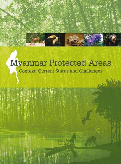
Myanmar Protected Areas: Context, Current Status ... - Istituto Oikos
Myanmar Protected Areas: Context, Current Status ... - Istituto Oikos
Myanmar Protected Areas: Context, Current Status ... - Istituto Oikos

Create successful ePaper yourself
Turn your PDF publications into a flip-book with our unique Google optimized e-Paper software.
<strong>Myanmar</strong> <strong>Protected</strong> <strong>Areas</strong><br />
<strong>Context</strong>, <strong>Current</strong> <strong>Status</strong> and Challenges
In memory of U Uga<br />
Forewords<br />
<strong>Myanmar</strong> <strong>Protected</strong> <strong>Areas</strong><br />
We, at the European Union, have been fully committed to environmental protection and conservation.<br />
Our engagement principles are embedded in the European Union Consensus on Development published<br />
in 2005 that outlines our support for biodiversity conservation, water and energy supply as well as the<br />
fight against climate change.<br />
Environmental protection underpins sustainable development, the more so in a country as Burma/<br />
<strong>Myanmar</strong> where large parts of the population rely on natural resources for their food, shelter and energy<br />
needs. The world’s poorest are those directly dependent on natural resources for their daily survival<br />
and therefore most vulnerable to environmental hazards. This is why the European Union has made<br />
the protection and sustainable management of natural resources a priority in its poverty reduction<br />
policies.<br />
In Burma/<strong>Myanmar</strong>, a key instrument for cooperation has been the Non State Actors (NSA) Programme.<br />
The overall objective of the NSA programme is to support the emergence of civil society organizations<br />
and enable them to fight poverty across a range of sectors such as education, health and livelihoods. The<br />
project “Strengthening environmental NGOs in Burma/<strong>Myanmar</strong>” implemented jointly by <strong>Istituto</strong> <strong>Oikos</strong><br />
and BANCA was the first environment initiative funded by the European Union under this programme.<br />
Sound environmental conservation is only effective if based on accurate data and analysis on the<br />
state of the environment. This project was a wonderful opportunity to build the knowledge base on<br />
biodiversity resources while, at the same time, building capacity for better data collection and analysis.<br />
In 2009-2010, the project brokered information exchange among 24 local environmental organisations,<br />
and the collection of data in line with internationally approved standards on the natural resources,<br />
management, land use, tourism and research in 30 protected areas.<br />
Ultimately, BANCA and other local organisations will be better equipped with tools and methodologies<br />
to assess biodiversity resources. In addition, we will have a comprehensive database on the state of<br />
biodiversity and protected areas across the country. This will allow biodiversity resources to be better<br />
understood and we hope it will lead other actors to invest more and better in biodiversity protection<br />
and resources conservation.<br />
Burma/<strong>Myanmar</strong> has a unique environment and we must all join forces to ensure that natural resources<br />
are sustainably exploited.<br />
David Lipman<br />
Ambassador<br />
Head of Delegation of the European Union to Thailand, Cambodia, Laos and <strong>Myanmar</strong><br />
III
<strong>Istituto</strong> <strong>Oikos</strong> believes that biodiversity conservation and equitable natural resources management<br />
are crucial to ensure the livelihood of local people, where land degradation and poverty are strictly<br />
connected. The approach is based on the following assumption: a well conserved environment is the<br />
only guarantee for socio-economic development, poverty alleviation, food security, health and wellbeing<br />
for current and future generations. That is why the core of all <strong>Istituto</strong> <strong>Oikos</strong>’ projects, whether they<br />
be technical-scientific assistance, environmental evaluations programs, fauna monitoring or support<br />
for youth or women’s cooperatives, is the relationship between man and nature. Many actions focus on<br />
protected areas and on natural areas risking deterioration due to irrational and unplanned use of natural<br />
resources. Moreover, the projects never leave aside the awareness-raising factor, so that those involved<br />
can understand and share <strong>Istituto</strong> <strong>Oikos</strong>’ objectives, as well as the training of local personnel to ensure<br />
the sustainability of work. After 15 years of field activities and more than 150 projects implemented, in<br />
Italy and abroad, on biodiversity conservation and sustainable development, <strong>Istituto</strong> <strong>Oikos</strong> has gained<br />
a wealth of experience in the definition and implementation of methodologies and strategies aimed<br />
at integrating the environmental dimension into the socio-economic processes. To reach concrete and<br />
sustainable results, as well as to ensure the highest standards of quality in its activities, <strong>Istituto</strong> <strong>Oikos</strong><br />
has established firm collaboration with local and national governments, universities, research institutes,<br />
conservation, development organisations and business companies, both in Italy and worldwide. <strong>Istituto</strong><br />
<strong>Oikos</strong> has been operating in <strong>Myanmar</strong> since 2006 in order to improve the conservation of natural<br />
resources and the capacity building of local NGOs as a tool of sustainable development. <strong>Myanmar</strong> is a<br />
country where natural resources are still well conserved, biodiversity is high and forests cover almost<br />
half of the territory. The protected areas of <strong>Myanmar</strong> conserve spectacular natural, cultural and spiritual<br />
values and provide communities with opportunities for recreation and education. As natural areas are<br />
progressively being destroyed under different types of human pressure, it becomes increasingly urgent<br />
to maintain and improve the condition and management of protected areas. The PA system of <strong>Myanmar</strong><br />
is essential to continue providing environmental services at community and national level, to prevent<br />
climate change and the loss of biodiversity. The protection of cultural values is another important role<br />
of the PA system that contributes to spiritual life and <strong>Myanmar</strong>’s historical traditions. Understanding<br />
the values within the PA system and evaluating the outcome of management is essential to being<br />
able to adapt and improve management practices. In the period 2009-2010, <strong>Istituto</strong> <strong>Oikos</strong> and BANCA,<br />
with the support of the European Union, the Lombardy Region and Stiftung Drittens Millenium, have<br />
managed the project “Strengthening environmental NGOs in Burma/<strong>Myanmar</strong>” aimed at improving<br />
the capacity of local NGOs to engage in biodiversity conservation and sustainable development<br />
programs and coordinate sustainable environmental development investments and activities. The<br />
publication “<strong>Myanmar</strong> <strong>Protected</strong> <strong>Areas</strong>: <strong>Context</strong>, <strong>Current</strong> <strong>Status</strong> and Challenges”, one of the outputs of<br />
the project, presents information on the status of the protected areas in <strong>Myanmar</strong>. We hope it will help<br />
to promote cost-effective initiatives and innovative approaches, to provide technical inputs for policy<br />
review processes and to mobilise international awareness and financial support to conserve the unique<br />
heritage of <strong>Myanmar</strong>’s protected areas.<br />
Rossella Rossi<br />
President<br />
<strong>Istituto</strong> <strong>Oikos</strong><br />
<strong>Myanmar</strong> <strong>Protected</strong> <strong>Areas</strong><br />
Among South-East Asian countries there is no doubt that <strong>Myanmar</strong> is the most biologically diverse<br />
country on the mainland. It possess a long coastal line of 2,000 kilometers, over 800 islands, mangroves,<br />
high mountains of the Eastern Himalayas in the north, a dry zone in the center, Sundaic forest in the<br />
south and many types of habitats and ecosystems. There are only few types of habitats left on earth that<br />
cannot be found in <strong>Myanmar</strong>. It still has a high percentage of natural forest cover which is home to a rich<br />
diversity of flora and fauna. It is also one of the least explored countries in the world. There have been<br />
expressions like“ after walking two days we found nothing but primeval forest”, “ we barely see a person<br />
coming along during our exploration” and “there is one new bird found in every step we took” from<br />
nature lovers and bird watchers who have visited <strong>Myanmar</strong>. The Leaf deer Muntiacus putaonensis and<br />
the <strong>Myanmar</strong> Snub-nosed Monkey Rhinopithecus strykeri are some of the new discoveries within recent<br />
years in the Northern part of <strong>Myanmar</strong>. Other species of reptiles and amphibians new to science have<br />
also been reported. The Ministry of Forestry has been trying to protect representative type of forests<br />
and up till now has gazetted, nominated and proposed 43 protected areas which cover 7.3 % of total<br />
land. But as a developing nation, <strong>Myanmar</strong> has financial as well as environmental issues. Unfortunately<br />
conserving biodiversity and environment is not the top priority of the government. Out of 43 protected<br />
area systems only a few have been properly gazetted and have a management system in place. Some<br />
are nominated and some are only in a proposal stage. Very few of the gazetted protected areas have full<br />
management resources and staff. Even big national parks are short of resources. For them top priorities<br />
like regular biodiversity surveys and patrolling are beyond their capacity. As a result very few parks have<br />
a comprehensive checklist of flora and fauna. Lampi Island Marine National Park falls in the category<br />
that does not have a proper management system and a checklist of flora and fauna that exist in the<br />
park. We BANCA and <strong>Oikos</strong> do sincerely feel honored to conduct this much needed survey which we<br />
hope will help the forest department to form a proper management system and serve as a baseline for<br />
further evaluation and monitoring of this park. Moreover, we also hope that this publication will serve as<br />
a good reference for all existing parks of <strong>Myanmar</strong>. During recent years people have changed. Their new<br />
lifestyle has become more advanced and sophisticated. New changes need new solutions. Population<br />
has also increased dramatically and consequently more space becomes essential for their livelihoods and<br />
sustainability. The more space they need the more destruction was made to nature and the environment.<br />
The lifestyle of people and the changes in the environment have become more interconnected. Issues<br />
have become too big and complicated to be handled by a single department or organization alone.<br />
Therefore people in the conservation field also have to change. All stakeholders including governments,<br />
private and public sectors have to work together to have successful conservation programs. BANCA and<br />
<strong>Istituto</strong> <strong>Oikos</strong> as stakeholders look forward to assist <strong>Myanmar</strong> within our capacity especially in the field<br />
of biodiversity for successful conservations programs. BANCA appreciates the support of international<br />
organizations and the European Union to meet the conservation challenge.<br />
Dr Htin Hla<br />
Chairman<br />
BANCA<br />
<strong>Myanmar</strong> <strong>Protected</strong> <strong>Areas</strong><br />
IV V
Acknowledgments<br />
VI<br />
<strong>Myanmar</strong> <strong>Protected</strong> <strong>Areas</strong><br />
A. Bonetti<br />
The authors of this publication are researchers affiliated with <strong>Istituto</strong> <strong>Oikos</strong> and BANCA.<br />
Chapter 1 “<strong>Context</strong>” was written by Lara Beffasti (Project Manager, <strong>Istituto</strong> <strong>Oikos</strong>) and Valeria Galanti<br />
(Biologist, <strong>Istituto</strong> <strong>Oikos</strong>).<br />
Chapter 2 “<strong>Protected</strong> <strong>Areas</strong>” is co-authored by Lara Beffasti, Valeria Galanti and Tint Tun (Project Manager,<br />
BANCA). The maps were produced by Simone Bianchi (GIS expert, <strong>Istituto</strong> <strong>Oikos</strong>), Mi Mi Choe (GIS expert,<br />
Forest Department) and Thein Ko (GIS expert, BANCA) thanks to data provided by Forest Department<br />
and Wildlife Conservation Society, and data collected in the field. Photographs are by project staff in<br />
<strong>Myanmar</strong> during project period 2009-2010.<br />
Chapter 3 “In-depth study of Lampi Island Marine National Park” was written by Lara Beffasti and Valeria<br />
Galanti, also based on the reports of the field surveys undertaken between 2008 and 2010 by researchers<br />
affiliated to MEP and MABR projects listed in Table 15. Photos of the Myeik archipelago 2006-2007 have<br />
been made available by Andrea Bonetti (www.andreabonetti.com).<br />
Chapter 4 “In-depth study of Rakhine state” is co-authored by Simone Bianchi and Roberto Colombo<br />
(Researcher, Università Milano Bicocca).<br />
Chapter 5 “Conclusions and Recommendations” was written by Lara Beffasti and Valeria Galanti, also<br />
including the results of the stakeholder workshop held in Yangon in March 2011.<br />
Serena Arduino reviewed the draft text and provided valuable corrections and suggestions. Useful<br />
revisions and translations to and from <strong>Myanmar</strong> language were ably made by Tint Tun and Htoo Htoo.<br />
English language editorial support was provided by Guy Waley.<br />
The authors wish to express their gratitude for the valuable inputs and involvement to all <strong>Istituto</strong><br />
<strong>Oikos</strong>, BANCA and Forest Department staff and others who have made various contributions to the<br />
implementation of project activities or in the preparation of this publication and in particular to (in<br />
alphabetical order) U Aung Than, U Aye Myint Maung, U Bo Ni, Daw Dewi Thant San, Alessandra<br />
Gagliardi, Paola Mariani, Dr. Maung Maung Kyi, Dr. Maung Maung Than,U Maung Maung Thein Pe,<br />
U Myint Sein, Daw San San Nwe, Francesca Santapaola, Dr. San Win, U Saw Han, Dr. Saw Mon Theint,<br />
U Ohn, U Saw Tun Khaing, U Shein Gai Lai, Sara Stingelin, Daw Thandar Win, U Than Latt Shein, Daw Than<br />
Than Aye, U Tin Tun, U Tint Wai, Guido Tosi, Brunella Visaggi, U Win Maung and U Win Naing Thaw.<br />
We especially acknowledge U Uga, former Chairman of BANCA, who passed away in April 2010, and<br />
without whom this project would have not been possible.<br />
We warmly acknowledge Delphine Brissonneau, Programme Officer of the European Union Delegation,<br />
and Rossella Rossi, President of <strong>Istituto</strong> <strong>Oikos</strong>, who went beyond the call of duty in the support to the<br />
programme in <strong>Myanmar</strong>.<br />
<strong>Istituto</strong> <strong>Oikos</strong> is grateful to Luca Schueli for the invaluable introduction to <strong>Myanmar</strong>.<br />
All project team wish to thank the participants in all of the meetings, discussions and interviews<br />
organized by this project – villagers, scientists, foresters, protected area managers, NGO workers and<br />
executives alike – who shared the willingness to make a positive contribution to the conservation of<br />
<strong>Myanmar</strong> natural resources.<br />
1<br />
1.1<br />
1.2<br />
1.3<br />
2.<br />
2.1<br />
2.2<br />
Contents<br />
Forewords III<br />
Acknowledgements VI<br />
Acronyms used in the text VIII<br />
Introduction IX<br />
Executive Summary X<br />
Executive Summary (<strong>Myanmar</strong> language) XII<br />
Background on <strong>Myanmar</strong> 1<br />
Natural Features 1<br />
Environmental Policy and Practice 4<br />
Environmental Non-governmental<br />
Organizations (ENGOs) 8<br />
<strong>Myanmar</strong> <strong>Protected</strong> <strong>Areas</strong> 11<br />
Methodology 11<br />
Results 14<br />
Alaungdaw Kathapa 22<br />
Bawditataung 24<br />
Bumhpabum 26<br />
Chatthin 28<br />
Hlawga 30<br />
Hponkanrazi 32<br />
Htamanthi 33<br />
Hukaung Valley 34<br />
Hukaung Valley (Extension) 34<br />
Indawgyi Lake 36<br />
Inlay Lake 38<br />
Kahilu 40<br />
Kelatha 42<br />
Khakaborazi 44<br />
Kyaikhtiyoe 46<br />
Kyauk-Pan-Taung 48<br />
Lampi Island 50<br />
Lawkananda 52<br />
Lenya 54<br />
Lenya (Extension)* 54<br />
Loimwe 56<br />
Maharmyaing 58<br />
Mainmahla Kyun 60<br />
Minsontaung 62<br />
Minwuntaung 64<br />
Moscos Island 66<br />
Moyingyi Wetland 68<br />
Mulayit 70<br />
Natma Taung 72<br />
Panlaung-Pyadalin Cave 74<br />
Par Sar 76<br />
Pidaung 78<br />
Popa 80<br />
Pyin-O-Lwin 82<br />
Rakhine Yoma Elephant Range 84<br />
Shinpinkyetthauk 86<br />
Shwesettaw 88<br />
Shwe-U-Daung 90<br />
Tanintharyi National Park 92<br />
3.<br />
3.1<br />
3.2<br />
3.3<br />
4.<br />
4.1<br />
4.2<br />
4.3<br />
5.<br />
5.1<br />
5.2<br />
<strong>Myanmar</strong> <strong>Protected</strong> <strong>Areas</strong><br />
Tanintharyi Nature Reserve 94<br />
Taunggyi 96<br />
Thamihla Kyun 98<br />
Wenthtikan 99<br />
In-depth Study of Lampi Island Marine<br />
National Park 101<br />
Purpose 101<br />
Results 101<br />
Conclusions and recommendations 118<br />
Box 1 Plain-pouched Hornbill 119<br />
Box 2 Moken Sea Gypsies 120<br />
3.4 Checklist of Lampi MNP resources 122<br />
In-depth Study of Rakhine Yoma Elephant<br />
Range Wildlife Reserve 133<br />
Data and methods 135<br />
Results 139<br />
Conclusions and recommendations 144<br />
Conclusion 145<br />
Progress and priorities for <strong>Myanmar</strong> PAs 146<br />
Recommendations 146<br />
References 148<br />
Appendices 150
Acronyms used in the text<br />
ASEAN Association of South East Asian Nations<br />
BANCA Biodiversity And Nature Conservation Association<br />
BLI BirdLife International<br />
CAS California Academy of Science<br />
CBD Convention on Biological Diversity<br />
CITES Convention on International Trade in Endangered<br />
Species of Wild Fauna and Flora<br />
DOF Department of Fisheries<br />
EIA Environmental Impact Assessment<br />
EBA Endemic Bird Area<br />
ENGO Environmental Non-governmental Organisation<br />
FAO Food and Agricultural Organization<br />
FD Forest Department<br />
FRA Forest Resource Assessment<br />
GEF Global Environment Facility<br />
IBA Important Bird Area<br />
IUCN International Union for Conservation of Nature<br />
KBA Key Biodiversity Area<br />
MFA Ministry of Foreign Affairs<br />
MOF Ministry Of Forestry<br />
MPA Marine <strong>Protected</strong> Area<br />
MoU Memorandum of Understanding<br />
NCEA National Commission for Environmental Affairs<br />
NFMP National Forest Master Plan<br />
NGO Non-governmental Organization<br />
NSDS National Sustainable Development Strategy<br />
NWCD Nature and Wildlife Conservation Division<br />
PA <strong>Protected</strong> Area<br />
PFE Permanent Forest Estate<br />
SEAFDEC Southeast Asian Fisheries Development Center<br />
SI Smithsonian Institution<br />
UNDP United Nations Development Programme<br />
UNEP United Nations Environment Programme<br />
WCPA World Commission on <strong>Protected</strong> <strong>Areas</strong><br />
WCS Wildlife Conservation Society<br />
WR Wildlife Reserve<br />
WS Wildlife Sanctuary<br />
Introduction<br />
<strong>Myanmar</strong> <strong>Protected</strong> <strong>Areas</strong><br />
<strong>Protected</strong> areas (PAs) are important tools for biodiversity<br />
conservation and sustainable development. PAs safeguard<br />
ecosystems and their services, such as water provision, food<br />
production, carbon sequestration and climate regulation,<br />
thus improving people’s livelihoods. They preserve the<br />
integrity of spiritual and cultural values placed by indigenous<br />
people on wild areas and offer opportunities of inspiration,<br />
study and recreation. Due to a long period of isolation,<br />
<strong>Myanmar</strong> has conserved an extraordinary natural and<br />
cultural heritage that is in part represented in its protected<br />
area system. The expansion of agriculture and industry,<br />
pollution, population growth, along with uncontrolled use<br />
and extraction of resources, are causing severe environmental<br />
and ecosystem degradation. Loss of biodiversity is the<br />
most pressing environmental problem because species<br />
extinction is irreversible. Realising the urgency of <strong>Myanmar</strong><br />
environmental challenges, several stakeholders, at national,<br />
international and regional level, have committed to support<br />
conservation and management of PAs. However, baseline<br />
information on natural resources, threats, management, staff,<br />
infrastructure, land use, tourism and research in <strong>Myanmar</strong> PAs<br />
was hardly ever updated and not systematically organised,<br />
thus limiting the subsequent planning and management of<br />
resources. Therefore, the aim of this publication is twofold:<br />
to raise awareness on the condition of the conservation of<br />
PAs and to mobilise national and international support for<br />
cost-effective initiatives, innovative approaches and targeted<br />
research in priority sites. The document provides background<br />
information on <strong>Myanmar</strong> natural features, environmental,<br />
government and non-government frameworks (Chapter 1).<br />
The core section makes available the information retrieved in<br />
the period 2009-2010 on the status of <strong>Myanmar</strong> PAs (Chapter<br />
2) and the results of the research conducted in Lampi<br />
Island Marine National Park (Chapter 3) and Rakhine Yoma<br />
Elephant Range Wildlife Reserve (Chapter 4). Data collection,<br />
analysis and organisation were part of the larger <strong>Myanmar</strong><br />
Environmental Project (MEP) managed by <strong>Istituto</strong> <strong>Oikos</strong> in<br />
partnership with BANCA. Conclusion and recommendations<br />
for the management of <strong>Myanmar</strong> PAs (Chapter 5) were jointly<br />
formulated by stakeholders during the MEP closing workshop<br />
held on March 17th 2011 in Yangon. The information presented<br />
in this publication is also organised in a database available to<br />
stakeholders that will be updated with new data provided<br />
by PA managers, academic institutions, environmental<br />
organisations and community-based groups working in<br />
<strong>Myanmar</strong> PAs to fill the existing gaps.<br />
VIII IX
Executive summary<br />
This publication presents the information<br />
collected on <strong>Myanmar</strong> protected areas (PAs),<br />
with the objective of mobilising national<br />
and international support for cost-effective<br />
initiatives, innovative approaches and<br />
targeted research implemented by non-<br />
State actors in collaboration with authorities<br />
and communities in sites needing priority<br />
conservation actions. <strong>Myanmar</strong> presents a<br />
great variety of habitats and ecosystems,<br />
from snow-capped mountains to coral reefs,<br />
supporting a rich biodiversity. Demographic<br />
and socio-economic pressures have been<br />
identified as the main causes of environmental<br />
degradation and biodiversity loss. The environmental protection framework set up by <strong>Myanmar</strong> during<br />
the 1990s shows legal and institutional constraints. Environmental laws are very sector-specific and<br />
institutions lack capacity and resources for their implementation. Nonetheless, progress has been made<br />
towards the integration of environmental issues in the national development process and stakeholders<br />
consultation mechanisms have increased coordination in planning. A small but growing number of<br />
<strong>Myanmar</strong> environmental NGOs has emerged and is playing an important role to facilitate environmental<br />
education, research work and co-management of resources at local level.<br />
In <strong>Myanmar</strong> there are currently 43 officially-recognised PAs but so far the information on their status<br />
has been poor, scattered and not updated. A comprehensive datasheet was prepared to organize in a<br />
systematic way the information collected on natural resources, management, staff and infrastructure,<br />
tourism, land use and human activities and research, following internationally approved criteria<br />
and standards. Existing information was first retrieved from authorities, organisations and academic<br />
institutions; then it was verified and integrated through field visits and meetings with stakeholders for<br />
30 PAs while maps were produced for all 43 PAs. All information is organised in a database available to<br />
stakeholders. <strong>Myanmar</strong> PA system currently covers 7.3 % of the country. Despite the long coastline there<br />
are only 4 marine protected areas and there is little capacity to conserve and manage marine resources.<br />
The number and size of PAs have increased over the years but also some terrestrial habitat types are still<br />
underrepresented, in particular beach and dune, mangrove and swamp forests. Human encroachment<br />
in PAs is common and requires intervention to limit it, however in most cases the conservation status is<br />
considered to be within an acceptable range of variation. Only half of the PAs have partial biodiversity<br />
inventories and an operational or management plan including actions that are regularly implemented<br />
despite inadequate human, technical and financial resources. Seventeen PAs are only paper parks.<br />
Religious tourism and ecotourism exist in many PAs but most lack the resources and skills to invest in<br />
effective tourism management and consequently forego the opportunity to generate revenues from<br />
it. Scientific research has been conducted in 28 PAs by national and international organisations and<br />
universities without a coordinated research programme.<br />
Two PAs were selected for in-depth studies: Lampi Island Marine National Park and Rakhine Yoma<br />
Elephant Range Wildlife Reserve. Lampi Island Marine National Park (MNP) is the only MNP in <strong>Myanmar</strong><br />
and the only protected area of the Myeik archipelago. Very little information was available on this area<br />
and it had not been updated since 1995. Collecting data on this area was considered very important<br />
to raise the awareness of <strong>Myanmar</strong> and international stakeholders on the importance of conserving<br />
the archipelago and involving the local heterogeneous population composed by indigenous minorities<br />
and migrants from different areas of <strong>Myanmar</strong> in participatory resources management. The rapid<br />
<strong>Myanmar</strong> <strong>Protected</strong> <strong>Areas</strong><br />
assessment survey conducted in January<br />
2009 confirmed the great value of the<br />
archipelago in terms of biological and cultural<br />
attributes, threatened by the uncontrolled<br />
and rapid increase of human settlements<br />
and activities. Field surveys identified 195<br />
species of plants of the evergreen forest, 63<br />
mangroves and associates, 19 mammals,<br />
228 birds, 19 reptiles, 10 amphibians. Among<br />
the marine resources, 333 plankton species,<br />
L.Beffasti<br />
73 seaweeds, 11 seagrass, 50 gastropods, 42<br />
crabs, 41 bivalves, 35 sea cucumbers and 42<br />
fish species. 29 species are new records for<br />
<strong>Myanmar</strong> (1 phytoplankton, 7 zooplanktons,<br />
2 seagrasses, 1 mangrove tree, 7 fishes, 3 amphibians, 8 birds). Furthermore, the issues of the Salone (or<br />
Moken) people were collected, as well as those of other human settlements in the area. As population<br />
grows inside and outside the park, the natural resources are increasingly threatened by unsustainable<br />
use. Consultations among authorities, organisations and communities were initiated to launch the<br />
participatory development of a management plan for the MNP to ensure the incorporation of the needs<br />
and aspirations of local communities along with conservations goals. The Rakhine Yoma Elephant Range<br />
Wildlife Reserve encompasses a great variety of habitats supporting high biodiversity and many endemic<br />
and endangered species, but it is one of the most encroached PAs. Local communities are dependent on<br />
natural resources for their livelihoods and are often damaging the environment and using its resources<br />
without due regard to sustainability. A GIS database was set up to propose a preliminary classification of<br />
vegetation types, which was then verified through a ground-truthing campaign. Ten vegetation classes<br />
were identified and land cover maps produced. The vegetation change between 1974 and 2003 was<br />
analysed showing the conversion of natural forests to agricultural areas and vice-versa. The main finding<br />
is the invasion of Melocanna bambusoides in the area, probably subsequent to forest fires and shifting<br />
cultivation practices; creation of a buffer zone and implementation of environmental education and<br />
sustainable development activities are crucial to prevent the degradation of the last patches of forest.<br />
New data and maps on vegetation change and land use can thus support sustainable development<br />
plans and activities, and raise awareness on the current threats to this ecosystem.<br />
According to project findings, <strong>Myanmar</strong> PA system should be reviewed giving emphasis to the<br />
management objective and strategically expanded to address gaps in coverage of globally threatened<br />
species, underrepresented mangrove and marine habitats, Key Biodiversity <strong>Areas</strong> and wildlife corridors.<br />
It is crucial to improve coordination between Forest Department (FD) and other departments and<br />
it is also advisable to pilot joint governance initiatives at local level in collaboration with NGOs and<br />
communities. While public awareness needs to be raised, from top to grass root level, on the role and<br />
benefits of protected areas in order to achieve comprehensive stakeholder participation in conservation,<br />
FD staff, especially young generations, should receive intensive training in ecology and management.<br />
This would enable the preparation of a management plan and a biodiversity inventory for every PA<br />
to be organised in a central database to facilitate coordination and information sharing at national<br />
and international level, also to develop coordinated research programmes. The human impacts of PAs<br />
should be measured in order to identify and implement innovative poverty reduction strategies that<br />
can contribute to meet the conservation and development goals. To ensure the allocation of adequate<br />
resources, sustainable financing mechanisms should be identified, including grants and donations and<br />
local business development.<br />
X XI
Executive summary (<strong>Myanmar</strong> language)<br />
<strong>Myanmar</strong> <strong>Protected</strong> <strong>Areas</strong><br />
XII XIII
Background on <strong>Myanmar</strong><br />
XIV 1<br />
L. Beffasti<br />
1<br />
1.1<br />
Natural Features<br />
Introduction<br />
<strong>Myanmar</strong>, the largest country in South East Asia, is part of the Sundaic subregion of the Indo-Malayan<br />
Realm (MacKinnon and MacKinnon 1986). Due to the combination and interaction of geography,<br />
topography, climate, pattern of seasonal rainfall, presence of high mountains and major rivers, <strong>Myanmar</strong><br />
presents a great variety of different habitats and ecosystems supporting a rich biodiversity. With about<br />
half (48%) of mainland covered by forests (FAO 2010), <strong>Myanmar</strong> ranks 6 out of 11 among the Southeast<br />
Asian countries in terms of percentage of land area covered by forest (FAO 2009).<br />
Figure 1 <strong>Myanmar</strong> Land Area (Source: NCEA 2009b)<br />
Forest<br />
48%<br />
Other land<br />
16%<br />
Other wooded lands<br />
33%<br />
Inland water bodies<br />
3%<br />
Northern <strong>Myanmar</strong> presents the highest mountains with permanent snow and glaciers, with Mount<br />
Khakaborazi (6,000 m) being the highest in <strong>Myanmar</strong> and in South East Asia. The country includes<br />
extensive lowland plains, major rivers running parallel to each other, one of the largest river deltas in<br />
Asia (Ayeyawaddy Delta) and plateau around 1,000 m above sea level like the Shan Plateau. <strong>Myanmar</strong>,<br />
with its 2,280 km long coast and more than 800 small islands, has important coast and marine habitats<br />
supporting an abundance of species. The climate is a tropical monsoon climate with three distinctive<br />
seasons: hot season from March to May, rainy season from June to October, cold season from November<br />
to February, with high rainfall variability, from 500 mm in the Dry Zone up to over 6,000 mm in<br />
Tanintharyi Region and northern Rakhine State.<br />
Biodiversity<br />
About 250 mammal species, more than 1,000 birds, 370 reptiles and 7,000 plants are recorded in <strong>Myanmar</strong>,<br />
including 39 species of mammals, 45 of birds, 21 of reptiles and 38 of plants which are globally threatened<br />
(NCEA, 2009a). More species could be added since new discoveries continue to be made every year,<br />
including the exceptional discovery, during a survey of FFI and BANCA in Kachin state, of a new species<br />
of primate in 2010, the Burmese snub-nosed monkey Rhinopithecus strykeri, immediately classified as<br />
critically endangered by IUCN. 76 Key Biodiversity <strong>Areas</strong> (KBAs) have been identified, out of which 54<br />
are recognized as Important Birds <strong>Areas</strong> (IBAs) (BLI 2005). Endemism is relatively low compared to other<br />
countries in South East Asia. There are seven Endemic Birds <strong>Areas</strong> EBAs and secondary endemic areas<br />
(BLI 2005 and IUCN-WCPA 2007), three exclusively located in <strong>Myanmar</strong> (Eastern Himalayas, Irrawaddy<br />
plains and North <strong>Myanmar</strong> Lowlands), two stretching across <strong>Myanmar</strong> and Thailand (<strong>Myanmar</strong>-Thailand<br />
mountains and Peninsular Thailand lowland forests) and two others centered mainly in other countries<br />
but extending in <strong>Myanmar</strong> (Andaman Islands and Yunnan mountains). Natma Taung National Park is a<br />
particular area of local endemism.
Habitats<br />
Important habitat types represented in <strong>Myanmar</strong> are forests, wetlands and the marine habitat. Eight<br />
different forest types are found in <strong>Myanmar</strong>: tropical evergreen forest, mixed deciduous forest, dry<br />
forest, deciduous dipterocarp forest, hill and temperate evergreen forest, tidal forest or mangrove forest,<br />
beach and dune forest, swamp forest (Tint, 1995).<br />
Figure 2 Forest Types of <strong>Myanmar</strong> (Source: NCEA 2009b)<br />
38% Mixed Deciduous Forest<br />
25% Hill and Temperate Evergreen Forest<br />
16% Tropical Evergreen Forest<br />
10% Dry Forest<br />
5% Deciduous Dipterocarp (Indaing) Forest<br />
4% Tidal Forest, Beach and Dune Forest,<br />
Swamp Forest<br />
2% Fallow Land<br />
The tropical evergreen forest is mainly represented in <strong>Myanmar</strong> by the lowland wet evergreen forest, a lush<br />
vegetation forest dominated by high value commercial species like the evergreen Dipterocarpus species.<br />
This forest is found quite well conserved along the coast of the Tanintharyi Region. The mixed deciduous<br />
forest is the major forest type of <strong>Myanmar</strong> and is characterized by the high-value timber species of Tectona<br />
grandis, commonly known as teak, often found in association with Xylia dolabriformis and different<br />
species of Terminalia. The presence of Tectona grandis makes this forest also the most economically<br />
important forest of the country. The mixed deciduous forest is strictly associated with bamboo species,<br />
which represent an important source of food for many wildlife species, and supports endangered species<br />
like the Hoolock Gibbon. The dry forest, represented by thorn scrub and forest, it is found in the Central<br />
Dry Zone, characterized by dry and seasonal climate, where the rainfall is usually under 1,000 mm.<br />
The dominant species are Terminalia oliveri and Tectona hamiltoniana, with a number of thorny Acacia<br />
species. The deciduous dipterocarp forest is found only in five countries in the world, namely <strong>Myanmar</strong>,<br />
Laos, Cambodia, Vietnam and Thailand. Also known as Indaing forest in <strong>Myanmar</strong>, is commonly found<br />
at higher altitudes in the northern part of the country. It is characterized by open canopy of deciduous<br />
species of Dipterocarpaceae. This forest type has remained isolated from other similar forests of South<br />
East Asia, making it one of the centres of endemism in <strong>Myanmar</strong>. It hosts endemic species like the critically<br />
endangered Burmese Star Tortoise and many threatened species like the vulnerable Eld’s Deer. The hill<br />
and temperate evergreen forest is found in high rainfall areas, on slopes between 900 m and 1,800 m<br />
(hill forests) and over 1,800 m (montane forest). Dominated by tree species of Quercus, Castanopsis,<br />
Schima, Fagaceae, Magnoliaceae, Lauraceae and Ericaceae, this forest type is characterized by many<br />
climber species and rich and lush undergrowth. Beyond the coniferous forests, sub-alpine forest and<br />
Background on <strong>Myanmar</strong><br />
alpine meadows are found at the highest elevations on the mountains, before the level of permanent<br />
snow and ice. Mangrove forests (or tidal forests), found along alluvial flats of river deltas and on muddy<br />
coastal areas, are salt tolerant and are flooded by seawater during high tide. This type of forest has<br />
a very important ecological function since it stabilises the shoreline, protects the coast from erosion<br />
and is a particularly important habitat for migratory waterbirds. Mangroves offer a variety of forest and<br />
aquatic products to many coastal people and largely support fish production. <strong>Myanmar</strong> hosts 8.8% of<br />
the total mangrove forests area of South East Asia, being the third richest country after Indonesia and<br />
Malaysia. Of the total mangroves area in <strong>Myanmar</strong>, 46% is located in Ayeyawaddy Region, 37% in the<br />
Tanintharyi Region and 17% in the Rakhine State (Giesen et al. 2006). They are all considered under<br />
threat, although many areas are nominally protected. Beach and dune forest represents a minority of<br />
total forest area in <strong>Myanmar</strong>, and it is found in narrow strips on beaches and dunes along the coasts,<br />
usually dominated by Casuarina equisetifolia. The swamp forest, found in the Ayeyawaddy Delta and<br />
in the floodplains of other rivers and lakes, and wetlands are of high ecological importance for many<br />
bird species which have suffered dramatic population declines across their global distributions. Many of<br />
these wetland sites have been recognized as Important Bird <strong>Areas</strong> and some proposed as Ramsar sites.<br />
The marine habitat, supporting a high biomass of fish and other aquatic organism, represents an important<br />
source of income for the country, with the fishery sector as the fourth largest sector in <strong>Myanmar</strong>, and<br />
shrimp export accounting for nearly 50% of the total value of fishery export. Coral reefs are extensive<br />
on the south east coast of <strong>Myanmar</strong> (fringing reefs and patch) and around the islands, extending further<br />
south into Thailand, covering 1,870 km², with the majority of coral reefs found in the Myeik Archipelago<br />
of the Tanintharyi Region. Coral reefs in <strong>Myanmar</strong> need to be more fully surveyed and better protected<br />
since they provide many functions, services and goods in terms of coastal protection and sediment<br />
retention, nurseries and habitats for aquatic organism, feeding grounds for economically important<br />
species of fish and other seafood products, potential revenues from tourism. Seagrasses are mainly<br />
found in Rakhine and Tanintharyi marine areas, while they are absent in the Ayeyawaddy Delta because<br />
of high turbidity. Seagrass beds represent a food source and shelter habitat for many economically<br />
important species of marine invertebrates and fishes, and globally threatened species like the Dugong<br />
(Dugong dugon). Seagrass habitat has an important role in stabilizing the coast, reducing waves and the<br />
effects of currents and trapping the sediments, thus protecting coral reefs from sedimentation.<br />
2 3<br />
L. Beffasti
Environmental problems<br />
In 2001, a report of the <strong>Myanmar</strong> Ministry of Forestry identified the following major threats to forest and<br />
biodiversity: conversion of closed forests to other land uses, shifting cultivation, invasive species, illegal<br />
fishing and water pollution, wildlife and timber trade, lack of environmental impact assessment (EIA) for<br />
development projects. The 4th National Report on Biodiversity (2009) confirms that <strong>Myanmar</strong> is losing<br />
biodiversity due to socio-economic pressure, with the main threats identified in habitat destruction,<br />
especially related to forest depletion, degradation and cover change, hunting and illegal wildlife<br />
trade. Invasive alien species are considered a minor threat. The net loss of 435,000 hectares of forest<br />
per year reported for the period 1990-2000, corresponding to a loss of 1.17%, was reduced to 310,000<br />
hectares per year in the period 2000–2010, corresponding to a loss of 0.93%. Despite this positive trend,<br />
<strong>Myanmar</strong> still remains one of the ten countries in the world with the largest annual net loss of forest<br />
area and among the five countries (Indonesia, Australia, <strong>Myanmar</strong>, Madagascar and Mozambique) with<br />
the largest net loss of mangrove area during the period 2000–2010 (FAO 2010). In the Ayeyawaddy<br />
Region, mangrove forest has been seriously degraded in recent years due to agricultural conversion and<br />
the high demand for firewood and charcoal from Yangon, with consequent decline of fish catches and<br />
increased vulnerability to natural disasters. In Tanintharyi Region the best conserved mangrove forests<br />
are found, especially in the Myeik Archipelago, but still a decrease of 2.4 % per annum is estimated (U<br />
Myint Pe 2003). In Rahkine, shrimp farming, representing 89% of all the shrimp farming in the country,<br />
has seriously contributed to mangrove depletion and prevented reforestation in many areas. Since<br />
shrimp farming is still encouraged without any proper planning, mangrove forests are expected to<br />
continue to decrease (Angell 2004). Agricultural expansion, shifting cultivation, conversion of forest<br />
to plantations are the main causes of habitat degradation and loss. Rubber plantations have almost<br />
doubled from 1990 to 2010 (FAO 2010) and together with large scale palm oil plantations are among<br />
the most impacting threats on biodiversity. Although accurate updated estimates are difficult to obtain,<br />
illegal wildlife trade in <strong>Myanmar</strong> is considered to be widespread, causing, with illegal hunting, a general<br />
decrease of wildlife population.<br />
L.Beffasti<br />
1.2 Environmental Policy and Practice<br />
Introduction<br />
After a period of intense exploitation of natural resources during the colonial and post-colonial period,<br />
<strong>Myanmar</strong> leaders showed their commitment to conserving the environment and promoting sustainable<br />
development with the creation in 1990 of ad hoc institutions in charge of preparing new environmental<br />
policies and legislation, of strengthening international cooperation on environmental issues and<br />
of improving the management of natural resources. However, the current environmental protection<br />
framework shows critical legal and institutional constraints, for instance very sector-specific laws that<br />
often exceed the technical and financial capability of the relevant government agencies.<br />
The future success of environmental protection in <strong>Myanmar</strong> depends on the formulation of policies<br />
reflecting a more integrated approach to planning and management of resources, as well as on the<br />
improved coordination between stakeholders and the allocation of the necessary resources for policy<br />
implementation.<br />
Background on <strong>Myanmar</strong><br />
Colonial period (1826-1948)<br />
After an initial phase of uncontrolled overharvesting of forest resources, the colonial government<br />
gradually shifted to the systematic management of forests (Bryant 1994). The first Forest Rules (1856),<br />
later adopted for the whole Indian province (1865), promoted the adoption of a scientific forestry<br />
method set up by the German forester Dietrich Brandis including the adoption of 30-year felling cycles<br />
and the prescription of exploitable tree sizes to fix the annual sustainable yield. Brandis’ guidelines<br />
were integrated into the Indian Forest Policy (1894) and Burma Forest Act (1902) and reviewed into<br />
the <strong>Myanmar</strong> Selection System for forest management in use since 1920, marking the government<br />
ownership of teak forests. Reserved forests and protected forests were created, whereas government<br />
timber-extraction was allowed, thereby restricting only resource access and use by local people. Shifting<br />
cultivation (taungya) practices, forest fires for hunting and non-timber forest products extraction<br />
were prohibited but difficult to control. To gain popular support for reserved forests, the government<br />
promoted the participation of local peasants, in particular Karen hill farmers, in forestry activities by<br />
encouraging them to sow teak trees in their taungya fields in exchange for tax exemption, paid labour<br />
and land, and thereby creating new plantations. The concern for wildlife conservation aroused only<br />
at the beginning of 20th century with the creation of the first wildlife sanctuary of Pidaung for the<br />
protection of Sumatran rhinoceros. At the end of the colonial period (1948), the protected areas system<br />
included 11 bird and wildlife sanctuaries 1 covering less than 0.3% of total country area.<br />
Development of <strong>Myanmar</strong> environmental governance and legislation<br />
In the first thirty years following independence (1948-1978), little attention was paid to environmental<br />
protection because the country was facing economic and political struggles. In the 1980s the Forest<br />
Department initiated, in collaboration with UNDP and FAO, the “Nature Conservation and National Parks<br />
project (1981-1984)” for the expansion of the protected area system 2 and the establishment of a new<br />
institution with specific competence on conservation and PA management.<br />
In the 1990s the legal and institutional framework of environmental governance was completely reviewed<br />
and updated resulting in the creation of new institutions and the formulation of new policies for forest<br />
and protected areas management (a list of environmental laws and policies is given in Appendix 1).<br />
Table 1: Chronology of Environmental Governance in <strong>Myanmar</strong><br />
1 Chatthin, Kahilu, Kelatha, Moscos Islands, Mulayit, Pidaung, Pyin-O-Lwin, Shwesettaw, Shwe-U-Daung, Taunggyi, Wenthtikan.<br />
2 14 designated protected areas (Htamanti, Minwuntaung and Thamila Kyun were established in the 1970s) for a total area of 4150 km², representing 0,6% of total country area.<br />
3 The original name was Nature Conservation and National Parks Division (NCNPD).<br />
4 5<br />
1990<br />
1990<br />
1992<br />
Creation of the National Commission for Environmental Affairs (NCEA) within<br />
the Ministry of Foreign Affairs (MFA) with competence on environmental policy<br />
and management with the objective of promoting environmental awareness,<br />
sustainable use of natural resources and collaboration with international<br />
organisations and foreign governments on environmental matters.<br />
Creation of the Nature and Wildlife Conservation Division (NWCD 3 ) within the<br />
Forest Department to supervise protected areas and wildlife conservation.<br />
Creation of the Ministry of Forestry constituted by four entities:<br />
1) Forest Department (FD) which is responsible for conservation and<br />
sustainable management of forest,<br />
2) <strong>Myanmar</strong> Timber Enterprise (MTE) in charge of commercial forest activities,<br />
3) Dry Zone Greening Department coordinating reforestation<br />
activities in central <strong>Myanmar</strong>,<br />
4) Planning and Statistics Department in charge of overall supervision.
% cover of total country area<br />
The Ministry of Forestry (MOF) gradually took over the coordination of environmental protection in<br />
<strong>Myanmar</strong>, especially after the nomination of the Minister of Forestry as chairman of the Environmental<br />
Conservation Committee in 2004 and the transfer of NCEA from MFA to MOF in 2005. As a consequence,<br />
the environmental policies and laws are very sectoral and focused on forest management and nature<br />
conservation instead of considering environmental issues as cross-cutting within the economic and<br />
social development of the country. Furthermore, MOF inherited the extractive mentality of the colonial<br />
government and its first priority remains the commercial exploitation of forests. NWCD and NCEA are<br />
the lowest institutions in the internal hierarchy of MOF, thus they have little capacity, opportunity<br />
and resources to mainstream environmental protection at national level. Nevertheless, both agencies<br />
have collaborated in the formulation of the Forest Law (1992) which regulates forest protection and<br />
management, establishment of forest plantations, extraction of forest products, as well as administrative<br />
action towards offences, replacing the old Burma Forest Act (1902). The importance given to public<br />
participation in forest management as well as to private sector involvement is highlighted in the<br />
Forest Rules and Community Forestry Instructions issued in 1995 to fulfill this law. In the same year<br />
the national Forest Policy was promulgated with the assistance of FAO, aiming for a more integrated<br />
approach towards environmental protection. The Forest Policy (1995) recognises different categories of<br />
forest: i) reserve (reserved) forests which are fully protected for commercial and local supply, watershed<br />
protection and biodiversity conservation, ii) public protected forests protecting trees but allowing<br />
other activities, iii) unclass (unclassified) forests where access is open to local people. The protected area<br />
system falls under the “Protection of Wildlife and Wild Plants and Conservation of Natural <strong>Areas</strong> Law”<br />
(1994), which replaced the old “Wildlife Protection Act” (1936). This law regulates the establishment<br />
of six categories of PAs (scientific nature reserve, national park, marine national park, nature reserve,<br />
wildlife sanctuary, geo-physically significant reserve) and of other nature reserves determined by the<br />
Minister of Forestry, which can be compared to international categories as further explained in chapter<br />
2. In 2001 a 30-year Forest Master Plan was approved mandating the increase of the Permanent Forest<br />
Estate PFE (constituted by reserved forests and public protected forests) to 30% and of PAs to 10% of<br />
the total country area. These targets reinforced and replaced those set by the Forest Policy (1995),<br />
respectively the increase of PFE to 30% and PA system to 5% of the total land area by 2010. Furthermore,<br />
the Forest Master Plan encourages the registration of unclassified forests into community or private<br />
forests. Data collected from combined sources 4 show that although in the 1999-2009 decade the forest<br />
cover of <strong>Myanmar</strong> has decreased, the area protected or managed under PFE, PA or community/private<br />
forestry has increased, which is indicative of the effort to prevent the conversion of unprotected forest<br />
areas to other land uses (see Figure 3).<br />
Figure 3 Trend of Forest and <strong>Protected</strong> Area 4<br />
60%<br />
50%<br />
40%<br />
30%<br />
20%<br />
10%<br />
0%<br />
forest cover Reserve forests and <strong>Protected</strong><br />
Public protected<br />
forests<br />
<strong>Areas</strong><br />
Community and<br />
private forests<br />
<strong>Status</strong> 1999-2000<br />
<strong>Status</strong> 2004<br />
<strong>Status</strong> 2009<br />
<strong>Status</strong> 2030<br />
Background on <strong>Myanmar</strong><br />
Since the 1990s <strong>Myanmar</strong> has also increased the participation in the international fora regarding<br />
environmental matters which resulted in the signing of several international environmental agreements<br />
which are given in Appendix 2.<br />
Policy implementation<br />
As for any other government policy, the effectiveness of environmental policies depends mostly on<br />
the political will and the availability of resources to implement it. Biodiversity conservation is hardly<br />
being given the first priority, especially in developing countries where it is generally perceived as a<br />
constraint to economic development. Furthermore, the legal and institutional constraints described<br />
above have an impact on the execution and enforcement of such policies. On one hand, the sectorspecific<br />
policies leave gray areas (e.g. no procedures or rules for Environmental Impact Assessments)<br />
or produce overlapping (e.g. marine national parks fall under both Ministry of Forestry as protected<br />
areas and Ministry of Livestock and Fisheries for the conservation of marine resources). The lack of<br />
coordination is not only between different ministries or departments but also between centre and<br />
peripheries. Although <strong>Myanmar</strong> state is highly centralised and most decisions are taken from centre,<br />
localities have ways of blocking and influencing decisions, for instance through slow and inaccurate<br />
information flow. Alongside the legal and institutional framework, it is important to consider the<br />
attitudes of the individuals towards conservation. The conservation and management of PAs rest with<br />
forest officers who are specifically trained in planning and implementing forestry operations. Most forest<br />
officers are not acknowledgeable of the ecological functions of ecosystems and recognize only a few<br />
tree species as valuable. Thus their professional judgment, summed up with the lack of incentives (low<br />
salaries and no travel allowance) and the low perceived control from the centre, reinforces the general<br />
attitude of neglecting PAs. However, many of NWCD staff are very dedicated to conservation, especially<br />
those who have received training abroad or from international agencies, and play a remarkable role<br />
4 Data for the period 1999-2000 are from FAO, Asia and the Pacific National Forestry Programmes: Update 34, December 2000. Data for 2004 are from Forest<br />
Research Institute, <strong>Status</strong> of forest genetic resources, their conservation and management in <strong>Myanmar</strong>, Presentation by Aung Zoe Moe 2004. Data for 2009 are<br />
from NCEA, Sustainable Forest Management: Perspectives on REDD development, Presentation by Htwe Nyo Nyo 2009.<br />
5 One example is the famous Buddhist monk Maing Fone of Par Sar, thanks to whom the protected area has been established and conserved so far without the<br />
allocation of staff and resources by FD.<br />
6 In 2010 the Forest Department reported international cooperation with the following organisations: Asian Wetland Census (AWC), Birdlife International<br />
(BLI), California Academy of Science (CAS), Global Tiger Forum (GTF), International Crane Foundation (ICF), <strong>Istituto</strong> <strong>Oikos</strong>, Makino Botanical Garden (MBK),<br />
Smithsonian Institute (SI), Wild Bird Society of Japan (WBSJ), Wildlife Conservation Society (WCS), World Conservation Union (IUCN), World Pheasant Association<br />
(WPA). Other organizations are working in <strong>Myanmar</strong> without official recognition.<br />
6 7<br />
L. Beffasti
in the protection of the areas where they are assigned. Other actors seem to have a positive influence<br />
on the effectiveness of conservation policies, for instance religious figures 5 and non-governmental<br />
organizations (NGOs). In particular, the cooperation with international organisations 6 , albeit limited by<br />
the economic sanctions and the complicated bureaucratical procedures that apply to foreign subjects<br />
in <strong>Myanmar</strong>, has supported research surveys that have resulted in the discovery of new species and the<br />
establishment of new PAs, and has provided funding and training for the management of PAs, including<br />
development actions to encourage grassroots support for conservation. International cooperation is<br />
also contributing to strengthen the civil society of <strong>Myanmar</strong> by building the capacity of national and<br />
local organizations to plan and manage conservation and development initiatives.<br />
Recent developments and future trends<br />
In 2009 NCEA published the National Sustainable Development Strategy (NSDS) for <strong>Myanmar</strong> which<br />
has been formulated in collaboration with UNEP through the combination of consultative forums and<br />
multi-stakeholders mechanisms. This represents an important step towards the improved coordination<br />
between relevant stakeholders and the integration of environmental considerations into development.<br />
Nevertheless, as of 2010 the members of the National Council for Sustainable Development, who shall be<br />
in charge of the implementation of NSDS, still have not been selected, thus deferring the promulgation<br />
and enforcement of detailed regulations.<br />
Further restructuring of the environmental policies and concerned institutions is expected in 2011,<br />
following the election of a new government in November 2010.<br />
1.3 Environmental Non-governmental Organizations (ENGOs)<br />
Introduction<br />
<strong>Myanmar</strong> has a small but growing number of NGOs working in the field of biodiversity<br />
conservation and sustainable development. Not only the number but also the capacity of ENGOs<br />
has increased, with bigger projects in the field and emerging networks of coordination between<br />
them. The recent participation of <strong>Myanmar</strong> ENGOs in stakeholder consultation mechanisms<br />
at national level is an indicator of the mounting recognition of their role in the development<br />
and implementation of environmental policies, including research work, awareness raising<br />
and environmental education. If existing constraints to their operations are overcome, ENGOs<br />
can contribute to processes of co-management of resources and sustainable development by<br />
coordinating and channeling the opinions, problems and expectations of the most vulnerable groups<br />
living in and around key biodiversity areas of <strong>Myanmar</strong>.<br />
Figure 4 Trend of Growth of <strong>Myanmar</strong> ENGOs (Source: MEP project)<br />
No. of ENGOs<br />
30<br />
25<br />
20<br />
15<br />
10<br />
5<br />
0<br />
1990-1994 1995-1999 2000-20004 2005-2009<br />
Year of establishment<br />
Background on <strong>Myanmar</strong><br />
Overview<br />
The number of ENGOs operating in <strong>Myanmar</strong> is very small compared to neighbouring countries due to<br />
the existing restrictions to civil society and the shortage of funding for environmental activities. However,<br />
during project duration (2009-2010) 24 organisations working in environment-related sectors have<br />
been identified, starting from a baseline data of 10 organisations provided by Local Resource Centre of<br />
Yangon in 2009. The information collected is also organised in a directory available to stakeholders.<br />
Most ENGOs were established by a strong charismatic leader. In particular, the bigger ones have been<br />
founded and managed by retired officials of the Forest Department, thus being able to implement<br />
their activities with lesser restrictions by township and district authorities. In addition, high-rank forest<br />
officers received during their career many opportunities of training and study abroad and collaboration<br />
with international agencies. With well-trained executives, direct access to local communities and easier<br />
collaboration with authorities, ENGOs seem to be in the best position to implement conservation<br />
activities in <strong>Myanmar</strong> and their potential is recognised by international organisations providing funding.<br />
On the other hand, ENGOs mirror to a certain extent some specific features of government departments,<br />
for instance very hierarchical management structure with low numbers of women and young people in<br />
high positions and weak strategic planning. The internal organisation is generally poor and, although<br />
most ENGOs have a management board, one third of them relies only on volunteers.<br />
ENGOs coordination was initially based on personal relations among the executives, sharing common<br />
education or work patterns, but it has lately become more consistent. The project got underway in<br />
March 2010 with the organisation of monthly meetings of the Environmental Working Group within<br />
<strong>Myanmar</strong> NGO Network, chaired in succession by different ENGOs which can hold discussions among<br />
themselves in <strong>Myanmar</strong> language. Parallel to this, the bigger ENGOs have also participated since 2009 in<br />
the Environmental Thematic Working Group chaired by UNDP, where government and non-government<br />
actors discuss the most pressing <strong>Myanmar</strong> environmental issues.<br />
Table 2 Facts about <strong>Myanmar</strong> ENGOs (Total number of ENGOs reviewed: 24)<br />
Category:<br />
Non-governmental organisation 67%<br />
Community-based organisation 17%<br />
Professional organisation 8%<br />
Association 4%<br />
Consortium of NGOs 4%<br />
Percentage of ENGOs formally registered 50%<br />
Percentage of ENGOs with management board 88%<br />
Volunteers number:<br />
No volunteers 20%<br />
>10 15%<br />
10-50 15%<br />
Over 50 50%<br />
Location of activities:<br />
Ayeyawaddy Region 67%<br />
Yangon Region 54%<br />
Chin State 50%<br />
Shan State 42%<br />
Kachin State 33%<br />
Mon State 21%<br />
Rakhine State 21%<br />
Tanintharyi Region 17%<br />
Mandalay Region 17%<br />
Sagaing Region 13%<br />
Magwe Region 13%<br />
Kayah State 4%<br />
Kayin State 4%<br />
Bago Region 4%<br />
Staff number:<br />
No staff 17%<br />
>10 25%<br />
10-50 29%<br />
Over 50 29%<br />
Sectors of activities:<br />
Forestry and Agroforestry 50%<br />
General Environmental Protection 33%<br />
Education 33%<br />
Water supply 29%<br />
Relief 21%<br />
Energy 13%<br />
Fisheries 8%<br />
Health 4%<br />
Banking and Financial Services 4%<br />
8 9<br />
L. Beffasti
Operations and challenges<br />
Environmental protection, forestry and public education are the main sectors of activities for <strong>Myanmar</strong><br />
ENGOs. These are increasingly being integrated with the provision of water, energy and other social<br />
services. Some ENGOs also take part in relief operations following natural disasters.<br />
Most ENGOs have their main office in Yangon and field offices spread all over <strong>Myanmar</strong>, except for securityrestricted<br />
areas. In particular, most operate in cyclone-affected areas 7 of Yangon and Ayeyawaddy<br />
Regions. Only four organisations are based in the ethnic states of Chin, Kachin and Rakhine, where they<br />
operate with a strong network of volunteers.<br />
In the implementation of their programmes, ENGOs face several constraints. First the funding for<br />
environmental activities, especially terrestrial and marine conservation, waste and recycling, climate<br />
change, is limited because of the international sanctions 8 . At present, funding comes mainly in form<br />
of partnership agreements with (or sub-granting by) international organisations. Larger ENGOs have<br />
recently been awarded small grants locally from Embassies and other donors based in Yangon. Many<br />
ENGOs do not meet the requirements to access either type of funding. Out of 24 organisations, only half<br />
are officially recognised by the <strong>Myanmar</strong> state as non-governmental organisations 9 , 2 are registered<br />
as professional organisations and the remaining 8 have not yet concluded the registration process.<br />
Moreover only registered ENGOs can open a foreign currency bank account at <strong>Myanmar</strong> Foreign Trade<br />
Bank and be exempted from 10% tax that applies to all international transactions.<br />
Indeed, the ultimate challenge for ENGOs is to gain the trust of local communities. ENGO workers may<br />
be regarded with some suspicion by local people, especially when they are not native to the area or are<br />
former forest officers. What is more, ENGOs can work mostly in the least valuable forest areas, waste<br />
lands that have become unproductive after few years of intensive exploitation with many difficulties in<br />
raising local interest for participation. People start to trust NGOs only when they see that they are not<br />
after profiting from forests and that they are bringing solutions for the most pressing issues such as<br />
land rights, water and energy supply. However, trust has to be constantly renegotiated by encouraging<br />
local participation in planning and implementing sustainable development strategies with immediate<br />
effects on poverty reduction.<br />
7 <strong>Areas</strong> hit by the Nargis Cyclone in May 2008.<br />
8 EU adopted the Common Position on <strong>Myanmar</strong> in 1996 (tightened in 2009 and renewed in 2010) including suspension of all bilateral aid except humanitarian<br />
assistance; US sanctions are in force since 1997 (stiffened in 2003 and 2010), Canada sanctions since 2007.<br />
9 Non-governmental organisations must register at the Home Affairs Ministry. The registration process is long and difficult, and must be renewed periodically<br />
(e.g. every other year) and submit monthly reports of their activities to the authorities at township level.<br />
<strong>Myanmar</strong> <strong>Protected</strong> <strong>Areas</strong><br />
10<br />
L. Beffasti<br />
11<br />
2<br />
2.1 Methodology<br />
In 2009 Forest Department provided a list of 43 sites,<br />
reported in Table 3, which has been updated with the<br />
recent designation in August 2010 of the proposed<br />
Hukaung Valley wildlife sanctuary extension, for a total<br />
of 35 designated and 8 proposed protected areas.<br />
Existing information about all the 43 PAs was collected<br />
from authorities, universities and organizations in<br />
<strong>Myanmar</strong>, and verified during the years 2009-2010;<br />
rapid assessment surveys to fill the gaps and to verify<br />
on-site the existing data were conducted in 30 out of<br />
43 PAs, mainly due to time and logistic constraints. Key<br />
information and maps are reported for all PAs. Detailed<br />
information is reported only for the 30 surveyed sites.<br />
Two in-depth studies were conducted in Lampi Island<br />
Marine National Park and Rakhine Yoma Elephant<br />
Range Wildlife Reserve and are presented respectively<br />
in chapters 3 and 4.<br />
To collect information in a systematic way, a<br />
comprehensive datasheet was prepared, including<br />
sections on 1) general information of the protected<br />
area; 2) natural resources: type and status of biodiversity<br />
resources; key protected resources; type, extension<br />
and severity of threats; flora and fauna checklists;<br />
3) management: availability of management/<br />
operational plans; implementation of management<br />
and development actions; type of management<br />
problems and respective required actions; 4) staff/<br />
resources: number and qualification of staff; existing<br />
infrastructure; needs; 5) tourism; accommodation and<br />
facilities; 6) land use and human activities; 7) research:<br />
type of activities carried out or in the PAs.<br />
The information was collected following criteria and<br />
standards identified and/or approved by international<br />
organizations like IUCN (Hockings et al. 2006), WWF<br />
(Ervin, 2003), IUCN-CMP (2006) and FAO (Young 1994).<br />
The information collected is also organised in a<br />
database available to stakeholders.
Table 3 List of <strong>Myanmar</strong> PAs*<br />
ID Site name National Designation <strong>Status</strong> Establishment Area<br />
Year (km2)<br />
1 Alaungdaw Kathapa National Park Designated 1989 1597.62<br />
2 Bawditataung Nature Reserve Proposed 2008 72.52<br />
3 Bumhpabum Wildlife Sanctuary Designated 2004 1854.43<br />
4 Chatthin Wildlife Sanctuary Designated 1941 269.36<br />
5 Hlawga Wildlife Park Designated 1989 6.24<br />
6 Hponkanrazi Wildlife Sanctuary Designated 2003 2703.95<br />
7 Htamanthi Wildlife Sanctuary Designated 1974 2150.73<br />
8 Hukaung Valley Wildlife Sanctuary Designated 2004 6371.37<br />
9 Hukaung Valley (Extension) Wildlife Sanctuary Designated 2004 15431.16<br />
10 Indawgyi Lake Wildlife Sanctuary Designated 2004 814.99<br />
11 Inlay Lake Wildlife Sanctuary Designated 1985 641.90<br />
12 Kahilu Wildlife Sanctuary Designated 1928 160.56<br />
13 Kelatha Wildlife Sanctuary Designated 1942 23.93<br />
14 Khakaborazi National Park Designated 1998 3812.46<br />
15 Kyaikhtiyoe Wildlife Sanctuary Designated 2001 156.23<br />
16 Kyauk-Pan-Taung Wildlife Sanctuary Proposed 2001 132.61<br />
17 Lampi Island Marine National Park Designated 1996 204.84<br />
18 Lawkananda Wildlife Sanctuary Designated 1995 0.47<br />
19 Lenya National Park Proposed 2002 1761.19<br />
20 Lenya (Extension) National Park Proposed 2004 1398.59<br />
21 Loimwe <strong>Protected</strong> Area Designated 1996 42.84<br />
22 Maharmyaing Wildlife Sanctuary Proposed 2002 1180.39<br />
23 Mainmahla Kyun Wildlife Sanctuary Designated 1993 136.69<br />
24 Minsontaung Wildlife Sanctuary Designated 2001 22.60<br />
25 Minwuntaung Wildlife Sanctuary Designated 1972 205.88<br />
26 Moscos Island Wildlife Sanctuary Designated 1927 49.19<br />
27 Moyingyi Wetland Bird Sanctuary Designated 1988 103.60<br />
28 Mulayit Wildlife Sanctuary Designated 1936 138.54<br />
29 Natma Taung National Park Proposed 1997 722.61<br />
30 Panlaung-Pyadalin Cave Wildlife Sanctuary Designated 2002 333.80<br />
31 Parasar (Par Sar) <strong>Protected</strong> Area Designated 1996 77.02<br />
32 Pidaung Wildlife Sanctuary Designated 1918 122.08<br />
33 Popa Mountain Park Designated 1989 128.54<br />
34 Pyin-O-Lwin Bird Sanctuary Designated 1918 127.25<br />
35 Rakhine Yoma Elephant Range Wildlife Reserve Designated 2002 1755.70<br />
36 Shinpinkyetthauk Wildlife Sanctuary Proposed 2006 71.90<br />
37 Shwesettaw Wildlife Sanctuary Designated 1940 552.70<br />
38 Shwe-U-Daung Wildlife Sanctuary Designated 1918 325.95<br />
39 Tanintharyi National Park Proposed 2002 2071.81<br />
40 Tanintharyi Nature Reserve Designated 2005 1699.99<br />
41 Taunggyi Bird Sanctuary Designated 1930 16.06<br />
42 Thamihla Kyun Wildlife Sanctuary Designated 1970 0.88<br />
43 Wenthtikan Bird Sanctuary Designated 1939 4.40<br />
*PAs in bold have been visited by the MEP project staff in the period 2009-2010<br />
<strong>Myanmar</strong> <strong>Protected</strong> <strong>Areas</strong><br />
12 13
Number of PAs<br />
2.2<br />
Results<br />
1. General Information<br />
Number and size<br />
According to Forest Department (2009), 43 protected areas exist in <strong>Myanmar</strong>. Thirty-five sites were<br />
designated in the period 1918-2010, including the extension of Hukaung Valley wildlife sanctuary in<br />
2010. Eight additional sites have been proposed in the period 1997-2008, also thanks to the efforts<br />
of international organizations and conventions, and are still at the proposal stage. Of these, the<br />
notification of Natma Taung National Park (proposed in 1997) is expected as soon as boundary<br />
demarcation is completed. There is no available information on the status of designation process of the<br />
remaining 7 proposed sites. The 35 designated protected areas cover approximately 42,000 km² of land,<br />
representing 6.2% of the total country area. With the establishment of 8 additional protected areas,<br />
proposed from 2001 to 2008, <strong>Myanmar</strong> would increase by 7,400 km² (1.1%) the total protected land,<br />
reaching 49,500 km² and representing 7.3% of the total land area, surpassing the 5% target set by the<br />
<strong>Myanmar</strong>’s Forest Policy (1995), but still under the 10% set by the National Forest Master Plan (2001).<br />
PAs range in size from 0.5 km² (Lawkananda Wildlife Sanctuary) to 22,000 km² (Hukaung Valley Wildlife<br />
Sanctuary including extension), with 28% of PAs under 100 km² wide, 42% between 100 and 1,000<br />
km², and 30% over 1,000 km². The average size is 930 km² and 1,200 km², respectively for proposed<br />
and designated areas. Differences in size are largely reflected by the different years of establishment.<br />
Old protected areas were very small in size because they aimed at protecting specific resources. Later<br />
established protected areas are larger in order to protect entire landscapes and ecosystems and wideranging<br />
species (Rao et al. 2002). In particular, Hukaung Valley Wildlife Sanctuary (2010) covers 44% of<br />
the total protected area coverage. Eleven protected areas were established in the first half of the 20th<br />
century covering 1,336 km² of land, fourteen between 1970 and 2000 adding 9,110 km², and nine new<br />
protected areas were declared in the first decade of the 21st century, adding 15,713 km² of protected<br />
areas to the system corresponding to an increase of 1.6% of national protected land. The trend is<br />
illustrated in the graph below.<br />
50<br />
45<br />
40<br />
35<br />
30<br />
25<br />
20<br />
15<br />
10<br />
5<br />
0<br />
Figure 5 Trend of growth of <strong>Myanmar</strong> PAs (Source: MEP project)<br />
1910<br />
1919<br />
1920<br />
1929<br />
1930<br />
1939<br />
1940<br />
1949<br />
1950<br />
1959<br />
1960<br />
1969<br />
Categories<br />
<strong>Myanmar</strong> PAs fall under seven categories recognized by the Protection of Wildlife and Wild Plants and<br />
Conservation of Natural <strong>Areas</strong> Law (1994) which have been compared to international categories<br />
(Salter 1997).<br />
1970<br />
1979<br />
Date of PA establishment<br />
1980<br />
1989<br />
No. of PAs Size<br />
1990<br />
1999<br />
2000<br />
2010<br />
60.000<br />
50.000<br />
40.000<br />
30.000<br />
20.000<br />
10.000<br />
0<br />
Size in Km 2<br />
Table 4 Classification of <strong>Myanmar</strong> <strong>Protected</strong> <strong>Areas</strong><br />
<strong>Myanmar</strong> categories N. of PAs<br />
Designated<br />
N. of PAs<br />
Proposed<br />
<strong>Myanmar</strong> <strong>Protected</strong> <strong>Areas</strong><br />
TOT IUCN categories<br />
a. Scientific Nature Reserve 0 0 0 I (Strict Nature Reserve)<br />
b. National Park 2 4 6 II (National Park)<br />
c. Marine National Park 1 0 1 II (National Park)<br />
d. Nature Reserve 1 1 2 VI (<strong>Protected</strong> Area<br />
with Sustainable Use of<br />
Natural Resources)<br />
e. Wildlife Sanctuary 26* 3 29 IV (Habitat/Species<br />
Management Area)<br />
f. Geo-physically Significant<br />
Reserve<br />
g. Other Nature Reserve<br />
determined by the Minister<br />
0 0 0 V (<strong>Protected</strong> Landscape/<br />
Seascape)<br />
5** 0 5 NA<br />
* including 4 Bird Sanctuaries<br />
** including 1 Wildlife Park, 1 Mountain Park, 1 Wildlife Reserve, 2 <strong>Protected</strong> <strong>Areas</strong><br />
None of the existing PAs are classified in the two categories “Scientific Nature Reserve” and “Geo-physically<br />
Significant Reserve”, while the majority of PAs are included in the category wildlife sanctuary. The list<br />
includes five protected areas lying under the seventh category of “other Nature Reserve established by<br />
the Minister”. In particular Hlawga Wildlife Park and Popa Mountain Park were established with the main<br />
objective of education and recreation, Rakhine Yoma Elephant Range Wildlife Reserve aims to combine<br />
conservation and controlled timber extraction to meet the needs of wildlife and local communities;<br />
Loimwe <strong>Protected</strong> Area was established to preserve the scenic beauty of the landscape and Par Sar<br />
<strong>Protected</strong> Area was upgraded from the status of reserved forest thanks to the influence of a famous<br />
Buddhist monk willing to protect the area around the pagoda. Referred to IUCN categories (Dudley,<br />
2008), the majority of <strong>Myanmar</strong> PAs belongs to category IV “Habitat/species management area”, where<br />
the PA is managed mainly for conservation through management interventions, while all the other<br />
IUCN categories are under-represented. In spite of the rich marine and coastal habitat, there are only<br />
4 marine protected areas (MPA) 10 including 1 marine national park and 3 wildlife sanctuaries. <strong>Current</strong>ly,<br />
only Thamihla Kyun Wildlife Sanctuary is classified as MPA while the remaining three are considered as<br />
both terrestrial and marine. Conservation efforts in all sites seem more focused on forest resources and<br />
terrestrial wildlife protection than on marine ecosystems.<br />
Site governance<br />
All <strong>Myanmar</strong> protected areas were until very recently government managed, in particular 22 by Forest<br />
Department and 21 by NWCD (which is the competent division for conservation within the Forest<br />
Department). In 2010 the site governance of Hlawga Wildlife Park has changed to joint management<br />
between government and private companies. The site was established in 1989 with the main objective<br />
of providing an environmental education centre near Yangon. The joint venture has strengthened<br />
the recreation purpose of the park by increasing tourist infrastructures and facilities. MOF is currently<br />
considering handing over the governance of other PAs, including Khakaborazi National Park, to private<br />
entrepreneurs, which raises greater concerns for biodiversity conservation. Indeed, Khakaborazi National<br />
Park could benefit from the establishment of a “Park for Peace” with the neighbouring protected areas<br />
in China and Nepal (UNEP-WCM 2007 Global List of Transboundary <strong>Protected</strong> <strong>Areas</strong>). Although some<br />
10 Lampi Island, Mainmahla Kyunn, Moscos islands, Thamila Kyunn.<br />
14 15
PAs are located close to national borders, like the Khakaborazi National Park, Lenya National Park<br />
with Namtok Huay Yang in Thailand, Tanintharyi Nature Reserve with Kaengkrachan Forest Complex<br />
in Thailand, there is no experience of transboundary protected area management which could play a<br />
crucial role in preserving biodiversity, as already noted by U Uga (in Henning 2007, 251). Lampi Marine<br />
National Park could also become part, together with the surrounding Myeik Archipelago, of the Ranong<br />
Biosphere Reserve already established in Thailand. There are at present no areas of governmentdelegated<br />
management to NGOs although, for instance, the role played by WCS in the management of<br />
Hukaung Valley Wildlife Sanctuary is very important, both in terms of provision of training and funding.<br />
There are also no examples of collaborative management with communities, nor areas established and<br />
run by indigenous groups.<br />
Boundaries<br />
About half of the 43 PAs have demarcated boundaries, most of them by road signs (boundary posts<br />
and board signals) or natural features like rivers and islands. The areas where the demarcation process<br />
is incomplete (Lenya, Lenya extension and Tanintharyi Nature Reserve) are not accessible by FD staff<br />
due to the presence of insurgents. The boundaries of Natma Taung National Park are also still under<br />
demarcation within the process of notification of the PA that is not yet concluded.<br />
Protection level<br />
Thirty-one of the PAs are totally protected and 12 are partially protected, whereas permanent<br />
settlements and activities like tourism, fishing, agriculture, logging and industry are explicitly allowed<br />
in the notification.<br />
Key resources<br />
All the designated and proposed protected areas support threatened species of mammal, bird and<br />
reptile (Appendix 3). Six PAs were designated/proposed to protect not only threatened species but their<br />
habitats. Specifically, Bawditataung Nature Reserve (proposed), Popa Mountain Park and Shwesettaw<br />
Wildlife Sanctuary have the main objective of protecting the dry forest of the central dry zone of<br />
<strong>Myanmar</strong>; Lampi Island Marine National Park was designated to protect coral reefs; Moyingyi Wetland<br />
Bird Sanctuary the wetland area; Chatthin Wildlife Sanctuary was designated to conserve the Indaing<br />
Forest (the only PA in <strong>Myanmar</strong> to support this type of forest).<br />
L. Beffasti<br />
L. Beffasti L. Beffasti<br />
<strong>Myanmar</strong> <strong>Protected</strong> <strong>Areas</strong><br />
2. Natural Resources<br />
Habitat representation<br />
With an occurrence of 28%, the mixed deciduous forest is the main forest type in the PAs, with 17%<br />
represented by the moist upper type, followed by hill and temperate evergreen forest with an occurrence<br />
of 24%, hill forest (21%, of which 11% is coniferous forest ) and dry forest (6%). The mangrove forest is<br />
present only in the 3% of the sample PAs, in Mainmahla Kyun Wildlife Sanctuary, where mangrove forest<br />
cover is almost total, in Lampi Island Marine National Park, where mangrove forest cover is approximately<br />
only 2% of total forest cover, and in Tanintharyi National Park. Considering the importance of mangroves,<br />
this habitat type is still under represented in the protected area system. Hlawga Wildlife Park is the only<br />
PA containing swamp forest with an approximate cover of 20% of the site, thus leaving a gap in the<br />
conservation of this important habitat type.<br />
Figure 6 Representation of habitat types in <strong>Myanmar</strong> PAs (Source: MEP project)<br />
Marine Habitat<br />
Wetland<br />
Swamp Forest<br />
Beach And Dune Forest<br />
Mangrove Forest<br />
Grassland<br />
Alpine Shrubs<br />
Hill And Temperate Evergreen Forest<br />
Deciduous Dipterocarp Forest<br />
Dry Forest<br />
Mixed Deciduos Forest<br />
Evergreen Forest<br />
0 5 10 15 20 25 30 35<br />
N° of protected areas<br />
16 17
Threats<br />
According to park staff, the conservation status of most protected area is good, i.e. within acceptable<br />
range of variation but requires some intervention. Significant concern has been expressed for areas like<br />
Kahilu, Lenya and Rakhine Yoma Elephant Range where large areas have been encroached or are not<br />
accessible to FD staff for security reasons. Information on the threats to biodiversity inside and outside<br />
the PAs have been collected following the classification proposed by IUCN-CMP (2006), that classifies<br />
threats into eleven main categories and from three to six subcategories as indicated in the table below.<br />
Table 5 Classification of threats to biodiversity (IUCN – CMP 2006)<br />
1 Residential & Commercial Development<br />
2 Agriculture & Aquaculture<br />
3 Energy Production & Mining<br />
4 Transportation & Service Corridors<br />
5 Biological Resource Use<br />
6 Human Intrusions & Disturbance<br />
7 Natural System Modifications<br />
8 Invasive & Other Problematic Species & Genes<br />
9 Pollution<br />
10 Geological Events<br />
11 Climate Change & Severe Weather<br />
1.1 Housing & Urban <strong>Areas</strong><br />
1.2 Commercial & Industrial <strong>Areas</strong><br />
1.3 Tourism & Recreation <strong>Areas</strong><br />
2.1 Annual & Perennial Non-Timber Crops<br />
2.2 Wood & Pulp Plantations<br />
2.3 Livestock Farming & Ranching<br />
2.4 Marine & Freshwater Aquaculture<br />
3.1 Oil & Gas Drilling<br />
3.2 Mining & Quarrying<br />
3.3 Renewable Energy<br />
4.1 Roads & Railroads<br />
4.2 Utility & Service Lines<br />
4.3 Shipping Lanes<br />
4.4 Flight Paths<br />
5.1 Hunting & Collecting Terrestrial Animals<br />
5.2 Gathering Terrestrial Plants<br />
5.3 Logging & Wood Harvesting<br />
5.4 Fishing & Harvesting Aquatic Resources<br />
6.1 Recreational Activities<br />
6.2 War, Civil Unrest & Military Exercises<br />
6.3 Work & Other Activities<br />
7.1 Fire & Fire Suppression<br />
7.2 Dams & Water Management/Use<br />
7.3 Other Ecosystem Modifications<br />
8.1 Invasive Non-Native/Alien Species<br />
8.2 Problematic Native Species<br />
8.3 Introduced Genetic Material<br />
9.1 Household Sewage & Urban Waste Water<br />
9.2 Industrial & Military Effluents<br />
9.3 Agricultural & Forestry Effluents<br />
9.4 Garbage & Solid Waste<br />
9.5 Air-Borne Pollutants<br />
9.6 Excess Energy<br />
10.1 Volcanoes<br />
10.2 Earthquakes/Tsunamis<br />
10.3 Avalanches/Landslides<br />
11.1 Habitat Shifting & Alteration<br />
11.2 Droughts<br />
11.3 Temperature Extremes<br />
11.4 Storms & Flooding<br />
<strong>Myanmar</strong> <strong>Protected</strong> <strong>Areas</strong><br />
Threats inside<br />
Hunting, logging, agriculture and human settlements are the most common threats occurring in the<br />
30 PAs surveyed on the ground. Biological Resource Use (threat 5) is reported in 25 out of 30 surveyed<br />
PAs, with hunting and collecting terrestrial animals (sub-threat 5.1) as the main threat of the category<br />
followed by logging and wood harvesting (5.3). Fishing (5.4) and gathering terrestrial plants (5.2) occur<br />
respectively in 8 and 6 sites. Shifting cultivation and/or permanent agricultural fields (2.1) are present<br />
inside 11 PAs linked to the presence of housing and urban areas. Forest fires (7.1) are also reported in 6<br />
PAs, connected to traditional agricultural and hunting practices of local people.<br />
Figure 7 Recorded threats inside the PAs. (Source: MEP project)<br />
Figure 8 Recorded threats outside the PAs. (Source: MEP project)<br />
subth 4 subth 3 subth 2 subth 1<br />
Th. 1 Th. 2 Th. 3 Th. 4 Th. 5 Th. 6 Th. 7 Th. 8 Th. 9 Th. 10 Th. 11<br />
The mere presence of illegal activities inside the PAs does not necessarily mean that they are a serious<br />
threat to biodiversity. In fact, in terms of severity of threats, the most widespread threats like the n.5<br />
(Biological Resource Use), are considered by local managers and staff of mild to moderate severity, while<br />
uncommon threats like n. 7 that includes dams and water management use and n. 8 including invasive<br />
non native species, are considered of high impact with a widespread extension.<br />
Threats outside<br />
The findings of threat occurrence outside the PAs reflect largely the trend inside the PAs (Fig.8). Among<br />
the main threats recorded outside, the most common threat is related to hunting and collecting terrestrial<br />
animals (5.1) and logging and wood harvesting (5.3), with an incidence of 18% and 14% respectively of<br />
all the threats recorded. Another important threat outside the PAs, with a frequency of 16% is related to<br />
commercial plantation (2.1). Threats n.8 (Invasive species) and n. 9 (Pollution) are not recorded outside<br />
PAs but this is probably due to a different perception of the problem.<br />
18 19<br />
% of PAs<br />
reporting threat<br />
% of PAs reporting<br />
threat outside<br />
50%<br />
40%<br />
30%<br />
20%<br />
10%<br />
0%<br />
50%<br />
40%<br />
30%<br />
20%<br />
10%<br />
0%<br />
Type of threat<br />
subth 4 subth 3 subth 2 subth 1<br />
Th. 1 Th. 2 Th. 3 Th. 4 Th. 5 Th. 6 Th. 7 Th. 8 Th. 9 Th. 10 Th. 11<br />
Type of threat
Fauna and Flora checklist<br />
Many PAs have partial or complete checklists of some natural resources, due to research activities on<br />
specific topics carried out, or because resources identification is part of the annual operational plan.<br />
The most common checklists are those on mammals, trees and birds owned respectively by 25, 23 and<br />
22 of PAs. Fewer PAs (9-11) possess checklists on insects, amphibians and reptiles. The PAs which do<br />
more inventories of different biological resources are Indawgyi Lake Wildlife Sanctuary, Lampi Island<br />
Marine National Park, Alaungdaw Kathapa National Park, Chatthin Wildlife Sanctuary, Htamanthi Wildlife<br />
Sanctuary, Khakaborazi National Park, Panlaung-Pyadalin Cave Wildlife Sanctuary and Shwesettaw<br />
Wildlife Sanctuary. All these sites are managed by NWCD.<br />
3. Management<br />
In terms of management 20 PAs have a planning document, in most cases an annual operational plan,<br />
and park wardens have to report about its completion to headquarters at the end of every year.<br />
Patrolling, environmental education and wildlife surveys are implemented in approximately half of<br />
the surveyed PAs. Development actions performed by park staff include, in 23% of the visited sites,<br />
community based natural resources management and community forestry in the surroundings areas<br />
of the PA. Outreach programs are implemented in 30% of the PA visited, in form of collaboration and<br />
meetings with neighbouring communities, but also in terms of education programs. In 70% of the PAs<br />
visited, lack of budget and staff (both in numbers and quality) are mentioned as the main constraints<br />
to the implementation of management actions. Conflicts with local communities and insurgents are<br />
identified as main limit to management in 15% of the visited sites.<br />
4. Staff/Resources<br />
Over 65% of the sample has some infrastructure for management, at least the park warden office, and<br />
staff assigned with some level of training. In most cases physical and human resources were judged<br />
inadequate by PA authority or staff. There are 17 out of 43 PAs with no allocated staff and all are under<br />
the governance of FD. Staff is missing in all proposed areas except Bawditataung and Natma Taung.<br />
The number of staff allocated to remaining 26 sites ranges from a minimum of 4 for Kelatha to a<br />
maximum of 131 for Hlawga without any correlation to the size of the PA. For instance, only 17 staff are<br />
allocated to the largest (Hukaung Valley, 22.000 km²) and over 30 to the smallest (Lawkananda, 0,5 km2 ).<br />
In general, PAs governed under NWCD have more infrastructure and staff, and consequently perform<br />
more conservation and management activities than those governed by FD, where the office is in general<br />
quite far from the PA and management actions are limited to sporadic patrolling and gap planting.<br />
Lack of financial resources is reported as the main cause of insufficient monitoring and patrolling; staff<br />
is not paid any travel allowance and vehicles and tools are inadequate.<br />
5. Tourism<br />
Tourism is permitted in some PAs, especially those that are listed among the <strong>Myanmar</strong> ecotourism sites<br />
(Moyingyi, Popa, Shwesettaw, Inlay Lake, Alaungdaw Kathapa, Natma Taung, Khakaborazi, Hponkanrazi,<br />
Mainmahla Kyun, Lampi Island, Hukaung Valley, Chatthin). Furthermore, religious tourism is present in<br />
other areas such as Kyaikhtiyoe, Bumhpabum and Par Sar. Tourism facilities are available in 19 sites but<br />
tourism statistics were not available at the park offices because they are managed under the <strong>Myanmar</strong><br />
Travel and Tourism. No community-based tourism activities were recorded inside or in the proximity of<br />
protected areas except for Inlay lake, which is one of the main tourist destinations in <strong>Myanmar</strong>.<br />
Figures for international tourism are very small for <strong>Myanmar</strong> compared to neighbouring countries but<br />
more investments are expected in the future, with special attention to ecotourism.<br />
6. Land use and Human activities<br />
Land use classification consists of 10 categories according to Young (1994) namely: 1) not used 2)<br />
conservation 3) collection 4) forestry 5) agricultural production 6) fisheries production 7) recreation 8)<br />
mineral extraction 9) settlement 10) use restricted by security. Data confirm that agricultural production,<br />
forestry and fisheries production are implemented in the majority of protected areas. Tourism and<br />
recreation areas are present in 32% of the analysed PAs, mining activities are reported in 10 sites, and<br />
security issues related to the presence of either insurgents or army compounds inside 6 sites.<br />
<strong>Myanmar</strong> <strong>Protected</strong> <strong>Areas</strong><br />
7. Research<br />
Research surveys have been implemented in 65% of sites, mainly by local universities, local NGOs<br />
and a few international organisations (WCS, California Academy of Science, Smithsonian Institute,<br />
<strong>Istituto</strong> <strong>Oikos</strong>). There are no clear procedures to undertake research in the PAs. Local researchers make<br />
agreements with park wardens while international scientists are required to get security clearance from<br />
the central FD office. Furthermore, research results are often not available at the park office.<br />
2.3 <strong>Protected</strong> <strong>Areas</strong> Datasheets<br />
In the following section, we report the general information provided by Forest Department and the<br />
maps produced by project GIS experts for all 43 PAs and selected information collected by the project<br />
on natural resources, threats, management, tourism, land use and human activities, research, about<br />
the 30 surveyed sites. All the information retrieved during the project has been inserted in a database<br />
available to stakeholders upon request. Such database has been created using MS Access 2007 and<br />
comprises a Graphic User Interface to easily browse all the <strong>Protected</strong> <strong>Areas</strong>. The instructions on how<br />
to use the Database are present in the Database itself. The maps displayed in the present publication<br />
have been created using data retrieved from different sources such as: SRTM for the digital elevation<br />
model (USGS 2004, Shuttle Radar Topography Mission, Global Land Cover Facility); Landsat 5 and 7 for<br />
satellite images (NASA); the UN agency MIMU-OCHA for the administrative boundaries, towns and road<br />
connections (<strong>Myanmar</strong> Information Management Unit, http://themimu.info/). The boundaries of the<br />
<strong>Protected</strong> <strong>Areas</strong> have been retrieved from the Forest Department and the Wildlife Conservation Society.<br />
Such boundaries, as well as the position of the Head Quarters and Ranger Posts, have been corrected<br />
when necessary after the field trips in the PAs of the present project. The two resulting maps have the<br />
objective to display the general topographic location and characteristics of each PA, and give more<br />
detailed information on the vegetation cover from remotely sensed data. To appreciate such information<br />
a colour scale is provided: black means generally presence of water; cyan-white means bare soils or<br />
artificial surfaces; red, on the other side, means presence of any kind of vegetation.<br />
20 21<br />
A.Bonetti
ALAUNGDAW KATHAPA<br />
Site ID 1<br />
Locality Sagaing Region, Kani and Mingin Townships<br />
Coordinates N22° 23’, E94°25’<br />
Size (km²) 1597<br />
Altitude (m. asl) 135-1335<br />
<strong>Myanmar</strong> category National Park<br />
IUCN category II<br />
Site Governance Nature and Wildlife Conservation Division<br />
Boundaries Demarcated<br />
Year gazetted 1989<br />
Protection level Partial (Recreation/Tourism allowed)<br />
Main purposes Conservation, Cultural Heritage, Recreation/Tourism<br />
Habitat<br />
Key resources<br />
Evergreen Forest (Typical), Mixed Deciduous Forest<br />
(Moist and Dry Upper Forest, Lower Forest), Hill Forest (Pine)<br />
Asian Elephant, Leopard, Gaur, Sambar Deer,<br />
Serow, Asiatic Black Bear<br />
Legend of topographic maps<br />
Head Quarters<br />
Ranger Post<br />
Towns<br />
<strong>Protected</strong> <strong>Areas</strong><br />
State/Region Boundaries<br />
Roads<br />
Water areas<br />
Rivers<br />
Elevation<br />
5.800 m. asl<br />
0 m. asl<br />
Legend of satellite maps<br />
Water Depth<br />
Deep<br />
Shallow<br />
Vegetation Density<br />
High<br />
Low<br />
SITE DESCRIPTION<br />
Alaungdaw Kathapa National Park is located in Kani and<br />
Mingin Townships of Sagaing Region in upper <strong>Myanmar</strong>.<br />
It is also an ASEAN Heritage Park. Sandy, gravel, very sticky<br />
clay, limestone, shale and rock are the ground types of the<br />
site. Average rainfall ranges from 25 to 50mm and average<br />
temperature is recorded as 10 to 40°C. Elevation ranges from<br />
135 to 1335m in the site. Two rivers, Pahtolone and Taungdwin<br />
Chaung Magyi, flow in the park.<br />
NATURAL RESOURCES<br />
Mixed deciduous forest (moist upper, dry upper and lower)<br />
is the typical forest type of the site. Other forest types are<br />
evergreen forest and pine forest. About 150 tree species, 42<br />
orchid species, 10 bamboo species, 4 cane species and more<br />
than 50 medicinal plants have been recorded from the park.<br />
Regarding the wildlife, the Indian tiger (Panthera tigris)<br />
is probably not present anymore. Twenty to 40 leopards<br />
(Panthera pardus), about 50 Asian elephants (Elephas<br />
maximus), 40 gaurs (Bos gaurus), 300 sambar deers (Cervus<br />
unicolor), muntjac, bear, cat species, insects and aquatic<br />
animals have been observed by park staff. Thirteen reptile<br />
species, 240 butterfly species and more than 240 bird species<br />
are also recorded from the park.<br />
<strong>Myanmar</strong> <strong>Protected</strong> <strong>Areas</strong><br />
MANAGEMENT<br />
Annual management plan.<br />
Buffer zone designated.<br />
Management actions in place:<br />
• Monthly patrolling by two patrol groups<br />
• Occasional special inspection by park warden<br />
• Meetings with the local communities<br />
Management problems:<br />
• Insufficient budget<br />
• Insufficient manpower<br />
• Conflicts with local communities (such as poachers)<br />
STAFF / RESOURCES<br />
A total of 86 staff is working for the site. Four ranger posts<br />
are built with 27 assigned staff. Local and international<br />
trainings are arranged for the staff.<br />
TOURISM<br />
Alaungdaw Kathapa is the name of the legendary monk<br />
living there in historical times. The site is famous for<br />
the cave and pagoda and receives every year many<br />
local and pilgrims and tourists, especially during the<br />
annual pagoda festival.<br />
22 23<br />
THREATS<br />
INSIDE<br />
• Tourism & Recreation <strong>Areas</strong><br />
• Oil & Gas Drilling<br />
• Roads & Railroads<br />
• Hunting & Collecting Terrestrial Animals<br />
• Gathering Terrestrial Plants<br />
OUTSIDE<br />
• Logging & Wood Harvesting<br />
• Hunting & Collecting Terrestrial Animals<br />
• Annual & Perennial Non-Timber Crops<br />
• Oil & Gas Drilling<br />
LAND USE AND HUMAN ACTIVITIES<br />
INSIDE<br />
• Conservation<br />
• Cultural heritage<br />
• Research<br />
• Recreation<br />
OUTSIDE<br />
• Management of natural forests by <strong>Myanmar</strong><br />
Timber Enterprise<br />
• Permanent cropping<br />
RESEARCH<br />
No information available.
BAWDITATAUNG<br />
Site ID 2<br />
Locality Sagaing Region, Monywa and Chaung Oo Townships<br />
Coordinates N22° 04’, E 95° 18’<br />
Size (km²) 73<br />
Altitude (m. asl) 85 – 375<br />
<strong>Myanmar</strong> category Nature Reserve<br />
IUCN category VI<br />
Site Governance Forest Department<br />
Boundaries Demarcated<br />
Year proposed 2008<br />
Protection level Total<br />
Main purposes Conservation, Cultural heritage<br />
Habitat Dry Forest<br />
Key resources Dry Zone Ecosystem<br />
Legend of topographic maps<br />
Head Quarters<br />
Ranger Post<br />
Towns<br />
<strong>Protected</strong> <strong>Areas</strong><br />
State/Region Boundaries<br />
Roads<br />
Water areas<br />
Rivers<br />
Elevation<br />
5.800 m. asl<br />
0 m. asl<br />
Legend of satellite maps<br />
Water Depth Vegetation Density<br />
Deep<br />
Shallow<br />
High<br />
Low<br />
SITE DESCRIPTION<br />
Bawditataung Nature Reserve is situated in Monywa and<br />
Chaung Oo Townships of Sagaing Region in middle <strong>Myanmar</strong>.<br />
The reserve is 20 km away from Monywa town. Kyaukkar (375<br />
m) is the highest hill of the Bawditataung range. The site<br />
is marked with 21 boundary posts on the ground. Young<br />
sandstone is upper layer and old sand stone is lower layer of<br />
the ground. The site has ridges, slopes and streams. The site<br />
has been designed to conserve the dry zone ecosystem and<br />
to promote the cultural heritage site of the pagodas. It has a<br />
hot and a dry season and the temperature ranges from 8° to<br />
40°C.<br />
NATURAL RESOURCES<br />
Tropical dry forest is the forest type of the Reserve. About 40%<br />
of the area is covered by dry forest, 30% by agricultural fields<br />
and plantations, 25% by urban/industrial areas and 5% by<br />
geological formations.<br />
<strong>Myanmar</strong> <strong>Protected</strong> <strong>Areas</strong><br />
MANAGEMENT<br />
Annual management plan<br />
Management actions in place:<br />
• Reforestation<br />
• Nature conservation<br />
STAFF / RESOURCES<br />
2 rangers and 8 foresters from the Forest Department and<br />
Tropical Region Greening Department have been working<br />
for the site. There are no ranger posts in Bawditataung but<br />
there are some buildings in the Pagoda Compound, not too<br />
far from head office based at Monywa.<br />
Access to the site is easy due to the presence of motor roads<br />
and nearby Monywa town.<br />
TOURISM<br />
The Bawditataung Nature Reserve is a national cultural<br />
heritage site. Standing Buddha concrete image is built in the<br />
site and it is the tallest and biggest standing Buddha image in<br />
<strong>Myanmar</strong>. The site is visited by many local and foreign pilgrims<br />
and tourists every year. Various types of accommodation are<br />
located at nearby Monywa town<br />
24 25<br />
THREATS<br />
INSIDE<br />
• Housing & Urban <strong>Areas</strong><br />
• Tourism & Recreation <strong>Areas</strong><br />
The site is frequented by visitors from various parts of<br />
<strong>Myanmar</strong>, with consequent issues of pollution, littering<br />
and disturbance to the environment.<br />
OUTSIDE<br />
• Housing & Urban <strong>Areas</strong><br />
• Annual & Perennial Non-Timber Crops<br />
• Livestock Farming & Ranching<br />
There are many villages outside the PA. However, it is<br />
reported that the villagers respect the site because of its<br />
religious value and the presence of the monks.<br />
LAND USE AND HUMAN ACTIVITIES<br />
INSIDE<br />
• Forest plantations<br />
• Conservation<br />
• Recreation<br />
• Reforestation activities are carried out by FD and<br />
local authorities<br />
OUTSIDE<br />
• Agriculture<br />
RESEARCH<br />
No information available.
BUMHPABUM<br />
Site ID 3<br />
Locality Kachin State, Sumprabom Township<br />
Coordinates N 26° 31’, E 97° 23’<br />
Size (km²) 1,854<br />
Altitude (m. asl) 140 – 3,435<br />
<strong>Myanmar</strong> category Wildlife Sanctuary<br />
IUCN category IV<br />
Site Governance Forest Department<br />
Boundaries Demarcated<br />
Year gazetted 2004<br />
Protection level Total<br />
Main purposes Conservation<br />
Habitat<br />
Key resources<br />
Evergreen Forest (Typical), Hill Forest (Evergreen),<br />
Hill Forest (Pine Forest)<br />
Asian Elephant, Gaur, Serow, Deer Spp., Clouded Leopard,<br />
Asiatic Golden Cat, Golden Jackal, Red Goral, Leopard, Birds Spp.<br />
Legend of topographic maps<br />
Head Quarters<br />
Ranger Post<br />
Towns<br />
<strong>Protected</strong> <strong>Areas</strong><br />
State/Region Boundaries<br />
Roads<br />
Water areas<br />
Rivers<br />
Elevation<br />
5.800 m. asl<br />
0 m. asl<br />
Legend of satellite maps<br />
Water Depth Vegetation Density<br />
Deep<br />
Shallow<br />
High<br />
Low<br />
<strong>Myanmar</strong> <strong>Protected</strong> <strong>Areas</strong><br />
26 27
CHATTHIN<br />
Site ID 4<br />
Locality Sagaing Region, Kanbalu and Kawlin Townships<br />
Coordinates N 23° 34’, E 95° 32<br />
Size (km²) 269<br />
Altitude (m. asl) 165 – 260<br />
<strong>Myanmar</strong> category Wildlife Sanctuary<br />
IUCN category IV<br />
Site Governance Nature and Wildlife Conservation Division<br />
Boundaries Demarcated<br />
Year gazetted 1941<br />
Protection level Total<br />
Main purposes Conservation, Research/Education , Recreation/Tourism<br />
Habitat<br />
Indaing Forest, Mixed Deciduous Forest (Dry Upper),<br />
Grassland<br />
Key resources Eld’s Deer, Sambar Deer, Barking Deer, Gaur<br />
Legend of topographic maps<br />
Head Quarters<br />
Ranger Post<br />
Towns<br />
<strong>Protected</strong> <strong>Areas</strong><br />
State/Region Boundaries<br />
Roads<br />
Water areas<br />
Rivers<br />
Elevation<br />
5.800 m. asl<br />
0 m. asl<br />
Legend of satellite maps<br />
Water Depth Vegetation Density<br />
Deep<br />
Shallow<br />
High<br />
Low<br />
SITE DESCRIPTION<br />
Chatthin Wildlife Sanctuary is situated in Kanbalu and Kawlin<br />
Townships of Sagaing Region in upper <strong>Myanmar</strong>. Boundary of<br />
the site is marked with posts and board signals on the ground.<br />
Elevation of the site ranges from 165 to 260 m.<br />
NATURAL RESOURCES<br />
Indaing forest is the main forest type covering about 90% of<br />
the site. Checklists of 263 tree species, 240 birds, 160 insects,<br />
47 fishes, 38 reptiles, 15 amphibians and 13 mammals are<br />
available at the Zoology Department of the University of<br />
Yangon. Eld’s deer (Cervus eldi thamin), is one of the three<br />
subspecies of Eld’s deer and is native to <strong>Myanmar</strong>.<br />
MANAGEMENT<br />
There is an annual management plan in place whose<br />
effectiveness is judged good. A buffer zone is present and the<br />
following activities are allowed in it: agriculture, fuel wood<br />
collection and fishing. Park staff patrol the buffer zone in<br />
cooperation with local villagers.<br />
Management actions in place:<br />
• Patrolling in order to reduce illegal hunting and logging<br />
• Environmental education to reduce timber exploitation<br />
pressure<br />
• Faunal surveys of Eld’s deer, Birds, Dhole, Squirrel.<br />
<strong>Myanmar</strong> <strong>Protected</strong> <strong>Areas</strong><br />
• Management of Natural Forests<br />
• Forest replantation through Community forestry is also<br />
implemented.<br />
Management problems:<br />
• insufficient manpower<br />
• insufficient budget<br />
Required actions:<br />
• Provision of GPS, binoculars and computer<br />
• Training to staff for communication and awareness raising<br />
activities with local communities<br />
• Training to local community for the management of<br />
community forests<br />
STAFF / RESOURCES<br />
39 Staff from the Nature and Wildlife Conservation Division<br />
of the Forest Department are assigned to the site, including<br />
1 warden, 8 rangers, 21 foresters and 9 labourers. 7 staff<br />
members have graduate level education. In addition, the<br />
warden and two rangers attended trainings. Only park warden<br />
can use computer at intermediate level.<br />
Park Warden office is situated in Kanbalu Township of Sagaing<br />
Region. 5 ranger posts are located in the surrounding villages<br />
(San Myaung, Kin san, Nyaung Gon, Pe Tabin, Let Khot Pin)<br />
each with at least 1 ranger and 1 forest guard allocated.<br />
28 29<br />
THREATS<br />
INSIDE<br />
• Hunting & Collecting Terrestrial Animals (subsistence)<br />
• Gathering Terrestrial Plants<br />
• Logging & Wood Harvesting<br />
• Fishing & Harvesting Aquatic Resources<br />
• Fire & Fire suppression.<br />
OUTSIDE<br />
• Fishing & Harvesting Aquatic Resources<br />
• Hunting & Collecting Terrestrial Animals<br />
LAND USE AND HUMAN ACTIVITIES<br />
INSIDE<br />
• Forest plantations for reforestation<br />
• Extensive grazing<br />
• Shifting cultivation during rainy season<br />
• Fishing with poison<br />
OUTSIDE<br />
• Permanent cropping<br />
• Fishing<br />
RESEARCH<br />
The NWCD and the Zoology Department of Yangon<br />
University have implemented research on the following<br />
subjects: Dipterocarp forest ecology, <strong>Myanmar</strong> hare habitat,<br />
ant and earthworm ecology, human impact assessment on<br />
fish species.
HLAWGA<br />
Site ID 5<br />
Locality Yangon Region, Mingaladon Township<br />
Coordinates N17°02’, E96°06’<br />
Size (km²) 6<br />
Altitude (m. asl) 20 – 55<br />
<strong>Myanmar</strong> category Wildlife Park<br />
IUCN category NA<br />
Site Governance Joint management by NWCD and private companies<br />
Boundaries Demarcated<br />
Year gazetted 1989<br />
Protection level Partial (Recreation/Tourism allowed)<br />
Main purposes Research/Education, Conservation<br />
Habitat<br />
Evergreen Forest (Typical), Mixed Deciduous Forest<br />
(Lower), Swamp Forest<br />
Key resources Eld’s Deer, Sambar Deer,Barking Deer, Hog Deer, Migratory birds<br />
Legend of topographic maps<br />
Head Quarters<br />
Ranger Post<br />
Towns<br />
<strong>Protected</strong> <strong>Areas</strong><br />
State/Region Boundaries<br />
Roads<br />
Water areas<br />
Rivers<br />
Elevation<br />
5.800 m. asl<br />
0 m. asl<br />
Legend of satellite maps<br />
Water Depth Vegetation Density<br />
Deep<br />
Shallow<br />
High<br />
Low<br />
SITE DESCRIPTION<br />
Hlawga Wildlife Park is an open zoo created in 1982 by the<br />
Forest Department in the proximity of Yangon with the<br />
objectives of providing environmental education facilities,<br />
protecting the forest and plant cover in the catchment of the<br />
Hlawga lake, and establishing a representative collection of<br />
<strong>Myanmar</strong> indigenous plants and wildlife species. In 2010 the<br />
site has passed to joint management of NWCD and private<br />
entities.<br />
NATURAL RESOURCES<br />
The site preserves three types of habitat: evergreen forests,<br />
mixed deciduous forests and swamp forests. 108 tree species<br />
have been identified. Common tree species are Dipterocarps.<br />
Deciduous species like teak (Tectona grandis) are also found.<br />
Barking deer, hog deer and wild boar are the most common<br />
of the 12 mammal species from the retrieved checklist. The<br />
overpopulation of non-native macaques (Macaca spp.) is<br />
negatively influencing the ecological balance of the site.<br />
Resident and migratory birds are abundant inside the park,<br />
with 191 identified species.<br />
MANAGEMENT<br />
Annual management plan<br />
Buffer zone designated<br />
Management actions in place:<br />
• Weekly monitoring of animal populations and tree cover<br />
• Regular patrolling of the Buffer Zone<br />
Management problems:<br />
• Introduction of non-native spp.<br />
<strong>Myanmar</strong> <strong>Protected</strong> <strong>Areas</strong><br />
• Park staff routinely allocated to other sites<br />
Required actions:<br />
• Increased patrolling<br />
The park is zoned in 3 areas: the mini zoo (where the education<br />
and management buildings are located), the open zoo (with<br />
facilities for jungle trekking, bird watching and wildlife safaris)<br />
and the buffer zone (where plantations are allowed). Change<br />
in management strategies is expected after the change of<br />
governance of the site.<br />
STAFF / RESOURCES<br />
At the time of the visit (2009) the site was well equipped with<br />
human resources (130 staff) and adequate infrastructure.<br />
The rangers (30) had been trained by Forest Department on<br />
forestry issues. Capacity building had been provided with the<br />
help from international organizations (Smithsonian Institute<br />
and WCS) to the Forest staff. The park facilities include one<br />
head office, 6 ranger posts, an education centre, an information<br />
centre, a veterinary clinic and an engineer section.<br />
In 2010, as a result of the joint management of the park with<br />
a private company, the staff was reorganised (rangers were<br />
sent back to central offices) and infrastructures are under<br />
renovation.<br />
TOURISM<br />
The site is visited every year by more than 100.000 local<br />
tourists and 400 foreigners, mainly coming from Yangon city.<br />
Tourists can use park facilities (tea shops, picnic sites,<br />
recreation sites, aviary, mini-zoo, biodiversity museum,<br />
environmental education centre and chalets).<br />
30 31<br />
THREATS<br />
• Tourism & Recreation <strong>Areas</strong><br />
• Logging & Wood Harvesting<br />
• Invasive Non-Native/Alien Species<br />
The site is highly frequented by visitors from Yangon and<br />
is used as a set for shooting local movies which is the<br />
main cause of littering, security problems and wildlife<br />
disturbance.<br />
LAND USE AND HUMAN ACTIVITIES<br />
INSIDE<br />
• Recreation<br />
OUTSIDE<br />
• Agriculture<br />
• Army compound (restricted area)<br />
The site is surrounded by anthropical activities due to<br />
the closeness to the biggest city in <strong>Myanmar</strong>. To decrease<br />
the pressure on natural resources, a buffer zone has been<br />
designated where only plantations are allowed.
HPONKANRAZI<br />
Site ID 6<br />
Locality Kachin State; Putao, Machanbaw and Naungmon Townships<br />
Coordinates N27° 38’, E97° 16’<br />
Size (km²) 2,704<br />
Altitude (m. asl) 295 – 5,165<br />
<strong>Myanmar</strong> category Wildlife Sanctuary<br />
IUCN category IV<br />
Site Governance Forest Department<br />
Boundaries Demarcated<br />
Year gazetted 2003<br />
Protection level Total<br />
Main purposes Conservation, Research/ Education, Recreation/ Ecotourism<br />
Habitat<br />
Key resources<br />
Alpine Shrubs, Mountainous Temperate Forest, Hill Forest<br />
(Pine), Mixed Deciduous Forest (Moist Upper)<br />
Barking Deer, Birds spp., Eastern Hoolock Gibbon, Red<br />
Goral, Small Asian Mongoose, Wild Dog<br />
Legend of topographic maps<br />
Head Quarters<br />
Ranger Post<br />
Towns<br />
<strong>Protected</strong> <strong>Areas</strong><br />
State/Region Boundaries<br />
Roads<br />
Water areas<br />
Rivers<br />
Elevation<br />
5.800 m. asl<br />
0 m. asl<br />
Legend of satellite maps<br />
Water Depth Vegetation Density<br />
Deep<br />
Shallow<br />
High<br />
Low<br />
HTAMANTHI<br />
Site ID 7<br />
Locality Sagaing Region, Homalin and Kamti Townships<br />
Coordinates N25° 25’, E95° 32’<br />
Size (km²) 2,151<br />
Altitude (m. asl) 105 – 2,465<br />
<strong>Myanmar</strong> category Wildlife Sanctuary<br />
IUCN category IV<br />
Site Governance Nature and Wildlife Conservation Division<br />
Boundaries Demarcated<br />
Year gazetted 1974<br />
Protection level Total<br />
Main purposes Conservation, Research/Education<br />
<strong>Myanmar</strong> <strong>Protected</strong> <strong>Areas</strong><br />
32 33<br />
Habitat<br />
Key resources<br />
Evergreen Forest (Typical), Mixed Deciduous Forest<br />
(Moist Upper)<br />
White-winged Duck, Asian Elephant, Tiger, Western<br />
Hoolock Gibbon, Masked Finfoot, Sumatran and Javan<br />
Rhinoceros (extinct since 1980)<br />
Legend of topographic maps<br />
Head Quarters<br />
Ranger Post<br />
Towns<br />
<strong>Protected</strong> <strong>Areas</strong><br />
State/Region Boundaries<br />
Roads<br />
Water areas<br />
Rivers<br />
Elevation<br />
5.800 m. asl<br />
0m. asl<br />
Legend of satellite maps<br />
Water Depth Vegetation Density<br />
Deep<br />
Shallow<br />
High<br />
Low
HUKAUNG VALLEY / HUKAUNG VALLEY (EXTENSION)<br />
HUKAUNG VALLEY<br />
Site ID 8<br />
Locality Kachin State, Tanaing Township<br />
Coordinates N 26° 42’, E 96° 49’<br />
Size (km²) 6,371<br />
Altitude (m. asl) 185 – 3,435<br />
<strong>Myanmar</strong> category Wildlife Sanctuary<br />
IUCN category IV<br />
Site Governance Nature and Wildlife Conservation Division<br />
Boundaries Demarcated<br />
Year gazetted 2004<br />
Protection level Total<br />
Main purposes Conservation, Research/Education<br />
Habitat<br />
Key resources<br />
Site ID 9<br />
Locality<br />
Coordinates N 26° 23’, E 96° 25’<br />
Size (km²) 15,431<br />
Altitude (m. asl) 125 – 3,255<br />
<strong>Myanmar</strong> category Wildlife Sanctuary<br />
IUCN category IV<br />
Site Governance<br />
Kachin State; Kamaing and Tanaing Townships.<br />
Sagaing Region, Nayun and Kamti Townships<br />
Nature and Wildlife<br />
Conservation Division<br />
Boundaries Demarcated<br />
Year gazetted 2010<br />
Protection level Total<br />
Main purposes Conservation, Research/Education, Recreation/Ecotourism<br />
Habitat<br />
Key resources<br />
Evergreen Forest (Typical), Mixed Deciduous Forest<br />
(Moist Upper), Hill Forest (Evergreen And Pine)<br />
Tiger, Asian Elephant, Hoolock Gibbon, Sun Bear,<br />
Asiatic Black Bear, White-bellied heron,<br />
White-winged duck, Masked Finfoot, Green Peafowl<br />
HUKAUNG VALLEY (EXTENSION)<br />
Evergreen Forest (Typical), Mixed Deciduous Forest (Moist Upper), Hill Forest<br />
(Evergreen and Pine)<br />
Tiger, Asian Elephant, Hoolock gibbon, Sun Bear, Asiatic Black Bear,<br />
White- bellied Heron, White-winged Duck, Masked Finfoot, Green Peafowl<br />
Legend of topographic maps<br />
Head Quarters<br />
Ranger Post<br />
Towns<br />
<strong>Protected</strong> <strong>Areas</strong><br />
State/Region Boundaries<br />
Roads<br />
Water areas<br />
Rivers<br />
Elevation<br />
5.800 m. asl<br />
0 m. asl<br />
Legend of satellite maps<br />
Water Depth Vegetation Density<br />
Deep<br />
Shallow<br />
High<br />
Low<br />
SITE DESCRIPTION<br />
Hukaung valley wildlife sanctuary is situated in Northern Forest<br />
Complex of <strong>Myanmar</strong>. In combination with its extension, the site<br />
is the world’s biggest tiger reserved area. However, over 3,500 km²<br />
inside the PA extension are occupied by commercial plantations.<br />
The two sites are managed as one protected area and share staff<br />
and infrastructure.<br />
NATURAL RESOURCES<br />
The area has been created with the purpose of conserving the<br />
tigers and their habitat. The area is mostly covered by evergreen<br />
forest (typical). Mixed deciduous forest (moist upper), hill forest<br />
(evergreen) and hill forest (pine forest) are the other forest types<br />
of the site. Checklists of 40 mammals and 140 birds are available<br />
at the park warden’s office.<br />
MANAGEMENT<br />
Soon after the declaration of the protected area, the FD made a<br />
cooperation agreement with the US-based Wildlife<br />
Conservation Society (WCS) for the conservation and management<br />
of the site.<br />
An annual management plan with good effectiveness is in<br />
place including management and conservation actions, also<br />
supported by two international organizations (Panthera and<br />
WCS):<br />
• Tiger survey<br />
• Elephant survey and protection<br />
• Bird survey<br />
• Patrolling<br />
• Conservation and environmental education<br />
• Community-based natural resources management<br />
Required actions:<br />
• More human resources to perform patrolling in such a wide<br />
area.<br />
• More environmental awareness seminars for local community,<br />
also to raise knowledge of community forestry.<br />
STAFF / RESOURCES<br />
A joint project between FD and WCS has provided the site<br />
with the necessary infrastructure, equipment and tools. The<br />
park warden’s office is situated at Tanaing town and the office<br />
<strong>Myanmar</strong> <strong>Protected</strong> <strong>Areas</strong><br />
has 17 staff. Four ranger posts have been positioned with<br />
two forest guards at each station. An education centre has been<br />
set up.<br />
Staff received specific training. They have basic IT knowledge.<br />
Staff and infrastructures have not been upgraded with the<br />
extension of the site. Consequently they are not sufficient to<br />
properly manage both sites.<br />
TOURISM<br />
Two guest houses were built in the office compound and two<br />
persons can stay at each house.<br />
LAND USE AND HUMAN ACTIVITIES<br />
NSIDE<br />
• Management of natural resources<br />
• Forest plantation<br />
• Grazing<br />
• Small-scale gold mining<br />
• Agriculture (commercial farms)<br />
OUTSIDE<br />
• Agriculture (commercial farms)<br />
• Fishing<br />
• Mining<br />
• Road and railroad<br />
RESEARCH<br />
Since 1999 tiger surveys have been undertaken in the Hukaung<br />
valley by the Forest Department in cooperation with WCS,<br />
facilitating the designation of the site and its extension.<br />
THREATS<br />
INSIDE<br />
• Housing & Urban <strong>Areas</strong> (temporary human settlements)<br />
• Mining & Quarrying (gold)<br />
• Hunting & Collecting Terrestrial Animals<br />
OUTSIDE<br />
• Housing & Urban <strong>Areas</strong><br />
• Mining & Quarrying (commercial goldmine)<br />
• Commercial & Industrial <strong>Areas</strong> (farms owned by one<br />
of the biggest <strong>Myanmar</strong> business groups)<br />
34 35
INDAWGYI LAKE<br />
Site ID 10<br />
Locality Kachin State, Monyin Township<br />
Coordinates N 25° 07’, E 96° 22’<br />
Size (km²) 815<br />
Altitude (m. asl) 105 -1,400<br />
<strong>Myanmar</strong> category Wildlife Sanctuary<br />
IUCN category IV<br />
Site Governance Nature and Wildlife Conservation Division<br />
Boundaries Demarcated<br />
Year gazetted 2004<br />
Protection level Partial (Recreation/Tourism and Fishing allowed)<br />
Main purposes<br />
Habitat<br />
Key resources<br />
Conservation, Cultural heritage, Research/Education,<br />
Recreation/Tourism<br />
Mixed Deciduous Forest (Moist Upper), Wetland, Evergreen<br />
Forest (Riverine), Mixed Deciduous Forest (Bamboo),<br />
Hill Forest (Pine Forest)<br />
Hoolock Gibbon, Burmese Bushlark, Hooded Treepie,<br />
Great Hornbill, Slender-billed Vulture, White-rumped<br />
Vulture, Himalayan Vulture<br />
Legend of topographic maps<br />
Head Quarters<br />
Ranger Post<br />
Towns<br />
<strong>Protected</strong> <strong>Areas</strong><br />
State/Region Boundaries<br />
Roads<br />
Water areas<br />
Rivers<br />
Elevation<br />
5.800 m. asl<br />
0 m. asl<br />
Legend of satellite maps<br />
Water Depth Vegetation Density<br />
Deep<br />
Shallow<br />
High<br />
Low<br />
SITE DESCRIPTION<br />
Indawgyi Lake Wildlife Sanctuary is situated in Monyin<br />
Township of Kachin State in northern <strong>Myanmar</strong>. It is an<br />
Important Bird Area (IBA) and an ASEAN Heritage site.<br />
NATURAL RESOURCES<br />
50% of the site is covered by mixed deciduous forest and 30%<br />
is wetland. Evergreen forest (riverine), mixed deciduous forest<br />
(bamboo), hill forest (pine forest) are other forest types of the<br />
site.<br />
Checklists of 165 different types of trees and medicinal plants,<br />
38 mammals, 448 birds, 41 reptiles, 34 amphibians and 50<br />
butterflies are available at the park warden’s office. BLI has<br />
designated the area as IBA in 2004 for the presence of 10<br />
threatened bird species, including the critically endangered<br />
White-rumped Vulture Gyps bengalensis and the near<br />
threatened Hooded Treepie Crypsirina cucullata endemic to<br />
<strong>Myanmar</strong>.<br />
MANAGEMENT<br />
Annual management plan<br />
Buffer zone designated<br />
Management actions in place:<br />
• Patrolling<br />
• Environmental education<br />
• Participatory rural assessment<br />
• Biodiversity surveys<br />
Management problems:<br />
<strong>Myanmar</strong> <strong>Protected</strong> <strong>Areas</strong><br />
36 37<br />
THREATS<br />
INSIDE<br />
• Hunting & Collecting Terrestrial Animals<br />
• Gathering Terrestrial Plants<br />
• Logging & Wood Harvesting<br />
• Fishing & Harvesting Aquatic Resources<br />
• Mining & Quarrying (gold)<br />
OUTSIDE<br />
• Hunting & Collecting Terrestrial Animals<br />
• Gathering Terrestrial Plants<br />
• Budget<br />
• Manpower<br />
Required equipment:<br />
• computer, camera, GPS, binoculars, telescope, bird watching<br />
tower and rest house for departmental visitors<br />
Required actions inside<br />
• Shifting cultivation control<br />
• Fishing regulation according to spawning seasons<br />
• Electric fishing prevention<br />
Required actions outside<br />
• Gold mining control<br />
STAFF / RESOURCES<br />
A total of 14 staff has been working at the site. The park<br />
warden’s office is situated in Monyin township. Ranger posts<br />
are situated at Monyin, Lonton sp. and Nantmon. Three<br />
ranger posts with four staff in Monyin, five buildings with six<br />
staff at Loneton and one building with four staff at Nantmon<br />
guard post. Staff attended local training and training in other<br />
countries.<br />
TOURISM<br />
The site is visited every year by local and foreign tourists but<br />
statistics on numbers of tourists are missing. A military guest<br />
house and a guest house which belongs to the local authority<br />
are present at the site. The pagoda at the site is famous in<br />
<strong>Myanmar</strong>.<br />
LAND USE AND HUMAN ACTIVITIES<br />
INSIDE<br />
• Fishing<br />
OUTSIDE<br />
• Gold mining<br />
• Cultivation<br />
RESEARCH<br />
Gibbon project: evaluation of the status of Hoolock Gibbon<br />
conducted by BANCA in 2009-2010.
INLAY LAKE<br />
Site ID 11<br />
Locality<br />
Coordinates N20°13, E96°56’<br />
Size (km²) 642<br />
Altitude (m. asl) 830 -1,270<br />
<strong>Myanmar</strong> category Wildlife Sanctuary<br />
IUCN category IV<br />
Shan State (Nyaung Shwe, Pinlaung and Peh Kon<br />
Townships)<br />
Site Governance Nature and Wildlife Conservation Division<br />
Boundaries Demarcated<br />
Year gazetted 1985<br />
Protection level Partial (Fishing and Agriculture allowed)<br />
Main purposes<br />
Habitat Wetland, Hill Forest<br />
Conservation, Natural resources maintenance,<br />
Cultural heritage, Recreation/Ecotourism<br />
Key resources Wetland Ecosystem; Migratory birds<br />
Legend of topographic maps<br />
Head Quarters<br />
Ranger Post<br />
Towns<br />
<strong>Protected</strong> <strong>Areas</strong><br />
State/Region Boundaries<br />
Roads<br />
Water areas<br />
Rivers<br />
Elevation<br />
5.800 m. asl<br />
0 m. asl<br />
Legend of satellite maps<br />
Water Depth Vegetation Density<br />
Deep<br />
Shallow<br />
High<br />
Low<br />
SITE DESCRIPTION<br />
The site is located on the Shan plateau of East <strong>Myanmar</strong>, in<br />
the Thanlwin river basin. The natural lake is fairly shallow<br />
and is located in a broad valley between two limestone<br />
ridges rising up to 1,200 m asl and covered by hill forest. The<br />
wetland sanctuary has been established to protect migratory<br />
birds and their habitats. It is famous for its traditional floating<br />
agriculture and it is also a major source of hydropower for<br />
<strong>Myanmar</strong>.<br />
NATURAL RESOURCES<br />
The key resource of the site is a large population of many<br />
migratory and resident birds (according to the Park staff, 175<br />
species have been recorded), besides native aquatic plants<br />
and freshwater fishes.<br />
MANAGEMENT<br />
Annual operation plan<br />
Buffer zone proposed<br />
Management actions in place:<br />
• Patrolling<br />
• Census of aquatic species and resident and migratory bird<br />
species<br />
• Plantations outside the PA<br />
• Environmental education activities with schools<br />
• Community forestry outside<br />
<strong>Myanmar</strong> <strong>Protected</strong> <strong>Areas</strong><br />
Management problems:<br />
• Budget constraints<br />
Actions required:<br />
• Zone management<br />
• Equipment maintenance<br />
STAFF / RESOURCES<br />
The human resources (13 staff) are barely sufficient to manage<br />
the site. More foresters are needed to carry out conservation<br />
activities on the surrounding slopes. Many infrastructures<br />
are present, such as office, ranger posts and a bird watching<br />
centre, and equipment is provided. Staff has a different level<br />
of training in environmental issues and computer literacy is<br />
higher than elsewhere.<br />
Access to the site is easy due to the presence of motor roads<br />
around the lake and boat transportation inside.<br />
TOURISM<br />
Inlay Lake is one of <strong>Myanmar</strong> ecotourism sites and ASEAN<br />
heritage site. It is visited every year by a large number of local<br />
and foreign visitors. Cultural highlights are the traditional<br />
Intha leg-rowing, fishing techniques, floating cultivations,<br />
traditional weaving and tobacco production, as well as<br />
important pagodas. Many accommodation and lodging<br />
facilities are provided around the lake as well as trekking<br />
opportunities in the surrounding hills. Community-based<br />
tourism options are available.<br />
38 39<br />
THREATS<br />
The site is in a state of environmental emergency. Poor<br />
agricultural practices based on the inappropriate use of<br />
chemical fertilizers and pesticides are polluting the water.<br />
The growing tourism industry is an increasing threat to<br />
water quality due to the growing facilities that have been<br />
built inside and outside the protected area without due<br />
respect to environmental issues. Zoning recommendations<br />
are not respected by local fishermen that are increasingly<br />
abandoning traditional practices. Soil erosion in the<br />
surrounding slopes, which have been largely converted to<br />
agriculture, is the main cause of a severe sedimentation in<br />
the water body. All this is resulting in the alarming lowering<br />
of the water level and of its quality.<br />
Poaching, the collection of firewood and housepoles,<br />
gathering orchids, traditional gold mining are localized<br />
threats considered to be of limited impact.<br />
LAND USE AND HUMAN ACTIVITIES<br />
• Agricultural production<br />
• Fisheries production<br />
• Recreation<br />
Floating plantations (tomato, flowers) and fishing represent<br />
the main income-generation strategy for the local<br />
communities. Tourism is a boost for the local economy.<br />
RESEARCH<br />
Yangon University in collaboration with BANCA studied<br />
the sedimentation of the site and the use of pesticides.<br />
Taunggyi University studied the plankton.
KAHILU<br />
Site ID 12<br />
Locality Kayin State, Phapon and Paan Townships<br />
Coordinates N 17° 32’, E 97° 30’<br />
Size (km²) 161<br />
Altitude (m. asl) 20 -260<br />
<strong>Myanmar</strong><br />
category<br />
IUCN category IV<br />
Wildlife Sanctuary<br />
Site Governance Forest Department<br />
Boundaries Demarcated<br />
Year gazetted 1928<br />
Protection level Total<br />
Main purposes Conservation<br />
Habitat Mixed Deciduous Forest (Moist Upper)<br />
Key resources Mouse Deer, Hog Deer, Serow<br />
Legend of topographic maps<br />
Head Quarters<br />
Ranger Post<br />
Towns<br />
<strong>Protected</strong> <strong>Areas</strong><br />
State/Region Boundaries<br />
Roads<br />
Water areas<br />
Rivers<br />
Elevation<br />
5.800 m. asl<br />
0 m. asl<br />
Legend of satellite maps<br />
Water Depth Vegetation Density<br />
Deep<br />
Shallow<br />
High<br />
Low<br />
SITE DESCRIPTION<br />
Kahilu Wildlife Sanctuary is situated in Phapon and Paan<br />
Townships of Kayin State. The Sanctuary is located on the<br />
west side of the road which links between Kamamaung and<br />
Phapon. The topography of the Sanctuary is mostly flat with<br />
some hills gradually lowering from north-west to south-east.<br />
Two streams, Yepu chaung and Kayindone chaung, flow in the<br />
Sanctuary. Rainfall is recorded at about 3,800 mm per year.<br />
NATURAL RESOURCES<br />
Moist upper mixed deciduous forest is the main forest type of<br />
the Kahilu Wildlife Sanctuary. Many bird species (junglefowl,<br />
parrot, myna, hornbill, woodpecker, dove, partridge, lapwing,<br />
drongos, kite and owl), monkeys and the Barking deer are<br />
found in the site. Teak and iron wood trees also occur inside<br />
the Sanctuary.<br />
<strong>Myanmar</strong> <strong>Protected</strong> <strong>Areas</strong><br />
40 41<br />
THREATS<br />
• Annual & Perennial Non-Timber Crops (shifting<br />
cultivation)<br />
• Hunting & Collecting Terrestrial Animals<br />
• Gathering Terrestrial Plants<br />
• Dams & Water Management/Use<br />
Occurrence of Sumatran rhinoceros was reported about 65<br />
years ago. In 1946-47, tracks of two Sumatran rhinoceros were<br />
seen in the site. In 1947-48, one animal had still been spotted.<br />
But, no information later than 1948 is available.<br />
MANAGEMENT<br />
The area is not managed because of security issues.<br />
The presence of insurgents is the main constraint to the<br />
occasional visits of forest staff and other researchers.<br />
Required resources:<br />
electricity; phone line; field equipment.<br />
STAFF / RESOURCES<br />
No human resources nor infrastructure is allocated to the site.<br />
At least 10 Park staff are considered necessary.<br />
TOURISM<br />
No available information.<br />
Access to foreign visitors is restricted.<br />
LAND USE AND HUMAN ACTIVITIES<br />
A dam is to be built near to Myaingyingu, about 33 km<br />
downstream from the Salween-Moei River confluence.<br />
Here, there is a particularly powerful rapid that becomes<br />
a waterfall which belongs to the Kahilu Wildlife Sanctuary.<br />
Part of the sanctuary may be flooded if the development<br />
project is carried out.<br />
RESEARCH<br />
No information available.
KELATHA<br />
Site ID 13<br />
Locality Mon State, Belin Township<br />
Coordinates N17° 13’, E97° 07’<br />
Size (km²) 24<br />
Altitude (m. asl) 0 – 355<br />
<strong>Myanmar</strong> category Wildlife Sanctuary<br />
IUCN category IV<br />
Site Governance Forest Department<br />
Boundaries Demarcated<br />
Year gazetted 1942<br />
Protection level Partial<br />
Main purposes Conservation<br />
Habitat<br />
Mixed Deciduous Forest (Moist Upper), Evergreen Forest<br />
(Typical)<br />
Key resources Monkeys, Wild Cats, Pangolin, Barking Deer<br />
Legend of topographic maps<br />
Head Quarters<br />
Ranger Post<br />
Towns<br />
<strong>Protected</strong> <strong>Areas</strong><br />
State/Region Boundaries<br />
Roads<br />
Water areas<br />
Rivers<br />
Elevation<br />
5.800 m. asl<br />
0 m. asl<br />
Legend of satellite maps<br />
Water Depth Vegetation Density<br />
Deep<br />
Shallow<br />
High<br />
Low<br />
SITE DESCRIPTION<br />
Kelatha Wildlife Sanctuary is situated in Belin Township, Mon<br />
State. It is a small sanctuary of about 24 square kilometers<br />
whose boundaries are demarcated by a road running<br />
all around the site. Settlements, farming and collection of<br />
non-timber-forest-products are allowed.<br />
NATURAL RESOURCES<br />
Forest types of the Kelatha Wildlife Sanctuary are mixed<br />
deciduous and typical evergreen forest. According to the<br />
information obtained in the park, leopard, serow, barking<br />
deer, sambar deer, wild boar, different species of monkeys,<br />
wildfowl, pheasant, hornbill and peacock were observed in<br />
the site in 1996.<br />
MANAGEMENT<br />
Forest Department Office is located at Belin town.<br />
Management actions in place:<br />
• No available information<br />
<strong>Myanmar</strong> <strong>Protected</strong> <strong>Areas</strong><br />
Management problems:<br />
• No available information<br />
Required actions:<br />
• No available information<br />
STAFF / RESOURCES<br />
Two rangers and two foresters are assigned from FD office<br />
in Belin. There are no field office, ranger posts or any other<br />
buildings inside. Staff didn’t receive any special training and<br />
doesn’t have any field equipment. Accessibility to the site is<br />
good thanks to a concrete road taking to the Kelatha pagoda.<br />
No field office for the site. Access to the site is easy due to the<br />
presence of motor roads and tracks.<br />
TOURISM<br />
The site receives many local pilgrims who visit the pagoda<br />
and monasteries. Visitor statistics are not available.<br />
42 43<br />
THREATS<br />
• Annual & Perennial Non Timber Crops<br />
• Hunting & Collecting Terrestrial Animals<br />
• Logging & Wood Harvesting<br />
Shifting cultivation farmers are encroaching park borders.<br />
Poaching and illegal logging for subsistence are moderate<br />
and localized threats.<br />
LAND USE AND HUMAN ACTIVITIES<br />
INSIDE<br />
• Recreation<br />
• Mining<br />
In the area there are 42 monasteries and granite stone<br />
production for road construction is underway.<br />
OUTSIDE<br />
• Agricultural production<br />
• Human settlement<br />
The site is surrounded by villages and anthropical activities.<br />
According to a survey conducted in 1996, there were<br />
no villagers who earn their living from forest and forest<br />
products of the site. Paddy fields in the surrounding area<br />
are fertile and they produce a good harvest. Villages and<br />
horticulture farms are located almost continuously one<br />
beside another and villagers are very concerned by forest<br />
fire outbreaks.
KHAKABORAZI<br />
Site ID 14<br />
Locality Kachin State, Naungmon Township<br />
Coordinates N28° 04’, E97° 50’<br />
Size (km²) 3,812<br />
Altitude (m. asl) 900 – 5,710<br />
<strong>Myanmar</strong> category National Park<br />
IUCN category II<br />
Site Governance Nature and Wildlife Conservation Division<br />
Boundaries Demarcated<br />
Year gazetted 1998<br />
Protection level Total<br />
Main purposes Conservation, Research/ Education<br />
Habitat<br />
Evergreen Forest (Typical), Hill Forest (Pine Forest),<br />
Mixed Deciduous Forest (Moist Upper)<br />
Key resources Black Musk Deer, Red Panda, Takin, Red Goral<br />
Legend of topographic maps<br />
Head Quarters<br />
Ranger Post<br />
Towns<br />
<strong>Protected</strong> <strong>Areas</strong><br />
State/Region Boundaries<br />
Roads<br />
Water areas<br />
Rivers<br />
Elevation<br />
5.800 m. asl<br />
0 m. asl<br />
Legend of satellite maps<br />
Water Depth Vegetation Density<br />
Deep<br />
Shallow<br />
High<br />
Low<br />
<strong>Myanmar</strong> <strong>Protected</strong> <strong>Areas</strong><br />
44 45
KYAIKHTIYOE<br />
Site ID 15<br />
Locality Mon State, Kyaikhto Township<br />
Coordinates N17° 28’, E97° 05’<br />
Size (km²) 156<br />
Altitude (m. asl) 50 -1,090<br />
<strong>Myanmar</strong> category Wildlife Sanctuary<br />
IUCN category IV<br />
Site Governance Nature and Wildlife Conservation Division<br />
Boundaries Demarcated<br />
Year gazetted 2001<br />
Protection level Partial<br />
Main purposes Conservation<br />
Habitat<br />
Evergreen Forest (Typical), Mixed Deciduous Forest<br />
(Moist Upper)<br />
Key resources Leopard, Serow, Red Goral, Tiger<br />
Legend of topographic maps<br />
Head Quarters<br />
Ranger Post<br />
Towns<br />
<strong>Protected</strong> <strong>Areas</strong><br />
State/Region Boundaries<br />
Roads<br />
Water areas<br />
Rivers<br />
Elevation<br />
5.800 m. asl<br />
0 m. asl<br />
Legend of satellite maps<br />
Water Depth Vegetation Density<br />
Deep<br />
Shallow<br />
High<br />
Low<br />
SITE DESCRIPTION<br />
The site was proposed as Wildlife Sanctuary in 1998 and<br />
gazetted in 2001 in order to conserve the flora and fauna<br />
of the surroundings of Kyaikhtiyoe Pagoda which is a<br />
National Heritage monument. The Kyaikhtiyoe Pagoda<br />
is built on a spectacular geological rock formation and<br />
has become a site of worship. The rock is a massive stone<br />
close to the top of the mountain and on the brink of a<br />
cliff. Now the rock has been covered by the golden leaves<br />
left by the Buddhist pilgrims and it is called the Golden<br />
Rock Pagoda.<br />
NATURAL RESOURCES<br />
The wildlife sanctuary was established to protect globally<br />
threatened species (Leopard, Serow, Goral).<br />
Leopard is still spotted in the wildlife sanctuary while<br />
there is no other recent available information on the<br />
presence of other species in the Sanctuary.<br />
MANAGEMENT<br />
An annual operation plan is present. According to Park<br />
staff, more patrolling and inspecting is needed.<br />
STAFF / RESOURCES<br />
Some staff is present (1 Park Warden, at least 2 rangers<br />
and 2 more foresters), but it is not sufficient: more<br />
administrative and field staff are needed. Only the Park<br />
Warden has received specific environmental training by<br />
Forest Department and local NGOs. The IT skills are low<br />
and digital equipment is required. One Park Office and 4<br />
Ranger Posts are present.<br />
TOURISM<br />
The Kyaikhtiyoe Pagoda on the Golden Rock (Golden Rock<br />
Pagoda) is considered one of the most famous tourist<br />
spots of <strong>Myanmar</strong> and is visited every year by thousands<br />
of pilgrims and tourists, especially during pagoda festival.<br />
Many facilities are present for tourists (hotels, restaurants<br />
and transport, etc.). A 15-km-long road crosses was built<br />
inside the sanctuary to take the pilgrims to the pagoda<br />
with trucks. Private vehicles are not allowed.<br />
<strong>Myanmar</strong> <strong>Protected</strong> <strong>Areas</strong><br />
46 47<br />
THREATS<br />
• Hunting & Collecting Terrestrial Animals<br />
• Logging & Wood Harvesting<br />
• Fire & Fire Suppression<br />
The main dangers to the area are the illegal logging of<br />
bamboo and poles for housing and working tools, and the<br />
poaching of the protected populations of Barking Deer<br />
and Wild Boar for subsistence by local hunters. Forest fires<br />
during the dry season are becoming a serious threat.<br />
RESEARCH<br />
Yangon university studied orchids and ferns (2005) and<br />
bamboo rats (2008). A bird survey was implemented by<br />
local NGO <strong>Myanmar</strong> Birds and Nature Society (2008) and<br />
an herpetology survey by CAS (2008).<br />
LAND USE AND HUMAN ACTIVITIES<br />
INSIDE<br />
• Recreation<br />
The site is highly used for the tourist activities<br />
and facilities.<br />
OUTSIDE<br />
• Agricultural production (Temporary and Permanent<br />
cropping)<br />
• Forestry (Forest Plantation)<br />
Apart from tourism, there are many agricultural activities,<br />
for subsistence (with crops like rice, peanuts, pepper and<br />
durian) and commercial rubber forest plantations
KYAUK-PAN-TAUNG<br />
Site ID 16<br />
Locality Chin State, Paletwa Township<br />
Coordinates N 21° 21’, E 93° 00’<br />
Size (km²) 133<br />
Altitude (m. asl) 25 – 1,310<br />
<strong>Myanmar</strong> category Wildlife Sanctuary<br />
IUCN category IV<br />
Site Governance Forest Department<br />
Boundaries Demarcated<br />
Year proposed 2001<br />
Protection level Total<br />
Main purposes<br />
Conservation, Research/ Education, Recreation/<br />
Ecotourism<br />
Habitat Evergreen Forest (Typical), Hill Forest (Evergreen)<br />
Key resources<br />
Wild Boar, Leopard, Jungle Cat, Barking Deer, Serow, Red<br />
Goral, Clouded Leopard, Barking Deer, Sambar Deer<br />
Legend of topographic maps<br />
Head Quarters<br />
Ranger Post<br />
Towns<br />
<strong>Protected</strong> <strong>Areas</strong><br />
State/Region Boundaries<br />
Roads<br />
Water areas<br />
Rivers<br />
Elevation<br />
5.800 m. asl<br />
0 m. asl<br />
Legend of satellite maps<br />
Water Depth Vegetation Density<br />
Deep<br />
Shallow<br />
High<br />
Low<br />
<strong>Myanmar</strong> <strong>Protected</strong> <strong>Areas</strong><br />
48 49<br />
M. Karim
LAMPI ISLAND<br />
Site ID 17<br />
Locality Tanintharyi Region (Boke Pyin Township)<br />
Coordinates N 10° 50’, E 98° 12’<br />
Size (km²) 205<br />
Altitude (m. asl) 0 – 455<br />
<strong>Myanmar</strong> category National Park<br />
IUCN category II<br />
Site Governance Nature and Wildlife Conservation Division<br />
Boundaries Demarcated<br />
Year gazetted 1996<br />
Protection level Total<br />
Main purposes Conservation<br />
Habitat<br />
Evergreen Forest (Typical), Mangrove Forest, Beach and<br />
Dune Forest, Sea Grass Beds, Coral Reefs<br />
Key resources Coral Reefs, Mouse Deer and Salone Ethnic Groups<br />
Legend of topographic maps<br />
Head Quarters<br />
Ranger Post<br />
Towns<br />
<strong>Protected</strong> <strong>Areas</strong><br />
State/Region Boundaries<br />
Roads<br />
Water areas<br />
Rivers<br />
Elevation<br />
5.800 m. asl<br />
0 m. asl<br />
Legend of satellite maps<br />
Water Depth Vegetation Density<br />
Deep<br />
Shallow<br />
High<br />
Low<br />
SITE DESCRIPTION<br />
Lampi Island Marine National Park encompasses a section of<br />
the Myeik Archipelago including Lampi Island, several smaller<br />
islands and the seas around them. The sea between Lampi<br />
and the mainland is on average 12 m deep and nowhere<br />
deeper than 24 m. Lampi island is generally hilly and rises<br />
steeply from sea level up to 455 m. The majority of the coast is<br />
rocky, presenting also sandy beaches, bays and inlets. Lampi<br />
island has two major perennial rivers and many small seasonal<br />
streams. Lampi habitats are mostly intact, and if measures are<br />
put into place soon, the representativeness and key attributes<br />
of this vast island ecosystem can be conserved at this site.<br />
Lampi is an ASEAN heritage site, an Important Bird Area (IBA)<br />
and a designated <strong>Myanmar</strong> ecotourism site.<br />
NATURAL RESOURCES<br />
Evergreen forest is the major forest type of the site. Mangrove<br />
and beach & dune forests are also present at the site. Coral<br />
reefs fringe the islands. Seagrass beds are present especially<br />
in the east side of the island.<br />
MANAGEMENT<br />
In 2009 the MEP project initiated consultations among the<br />
different stakeholders aimed at launching the process for a<br />
participatory development of the management plan to ensure<br />
50 51<br />
THREATS<br />
• Housing & Urban <strong>Areas</strong><br />
• Fishing & Harvesting Aquatic Resources<br />
• Hunting & Collecting Terrestrial Animals<br />
• Logging & Wood Harvesting<br />
• Wood & Pulp Plantations<br />
• Garbage & Solid Waste<br />
For a detailed list see chapter 3.<br />
LAND USE<br />
• Residential (4 villages inside and 1 outside)<br />
• Industrial (fish factory in War Kyunn)<br />
• Fishing<br />
• Temporary and permanent cropping<br />
the involvement of local communities and the incorporation<br />
of their needs and aspirations. It has also supported field<br />
surveys to gather scientific data on the naturalistic and<br />
cultural features of the area, to enable participatory planning<br />
and management of natural resources.<br />
STAFF / RESOURCES<br />
The planned staff will include 25 people but none has been<br />
assigned yet.<br />
<strong>Istituto</strong> <strong>Oikos</strong> and BANCA have supported the construction of<br />
a field camp at Makyone Galet village on Bo Cho Island which<br />
is very near to the southern coast of Lampi island. The camp<br />
includes a basic office and a rest house and is equipped with<br />
1 motorboat, 3 GPS, 2 binoculars, 1 laptop, 1 printer, camping<br />
equipment, field guides.<br />
TOURISM<br />
At present there is no tourist accommodation on Lampi Island<br />
or on the other islands inside the marine national park, and<br />
visitors are not allowed to spend the night on these islands.<br />
Therefore, visitor opportunities to Lampi are limited to sailing<br />
cruises including diving opportunities. The few boats allowed<br />
to bring tourists in the Myeik Archipelago belong to <strong>Myanmar</strong><br />
or Thai companies which have license from <strong>Myanmar</strong> Ministry<br />
of Hotel and Tourism.<br />
RESEARCH<br />
<strong>Myanmar</strong> <strong>Protected</strong> <strong>Areas</strong><br />
Surveys to Lampi were conducted by FAO in 1983, WCS<br />
in 1995-96) and Ecoswiss in 2006-7. Since 2008 <strong>Istituto</strong><br />
<strong>Oikos</strong> and BANCA have been conducting field research on<br />
several topics.<br />
In the Myeik Archipelago, marine biological surveys were<br />
conducted by the Department of Botany and Zoology of<br />
Moulmein (Mawlamyine) University. The Department of<br />
Marine Science at Mawlamyine and Myeik Universities also<br />
conducted marine biological studies
LAWKANANDA<br />
Site ID 18<br />
Locality Mandalay Region (Nyaung Oo Township)<br />
Coordinates N 21° 07’, E 94° 51’<br />
Size (km²) 0.47<br />
Altitude (m. asl) 45 – 70<br />
<strong>Myanmar</strong> category Wildlife Sanctuary<br />
IUCN category IV<br />
Site Governance Nature and Wildlife Conservation Division<br />
Boundaries Demarcated<br />
Year gazetted 1995<br />
Protection level Partial (Recreation allowed)<br />
Main purposes Conservation<br />
Habitat Dry Forest<br />
Key resources Burmese Star Tortoise and Rare Birds<br />
Legend of topographic maps<br />
Head Quarters<br />
Ranger Post<br />
Towns<br />
<strong>Protected</strong> <strong>Areas</strong><br />
State/Region Boundaries<br />
Roads<br />
Water areas<br />
Rivers<br />
Elevation<br />
5.800 m. asl<br />
0 m. asl<br />
Legend of satellite maps<br />
Water Depth Vegetation Density<br />
Deep<br />
Shallow<br />
High<br />
Low<br />
SITE DESCRIPTION<br />
Lawkananda wildlife sanctuary has been created with the main<br />
purpose of conserving the dry forest ecosystem of central<br />
<strong>Myanmar</strong> which is threatened by advancing desertification.<br />
This small protected area is strategically located close to the<br />
famous pagodas of Bagan and it borders with the Ayeyawaddy<br />
river which is one of <strong>Myanmar</strong>’s major rivers.<br />
NATURAL RESOURCES<br />
The protected area is entirely covered by dry forest hosting<br />
four types of deer (barking, sambar, hog and eld’s deer), the<br />
endangered (but not native) star tortoise and rare birds.<br />
MANAGEMENT<br />
The area doesn’t have any management plan. Nevertheless<br />
the park staff implement several conservation activities,<br />
including conservation of commercial timber trees (Tectona<br />
grandis, Dipterocarpus species), captive animals breeding<br />
(star tortoise, eld’s deer), bird annual survey, as well as<br />
management activities such as patrolling, cleaning, floods and<br />
fire protection. In addition, there is a mobile environmental<br />
education programme for the surrounding villages.<br />
STAFF / RESOURCES<br />
The park has 31 staff members including 1 warden,<br />
3 rangers, 4 foresters and 23 clerks and labourers. These are<br />
52 53<br />
THREATS<br />
Because of the advancing desertification and the local<br />
reliance on firewood, local people often encroach the park<br />
in search of dry wood. Besides, during the dry season they<br />
take their cattle to graze in the Ayeyawaddy river bed,<br />
thereby damaging the habitat for birds. However, drought<br />
periods, forest fires and the poaching of snakes represent<br />
the main threats to the dry forest ecosystem.<br />
Illegal fishing is reported in the park creek. In addition,<br />
some tourists try to access the park without paying entry<br />
fees, some of them also take away valuable relics. Most<br />
worringly, tourism businessmen are very interested in<br />
building hotel facilities inside the area.<br />
based at the park head office and park staff quarters. The<br />
park warden and the rangers have received several trainings<br />
from the Forest Department and the Smithsonian Institution.<br />
As yet, although they have some basic IT skills, there is no<br />
computer available.<br />
TOURISM<br />
In 2008 the park received about 4,500 visitors, less than 10%<br />
were foreigners. Tourist statistics are kept at park head office.<br />
There are no tourist facilities except for a restaurant which is<br />
privately owned and managed.<br />
LAND USE<br />
The only allowed land use within the park boundaries<br />
is recreation. There are several high value pagodas and<br />
archeological sites which are protected by the Forest<br />
Department and conserved by the Archeology Department.<br />
The population living in the surrounding areas is very poor<br />
and, except for those employed in tourism, most rely on<br />
subsistence agriculture, fisheries and livestock herding. All<br />
these activities have a high impact on the fragile dry forest<br />
ecosystem and are as well very vulnerable to the frequent<br />
droughts with consequent issues of water scarcity and food<br />
insecurity.<br />
RESEARCH<br />
<strong>Myanmar</strong> <strong>Protected</strong> <strong>Areas</strong><br />
Research on the star tortoise has been implemented by<br />
a PhD student of Mandalay University. Furthermore, the<br />
Forest Department has further researched the ecology and<br />
biology of star tortoises in order to plan the reintroduction<br />
of 400 confiscated animals to the Minsontaung Wildlife<br />
Sanctuary.
LENYA / LENYA (EXTENSION)<br />
LENYA<br />
Site ID 19<br />
Locality Tanintharyi Region, Bokepyin Township<br />
Coordinates N 11° 08’, E 99° 03’<br />
Size (km²) 1,761<br />
Altitude (m. asl) 10 – 855<br />
<strong>Myanmar</strong><br />
category<br />
IUCN category II<br />
Site ID 20<br />
Locality<br />
Tanintharyi Region, Bokepyin<br />
Township<br />
Coordinates N 11° 35’, E99° 19’<br />
Size (km²) 1,399<br />
Altitude (m. asl) 15 -1,240<br />
<strong>Myanmar</strong> category National Park<br />
IUCN category II<br />
Site Governance Forest Department<br />
Boundaries Demarcation in course<br />
Year proposed 2004<br />
Protection level<br />
Partial (Tree logging, Forest<br />
plantations allowed)<br />
Main purposes Natural resources maintenance<br />
Habitat Evergreen forest (typical)<br />
Key resources<br />
National Park<br />
Site Governance Forest Department<br />
Boundaries Demarcation in course<br />
Year proposed 2002<br />
Protection level Partial (Tree logging, Forest plantations allowed)<br />
Main purposes Natural resources maintenance<br />
Habitat Evergreen Forest (Typical)<br />
Key resources<br />
LENYA (EXTENSION)<br />
Gurney’s Pitta, Tapir, Asian Elephant, Barking Deer,<br />
Sambar Deer, Wild Boar, Bear, Pangolin, Hoolock<br />
Gibbon, Porcupine, Mouse Deer, Wild Cat, Civet<br />
Asian Elephant, Tapir, Gaur,<br />
Banteng, Sambar Deer, Gurney’s Pitta<br />
Legend of topographic maps<br />
Head Quarters<br />
Ranger Post<br />
Towns<br />
<strong>Protected</strong> <strong>Areas</strong><br />
State/Region Boundaries<br />
Roads<br />
Water areas<br />
Rivers<br />
Elevation<br />
5.800 m. asl<br />
0 m. asl<br />
Legend of satellite maps<br />
Water Depth Vegetation Density<br />
Deep<br />
Shallow<br />
High<br />
Low<br />
SITE DESCRIPTION<br />
The creation of Lenya National Park and its extension was<br />
proposed after the rediscovery of the endangered bird species<br />
of Gurney’s Pitta, but it has not been gazetted yet. Therefore,<br />
the area is still unprotected and its conservation status is<br />
considered only fair due to the presence of commercial<br />
plantations and human settlements within its borders.<br />
NATURAL RESOURCES<br />
The area is covered by evergreen forest of medium<br />
conservation value. The highlight is the discovery in 2008 by<br />
BLI of 9,300-35,000 Gurney’s Pitta (Pitta gurneyi) territories in<br />
the Lenya area. This bird species was considered extinct until<br />
the rediscovery of a population in Thailand in 1986. After this<br />
discovery the species was downlisted by IUCN from “critically<br />
endangered” to “endangered” and 99% of the population is in<br />
<strong>Myanmar</strong>. The lowland extension of Lenya National Park will<br />
contain much of the Gurney’s Pitta population, thus ensuring<br />
the species’ long-term survival.<br />
MANAGEMENT<br />
The protected area is still only a proposal and there is<br />
neither management plan nor staff allocated. BLI received<br />
funding for the designation and protection of Lenya National<br />
Park and its extension which is still on hold pending the<br />
signing of a memorandum of understanding with FD. The<br />
staff of Kawthoung Forest Department is in charge of the<br />
management of both sites (Lenya and its extension) but they<br />
have no financial resources to implement any enforcement.<br />
In addition, they haven’t been able to conclude the boundary<br />
demarcation in the north-eastern part due to the alleged<br />
presence of insurgents.<br />
STAFF / RESOURCES<br />
No infrastructure is present in the site and its extension. No<br />
staff is assigned but the Forest Department of Kawthoung is<br />
in charge of inspections.<br />
LAND USE<br />
Although the area should be reserved for natural resources<br />
maintenance, a big portion of the land has been or is being<br />
converted to oilpalm and timber plantations.<br />
54 55<br />
THREATS<br />
Loss of lowland Sundaic forest for the establishment<br />
of palm oil plantation along with encroachment from<br />
surrounding human settlements, is the main threat to<br />
the Gurney’s Pitta and other wildlife.<br />
RESEARCH<br />
<strong>Myanmar</strong> <strong>Protected</strong> <strong>Areas</strong><br />
Ornithological research was funded by the UK<br />
government’s Darwin Initiative and led by the Royal<br />
Society for the Protection of Birds, the British arm of<br />
BLI, in partnership with the <strong>Myanmar</strong> NGO, Biodiversity<br />
and Nature Conservation Association (BANCA) and the<br />
Indochina programme of BLI.
LOIMWE<br />
Site ID 21<br />
Locality Shan State, Kyaing Tong Township<br />
Coordinates N 21° 12’, E 99° 46’<br />
Size (km²) 43<br />
Altitude (m. asl) 925 -1,920<br />
<strong>Myanmar</strong> category <strong>Protected</strong> Area<br />
IUCN category NA<br />
Site Governance Forest Department<br />
Boundaries Demarcated<br />
Year gazetted 1996<br />
Protection level Total<br />
Main purposes Conservation<br />
Habitat Hill Forest (Dry), Hill Forest (Pine)<br />
Key resources Asiatic Black Bear, Pangolin, Pheasant<br />
Legend of topographic maps<br />
Head Quarters<br />
Ranger Post<br />
Towns<br />
<strong>Protected</strong> <strong>Areas</strong><br />
State/Region Boundaries<br />
Roads<br />
Water areas<br />
Rivers<br />
Elevation<br />
5.800 m. asl<br />
0 m. asl<br />
Legend of satellite maps<br />
Water Depth Vegetation Density<br />
Deep<br />
Shallow<br />
High<br />
Low<br />
SITE DESCRIPTION<br />
Loimwe is a <strong>Protected</strong> Area established in 1996 around a<br />
hill station which was built by the British government as a<br />
location for officers’ summer vacations during colonial times.<br />
Old buildings are still present and some have been renewed.<br />
The site is endowed with beautiful mountain scenery, and the<br />
surroundings are inhabited by several ethnic tribes (Ann, Wa,<br />
Palaung, etc.).<br />
NATURAL RESOURCES<br />
Dry hill forest is the forest type of the site as it covers 80%<br />
and the other forest type is pine forest which covers 20% of<br />
the site.<br />
MANAGEMENT<br />
The site is managed from the Forest Department of Kyaing<br />
Tong Township. However, the only activities carried out are<br />
scattered tree planting in forest gaps. No management<br />
plan is present. Around the town of Loimwe, experimental<br />
agricultural plots are run from the Ministry of Agriculture and<br />
Irrigation and/or local NGOs.<br />
STAFF / RESOURCES<br />
Proper staff needs to be allocated to the site. No facilities are<br />
present.<br />
56 57<br />
THREATS<br />
<strong>Myanmar</strong> <strong>Protected</strong> <strong>Areas</strong><br />
TOURISM<br />
From the town of Kyaing Tong it is possible to request a<br />
permit to visit the place and do trekking in the surrounding<br />
mountains, with the opportunity to meet the local tribes and<br />
buy traditional handicraft. Overnight stays are allowed only in<br />
the town of Kyaing Tong where a variety of hotels and other<br />
forms of accommodation are available.<br />
LAND USE AND HUMAN ACTIVITIES<br />
INSIDE<br />
• Permanent cropping<br />
• Shifting cultivation<br />
• Residential<br />
• Security restricted areas<br />
The most famous crops in the area are the paddy rice, tea,<br />
fruit plantation (apples), tomatoes. Other important sources<br />
of income are beekeeping and the production of local spirits.<br />
A few herds of cows are present over an extended area. The<br />
town of Loimwe is inhabited by local farmers and government<br />
officers.<br />
OUTSIDE<br />
The agricultural activities outside the site are similar. Human<br />
settlements increase in the proximity of Kyaing Tong.<br />
RESEARCH<br />
No research records available at FD office.<br />
• Logging & Wood Harvesting<br />
• Annual & Perennial Non-Timber Crops<br />
• Hunting & Collecting Terrestrial Animals<br />
Even if the population density in and around the site is not high, increasing practices of shifting cultivation and conversion<br />
of slopes to paddy rice cultivation are becoming more dangerous threats. Another important problem is the exploitation of<br />
timber and the magnitude of the logs collected seems to be very high. Few poachers for their own subsistence are present.
MAHARMYAING<br />
Site ID 22<br />
Locality Sagaing Region, Kalay and Mawlaik Townships<br />
Coordinates N 23° 21’, E 94° 40’<br />
Size (km²) 1,180<br />
Altitude (m. asl) 145 – 590<br />
<strong>Myanmar</strong> category Wildlife Sanctuary<br />
IUCN category IV<br />
Site Governance Forest Department<br />
Boundaries Demarcated<br />
Year proposed 2002<br />
Protection level Total<br />
Main purposes Conservation, Research/ Education, Recreation/ Ecotourism<br />
Habitat<br />
Key resources<br />
Evergreen Forest (Typical), Mixed Deciduous Forest<br />
(Moist Upper)<br />
Banteng, Sambar Deer, Asiatic Wild Dog, Hoolock Gibbon,<br />
Small Asian Mongoose, Wild Boar, Mongoose, Asian<br />
Elephant, Jungle Cat<br />
Legend of topographic maps<br />
Head Quarters<br />
Ranger Post<br />
Towns<br />
<strong>Protected</strong> <strong>Areas</strong><br />
State/Region Boundaries<br />
Roads<br />
Water areas<br />
Rivers<br />
Elevation<br />
5.800 m. asl<br />
0 m. asl<br />
Legend of satellite maps<br />
Water Depth Vegetation Density<br />
Deep<br />
Shallow<br />
High<br />
Low<br />
<strong>Myanmar</strong> <strong>Protected</strong> <strong>Areas</strong><br />
58 59
MAINMAHLA KYUN<br />
Site ID 23<br />
Locality Ayeyawaddy Region, Bogale Township<br />
Coordinates N 15° 58’, E 95° 17’<br />
Size (km²) 137<br />
Altitude (m. asl) 0 – 30<br />
<strong>Myanmar</strong> category Wildlife Sanctuary<br />
IUCN category IV<br />
Site Governance Nature and Wildlife Conservation Division<br />
Boundaries Demarcated<br />
Year gazetted 1993<br />
Protection level Total<br />
Main purposes<br />
Habitat Mangrove Forest<br />
Conservation, Cultural heritage, Recreation/ Ecotourism,<br />
Research/ Education<br />
Key resources Mangroves, Salt-water Crocodile, Birds spp.<br />
Legend of topographic maps<br />
Head Quarters<br />
Ranger Post<br />
Towns<br />
<strong>Protected</strong> <strong>Areas</strong><br />
State/Region Boundaries<br />
Roads<br />
Water areas<br />
Rivers<br />
Elevation<br />
5.800 m. asl<br />
0 m. asl<br />
Legend of satellite maps<br />
Water Depth Vegetation Density<br />
Deep<br />
Shallow<br />
High<br />
Low<br />
SITE DESCRIPTION<br />
Mainmahla Kyun Wildlife Sanctuary is situated in Bogalay<br />
Township, Ayeyawaddy Region. It is an island of low flat land<br />
delta area and it is located very near to the open sea. The site is<br />
fringed by the Bogalay River in the east and by the Kadonkani<br />
River in the west. Many small streams are present as a network<br />
in the Sanctuary and accessibility into the streams is governed<br />
by the tide. The Sanctuary is covered with mangrove forest<br />
only. Soil type is tidal mud and silt. Annual rainfall of the<br />
site ranges from 2,500 to 3,000 mm. Myauktayar pagoda, a<br />
famous pagoda of the region, is situated to the south-east of<br />
the Sanctuary. Mainmahla Kyun is one of <strong>Myanmar</strong>’s ASEAN<br />
Heritage sites.<br />
NATURAL RESOURCES<br />
Mangroves are the main resources of the site. About 40<br />
mangrove species have been recorded; 53 medicine plant<br />
species, 11 orchid species, 18 mammals, including Irrawaddy<br />
dolphin species, 117 bird species, 59 fish species, 12 shrimp<br />
species, 10 crab species, 35 butterfly species and 26 snake<br />
species have been recorded by the Sanctuary staff.<br />
MANAGEMENT<br />
Annual management plan<br />
Management actions in place:<br />
• Fire protection and infrastructure renovation<br />
• Crocodile conservation<br />
• Monitoring animal populations and tree cover<br />
• Regular patrolling<br />
• Awareness raising<br />
<strong>Myanmar</strong> <strong>Protected</strong> <strong>Areas</strong><br />
Management problems:<br />
• Budget<br />
• Inadequate staff<br />
Required actions:<br />
• Increase patrolling<br />
• Communication equipments<br />
• Field equipments<br />
• Guard post<br />
STAFF / RESOURCES<br />
The administrative office is located in Bogalay town which is<br />
12 miles away from the site in the north. The conservation and<br />
research activities have been performed with 14 permanent<br />
forest staff and seven daily wages staff. Two crocodile<br />
conservation camps with natural pond are located on the west<br />
side of the island. Monitoring, research and capacity building<br />
activities have also been conducted in coordination and<br />
collaboration with both local and international organizations<br />
and agencies. The park facilities include one head office, 2<br />
ranger posts, three small field camps, an education centre<br />
and a boat.<br />
TOURISM<br />
The site is occasionally busy with pilgrims mainly from<br />
the villages of that area to the Myauktayar pagoda. The<br />
development of ecotourism is an objective of the site and a<br />
few foreign tourists have visited the site.<br />
A guest house was built by a local environmental NGO, FREDA,<br />
on the Byone hmwe Island which is situated on the west side<br />
of the Kadonkani River facing the Sanctuary in the east.<br />
60 61<br />
THREATS<br />
• Gathering Terrestrial Plants (collection of ferns, tha bot<br />
and nipa palm)<br />
• Logging & Wood Harvesting (mangrove wood for charcoal<br />
and firewood)<br />
• Fishing & Harvesting of Aquatic Resources (poison fishing<br />
practice)<br />
LAND USE AND HUMAN ACTIVITIES<br />
INSIDE<br />
• Conservation<br />
• Research<br />
• Recreation<br />
Conservationists, researchers and tourists are allowed to<br />
come to the Sanctuary with permission.<br />
OUTSIDE<br />
• Fishery<br />
• Restricted area (reserved forest)<br />
• Mangrove plantation
MINSONTAUNG<br />
Site ID 24<br />
Locality Mandalay Region, Nwahtogyi Township<br />
Coordinates N 21° 25’, E 95° 47’<br />
Size (km²) 23<br />
Altitude (m. asl) 195 – 375<br />
<strong>Myanmar</strong> category Wildlife Sanctuary<br />
IUCN category IV<br />
Site Governance Nature and Wildlife Conservation Division<br />
Boundaries Demarcated<br />
Year gazetted 2001<br />
Protection level Total<br />
Main purposes<br />
Habitat Dry Forest<br />
Key resources Burmese Star Tortoise<br />
Recreation/Ecotourism, Research/Education,<br />
Conservation<br />
Legend of topographic maps<br />
Head Quarters<br />
Ranger Post<br />
Towns<br />
<strong>Protected</strong> <strong>Areas</strong><br />
State/Region Boundaries<br />
Roads<br />
Water areas<br />
Rivers<br />
Elevation<br />
5.800 m. asl<br />
0 m. asl<br />
Legend of satellite maps<br />
Water Depth Vegetation Density<br />
Deep<br />
Shallow<br />
High<br />
Low<br />
SITE DESCRIPTION<br />
Minsontaung Wildlife Sanctuary was established for<br />
the promotion of ecotourism, public education and the<br />
conservation of dry zone ecosystem.<br />
NATURAL RESOURCES<br />
The area is covered by dry forest hosting over seventy bird<br />
species, including 3 <strong>Myanmar</strong> endemic species (Whitethroated<br />
Babbler, Hooded Treepie and Burmese Bushlark).<br />
Barking deers, civets, rodents and bats can be found in the<br />
site. Furthermore, checklists of 9 species of amphibians,<br />
26 reptiles, over 50 butterflies are available at park office. A<br />
highlight is the critically endangered Burmese Star Tortoise.<br />
MANAGEMENT<br />
A 5-year management plan is available at the site and<br />
conservation and management actions are implemented by<br />
park staff, in some cases, with the support of university and<br />
<strong>Myanmar</strong> <strong>Protected</strong> <strong>Areas</strong><br />
62 63<br />
THREATS<br />
The main threat to Minsontaung forest and biodiversity<br />
is the occurrence of bush/forest fire outbreaks. Another<br />
issue is the poaching of star tortoise to be sold to foreign<br />
markets, especially Japan, as a pet. Occasionally local<br />
people encroach the protected forest to collect firewood<br />
or in search of pasture land for their livestock.<br />
international agencies. Park staff patrol the site twice a week<br />
and perform an annual bird survey. In 2008 the star tortoise<br />
was reintroduced from Lawkananda Wildlife Sanctuary.<br />
In addition, park staff are educating the population of<br />
neighbouring villages on environmental issues with the<br />
support of Conservation International.<br />
STAFF / RESOURCES<br />
10 staff members are permanently allocated to the site,<br />
including 1 warden, 2 rangers, 3 foresters and 4 clerks<br />
and labourers. All staff has been trained by Conservation<br />
International on the conservation of the star tortoises. Park<br />
infrastructure is constituted by a park warden office and five<br />
water ponds against droughts. The office needs electricity<br />
and computers.<br />
TOURISM<br />
No available information.<br />
LAND USE AND HUMAN ACTIVITIES<br />
Conservation is the only land use allowed inside the<br />
area. Outside local people depend on shifting cultivation<br />
(sesame, peas, etc.).<br />
RESEARCH<br />
Herpetological research has been conducted by the<br />
California Academy of Science.
MINWUNTAUNG<br />
Site ID 25<br />
Locality Sagaing Region, Sagaing Township<br />
Coordinates N 22° 03’, E 95° 57’<br />
Size (km²) 206<br />
Altitude (m. asl) 75 – 305<br />
<strong>Myanmar</strong> category Wildlife Sanctuary<br />
IUCN category IV<br />
Site Governance Forest Department<br />
Boundaries Demarcated<br />
Year gazetted 1972<br />
Protection level Total<br />
Main purposes Conservation<br />
Habitat Dry Forest<br />
Key resources Barking Deer, Hog Deer, Birds spp.<br />
Legend of topographic maps<br />
Head Quarters<br />
Ranger Post<br />
Towns<br />
<strong>Protected</strong> <strong>Areas</strong><br />
State/Region Boundaries<br />
Roads<br />
Water areas<br />
Rivers<br />
Elevation<br />
5.800 m. asl<br />
0 m. asl<br />
Legend of satellite maps<br />
Water Depth Vegetation Density<br />
Deep<br />
Shallow<br />
High<br />
Low<br />
<strong>Myanmar</strong> <strong>Protected</strong> <strong>Areas</strong><br />
64 65
MOSCOS ISLAND<br />
Site ID 26<br />
Locality Tanintharyi Region, Yebyu and Launglon Townships<br />
Coordinates N 14° 04’, E 97° 50’<br />
Size (km²) 49<br />
Altitude (m. asl) 0 - 355<br />
<strong>Myanmar</strong> category Wildlife Sanctuary<br />
IUCN category IV<br />
Site Governance Forest Department<br />
Boundaries Demarcated<br />
Year gazetted 1927<br />
Protection level Total<br />
Main purposes Conservation, Natural resources maintenance<br />
Habitat Evergreen Forest (Typical)<br />
Key resources Sambar Deer, Swiftlets, Barking Deer<br />
Legend of topographic maps<br />
Head Quarters<br />
Ranger Post<br />
Towns<br />
<strong>Protected</strong> <strong>Areas</strong><br />
State/Region Boundaries<br />
Roads<br />
Water areas<br />
Rivers<br />
Elevation<br />
5.800 m. asl<br />
0 m. asl<br />
Legend of satellite maps<br />
Water Depth Vegetation Density<br />
Deep<br />
Shallow<br />
High<br />
Low<br />
SITE DESCRIPTION<br />
Moscos Island Wildlife Sanctuary is situated in Dawei District,<br />
Tanintharyi Region. The sanctuary comprises the south,<br />
middle and north Moscos group of islands in the northern<br />
part of the Andaman Sea. Except for some rocky islands, they<br />
are covered with evergreen forest. The size reported in the list<br />
provided by FD in 2009 (49 km²) is not consistent with the size<br />
calculated with the GIS boundary (17.5 km²).<br />
NATURAL RESOURCES<br />
Although it is one of the four marine protected areas, mostly<br />
the terrestrial part of the islands is protected. The most<br />
common forest type (75%) is evergreen forest. Swiftlets,<br />
Collocalia fuciphaga, make nests on the rocky islands of the<br />
sanctuary which have a very high commercial value.<br />
MANAGEMENT<br />
The site is not managed. Occasional visits by the Forester<br />
Department staff based in the coast are aimed at the collection<br />
of edible birdnests. No further information is available as we<br />
weren’t given access to the site and local offices don’t have<br />
any data.<br />
STAFF / RESOURCES<br />
The site is situated on the remote island groups and it has<br />
no field office and staff. It can only be reached by boat after<br />
receiving permits from the Navy.<br />
TOURISM<br />
No tourism is allowed in the island but Maungmagan scenic<br />
beach, which is situated on the coast in front of middle Moscos,<br />
<strong>Myanmar</strong> <strong>Protected</strong> <strong>Areas</strong><br />
66 67<br />
THREATS<br />
The islands of Maungma Kan (middle islands) are under the<br />
control of the Navy but fishing and harvesting of aquatic<br />
resources still represents the main threat together with the<br />
overextraction of birdnests.<br />
is one of the most famous tourist attractions of <strong>Myanmar</strong>. It is<br />
15 km south from Dawei town and airport, thus accessible in<br />
less than 2 hours travel from Yangon. There is only one beach<br />
resort in Kanton village, mostly hosting <strong>Myanmar</strong> tourists.<br />
LAND USE AND HUMAN ACTIVITIES<br />
INSIDE<br />
• Edible birdnest collection<br />
• Turtle Conservation<br />
• Restricted area<br />
• Regional Development Project<br />
• Military frontier base<br />
Sea turtle conservation has been conducted by the<br />
Department of Fishery at the South Moscos (Longlon boak)<br />
Island. An army base is also stationed on the South Moscos<br />
Island. Birdnest collection at some rocky islands of the<br />
Sanctuary is permitted to the private sector by the Forest<br />
Department. Some northern Islands are included in the<br />
Dawei deepsea port and industrial zone development project<br />
area which has been jointly implemented with Thailand.<br />
OUTSIDE<br />
• Fishery<br />
• Restricted area<br />
• Regional Development Project<br />
The site is surrounded by sea and some villages on the<br />
mainland are fish landing sites and they are busy with<br />
artisanal nearshore fishing boats<br />
RESEARCH<br />
No information available.
MOYINGYI WETLAND<br />
Site ID 27<br />
Locality Bago Region, Bago and Waw Townships<br />
Coordinates N 17° 32’, E 96° 36’<br />
Size (km²) 104<br />
Altitude (m. asl) 0 – 30<br />
<strong>Myanmar</strong> category Bird Sanctuary<br />
IUCN category IV<br />
Site Governance Nature and Wildlife Conservation Division<br />
Boundaries Demarcated<br />
Year gazetted 1988<br />
Protection level Partial (fishing allowed)<br />
Main purposes Conservation<br />
Habitat Wetland<br />
Key resources Wetland Ecosystem, Water Birds<br />
Legend of topographic maps<br />
Head Quarters<br />
Ranger Post<br />
Towns<br />
<strong>Protected</strong> <strong>Areas</strong><br />
State/Region Boundaries<br />
Roads<br />
Water areas<br />
Rivers<br />
Elevation<br />
5.800 m. asl<br />
0 m. asl<br />
Legend of satellite maps<br />
Water Depth Vegetation Density<br />
Deep<br />
Shallow<br />
High<br />
Low<br />
SITE DESCRIPTION<br />
The site is located around an artificial lake constructed in<br />
1904 in the Bago Region, 113 km far from Yangon City. The<br />
area is mostly flat. Therefore, it becomes flooded during<br />
the rainy season and dry during summer, although some<br />
permanent water bodies exist. It aims to conserve resident<br />
and migratory birds and their habitats, which also constitute<br />
the main attraction for tourists.<br />
NATURAL RESOURCES<br />
The site supports several wetland habitats with high<br />
ecological value for resident and migratory waterbirds. More<br />
than 20 aquatic plants are present, including Kaing grass and<br />
Nwaysaba (Oxyza officinalis), growing especially in the shallow<br />
areas of the site, which are a breeding ground for water birds.<br />
Checklists of 130 bird species, 20 reptiles, 9 amphibians, 45<br />
fish and 30 insects are compiled at the sanctuary office.<br />
MANAGEMENT<br />
The site is managed according to an annual management plan<br />
that includes patrolling activities, maintenance of roads and<br />
building and zoning programme. No human access is allowed<br />
in the core zone which is delimited by nets. In addition, a<br />
no-fishing zone is marked by poles. Nevertheless increasing<br />
conflicts with the poor local communities are reported. More<br />
patrolling against illegal fishing, environmental education<br />
campaigns and the involvement of local authorities are<br />
necessary actions for the conservation of site.<br />
<strong>Myanmar</strong> <strong>Protected</strong> <strong>Areas</strong><br />
68 69<br />
THREATS<br />
Overfishing, including illegal fishing techniques such as<br />
electric fishing, is the main threat for the site. Of moderate<br />
concern is the large number of water buffalos and other<br />
livestock grazing in the marshy areas of the sanctuary<br />
during the dry season. In addition, rice cultivation and<br />
human settlements are encroaching as the water level<br />
recedes within the basin.<br />
STAFF / RESOURCES<br />
The sanctuary has eight staff. The staff training level is<br />
satisfactory. Park warden, rangers and clerks have universitylevel<br />
education in environmental subjects. In addition,<br />
warden and rangers have received further training from<br />
Forest Department and NGOs. Nevertheless the level of IT<br />
skills is very low.<br />
In terms of infrastructure, the park warden office, where five<br />
staff are based, is located in the Pyin Bon Gyi village. Three<br />
ranger posts (1 staff each) are located in the villages of Kapin,<br />
Pyun Chaung and Pauk Taw. The information centre, nine<br />
boat houses and two rest houses are located close to the<br />
reservoir and are accessible by motor road. Another road (32<br />
km) surrounds the reservoir but is accessible only during the<br />
dry season. Basic tools and equipment (binoculars, telescope,<br />
GPS, camera, etc.) are available in the site. The office doesn’t<br />
have electricity or phone line for budget limitations. The birdwatching<br />
towers were destroyed by the Nargis cyclone in<br />
2007 and need to be rebuilt.<br />
TOURISM<br />
The site was visited by over 2,000 tourists in 2009. The<br />
potential is high for bird-watchers and nature lovers<br />
LAND USE AND HUMAN ACTIVITIES<br />
Fishing is tolerated in the basin for daily subsistence of local<br />
communities. 17 villages surround the site and mainly rely on<br />
rice cultivation. Rice fields are expanding inside because they<br />
are allowed by local authorities against the recommendations<br />
of Forest Department.<br />
RESEARCH<br />
Wetland biodiversity of the site has been studied by the<br />
Zoology Department of Yangon University, California<br />
Academy of Science, Wild Bird Society of <strong>Myanmar</strong> and the<br />
Forest Department.
MULAYIT<br />
Site ID 28<br />
Locality Kayin State (Kya-in Seik-kyi Township)<br />
Coordinates N 16° 06’, E 98° 29’<br />
Size (km²) 139<br />
Altitude (m. asl) 80 – 2010<br />
<strong>Myanmar</strong> category Wildlife Sanctuary<br />
IUCN category IV<br />
Site Governance Forest Department<br />
Boundaries Demarcated<br />
Year gazetted 1936<br />
Protection level Unknown<br />
Main purposes Conservation<br />
Habitat<br />
Key resources<br />
Grassland, Evergreen Forest (Typical), Mixed Deciduous<br />
Forest (Moist Upper), Hill Forest (Evergreen)<br />
Barking Deer, Tiger, Leopard, Javan Rhinoceros (extinct<br />
since 1948)<br />
Legend of topographic maps<br />
Head Quarters<br />
Ranger Post<br />
Towns<br />
<strong>Protected</strong> <strong>Areas</strong><br />
State/Region Boundaries<br />
Roads<br />
Water areas<br />
Rivers<br />
Elevation<br />
5.800 m. asl<br />
0 m. asl<br />
Legend of satellite maps<br />
Water Depth Vegetation Density<br />
Deep<br />
Shallow<br />
High<br />
Low<br />
<strong>Myanmar</strong> <strong>Protected</strong> <strong>Areas</strong><br />
70 71
NATMA TAUNG<br />
Site ID 29<br />
Locality Chin State; Matupi, Mindat and Kanpetlet Townships<br />
Coordinates N 21° 25’, E 93° 47’<br />
Size (km²) 723<br />
Altitude (m. asl) 740 – 3,070<br />
<strong>Myanmar</strong> category National Park<br />
IUCN category II<br />
Site Governance Nature and Wildlife Conservation Division<br />
Boundaries Demarcation in course<br />
Year proposed 1997<br />
Protection level Total<br />
Main purposes Conservation<br />
Habitat Hill Forest (Evergreen and Pine), Grassland<br />
Key resources Gaur, Serow, Goral, White-blowed Nuthatch, Avifauna<br />
Legend of topographic maps<br />
Head Quarters<br />
Ranger Post<br />
Towns<br />
<strong>Protected</strong> <strong>Areas</strong><br />
State/Region Boundaries<br />
Roads<br />
Water areas<br />
Rivers<br />
Elevation<br />
5.800 m. asl<br />
0 m. asl<br />
Legend of satellite maps<br />
Water Depth Vegetation Density<br />
Deep<br />
Shallow<br />
High<br />
Low<br />
SITE DESCRIPTION<br />
The site has been proposed as a National Park in 1997 but<br />
the designation process along with boundary demarcation is<br />
still ongoing. The area preserves plant species endemism. it<br />
is an Important Bird Area (IBA, designated by BLI 2004) and<br />
one of the world’s high plant diversity site (IUCN 2005). Natma<br />
Taung is also an important catchment of two big rivers and<br />
nine medium and small rivers, on which 3 million people<br />
depend for their livelihood. The highest elevation is 3,200 m<br />
at Natmataung Peak while Kanpetlet area is about 1,390 m<br />
which is the most populated area.<br />
NATURAL RESOURCES<br />
The forest cover is made up of hill forest and comprises<br />
dipterocarp forest, pine forest, laurel and stone oak forest,<br />
oak forests, oak and rhododendron forests and meadows.<br />
808 species of plants (including 70 ferns), 299 birds, 23<br />
amphibians, 65 reptiles and 77 butterflies have been identified<br />
and checklists are available at the park office. A rich variety of<br />
wild orchid species, including endangered medicinal orchids,<br />
occurs at altitudes between 1,000 and 2,000 m and are very<br />
important for the livelihood of local people in terms of local<br />
use and tourism.<br />
MANAGEMENT<br />
The park is managed according to an annual plan based<br />
on zoning principles. In the core zone, flora and fauna are<br />
<strong>Myanmar</strong> <strong>Protected</strong> <strong>Areas</strong><br />
72 73<br />
THREATS<br />
The presence of human settlements inside and outside<br />
the site is increasingly impacting upon biodiversity and<br />
forests. Some villagers are poaching wildlife and illegally<br />
extracting forest products from Natma Taung forests. The<br />
fire from shifting cultivations is spreading also into the<br />
protected forests and is difficult to control. Furthermore,<br />
fallow period between two successive cultivation periods<br />
has been reduced to 3-4 years resulting in erosion,<br />
landslides, loss of land fertility and productivity.<br />
regularly monitored by park staff and biodiversity surveys are<br />
occasionally conducted with international agencies. Patrolling<br />
is undermined by the lack of tools and financial resources. In<br />
the buffer zone, livelihood inputs have been provided to the<br />
local communities by a network of international and national<br />
agencies (JICA, UNDP, CARE, BLI, BANCA) in collaboration with<br />
park authorities and community-based organisations.<br />
STAFF / RESOURCES<br />
Although the site has not been officially designated yet, 32<br />
staff members (1 Park warden, 5 rangers, 6 foresters, 3 clerks<br />
and 17 labourers) work in the park during the open season.<br />
The head office is located in Kanpetlet town where the<br />
warden and clerks are based. Remaining staff is allocated to<br />
two offices in Mindat and Matupi towns. Two guardposts, a<br />
colonial building and bungalows are present but are not<br />
currently in use.<br />
TOURISM<br />
The park is considered as an ecotourism site and is visited<br />
by a few hundred visitors every year. Three lodges can<br />
accommodate local and foreign tourists who are mostly<br />
interested in bird watching, trekking and meeting the local<br />
Chin communities. Foreigners need special permission to<br />
access the area which can be obtained only by local tour<br />
agencies.<br />
LAND USE AND HUMAN ACTIVITIES<br />
• Recreation<br />
• Agricultural production<br />
Natma Taung National Park and its buffer zone are populated<br />
by about 120 villages and 32 of which are located inside<br />
the park. Forest degradation is caused not only by forest<br />
fires and shifting cultivation but also by encroachment of<br />
government-promoted tea plantations.<br />
RESEARCH<br />
BLI, CAS, Makino Botanical Garden have undertaken research<br />
in the site in collaboration with the park authorities.
PANLAUNG-PYADALIN CAVE<br />
Site ID 30<br />
Locality Shan State, Ywa Ngan Township<br />
Coordinates N 21° 01’, E 96° 21’<br />
Size (km²) 334<br />
Altitude (m. asl) 150 – 1,555<br />
<strong>Myanmar</strong> category Wildlife Sanctuary<br />
IUCN category IV<br />
Site Governance Nature and Wildlife Conservation Division<br />
Boundaries Demarcated<br />
Year gazetted 2002<br />
Protection level Total<br />
Main purposes<br />
Habitat<br />
Conservation, Cultural heritage, Research/ Education,<br />
Recreation/ Ecotourism<br />
Mixed Deciduous Forest (Moist Upper), Mixed Deciduous<br />
Forest (Dry Upper), Indaing Forest<br />
Key resources Asian Elephant, Banteng, Gaur, Clouded Leopard, Serow<br />
Legend of topographic maps<br />
Head Quarters<br />
Ranger Post<br />
Towns<br />
<strong>Protected</strong> <strong>Areas</strong><br />
State/Region Boundaries<br />
Roads<br />
Water areas<br />
Rivers<br />
Elevation<br />
5.800 m. asl<br />
0 m. asl<br />
Legend of satellite maps<br />
Water Depth Vegetation Density<br />
Deep<br />
Shallow<br />
High<br />
Low<br />
SITE DESCRIPTION<br />
Panlaung-Pyadalin Cave Wildlife Sanctuary is situated in Ywa<br />
Ngan Township of Shan State. It was established with the<br />
purpose of preserving the archeological site of the Pyadalin<br />
limestone caves, to conserve the surrounding environment<br />
and habitat for mammals like Wild Elephants, Gaur, Leopard,<br />
Banteng, Sambar, many species of monkeys and many species<br />
of birds. The sanctuary is an important watershed area for the<br />
Kingda dam. The climate is hot and dry in lower elevation and<br />
moderate in higher elevation, with average rainfall recorded<br />
between 1,250 – 2,000 mm per year.<br />
NATURAL RESOURCES<br />
Moist upper and dry upper mixed deciduous forests and<br />
deciduous dipterocarp (Indaing) forest are the forest types of<br />
the site. A new species of lizard, Cyrtodactylus chrysopylos, was<br />
discovered in 2003 by the California Academy of Science.<br />
MANAGEMENT<br />
Annual operation plan<br />
Management actions in place:<br />
• Environmental education<br />
Management problems:<br />
• Budget<br />
74 75<br />
THREATS<br />
INSIDE<br />
• Logging & Wood Harvesting<br />
OUTSIDE<br />
• Housing & Urban <strong>Areas</strong><br />
• Man power<br />
Required actions:<br />
• To build a field office and guard posts<br />
• Settlement for the encroaching people<br />
• Provision of communication and field equipments<br />
STAFF / RESOURCES<br />
The site is administered by the Nature and Wildlife<br />
Conservation Division of the Forest Department. The office<br />
with 12 staff for the site is located at Ywa Ngan town. Four<br />
ranger posts have been built. Local and international trainings<br />
were given for the staff.<br />
TOURISM<br />
The site is easily accessible all season to local tourists who can<br />
reach it by car 37 km east from Kume on Yangon Mandalay<br />
Highway.<br />
The main attractions are the two limestone Pyadalin caves<br />
located in the Panlaung forest reserve. The smaller contains<br />
paintings that are over 11,000 years old, dated between the<br />
Mesolithic and Neolithic periods. Both caves contain over<br />
1,600 stone relics and many animal and human bones and<br />
red ochre.<br />
LAND USE AND HUMAN ACTIVITIES<br />
INSIDE<br />
• Conservation<br />
• Recreation<br />
OUTSIDE<br />
• Agriculture<br />
<strong>Myanmar</strong> <strong>Protected</strong> <strong>Areas</strong>
PAR SAR<br />
Site ID 31<br />
Locality Shan State, Tachilek Township<br />
Coordinates N 20° 31’, E 100° 00’<br />
Size (km²) 77<br />
Altitude (m. asl) 370 – 1,105<br />
<strong>Myanmar</strong> category <strong>Protected</strong> Area<br />
IUCN category NA<br />
Site Governance Forest Department<br />
Boundaries Demarcated<br />
Year proposed 1996<br />
Protection level Total<br />
Main purposes Conservation<br />
Habitat Mixed Deciduous Forest (Moist Upper), Hill Forest (Dry)<br />
Key resources Jungle Fowl, Chinese Pangolin<br />
Legend of topographic maps<br />
Head Quarters<br />
Ranger Post<br />
Towns<br />
<strong>Protected</strong> <strong>Areas</strong><br />
State/Region Boundaries<br />
Roads<br />
Water areas<br />
Rivers<br />
Elevation<br />
5.800 m. asl<br />
0 m. asl<br />
Legend of satellite maps<br />
Water Depth Vegetation Density<br />
Deep<br />
Shallow<br />
High<br />
Low<br />
SITE DESCRIPTION<br />
The site was a Reserved Forest until 1996, and then it<br />
was upgraded to the status of protected area thanks<br />
to the efforts of Reverend Maing Fone, a famous Shan<br />
ethnic Buddhist monk, who has been promoting nature<br />
conservation activities around the Pagoda of Lwan Lin<br />
town.<br />
NATURAL RESOURCES<br />
Very little information is available. Park staff report the<br />
presence of the Sun Bear (Ursus malayanus).<br />
MANAGEMENT<br />
The site is managed by the Forest Department of the Keng<br />
Tung Township. However, the only activities carried out<br />
are scattered tree planting in forest gaps. No management<br />
plan is present. Security problems are reported as one of<br />
the major management constraints.<br />
STAFF / RESOURCES<br />
No park staff, no infrastructure, no facilities and equipment<br />
are present on site.<br />
TOURISM<br />
No information on tourism is available and access is<br />
restricted for security reasons. There are local pilgrims<br />
visiting the Pagoda. Foreign tourists are allowed in<br />
Tachilek town with a special visa which can be obtained<br />
at the Thai border or a special permit from Yangon from<br />
where they can reach the area only by plane.<br />
<strong>Myanmar</strong> <strong>Protected</strong> <strong>Areas</strong><br />
76 77<br />
THREATS<br />
• Annual & Perennial Non-Timber Crops<br />
• Wood & Pulp Plantations<br />
• Hunting & Collecting Terrestrial Animals<br />
The natural resources of the area are threatened by the<br />
increasing pressure of shifting cultivation. Moreover,<br />
being villages so close to the PA borders, illegal<br />
logging or poaching activities may occur in the forest.<br />
Around the area artificial plantations (like Rubber tree<br />
and Tea) could cause an encroachment of the natural<br />
habitats.<br />
LAND USE AND HUMAN ACTIVITIES<br />
INSIDE<br />
• Shifting cultivation<br />
OUTSIDE<br />
• Management of natural forests<br />
• Forest Plantations<br />
• Permanent cropping<br />
Around the site there are some activities of Community<br />
Forestry. However, the main land uses are plantations<br />
of Rubber tree and Tea.<br />
RESEARCH<br />
No information available.
PIDAUNG<br />
Site ID 32<br />
Locality Kachin State (Myitkyina Township)<br />
Coordinates N 25° 29’, E 97° 10’<br />
Size (km²) 122<br />
Altitude (m. asl) 155 – 665<br />
<strong>Myanmar</strong> category Wildlife Sanctuary<br />
IUCN category IV<br />
Site Governance Nature and Wildlife Conservation Division<br />
Boundaries Demarcated<br />
Year gazetted 1918<br />
Protection level Total<br />
Main purposes Conservation , Research/Education<br />
Habitat Evergreen Forest (Typical), Agricultural/Plantation <strong>Areas</strong><br />
Key resources<br />
Leopard, Gaur, Sambar Deer, Hog Deer, Wild Boar, Asiatic<br />
Black Bear, Rhesus Macaque, Hoolock Gibbon, Wreathed<br />
Hornbill, Oriental Pied Hornbill<br />
Legend of topographic maps<br />
Head Quarters<br />
Ranger Post<br />
Towns<br />
<strong>Protected</strong> <strong>Areas</strong><br />
State/Region Boundaries<br />
Roads<br />
Water areas<br />
Rivers<br />
Elevation<br />
5.800 m. asl<br />
0 m. asl<br />
Legend of satellite maps<br />
Water Depth Vegetation Density<br />
Deep<br />
Shallow<br />
High<br />
Low<br />
SITE DESCRIPTION<br />
The sanctuary was the first <strong>Protected</strong> Area to be designated<br />
in <strong>Myanmar</strong>. It is situated in Myitkyina Township of Kachin<br />
State in northern <strong>Myanmar</strong>. The Sanctuary was established<br />
in order to conserve biodiversity, to educate local people in<br />
environmental conservation, to encourage local people to<br />
participate in conservation activities and to develop their<br />
socio-economic conditions.<br />
NATURAL RESOURCES<br />
Evergreen forest covers 80% of the site.<br />
The site was established to protect many threatened species,<br />
but only leopard and Hoolock Gibbon, among the most<br />
threatened species, were observed recently.<br />
MANAGEMENT<br />
Annual operation plan<br />
Management actions in place:<br />
• Regular patrolling<br />
• General observation of animal distribution<br />
• Collection of medicinal plants<br />
• Educational talks on conservation and protected area at<br />
villages<br />
• Erection of boundary marker boards<br />
78 79<br />
THREATS<br />
INSIDE and OUTSIDE<br />
• Annual & Perennial Non-Timber Crops<br />
• Logging & Wood Harvesting<br />
• Hunting & Collecting Terrestrial animals<br />
• Border line inspection<br />
• Forest plantation<br />
Management problems:<br />
• Financial constraint<br />
• Inadequate manpower<br />
• Difficult access to the site<br />
Required actions:<br />
• More patrolling<br />
• More staff<br />
• Staff training<br />
• Budget<br />
• Computer training<br />
• Provision of field and communication equipments<br />
• Staff quarters<br />
STAFF / RESOURCES<br />
The Warden’s office is situated at Myitkyina town and nine<br />
permanent forest staff and two daily wages staff are assigned<br />
duties for the site. Two ranger posts have been built. Local<br />
and international training were provided for the staff.<br />
TOURISM<br />
No available information<br />
LAND USE AND HUMAN ACTIVITIES<br />
INSIDE<br />
• Shifting cultivation<br />
• Conservation<br />
• Forest replantation<br />
OUTSIDE<br />
• Shifting cultivation<br />
• Temporary buildings<br />
RESEARCH<br />
No available information.<br />
<strong>Myanmar</strong> <strong>Protected</strong> <strong>Areas</strong>
POPA<br />
Site ID 33<br />
Locality Mandalay Region, Kyaukpadaung Township<br />
Coordinates N 20° 53’, E 95° 14’<br />
Size (km²) 129<br />
Altitude (m. asl) 285 – 1,490<br />
<strong>Myanmar</strong> category Mountain Park<br />
IUCN category IV<br />
Site Governance Nature and Wildlife Conservation Division<br />
Boundaries Demarcated<br />
Year gazetted 1989<br />
Protection level Partial (Tourism and settlements allowed)<br />
Main purposes<br />
Habitat<br />
Conservation, Natural resources maintenance, Research/<br />
Education, Recreation/Ecotourism<br />
Deciduous Dipterocarp Forest (Indaing) Forest, Mixed<br />
Deciduous Forest (Dry Upper), Dry Forest<br />
Key resources Dry Zone Ecosystem, Traditional Medicinal Plants<br />
Legend of topographic maps<br />
Head Quarters<br />
Ranger Post<br />
Towns<br />
<strong>Protected</strong> <strong>Areas</strong><br />
State/Region Boundaries<br />
Roads<br />
Water areas<br />
Rivers<br />
Elevation<br />
5.800 m. asl<br />
0 m. asl<br />
Legend of satellite maps<br />
Water Depth Vegetation Density<br />
Deep<br />
Shallow<br />
High<br />
Low<br />
SITE DESCRIPTION<br />
Popa mountain is an extinct volcano in middle <strong>Myanmar</strong>.<br />
Popa Mountain Park was established to protect the dry zone<br />
ecosystem, conserve the watershed area of Kyetmauk Taung<br />
reservoir, conserve medicinal plant species of Popa mountain,<br />
to conduct public education and research, and to promote<br />
ecotourism.<br />
NATURAL RESOURCES<br />
The deciduous dipterocarp forest (Indaing) and the dry forest<br />
(Than-Dahat) are the main forest types of the site. Checklists<br />
of trees, mammals, birds and butterflies of the park are<br />
compiled at the office. Medicinal plants of Popa Mountain are<br />
famous all over <strong>Myanmar</strong>. Many globally threatened species<br />
of mammals are recorded in the area (Eld’s Deer, Dusky<br />
Langur, Capped Langur, Dhole). Checklists of trees, mammals,<br />
birds and insects are available.<br />
MANAGEMENT<br />
The site has a 4-year management plan. There is a buffer zone<br />
where the Forest Department (and in particular former NWCD<br />
directors) has supported the local people to establish cash<br />
crops and firewood plantations. Management actions include<br />
weekly patrolling and annual biodiversity surveys. Special<br />
80 81<br />
THREATS<br />
• Tourism & Recreation <strong>Areas</strong><br />
• Annual & Perennial Non-Timber Crops plantation<br />
• Logging & Wood Harvesting<br />
• Housing & Urban <strong>Areas</strong><br />
• Gathering Terrestrial Plants<br />
There are severe conflicts with neighbouring communities<br />
who clear the forest for tourism activities, tea plantations<br />
and agricultural expansion (banana and mango). Several<br />
villages and extensive banana and mango plantations are<br />
located in the buffer zone. Illegal collection of firewood<br />
and medicinal plants (especially Michelia champaca) is<br />
conducted but impact is difficult to estimate.<br />
conservation actions target the dusky leaf monkey population<br />
inhabiting the old crater. The establishment of banana and<br />
mango plantations have supported the development of<br />
the villagers located in the buffer zone, although further<br />
assistance is needed.<br />
STAFF / RESOURCES<br />
About 120 staff are allocated to the protected area and have<br />
been trained over time by Forest Department, the Smithsonian<br />
Institute, WCS and Japan Makino Botanical Garden. Existing<br />
infrastructure includes 1 park warden office, 4 ranger posts,<br />
1 guest house, 1 environmental education centre, 1 library<br />
for medicinal plants, staff quarters. The park is in need of field<br />
and communication equipment and tools such as computers,<br />
GPS and binoculars.<br />
TOURISM<br />
Popa mountain is a famous tour site of <strong>Myanmar</strong> and many<br />
local and foreign tourists visit Popa throughout the year due<br />
to its good location on the way to or from famous ancient<br />
Bagan pagodas. Most only pay a one-day visit to the Nats<br />
temples and have a walk in the mountain trails. Restaurants<br />
are available inside the area as well as a government guest<br />
house and a private luxury hotel for overnight guests.<br />
LAND USE AND HUMAN ACTIVITIES<br />
<strong>Myanmar</strong> <strong>Protected</strong> <strong>Areas</strong><br />
Permitted land uses inside the area are conservation,<br />
research, recreation and extraction of medicinal plants.<br />
Neighbouring villages depend on tourism and the<br />
cultivation of permanent crops (Bean, Pea, Maize, Sesame,<br />
Onion).<br />
RESEARCH<br />
Herpetological research was conducted by CAS and a<br />
PhD thesis was written on the ecology of the Dusky Leaf<br />
Monkey.
PYIN-O-LWIN<br />
Site ID 34<br />
Locality Mandalay Region, Pyin-O-Lwin Township<br />
Coordinates N 22° 00’, E 96° 30’<br />
Size (km²) 127<br />
Altitude (m. asl) 975 -1,210<br />
<strong>Myanmar</strong> category Bird Sanctuary<br />
IUCN category IV<br />
Site Governance Forest Department<br />
Boundaries Demarcated<br />
Year gazetted 1918<br />
Protection level Total<br />
Main purposes Conservation, Research/ Education<br />
Habitat Hill Forest (Evergreen)<br />
Key resources Green Peafowl, Barking Deer, Grey Peacock Pheasant<br />
Legend of topographic maps<br />
Head Quarters<br />
Ranger Post<br />
Towns<br />
<strong>Protected</strong> <strong>Areas</strong><br />
State/Region Boundaries<br />
Roads<br />
Water areas<br />
Rivers<br />
Elevation<br />
5.800 m. asl<br />
0 m. asl<br />
Legend of satellite maps<br />
Water Depth Vegetation Density<br />
Deep<br />
Shallow<br />
High<br />
Low<br />
<strong>Myanmar</strong> <strong>Protected</strong> <strong>Areas</strong><br />
82 83
RAKHINE YOMA ELEPHANT RANGE<br />
Site ID 35<br />
Locality Rakhine State , Thandwe and Gwa Townships)<br />
Coordinates N18° 00’, E94°45’<br />
Size (km²) 1,756<br />
Altitude (m. asl) 20 – 1,270<br />
<strong>Myanmar</strong> category Wildlife Reserve<br />
IUCN category NA<br />
Site Governance Nature and Wildlife Conservation Division<br />
Boundaries Demarcated<br />
Year gazetted 1997<br />
Protection level Total<br />
Main purposes Conservation<br />
Habitat<br />
Evergreen Forest, Bamboo Brakes, Mixed Deciduous<br />
Forest (Moist Upper)<br />
Key resources Elephant, Gaur, Leopard, Jackal, Asiatic Black Bear<br />
Legend of topographic maps<br />
Head Quarters<br />
Ranger Post<br />
Towns<br />
<strong>Protected</strong> <strong>Areas</strong><br />
State/Region Boundaries<br />
Roads<br />
Water areas<br />
Rivers<br />
Elevation<br />
5.800 m. asl<br />
0 m. asl<br />
Legend of satellite maps<br />
Water Depth Vegetation Density<br />
Deep<br />
Shallow<br />
High<br />
Low<br />
SITE DESCRIPTION<br />
The site is located in the southern part of the Rakhine Yoma<br />
mountain range. The topography consists of a series of steep<br />
ridges running from north to south, with the main drainage<br />
lines cutting them from east to west. The area is famous for<br />
luxurious patches of evergreen forest as well as the presence<br />
of bamboo brakes (mainly Melocanna bambusoides). The<br />
key protected resources are 150 Asian Elephants, which<br />
constitutes the largest remaining population of wild elephants<br />
in <strong>Myanmar</strong>, and the endemic species of Rakhine Forest Turtle<br />
(Heosemys depressa).<br />
NATURAL RESOURCES<br />
Most of the site is covered with evergreen forest, bamboo<br />
brakes and mixed deciduous forest (moist upper). Nine<br />
mammals are recorded: Asian Elephant, Clouded Leopard,<br />
Leopard, Gaur, Common Otter, Hoolock Gibbon, Barking<br />
Deer, Sambar Deer, Hog Deer, Malaysian Sun Bear, Himalayan<br />
Black Bear. Tigers were present until 30 years ago but are now<br />
extinct. Rakhine Forest Turtle (Heosemys depressa) is endemic<br />
to the range and critically endangered. 123 bird species<br />
including Bamboo Woodpecker, Oriental Pied Hornbill, Great<br />
Hornbill, Red-headed Trogon, Green-billed Malkoha, Vernal<br />
Hanging Parrot and Green Lora have been recorded and a<br />
checklist is compiled at the park warden’s office.<br />
<strong>Myanmar</strong> <strong>Protected</strong> <strong>Areas</strong><br />
84 85<br />
THREATS<br />
INSIDE<br />
Many poachers enter the sanctuary from the southern<br />
point, at the boundary between Ayeyawaddy Division and<br />
Rakhine State. Gaur and Barking Deer are mainly hunted<br />
for meat; elephant for trade; Malaysian sun bear for selling<br />
legs to Thailand; otter for selling parts of the body to<br />
Thailand. River poisoning for fishing is also reported.<br />
OUTSIDE<br />
Shifting cultivation fields in the buffer zone by poor<br />
landless families who are encroaching into the protected<br />
area. Tree cutting for charcoal production to be sold to<br />
Yangon. Poison fishing is mainly done by outsiders.<br />
MANAGEMENT<br />
An annual plan is present, as well as indications for a Buffer<br />
zone. However, both tools are not implemented. Conflicts<br />
between wild elephants and agricultural activities have been<br />
reported in the villages around the site.<br />
STAFF / RESOURCES<br />
A Park Warden is present, along with 15 other staff from<br />
the Nature and Wildlife Conservation Division of the Forest<br />
Department. More rangers for patrolling activities are needed.<br />
The Park Office is located in the town of Gwa, and four Ranger<br />
posts are present in the surrounding areas of the PA, outside<br />
its border. Equipment such as boats and motorbikes are<br />
needed in order to patrol the area and a new ranger post is<br />
required in the southern part to control poaching.<br />
TOURISM<br />
Access to the site is difficult with no transportation except<br />
footpath.<br />
The area is restricted to foreign visitors and special permits<br />
are needed to access it. Permits can be requested through<br />
local travel agencies in Yangon. Nevertheless, the potential<br />
for ecotourism is very high due to the proximity to a major<br />
tourism destination, Ngapali beach, on the Rakhine coast.<br />
LAND USE AND HUMAN ACTIVITIES<br />
INSIDE<br />
• Shifting cultivation<br />
OUTSIDE<br />
• Permanent cultivation<br />
• Fishing (capture)<br />
RESEARCH ACTIVITIES<br />
Surveys on tortoises and gibbons were implemented<br />
respectively by WCS and FFI in collaboration with the<br />
community-based organisation Rakhine Coastal Area<br />
Conservation Association (RCA).
SHINPINKYETTHAUK<br />
Site ID 36<br />
Locality Bago Region , Taungoo and Oaktwin Townships<br />
Coordinates N 18° 54’, E 96° 12’<br />
Size (km²) 72<br />
Altitude (m. asl) 60 – 320<br />
<strong>Myanmar</strong> category Wildlife Sanctuary<br />
IUCN category IV<br />
Site Governance Forest Department<br />
Boundaries Demarcated<br />
Year proposed 2006<br />
Protection level Total<br />
Main purposes Conservation, Research/ Education, Recreation/ Ecotourism<br />
Habitat<br />
Key resources<br />
Evergreen Forest (Typical), Mixed Deciduous Forest<br />
(Moist Upper)<br />
Asiatic Wild Dog, Sunda Pangolin, Reptile Spp., Wild Boar,<br />
Barking Deer, Hog Deer<br />
Legend of topographic maps<br />
Head Quarters<br />
Ranger Post<br />
Towns<br />
<strong>Protected</strong> <strong>Areas</strong><br />
State/Region Boundaries<br />
Roads<br />
Water areas<br />
Rivers<br />
Elevation<br />
5.800 m. asl<br />
0 m. asl<br />
Legend of satellite maps<br />
Water Depth Vegetation Density<br />
Deep<br />
Shallow<br />
High<br />
Low<br />
<strong>Myanmar</strong> <strong>Protected</strong> <strong>Areas</strong><br />
86 87
SHWESETTAW<br />
Site ID 37<br />
Locality<br />
Coordinates N 20° 12’, E 94° 33’<br />
Size (km²) 553<br />
Altitude (m. asl) 55 – 555<br />
<strong>Myanmar</strong> category Wildlife Sanctuary<br />
IUCN category IV<br />
Magway Region, Minbu, Pwintphyu, Ngape<br />
and Saytotetaya Townships<br />
Site Governance Nature and Wildlife Conservation Division<br />
Boundaries Demarcated<br />
Year gazetted 1940<br />
Protection level Total<br />
Main purposes Conservation<br />
Habitat<br />
Key resources<br />
Mixed Deciduous Forest (Dry Upper), Mixed Deciduous<br />
Forest (Moist Upper)<br />
Eld’s Deer, Sambar Deer, Barking Deer, Gaur, Burmese<br />
Star Tortoise, Dry Zone Ecosystem<br />
Legend of topographic maps<br />
Head Quarters<br />
Ranger Post<br />
Towns<br />
<strong>Protected</strong> <strong>Areas</strong><br />
State/Region Boundaries<br />
Roads<br />
Water areas<br />
Rivers<br />
Elevation<br />
5.800 m. asl<br />
0 m. asl<br />
Legend of satellite maps<br />
Water Depth Vegetation Density<br />
Deep<br />
Shallow<br />
High<br />
Low<br />
SITE DESCRIPTION<br />
The Shwesettaw Wildlife Sanctuary is situated in Minbu, Pwint<br />
Phyu, Ngape and Saytotetaya Townships of Magwe Region<br />
in middle <strong>Myanmar</strong>. The site boundaries are well marked by<br />
the Mone and Mann streams. The site was established to<br />
conserve the dry zone ecosystem conservation and especially<br />
the habitat of Eld’s deer Cervus eldii.<br />
NATURAL RESOURCES<br />
Dry upper and moist upper mixed deciduous forests cover<br />
respectively 80% and 20% of the Sanctuary. The critically<br />
endangered Burmese Star Tortoise Geochelone platynota<br />
endemic to <strong>Myanmar</strong>, is present in the site, together with<br />
other globally threatened species like the endangered<br />
Dhole Cuon alpinus and the Sunda Pangolin Manis javanica.<br />
Checklists of trees, mammals, birds, reptiles, amphibians and<br />
butterflies are available.<br />
MANAGEMENT<br />
Annual operation plan<br />
Buffer zone designated (firewood, post and bamboo<br />
collection allowed)<br />
Management actions in place:<br />
• Recovery centre for Burmese star tortoise<br />
(Geochelone platynota)<br />
• Regular patrolling<br />
• Erection of warning and notification signboards<br />
• Annual Eld’s deer counting<br />
• Annual migratory birds observation<br />
<strong>Myanmar</strong> <strong>Protected</strong> <strong>Areas</strong><br />
88 89<br />
THREATS<br />
INSIDE<br />
The most severe threat is the hydropower dam and power<br />
cable line construction. Collection of Burmese star tortoise<br />
and poaching of deer, shifting cultivation and forest<br />
encroachment occur in the site.<br />
OUTSIDE<br />
Increasing human pressure in the buffer zone in terms of<br />
human settlement, collection of firewood and house poles,<br />
agriculture expansion.<br />
• Public environmental education<br />
Management problems:<br />
• Budget constraint<br />
• Human capacity constraint<br />
Required actions:<br />
• More staff<br />
• More patrolling<br />
• Improvement of water ponds<br />
• Building of one watchtower<br />
• Improve the livelihood of people in buffer area<br />
STAFF / RESOURCES<br />
The site is well conserved with 54 forest staff and adequate<br />
infrastructure. The park warden’s office is situated in the site.<br />
Twelve ranger posts are stationed with 1 range officer and 2<br />
forest guards at each post. Trainings for the forest staff were<br />
conducted in collaboration with SI, WCS and CAS. There is<br />
neither capacity nor equipment for computer operation. One<br />
well furnished guest house, provided by FREDA, for 12 people<br />
is built in the administrative office compound. Access to the<br />
site is easy due to the presence of motor roads and tracks.<br />
TOURISM<br />
Shwesettaw pagoda is situated in the site and it is one of the<br />
most famous pagodas of <strong>Myanmar</strong>. The site is visited every<br />
year by about 200,000 local pilgrims and tourists. Private<br />
temporary lodges for 800 guests are built along the Man<br />
Stream during the pagoda festival.<br />
LAND USE AND HUMAN ACTIVITIES<br />
INSIDE<br />
• Conservation<br />
• Recreation<br />
• Fishing<br />
• Research<br />
OUTSIDE<br />
• Agriculture<br />
RESEARCH ACTIVITIES<br />
A study on the eld’s deer was undertaken by FD in collaboration<br />
with SI. Star tortoise was studied by FD. The Zoology<br />
department of Yangon university has studied endemic and<br />
endangered species (2004) and wildlife trade (2008).
SHWE-U-DAUNG<br />
Site ID 38<br />
Locality<br />
Coordinates N 23° 01’, E96° 13’<br />
Size (km²) 326<br />
Altitude (m. asl) 180 -1,845<br />
<strong>Myanmar</strong> category Wildlife Sanctuary<br />
IUCN category IV<br />
Mandalay Region, Thabaikkyin and Mogok Townships;<br />
Shan State, Mong Mit Township<br />
Site Governance Nature and Wildlife Conservation Division<br />
Boundaries Demarcated<br />
Year gazetted 1918<br />
Protection level Total<br />
Main purposes Conservation, Research/Education<br />
Habitat<br />
Evergreen Forest (Typical), Mixed Deciduous Forest (Dry<br />
Upper), Indaing Forest<br />
Key resources Gaur, Elephant, Banteng, Bears, Sambar Deer, Serow Deer<br />
Legend of topographic maps<br />
Head Quarters<br />
Ranger Post<br />
Towns<br />
<strong>Protected</strong> <strong>Areas</strong><br />
State/Region Boundaries<br />
Roads<br />
Water areas<br />
Rivers<br />
Elevation<br />
5.800 m. asl<br />
0 m. asl<br />
Legend of satellite maps<br />
Water Depth Vegetation Density<br />
Deep<br />
Shallow<br />
High<br />
Low<br />
SITE DESCRIPTION<br />
Shwe-U-Daung Wildlife Sanctuary is situated in Thabaikkyin<br />
and Moegoke Townships of Mandalay Region and Moemate<br />
Township of Shan State. Objectives of the Sanctuary are:<br />
to prevent biodiversity habitat loss and degradation; to<br />
support the agriculture and livestock breeding activities<br />
of the surrounding villages; to conserve elephants; to<br />
prevent poaching and hill-side cultivation and to serve as an<br />
ecotourism site.<br />
NATURAL RESOURCES<br />
Evergreen forest is the main forest type of the site. Mixed<br />
deciduous and deciduous dipterocarp (Indaing) forests are<br />
also present. Checklists of plants, mammals, are available at<br />
the park warden office and WCS.<br />
MANAGEMENT<br />
Annual operation plan<br />
Management actions in place:<br />
• Regular patrolling<br />
• Environmental education<br />
• Research<br />
<strong>Myanmar</strong> <strong>Protected</strong> <strong>Areas</strong><br />
90 91<br />
THREATS<br />
INSIDE<br />
• Logging & Wood Harvesting<br />
• Mining & Quarrying (gold)<br />
• Hunting & Collecting Terrestrial Animals<br />
• Gathering Terrestrial Plants<br />
• Housing & Urban <strong>Areas</strong><br />
OUTSIDE<br />
• Housing & Urban <strong>Areas</strong><br />
• Wood & Pulp Plantations<br />
• Roads & Railroads<br />
• Hunting & Collecting Terrestrial Animals<br />
• Logging & Wood Harvesting<br />
Management problems:<br />
• Inadequate manpower<br />
• Budget<br />
Required actions:<br />
• Environmental awareness raising<br />
• Enhance patrolling activities<br />
• More ranger posts<br />
• Provision of communication and field equipments<br />
• Education center building<br />
• Computer training.<br />
STAFF / RESOURCES<br />
Headquarters is situated in Thabaikkyin town and a total of 15<br />
permanent and one temporary staff are working at the office.<br />
Four ranger posts are built. Local and international training<br />
have been provided to the staff. Computer knowledge is at<br />
a basic level.<br />
TOURISM<br />
No information available.<br />
LAND USE AND HUMAN ACTIVITIES<br />
INSIDE<br />
• Conservation<br />
• Research<br />
• Forest plantation<br />
OUTSIDE<br />
• Forest plantations<br />
• Gold mining<br />
• Human settlement<br />
RESEARCH<br />
The Zoology department of Yangon university studied<br />
the habitat utilization and distribution of wild elephant<br />
Elephas maximus
TANINTHARYI NATIONAL PARK<br />
Site ID 39<br />
Locality Tanintharyi Region, Tanintharyi Township<br />
Coordinates N 12° 41’, E 99° 04’<br />
Size (km²) 2072<br />
Altitude (m. asl) 0 - 1,490<br />
<strong>Myanmar</strong> category National Park<br />
IUCN category II<br />
Site Governance Forest Department<br />
Boundaries Demarcated<br />
Year proposed 2002<br />
Protection level Total<br />
Main purposes Conservation<br />
Habitat<br />
Key resources<br />
Evergreen Forest (Typical), Hill Forest (Evergreen),<br />
Mangrove Forest<br />
Sambar Deer, Asian Elephant, Barking Deer, Serow,<br />
Red Goral, Leopard, Birds Spp<br />
Legend of topographic maps<br />
Head Quarters<br />
Ranger Post<br />
Towns<br />
<strong>Protected</strong> <strong>Areas</strong><br />
State/Region Boundaries<br />
Roads<br />
Water areas<br />
Rivers<br />
Elevation<br />
5.800 m. asl<br />
0 m. asl<br />
Legend of satellite maps<br />
Water Depth Vegetation Density<br />
Deep<br />
Shallow<br />
High<br />
Low<br />
<strong>Myanmar</strong> <strong>Protected</strong> <strong>Areas</strong><br />
92 93
TANINTHARYI NATURE RESERVE<br />
Site ID 40<br />
Locality Tanintharyi Region (Yebyu and Tavoy Townships)<br />
Coordinates N 14° 36’, E 98° 17’<br />
Size (km²) 1,700<br />
Altitude (m. asl) 20 -130<br />
<strong>Myanmar</strong> category Nature Reserve<br />
IUCN category VI<br />
Site Governance Forest Department<br />
Boundaries Demarcation in course<br />
Year gazetted 2005<br />
Protection level Partial (Industry allowed)<br />
Main purposes<br />
Habitat<br />
Conservation, Scientific research and education,<br />
Natural Resources Maintenance<br />
Evergreen Forest (Giant and Riverine), Mixed Deciduous<br />
Forest (Bamboo), Grassland<br />
Key resources Gurney’s Pitta, Elephant<br />
Legend of topographic maps<br />
Head Quarters<br />
Ranger Post<br />
Towns<br />
<strong>Protected</strong> <strong>Areas</strong><br />
State/Region Boundaries<br />
Roads<br />
Water areas<br />
Rivers<br />
Elevation<br />
5.800 m. asl<br />
0 m. asl<br />
Legend of satellite maps<br />
Water Depth Vegetation Density<br />
Deep<br />
Shallow<br />
High<br />
Low<br />
SITE DESCRIPTION<br />
The protected area has been created with the main purpose<br />
of conserving the tropical rain forest and constituent<br />
biodiversity in the Tanintharyi region. The management<br />
plan also says that it aims to contribute to the reduction of<br />
climate change and to support the management of natural<br />
gas transportation corridor from offshore drilling rigs in an<br />
ecologically sound manner.<br />
NATURAL RESOURCES<br />
Over 75% of the area is covered by evergreen forest which<br />
supports a rich biodiversity. Checklists of trees, mammals and<br />
birds are available.<br />
The site hosts the endangered Gurney’s Pitta (Pitta gurneyi)<br />
endemic to Thailand and <strong>Myanmar</strong>, and almost 70 species of<br />
mammals, many of which are globally threatened.<br />
Checklists of trees, mammals and birds are available.<br />
MANAGEMENT<br />
The Total company has funded a multi-year project to the<br />
Forest Department for the conservation and management of<br />
the reserve. The project has supported all human resources<br />
(staff and consultants) as well as park infrastructure and<br />
equipment. The project has prepared a 4-year management<br />
plan of the area to last until 2013. The plan extends to<br />
the buffer zone where several villages are located whose<br />
livelihoods depend on agriculture, fishing, hunting and<br />
<strong>Myanmar</strong> <strong>Protected</strong> <strong>Areas</strong><br />
94 95<br />
THREATS<br />
Main threats to the conservation of the area are shifting<br />
cultivations, illegal hunting and logging, outbreak of<br />
frequent forest fires and catastrophic floods associated<br />
with massive landslides. Outside the area, forest is rapidly<br />
being converted into rubber plantations.<br />
subsistence logging. Park staff is conducting environmental<br />
education seminars for the communities in order to try to<br />
encourage the establishment of community forestry.<br />
STAFF / RESOURCES<br />
A total of 32 staff members are allocated to the reserve, 3 of<br />
which are based in Yangon (project director and clerks). The<br />
park warden, 9 rangers, 7 foresters and labourers are based<br />
at Gangaw taung village. Former staff received training from<br />
WCS and CAS but at the end of the first phase of the project<br />
they were all transferred to other sites. Access to the area is<br />
possible thanks to a main road which cuts longitudinally from<br />
the coast to the mountains on the top of the gas pipeline.<br />
There is 1 head office, 4 ranger posts and 1 forest nursery.<br />
The facilities are equipped with necessary tools to perform<br />
patrolling and monitoring activities.<br />
TOURISM<br />
No tourists allowed in the site.<br />
LAND USE AND HUMAN ACTIVITIES<br />
Allowed land uses are only conservation and infrastructure<br />
(gas pipeline). Part of the area is restricted for security reasons,<br />
both for the presence of an army quarter and for insurgents.<br />
The villagers in the buffer zone rely on the paddy fields<br />
associated to shifting cultivation while rubber plantations<br />
belong to the businessmen.<br />
RESEARCH<br />
Research has been carried out by park staff in association<br />
with the University of Forestry, Yezin, on socio-economic<br />
and flora studies and by NWCD on mammals and birds. CAS<br />
has studied reptiles and fish of the site.
TAUNGGYI<br />
Site ID 41<br />
Locality Shan State, Taunggyi Township<br />
Coordinates N 20° 43’, E 97° 05’<br />
Size (km²) 16<br />
Altitude (m. asl) 1,045 – 1,750<br />
<strong>Myanmar</strong> category Bird Sanctuary<br />
IUCN category IV<br />
Site Governance Forest Department<br />
Boundaries Demarcated<br />
Year gazetted 1989<br />
Protection level Unknown<br />
Main purposes Conservation<br />
Habitat Hill Forest (Pine and Dry)<br />
Key resources Birds spp.<br />
Legend of topographic maps<br />
Head Quarters<br />
Ranger Post<br />
Towns<br />
<strong>Protected</strong> <strong>Areas</strong><br />
State/Region Boundaries<br />
Roads<br />
Water areas<br />
Rivers<br />
Elevation<br />
5.800 m. asl<br />
0 m. asl<br />
Legend of satellite maps<br />
Water Depth Vegetation Density<br />
Deep<br />
Shallow<br />
High<br />
Low<br />
SITE DESCRIPTION<br />
Established since August 1906 as the Taunggyi Wildlife<br />
Reserve, the area was redesignated as a Bird Sanctuary in<br />
1989. The size reported in the list provided by FD in 2009 (16<br />
km²) is not consistent with the size calculated with the GIS<br />
boundary (8 km²). The purpose of the area is to conserve<br />
resident birds and the dry hill forest ecosystem. It is very<br />
famous for the beautiful Shwe Pon Pwint pagoda on the top<br />
of the hill, which is visited by many pilgrims, especially during<br />
the annual Balloon Festival.<br />
NATURAL RESOURCES<br />
The area is covered by dry hill forest; pine forest and moist<br />
forest types. Main species are Pine (Pinus species); Wetthitcha<br />
(Quercus semiserrata); Cherry (Betula alnoides); Laukya<br />
(Schima khassina); Zi phyu (Emblica officinalis). The forest<br />
is supposedly habitat for a variety of resident birds, but no<br />
checklist is available.<br />
MANAGEMENT<br />
The area falls under the responsibility of the Shan state<br />
Forest Department of Taunggyi town which has demarcated<br />
its boundaries with visible signs and performs occasional<br />
<strong>Myanmar</strong> <strong>Protected</strong> <strong>Areas</strong><br />
96 97<br />
THREATS<br />
• Fire & Fire Suppression<br />
• Logging & Wood Harvesting (firewood and turpentine oil)<br />
• Housing & Urban areas (proximity to Taunggyi town)<br />
patrolling. There is no management plan.<br />
PARK RESOURCES<br />
There is no park infrastructure and no staff assigned to protect<br />
and conserve the area.<br />
TOURISM<br />
The area offers various opportunities for Study and Recreation:<br />
a) Observation of Dry hill forest and Pine forest ecosystem;<br />
b) Observation of Resident Bird species; c) Observation and<br />
enjoyment of scenic beauty of the Shan Plateau. In spite of<br />
that, it is mostly accessed by <strong>Myanmar</strong> pilgrims visiting the<br />
pagoda. Many of the international tourists come from nearby<br />
Inlay lake (site 11) and occasionally proceed to visit Pyadalin<br />
caves (site 30).<br />
LAND USE AND HUMAN ACTIVITIES<br />
INSIDE<br />
• Recreation (Religious tourism)<br />
OUTSIDE<br />
The site is surrounded by Taunggyi town which is the fourth<br />
largest city in <strong>Myanmar</strong>, which used to be a trading centre<br />
for agricultural goods. The north-eastern part of the city is<br />
occupied by an important army compound.<br />
RESEARCH<br />
According to the FD, no research survey has been<br />
implemented in the site.
THAMIHLA KYUN<br />
Site ID 42<br />
Locality Ayeyawaddy Region, Ngaputaw Township<br />
Coordinates N 15° 51’, E 94° 16’<br />
Size (km²) 0.88<br />
Altitude (m. asl) 0 – 35<br />
<strong>Myanmar</strong> category Wildlife Sanctuary<br />
IUCN category IV<br />
Site Governance Forest Department<br />
Boundaries Demarcated<br />
Year gazetted 1970<br />
Protection level Total<br />
Main purposes Conservation<br />
Habitat Mixed Deciduous Forest (Lower), Evergreen Forest (Typical)<br />
Key resources<br />
Olive Ridley, Green Turtle, Logger Head Turtle,<br />
Leatherback, Hawksbill Turtle<br />
WENTHTIKAN<br />
Legend of topographic maps Site ID 43<br />
Legend of topographic maps<br />
Head Quarters<br />
Locality Magway Region,Salin Township<br />
Head Quarters<br />
Ranger Post<br />
Towns<br />
Coordinates N 20° 34’, E 94° 38’<br />
Ranger Post<br />
Towns<br />
<strong>Protected</strong> <strong>Areas</strong><br />
Size (km²) 4.4<br />
<strong>Protected</strong> <strong>Areas</strong><br />
State/Region Boundaries<br />
Altitude (m. asl) 60 – 90<br />
State/Region Boundaries<br />
Roads<br />
Water areas<br />
<strong>Myanmar</strong> category Bird Sanctuary<br />
Roads<br />
Water areas<br />
Rivers<br />
IUCN category IV<br />
Rivers<br />
Elevation Site Governance Forest Department<br />
Elevation<br />
5.800 m. asl<br />
Boundaries Demarcated<br />
5.800 m. asl<br />
0 m. asl<br />
Legend of satellite maps<br />
Water Depth Vegetation Density<br />
Deep<br />
Shallow<br />
High<br />
Low<br />
Year gazetted 1939<br />
Protection level Total<br />
Main purposes Conservation<br />
Habitat Mixed Deciduous Forest (Moist Upper), Dry Forest, Wetland<br />
Key resources Water Bird species<br />
<strong>Myanmar</strong> <strong>Protected</strong> <strong>Areas</strong><br />
Legend of satellite maps<br />
Water Depth Vegetation Density<br />
98 99<br />
0 m. asl<br />
Deep<br />
Shallow<br />
High<br />
Low
L. Beffasti<br />
100 101<br />
3<br />
3.1<br />
3.2<br />
In-depth Study of Lampi Island Marine National Park<br />
A. Bonetti<br />
Purpose<br />
The objective of this in-depth study was to verify existing information and to collect new – mainly<br />
qualitative – data to fill in some of the gaps in the existing information on the protected area, with<br />
the available resources and under the strong limitations of accessibility (permits and climate). Prior to<br />
the current surveys, information on the occurrence and status of critical biodiversity in Lampi Island<br />
Marine National Park (MNP) were collected from reputable sources: FAO 1983b; FD-UNDP-FAO 1986;<br />
Rabinowitz 1995; Fischer 1996 & 1997. Up-to-date, reliable and more comprehensive information are<br />
needed to guide future planning and management strategies. To fulfil this objectives, surveys were<br />
undertaken of marine and terrestrial flora and fauna, specifically on plant, mammal, bird, reptile,<br />
amphibian, fish, crab, mollusc, sea-cucumber, seaweed and plankton species. Interviews to local<br />
villagers to asses socio-economic conditions were also conducted. Time and resource constraints<br />
allowed the organization of a limited number of surveys of the flora and fauna of Lampi Island MNP.<br />
The focus of the surveys was selected based on the analysis of the main gaps concerning biodiversity<br />
information and on the consensus agreed between stakeholders, in particular <strong>Istituto</strong> <strong>Oikos</strong>, BANCA<br />
and FD. Priority was given to qualitative surveys in order to produce information on the type of<br />
biodiversity resources present in the protected area. Surveys took place in the period 2006 – 2010<br />
in the framework of the MABR (2006-2009) and MEP (2009-2010) projects. A detailed list of surveys<br />
is given under paragraph 7 - Research (current chapter). The description of the Lampi Island MNP<br />
contained in this chapter therefore present the preliminary findings of the surveys carried out under the<br />
MABR and MEP projects, being fully aware that further investigation is required and desired to bring more<br />
significant results, fill the remaining information gaps and continue to update the data.<br />
Results<br />
Geography<br />
The Myeik Archipelago, located in the Tanintharyi Region, the most southern Region of <strong>Myanmar</strong>, comprises<br />
800 islands distributed along 600 km of coastline in the Andaman sea. The Archipelago was formed by a<br />
combination of tectonic movement and volcanic activity. The islands, ranging in size from very small to<br />
hundreds of square kilometers, are covered by tropical lowland wet evergreen forests with a high biodiversity<br />
and surrounded by an extensive coral reef system. Lampi Island Marine National Park is one of the four<br />
marine protected areas in <strong>Myanmar</strong> and the only protected site in the Myeik Archipelago. It protects a variety<br />
of different habitats (evergreen forest, mangrove forest, beach and dune forest, coral reefs, sea grass) and a<br />
rich biodiversity. 195 plant species of the evergreen forest and 63 species typical of the mangrove forest, 19<br />
mammal, 228 bird, 19 reptile, 10 amphibian, 42 fish, 42 crab, 50 gastropod, 41 bivalves, 35 sea-cucumber<br />
(holothurians), 73 seaweed, 11 seagrass and 333 plankton species have been identified so far and more<br />
are likely to be added with further surveys (see paragraph 3.4 checklist). The protected area provides food,<br />
water and energy sources to the local population (3,000 people in 5 settlements). Spiritual and cultural<br />
values are attributed to the site by Moken sea gypsies who consider Lampi as a “Mother island”. Socioeconomic<br />
and demographic pressures are the main threats to the natural and cultural values of the park.
In-depth Study of Lampi Island Marine National Park<br />
1. General Information<br />
Lampi Island Marine National Park is located in Boke Pyin Township of Tanintharyi Region. The protected<br />
area was designated in 1996 to include an area extending two miles from the outer islands but there is<br />
no demarcation buoy or signal. Lampi Island is the biggest island and the core of the site. It is 205 km²<br />
and is oriented in a north-south direction, with a length of 48 km and a maximum width of about 6 km.<br />
Lampi Island is generally hilly (150 – 270 m), presenting a rocky coast with presence of sandy beaches,<br />
bays and inlets. The sea depth between Lampi Island MNP and the mainland is on average 12 m and<br />
nowhere deeper than 24m. The protection level of the site is total. According to the notification no.<br />
40/96, the boundaries of Lampi Island Marine National Park are as follows:<br />
North boundary: two nautical miles north from the shoreline of Two Hill Island.<br />
East Boundary: two nautical miles east from the shoreline of Pulo Gabon Island, Dolphin Islands (War<br />
Kyunn), Marble Island, Gregory Group Islands, Palo Taban Islands.<br />
South Boundary: two nautical miles south from the shoreline of Pulo Tuhan Island which is south east of<br />
Lampi Island, Palo Nalo (Bo Cho) Island, Gu Gyi (Kyun) Island, Pulo Lobiaung Island.<br />
West Boundary: two nautical miles west from the shoreline of Kanzagyi Island, Wa Ale Kyun Island, Ko<br />
Phawt Island, Pulo Tayu Island, Kular Island, Observation Island, Pulo Tu-ante Island, Pulo Lobiaung<br />
(Lin Shu) Island.<br />
Legal reference<br />
Notification letter No. 40/96 from Minister of Forestry Lieutenant Gen. Chit Swe (1996 August 20th)<br />
Laws and policy framework affecting the MNP<br />
Protection of Wildlife and Wild Plants and Conservation of Natural <strong>Areas</strong> Law, Art. 8A, 1994<br />
Forest Department: Notification letter to DOF, 2004 February 23rd, REF: No fishing within 2 miles offshore<br />
from the low water level around Lampi Island<br />
Ministry of Home Affairs, General Administration Office, Boke Pyin: Notification of Lampi Island Marine<br />
National Park, N. 7/96, 1st September 1996<br />
Key protected resources<br />
Coral reefs, Lesser Mouse-deer Tragulus javanicus subsp. Lampensis, Salone ethnic culture (see Box 2).<br />
2. Natural Resources<br />
Lampi Island MNP is covered by tropical lowland wet evergreen forest in the interior, mangrove forest<br />
along rivers and fresh-water sources, and beach and dune forest along the coast. Other important habitat<br />
types are coral reefs, seagrass, freshwater streams and swamps. The main island of Lampi has two major<br />
perennial rivers and many small seasonal streams. Fresh-water resources are abundant. The variety of<br />
habitats supports a high diversity of both terrestrial and marine resources. The whole area of the Myeik<br />
Archipelago is rich in coral reefs, seaweed and seagrass beds which serve as important habitats for<br />
molluscs, crustaceans, echinoderms and fishes, of which many species are of economic importance as<br />
food resources for local use and export. The seagrass meadows around Lampi Island MNP also supports<br />
threatened species like the green turtle and the dugong that feed on seagrass, and a variety of birds<br />
that feed in the intertidal zone and sublittoral zone. Mangrove forests, found in the park in a very good<br />
conservation status, also provide an important habitat for many species of molluscs, crustaceans and<br />
fishes. The evergreen forest, characterized by a high diversity of plants, still has small populations of<br />
valuable tree species like Dipterocarpus, Shorea, Vatica and Hopea, although mature exemplars are quite<br />
scarce due to illegal selected logging. The interior of Lampi, covered by thick evergreen forest, supports<br />
a good variety of amphibians, reptiles, birds and mammals. The rational management and conservation<br />
of the different habitats of Lampi Island Marine National Park is essential for the conservation of the rich<br />
biodiversity of the area.<br />
HABITAT TYPES<br />
Evergreen forest type covers 22% of the MNP area, mangrove forest 2%, dune and beach forest 1%; 75%<br />
of the MNP coverage is represented by marine habitat.<br />
Forest habitat<br />
A total of 195 tree species representing 120 genera and 50 families were recorded in the studied area<br />
102 103
(MEP, 2009-2010), belonging to evergreen forest and beach and dune forest and 63 species were<br />
identified in the mangrove forest. The evergreen forest is the dominant vegetation type in Lampi Island<br />
MNP, characterized by large trees that can reach more than 26 meter in height. Common species are<br />
Bouea burmanica, Cinnamonum sp., Dipterocarpus costatus, Dipterocarpus obtusifolius, Firmicana colorata,<br />
Homalium griffithianum, Lophopetalum filiforme, Macaranga gigantean, Phoebe tavoyana, Pterospermum<br />
acerifolium, Parashorea stellata, Strombosia javanica, Shorea farinose, Vatica dyeri, Xerospermum<br />
noronhianum, Wendlandia glabrata.<br />
Evergreen Forest in Lampi Island MNP (A. Bonetti)<br />
17 tree species found in Lampi Island MNP are threatened according to IUCN categories:<br />
Scientific name <strong>Status</strong> (Red List 2010)<br />
Anisoptera curtisii CR<br />
Dipterocarpus dyeri CR<br />
Dipterocarpus grandiflorus CR<br />
Dipterocarpus turbinatus CR<br />
Hopea helferi CR<br />
Hopea sangal CR<br />
Parashorea stellata CR<br />
Shorea farinosa CR<br />
Diospyros crumenata EN<br />
Dipterocarpus alatus EN<br />
Dipterocarpus costatus EN<br />
Shorea gratissima EN<br />
Syzygium zeylanicum EN<br />
Ternstroemia penangiana EN<br />
Abarema bigemina VU<br />
Hopea odorata VU<br />
Memecylon grande VU<br />
Table 6<br />
Threatened tree species<br />
of Lampi Island MNP<br />
CR = Critically Endangered<br />
EN = Endangered<br />
VU = Vulnerable<br />
Scientific name <strong>Status</strong> (Red List 2010)<br />
Sonneratia griffithii CR<br />
Heritiera fomes EN<br />
Aegialitis rotundifolia NT<br />
Brownlowia tersa NT<br />
In-depth Study of Lampi Island Marine National Park<br />
The beach and dune forest is found along narrow strips on beaches and dunes along the coast in<br />
the locality of Baik Aw or Tourist River, Balaik Aw and Bawin Aw. It supports pure stands of Casuarina<br />
equisetifolia and species of Dillenia and Calophyllum.<br />
Beach and dune forest in Lampi Island MNP (L. Beffasti)<br />
The mangrove forest, although minor in terms of extension, is in almost intact conditions with high<br />
ecological value. The pristine areas are located at Labi Chaung, Khe Chaung, Mi Gyaung Aw and Thit<br />
Wa Aw on the west coast and in Bulet Aw on the east coast of Lampi Island. The mangrove survey<br />
conducted in Lampi Island MNP area in February-April 2010 recorded a total of 63 species belonging<br />
to 31 families, comprising both woody species (40 species) and mangrove associates (23 species of<br />
shrubs and climbers), which is a reflection of the fact that the Myeik Archipelago is located within<br />
the Indo-Malayan biogeographic region which has the highest diversity of mangroves in the world.<br />
Two community types of mangrove forests are found in Lampi Island MNP, the Rhizophora apiculata<br />
community and the Bruguiera cylindrica community, well correlated to the level of tidal zone and the<br />
sediment types. Dominant species of mangroves are Rhizophora apiculata (Byu-che-dauk-apo) and<br />
Rhizophora mucronata (Byu-che-dauk-ama), species that in the seashore where salinity is very high are<br />
the only ones present. One species Pemphis acidula recorded during the mangrove study is of particular<br />
interest since it is known to occur in East Africa but absent from South India to Sumatra, and it reappears<br />
in East Malaysia. Its presence on Lampi and adjacent islands fills a critical gap in the available information<br />
about the distribution of this species. On the other hand, some mangrove species such as Sonneratia<br />
apuitala (Kan-pa-la), Sonneratia cassiolaris (La-mu), Xylocarpus mulocensis (Kya-na) and Amoora cucullata<br />
(Pan-tha-ka), present in other mangrove areas of <strong>Myanmar</strong>, are not found in Lampi area, due to high<br />
salinity (3.5% - 3.8%) and soil types (loamy sand and sandy loam soils are common).<br />
Table 7<br />
Threatened and near threatened<br />
mangrove species of Lampi Island MNP<br />
CR = Critically Endangered<br />
EN = Endangered<br />
NT = Near Threatened<br />
104 105
Marine habitat<br />
The marine habitat is more difficult to study, in part due to the fact that the NWCD has no trained<br />
staff for marine protected areas, and in part because marine surveys require specific equipment and<br />
tools that are not readily available in a remote area. Coral reefs remain largely unexplored despite<br />
being one of the main resources of the MNP for notification letter. On the other hand, it was possible<br />
to conduct research on plankton, seagrass, seaweeds and some aquatic fauna (echinoderms, molluscs,<br />
crustaceans and fishes). Data available on coral reefs as from Fischer (1985), Reef Check Europe (2001)<br />
and GCRMN (2005), affirm that the Myeik Archipelago contains 1,700 km² of coral formations, with the<br />
major ones around the smaller islands, especially in the Gregory Group, and relatively poor formations<br />
around the main island of Lampi. The coral formations consists of fringing reefs, submerged pinnacles<br />
and seamounts, limestone caves, sheer and sloping rock walls, and boulder-strewn sand bottoms. Reef<br />
Check Europe in 2001 identified in the Myeik Archipelago 61 species and 31 genera of hermatypic<br />
corals, and 4 species and 3 genera of ahermatypic corals. Reef Check Europe estimated that between<br />
60 and 95 species of hard corals are to be found in the Myeik Archipelago. According to the recent<br />
research by the Department of Marine Science at Mawlamyine University, a total of 512 species of hard<br />
corals (Scleractenian and Hydrozoa corals) were identified from 24 islands of the Myeik Archipelago.<br />
The highest species composition was observed at Pa lei Island (Sir J. Malcolm Island) representing 104<br />
species and 42 genera, and followed by Sin Island (High Island), Ka mar Island (Sir E. Owen Island) and<br />
Thayawthedangyi Island (Elphinstone Island). Additional coral reef surveys are required, specifically in<br />
Lampi Island MNP, to confirm species composition and to verify the conservation status.<br />
Coral reefs of Pony island (A. Bonetti)<br />
In the seagrass meadows around Lampi Island MNP, 11 species of seagrass were found, among which<br />
Halophila minor and Thalassia hemprichii (dominant species in Lampi Island) are new records for<br />
<strong>Myanmar</strong>. Cymodocea serrulata is the rarest species in the area, as it was recorded at only one site on<br />
the east of Lampi Island. There is evidence that seagrass beds in the park provide feeding habitat for<br />
dugongs (Dugong dugon) and green turtles (Chelonia mydas), both of which are threatened and are the<br />
object of considerable conservation efforts. Halophila ovalis is the dominant species in the seagrass beds<br />
In-depth Study of Lampi Island Marine National Park<br />
grazed by dugongs. The number, size and species composition of the meadows observed in the Lampi<br />
Island MNP suggest that there is enough seagrass in the area to support a small population of dugongs.<br />
The plankton survey of March 2010 recorded 136 species of phytoplankton belonging to 49 genera<br />
and 150 species of zooplankton belonging to 93 genera were observed. Eight species of plankton are<br />
identified as new records for <strong>Myanmar</strong>: one phytoplankton species, the pinnate diatom Pleurosigma<br />
nicobaricum, and seven zooplankton species, namely: Pegantha sp. (Hydromedusa), Pelagia noctiluca<br />
(Jelly fish), Pleurobranchia rhodopis (Ctenophore) Phtisica marina (Amphipod), Thallassomysis sewelli<br />
(Mysid), Salpa maxima (Salp), Iasis zonaria (Salp). The seaweed surveys recorded 73 species belonging to<br />
46 genus, belonging to blue-green algae Cyanophyta (2 species), green algae Chlorophyta (24 species),<br />
brown algae Phaeophyta (9 species) and red algae Rhodophyta (38). Some important economically,<br />
industrially and medicinally seaweed species were observed. Some green algae, such as Catenella,<br />
Caulerpa and Ulva can be used for the production of health foods and sea vegetables. Catenella which is<br />
known as “Kyauk Pwint” in <strong>Myanmar</strong>, is a famous seafood item and it is also used as food and medicine<br />
to cure or prevent gout. Certain species of brown algae, for example, Dicthyota, Padina, Turbinaria and<br />
Sargassum, could be utilized for the production of alginates, manitol and iodine. Certain species of red<br />
algae, such as Gracilaria could be used for the production of agar-agar while species of Catenella, Hypnea<br />
and Acanthophora are harvested for the production of carrageenan compounds.<br />
Fauna<br />
The project identified 32 species of sea cucumbers, 17 of these were found in the catches of fishermen of<br />
Lampi Island MNP. The diverse sea cucumber fauna supports a small-scale industry that is an important<br />
source of income for local fishers. Interviews with local fishers of sea-cucumbers and dry fish revealed<br />
that the sea-cucumber market is a very profitable one, both for the local and for the foreign market, with<br />
prices ranging from 9 euros/kg for species like Holothuria atra up to more than 30 euros/kg for species<br />
like the sandfish Holothuria scabra, one of the most valuable species. The uncontrolled fishing of sea<br />
cucumber inside the park is arguably leading to over-exploitation, as is the case with other sea cucumber<br />
fisheries in the region. However, the existence of some apparently healthy stocks in some bays of Lampi<br />
Island provides an opportunity to conserve this important fishery through proper management. The<br />
survey of molluscs fauna revealed in the water surrounding the MNP, both within and outside the two<br />
miles of protection, 50 gastropod species belonging to 27 families and 41 bivalve species belonging<br />
to 18 families. Among the Gastropods found in Lampi Island MNP, many species are of economic<br />
importance as food resource and for traditional decoration and shell jewellery: i) Trochus niloticus is the<br />
most economically important shell, collected for commercial use by local divers; ii) Strombus canarium<br />
(Strombidae), very common and abundant in mud, muddy sand habitat and algae bottom of south and<br />
southeast part of Lampi, is collected for food and traditional decoration, for both local use and export<br />
to neighbouring countries; iii) Cerithidea cingulata (Potamidae), a shell traditionally used for decoration<br />
in other coastal areas of <strong>Myanmar</strong> but not in Lampi Island MNP, is abundant in muddy sand, muddy rock<br />
and mangrove fringe habitats; iv) Babylonia areolata (Buccinidae), harvested on sand and mud grounds<br />
near Ko Phawt Island, for food and traditional decoration, both for local use and for export to Thailand; v)<br />
Turbo marmoratus is collected for export to Thailand as a food resource and for shell jewellery. Most of<br />
the species of Family Cypraeidae, generally known as “Kywe poke kha yu”, are very common and inhabit<br />
reef areas and sandy habitats among rock environments, tidal pools, branch corals and seaweed of the<br />
intertidal and sublittoral zone. Almost all species are collected for the food and shell market. The most<br />
famous is Cypraea tigris (tiger cowrie), collected for its shell. Only one individual of this species was found<br />
in Lampi Island MNP, suggesting the need for further investigation. Among the Bivalves found in Lampi<br />
Island MNP, the species of economic importance are: i) pearl oyster Pinctada margaritifera found on hard<br />
substrate in clear water along the coast of Lampi Island and several nearby islands north of Lampi Island;<br />
ii) three species of hammer oyster (Malleidae), Malleus malleus, Malleus albus, Malleus regula, abundant<br />
in rocky and coral reef habitats around the Island, are used by Moken people as traditional food; iii)<br />
edible Polymesoda bangalensis found in brackish water in mangrove swamps area of Crocodile River<br />
bank. Giant clams (Tridacna spp.), collected for their flesh and shell, have also high commercial value<br />
both for the export market and for local trade.<br />
106 107
Hermit crab in Lampi Island MNP (A. Bonetti)<br />
The crustaceans survey concentrated only on crabs, recording 42 crab species belonging to 25 genera<br />
and 11 families. Among these, families Grapsidae, Potunidae and Ocypodidae are the most diverse<br />
groups represented respectively by 11, 9 and 8 species. The species Sesarma intermedia has the highest<br />
abundance followed by Sesarma minutum and Sesarma picta. Highest abundance of crabs were<br />
observed in the seagrass habitat type with 15 species (Charybdids and Matuta species) followed by<br />
mangrove, sandy beach and sea habitat types respectively with 10, 8 and 7 species. Many of these crabs<br />
are potentially economically important as primary food species such as the mud crab, Scylla serrata, and<br />
the larger species belonging to the genus Sesarma, which is also the most abundant in Lampi Island<br />
MNP. A species with commercial potential is the mangrove stone crab of the genus Potunus. Many<br />
species, in particular the sesarmines and ocypodids, are ecologically important in mangrove energetics,<br />
being involved in nutrient cycling. A partial preliminary icthyological (fish) assessment survey at Lampi<br />
Island MNP recorded a total of 42 fish species belonging to 22 families, including 7 new records for<br />
<strong>Myanmar</strong> belonging to the family Oryziatidae. A more detailed fish surveys is needed, including a fish<br />
stock assessment. The herpetofauna surveys was carried out only in the west part of Lampi Island MNP<br />
and adjacent to Bo Cho Island for time and logistic constraints; 10 amphibians and 19 reptiles, out of<br />
which one species Leptolalax heteropus (amphibians, order Anura) is a new record for <strong>Myanmar</strong>. Two<br />
species of Amphibians (Ichthyophis spp. order Gymnophiona and Occidozyga spp. Order Anura ) could<br />
be new to science but still need verification. From local people knowledge, eight more species have<br />
been recorded to occur in Lampi Island MNP but need confirmation.<br />
Table 8 Threatened and near threatened herpetofauna of Lampi Island<br />
Scientific name Common name <strong>Status</strong> (Red List 2010)<br />
Indotestudo elongata Yellow Tortoise EN<br />
Limnonectes blythii Blyth’s Giant Frog NT<br />
EN= Endangered;<br />
NT=Near Threatened<br />
Mangrove Pit-Viper in Lampi Island MNP (A. Bonetti)<br />
Most of the amphibians and reptiles found in Lampi MNP are restricted to evergreen and mangrove<br />
forests in good conditions, proving the importance of the forests for the diversity of amphibians and<br />
reptiles. Mountain streams represent another important habitat for many species like Limnonectes blythii<br />
and Leptolalax heteropus. The species of the genus Ichthyophis was found in agriculture habitat of muddy<br />
area and beside of stream. Species utilizing the mangrove streams consist mainly of arboreal snakes<br />
(Cryptetytrops purpureomaculatus) and larger species of giant frogs (Limnonectes blythii, Limnonectes<br />
doriae, Limnonectes hascheanus, Limnonectes cf.macrognathus, Ingerana tenasserimensis and Occidozyga<br />
s.) found on fresh water creek and spring. Cyrtodactylus oldhami (Slender toe gecko) is found in<br />
evergreen forest, while forest crested Lizard Draco blanfordii and flying Dragon Calotes emma inhabit<br />
the mangrove habitat at Tourist River site. Three species of sea turtles are reported to inhabit Lampi<br />
Island MNP and surroundings, out of the five species considered to be living in the waters of <strong>Myanmar</strong>,<br />
although Hawksbill (Eretmochelys imbricata) and Leatherback (Dermochelys coriacea) are considered<br />
extremely rare. Carapaces of Green Turtle and Loggerhead Turtle were found on the beaches of the park,<br />
confirming the existence of these species in the area, while for the Olive Ridley Turtle information are<br />
coming only from interviews to local people and no direct observations were done by the survey team.<br />
Table 9 Threatened sea turtlesof Lampi Island<br />
Scientific name Common name <strong>Status</strong> (Red List 2010) Note<br />
Caretta caretta Loggerhead Turtle EN Carapaces found<br />
Chelonia mydas Green Turtle EN Carapaces found<br />
Lepidochelys olivacea Olive Ridley Turtle VU Information from local people<br />
EN = Endangered ; VU = Vulnerable<br />
In-depth Study of Lampi Island Marine National Park<br />
Several beaches on the main Lampi Island and on smaller islands of the MNP were indicated by local<br />
people as sea turtle breeding sites. Evidences were found only on a beach close to Sitta Galet village,<br />
where two nests with open eggshells were found. Local people reported that the turtles hatchlings<br />
occurred between 15 and 20 November.<br />
108 109
Several bird surveys were carried out in different years and periods of the year, first under the MABR<br />
project (2006-2009) and then in the framework of the MEP project (2009-2010).<br />
Beach Thicknee in Lampi Island MNP (A. Bonetti)<br />
Table 10 Threatened and near threatened birds of Lampi Island MNP<br />
A total of 228 species were observed in Lampi<br />
Island Marine National Park and surrounding<br />
areas. Out of these, 8 species are new records<br />
for <strong>Myanmar</strong>: Malaysian Plover (Charadrius<br />
peronii), Bar-tailed Godwit (Limosa lapponica),<br />
Common Tern (Sterna hirundo), Rusty-breasted<br />
Cuckoo (Cacomantis sepulcralis), Short-tailed<br />
Babbler (Malacocincla malaccensis), Little<br />
Curlew (Numenius minitus), Grey-chested Jungle<br />
Flycatcher (Rhinomyias umbratilis), Golden-bellied<br />
Gerygone (Gerygone sulphurea). 19 species are<br />
listed as threatened and near threatened in the<br />
IUCN Red List of Threatened Species.<br />
Scientific name Common name <strong>Status</strong> (Red List 2010)<br />
Aceros subruficollis Plain-pouched Hornbill VU<br />
Spizaetus nanus Wallace’s Hawk Eagle VU<br />
Rollulus rouloul Crested Partridge NT<br />
Caloperdix oculea Ferruginous Partridge NT<br />
Megalaima mystacophanos Red-throated Barbet NT<br />
Buceros bicornis Great Hornbill NT<br />
Halcyon amauroptera Brown-winged Kingfisher NT<br />
Phaenicophaeus diardi Black-bellied Malkoha NT<br />
Treron fulvicollis Cinnamon-headed Green Pigeon NT<br />
Numenius arquata Eurasian Curlew NT<br />
Esacus neglectus Beach Thicknee NT<br />
Ichthyophaga ichthyaetus Grey-headed Fish Eagle NT<br />
Pitta megarhyncha Mangrove Pitta NT<br />
Pericrocotus igneus Fiery Minivet NT<br />
Aegithina viridissima Green Lora NT<br />
Rhinomyias umbratilis Gray-chested Jungle Flycatcher NT<br />
Anthreptes rhodolaema Red-throated Sunbird NT<br />
Charadrius peronii Malaysian Plover NT<br />
Platysmurus leucopterus Black Magpie NT<br />
VU=Vulnerable; NT=Near Threatened<br />
Additional surveys in different periods of the year are needed as well as specific studies on population<br />
densities and dynamics for species of conservation concern like the vulnerable Plain-pouched Hornbill<br />
(see Box 1) and Wallace’s Hawk Eagle.<br />
The assessment survey on mammals recorded 19 species of small, medium and large size mammal.<br />
Out of these, 7 species are in danger according to the IUCN Red List of Threatened Species (2010).<br />
Table 11 Threatened and near threatened mammals of Lampi Island MNP<br />
Scientific name Common name <strong>Status</strong> (IUCN Red List 2010)<br />
Elephas maximus Asian Elephant EN<br />
Sunda pangolin Sunda Pangolin EN<br />
Dugong dugon Dugong VU<br />
Macaca nemestrina Southern Pig-tailed Macaque VU<br />
Aonyx cinerea Oriental Small-clawed Otter VU<br />
Ratufa bicolor Black Giant Squirrel NT<br />
Trachypithecus obscurus Dusky Langur NT<br />
EN=Endangered; VU=Vulnerable; NT=Near Threatened<br />
The Lesser Mouse-deer can be considered abundant on Lampi Island since it is very common to find<br />
traces of this animal in the forest, but the high incidence of illegal hunting reported by the villagers<br />
and directly observed by the project team, poses serious concern about the long term survival of the<br />
population of Lesser Mouse-deer in Lampi. The Lesser Mouse-deer found in Lampi is considered a<br />
subspecies (Tragulus kanchil subsp. lampensis) although further investigation is required to confirm it. 11<br />
A large colony of island flying foxes Pteropus hypomelanus, between 3500-4000 individuals, was recorded<br />
(MABR, MEP) on the small island of Than dar Ni Island in the Gregory Group, although in 2010 only few<br />
individuals were observed. The Dugong (Dugong dugon) occurs in the area since feeding trails were<br />
observed several times starting from 2008, on a dense seagrass meadow in the east coast of Lampi<br />
Island, where Halophila ovalis is the dominant seagrass species (one of the dugong’s favourite seagrass<br />
species). Occurrence of dugong at some islands of Myeik Archipelago such as Sular Island, La Ngan<br />
Island, Bo Lut Island and War Kyunn Island was also reported by local people. The feeding trails found in<br />
Lampi constitute the first proof of the occurrence of the dugong in the Myeik Archipelago.<br />
Mammal species mentioned by the FAO report (1983) and in the notification letter for the establishment<br />
of Lampi Island MNP, like the Barking Deer (Muntiacus muntjak), the capped Langur (Trachypithecus<br />
pileatus) and the White-handed Gibbon (Hylobates lar), were not found during the current surveys and<br />
nor had they been observed by local people.<br />
Threats<br />
Lampi Island Marine National Park has total protection, but its status until now of paper park, with no staff<br />
and infrastructure, has caused an increasing development of illegal human activities and settlements.<br />
The main island of Lampi is the only one where also local people have the perception that activities<br />
conducted there are in a sort of illegality framework, while on the minor islands, although part of the<br />
marine NP, there is an unwritten consensus about the possibility to exercise different types of activity and<br />
to establish temporary or even permanent settlements. Therefore the MNP is coming under increasing<br />
threat from settlements and human activities even within the park’s boundaries. As human population<br />
increases in its immediate vicinity, there is a corresponding increase in the use of natural resources also<br />
inside the protected area to satisfy human needs. The main threats recorded by the project in the area<br />
can be classified as follows, according to the IUCN and the Conservation Measures Partnership (CMP)<br />
classification of threats:<br />
11 For a discussion on mouse-deer systematics, see Miller (1903) and Meijaard & Groves (2004).<br />
In-depth Study of Lampi Island Marine National Park<br />
110 111
Table 12 Threats recorded in Lampi Island MNP<br />
IUCN-CMP THREATS<br />
CLASSIFICATION<br />
1 Residential &<br />
Commercial Development<br />
1.1 Housing & Urban <strong>Areas</strong><br />
2 Agriculture & Aquaculture<br />
2.1 Annual & Perennial<br />
Non-Timber Crops<br />
5 Biological Resource Use<br />
5.1 Hunting & Collecting<br />
Terrestrial Animals<br />
5.3 Logging & Wood<br />
Harvesting<br />
5.4 Fishing & Harvesting<br />
Aquatic Resources<br />
7 Natural System<br />
Modifications<br />
7.2 Dams & Water<br />
Management/Use<br />
7.3 Other Ecosystem<br />
Modifications<br />
9 Pollution<br />
9.1 Household Sewage &<br />
Urban Waste Water<br />
11 Climate Change<br />
& Severe Weather<br />
11.1 Climate change<br />
11.4 Storms & Flooding<br />
THREATS IDENTIFIED INSIDE<br />
LAMPI ISLAND MNP<br />
Illegal and legal human settlements<br />
on 4 small islands causing forest<br />
destruction<br />
Agricultural expansion (rubber,<br />
beetlenut, mango and other<br />
plantations in Makyone Galet village)<br />
Heavy poaching of forest mammals<br />
(mouse-deer, wild pig, monkeys,<br />
civet)<br />
Extraction of akarwood and rattan<br />
Logging of mangroves in Crocodile<br />
river and Ko Phawt<br />
Logging of mature trees of<br />
Dipterocarpus and other valuable<br />
species<br />
Overfishing, illegal fishing techniques<br />
incl. dynamite fishing<br />
Overharvesting of marine flora and<br />
fauna (including sea cucumbers, sea<br />
shells, echinoderms, etc.)<br />
Unplanned/illegal water use from<br />
springs and rivers, for domestic use<br />
and commercial use (fish factory<br />
located in War Kyunn)<br />
Sedimentation especially in the<br />
East side<br />
Waste disposal from existing<br />
settlements and visiting fishing boats<br />
THREATS IDENTIFIED<br />
OUTSIDE LAMPI ISLAND MNP<br />
Growing population in Nyaung<br />
Wee and increasing number of<br />
fishing boats.<br />
Forest clearing for rubber<br />
plantation in Kyun Pila.<br />
Heavy poaching of forest<br />
mammals (mouse-deer, wild<br />
pig, monkeys, civet)<br />
Logging of mature trees<br />
of Dipterocarpus and other<br />
valuable species in Nyaung<br />
Wee.<br />
Overfishing, illegal fishing<br />
techniques including<br />
dynamite fishing<br />
Overharvesting of marine<br />
flora and fauna (including<br />
sea cucumbers, sea shells,<br />
echinoderms, etc.)<br />
Sand digging on Pine Tree<br />
Island<br />
Waste disposal from fishing<br />
boats<br />
Change in sea currents<br />
Sea level rise Change in sea currents<br />
Forest destruction due to storm in<br />
1989 in War Kyunn<br />
3. Management<br />
Although Lampi Island Marine National Park was designated in 1996, no management or operational<br />
plan was prepared and systematically implemented. As a consequence of weak control over the territory,<br />
the human settlements inside and outside the protected area have considerably and rapidly increased.<br />
In 2009 the MEP project initiated consultations among the different stakeholders aimed at launching<br />
the process for a participatory development of the management plan to ensure the involvement of local<br />
communities and the incorporation of their needs and aspirations. It has also supported field surveys<br />
to gather scientific data on the naturalistic and cultural features of the area, the results of which are<br />
reported in this publication, to enable participatory planning and management of natural resources.<br />
Low levels of social cohesion among the heterogeneous population groups and of trust towards the<br />
authorities are a major obstacle to the organization of successful meetings where all people feel free<br />
to express their opinion. In order to ensure productive discussion during multi-stakeholder workshops,<br />
focus group discussions (FGDs) have been conducted to obtain a better insight into local perceptions of<br />
the status of the environment, threats, problems and solutions, as they emerge, while a small number<br />
of people with the same livelihood strategy interacts. Furthermore, every focus group has elected a<br />
representative who would participate at the first general workshop on “Conservation and Sustainable<br />
Management of Lampi Island Marine National Park” which took place in the village of Makyone Galet<br />
on 8th and 9th December 2010 with representatives from authorities, communities and NGOs. All<br />
stakeholders took part in mixed group discussion on the values and threats of the park and the objectives<br />
of the management plan. Finally, a zoning exercise was conducted to receive suggestions on how to<br />
plan conservation and sustainable use of resources. More workshops need to be conducted during the<br />
preparation of the general management plan which aims to be finalized in 2011. Yet the implementation<br />
of the GMP hangs on the resource allocation by the FD with the possible support from NGOs.<br />
4. Park staff and other resources<br />
At present Lampi Island MNP has no staff assigned on site but only on paper. 25 people were formally<br />
assigned as park staff - wardens and rangers, but they are not yet present in the park. In 2010 <strong>Istituto</strong><br />
<strong>Oikos</strong> and BANCA supported the construction of a field camp at Makyone Galet village on Bo Cho<br />
Island which is very near to the southern coast of Lampi Island. The camp includes a basic office and<br />
a rest house and is equipped with 1 motorboat, 3 GPS, 2 binoculars, 1 laptop, 1 printer, field guides.<br />
Four ranger posts will be necessary to facilitate patrolling especially in the proximity of human<br />
settlements, equipped with a 48 miles radar station. Since the area has no or very basic services, there<br />
is the need to have park staff who are well trained in boat handling and maintenance procedures,<br />
swimming, diving, first aid and basic life saving techniques. Wardens and rangers should be specifically<br />
trained on field surveys and monitoring techniques, especially on marine ecosystem management.<br />
Furthermore, park staff organization should include a community outreach program.<br />
Table 13 Park staff assigned to Lampi MNP<br />
112 113<br />
Park<br />
Warden<br />
Range<br />
officer<br />
Rangers Foresters<br />
Forest<br />
guards<br />
Upper<br />
clerk<br />
Lower<br />
clerk<br />
In-depth Study of Lampi Island Marine National Park<br />
Typewriter Permanent<br />
Labourer<br />
1 1 3 5 5 1 1 1 7<br />
L. Beffasti
5. Tourism<br />
Ecotourism was identified as one of the main vocation of the site by the 1995 joint survey prior to the<br />
designation of the Marine National Park. At that time the whole archipelago was closed to tourism<br />
due to security concerns. In January 1997 the Ministry of Tourism issued the Tourist Transport Business<br />
licence to three companies based in Phuket, Thailand. Nowadays the number of companies allowed to<br />
bring tourists to Lampi Island MNP and other selected islands of the archipelago has increased to 34,<br />
including both Thai and <strong>Myanmar</strong> companies. Nonetheless, the development of tourist infrastructures<br />
has been slow and limited to three sites:<br />
· Andaman Resort - Kha Yin Gwa (MacLeod) Island<br />
· Andaman club - Thu Htay Island<br />
· Treasure Island Resort - Pakchan river, off Kawthaung<br />
At present there is no accommodation for tourists on Lampi Island or on the other islands closer to<br />
Lampi. Opportunities to visit Lampi are limited to sailing cruises including diving opportunities. There<br />
are no recreation facilities inside the MNP. Tea shops and restaurants offer very low standard of food<br />
options. Local authorities look at ecotourism as a possible tool to boost the local economy, also including<br />
community-based tourism opportunities, in form of guided walks or boat trips.<br />
6. Land use<br />
Table 14 Household (HH) trend in Lampi Island MNP<br />
1<br />
Survey<br />
year<br />
1995 2008 2010<br />
Source FD BANCA <strong>Istituto</strong><br />
<strong>Oikos</strong><br />
Makyone<br />
Galet<br />
55 12 88 191<br />
2 War Kyunn 172 243 255<br />
3 Ko Phawt<br />
4 Sitta Galet<br />
5<br />
Nyaung<br />
Wee<br />
Not<br />
existing<br />
Not<br />
existing<br />
Only<br />
boats<br />
8 30<br />
9 26<br />
27 62<br />
TOTAL 227 375 564<br />
12 In 1995 two Salone villages were situated on the southern tip of Lampi island on the passage (“Galet” in local language) that faces up to Bo Cho<br />
island. After designation of Lampi Island MNP in 1996, the villages have been resettled on the northern coast of Bo Cho island, facing the same<br />
passage and maintaining the same name.<br />
During the survey period (2009-10), 4 permanent human settlements (Makyone Galet, War Kyunn, Ko<br />
Phawt and Sittat Galet) were identified in Lampi Island MNP core area and 1 in the proposed buffer<br />
zone (Nyaung Wee). Only Makyone Galet is an officially recognised village, War Kyunn is a private work<br />
camp and Ko Phawt, Sittat Galet and Nyaung Wee were until 2008 only temporary camps. Since the area<br />
has been opened to tourism and business in 1996 13 , the population size of the area has dramatically<br />
increased through several flows of migration in the last 15 years as illustrated in table 1.<br />
Although human settlements are officially not allowed in the park, this rule has been applied so far only<br />
to Lampi main island, for instance the former Moken settlement has been moved from southern Lampi<br />
Island to Bo Cho Island (still inside park boundaries). The proposal (field report 1995) to move War Kyunn<br />
fish factory to the coast has been diresgarded. There are no official rules for land allocation and use in<br />
the five human settlements of Lampi area but the informal tenure system is respected by all community<br />
members, thus secure in its own context. In the former days a person who was the first to use a parcel<br />
of land for dwelling or farming was recognized as having land rights. Land resources were relatively<br />
abundant to local population so that every household could easily find suitable lands for settlement<br />
and cultivation. Hence, there have, till recently, been very few land disputes and all disputes could be<br />
settled personally or locally through mediation by community leaders. The land tenure system of War<br />
Kyunn camp is an interesting exception to this rule. According to local informants, War Kyunn land<br />
has been almost entirely leased to Annawarsoe company for the last 25 years. The company brought<br />
migrant workers from various places of Tanintharyi Region, especially from Palaw Township, to establish<br />
a huge fishing industry, raising the number of residents in the War Kyunn who are only tenants.<br />
Rational planning of human settlements is required to avoid future conflicts among villagers and<br />
destructive impact on natural resources<br />
HUMAN ACTIVITIES<br />
The project livelihood survey (2010) shows that fishery is still the most important economic activity of<br />
the area. The number of fishing boats, both in-shore and off-shore, has increased, as well as the type<br />
of catches and fishing gear and techniques. This has induced the opening of other smaller economic<br />
activities to provide fishers with a wide range of consumer goods and services (from karaoke to<br />
mechanical workshops). The living standards and education level of most households surveyed in<br />
Lampi area are low. Many are self-employed fishers, yet they contracted large debts to buy the fishing<br />
equipment. Access to electricity and safe water is limited. In addition, the health facilities and waste<br />
management (and infrastructure) is lacking and people stress that these issues need urgent attention.<br />
Sea cucumber collector in Lampi Island MNP (L. Beffasti)<br />
13 Formerly the area was designated as a restricted or “ black” area with security problems, namely insurgents and pirates<br />
In-depth Study of Lampi Island Marine National Park<br />
114 115
Agriculture in Makyone Galet (Lampi Island MNP) (A.Bonetti)<br />
Fisheries<br />
Although fishing is prohibited inside the park boundaries, a variety of fishing gears are used by<br />
subsistence and commercial fishermen for different catches. Lines, net and set gillnet are used for prawn<br />
fishing especially in War Kyunn area; traps, bag and artificial prawn baits are used to catch squid in the<br />
area of Makyone Galet, Ko Phawt, Sitta Galet and War Kyunn. A very small minority of fishermen has the<br />
necessary collection and carrying license from the Fishery Department. Local fishers use fishing vessels<br />
of small-medium dimension and they have frequent disputes with large fishing vessels illegally coming<br />
to catch near the shore destroying their traps and nets as well as the fishing ground. The collection of<br />
molluscs and sea cucumber is common amongst the Moken-Salone and Karen people respectively. The<br />
main market for the Lampi catches is neighboring Thailand. The illegal practice of dynamite fishing (or<br />
blast fishing) is common in this area and its destructive effects are visible on the corals around Lampi<br />
Island.<br />
Secondary occupations<br />
Grocery, general stores and tea shops are common in the five human settlements. Shopkeepers buy<br />
food supply directly from Kawthoung (border town in <strong>Myanmar</strong>) and/or Ranong (border town in<br />
Thailand) and resell to the local inhabitants and fishers from passing fishing boats. Hunting, especially<br />
by Karen migrants, is an illegal yet very lucrative livelihood. A single hunter can kill daily 10 to 20 animals<br />
such as mouse-deer, pangolin, giant lizard and wild-pigs, which he sells to the local fishermen or keeps<br />
conserved in cool box and then sends to Makyone Galet market. Although on small scale and with basic<br />
equipment, hunting in Lampi area could have severe consequences on the biodiversity of the site.<br />
Horticultural farming is only present in Makyone Galet village and War Kyunn work camp. Cashew, betel<br />
and rubber are the main crops of Makyone Galet and cashew betel and mango are primary cash crops<br />
in War Kyunn. The vegetables consumed in the area are mainly imported from Kawthoung.<br />
Very recently, due to the State policy encouraging rubber plantations under an agricultural.<br />
commercialization scheme, local people of Makyone Galet have started to convert the natural forest of<br />
Bo Cho Island into private rubber plantations. Logging is illegal but common in the site, especially in Bo<br />
Cho Island during rainy season when the transport of logs from the forest to the boats is made easier<br />
by water streams. The most common trees felled in the forest are Shorea sp., Dipterocarpus sp., Firmiana<br />
sp., Syzygium sp., Cinnamomum sp., Shorea farinose Fischer Mitra, Heritiera javanica (Blume), Artocarpus<br />
calophyllus Kurz, Hopea sangol Korth, Hopea odorata Roxb., Strombosia javanica Blume.<br />
7. Research<br />
The isolation of the Myeik Archipelago precluded for many years the possibility to conduct scientific<br />
expeditions in the area. Only recently <strong>Istituto</strong> <strong>Oikos</strong> and the local partner BANCA, in collaboration with<br />
other organizations like Ecoswiss, and with the support of Forest Department, had the opportunities to<br />
jointly organize some basic resource assessments in Lampi Island Marine National Park.<br />
Table 15 Survey reports about Lampi Island MNP<br />
Survey title Conducted by Timeframe<br />
Birds of the Mergui Archipelago:<br />
preliminary observations<br />
Andrea Bonetti 2006-2007<br />
Sea Cucumber Report Barry Bendel May 2008<br />
Socio-economic survey report Tint Tun and Aung Myint Oo May 2008<br />
Lampi fish report Tint Swe, San Tha Tun and Tint Tun September 2008<br />
Seagrass report Barry Bendel and Tint Tun December 2008<br />
Mangrove of Myeik Archipelago rapid<br />
survey assessment<br />
Hornbills of <strong>Myanmar</strong> (poster<br />
presented at the fifth International<br />
Hornbill conference in Singapore<br />
22-25 March 2009)<br />
Win Maung January 2009<br />
Lara Beffasti and Tint Tun March 2009<br />
Birds survey report San San Nwe and Nila Pwin April 2010<br />
Flora survey report Ei Ei Phyo and Myint Sein April 2010<br />
Livelihoods survey report Lara Beffasti and Saw Mon Theint April 2010<br />
Mammals survey report Khin Maung Soe, Thaw Sin, Pyi Phyo Swe April 2010<br />
Mangroves survey report Moe Min Win April 2010<br />
Marine resources survey report<br />
Birds survey report<br />
Saw Han Shein (plankton), Tint Tun, Tint<br />
Wai and Thuang Htut (seagrass and<br />
seaweeds)<br />
Sein Myo Aung, Saw Moises, San San<br />
Nwe and Nila Pwint<br />
In-depth Study of Lampi Island Marine National Park<br />
List of technical reports on Lampi Island MNP<br />
produced in the framework of the MABR and MEP projects.<br />
Surveys implemented in the period 2006-2008 were part of the Mergui Archipelago Biodiversity<br />
Research (MABR) project managed by Ecoswiss in partnership with <strong>Istituto</strong> <strong>Oikos</strong> and BANCA, funded by<br />
Stiftung Drittes Millennium. Surveys implemented in the period 2009-2010 were part of the <strong>Myanmar</strong><br />
Environmental Project (MEP) and Conservation and Sustainable Management of Lampi MNP (COSMO)<br />
project, both managed by <strong>Istituto</strong> <strong>Oikos</strong> in partnership with BANCA, co-funded by European Union,<br />
Regione Lombardia and Stiftung Dritt Millennium. Survey reports are reported in chronological order in<br />
Table 15. They are available under request (coverpage for contacts).<br />
116 117<br />
April 2010<br />
December 2010<br />
Crabs survey report Tat Su Mar December 2010<br />
Dugongs status survey report Tint Tun December 2010<br />
Focus Group Discussion Report Saw Mon Theint and Than Than Aye December 2010<br />
Molluscs survey report Tint Tun, Tint Wai and Thaung Htut December 2010<br />
Reptiles and amphibians survey report Kyo Soe Lwin and Khin Mar Tin December 2010<br />
Salone cultural ecology study Mya Thidar Aung and Moe Thidar Twe December 2010<br />
Sea turtles survey report Aung Hlaing Win and Htet Myint Aung December 2010
3.3 Conclusions and recommendations<br />
Lampi Island Marine National Park preserves important natural and cultural resources. It is the only<br />
protected area of the Myeik Archipelago and the only marine national park of <strong>Myanmar</strong>. The diversity<br />
of marine and terrestrial biodiversity is of significant value at national, international and regional level<br />
(IBA, ASEAN heritage site). A total of fifty globally protected species have been identified so far but it<br />
is likely that further and more detailed surveys inside and outside Lampi Island MNP will lead to more<br />
discoveries. Lampi mangrove forests are the best conserved of <strong>Myanmar</strong> and, possibly, of the region.<br />
Seagrass beds provide a feeding habitat for endangered species such as dugongs and sea turtles. Both<br />
habitats are under threat of degradation. Some 3,000 people depend on the natural resources of Lampi<br />
Island Marine National Park. The current conflicts between resource protection and use by people<br />
need to be addressed in time. Destruction and overexploitation must be prevented by promoting the<br />
participation of all stakeholders in conservation and wise management of resources and encouraging<br />
sustainable revenue-generating activities. If it is set in such a way as successful, the participatory approach<br />
initiated in Lampi Island MNP will be the cornerstone of how <strong>Myanmar</strong> can work to protect its precious<br />
resources and natural environment. The following recommendations are made for the conservation and<br />
sustainable development of the Lampi Island MNP. The conservation and management goals of the<br />
protected area should be realistically achievable in the present situation, considering that, although not<br />
allowed on paper, there are already not only permanent villages and settlements, but many commercial<br />
activities. At present, only Lampi Island is to some extent protected while smaller islands and the marine<br />
side have been left totally unprotected ever since the park designation. A 4-year management plan,<br />
where different uses and limits of use are defined according to different zones, should be prepared and<br />
enacted in time. The creation of a management/advisory committee including representatives of Forest<br />
Department, Navy and Fisheries Department (as recommended by Rabinowitz 1995), as well as civil<br />
society is envisaged to support the park staff in accomplishing the conservation and development goals.<br />
Zoning: total protection should be granted to the main Lampi Island and to priority habitats inside the<br />
park boundaries, for instance mangrove forests, seagrass beds and coral reefs. Sustainable management<br />
of resources in the other minor islands of Lampi Island MNP should be encouraged, starting with the<br />
legalization of existing villages and definition of a land plan. In particular, further expansion of human<br />
settlements should be contained and support to the livelihoods of current settlers should be given<br />
to promote wise resource use and participation in controlling illegal activities, like logging, poaching,<br />
fishing with illegal techniques. Park staff should be permanently allocated to the newly constructed<br />
park office in Makyone Galet for the implementation of the activities according to the management plan,<br />
monitoring key resources and patrolling illegal activities, in particular logging and dynamite fishing.<br />
More research should be conducted to monitor the status of key resources and to fill information gaps,<br />
in particular on coral reefs, sea turtles nesting sites, dugongs, plain-pouched hornbill. Information about<br />
the park should be divulgated to the villages and boats, signs should be installed around the perimeter.<br />
Stakeholder consultations should continue to be organised on a regular basis with attention to gender<br />
and ethnic balance. Collaboration between the park staff and organised groups of villagers should be<br />
encouraged, especially to control illegal logging and fishing, and to regulate the access and use of<br />
water resources. Environmental education should be included in the school programmes and seminars<br />
regularly organised for the communities. Sound waste management should be initiated starting with<br />
cleaning campaigns on the beach and around water springs. Water, energy and health programmes<br />
are needed to address current problems. As recommended by Rabinowitz (1995) and Fischer (1996),<br />
ecotourism should be developed only after park management is in place and in a manner that favours<br />
community-based initiatives. As the only protected area of Myeik Archipelago in the <strong>Myanmar</strong> side,<br />
the site ought to be connected to Surin and Similan MPAs in Thailand within a large transboundary<br />
reserve to apply the Convention on Biological Diversity (CBD) ecosystem approach and accommodate<br />
different land uses and planning needs.<br />
BOX 1<br />
Plain-pouched Hornbill<br />
Plain-pouched Hornbill in Lampi Island MNP (A. Bonetti)<br />
The Plain-pouched hornbill Aceros subruficollis is an endangered species listed as vulnerable in the IUCN<br />
Red List (2010) due to its small and declining population. The main threats are hunting and shrinking of<br />
the preferred habitat, the lowland wet evergreen forest. The species is confined to Southern <strong>Myanmar</strong><br />
and adjacent Thailand, and to northern Malaysia. Historically described (Anderson, 1889) as common<br />
in <strong>Myanmar</strong> and occurring in great numbers in the Myeik Archipelago, being the commonest hornbill<br />
in the area, it was not recorded in <strong>Myanmar</strong> since as far back as 1941 (Smith 1942) and in the Myeik<br />
Archipelago since 1920 (unknown source in BLI 2005). It appears to have undergone a rapid and huge<br />
decline in the last century (Rasmussen in litt. 1999). During the MABR and MEP project surveys in Myeik<br />
Archipelago and Lampi Island MNP (2006-2010), two roosting sites were localized, a major one with<br />
up to 150 individuals in Hornbill Island, and a minor one, comprising 20-25 individuals, on an islet<br />
immediately south of Bo Cho Island. At least one count per year was done at the Hornbill Island roost<br />
from 2006 and 2010, in the period between December and April, recording a maximum of 149 (end of<br />
January 2006) and a minimum of 43 (beginning of December 2010) individuals. More counts at fixed<br />
period should be carried out to understand if the variation in numbers is related to the breeding season<br />
or to a population decline. Furthermore, to assess the conservation status of the species, more surveys<br />
in the whole Myeik Archipelago are needed.<br />
Plain-pouched Hornbill trend in Lampi Island MNP (Source: MABR 2006-2008; MEP 2009-2010)<br />
118 119<br />
N° individuals<br />
160<br />
140<br />
120<br />
100<br />
80<br />
60<br />
40<br />
20<br />
0<br />
3 January<br />
2006<br />
31 January<br />
2006<br />
April<br />
2006<br />
March<br />
2007<br />
March<br />
2008<br />
Survey period<br />
January<br />
2009<br />
In-depth Study of Lampi Island Marine National Park<br />
March<br />
2009<br />
March<br />
2010<br />
December<br />
2010
BOX 2<br />
Moken Sea Gypsies<br />
An indigenous population arisen from aboriginal Malay stock, the Moken (as they call themselves or<br />
“Salone” as they are called in <strong>Myanmar</strong>) have lived in the Myeik Archipelago since the last century, roaming<br />
the sea from island to island, collecting and trading sea products. During the rainy season the sea gypsies<br />
used to settle in some islands that offered good shelter and whose forests provided food when the sea<br />
was too rough for navigation. They built their huts on stilts very close to the shore, in order to be able to<br />
constantly check the sea and their boats. Most live also during the dry season in the huts, except when<br />
they have to embark in longer fishing trips. It is estimated that a total population of 4,000 Moken still<br />
inhabit the archipelago both on the <strong>Myanmar</strong> and Thai side. However, in the surroundings of Lampi<br />
Island Marine National Park the project (2009-2010) recorded less than 100 Moken households (about<br />
400 individuals) based, at the villages of Makyone Galet, Nyaung Wee and Ko Phawt. A reason for their<br />
sedentarisation, is the decrease in number of the traditional Moken big boats kabang in the archipelago. In<br />
Lampi area, there are only a few kabangs left and they are either owned by non-Moken fishermen or they<br />
are stranded on the shore out of use. Moken nowadays own smaller dug-out canoes and row close to the<br />
coastline in search of sea products or have one big boat pull many canoes to the fishing ground and back.<br />
There are still a few men in the Nyaung Wee village able to build boats in the traditional way. They carve<br />
a type of wood which is not hard<br />
but very floatable such as Taungpain-hne<br />
(Artocarpus chaplasha),<br />
Katut (Aporusa wallichii),<br />
Kan-soe (Heritiera javanica),<br />
Zi (Zizyphus sp.) and Tha-pyay<br />
(Sizygium sp.). The raw boat is<br />
then heated using Tha-naigther<br />
(Hopea odorata) wood over<br />
bamboo slats or dry coconut<br />
shells to brighten the original<br />
colour and kill moths, and<br />
eventually it is smeared with oil<br />
dregs. Finally, the boat is heated<br />
again to become light on the<br />
surface of the water. The boat<br />
can be used continuously for six<br />
years if some basic maintenance<br />
work, such as clearing away the<br />
moss and occasional heating, is<br />
regularly done. For their housing they mostly use a kind of wood called La-nga-dote which lasts long<br />
without being eaten by moths or worm-holed. The roofing is made of thatch which they cut from the<br />
plants themselves. The Moken of Makyone Galet now build their houses with timber and corrugated iron<br />
like the other migrants. But they usually choose as building site the sand beach along the coastal line.<br />
Moken do not traditionally conserve any specific area or resource. They have never perceived resources<br />
as limited because under such a limited population pressure and low impact activities, resources would<br />
regenerate during their movements from island to island or during the rainy season. Yet they believe<br />
that one shouldn’t be greedy but take from the sea and the forest only what is necessary for subsistence.<br />
Livelihoods<br />
In former days the Mokens’ livelihood depended on the collection of a variety of molluscs and other marine<br />
creatures together with subsistence spear fishing and hunting. A good income generating activity was the<br />
collection of sea cucumbers at low tide or even up to 10-12 m deep grounds. Moken are famous for being<br />
good divers14 . Nevertheless, recently the resources in and around the park have become scarcer and<br />
Moken can not compete with the better equipped divers from Dawei and Ayeyawaddy region in search<br />
14 A study demonstrates that Moken children have a 50% better underwater vision than European children (Gislen et al., 2003).<br />
15 1 kg of squid is sold for 1,5-2 USD (2010).<br />
In-depth Study of Lampi Island Marine National Park<br />
of valuable sea cucumbers for the Chinese market. Since 1998-99 the main economic activity of Moken<br />
living in and around Lampi has become squid fishing (Loligo sp.). However, as opposite to <strong>Myanmar</strong> fishers<br />
who use kerosene lamps to attract and catch a variety of squid known as Kin-mon yet fout, they only catch<br />
the small squids Kin-mon gandu with a very basic technique of putting a fake fish as bait into the water. In<br />
the former days the bait was carved out of wood but now it has been replaced by a Thai made plastic toy.<br />
A good catch is said to be about 5-7 kg whereas on unlucky days it is just about 1-2 kg or none. During<br />
moon waxing days, when best catches are expected, several canoes tied together with a long rope go<br />
out fishing pulled by a motorboat. The trip may last for a few days, during which Moken, mainly women,<br />
will have to sleep in the small canoe and eventually sell all the catch to the motorboat owner at a very<br />
low price15 , in exchange for the diesel and food rations consumed during the trip. For their subsistence<br />
the Moken collect mainly sea worms, sea urchins and different kinds of molluscs. These activities are<br />
exclusively performed by women, while men try to catch several kinds of crabs among the rocks at ebb<br />
tide or fish by spearing in the open sea. Though sea people, they use forest products for a number of<br />
purposes apart from boat and house construction, mainly for food, firewood and traditional medicine.<br />
Especially during the rainy season, Moken hunt in the forests with their dogs for wildboars, mouse-deer<br />
and bats, and they gather wild<br />
vegetables and fruits. They<br />
especially look for a big tuber<br />
kywe-ou, small fruits called<br />
Ma-yan, purgative crotons and<br />
cockscomb flowers which they<br />
call Taw-kyet-mauk. They use<br />
a variety of medicinal herbs<br />
to treat the most common<br />
diseases. A mixture of honey<br />
and the gum of a creeper Lar-lat<br />
is prepared as a remedy for high<br />
temperature. Boiled leaves and<br />
branches of Ba-ine are taken by<br />
women that have recently given<br />
birth. The same medicinal herb<br />
is also used as a medication<br />
when their babies suffer from<br />
stomach ache by grinding the<br />
branch and smearing it over the<br />
belly. The scale of a pangolin is believed to be useful in preventing infantile ailments that can result in<br />
nervous disorders and muscular dysfunctions.<br />
What future for the sea gypsies?<br />
The quickening and broadening processes of economic, political, social and technological development<br />
in the archipelago are leading to the marginalisation and impoverishment of the Moken. The reliance on a<br />
single catch (squid) is eroding their ecological knowledge of the archipelago and its resources. In addition,<br />
without motorboats they have no choice but to work as underpaid temporary labourers for traders from<br />
the mainland coming to settle in the park. Without ID cards Moken can not access the, albeit poor, public<br />
education and health services and they can’t own land or fishing license. With these premises, integration<br />
into <strong>Myanmar</strong> society is difficult and almost limited to women choosing to marry a <strong>Myanmar</strong> man, learn<br />
his language and adopt Buddhist religion. Pure Moken households live in the smaller huts without water<br />
and electricity, separated from the other migrants. The rate of alcoholism and drug abuse is alarming and,<br />
summed up with low hygienic standards and an increasingly polluted environment, is leading towards<br />
shorter life- spans especially among men. As the competition over resources in Lampi steadily increases,<br />
a few Moken groups have chosen to move to more distant islands, resuming the nomadic lifestyle from<br />
which they derived their identity and freedom.<br />
Moken village in Nyaung Wee (A. Bonetti) Moken kabang and dug-out canoes in Lampi Island MNP (A. Bonetti)<br />
120 121
3.4 Checklist of Lampi Island MNP resources<br />
Species that are new records for <strong>Myanmar</strong> or possible new species, are indicated in red.<br />
PHYTOPLANKTON<br />
(in alphabetical order)<br />
Scientific Name<br />
1 Bacillaria paradoxa<br />
2 Bacteriastrum comosum<br />
3 Bacteriastrum elongatum<br />
4 Bacteriastrum hyalinum<br />
5 Bacteriastrum varians<br />
6 Bellerochea malleus<br />
7 Biddulphia sinensis<br />
8 Campylodiscus undulatus<br />
9 Cerataulina bergoni<br />
10 Ceratium candelabrum<br />
11 Ceratium deflexum<br />
12 Ceratium dens<br />
13 Ceratium extensum<br />
14 Ceratium fusus<br />
15 Ceratium macroceros<br />
16 Ceratium pennatum<br />
17 Ceratium ponectum<br />
18 Ceratium pulchellum<br />
19 Ceratium sumatranum<br />
20 Ceratium tenue<br />
21 Ceratium trichoceros<br />
22 Ceratium tripos<br />
23 Ceratium turca<br />
24 Ceratium vulture<br />
25 Chaetoceros affinis<br />
26 Chaetoceros coarctatus<br />
27 Chaetoceros compressus<br />
28 Chaetoceros curvisetus<br />
29 Chaetoceros decipiens<br />
30 Chaetoceros denticulatum<br />
31 Chaetoceros lauderi<br />
32 Chaetoceros lorenzianus<br />
33 Chaetoceros paradoxum<br />
34 Chaetoceros peruvianus<br />
35 Chaetoceros pseudicrinatus<br />
36 Chaetoceros pseudicurvisetus<br />
37 Chaetoceros rostratus<br />
38 Chaetoceros siamensis<br />
39 Chaetoceros subtilis<br />
40 Chaetoceros tortissimus<br />
41 Chaetoceros weisfiogii<br />
42 Climacodium biconcavum<br />
43 Climacodium frauenfeldianum<br />
44 Cocconeid pediculus<br />
45 Coscinodiscus astromphalus<br />
46 Coscinodiscus cintrales<br />
47 Coscinodiscus concinnus<br />
48 Coscinodiscus excentricus<br />
49 Coscinodiscus gigas<br />
50 Coscinodiscus janesianus<br />
51 Coscinodiscus lineatus<br />
52 Coscinodiscus nodulifer<br />
53 Coscinodiscus oculus-iridis<br />
54 Coscinodiscus radiatus<br />
55 Coscinodiscus subtilis<br />
56 Cyclotella comta<br />
57 Dictyocha fibula<br />
58 Dinophysis homunculus<br />
59 Dinophysis miles<br />
60 Diplosalis lenticulata<br />
61 Ditylum brightwelll<br />
62 Ditylum sol<br />
63 Eucampia cornuta<br />
64 Eucampia zoodiacus<br />
65 Frgilaria oceanica<br />
66 Gonyaulax polygramma<br />
67 Gonyaulax sp.<br />
68 Guinardia flaccida<br />
69 Gymnodinium sp<br />
70 Gyrosigma sp<br />
71 Hemiaulus indica<br />
72 Hemiaulus sinensis<br />
73 Hemidiscus cuneiformis<br />
74 Hyalodiscus stelliger<br />
75 Lauderia borealis(annulata )<br />
76 Leptocylindrus danicus<br />
77 Melosira borreri<br />
78 Navicula cuspidata<br />
79 Navicula sp.1<br />
80 Navicula sp.2<br />
81 Nitzschia closterium<br />
82 Nitzschia seriata<br />
83 Nitzschia sigma<br />
84 Nitzschia sp<br />
85 Noctiluca scintillans<br />
86 Ornithocercus magnificus<br />
87 Ornithocercus steini<br />
88 Peridinum (Protoperidinium) catenatum<br />
89 Peridinum (Protoperidinium) cerasus<br />
90 Peridinum (Protoperidinium) conicum<br />
91 Peridinum (Protoperidinium) depressum<br />
92 Peridinum (Protoperidinium) divergens<br />
93 Peridinum (Protoperidinium) oceanicum<br />
94 Peridinum (Protoperidinium) steini<br />
95 Pinnularia sp.<br />
96 Pleurosigma aesturii<br />
97 Pleurosigma intermedia<br />
98 Pleurosigma nicobaricum<br />
99 Pleurosigma normani<br />
100 Pleurosigma sp.1<br />
101 Pleurosigma sp.2<br />
102 Podolampas biped<br />
103 Pyrocystis fusiformis<br />
104 Pyrocystis lunula<br />
105 Pyrocystis noctiluca<br />
106 Pyrophacus horologicum<br />
107 Rhizosolenia (Proboscia)alata<br />
108 Rhizosolenia (Pseudosolinia) calcaravis<br />
109 Rhizosolenia alata f. innermis<br />
110 Rhizosolenia alata f. indica<br />
111 Rhizosolenia bergoni<br />
112 Rhizosolenia castracenei<br />
113 Rhizosolenia clevei<br />
114 Rhizosolenia imbricata<br />
115 Rhizosolenia rhombus<br />
116 Rhizosolenia robusta<br />
117 Rhizosolenia setigera<br />
118 Rhizosolenia stoltertofothii<br />
119 Rhizosolenia styliformis<br />
120 Schrodirella delicatula<br />
121 Skeletonema costatum<br />
122 Stephanopyxis palmeriana<br />
123 Streptotheca thamensis<br />
124 Thalassiaosira sp.1<br />
125 Thalassioira gravida<br />
126 Thalassionema nitzschioides<br />
127 Thalassiosira rotula<br />
128 Thalassiosira subtilis<br />
129 Thalassiothrix frauenfeldii<br />
130 Thallassiothrix longissima<br />
131 Thallassiothrix mediterranea<br />
132 Triceratium favus<br />
133 Triceratium reticulatum<br />
134 Triceratium revale<br />
135 Trichodesmium theibauti<br />
136 Trichodesmiun (Oscillatoria) erythraeum<br />
ZOOPLANKTON<br />
(in alphabetical order)<br />
Scientific Name<br />
1 Abyla hakaeli<br />
2 Abylopsis eschscholtzi<br />
3 Acartia centula<br />
4 Acartia erythraea<br />
5 Acartia spinicauda<br />
6 Acetes indicus<br />
7 Acrocalanus gibbe<br />
8 Acrocalanus gracilis<br />
9 Aequorea macrodactyla<br />
10 Aequorea sp.<br />
11 Alciopa sp.<br />
12 Aulophaera sp.<br />
MEROPLANKTON<br />
(in alphabetical order)<br />
Scientific Name<br />
1 Actinotrocha of Phoronids<br />
2 Alim of Stomatopods (various)<br />
3 Arachnactis larva of anthozoa<br />
4 Auricularia of Holothurouds<br />
5 Bipinnaria of Starfish<br />
6<br />
Copepodite of various taxa of Copepods<br />
(various development states 1-4)<br />
7 Cydippid larva of ctenophore<br />
8 Cypris of Acorn barnacle<br />
9 Echinopluteus of Echinoids<br />
10 Juvenile of Acetes<br />
11 Juvenile of Cryptonisidis<br />
12 Juvenile of Leptochela<br />
13 Lanice larva<br />
14 Larvae of Alciopids<br />
15 Larvae of alpheid caridean (various)<br />
16 Larvae of Anomuran (Pagurid)<br />
17 Larvae of Megalonids<br />
18 Larvae of Nereid (various)<br />
19<br />
Larvae of Palae monid caridean<br />
(various)<br />
20 Larvae of Processid caridean (various)<br />
21 Larvae of Savellarids<br />
22 Larvae of Spionids<br />
23 Larvae of Tuberellids<br />
122 123<br />
13 Aurellia sp.<br />
14 Beroe cucumis<br />
15 Beroe forskali<br />
16 Bolivina sp.<br />
17 Bougainvilea pyramidata<br />
18 Brachycelus sp.<br />
19 Calanopia elliptica<br />
20 Calanus sp.<br />
21 Callizona sp.<br />
22 Candacia bradyi<br />
23 Canthocalanus pouper<br />
24 Cavolinia longirostris<br />
25 Centropages furcatus<br />
26 Clytemnestra rostrata<br />
27 Clytemnestra scutellata<br />
28 Codonellopsis morchella<br />
29 Codonellopsis ostenfeldi<br />
30 Codonellopsis parva<br />
31 Conchoecia elegans<br />
32 Conchoecia sp.<br />
33 Corycaeus andrewsi<br />
34 Corycaeus catus<br />
35 Corycaeus latus<br />
36 Corycaeus sp.1<br />
37 Corycaeus sp.2<br />
38 Corycaeus speciosus<br />
39 Creseis acicula<br />
40 Cypridina noctiluca<br />
41 Dactylometra pacifica<br />
42 Diphyes appendiculata<br />
43 Diphyes chamisonis<br />
44 Diphyes dispar<br />
45 Disoma sp.<br />
46 Doliolum denticulatum<br />
47 Doliolum nationalis<br />
48 Dromosphoera sp.<br />
49 Eirene sp.<br />
50 Eucalanus crassus<br />
51 Eucalanus minachus<br />
52 Eucalanus subcrassus<br />
53 Euchaeta concinna<br />
54 Euphysa bigelowi<br />
55 Euterpona acutifrons<br />
56 Eutintinnus lusus-undae<br />
57 Evadne teroestina<br />
58 Fritillaria formica<br />
59 Fritillaria haplostoma<br />
60 Fritillaria pellucid<br />
61 Fritillaria venusta<br />
62 Gammaris sp.<br />
63 Gastrosaccus sp.<br />
64 Globigerina bulloides<br />
65 Globoquadrina sp.<br />
66 Heliocladus sp.<br />
67 Hyperia sp.<br />
68 Iasis zonaria (solitary forms)<br />
69 Krohnitta subtilis<br />
70 Labidocera acuta<br />
71 Labidocera bengaliensis<br />
72 Labidocera euchaeta<br />
73 Labidocera minuta<br />
74 Labidocera pectinata<br />
75 Laophonte sp.<br />
76 Lensia conoidea<br />
77 Lensia sp.<br />
78 Leprotintinnus nordqvisti<br />
79 Leucosolenia(spicules) sp.<br />
80 Liriope tetraphylla<br />
81 Lopadorhynchus sp.<br />
82 Lucicutia flavicornis<br />
83 Lucifer penicilifer<br />
84 Macrosetella gracilis<br />
85 Mastigias papua<br />
86 Metacalanus sp.<br />
87 Microsetella morvigeca<br />
88 Microsetella rosea<br />
89 Notholca sp. (Loricas)<br />
90 Obelia sp.<br />
91 Oikopleura cophocerca<br />
92 Oikopleura dioica<br />
93 Oikopleura longicauda<br />
94 Oithona brevicornis<br />
95 Oithona linearis<br />
96 Oithona nana<br />
97 Oithona plumefera<br />
98 Oithona rigesa<br />
99 Oithona similis<br />
100 Oncaea conifer<br />
101 Oncaea venusta<br />
102 Paracalanus aculetus<br />
103 Paracalanus crassirostris<br />
104 Paracalanus parvus<br />
105 Pegantha sp.<br />
106 Pegea confoederata<br />
107 Pelagia noctiluca<br />
108 Pelagobia longicirrata<br />
109 Penilia avirostris<br />
110 Phialidium discoid<br />
111 Phtisica marina<br />
112 Pleurobranchia pileus<br />
113 Pleurobranchia rhodopis<br />
114 Pontella andersoni<br />
115 Pontella danae<br />
116 Pontellopsis scotti<br />
117 Pseudodiaptomus aurivilli<br />
118 Pterosagitta draco<br />
119 Pyrocypris sp.<br />
120 Rhopilema asamushi<br />
121 Rhopilema esculenta<br />
122 Sagitta bedoti<br />
123 Sagitta crassa<br />
124 Sagitta enflata<br />
In-depth Study of Lampi Island Marine National Park<br />
125 Sagitta hexaptera<br />
126 Sagitta neglecta<br />
127 Sagitta pulchra<br />
128 Sagitta terox<br />
129<br />
Salpa fusiformis<br />
(solitary and aggregate forms)<br />
130 Salpa maxima (solitary form)<br />
131 Saphirella sp.<br />
132 Sapphirina nigromaculata<br />
133 Stegosoma magnum<br />
134 Stomolophus sp<br />
135 Sulculeoria biloba<br />
136 Temora discaudata<br />
137 Temora turbinate<br />
138 Thalassomysis sewelli<br />
139 Thalia democratica (solitary form)<br />
140 Tintinnopsis aperta<br />
141 Tintinnopsis beroidea<br />
142 Tintinnopsis butschlii<br />
143 Tintinnopsis cylindrical<br />
144 Tintinnopsis gracilis<br />
145 Tintinnopsis mortenseni<br />
146 Tintinnopsis nana<br />
147 Tintinnopsis radix<br />
148 Tortanus forcipatus<br />
149 Undinula vulgaris<br />
150 Vorticella oceanica
24 Megalopa of brachyuran (various)<br />
25 Metanectochaete (late) larvae (various)<br />
26 Mitraria larvae<br />
27 Mysis of Penaeids (various)<br />
28 Nauplius of Acorn barnacle<br />
29 Nauplius of Calanoids (various)<br />
30 Nauplius of Cyclopoids (various)<br />
31 Nauplius of Goose barnacle<br />
32 Nauplius of Pontillids (various)<br />
33 Nectochaete larvae (various)<br />
34 Ophipluteus of Brittle Star<br />
35 Pilidium larvae<br />
36 Planktonic fish eggs<br />
37 Planktonic fish larvae<br />
38 Planula larva of hydrozoa<br />
39 Polydora larva<br />
40 Trochophora larvae (various)<br />
41 Veligers of gastropods (various)<br />
42 Viligers of bivalves (various)<br />
43 Young nematodes (unidentified)<br />
44 Zoea and juveniles of Lucifer<br />
45 Zoea of brachyuran (various)<br />
46 Zoea of Penaeids (various)<br />
47 Zoea of Porcellanids (various)<br />
SEAGRASS<br />
Scientific Name<br />
1 Cymodocea rotundata<br />
2 Cymodocea serrulata<br />
3 Syringodium isoetifolium<br />
4 Enhalus accoroides<br />
5 Halodule pinifolia<br />
6 Halodule uninervis<br />
7 Halophila baccarii<br />
8 Halophila minor<br />
9 Halophila ovalis<br />
10 Halophila decipiens<br />
11 Thalassia hemprichii<br />
SEAWEEDS<br />
Scientific Name<br />
Blue green algae (Phylum: Cyanophyta)<br />
1 Lyngbya sp.<br />
2 Oscillatoria sp.<br />
Green algae (Phyum: Chlorophyta)<br />
1 Anadyomene stellata<br />
2 Avrainvillea erecta<br />
3 Boergesenia forbesii<br />
4 Boodlea composita<br />
5 Caulerpa racemosa<br />
6 Caulerpa serrulata<br />
7 Caulerpa sertulariodes<br />
8 Caulerpa taxifolia<br />
9 Caulerpa verticillata<br />
10 Chaetomorpha gracilis<br />
11 Chaetomorpha sp1.<br />
12 Chaetomorpha sp2.<br />
13 Cladophora sp1.<br />
14 Cladophora sp2.<br />
15 Codium arabicum<br />
16 Codium edule<br />
17 Codium geppei<br />
18 Halimeda discoidea<br />
19 Halimeda macroloba<br />
20 Halimeda opuntia<br />
21 Rhizoclonium sp.<br />
22 Ulva intestinalis<br />
23 Ulva reticulata<br />
24 Ulva sp.<br />
Brown algae (Phylum: Phaeophyta)<br />
1 Dictyota bartayresiana<br />
2 Dictyota divaricata<br />
3 Lobophora variegata<br />
4 Padina minor<br />
5 Padina australis<br />
6 Padina sp.<br />
7 Sargassum stolonifolium<br />
8 Sargassum polycystum<br />
9 Turbinaria ornata<br />
Red algae (Phylum: Rhodophyta)<br />
1 Acanthophora spicifera<br />
2 Actinotrichia fragilis<br />
3 Amphiroa fragilissima<br />
4 Asterocystes ornate<br />
5 Bostrychia binderii<br />
6 Catenella nipae<br />
7 Centroceras clavulatum<br />
8 Ceramium sp1.<br />
9 Ceramium sp2.<br />
10 Dichotomaria marginata<br />
11 Dichotomaria obtusata<br />
12 Endosiphonia clavigera<br />
13 Galaxaura filamentosa<br />
14 Galaxaura rugosa<br />
15 Gelidiella acerosa<br />
16 Gelidium arenarium<br />
17 Gracilaria<br />
18 Gracilaria canaliculata<br />
19 Grateloupia durvillaei<br />
20 Grateloupia filicina<br />
21 Hydropuntia eucheumoides<br />
22 Hypnea pannosa<br />
23 Hypnea charoides<br />
24 Hypnea musciformis var. Hippuriodes<br />
25 Hypnea saidana<br />
26 Jania sp.<br />
27 Martensia fragilis<br />
28 Phyllophora sp.<br />
29 Plocamium cartilagineum<br />
30 Polysiphonia sp1.<br />
31 Polysiphonia subtilissima<br />
32 Portieria hornemanii<br />
33 Rhodymenia sp.<br />
34 Spondylothamnion sp.<br />
35 Tolypiocladia calodictyon<br />
36 Tolypiocladia glomerulata<br />
37 Vanvoorstia spectabilis<br />
38 Wrangelia hainanensis<br />
A. Bonetti<br />
SPECIES OF THE EVERGREEN FOREST &<br />
DUNE AND BEACH FOREST (in alphabetical order)<br />
N° Scientific Name <strong>Myanmar</strong> Name<br />
1 Abarema bigemina (L.) Kosterm. Hin-cho-gyi<br />
2 Actinodaphne sesquipetalis Me-daung<br />
3 Adenanthera pavonina L. Ywe-gyi<br />
4 Albizia odoratissima (L.f.) Benth. Taung-ma-gyi<br />
5 Albizia sp. Sit_myaw<br />
6 Alstonia scholaris (L.) R. Br. Taung-mayo<br />
7 Anacardium occidentale L. Thiho-thayet<br />
8 Anisoptera curtisii Dyer Kaung-hmu<br />
9 Anthocephalus chinensis Rich Ma-U<br />
10 Antiaris toxicaria (Pers.) Lesch. Hmya-seik<br />
11 Aporusa frutescens Blume Liyo<br />
12 Aporusa villosula Kurz. Thit-khauk<br />
13 Aporusa wallichii Hook.f. Ka-dauk<br />
14 Aquilania agallocha Roxb. Akyaw<br />
15 Archidendron jiringa Jack Da-nyin<br />
16 Ardisia polycephala Wall. Kyet-ma-oke<br />
17 Artocarpus calophyllus Kurz Taung-bein<br />
18 Artocarpus chaplasha Roxb. Taung-peinne<br />
19 Baccaurea parviflora Muell. Arg. Kana-so<br />
20 Baccaurea sapida Muell. Arg. Sha-yu-tar<br />
21 Barringtonia racemosa (L.) Spreng Ye-kyi<br />
22 Bischofia javanica Blume Ye-pa-don<br />
23 Bombax insigne Wall Taung-let-pan<br />
24 Bouea burmanica Griff. Ma-yan<br />
25 Bridelia sp. Not known<br />
26 Bruguiera conjugata (L.) Merr. Byu-u-talon<br />
27 Bruguiera gymnorhiza (L.) Lamk. Byu-oak-song<br />
28 Calophyllum amoenum Wall. Tha-ra-phi<br />
29 Calophylum inophyllum L. Pon-nyet<br />
30 Carallia brachiata (Lour.) Merr. Yap-pin<br />
31 Carallia sp. Ma-ni-awl-za<br />
32 Castanopsis argyrophylla King Thit-tat<br />
33 Casuarina equisetifolia Forst. Lae-tha-pin<br />
34 Celtis sp. Thit-pok-taing<br />
35 Cerbera manghas L. Ye-za-lat<br />
36 Cinnamomum iners Hman-thin<br />
37 Cinnamomum sp. (1) Taung-pa-yon<br />
38 Cinnamomum sp. (2) Kara-way-yaing<br />
39 Cinnamomum sp. (3) Kyam-bo<br />
40 Cinnamomum verum Pres Thit-kya-bo<br />
41 Citrus hystrix DC. Bya-thi<br />
42 Coccoceras plicatum Muell. Arg. Yaung-ban<br />
43 Crateva sp. Not known<br />
44 Croton robustus Kurz. Tha-yin-phyu<br />
45 Crptocarya griffithina Wight Ka-lak-thiang<br />
46 Crypteronia sp. Yon-bin<br />
47 Cynometra ramiflora L. Myin-ga<br />
48 Dalbergia rimosa Roxb. Not known<br />
49 Derris indica Burrel Than-that<br />
50 Dialium indum L. Taung-ka-ye<br />
51 Dillenia parviflora Griff. Zin-byun<br />
52 Dillenia sp. Thaung-thami-laung<br />
In-depth Study of Lampi Island Marine National Park<br />
53 Diospyros peregrina (Gaertn) Gurte Bot-the<br />
54 Diospyros crumentata Thwaites Taung-bok<br />
55 Diospyros ehretioides Wall. Auk-chin-sa<br />
56 Dipterocarpus alatus Roxb. Ka-nyin-phyu<br />
57 Dipterocarpus costatus Gaertm.f. Ka-nyin-ni<br />
58 Dipterocarpus dyeri Pierre Ka-nyin<br />
59 Dipterocarpus grandiflorus Blanco Kanyin<br />
60 Dipterocarpus obtusifolius Teysm Ka-nyin<br />
61 Dipterocarpus tuberculatus Roxb. In<br />
62 Dipterocarpus turbinatus Gaertn.f. Ka-nyin<br />
63 Dolichandrone serrulata L.f. Tha-kut<br />
64 Dolichandrone sp. Ye-tha-kut<br />
65 Dracontomelon sp. Payar-koe-su-pin<br />
66 Duabanga grandiflora Walp. Myauk-ngo<br />
67 Elaeocarpus sp. Moo-ti-ya<br />
68 Engelhardtia spicata Blume Taung-min-sok<br />
69 Eriolaena sp. Taung-tha-yaw<br />
70 Erythrina stricta Roxb. Taung-kathit<br />
71 Exoecaria agallocha L. Ta-yaw<br />
72 Ficus glomerata Roxb. Taung-tha-phan<br />
73 Ficus hispida L. Kha-aung<br />
74 Ficus pisocarpa Nyaung<br />
75 Ficus sp.(1) Pa-aung<br />
76 Ficus sp.(2) Ye-tha-phan<br />
77 Ficus sp.(3) Ka-dut-pho<br />
78 Firmiana colorata (Roxb.) R. Br. Gant-phyu<br />
79 Firmiana sp. Gan-ni<br />
80 Garcinia cowa Roxb. Taung-tha-le<br />
81 Garcinia heterandra Wall. Taung-min-gut<br />
82 Glycosmis cyanocarpa Spreng. Mat-paw<br />
83 Gmelina arborea Roxb. Ye-ma-nae<br />
84 Heritiera fomes Buch._ham. Ye-ka-na-zo<br />
85 Heritiera javanica (Blume) Kosterm. Kant-so<br />
86 Heritiera sp.(1) Taung-ka-naso-phyu<br />
87 Heritiera sp.(2) Taung-ka-naso-ani<br />
88 Hibiscus tiliaceus L. Pin-le-shaw<br />
89 Holigarna kurzii King Che-po<br />
90 Homalium griffithianum Kurz. Taung-ka-byaw<br />
91 Homalium tomentosun Benth. Myauk-chaw<br />
92 Hopea helferi (Dyer) Brandis Thingan-kyauk<br />
93 Hopea odorata Roxb. Thin-gan<br />
94 Hopea sangal Korth. Thingan-magale<br />
95 Hopea sp. Thinganwar<br />
96 Hypobathrum racemosum Kurz Pinle-kyetyo<br />
97 Lagerstroemia floribunda Jack Pyinma<br />
98 Lagerstroemia sp. Tha-beik-kyan<br />
99 Lagerstroemia speciosa (L.) Pers. Pyin-ma<br />
100 Lagerstroemia tomentosa Presl. Le-sa<br />
101 Lannea coromandelica (Houtt.) Merr. Ye-kyaung-sha<br />
102 Lepisanthes tetraphylla (Vabl) Radlk Myauk-nyo<br />
103 Limonia acidissima L. Thee-pin<br />
104 Linociera terniflora Wall. San-sae-pin<br />
105 Litsea grandis (Nees) Hook. F. Tha-ku-mae-nal<br />
106 Litsea lancifolia On-don<br />
107 Litsea sp. Taung-ta-gu<br />
108 Lophopetalum filiforme Laws. Yemane-ani<br />
124 125
109 Lophopetalum fimbriatum Wight Yemane-aphyu<br />
110 Lophopetalum sp. Yae-ma-nae-chauk<br />
111 Macaranga denticulata Muell. Arg. Not known<br />
112 Macaranga gigantea Phet-wun<br />
113 Maesa ramentacea A.DC. Nga-nwa<br />
114 Mallotus floribundus Muell. Arg. Taung-ka-do<br />
115 Mallotus oblongifolius Mull.Arg. Not known<br />
116 Mallotus sp. Not known<br />
117 Manglietia insignis (Wall.) Blume Taung-saga-wa<br />
118 Melanorrhoea glabra Wall. Thit-sae<br />
119 Memecylon grande Retz. Taung-phyu<br />
120 Mesua nervosa Planch.&Triana Gan-gaw<br />
121 Mesua sp. Gant-gwe-paung<br />
122 Michelia champaca L. Sa-ga-pin<br />
123 Millettia atropurpurea Dunn. Kywe-da-nyin<br />
124 Mitragyna rotundifoliaKuntze Bin-ga<br />
125 Morinda angustifolia Roxb. Nibase<br />
126 Myristica angustifolia Roxb. Kywe-thwe<br />
127 Myrsine sp. Min-ka-zaw<br />
128 Opuntia dillenii (Ker Gawl.) Haw. Ka-la-zaung<br />
129 Ormosia watsonii Fisch Le-zin<br />
130 Palaquium obovatum (Griff.) Engl. Pinle-byin<br />
131 Parashorea stellata Kurz Lay-tha-yet<br />
132 Payena paralleloneura Kurz Zin-zwel<br />
133 Pemphis acidula Forst. Not-known<br />
134 Phoebe tavoyana Hook. F. Kye-se<br />
135 Podocarpus neriifolicus D.Don Thit-min<br />
136 Prismatomeris albidiflora Thwaites Kyet-yon<br />
137 Pterocarpus sp. Pa-dauk-pho<br />
138 Pterospermum acerifolium Willd. Taung-phet-wun<br />
139 Pterospermum jackiamun Nwa-ba-byin<br />
140 Pterygota alata (Roxb.) R.Br. Khok-thin-nya<br />
141 Quercus sp. Not known<br />
142 Rhizophora candelaria DC. Byu-chidauk-apo<br />
143 Rhizophora mucronata Lam. Byu-chidauk-ama<br />
144 Samadera lucida Wall Ka-the<br />
145 Sandoricum koetjape (Burm.f) Merr. Thit-to<br />
146 Sapium baccatum Roxb. Aw-le<br />
147 Sapium insigne (Muell.Arg.) Trimen Taung-kala<br />
148 Scaevola taccada (Gaertn.) Roxb. Not known<br />
149 Semecarpus heterophyllus Blume Kyae-pin<br />
150 Senna timoriensis DC. Taw-me-za-li<br />
151 Shorea cinerea Fisher Ka-dut-ni<br />
152 Shorea farinosa Fischer U-ban<br />
153 Shorea gratissima Dyner U-ban-hput<br />
154 Shorea sp.(1) Not known<br />
155 Shorea sp.(2) Hput-ma-tet<br />
156 Shorea sp.(3) Ka-dut-phyu<br />
157 Spondias sp.(1) Taw-gwe<br />
158 Spondias sp.(2) Not known<br />
159 Sterculia foetida Linn. Let-khok<br />
160 Sterculia sp. Not known<br />
161 Sterculia urens Roxb. Shaw<br />
162 Strombosia javanica Blume Ban-na-tha<br />
163 Swintonia floribunda Griff. Taung-tha-yet<br />
164 Syzygium cymosum DC. Thabye-kyetter<br />
165 Syzygium formosum (Wall) Masam. Tha-bye-phyu<br />
166 Syzygium fruticosum Kyet-yoe_tha-bye<br />
167 Syzygium grande (ight) Walp. Thabye-ywet-gyi<br />
168 Syzygium gratum (Wight) SN. Mitra Thebye-pauk-pauk<br />
169 Syzygium inophyllum DC. Thabye-satche<br />
170 Syzygium polyanthum (Wight) Walp. Mat-la-ga<br />
171 Syzygium sp.(1) Tha-bye<br />
172 Syzygium sp.(2) Thabyae-khun-bya<br />
173 Syzygium zeylanicum (L.) DC. Thabye-ni<br />
174 Tamarindus indica L. Ma-gyi<br />
175 Tarennoidea wallichii (Hook.f.) D. Khat-mya<br />
176 Terminalia catappa L. Ban-da<br />
177 Ternstroemia penangiana Choisy Let-put-thi-pin<br />
178 Tetrameles nudiflora R. Br. Thit-pok<br />
179 Trema orientalis (L.) Blume Kywe-sa<br />
180 Tristania merguensis Griff. Mya-kamaung<br />
181 Unknown Not-known<br />
182 Unknown Not-known<br />
183 Unknown 1 Pin-sein<br />
184 Unknown 2 Man-bar<br />
185 Unknown 3 Pan-da-nyin<br />
186 Unknown 4 Sanwin-pok<br />
187 Vatica dyeri King Kanyin-Kyaung-che<br />
188 Vitex pubescens Vahl. Kyet-yo<br />
189 Wendlandia tinctoria DC. Thit-me<br />
190 Wendlandia glabrata DC. Thit-phyu<br />
191 Wendlandia sp.(1) Kywe-nan<br />
192 Wendlandia sp.(2) Sa-kit-pin<br />
193 Xerospermum noronhianum Blume Taung-kyetmauk<br />
194 Xylocarpus gangeticus C.E.Park. Pinle-on<br />
195 Ziziphus sp. Not known<br />
SPECIES OF THE MANGROVE FOREST<br />
(in alphabetical order)<br />
N° Scientific Name <strong>Myanmar</strong> Name<br />
1 Acanthus illicifolius Kha-ya<br />
2 Acrostichum aureum Nyet-kyi-taung-gyi<br />
3 Acrostichum speciosum Nyet-kyi-taung-thay<br />
4 Aegialitis rotundifolia Sar-pin<br />
5 Aegialitis annulata<br />
6 Aegiceras corniculatum Yae-kha-ya<br />
7 Aegiceras iripa -<br />
8 Avicennia alba Tha-me-kyet-tet<br />
9 Avicennia marina Tha-me-phyu<br />
10 Avicennia officinalis Tha-me-gyi<br />
11 Barringtonia asiatica -<br />
12 Brownlowia tersa Yae-tha-man<br />
13 Bruguiera cylindrica Bue-khar-kyeik-leim<br />
14 Bruguiera gymnorhiza Byu-oak-sung<br />
15 Bruguiera parviflora Hni-phyu<br />
16 Bruguiera sexangula Byu-shwe-war<br />
17 Caesalpinia crista Alo-lay-new<br />
18 Calamus arborescens Da-non<br />
19 Calophyllum inophyllum Pon-nyet<br />
20 Calycopteris floribunda Kywet-new<br />
21 Cerbera manghas -<br />
22 Cerbera odollam -<br />
23 Ceriops decandra Ma-da-ma<br />
24 Ceriops targal Ma-da-ma-myaw<br />
25 Clerodendrum inerme Taw-kyaung-pan<br />
26 Cynometra iripa -<br />
27 Derris indica Thin-win-phyu<br />
28 Derris trifoliata New-net<br />
29 Diospyros embryopteris Tae<br />
30 Dolichandrone spathacea Yae-tha-kut<br />
31 Ecoecaria agallocha Tha-yaw<br />
32 Erythrina indica Pin-le-ka-thit<br />
33 Finlaysonia maritima Byauk-new<br />
34 Flagellaria indica Myauk-kyein<br />
35 Heritiera fomes Ye-ka-na-so<br />
36 Heritiera littoralis Kon-ka-na-so<br />
37 Hibscus tiliaceus Tha-man-shaw<br />
38 Intsia bijuge Sa-gar-lun<br />
39 Ipomoea pes-caprae Pin-le-kazun<br />
40 Lumnitzera littorea Eik-ma-thwe-ni<br />
41 Lumnitzera racemosa Eik-ma-thwe-phyu<br />
42 Merope angulata Taw-shauk<br />
43 Nypa fruticans Da-ni<br />
44 Oncoperma tigillarium Ka-zaung<br />
45 Pandanas foetidus Tha-baw<br />
46 Pandanas tectorius -<br />
47 Pemphis acidula -<br />
48 Phoemix paludosa -<br />
49 Premna obtusifolia Taw-taung-tan-gyi<br />
50 Rhizophora apiculata Byu-chae-dauk-pho<br />
51 Rhizophora mucronata Byu-chae-dauk-ma<br />
52 Sarcolobus carinatus Sut-kha-mon-new<br />
53 Scaevola taccada -<br />
54 Scyphiphora hydrophyllaceae -<br />
55 Sesuvium portulacastrum -<br />
56 Sonneratia alba La-mu-ka-thet<br />
57 Sonneratia griffithii La-ba<br />
58 Terminalia catappa Ban-da<br />
59 Thespesia populnea -<br />
60 Xylocarpus moluccensis<br />
61 Xylocarpus granatum Pin-le-ohn<br />
62 Xylocarpus rumphii -<br />
63 Morinda citrifolia -<br />
ECHINODERMS-HOLOTHUROIDEA<br />
(SEA CUCUMBERS)<br />
N° Species Name Scientific Name<br />
1 Stonefish Actinopyga lecanora<br />
2 Actinopyga sp. **<br />
3 Bohadschia atra<br />
4 Bohadschia marmorata<br />
5 Chalkfish Morph tenuissima<br />
6 Morph vitiensis<br />
GASTROPODS (MOLLUSCS)<br />
N° Scientific Name Common Name<br />
1 Architectonica maxima (Philippi, 1849) Giant Sundial<br />
2 Babylonia areolata (Link, 1807)<br />
126 127<br />
Maculated Ivory<br />
Whelk<br />
3 Casis cornuta (Linnaeus, 1758) Horned Helmet<br />
4 Rhinoclavis vertagus (Linnaeus, 1758) Common Vertagus<br />
5 Conus suratensis Hwass,1792 Suratan Cone<br />
6 Conus litteratus Linnaeus, 1758 Lettered Cone<br />
7 Cypraea tigris Linnaeus, 1758 Tiger Cowrie<br />
8 Cypraea vitellus Linnaeus, 1758 Pacific Deer Cowrie<br />
9 Cypraea talpa Linnaeus, 1758 Mole Cowrie<br />
10 Cypraea eglantine Duclos, 1833 Eglamtine Cowrie<br />
11 Cypraea mauritiana Linnaeus, 1758 Humpback Cowrie<br />
12 Pleuroplaea trapezium (Linnaeus, 1758)<br />
In-depth Study of Lampi Island Marine National Park<br />
7 Morph cousteaui<br />
8 Lollyfish Holothuria atra<br />
9 Pinkfish Holothuria edulis<br />
10 Holothuria fuscocinerea<br />
11 Holothuria hilla<br />
12 Holothuria impatiens<br />
13 Holothuria leucospilota<br />
14 Holothuria moebii<br />
15 Sandfish Holothuria scabra<br />
16 Holothuria verrucosa<br />
17 Holothuria pardalis<br />
18 Holothuria sp. **<br />
19 Holothuria sp. **<br />
20 Holothuria sp. **<br />
21 Holothuria sp.<br />
22 Flowerfish Pearsonothuria graeffei<br />
23 Greenfish Stichopus chloronotus **<br />
24 Curryfish Stichopus hermanni<br />
25 Dragonfish Stichopus c.f. horrens sp. 1<br />
26 Stichopus c.f. horrens sp. 2<br />
27 Stichopus c.f. naso<br />
28 Stichopus vastus<br />
29 Opheodesma sp. 1<br />
30 Opheodesma sp. 2<br />
31 Opheodesma sp. 3<br />
32 Protankyra sp.<br />
33 Synaptula sp. 1<br />
34 Synaptula sp. 2<br />
35 Ohshimella ehrenbergii<br />
Rapizium Horse<br />
Conch<br />
13 Fusinus colus (Linnaeus,1758) Distaff Spidle
14 Ficus subintermedia (Orbigny,1852) Underlined Fig Shell<br />
15 Marginella ventricosa<br />
16 Ellobium aurismidae (Linnaeus, 1758)<br />
17 Pugilina cochlidium (Linnaeus,1758) Spiral Melongena<br />
18 Chicireus torrefactus (Sowerby, 1841) Firebrand Murex<br />
19 Chicoreus ramosus (Linnaeus,1758) Ramose Murex<br />
20 Murex ternispina Lamaeck, 1822 Black Spined Murex<br />
21 Thais alouina (Roding, 1798) Alou Rock Shell<br />
22 Nassarius dorsatus (Roding, 1798) Channeled Nassa<br />
23 Polinices mammilla (Linnaeus,1758)<br />
Pear Shaped Moon<br />
Snail<br />
24 Natica lineate (Roding, 1798) Lined Moon Anail<br />
25 Natica vitellus (Linnaeus,1758) Calf Moon Snail<br />
26 Nerita costata Gmelin, 1791 Costate Nerite<br />
27 Nerita polita Linnaeus, 1758 Polished Nerite<br />
28 Nerita albicilla Linnaeus, 1758 Oxpalate Nerite<br />
29 Nerita chameleon Linnaeus, 1758 Chamelon Nerite<br />
30 Oliva miniacea (Roding, 1798) Redmouth Oliver<br />
31 Cellana rota (Gmelin, 1791) Rayed Limpet<br />
32 Cerithidea cingulata (Gmelin, 1791) Girdled Horn Shell<br />
33 Cymatium sp. Triton Shell<br />
34 Strombus canarium Linnaeus, 1758 Dog Conch<br />
35 Strombus luhuanus Linnaeus, 1758 Strawberry Conch<br />
36 Strombus variabilis Swainson, 1820 Variable Conch<br />
37 Strombus urceus Linnaeus, 1758 Little Pitcher Conch<br />
38 Lambis lambis (Linnaeus,1758)<br />
39<br />
Lambis chiragra chiragra<br />
(Linnaeus,1758)<br />
Common Spider<br />
Conch<br />
Chiragra Spider Conch<br />
40 Terebra areolata (Link, 1807) Fly Spotted Auger<br />
41 Tonna dolium (Linnaeus, 1758) Spotted Tun<br />
42 Tonna olearium (Linnaeus, 1758) Oily Tun<br />
43 Trochus niloticus Linnaeus, 1767 Commercial Top<br />
44 Tectus pyramis (Born, 1778) Pyramid Top<br />
45 Turbo argyrostomus Linnaeus, 1758 Silvermouth Turban<br />
46 Turbo marmoratus Linnaeus, 1758 Green Turban<br />
47 Turritella duplicate (Linnaeus, 1758) Duplicate Turret<br />
48 Turritella terebra (Linnaeus,1758) Screw Turret<br />
49 Melo melo (Lightfoot, 1786) Indian Volute<br />
50 Xenophora solaris (Linnaeus, 1764)<br />
BIVALVES (MOLLUSCS)<br />
Sunburust Carrier<br />
Shell<br />
N° Scientific Name Common Name<br />
1<br />
Scapharca inaequivalvis<br />
(Bruguiere,1789)<br />
Inequivalve Ark<br />
2 Arca ventricosa Lamarck,1819 Ventricose Ark<br />
3 Barbatia foliate (Firsskal,1775) Decussate Ark<br />
4 Scapharca indica (Gmelin,1791) Rudder Ark<br />
5 Fragum unedo (Linnaeus,1758)<br />
Pacific Strawberry<br />
Cockle<br />
6 Fragum fragum (Linnaeus,1758)<br />
White Strawberry<br />
Cockle<br />
7<br />
Trachycardium rugosum<br />
(Lamarck,1819)<br />
Pacific Yellow Cockle<br />
8 Fulvia papyraea (Bruguiere,1789) Paper Cockle<br />
9<br />
Polymesoda bangalensis<br />
(Larmarck,1818)<br />
Bengali Geloina<br />
10 Donax socortum (Linnaeus, 1758) Leather Donax<br />
11 Donax faba Gmelin, 1791 Pacific Bean Donax<br />
12 Hyotissa hyotis (Linnaeus, 1758) Honeycomb Oyster<br />
13<br />
Isognomon isognomum<br />
(Linnaeus, 1758)<br />
Wader Tree Oyster<br />
14 Anondontia edentula (Linnaeus, 1758) Toothless Lucine<br />
15 Mactra sp. Trough Shell<br />
16 Malleus malleus (Linnaeus, 1758) Black Hummer Oyster<br />
17 Malleus regula (Fosskal, 1775)<br />
Straight Hummer<br />
Oyster<br />
18 Malleus albus (Lamarck,1819) White Hammer Oyster<br />
19 Septifer bilocularis (Linnaeus, 1758) Box Mussel<br />
20 Modiolus aratus (Dunker,1857)<br />
Furrowed Horse<br />
Mussel<br />
21 Modiolus metcafei (Hanley,1843)<br />
Yellow Banded Horse<br />
Mussel<br />
22 Minnivola pyxidata (Born, 1778) Box Scallop<br />
23 Gloripallium pallium (Linnaeus, 1758) Royal Cloak Scallop<br />
24 Atlrina vexillum (Born,1778) Flag Pen Shell<br />
25 Placuna ephippium (Philipsson,1788) Saddle Oyster<br />
26 Pinctada margaritifera (Linnaeus,1758) Blacklip Pearl Oyster<br />
27 Pinctada maculate (Gould, 1850) Spotted Pearl Oyster<br />
28 Solen grandis Dunker, 1861 Grand Razer Shell<br />
29 Solen roseomaculatus Pilsbry, 1901 Spotted Razer Shell<br />
30 Siliqua radiate Radar Clam<br />
31 Spondylus barbatus Reeve, 1856<br />
Bearded Thorny<br />
Oyster<br />
32 Spondylus sp.1 Thorny Oyster<br />
33 Spondylus sp.2 Thorny Oyster<br />
34 Tridacna crocea Lamarck, 1819 Crocus Giant Clam<br />
35 Paphia textile (Gmelin,1791) Textile Venus<br />
36 Placamen tiara (Dillwyn, 1817) Tiar Venus<br />
37 Katelysia hiantina (Lamarck, 1818) Hiant Venus<br />
38 Paphia sp.1 Venus<br />
39 Periglypta puerpera (Linnaeus, 1771) Youthful Venus<br />
40 Cyclina sinensis (Gmelin, 1791) Oriential Cyclina<br />
41 Sunetta menstruali (Menke, 1843) Mauve Sunetta<br />
CRAB (CRUSTACEAN)<br />
N° Scientific Name Common Name<br />
1 Dorippe astuta<br />
2 Philyra pisum<br />
3 Matuta lunaris<br />
4 Matuta planipes<br />
5 Matuta cuetispina<br />
6 Calappi japonica<br />
7 Calappi lophos<br />
8 Doclea andersoni<br />
9 Dromia dehaani<br />
10 Scylla serrata<br />
11 Potunus pelagicus<br />
12 Potunus sanguinolentus<br />
13 Charybdids cruciata<br />
14 Charybdids annulata<br />
15 Charybdids merguiensis Mangrove crab<br />
16 Charybdids rivers-andersoni<br />
17 Charybdids callianassa<br />
18 Thalamita prymna<br />
19 Leptodicus exaratus<br />
20 Etisus laevimanus<br />
21 Etisus rhynchophorus<br />
22 Pilumnus vespertilio<br />
23 Geocarcinus logostoma<br />
24 Ocypoda routandus<br />
25 Ocypoda stimpsons<br />
26 Gelasimus annulipes Venigar crab<br />
27 Gelasimus tetragonun Venigar crab<br />
28 Macrophthalamus depressus Venigar crab<br />
29 Scopimera globosa Mangrove crab<br />
30 Dottila myctiroides<br />
31 Grapsus strigosus Mangrove crab<br />
32 Pseudograpsus intermedius Mangrove crab<br />
33 Clistocoeloma Mangrove crab<br />
34 Varuna littreta Hairy crab<br />
35 Sesarma quadratum Paddler crab<br />
36 Sesarma biden -<br />
37 Sesarma singaporensis<br />
38 Sesarma andersoni<br />
39 Sesarma picta<br />
40 Sesarma intermedia<br />
41 Sesarma minutum<br />
42 Raninia ranina<br />
FISH (in alphabetical order)<br />
N° Scientific Name<br />
1 Albula neoguinaica<br />
2 Alepes djeddaba<br />
3 Ambassis interruptus<br />
4 Ambassis vachelli<br />
5 Atherinomorus endrachtensis<br />
6 Atherinomorus ogilbyi<br />
128 129<br />
7 Blenny<br />
8 Carangoides chrysophrys<br />
9 Carangoides ferdau<br />
10 Epinephelus areolatus<br />
11 Epinephelus sp.<br />
12 Gerres abbreviatus<br />
13 Gerres oyena<br />
14 Gerres filamentosus<br />
15 Half beak larvae (Hemirhamphus sp.)<br />
16 Hemirhamphus far<br />
17 Hyporhamphus offinis<br />
18 Ilisha melastoma<br />
19 Leiognathus equulus<br />
20 Liza tade<br />
21 Liza vaigiensis<br />
22 Megalaspis cordyla<br />
23 Megalops cyprinoids<br />
24 Opisthopterus tardoore<br />
25 Opisthopterus valenciennesi<br />
26 Oryzias sp.<br />
27 Pentaprion longimanus<br />
28 Periophthalmus koelreuteri<br />
29 Platybelone platyura<br />
30 Pomadasys olivaceun<br />
31 Rastrelliger karnagurta<br />
32 Rhoniscus sp.<br />
33 Saurida micropectoralis<br />
34 Scomberoides tol<br />
35 Selar crumenophthalmus<br />
36 Selaroides leptolepis<br />
37 Siganus canaliculatus<br />
38 Siganus lineatus<br />
39 Sillago sihama<br />
40 Tetraodon sp.<br />
41 Therapon jarbua<br />
42 Tylosurus gavialoides<br />
AMPHIBIAN<br />
N° Scientific Name<br />
Common<br />
Name<br />
Note<br />
1 Bufo melanostictus Common Toad<br />
2 Leptolalax heteropus<br />
Variable Slender<br />
Frog<br />
3 Ingerana tenasserimensis Tanintharyi Frog<br />
4 Limnonectes blythii<br />
Blyth's Giant<br />
Frog<br />
5 Limnonectes doriae Frog<br />
6 Limnonectes hascheanus Frog<br />
7 Limnonectes macrognathus Big-headed Frog<br />
8 Occidozyga spp. Floating Frog<br />
Possible new<br />
species
9 Polypedates leucomystax<br />
REPTILE<br />
N° Scientific Name Common Name<br />
1 Caretta caretta Loggerhead Turtle<br />
2 Chelonia mydas Green Turtle<br />
3 Lepidochelys olivacea Olive Ridley Turtle<br />
4 Indotestudo elongata Yellow Tortoise<br />
5 Calotes emma Forest Creasted Lizard<br />
6 Draco blanfordii Flying Dragon<br />
7 Cyrtodactylus oldhami Slender Toe Gecko<br />
8 Gekko gecko Tocky<br />
9 Hemidactylus spp. House Gecko<br />
10 Dasia olivacea Olive Tree Skink<br />
11 Eutropis multifasciata Common Sun Skink<br />
12 Sphenomorphus maculatus Streamside Skink<br />
13 Tropidophorus spp. Water Skink<br />
14 Varanus salvator Water Monitor Lizard<br />
15 Python reticulatus Reticulated Python<br />
16 Ahaetulla prasina Oriental Whip Snake<br />
17 Boiga cyanea Green Cat Snake<br />
18 Dendrelaphis spp. Bronzebacks Snake<br />
19 Trimeresurus purpureomaculatus Mangrove Pit-viper<br />
BIRD<br />
N° Scientific Name<br />
Common Tree<br />
Frog<br />
10 Ichthyophis spp. Caecilians<br />
Possible new<br />
species<br />
Common<br />
Name<br />
1 Rollulus rouloul Crested Partridge<br />
2 Caloperdix oculea Ferruginous Partridge<br />
3 Dinopium javanense Common Flameback<br />
4 Chrysocolaptes lucidus Greater Flameback<br />
5 Hemicircus canente<br />
Heart-spotted<br />
Woodpecker<br />
6 Mulleripicus pulverulentus<br />
Great Slaty<br />
Woodpecker<br />
7 Megalaima haemacephala Coppersmith Barbet<br />
8 Megalaima australis Blue-eared Barbet<br />
9 Megalaima asiatica Blue-throated Barbet<br />
10 Megalaima mystacophanos Red-throated Barbet<br />
11 Buceros bicornis Great Hornbill<br />
12 Anthracoceros albirostris Oriental Pied Hornbill<br />
13 Anorrhinus galeritus<br />
Bushy-crested<br />
Hornbill<br />
14 Aceros subruficollis<br />
Plain-pouched<br />
Hornbill<br />
15 Harpactes oreskios<br />
Orange-breasted<br />
Trogon<br />
16 Eurystomus orientalis Dollarbird<br />
17 Alcedo atthis Common Kingfisher<br />
18 Ceyx rufidorsa<br />
Rufous-backed<br />
Kingfisher<br />
19 Halcyon amauroptera<br />
Brown-winged<br />
Kingfisher<br />
20 Halcyon capensis<br />
Stork-billed<br />
Kingfisher<br />
21 Halcyon smyrnensis<br />
White-throated<br />
Kingfisher<br />
22 Halcyon pileata<br />
Black-capped<br />
Kingfisher<br />
23 Halcyon coromanda Ruddy Kingfisher<br />
24 Todiramphus chloris Collared Kingfisher<br />
25 Merops leschenaulti<br />
Chestnut-eeaded<br />
Bee-eater<br />
26 Cacomantis sepulcralis<br />
Rusty-breasted<br />
Cuckoo<br />
27 Hiercoccyx fugax<br />
Malaysian Hawk<br />
Cuckoo<br />
28 Eudynamys scolopacea Asian Koel<br />
29 Phaenicophaeus diardi Black-bellied Malkoha<br />
30 Phaenicophaeus tristis Green-billed Malkoha<br />
31 Phaenicophaeus sumatranus<br />
Chestnut-bellied<br />
Malkoha<br />
32 Centropus sinensis Greater Coucal<br />
33 Loriculus vernalis Vernal Hanging Parrot<br />
34 Loriculus galgulus<br />
Blue-crowned<br />
Hanging Parrot<br />
35 Collocalia esculenta Glossy Swiftlet<br />
36 Collocalia maxima Black-nest Swiftlet<br />
37 Collocalia fuciphaga Edible Nest Swiftlet<br />
38 Collocallia germane Germain Swiftlet<br />
39 Hirundapus giganteus<br />
Brown-backed<br />
Needletail<br />
40 Rhaphidura leucopygialis<br />
Silver-rumped<br />
Needletail<br />
41 Apus affinis House Swift<br />
42 Hemiprocne longipennis<br />
Grey-rumped<br />
Treeswift<br />
43 Hemiprocne comate Whiskered Treeswift<br />
44 Otus sunia Oriental Scops Owl<br />
45 Otus bakkamoena Collared Scops Owl<br />
46 Bubo sumatranus Barred Eagle Owl<br />
47 Glaucidium cuculoides Asian Barred Owlet<br />
48 Glaucidium brodiei Collared Owlet<br />
49 Ninox scutulata Brown Hawk Owl<br />
50 Tyto alba Barn Owl<br />
51 Strix leptogrammica Brown Wood Owl<br />
52 Caprimulgus macrurus Large-tailed Nightjar<br />
53 Eurostopodus macrotis Great Eared Nightjar<br />
54 Columba livia Rock Pigeon<br />
55 Streptopelia chinensis Spotted Dove<br />
56 Chalcophaps indica Emerald Dove<br />
57 Caloenas nicobarica Nicobar Pigeon<br />
58 Treron vernans<br />
Pink-necked Green<br />
Pigeon<br />
59 Treron bicincta<br />
Orange-breasted<br />
Green Pigeon<br />
60 Treron pompadora<br />
Pompadour Green<br />
Pigeon<br />
61 Treron curvirostra<br />
Thick-billed Green<br />
Pigeon<br />
62 Treron fulvicollis<br />
Cinnamon-Headed<br />
Green Pigeon<br />
63 Ducula bicolar Pied Imperial Pigeon<br />
64 Ducula aenea<br />
Green Imperial<br />
Pigeon<br />
65 Ducula badia<br />
Mountain Imperial<br />
Pigeon<br />
66 Rallina spp Crake<br />
67 Lymnocryptes minimus Jack Snipe<br />
68 Limosa limosa Black-tailed Godwit<br />
69 Limosa lapponica Bar-tailed Godwit<br />
70 Numenius minutus Little Curlew<br />
71 Numenius phaeopus Whimbrel<br />
72 Numenius arquata Eurasian Curlew<br />
73 Tringa totanus Common Redshank<br />
74 Tringa nebularia Common Greenshank<br />
75 Tringa ochropus Green Sandpiper<br />
76 Actitis hypoleucos Common Sandpiper<br />
77 Arenaria interpres Ruddy Turnstone<br />
78 Esacus recurvirostris Great Thick-knee<br />
79 Esacus neglectus Beach Thick-knee<br />
80 Charadrius peronii Malaysian Plover<br />
81 Pluvialis squatarola Grey Plover<br />
82 Charadrius leschenaultii Greater Sand Plover<br />
83 Gelocbelidon nilotica Gull-billed Tern<br />
84 Sterna anaethetus Bridled Tern<br />
85 Sterna aurantia River Tern<br />
86 Sterna bengalensis Lesser Crested Tern<br />
87 Sterna bergii Great Creasted Tern<br />
88 Sterna hirundo Common Tern<br />
89 Sterna albifrons Little Tern<br />
90 Sterna dougallii Roseate Tern<br />
91 Sterna sumatrana Black-naped Tern<br />
92 Chlidonias hybridus Whiskered Tern<br />
93 Chlidonias leucopterus White-winged Tern<br />
94 Pandion haliaetus Osprey<br />
95 Pernis ptilorhyncus<br />
Oriental Honey<br />
Buzzard<br />
96 Milvus migrans Black Kite<br />
97 Aviceda jerdoni Jerdon’s Baza<br />
98 Haliastur indus Brahminy Kite<br />
99 Haliaeetus leucogaster<br />
White-bellied Sea<br />
Eagle<br />
100 Ichthyophaga ichthyaetus<br />
Grey-headed Fish<br />
Eagle<br />
101 Accipiter trivirgatus Crested Goshawk<br />
102 Accipiter badius Shikra<br />
103 Accipiter Soloensis<br />
Chinese<br />
Sparrowhawk<br />
104 Accipiter gularis<br />
Japanese<br />
Sparrowhawk<br />
105 Accipiter virgatus Besra<br />
106 Butastur teesa White-eyed Buzzard<br />
107 Butastur indicus Grey-faced Buzzard<br />
108 Buteo buteo Common Buzzard<br />
109 Spizaetus cirrhatus<br />
Changeable Hawk<br />
Eagle<br />
110 Spizaetus nanus Wallace's Hawk Eagle<br />
111 Spilornis cheela Crested Serpent Eagle<br />
112 Hieraaetus pennatus Booted Eagle<br />
113 Falco tinnunculus Common Kestrel<br />
In-depth Study of Lampi Island Marine National Park<br />
114 Falco Peregrinus Peregrine Falcon<br />
115 Egretta sacra Pacific Reef Egret<br />
116 Ardea sumatrana Great-billed Heron<br />
117 Ardea cinerea Grey Heron<br />
118 Casmerodius albus Great Egret<br />
119 Mesophoyx intermedia Intermediate Egret<br />
120 Bubulcus ibis Cattle Egret<br />
121 Ardeola spp Pond Heron<br />
122 Butorides striatus Little Heron<br />
123 Gorsa chius melano lophus Malayan Night Haron<br />
124 Nycticorax nycticorax<br />
Black-crowned Night<br />
Heron<br />
125 Ixobrychus cinnamomeus Cinnamon Bittern<br />
126 Calyptomena viridis Green Broadbill<br />
127 Pitta cyanea Blue Pitta<br />
128 Pitta sordid Hooded Pitta<br />
129 Pitta megarhyncha Mangrove Pitta<br />
130 Irena puella Asian Fairy Bluebird<br />
131 Chloropsis sonnerati<br />
Greater Green<br />
Leafbird<br />
132 Chloropsis cyanopogon Lesser Green Leafbird<br />
133 Lanius cristatussuperciliosus Brown Shrike<br />
134 Lanius cristatus Brown Shrike<br />
135 Corvus macrorhynchos Large-Billed Crow<br />
136 Platysmurus leucopterus Black Magpie<br />
137 Cissa chinensis<br />
Common Green<br />
Magpie<br />
138 Oriolus chinensis Black-naped Oriole<br />
139 Pericrocotus cantonensis Swinhoe's Minivet<br />
140 Pericrocotus divaricatus Ashy Minivet<br />
141 Pericrocotus igneus Fiery Minivet<br />
142 Pericrocotus flammeus Scarlet Minivet<br />
143 Rhipidura albicollis<br />
White-throated<br />
Fantail<br />
144 Rhipidura javanica Pied Fantail<br />
145 Dicrurus macrocercus Black Drongo<br />
146 Dicrurus leucophaeus Ashy Drongo<br />
147 Dicrurus remifer<br />
Lesser Racket-tailed<br />
Drongo<br />
148 Dicrurus paradiseus<br />
Greater Racket-tailed<br />
Drongo<br />
149 Pachycephala grisola Mangrove Whistler<br />
150 Hypothymis azurea Black-naped Monarch<br />
151 Terpsiphone paradisi<br />
Asian Paradise<br />
Flycatcher<br />
152 Philentoma pyrhopterum<br />
Rufous-winged<br />
Philentoma<br />
153 Aegithina tiphia Common Iora<br />
154 Aegithina viridissima Green Iora<br />
155 Tephrodornis gularis Large Woodshrike<br />
156 Monticola solitarius Blue Rock Thrush<br />
157 Zoothera citrina<br />
Orange-headed<br />
Thrush<br />
158 Rhinomyias umbratilis<br />
Grey-chested Jungle<br />
Flycatcher<br />
159 Muscicapa sibirica Dark-sided Flycatcher<br />
160 Muscicapa dauurica<br />
Asian Brown<br />
Flycatcher<br />
130 131
161 Ficedula parva<br />
Red-throated<br />
Flycatcher<br />
162 Copsychus saularis<br />
Oriental Magpie<br />
Robin<br />
163 Copsychus malabaricus White-rumped Shama<br />
164 Acridotheres tristis Common Myna<br />
165 Gracula religiosa Hill Myna<br />
166 Acridotheres fuscus Jungle Myna<br />
167 Riparia paludicola Plain Martin<br />
168 Riparia riparia Sand Martin<br />
169 Hirundo rustica Barn Swallow<br />
170 Hirundo daurica Red-rumped Swallow<br />
171 Delichon dasypus Asian House Martin<br />
172 Hirundo tahitica Pacific Swallow<br />
173 Pycnonotus atriceps Black-headed Bulbul<br />
174 Pycnonotus finlaysoni<br />
Stripe-throated<br />
Bulbul<br />
175 Pycnonotus goiavier Yellow-vented Bulbul<br />
176 Pycnonotus brunneus Red-eyed Bulbul<br />
177 Pycnonotus plumosus Olive-winged Bulbul<br />
178 Alophoixus pallidus Puff-throated Bulbul<br />
179 Alophoixus ochraceus Ochraceous Bulbul<br />
180 Alophoixus bres Grey-cheeked Bulbul<br />
181 Iole virescens Olive Bulbul<br />
182 Iole propinqua Grey-Eyed Bulbul<br />
183 Prinia hodgsonii Grey-breasted Prinia<br />
184 Zosterops palpebrosus Oriental White-eye<br />
185 Zosterops everetti Everett’s White-eye<br />
186 Gerygone sulphurea<br />
Golden-bellied<br />
Gerygone<br />
187 Acrocephalus aedon Thick-billed Warbler<br />
188 Orthotomus sutorius Common Tailorbird<br />
189 Orthotomus atrogularis<br />
Dark-necked<br />
Tailorbird<br />
190 Orthotomus sericeus<br />
Rufous-tailed<br />
Tailorbird<br />
191 Phylloscopus fuscatus Dusky Warbler<br />
192 Phylloscopus inornatus<br />
Yellow-browed<br />
Warbler<br />
193 Phylloscopus borealis Arctic Warbler<br />
194 Phylloscopus trochiloides Greenish Warbler<br />
195 Phylloscopus magnirostris<br />
Large-billed Leaf<br />
Warbler<br />
196 Phylloscopus tenellipes Pale-legged Warbler<br />
197 Phylloscopus coronatus<br />
Eastern Crowned<br />
Warbler<br />
198 Garrulax pectoralis<br />
Greater Necklaced<br />
Laughingthrush<br />
199 Malacocincla abbotti Abbott's Babbler<br />
200 Pellorneum tickelli Buff-breasted Babbler<br />
201 Pellorneum ruficeps Puff-throated Babbler<br />
202 Macronous gularis Striped Tit Babbler<br />
203 Alcippe poioicephala<br />
Brown-cheeked<br />
Fulvetta<br />
204 Malacocincla malaccensis Short-tailed Babbler<br />
205 Pellorneum capistratum Black-capped Babbler<br />
206 Trichastoma bicolor Ferruginous Babbler<br />
207 Malacopteron magnirostre Moustached Babbler<br />
208 Malacopteron magnum<br />
Rufous-crowned<br />
Babbler<br />
209 Stachyris erythroptera<br />
Chest-nut Winged<br />
Babbler<br />
210 Erpornis zantholeuca<br />
White-bellied<br />
Erpornis<br />
211 Dicaeum agile<br />
Thick-billed<br />
Flowerpecker<br />
212 Dicaeum trigonostigma<br />
Orange-bellied<br />
Flowerpecker<br />
213 Dicaeum concolor Plain Flowerpecker<br />
214 Dicaeum cruentatum<br />
Scarlet-backed<br />
Flowerpecker<br />
215 Anthreptes simplex Plain Sunbird<br />
216 Anthreptes malacensis<br />
Brown-throated<br />
Sunbird<br />
217 Anthreptes rhodolaema Red-throated Sunbird<br />
218 Nectarinia sperata<br />
Purple-throated<br />
Sunbird<br />
219 Nectarinia calcostetha<br />
Copper-throated<br />
Sunbird<br />
220 Nectarinia asiatica Purple Sunbird<br />
221 Nectarinia jugularis Olive-backed Sunbird<br />
222 Aethopyga saturata<br />
Black-throated<br />
Sunbird<br />
223 Aethopyga siparaja Crimson Sunbird<br />
224 Arachnothera longirostra Little Spiderhunter<br />
225 Dendronanthus indicus Forest Wagtail<br />
226 Motacilla citreola Citrine Wagtail<br />
227 Motacilla flava Yellow Wagtail<br />
228 Motacilla cinerea Grey Wagtail<br />
MAMMAL<br />
N° Scientific Name Common Name<br />
1 Elephas maximus Asian Elephant<br />
2 Dugong dugon Dugong<br />
3 Ratufa bicolor Black Giant Squirrel<br />
4 Callosciurus erythraeus Pallas's Squirrel<br />
5 Galeopterus variegatus Sunda Colugo<br />
6 Macaca fascicularis<br />
Long-Tailed Macacque (Crab<br />
Eating Monkey)<br />
7 Macaca nemestrina Southern Pig-Tailed Macaque<br />
8 Trachypithecus obscurus Dusky Langur<br />
9 Tragulus kanchil Lesser Mouse-Deer<br />
10 Sus scrofa Eurasian Wild Pig<br />
11 Tursiops aduncus Indo-Pacific Bottlenose Dolphin<br />
12 Aonyx cinerea Oriental Small Clawed-Otter<br />
13 Paradoxurus hermaphroditus Common Palm Civet<br />
14 Arctogalidia trivirgata<br />
Small-Toothed Palm Civet<br />
(Three Stripe Palm Civet)<br />
15 Pteropus hypomelanus Island Flying Fox<br />
16 Cynopterus sphinx Greater Short-Nosed Fruit Bat<br />
17 Megaderma lyra Greater False Vampire<br />
18 Taphozous longimanus Long-Winged Tomb Bat<br />
19 Manis javanica Sunda Pangolin<br />
In-depth Study of Rakhine Yoma Elephant Range Wildlife Reserve<br />
132 133<br />
4<br />
F. Bianchi<br />
Introduction<br />
The Rakhine Yoma Elephant Range Wildlife Reserve has been selected for in-depth study because of<br />
its vulnerability to the loss of biodiversity due to human pressure in the area. The threats are several:<br />
logging for timber, fuel wood or poles; forest encroachment for cultivation (both permanent and<br />
shifting); trade-driven hunting of endangered species. BANCA has already worked in the area alongside<br />
the Rakhine Coastal Conservation Association (RCCA), among the most important and diffused CBOs<br />
operating in southern Rakhine State, in projects about environmental awareness, community forestry<br />
and biodiversity assessment. RCCA itself has expressed its interest in the result of a research involving<br />
the Rakhine Yoma region; therefore, after a joint consultation, the following objectives for this in-depth<br />
study have been decided:<br />
1) to prepare a land cover map of the Rakhine Yoma Elephant Range Wildlife Reserve and of the<br />
surrounding areas;<br />
2) to conduct a study of the vegetation changes which have occurred in the last decades;<br />
3) to draw up management-relevant recommendations<br />
Land Cover maps usually represent the different vegetation types covering a portion of the Earth’s<br />
surface. Due to the lack of existing reliable maps of the study area, it has been decided to use the<br />
knowledge of both BANCA and RCCA experts, alongside the photointerpretation of remotely sensed<br />
data, such as from Landsat Satellite. BANCA and RCCA experts successfully contributed to the field<br />
survey and actively participated to the map legend formulation. Images acquired from the space are a<br />
powerful tool to discriminate the different vegetation types present on the Earth’s surface, and, given<br />
the possibility to analyse data coming from different years, to study the vegetation change dynamics.<br />
The outputs of this project will provide RCCA with a valuable tool for planning future conservation<br />
activities and addressing current threats, identifying the most vulnerable areas in the Rakhine Yoma.<br />
Although some land cover maps derived from satellite imageries exist for this area, none of these maps<br />
has a fine spatial resolution and an appropriate legend derived from a field survey. The study has also<br />
been extended to the surroundings of the PA to better understand the situation in the more inhabited<br />
regions, and because it is not possible to separate the environment of the Rakhine Yoma from the close<br />
coastal and valley regions situated around it. The Department of Environmental Sciences, Remote<br />
Sensing Lab., University of Milano – Bicocca (Italy), has been directly involved in the process.
Geography<br />
The Rakhine Yoma Elephant Range Wildlife Reserve (WR) is located in the southern portion of the<br />
Rakhine State, in the Thandwe District, inside the homonymous mountain range. The central area of<br />
the Yoma consists of a series of ridges running more or less from north to south, although the main<br />
drainage lines cut across them from east to west. The streams are in steep valleys with many waterfalls.<br />
The geology is dominated by Cretaceous Flysch-type sediments and limestones. The main lithologies<br />
found are sandstone, shales and limestone, where the soils are principally of the red brown forest type.<br />
The steep slopes and the friable soils result in frequent landslides. The area experiences a monsoonal<br />
climate typical of that found throughout Southern <strong>Myanmar</strong>. Rainfall occurs only between May and<br />
September, with an annual rainfall on the coast of more than 4000 mm (source: World Meteorological<br />
Organization and FAOCLIM database), decreasing towards the mainland to the east. The humidity is<br />
highly intercepted by the mountains, and in the valley of the Ayeyawaddy annual rainfall drops to<br />
around 1000 mm. Temperatures are usually between 20° C in January and less than 30° C during April/<br />
May. The leafless season for the deciduous species starts in December and ends at the beginning of the<br />
rainy season in May. The protected area was established in 2002 and is more than 1,700 Km². large. The<br />
main key protected resources are wildlife species, among the most important is a population of wild<br />
Asian Elephant (Elephas maximus): according to the Park staff, currently there are around 150 living in the<br />
area. The topography of the protected<br />
area is mountainous, ranging from<br />
80 meters asl. in the valleys of the<br />
southern region, to more than 1,200<br />
meters asl in the northern heights.<br />
Several streams and rivers dissect the<br />
area and are all part of the western<br />
catchment (e.g. Kyeintali river), flowing<br />
westwards to the sea which is located<br />
only around 15 km from the border<br />
of the PA. Moving towards the east<br />
side, outside the protected area, the<br />
elevation decreases as well, eventually<br />
reaching the large alluvial valley of the<br />
Ayeyawaddy river.The main vegetation<br />
types occurring inside the mountain<br />
range and in the protected area are<br />
the evergreen forest and the bamboo<br />
brakes. Going towards the sea there<br />
are many deciduous species mixing<br />
with the evergreen, and occasional<br />
mangrove forests or agricultural areas<br />
on the coast and in the narrow valleys.<br />
The pattern of vegetation types is<br />
determined by rainfall, altitude and<br />
exposure, therefore an interesting<br />
natural mosaic of different habitats was<br />
observed also in previous surveys (FAO<br />
1983a). On the east side dry deciduous<br />
species became quickly dominant,<br />
and eventually the agricultural areas<br />
prevail close the Ayeyawaddy River:<br />
the pattern of the vegetation seems to<br />
Location of Rakhine Yoma Elephant Range WR<br />
be more homogenous.<br />
In-depth Study of Rakhine Yoma Elephant Range Wildlife Reserve<br />
4.1 Data and methods<br />
The study was conducted following subsequent steps. In this context, a simple overview of the<br />
methodology used is given; for more information it is possible to contact the authors.<br />
Step 1. Data harmonisation and collection<br />
The first step was to carry out consultation meetings with Forestry experts from BANCA and<br />
Environmental experts from RCCA to review the baseline knowledge about the vegetation of the study<br />
area. At the same time, a GIS database was set up using, as a basis, topographic maps, Landsat satellite<br />
images and Digital Elevation Models, alongside many shapefiles coming from the <strong>Myanmar</strong> Information<br />
Management Unit (MIMU), the mapping facility of United Nations operating in Yangon. Combining all<br />
the information, a preliminary land cover classification of years 2000-2003 was carried out. The most<br />
evident land cover classes were drawn in a map, such as mangrove forests, bamboo brakes, evergreen<br />
forests, mixed deciduous forest and agricultural areas. With the same approach, a satellite image dating<br />
from 1974 was analyzed using as a primary source of information the knowledge of the past situation of<br />
the RCCA expert, eventually producing another draft vegetation map.<br />
Vegetation maps from international organizations, such as the JRC GLC2000 Project, UNEP 2001 Land Use/<br />
Land Cover, and ESA Ionia GlobCover, have been retrieved and their accuracy analysed. Unfortunately<br />
their spatial accuracy is very low compared to the needs of the present ²project, and some errors were<br />
found in such maps mainly due to the lack of a ground survey. For example, the UNEP 2001 land cover<br />
map erroneously classified some areas as covered by coniferous forest that are in fact absent in the study<br />
area. Therefore it has been chosen not to use them. Data used in this study are summarised in Table 1.<br />
Table 16 GIS data used<br />
LIST OF GIS DATA USED:<br />
Digital Elevation Models:<br />
Aster GDEM (a product of METI and NASA), 30 m of resolution<br />
Landsat Satellite Images (USGS – NASA):<br />
1) Landsat 7 ETM+, p133r048, Date: 03.03.2000<br />
2) Landsat 7 ETM+, p133r047, Date: 24.02.2000<br />
3) Landsat 7 ETM+, p134r047, Date: 03.03.2003<br />
4) Landsat 1 TM, p143r048, Date: 11.02.1974<br />
Topographic Maps:<br />
Indian Grid IVB, Sheets 85J-85K-85L, Half-Inch to One Mile<br />
Climate:<br />
FAOCLIM database<br />
Shapefiles:<br />
Administrative boundaries, Road network, Hydrology<br />
(all from <strong>Myanmar</strong> Information Management Unit)<br />
Step 2. Ground truth campaign<br />
Subsequently, a field trip of five days (from 22nd to 26th March 2010) was organized to collect ground<br />
truth data, in order to refine the preliminary classification and define a complete legend of the vegetation<br />
types occurring in the area. The map below indicates the route followed by the field team, comprising: a<br />
remote Sensing researcher from the University of Milano - Bicocca, a GIS expert from the <strong>Istituto</strong> <strong>Oikos</strong>,<br />
a forestry expert from BANCA, an environmental expert from RCCA.<br />
134 135
During all the stops the following data was collected:<br />
• vegetation type;<br />
• dominant tree species;<br />
• qualitative assessment of the vegetation status;<br />
• observations on morphology, soil and lithology;<br />
• panoramic views of the inaccessible areas;<br />
• observation of the possible vegetation changes in place.<br />
For the last item the local knowledge of the RCCA expert and of all the local inhabitants interviewed<br />
was crucial.<br />
Topography of the Rakhine Yoma<br />
and Ground Survey trip route<br />
(March 2010)<br />
The main constraint of the trip<br />
was the lack of roads accessible<br />
by vehicles: the team could<br />
not enter inside the protected<br />
area itself. Paths permitted<br />
walking access only to the park<br />
border and, in future, it will be<br />
useful to plan a walking tour<br />
of a few days within the Park,<br />
identifying some strategic<br />
environmental points/areas.<br />
However, all the different<br />
regions have been crossed<br />
and four main transects have<br />
been carried out to cover all<br />
the possible situations: one<br />
East-West transect in the<br />
southern mountain range; one South-North in the coastal area; another one West-East in the northern<br />
range; and finally one in the inland valley region. Although the ground-truth of the land cover were<br />
collected far away from the PA, satellite multispectral data allowed to derive transfer keys based on<br />
multispectral signatures, colour and spatial patterns typical of each land cover and hence to extrapolate<br />
the information at regional level.<br />
Land cover map of Rakhine area 1974 (left) and 2000-2003 (right)<br />
In-depth Study of Rakhine Yoma Elephant Range Wildlife Reserve<br />
Step 3. Land cover maps<br />
After organizing all the data collected, 10 land cover classes were defined as indicated in the legend<br />
below.It was possible to identify the same land cover classes in all the satellite maps utilised for the<br />
analysis, with the exception for the 1974 map which do not include category 9 “Plantation and degraded<br />
dry deciduous land”, that was not yet present in the past.<br />
By means of visual interpretation of satellite images and using the previously described legend the<br />
Land Cover map of years 2000-2003 and the Land Cover map of 1974 were drawn up.<br />
In spite of the technical differences in the maps of different years that make difficult an accurate<br />
comparison, the land cover maps from 1974 and 2000-2003 have been overlapped and a spatial analysis<br />
has been carried out to underline the areas where changes have occurred. Small changes, less than 1<br />
hectare, have been excluded because are caused probably only by an imperfect overlapping of the<br />
maps caused by the technical differences of the dataset of satellite images used.<br />
136 137
Step 4. Change detection analysis<br />
In order to detect and to evaluate the land cover changes (decreasing and recovering process over time)<br />
the multi-temporal Landsat MSS and ETM+ images, acquired respectively on 23 November 1978 and 17<br />
November 2001 at full vegetation cover in the cool season, were initially pre-processed and adopted for<br />
a NDVI (Normalised Difference Vegetation Index) Image Differencing algorithm for change detection.<br />
Changes were classified into 5 categories such as “increase”, “moderate increase”, “no-change”, “moderate<br />
decrease” and “decrease” of NDVI change. A final map illustrating the types of change found in the study<br />
area was produced.<br />
Land cover change in Rakhine Yoma Elephant Range WR<br />
In-depth Study of Rakhine Yoma Elephant Range Wildlife Reserve<br />
4.2 Results<br />
Description of land cover classes<br />
A brief description of each land cover classes is presented, including mention of the causes of<br />
degradation.<br />
Mangrove Forest<br />
This class can be commonly encountered around the coastal area, principally along the estuaries. Main<br />
species are trees such as Avicennia officinalis and Rhizophora spp. Largely diffused by human activities is<br />
the palm Nipa fruticans, used for its fibres. Even if their extension is limited as total surface (only 2% of<br />
the study area), mangrove forests cover a big portion of the seaside. The importance of this ecosystem<br />
for the coastal region is very high in terms of biodiversity, coastal stabilisation, primary production<br />
and provision of nursery habitat for marine fish. The main threats to this habitat are the permanent<br />
conversion to agriculture or fish nurseries, and the degradation due to over-collection of fuel wood and<br />
poles.<br />
Western Coastal and Valley Agricultural <strong>Areas</strong><br />
This class comprises three different kinds of vegetation: the large agricultural fields situated on the<br />
coastal region; the small farms in the narrow valleys of the eastern side of the Rakhine Yoma; the seminatural<br />
dune and beach forests, often substituted with artificial plantation of palm species (such as<br />
coconut). The main crops are: dry paddy rice; different kinds of nuts and beans; chilli; tobacco. The<br />
surface of this class is around the 4% of the total.<br />
Western Mixed Deciduous Forest<br />
This forest type is encountered in the lowest western slopes of the Rakhine Yoma, where the evergreen<br />
species are reduced in abundance and mostly only deciduous trees are present: Xylia dolabriformis<br />
(Pyinkado or Iron Wood), Lannea grandis (Nabe), and Lagerstromea speciosa (Pyinma). Due to their close<br />
location to the most inhabited areas of the coastal region, this class is highly threatened by human<br />
pressure for timber, fuelwood and housing material. Moreover, as a result of traditional practices of weed<br />
and vermin control in the bordering agricultural areas, these forests are usually disturbed by fires. As a<br />
result, generally the fertility of this class seems to be severely degraded. Some artificial plantations have<br />
been found of Hevea brasiliensis (Rubber tree), Tectona grandis (Kyun or Teak), and Xylia dolabriformis,<br />
established mostly more than 10 years ago. The surface of this class is limited, covering only around the<br />
3% of the study area.<br />
Closed Semi-Evergreen Forest<br />
An intermediate step between the lowland mixed deciduous woodland and the evergreen forest present<br />
at the higher altitude, in this class deciduous and evergreen species are intimately mixed together. The<br />
most common species are Xylia dolabriformis and Dipterocarpus spp. (Kanyin), which are particularly<br />
characteristic of this ecosystem and can both form almost pure patches. Other trees occurring are Lannea<br />
grandis, Lagerstromea speciosa, as well as other evergreen species. Bamboos, like Bambusa polymorpha<br />
(Kyathaung Wa), and rattans (Calamus sp) are also found. The overall status of these forests seems to<br />
be better than the previous Western Mixed Deciduous Forest, although they cover only 4% and are<br />
increasingly threatened by human activities such as wood collection and fire disturbances.<br />
138 139
Evergreen Forest<br />
Typical vegetation of the central Rakhine Yoma, these forests are located mainly in the mountainous<br />
regions of the study area, covering around 19% of the total. The dominant trees are Dipterocarpus spp.,<br />
but also examples of Swintonia floribunda (Taung Theyet), Michelia champaca (Sagawa) and Mesua<br />
ferrea (Gangaw) have been found. Some scattered deciduous trees are present, like Xylia dolabriformis,<br />
Lannea grandis and Lagerstromea speciosa. The lower storey is rich in many species, mainly evergreen<br />
and bamboos like Melocanna bambusoides (Kayin-Wa). The main threats are timber exploitation and<br />
shifting cultivation that are causing a dangerous fragmentation and encroachment of this habitat. The<br />
overall status of the remaining patches of forests seems to be still good.<br />
Sparse Semi-evergreen Forest<br />
The identification of this class turned out to be the most difficult due to the high habitat fragmentation.<br />
This situation comprises a deeply intermixed mosaic of evergreen trees and deciduous trees, as scattered<br />
big examples or small plots, and pure patches of Melocanna bambusoides, with different percentages of<br />
composition. The process that has led to the creation of this vegetation seems generally the introduction<br />
of Melocanna bambusoides in the evergreen and semi-evergreen forests, and then the establishment of<br />
this aggressive species as pure patches. Totally this class comprises about 22% of the surface.<br />
Bamboo Brakes<br />
Other typical vegetation of the area, this class covers around 15% of the study area and is dominated<br />
by Melocanna bambusoides, accompanied by scattered deciduous or evergreen individual trees. This<br />
intrusive species has been signaled since 1956 (Chein Hoe 1956) and has the potential to spread to and<br />
substitute many other forest types. As the dense growth of this bamboo precludes natural regeneration<br />
of most species, the tendency is to produce pure plots of Melocanna bambusoides. The flowering of this<br />
species occurs in mass after 30-40 years, and then they all wither and die. Other bamboo species present<br />
in the region are Dendrocalamus longispatus (Talagu Wa), Gigantochloa macrostachya (Wa Pyu Gyi) and<br />
Bambusa polymorpha.<br />
Eastern dry deciduous forest and shrubs<br />
Due to the low rainfall occurring on the eastern slopes, the vegetation is here formed entirely by<br />
deciduous species. Generally the dominant layer is close but not dense, and there is a thick understorey<br />
of bamboo (Dendrocalamus strictus or Hmyin Wa). The main trees found are Lannea grandis and Albizzia<br />
procera (Sit). The area covered by this class is around 12% of the entire study area. Close to the road<br />
many evidences of wood collection and over-exploitation have been observed, and the overall status<br />
seems to decrease heading more and more to the lowest eastern slopes where the population density<br />
is higher.<br />
Plantation and degraded dry deciduous land<br />
Moving towards the lowest slopes on the east side, the natural dry vegetation becomes highly<br />
degraded by over-logging and forest fires. Remaining scattered patches of the so called Indaing forest<br />
can be found: the main species present are Dipterocarpus obtusifolius (Inbo) and Dendrocalamus strictus.<br />
Common in the area are large plantations of Tectona grandis, established in the last 2 to 3 years, or<br />
other tree crops like cashew nuts. This class is covering around 13% of the total. Serious evidences of<br />
soil erosion, in forms of both rills and gullies, are widely present. The habitat degradation due to human<br />
over-exploitation of natural resources and modification on the natural vegetation cover is high.<br />
Eastern Agricultural <strong>Areas</strong><br />
Differences from its western counterparts come from the diverse topographic location: the valley of the<br />
Ayeyawaddy River. Due to the presence of extensive terraces of both alluvial and colluvial material, the<br />
size of the farms is usually bigger, with a more homogenous distribution. Main crops are paddy rice,<br />
both dry and irrigated, fruit trees, cotton, nuts, palms. The surface of this class is around 6% of the total.<br />
Between the fields, some remaining patches of degraded dry deciduous forest are present.<br />
DESCRIPTION OF VEGETATION COVER CHANGE<br />
AND IDENTIFICATION OF MAIN CAUSES OF CHANGE<br />
The overlapping of the land cover maps from 1974 and 2000/2003 has allowed to identify main changes<br />
in the vegetation cover of the area.<br />
The conversion from any type of natural vegetation to agriculture areas has been estimated at around<br />
173 km² on the Ayeyawaddy valley and 92 Km² on the coastal side. This is consistent with the higher<br />
rate of agricultural development possible in the lowlands close to the Ayeyawaddy River. An inverse<br />
process, still to be analysed, has been the conversion of agricultural or degraded forest areas in mixed<br />
deciduous forest: the surface involved has been estimated at 92 km². Also the conversion from Eastern<br />
Dry Deciduous Forest to Plantation & Dry Degraded Forest is an indication of the high negative human<br />
impact on the eastern slopes. This change has been noted in about 99 km². The lower rainfalls and worst<br />
soil conditions could be enhancing the degradation process, giving to the vegetation fewer chances to<br />
regenerate properly. The largest change has been identified however in the transformation from any<br />
class to the Sparse Semi-Evergreen Forest or Bamboo Brakes (Table 17), evidence of the invasion of<br />
Melocanna bambusoides in the area. More than 1,455 km² has been identified as being subject to this<br />
trend. Although the Melocanna bambusoides is found naturally in the Rakhine Yoma Elephant Range WR,<br />
it has been confirmed from this study that human practices in the area, like shifting cultivation and forest<br />
fires, are a cause of first spreading of bamboo in new areas, where later it established itself as pure patches.<br />
Vegetation class AREA<br />
(Km2)<br />
1974 2000<br />
PERCENTAGE<br />
of COVER<br />
In-depth Study of Rakhine Yoma Elephant Range Wildlife Reserve<br />
Vegetation class AREA<br />
(Km2)<br />
PERCENTAGE<br />
of COVER<br />
Bamboo brakes 455 27% Bamboo brakes 492 29%<br />
Evergreen forest 913 54% Evergreen forest 508 30%<br />
Sparse semi-evergreen<br />
forest<br />
320 19% Sparse semi-evergreen<br />
forest<br />
710 42%<br />
Table 17 Main changes occurred in the vegetation cover classes from 1974 to 2000 in Rakhine Yoma<br />
Elephant Range WR<br />
140 141
The main drivers identified during field survey as causes of the vegetation cover changes are: woodlands<br />
clearing to establish agricultural fields; conversion of natural vegetation to artificial plantation; fires<br />
and shifting cultivation followed by bamboo invasion. In general in the field a general degradation has<br />
been observed due to wood over-exploitation and forest fires, higher in the forests close to the lowland<br />
inhabited areas than in the highest mountains. This process seems to be severe in both sides, even if it<br />
is generally higher on the eastern valley, maybe for differences in climate regimes.<br />
IDENTIFICATION OF TYPES OF CHANGE<br />
Figure 5 shows the final map, and a more detailed subset, to illustrate the types of change found in the<br />
study area. In Figure 5 the magnitude of increase and decrease of vegetation NDVI is expressed in tones<br />
of cyan and red, respectively. Recent road networks, quarries and dams constitute large decrease of<br />
vegetation and are easily detected from their spatial pattern. There are also clearly visible negative and<br />
positive changes due to clear cutting and regeneration which represent the traditional slash and burn<br />
cultivations in hilly and mountainous forest.<br />
Vegetation change<br />
in Rakhine Yoma Elephant<br />
Range WR<br />
In-depth Study of Rakhine Yoma Elephant Range Wildlife Reserve<br />
Overall, within the protected area about 70% of surface remain stable in time and this area cannot be<br />
considered to be a hot spot of degradation. On the contrary the western and eastern mixed deciduous<br />
forest are more affected by damage (prevalently human-induced) with variable intensity and recovering<br />
in relation to distance from the coast line and hence to the spatial pattern of rainfall (data not shown).<br />
Within the park a net decrease of NDVI of about 10% was however observed from 1974 to 2001. The<br />
main land cover found in the area consists of Bamboo Brakes, Evergreen and Sparse Semi-Evergreen<br />
forest. Overall, it appears that evergreen forests are subjected to subtle degradation associated to an<br />
increase of vigour in bamboo formations.<br />
NDVI changes for land cover (2000)<br />
within the Rakhine Yoma Elephant Range WR<br />
142 143
4.3 Conclusions and recommendations<br />
The study has achieved the objectives agreed among stakeholders.<br />
In-depth Study of Rakhine Yoma Elephant Range Wildlife Reserve<br />
A land cover map representing the different vegetation types covering the Rakhine Yoma Elephant Range<br />
Wildlife Reserve and the surrounding areas is now available. Local stakeholders have the possibility<br />
to use the maps and data produced during the present activity to conduct future activities and raise<br />
awareness on the problems threatening ecosystem and biodiversity in relation to the generation of a<br />
protected area.<br />
Overall, it seems that from the 1974 this remote protected area has not undergone major changes<br />
in terms of vegetation reduction and cannot be considered as a hot spot of degradation. Generally,<br />
human activities are reduced inside the Wildlife Sanctuary compared with the surrounding areas and<br />
the vegetation status seems to be better, even if it is subject to fragmentation mainly due to shifting<br />
cultivation. Moreover, due to the high impact of the human activities all around the border, also the<br />
protected area may be at risk for future encroachment due to agricultural expansion or commercial<br />
plantation.<br />
In this context it should be useful to quantify the human-pressure and potential future market which<br />
may determine uncontrolled change in the protected area.<br />
As well as the danger of encroachment, also the degradation of the remaining patches of forest owing<br />
to over-exploitation of timber, fires started by people and soil erosion seem to be a major concern. Many<br />
small landslides have been also detected on satellite images and during field survey, but they have not<br />
been quantified. Creation of a buffer zone, accessibility tracks, elephant inventory, spring and water<br />
points, should be evaluated in the future in order to generate a strategic and sustainable plan for the<br />
development of the PA.<br />
An interesting scientific point would be to evaluate the ecological/biological effect of the expansion<br />
of Melocanna bambusoides, and to understand how much human activity is enhancing this process.<br />
Also the impacts of this process on the wildlife could not been assessed in the present study, but they<br />
are nevertheless of critical importance and should be investigated in the future. For example, the<br />
population of wild elephants widely feeds on bamboos. At the same time, a population of Hoolock<br />
Gibbons (Bunopithecus hoolock) seems to be present in the southern fringes of the Rakhine Yoma, and<br />
for this monkey large patches of bamboo brakes are a barrier (Pers. comm., Gibbon Project from BANCA).<br />
Overall a reduction of greenness was found using the satellite images and, although some trends can be<br />
outlined, evergreen forests appear subject to degradation while bamboo formations increase in vigour.<br />
Conclusion<br />
144 145<br />
L. Beffasti<br />
5
5.1<br />
Progress and priorities for <strong>Myanmar</strong> PAs<br />
The <strong>Myanmar</strong> protected area system currently includes 35 designated and 8 proposed PAs that were<br />
established in the period 1918-2010. The 43 PAs cover 49,500 km² which is equivalent to 7.3% of total<br />
country area.<br />
PAs fall under five of the seven categories foreseen by the Protection of Wildlife and Wild Plants and<br />
Conservation of Natural <strong>Areas</strong> Law (1994). In particular, 29 PAs are Wildlife Sanctuaries comparable<br />
to IUCN category IV (Habitat/Species management area). However, the category description is often<br />
inconsistent with the current protection level and restrictions on site.<br />
In spite of <strong>Myanmar</strong>’s long coastline, only 4 out of 43 sites are MPAs. The capacity and resources for<br />
marine resources management by park authorities need to be enhanced also by increasing coordination<br />
with DOF and universities.<br />
In terms of governance, 22 sites fall under FD and 21 under NWCD. Two experiences of joint governance<br />
with private companies in Hlawga Wildlife Park and Hukaung Valley Wildlife Sanctuary present<br />
incompatibilities between conservation and economic goals, highlighting the need for coordinated<br />
land use planning and a clear and transparent regulatory system. No other forms of joint governance<br />
(including transboundary PAs) exist in <strong>Myanmar</strong>.<br />
The number and the size of <strong>Myanmar</strong> PAs have increased over the years in a positive trend aimed<br />
at the protection of entire ecosystems instead of single species. Nonetheless, some habitats are still<br />
underrepresented, in particular beach and dune, mangrove and swamp forests.<br />
The conservation status of most PAs is generally judged good by park staff, i.e. within acceptable range<br />
of variation but requires some intervention. Biological resource use, agriculture and human settlements<br />
occur respectively in 87%, 47% and 43% of surveyed PAs. Less common threats, such as infrastructure<br />
and invasive species, are considered of higher impact on biodiversity conservation.<br />
About half of PAs have partial biodiversity inventories and management or operational plans. In these<br />
sites which, interestingly, fall under NWCD governance, monitoring, patrolling and environmental<br />
education are implemented regularly despite the inadequate human, technical and financial resources.<br />
Absence of infrastructure and staff is reported in 17 sites 16 where no conservation and management<br />
actions are systematically implemented.<br />
Twelve out of 43 PAs are listed among <strong>Myanmar</strong> ecotourism sites but access to 8 of them is difficult and<br />
in most cases special permits for foreign visitors are required. Religious tourism occurs in many areas<br />
related to the presence of famous Buddhist pagodas. Nevertheless, the presence of tourists is reported<br />
more as a threat than as a resource due to the fact that tourist revenues do not directly contribute to<br />
support PA management.<br />
Research surveys have been implemented in 65% of sites by national and international organisations<br />
and universities as well as by FD staff, without coordinated research programmes. Consequently,<br />
information was not always made available to park wardens and data are difficult to compare.<br />
5.2 Recommendations<br />
1. Review and strengthen the protected area system<br />
• The legal framework of PAs should be rationalised and updated. Existing PAs should be re-categorised<br />
according to updated information with emphasis given to the purpose of management. More<br />
importantly, objectives need to be realistically achievable in respective sites.<br />
• The protected area system should be strategically expanded to reach the target of 10% of total country<br />
area (NFMP 2001) by addressing gaps in coverage of globally threatened species and Key Biodiversity<br />
<strong>Areas</strong> (BLI 2005) as well as wildlife corridors, in full compliance with the rights of indigenous peoples<br />
mobile peoples and local communities (Durban Action Plan 2003). Underrepresented habitats, in<br />
particular mangroves and swamp forests, should be protected. The constitution of more MPAs is also<br />
to be considered a priority.<br />
16 Bumhpabum, Hponkarazi, Kahilu, Kelatha, Kyauk-Pan-Taung, Lenya, Lenya (ext.), Loimwe, Maharmyaing, Mulayit, Par Sar, Pyin-O-Lwin,<br />
Shinpinkyetthauk, Tanintharyi National Park, Taunggy, Thamila Kyun, Wenthtikan.<br />
146 147<br />
Conclusion<br />
• PA governance should be enhanced to ensure effectiveness. The coordination of FD/NWCD with other<br />
stakeholders is crucial to achieve the management objectives, share costs and benefits, and create<br />
long-term support to conservation. Other forms of governance should be piloted, in particular<br />
co-managed protected areas (including transboundary PAs) and community conserved areas, to<br />
build a flexible and responsive PA system (Borrini-Feyerabend et al. 2004) as recommended by CBD<br />
convention ratified by <strong>Myanmar</strong> in 1994.<br />
2. Raise awareness and build capacity for conservation<br />
• Communication and education on the role and benefits of protected areas need to be increased<br />
through awareness raising campaign targeting from decision makers to grassroots levels, also using<br />
the media.<br />
• Intensified capacity-building of FD staff at local and national level, with special attention to the young<br />
generations, is needed to address timely the complex issues related to PA management and secure<br />
effective implementation of conservation actions.<br />
• The creation of a platform on conservation and protected areas among policy-makers, practitioners<br />
and communities is essential to achieve comprehensive stakeholder participation<br />
• The knowledge at national and international level of natural, cultural and social values of <strong>Myanmar</strong><br />
PAs should be improved, also through the international designation of PAs (e.g. World Heritage Sites,<br />
Biosphere Reserves, Ramsar sites, etc.), to enhance technical, technological, scientific and financial<br />
cooperation.<br />
3. Improve protected area management<br />
• All PAs should have at least an annual management plan that needs to be site-specific and include a<br />
land use plan agreed with local authorities and other relevant stakeholders. In those sites containing<br />
cultural heritage premises, human settlements or permanent economic activities, the plan should be<br />
sensitive to the spiritual values and contain different management zones. However, the majority of<br />
the area should be managed for the primary purpose of the site according to the legal category.<br />
• PAs should be provided with adequate human, technical and financial resources to implement<br />
effectively the conservation and management activities foreseen by the management plan. Priority<br />
should be given to the 17 under-resourced PAs. The management effectiveness of PAs should be<br />
periodically assessed using IUCN procedures.<br />
• An inventory of biodiversity should be compiled in all PAs through the collaboration with academic<br />
institutions and NGOs. Procedures for monitoring should be standardised and based on globally-<br />
agreed criteria. Checklists should be organized in a database at the central office of NWCD to facilitate<br />
information sharing on priority species at national and international level. Information should be<br />
periodically sent to the WCPA website and ASEAN Centre for Biodiversity (ACP).<br />
• The human impacts of PAs should be measured in order to identify and implement innovative poverty<br />
reduction strategies that can contribute to meet the conservation and development goals. Such<br />
mechanisms may include: community forestry, payments for environmental services, fish spillover,<br />
ecotourism and protected area jobs.<br />
4. Support collaboration and sustainable financing<br />
• Collaboration of PAs with NGOs and universities is essential and needs to be enhanced. In particular,<br />
there is a need for coordinated research programmes related to conservation actions. Every site should<br />
establish research priorities and researchers should give a copy of their findings to the park warden<br />
who communicates to central office.<br />
• A combination of financing mechanisms should be identified to ensure stable revenue sources for<br />
PAs, to support the management of the area and the sustainable development of its surroundings.<br />
Donor-funded projects in collaboration with INGOs can support the preparation of management plans<br />
and/or biodiversity inventories can train the park staff and provide infrastructure and tools. However,<br />
a sustainable strategy should create a stable cash flow for management operations through the<br />
involvement of all stakeholders benefitting from the ecosystem services provided by the site. Besides<br />
grants and donations, PAs could benefit from the development of local businesses (e.g. community-<br />
based initiatives, marketing ecosystem services, ecotourism) that are also more flexible to amend<br />
based on impacts and needs.
References<br />
Angell, C.L. (2004) Review of Critical Habitats: Mangroves and Coral Reefs. Final Report. BOBLME.<br />
Anon. (2003) Gurney’s pitta rediscovered in <strong>Myanmar</strong>. World Birdwatch 25 (3): 12.<br />
Aung, M. (2007) Policy and practice in <strong>Myanmar</strong>’s protected area system. Journal of Environmental<br />
Management 84 (2007) 188–203.<br />
BLI (2005) <strong>Myanmar</strong> Investment Opportunities in Biodiversity Conservation. Yangon: Birdlife<br />
International.<br />
BLI (2004) Important Bird <strong>Areas</strong> in Asia. Birdlife Conservation Series N. 13. Cambridge, UK: Birdlife<br />
International.<br />
BLI and IUCN – WCPA South-East Asia (2007) Gap analysis of protected area coverage in the ASEAN<br />
countries. Cambridge, UK: Birdlife International.<br />
Bryant, RL (1994) From Laissez-Faire to Scientific Forestry: Forest Management in Early Colonial Burma,<br />
1826- 85. in: Bryant, RL Forest & Conservation History. Vol. 38 (4) 160-170.<br />
Chein Hoe, T (1856) The Forest Types of Burma, published by the Chief Conservator of Forests, Burma.<br />
Clarke, JE (1999) Biodiversity and protected areas: <strong>Myanmar</strong>. Unpublished report to the Regional<br />
Environmental Technical Assistance 5771 Poverty Reduction and Environmental Management in<br />
Remote Greater Mekong Subregion Watershed Project (Phase I).<br />
Dudley, N. (ed) (2008) Guidelines for Applying <strong>Protected</strong> Area Management Categories. Gland, Switzerland:<br />
IUCN.<br />
Ervin, J. (2003) WWF: Rapid Assessment and Prioritization of <strong>Protected</strong> Area Management (RAPPAM)<br />
Methodology. Gland, Switzerland: WWF.<br />
FAO (2010) Global Forest Resource Assessment (FRA). Country Report <strong>Myanmar</strong>. Rome: FAO.<br />
FAO (2009) State of the World’s Forests. Rome: FAO.<br />
FAO (2009b) <strong>Myanmar</strong> Forestry Outlook Study, Bangkok: FAO.<br />
FAO (2000) Asia and the Pacific National Forestry Programme. Update 34.<br />
FAO (1983a) A study on the Taungup pass – Central Arakan. Unpublished report<br />
FAO (1983b) Nature Conservation and National Parks Project Burma. Report on a reconnaissance of part of<br />
Pakchan Reserved Forest and Lampi Island. Unpublished report.<br />
FD (2009) An updated list of notified and proposed protected areas, March 2009.<br />
FD (1995), <strong>Myanmar</strong> Forest Policy 1995, Forest Department, Ministry of Forestry, the Union of <strong>Myanmar</strong>.<br />
Fischer, K. (1996) Lampi Island National Park , Mergui Archipelago, Union of <strong>Myanmar</strong>. Preliminary<br />
recommendations for marine conservation. Unpublished report.<br />
Young, A. (1994) Towards an international classification of land use. Consultancy report to UNEP/FAO,<br />
February 1994.<br />
FRI (2009) <strong>Status</strong> of forest genetic resources, their conservation and management in <strong>Myanmar</strong>, Presentation<br />
by Aung Zoe Moe to the International Symposium on Forest Genetic Resources Conservation and<br />
Sustainable Utilization towards Climate Change Mitigation and Adaptation. Kuala Lumpur, Malaysia,<br />
5-8 October 2009.<br />
Giesen, W., Wulffraat, S., Zieren, M., Scholten, L. (2006) Mangrove Guidebook for South East Asia. Bangkok:<br />
FAO.<br />
Henning, D.H (2007) Some Biodiversity Points and Suggestions for the <strong>Myanmar</strong> <strong>Protected</strong> Area System.<br />
USDA Forest Service Proceedings RMRS-P-49. 2007<br />
Hockings, M., Stolton, S., Leverington, F., Dudley, N. And Courrau, J. (2006) Evaluating effectiveness- a<br />
framework for assessing management effectiveness of protected areas. 2nd edition. Gland, Switzerland:<br />
IUCN.<br />
IUCN (2010). IUCN Red List of Threatened Species. Version 2010.4.<br />
IUCN-CMP (2006) Unified Classification of Direct Threats, Version 1.0.<br />
Ivanoff, J., Lejard, T. (2002) A journey through the Mergui Archipelago. Bangkok: White Lotus.<br />
Kywe, T. (2008) The properties of hardwoods, identification and its utilization in <strong>Myanmar</strong>. Yangon: ITTO.<br />
Lwin, K.N., Thwin, K.M.M. (2003) Birds of <strong>Myanmar</strong>. Yangon.<br />
MacKinnon, J. and MacKinnon, K. (1986) Review of the <strong>Protected</strong> <strong>Areas</strong> System of the Indo-Malayan Realm.<br />
Gland, Switzerland: IUCN.<br />
148 149<br />
Conclusion<br />
MOF (2001) National Forestry Action Plan (2001 2002 to 2030 2031). Vol.1 & 2. Ministry of Forestry. Union<br />
of <strong>Myanmar</strong>.<br />
MOF (1995) Preliminary survey for the development of Lampi Marine National Park in Bok Pyin Township,<br />
Tanintharyi Division. Unpublished field report prepared by the multi-disciplinary team of related<br />
professionals.<br />
NCEA (2009a) Fourth National Report to the United Nations Convention of Biological Diversity.<br />
NCEA 2009b, Sustainable Forest Management: Perspectives on REDD development, Presentation by Htwe<br />
Nyo Nyo at Greater Mekong Subregion (GMS) Working Group on Environment, 4th Semi-Annual Meeting<br />
(WGE - SAM 4) & Technical Workshop 25 – 26 November 2009, Bangkok, Thailand.<br />
NCEA (1997) <strong>Myanmar</strong> Agenda 21.<br />
NCEA, MOF, UNEP (2006) <strong>Myanmar</strong> National Environmental Performance Assessment (EPA) Report.<br />
Bangkok: GMS Environment Operations Centre.<br />
Rabinowitz, A. (1995) Lampi Island, Mergui Archipelago, <strong>Myanmar</strong>. Unpublished trip report.<br />
Rao, M., Rabinowitz, A. and Khaing, S.T. (2002) <strong>Status</strong> review of the <strong>Protected</strong>-Area system in <strong>Myanmar</strong>,<br />
with recommendations for conservation planning, Conservation Biology, 16(2):360–7.<br />
Salter, R. E. (1994) Priorities for further development of the protected areas system in <strong>Myanmar</strong>. Technical<br />
note. Yangon: NWCD.<br />
Skidmore, M. and Wilson, T. (eds) (2007) <strong>Myanmar</strong>—the state, community and the environment. Asia<br />
Pacific Press.<br />
SLORC (1994) Protection of Wildlife, Wild Plants and Conservation of Natural <strong>Areas</strong> Law.<br />
Smythies, B.E., 2001. Birds of Burma. Fourth edition. Natural History Publication (Borneo), Kota Kinabalu,<br />
Malaysia.<br />
Tan, A.K.J. (1998) Preliminary Assessment of <strong>Myanmar</strong>’s Environmental Law. http://sunsite.nus.edu.sg/<br />
apcel/dbase/myanmar/reportmy.html#sec4.1 (last accessed on 31st March 2009).<br />
Tint, K. (1995) <strong>Status</strong> Report on the Forestry Sector of <strong>Myanmar</strong>. Yangon: Forest Department.<br />
U Myint Pe. 2003. National report of <strong>Myanmar</strong> on the sustainable management of the Bay of Bengal Large<br />
Marine Ecosystem (BOBLME) GEF PDF Block B Phase of FAO/BOBLME Programme. Chennai, India.<br />
Lysenko I., Besançon C., Savy C. (2007) 2007 UNEP-WCMC Global List of Transboundary <strong>Protected</strong> <strong>Areas</strong>.<br />
Cambridge, UK: UNEP.<br />
U Uga (2001) Biodiversity Conservation in <strong>Myanmar</strong>: A Review with Reflections and Recommendations.<br />
A manuscript submitted to Conservation and Research Centre of National Zoological Park. Smithsonian<br />
Institution. Front Royal, Virginia, USA.<br />
U Uga (2002) Requirements for nature, wildlife and biodiversity conservation and eco region descriptions of<br />
<strong>Myanmar</strong> based on bio units. A manuscript, submitted to the Centre for Southeast Asian Studies, Kyoto<br />
University, Japan.<br />
UNDP and FAO (1982) Maungmagan, Moscos islands and Mergui Archipelago. Report on a preliminary<br />
survey. FAO BUR/80/006.<br />
Wilkinson C., Souter D., Goldberg J. (eds.) (2005) <strong>Status</strong> of coral reefs in tsunami affected countries.<br />
Townsville, Australia: Australian Institute of Marine Science.<br />
Wilkinson, C. (ed.) (2004) <strong>Status</strong> of coral reefs of the world: 2004. Volume 1. Townsville, Australia: Australian<br />
Institute of Marine Science.
Appendices<br />
Appendix 1 Major <strong>Myanmar</strong> Environmental Laws and Policies<br />
Laws and policies are given in chronological order according to the date of approval.<br />
# Legislation Year Purposes/objectives<br />
1 Forest Rules 1856<br />
To regulate teak harvesting (All India, including the then Province<br />
of Burma)<br />
2 Elephant Preservation Act 1879 To regulate the capturing of wild elephants<br />
3 Burma Forest Act 1881<br />
4 Indian Forest Policy 1894<br />
To impose law enforcement in forests throughout the country (not<br />
applicable to private land)<br />
To ensure maintenance of adequate forest cover for the general wellbeing<br />
of the country, meeting needs of local people and maximum<br />
revenue collection.<br />
5 Burma Forest Act & Rules 1902 To impose sustainable management of forests<br />
6 Wild Birds & Animals Protection Act 1912<br />
7 Burma Village Act 1921<br />
8 Burma Game Rules 1927<br />
9<br />
10<br />
Wild Birds and Animals Protection<br />
Act Amendment<br />
Wild Birds and Animals Protection<br />
Act Amendment<br />
11 The Wildlife Protection Act 1936<br />
12<br />
The Wildlife Protection Act<br />
Amendment<br />
To protect the fauna (birds and mammals) (applied to all of British<br />
India)<br />
To encourage forest conservation and teak plantation through the<br />
establishment of forest taungya villages<br />
To establish seasons and bag limits on game birds and mammals<br />
(under Burma Forest Act)<br />
1929 To increase the number of protected species<br />
1934 To increase the number of protected species<br />
To establish wildlife sanctuaries, to designate hunting seasons, and to<br />
accord complete and partial protection to mammals, birds and reptiles<br />
(except snakes)<br />
1956 To accord protected status to additional wildlife species<br />
13 Burma Forest Act Amendment 1956 To regulate timber harvesting<br />
14 Forest Law 1992<br />
To conserve and manage the forest systematically, and to control<br />
timber extraction<br />
15 National Environmental Policy 1994<br />
16<br />
Protection of Wildlife and Wild Plants<br />
and Conservation of Natural <strong>Areas</strong><br />
Law<br />
1994<br />
17 <strong>Myanmar</strong> Forest Policy 1995<br />
18<br />
Forest Rules and Community<br />
Forestry Instructions<br />
1995<br />
19 <strong>Myanmar</strong> Agenda 21 1997<br />
To enhance the quality of the life of all <strong>Myanmar</strong> citizens through the<br />
integration of environmental considerations into the development<br />
process<br />
To protect wild animals and plants, conserve natural areas, and fulfil<br />
<strong>Myanmar</strong>’s obligations under international agreements<br />
To conserve the environment and biodiversity; to promote sustainable<br />
management of natural forests, and to establish forest plantations<br />
To regulate sustainable forest management and forest plantations, and<br />
promote community participation<br />
To promote biodiversity conservation through the involvement of local<br />
communities in designing and planning protected area management,<br />
gathering data, consultation and decision-making.<br />
20 National Forest Master Plan 2001 To maintain the forest and biodiversity of <strong>Myanmar</strong>.<br />
21<br />
22<br />
Rules on Protection of Wildlife, and<br />
<strong>Protected</strong> Area Conservation Law<br />
National Sustainable Development<br />
Strategy<br />
2003<br />
2009<br />
To establish a procedural framework for the 1994 Protection of Flora<br />
and Fauna, and <strong>Protected</strong> Area Conservation Law<br />
Sustainable management of natural resources, integrated economic<br />
development, sustainable social development.<br />
International Convention Place Year<br />
Convention for the Protection of the Ozone Layer (Vienna Convention) Vienna 1988 1993 (Ac)<br />
Protocol on Substances that Deplete the Ozone Layer (Montreal<br />
Protocol)<br />
Montreal 1989 1993 (Ac)<br />
London Amendment to the Montreal Protocol London 1992 1993 (Ac)<br />
Convention for the Protection of the World Cultural and Natural Heritage Paris 1972 1994 (At)<br />
Convention on Biological Diversity Rio de Janeiro 1992 1994 (R)<br />
United Nations Convention to Combat Desertification in those Countries<br />
Experiencing Serious Drought and/or Desertification, Particularly in<br />
Africa<br />
Convention on International Trade in Endangered Species of Wild Fauna<br />
and Flora (CITES)<br />
Paris 1994 1997(Ac)<br />
Bonn 1979 1997(Ac)<br />
United Nations Framework Convention on Climate Change New York 1992 2003 (Ac)<br />
Convention on Wetlands (Ramsar Convention) Ramsar 1971 2005 (R)<br />
Copenhagen Amendment to the Montreal Protocol Copenhagen 1994 2009 (Ac)<br />
150 151<br />
Conclusion<br />
Appendix 2 Major International Conventions related to protected areas and<br />
forest lands signed by <strong>Myanmar</strong><br />
Conventions are given in chronological order according to the date of accession (Ac), acceptance (At)<br />
or ratification (R) by <strong>Myanmar</strong>.<br />
Date of deposit<br />
by <strong>Myanmar</strong>
Appendix 3 Key resources supported by PAs as for notification letter<br />
LC=Least Concern, NT=Near Threatened, VU=Vulnerable, EN=Endagered, CR=Critically Endangered<br />
Common name Scientific name<br />
Reptiles<br />
STATUS<br />
Red List<br />
PAs supporting<br />
threatened<br />
species<br />
Loggerhead Turtle Caretta caretta EN 42<br />
Green Turtle Chelonia mydas EN 42<br />
Salt-Water Crocodile Crocodylus porosus LR/LC 23<br />
Leatherback Dermochelys coriacea CR 42<br />
Hawksbill Turtle Eretmochelys imbricata CR 42<br />
Endemic to<br />
<strong>Myanmar</strong><br />
Burmese Star Tortoise Geochelone platynota CR 18,24,37 Endemic<br />
Olive Ridley Lepidochelys olivacea VU 42<br />
Birds<br />
Wreathed Hornbill Aceros undulatus LC 32<br />
Plain-Pouched Hornbill Aceros subruficollis VU 17<br />
Oriental Pied Hornbill Antharcoceros albirostris LC 32<br />
White Bellied Heron Ardea insignis CR 8, 9<br />
Great Hornbill Buceros bicornis NT 10<br />
White-Winged Duck Cairina scutulata EN 7,8,9<br />
Edible Nest Swiftlet Collocalia fuciphaga LC 26<br />
Hooded Treepie Crypsirina cucullata NT 10 Endemic<br />
Red Junglefowl Gallus gallus LC 31<br />
White-Rumped Vulture Gyps bengalensis CR 10<br />
Himalayan Vulture Gyps himalayensis LC 10<br />
Slender-Billed Vulture Gyps tenuirostris CR 10<br />
Masked Finfoot Heliopais personatus EN 7,8,9<br />
Burmese Bushlark Mirafra microptera LC 10 endemic<br />
Green Peafowl Pavo muticus EN 8,9,34<br />
Gurney's Pitta Pitta gurneyi EN 19,20,40<br />
Grey Peacock Pheasant Polyplectron bicalcaratum LC 34<br />
White-Browed Nuthatch Sitta victoriae EN 29 endemic<br />
152 153<br />
Mammals<br />
Red Panda Ailurus fulgens VU 14<br />
Hog Deer Axis porcinus EN 5,12,25<br />
Gaur Bos gaurus VU 3, 29, 32,35,37,38<br />
Banteng Bos javanicus EN 22,38<br />
Takin Budorcas taxicolor VU 14<br />
Golden Jackal Canis aureus LC 3<br />
Serow Capricornis milneedwardsii NT 1,3,12,15,16,29,38,39<br />
Eld’s Deer Cervus eldi thamin EN 4,5,37 endemic<br />
Wild Boar Sus scrofa<br />
not<br />
threatened<br />
32,36<br />
Sambar Deer Cervus unicolor VU 1,5,16,19,22,26,32,37,38,39<br />
Dhole (Asiatic Wild Dog) Cuon alpinus EN 6,22,36<br />
Asian Elephant Elephas maximus EN<br />
1,3,7,8,9,19,22,35,38,<br />
39,40<br />
Jungle Cat Felis chaus LC 16,22<br />
Small Asian Mongoose Herpestes javanicus LC 6,22<br />
Western Hoolock Gibbon<br />
Hoolock hoolock (Bunopithecus<br />
hoolock)<br />
EN 7,8,9,10,19,32<br />
Eastern Hoolock Gibbon Hoolock leuconedys VU 6,22<br />
Rhesus Monkey Macaca mulatta LC 32<br />
Sunda Pangolin Manis javanica EN 13,19,21,36<br />
Chinese Pangolin Manis pentadactyla EN 31<br />
Black Musk Deer Moschus fuscus EN 14<br />
Barking Deer Muntiacus muntjak LC<br />
5,6,13,16,19,25,26,28,<br />
34,36,37,39<br />
Red Goral Naemorhedus baileyi VU 3,6,14,15,16,29,39<br />
Clouded Leopard Neofelis nebulosa VU 3,16<br />
Leopard Panthera pardus NT 1,3,15,16,28,32,35, 39<br />
Tiger Panthera tigris EN 1,7,8,9,15,28<br />
Asiatic Golden Cat Pardofelis temminckii NT 3 endemic<br />
Wild Boar Sus scrofa LC 16,19,22,28,32,36<br />
Asian Tapir Tapirus indicus EN 19<br />
Lesser Mouse-deer<br />
Tragulus kanchil (javanicus)<br />
Tragulus javanicus subsp.<br />
Lampensis<br />
LC<br />
Unknownn<br />
Sun Bear Ursus malayanus unknown 8,9<br />
12,19<br />
Asiatic Black Bear Ursus thibetanus VU 1,8,9,19,21,32,35,38<br />
17<br />
Conclusion