Final EIA Report - CSIR
Final EIA Report - CSIR
Final EIA Report - CSIR

Create successful ePaper yourself
Turn your PDF publications into a flip-book with our unique Google optimized e-Paper software.
<strong>CSIR</strong> – February 2012<br />
pg 1
Changes made to the Draft <strong>EIA</strong> <strong>Report</strong><br />
SECTION CHANGES<br />
Summary Changes to contact details to which comments should be<br />
sent. DEA to receive comments.<br />
Chapter 5 Added section 5.6 on other renewable energy projects in<br />
the area.<br />
Chapter 6 Added section 6.10 and 6.11 on reversibility and<br />
irreplaceability<br />
Chapter 7 Added section 7.8 on reversibility and irreplaceability<br />
Chapter 8 Added section 8.8 on reversibility and irreplaceability<br />
Chapter 9 Added section 9.8 on reversibility and irreplaceability<br />
Chapter 11 Added section 11.7 on reversibility and irreplaceability<br />
Chapter 12 Added section 12.7 on reversibility and irreplaceability<br />
Chapter 13 Added section 13.5 on reversibility and irreplaceability<br />
Chapter 14 Updated issues and response trail to include all comments<br />
received on the Draft <strong>EIA</strong> <strong>Report</strong>.<br />
Appendix D Updated I&AP database<br />
Appendix E Included all project related correspondance after the<br />
release of the Draft <strong>EIA</strong> <strong>Report</strong><br />
Appendix F Added Appendix F on the public meeting held in<br />
Vredendal on 16 January 2012<br />
Appendix G Added Appendix G - the Advertisement of Draft <strong>EIA</strong><br />
<strong>Report</strong> and Public Meeting<br />
<strong>CSIR</strong> – February 2012<br />
pg 2
PART A: FINAL ENVIRONMENTAL IMPACT ASSESSMENT REPORT<br />
Chapter 1 Introduction<br />
Chapter 2 Project Description<br />
Chapter 3 Project Alternatives<br />
Chapter 4 Approach to the <strong>EIA</strong> Phase<br />
Chapter 5 Description of the Receiving Environment<br />
Chapter 6 Botanical and Terrestrial Faunal Impact Assessment<br />
Chapter 7 Bird Impact Assessment<br />
Chapter 8 Bat Impact Assessment<br />
Chapter 9 Archaeological Impact Assessment<br />
Chapter 10 Palaeontological Impact Assessment<br />
Chapter 11 Visual Impact Assessment<br />
Chapter 12 Agricultural Impact Assessment<br />
Chapter 13 Freshwater Resources Impact Assessment<br />
Chapter 14 Issues and Responses Trail<br />
Chapter 15 Conclusions<br />
APPENDICES Appendix A <strong>EIA</strong> Team Details and Declarations<br />
Appendix B Site details<br />
Appendix C DEA Acceptance of the <strong>Final</strong> Scoping <strong>Report</strong><br />
Appendix D Vredendal I&AP Database<br />
Appendix E Correspondence from I&APs<br />
Appendix F Public Meeting Minutes<br />
Appendix G Advertising of Draft <strong>EIA</strong> <strong>Report</strong> and Public Meeting<br />
PART B: DRAFT ENVIRONMENTAL MANAGEMENT PLAN<br />
<strong>CSIR</strong> – February 2012<br />
pg 3
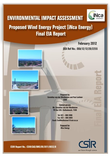
Title: Environmental Impact Assessment for the proposed iNca Vredendal Wind project<br />
in the Western Cape Province: <strong>Final</strong> <strong>EIA</strong> <strong>Report</strong><br />
Purpose of this report: This <strong>Final</strong> Environmental Impact Assessment (<strong>EIA</strong>) <strong>Report</strong> forms part of a series of<br />
reports and information sources that are being provided during the <strong>EIA</strong> process<br />
for the proposed iNca Vredendal Wind project in the Western Cape Province. In<br />
accordance with the <strong>EIA</strong> Regulations, the purpose of the <strong>EIA</strong> <strong>Report</strong> is to:<br />
Present the proposed project, including project alternatives and the need<br />
for the project;<br />
Describe the affected environment, including the planning context, at a<br />
sufficient level of detail to facilitate informed decision making;<br />
Provide an overview of the <strong>EIA</strong> process being followed, including public<br />
consultation;<br />
Assess the predicted positive and negative impacts of the project on the<br />
environment;<br />
Provide recommendations to avoid or mitigate negative impacts and to<br />
enhance the positive benefits of the project;<br />
Provide a draft EMP for the design, construction and operational phases of<br />
the project.<br />
The <strong>Final</strong> <strong>EIA</strong> <strong>Report</strong> and EMP are being made available to all stakeholders for a<br />
review period extending from 10 February 2012 to 02 March 2012. All comments<br />
on the <strong>Final</strong> <strong>EIA</strong> and EMP will be considered for decision-making and are to be<br />
submitted to the National Department of Environmental Affairs (DEA) as well as<br />
the Environmental Assessment Practitioner (EAP).<br />
Prepared for: iNca Vredendal Wind (Pty) Ltd<br />
Contact person: Mr Ian McGregor<br />
Published by: <strong>CSIR</strong>, P O Box 320, Stellenbosch, 7599, South Africa<br />
Tel: +27-21-888 2400<br />
Fax: +27-21-888 2693<br />
Lead Authors: Cornelius van der Westhuizen & Paul Lochner<br />
<strong>CSIR</strong> <strong>Report</strong> Number:<br />
<strong>CSIR</strong> Project Number:<br />
DEA Ref Number 12/12/20/2255<br />
<strong>CSIR</strong>/CAS/EMS/ER/2011/0032/B<br />
CASKG92<br />
Date: 10 February 2012<br />
To be cited as: <strong>CSIR</strong>, 2012. Environmental Impact Assessment for the proposed iNca Vredendal<br />
Wind project in the Western Cape: <strong>Final</strong> <strong>EIA</strong> <strong>Report</strong>. <strong>CSIR</strong> <strong>Report</strong> Number:<br />
<strong>CSIR</strong>/CAS/EMS/ER/2011/0032/B. Stellenbosch.<br />
<strong>CSIR</strong> – February 2012<br />
pg 4
<strong>CSIR</strong> has been commissioned by iNca Vredendal Wind (Pty) Ltd to undertake an environmental<br />
impact assessment in terms of the 2010 <strong>EIA</strong> Regulations R.543, R.544, R.545 and R.546 under the<br />
National Environmental Management Act, 1998 (Act 107 of 1998, with amendments). <strong>CSIR</strong><br />
complies with the general requirements set out below in the Regulations:<br />
General requirements for EAPs or a person compiling a specialist report or undertaking a<br />
specialised process<br />
17. An EAP appointed in terms of regulation 16(1) must -<br />
(a) be independent;<br />
(b) have expertise in conducting environmental impact assessments, including knowledge<br />
of the Act, these Regulations and any guidelines that have relevance to the proposed<br />
activity;<br />
(c) perform the work relating to the application in an objective manner, even if this results<br />
in views and findings that are not favourable to the applicant;<br />
(d) comply with the Act, these Regulations and all other applicable legislation;<br />
(e) take into account, to the extent possible, the matters referred to in regulation 8 when<br />
preparing the application and any report relating to the application; and<br />
(f) disclose to the applicant and the competent authority all material information in the<br />
possession of the EAP that reasonably has or may have the potential of influencing-<br />
(i) any decision to be taken with respect to the application by the competent<br />
authority in terms of these Regulations; or<br />
(ii) the objectivity of any report, plan or document to be prepared by the EAP in<br />
terms of these Regulations for submission to the competent authority.<br />
<strong>CSIR</strong> – February 2012<br />
pg 5
I. INLEIDING 7<br />
II. DIE VOORSTELLER 8<br />
III. III BEHOEFTE AAN DIE PROJEK 9<br />
IV. OMGEWINGSASSESSERINGSPROSES 10<br />
V. VOORGESTELDE INFRASTRUKTUUR 11<br />
VI. OPSOMMING VAN IMPAKASSESSERING 12<br />
A. Plantkunde en aard-fauna 12<br />
B. Voëls 12<br />
C. Vlermuise 13<br />
D. Argeologie 14<br />
E. Paleontologie 14<br />
F. Visueel 14<br />
G. Landbou 15<br />
H. Water 16<br />
<strong>CSIR</strong> – February 2012<br />
pg 6
I. Inleiding<br />
iNca Vredendal Wind (Edms.) Bpk. –filiaal van iNca Energy (Edms.) Bpk. – is van voorneme om<br />
elektrisiteit met behulp van windenergie op die Restant van Plaas 293, Groot Draaihoek, en die<br />
Resterende Gedeeltes 1, 7 en 8 van Plaas 293, net buite die dorp Vredendal in die Wes-Kaap op te<br />
wek (sien Figuur 1). Die aanleg en die gepaardgaande infrastruktuur sal bestaan uit tot 15<br />
turbines met ʼn opwekings kapasiteit van 2 tot 3 MW elk, om 30 MW elektrisiteit op te wek. Die<br />
alternatiewe wat in hierdie ondersoek oorweeg is, is soos volg:<br />
● Geen projek alternatief,<br />
● 15 turbines van 2 MW elk; en<br />
● 10 turbines van 3 MW elk.<br />
Die totale oppervlak beskikbaar vir die voorgestelde aanleg bestaan uit sowat 3 530 ha, waarvan<br />
nagenoeg 7 ha fisiese wysiging sal ondergaan vir die bou van toegangspaaie, ondergrondse<br />
bekabeling, bergingsgebiede en betonfondasies vir die turbines. Die aanleg sal ook die oprigting<br />
van ’n 66 kV-lyn van nagenoeg 8 km na die bestaande Vredendal-substasie benodig. ’n Gebied van<br />
minder as 35 ha sal deur die voorgestelde ontwikkeling ingesluit word (sien Figuur 2).<br />
Figuur 1: Ligging van iNca Vredendal-windaanleg(in rooi omlyn)<br />
(Google Earth-beeld)<br />
<strong>CSIR</strong> – February 2012<br />
pg 7
Figuur 2: Voorlopige terreinuitleg vir 15 × 2 MW-turbines met: beheerkamer, meetmas, harde staanoppervlakke<br />
(grys), bestaande paaie (groen), paaie wat gebou moet word (oranje), kraglyne (wit), buffer van 1.5 keer die<br />
tuimelafstand (geel), en grens van die eiendom (rooi).<br />
(Bron: Google Earth)<br />
II. Die Voorsteller<br />
iNca Energy se hooffokusarea is om wind- en sonkragprojekte in Suid-Afrika te ontwikkel en te<br />
bedryf met die uiteindelike doel om ʼn toonaangewende, onafhanklike kragvoorsiener in Suider-<br />
Afrika te word. Die maatskappy se meerderheidsaandeelhouer is Nu Age Energy (deur die Kopano<br />
Ke Matla Investment Company – KKM), die beleggingsarm van die kontinent se grootste<br />
vakbondfederasie, COSATU, waarby meer as 2 miljoen lede en hulle gesinne baat vind. KKM se<br />
hoofdoelstellings is om beleggingsmoontlikhede op ʼn sosiaal-verantwoordelike wyse na te streef.<br />
Die maatskappy is op soek na beleggingsgeleenthede wat regstreeks sal bydra tot die bemagtiging<br />
van werkers en die gemeenskap waarin hulle woon.<br />
iNca Vredendal Wind (Edms.) Bpk. het die WNNR aangestel om die Omgewingsimpakassesseringsproses<br />
van die voorgestelde windenergie-aanleg te onderneem en die<br />
biofisiese, sosiale en ekonomiese impakte wat met die onderneming van die voorgestelde<br />
aktiwiteite verband hou, te bepaal.<br />
<strong>CSIR</strong> – February 2012<br />
pg 8
III. Behoefte aan die Projek<br />
Die Wes-Kaap loop tans kwaai deur onder beperkings wat die beskikbaarheid en stabiliteit van<br />
elektrisiteitstoevoer betref. Dit is ʼn gevolg van die oorbelasting van Suid-Afrika se<br />
elektrisiteitopwekking-en-voorsieningstelsel, en die feit dat die Wes-Kaap die meeste van sy krag<br />
moet invoer. Die transmissielyne wat die Wes-Kaap met die nasionale netwerk verbind, kan nie in<br />
die provinsie se maksimum elektrisiteitsaanvraag van ongeveer 3 500 tot 3 900 MW voorsien nie.<br />
Druk op die plaaslike ontwikkelingskapasiteit – veral op die Koebergkernkragsentrale (2 eenhede<br />
met ʼn gesamentlike maksimum kapasiteit van 1 800 MW) – is sodanig dat, as een reaktor by<br />
Koeberg nie gekoppel is nie, die hele provinsie toevoertekorte ondervind. Die behoefte om<br />
bykomende krag in die provinsie op te wek, is gevolglik aangetoon.<br />
Die tradisionele steenkoolgebaseerde elektrisiteitsontwikkeling voorsien tans ongeveer 90% van<br />
Suid-Afrika se toevoer. Die ontwikkeling van nuwe krag uit windenergie gaan na verwagting<br />
alreeds in 2020 tot 2025, en dalk selfs vroeër, goedkoper steenkoolgebaseerde<br />
elektrisiteitsontwikkeling raak. Daarna gaan windenergie na verwagting steeds goedkoper word<br />
in vergelyking met die stygende koste van steenkoolkrag (NERSA, 2009). Dit toon die ekonomiese<br />
behoefte om windenergie-aanlegte in Suid-Afrika te ontwikkel.<br />
Die ontwikkeling van windenergie is ook vir Suid-Afrika belangrik ten einde sy algemene<br />
omgewingsvoetspoor uit kragopwekking (sosiale, ekonomiese en omgewings<br />
eksternaliteitskostes ingereken) te verklein, en die land daardeur op die weg na volhoubaarheid<br />
te plaas. Steenkoolgebaseerde kragopwekking is wêreldwyd ʼn groot bron van<br />
koolstofdioksiedemissies, wat tot aardverwarming bydra. Indien die iNca Vredendal-windprojek<br />
realiseer, kan dit toekomstige koolstofemissies met 125 000 ton per jaar verminder (bereken as<br />
2.5 GWh kragopwekking per geïnstalleerde MW, met ʼn emissiefaktor van 1 ton CO2/MW).<br />
Windopwekking skakel ook die waterverbruik wat met die opwekking van krag uit steenkool<br />
gepaardgaan uit, wat belangrik is gegewe dat Suid-Afrika ʼn droë land met streng waterbeperkings<br />
is. Eskom gebruik tans ongeveer 2% van Suid-Afrika se totale varswaterbronne om krag op te<br />
wek, hoofsaaklik met behulp van natverkoelde steenkoolkragsentrales. Versnelde<br />
klimaatsverandering het die potensiaal om die beskikbaarheid van water en die hoeveelheid<br />
water in Suid-Afrika te beïnvloed. Dit skep ʼn risiko vir waterafhanklike kragopwekking. In<br />
vergelyking daarmee behels windenergie geen direkte waterverbruik gedurende die operationele<br />
fase nie.<br />
Die Wes-Kaap beoog om die provinsie se huidige energiesamestelling te verander sodat dit teen<br />
2014 15% hernubare energiebronne sal bevat (Witskrif oor Volhoubare Energie, Wes-Kaap,<br />
2008), wat ongeveer 500 tot 600 MW van die beskikbare hernubare energie is. Daar word verwag<br />
dat die Wes-Kaapse windregime minstens ʼn 30%-kapasiteitsfaktor sal voorsien (d.w.s. 30% van<br />
die tyd voldoende windenergie by geskikte terreine sal opwek). Indien hierdie hernubare<br />
energieteiken volledig uit windenergie sou moes bestaan, sou dit dus ʼn geïnstalleerde kapasiteit<br />
van ongeveer 1 600 tot 2 000 MW benodig. Die iNca Vredendal-projek sal tot hierdie teiken bydra.<br />
Nagenoeg 60 werksgeleenthede oor verskeie vaardigheidsvlakke heen sal ook gedurende die<br />
konstruksiefase van die projek oor ongeveer 12 maande geskep word. Bykomende sekondêre<br />
sakegeleenthede vir die plaaslike en streeksekonomieë sal verskaf word. Alhoewel minder mense<br />
(tussen 2 en 5) in diens geneem sal word gedurende die operasionele fase, sal dit geleenthede vir<br />
vaardigheidsopleiding en sakeontwikkeling in die gebied verskaf.<br />
<strong>CSIR</strong> – February 2012<br />
pg 9
IV. Omgewingsassesseringsproses<br />
Regulasies vir Omgewingsimpakassesserings (OIA) is kragtens hoofstuk 5 van die Wet op<br />
Nasionale Omgewingsbestuur (NEMA), Wet 107 van 1998, in 1997 en 2006 afgekondig en, meer<br />
onlangs, in 2010. Die voorgestelde projek benodig ingevolge Regeringskennisgewing R545<br />
volledige Bestekopname- en Omgewingsimpakverslagdoening, en sluit aktiwiteite in wat in<br />
Regeringskennisgewing R544 (wat Basiese Assessering vereis) en Regeringskennisgewing R546<br />
(vir geografiese gebiede) gelys is. Gegewe die strategiese belang van energie, benodig die projek<br />
magtiging van die nasionale Departement van Omgewingsake (DOS). Openbare betrokkenheid<br />
maak ʼn belangrike komponent van hierdie proses uit deur bystand te verleen met die<br />
identifisering van kwessies en alternatiewe wat geëvalueer moet word.<br />
Hierdie OIA-verslag is voorafgegaan deur ’n omvattende bestekopnameproses wat gelei het tot<br />
die voorlegging op 14 Oktober 2011 van ’n <strong>Final</strong>e Bestekopnameverslag (en Studieplan vir die<br />
OIA) aan die Departement van Omgewingsake (DOS) vir goedkeuring. Goedkeuring is op 08<br />
Desember 2011 ontvang, wat die einde van die Bestekopnamefase aangedui het, waarna die OIAproses<br />
na die impakassessering en verslagdoeningfase beweeg het. Vir agtergrond oor die<br />
bestekopnameproses word die leser na die <strong>Final</strong>e Bestekopnameverslag verwys.<br />
As deel van die Bestekopnameproses is alle Belanghebbendes en Geaffekteerde Partye (B&GP’e)<br />
genooi om op die Konsep- Omgewingsassesseringsverslag kommentaar te lewer. Kommentaar<br />
ontvang gedurende hierdie kommentaar periode is in hierdie finale verslag ingesluit. Hierdie<br />
finale verslag is weereens vir openbare inspeksie beskikbaar by die openbare biblioteke te<br />
Vredendal, Klawer en Lutzville. ʼn Elektroniese weergawe van hierdie verslag is op die internet<br />
beskikbaar by:<br />
http://www.csir.co.za/eia/vredendal.html<br />
Hierdie verslag is vir ʼn tydperk van 21 dae vir kommentaar beskikbaar. Alle kommentare<br />
en reaksies moet teen 02 Maart 2012 aan die Nationale Departement van Omgewingsake<br />
en die Omgewingsassesseringspraktisyn gerig word by die onderstaande<br />
kontakbesonderhede.<br />
Mpho Morudu<br />
Nasionale Departement van Omgewingsake<br />
Privaatsak X 447<br />
Pretoria<br />
Tel: 012 395 1775<br />
Faks:012 320 7539<br />
E-pos: Mmorudu@environment.gov.za<br />
<strong>CSIR</strong> – February 2012<br />
pg 10<br />
Cornelius van der Westhuizen<br />
WNNR<br />
Posbus 320<br />
Stellenbosch<br />
Tel: 021 888 2408<br />
Faks: 021 888 2693<br />
E-pos: CvdWesthuizen1@csir.co.za
V. Voorgestelde Infrastruktuur<br />
Die aanleg en die gepaargaande infrastruktuur sal uit die onderstaande infrastruktuur bestaan:<br />
Paaie<br />
● Deur minder as een kilometer pad deur droëland- landbougrond te bou, kan die voorgestelde<br />
terrein vanaf die R363- openbare pad bereik word. Afgesien van die een kilometer pad wat<br />
gebou moet word, sal ’n bestaande pad van ongeveer 7.5 km wat tot die terrein lei, waar<br />
nodig opgegradeer word.<br />
● ʼn Interne padnetwerk na die turbines en ander infrastruktuur (substasie en beheerkamer)<br />
word benodig. Die padnetwerk kan draaisirkels vir groot vragmotors, en verbysteekpunte<br />
insluit.<br />
Elektriese aansluitings<br />
● Twee oorhoofse 11 kV-lyne van ongeveer 8 km sal die aanleg met die bestaande 66 kV-<br />
Vredendal-substasie, wat op die terrein geleë is, verbind. Vanaf die terrein tot by die substasie<br />
sal die kraglyne in die bestaande padreserwe en in bestaande kraglynserwitute geïnstalleer<br />
word.<br />
● Elektriese transformators sal langs elke turbine geplaas word.<br />
● Die windturbines sal deur ondergrondse mediumspanningskabels langs die interne<br />
padnetwerk met mekaar verbind word, behalwe waar tegniese assessering daarop dui dat<br />
oorhoofse lyne geskik is. Hierdie kraglyne sal in die interne padserwitute geïnstalleer word.<br />
Windturbines<br />
● Daar is nog nie op turbinetegnologie besluit nie, maar tot 15 turbines met ʼn geïnstalleerde<br />
kapasiteit van tussen 2 MW en 3 MW elk, na gelang van die finale ontwerp, word in die<br />
vooruitsig gestel. Moontlike turbines wat oorweeg word, is die 3 MW Alstorm ECO 100 en die<br />
3 MW Vestas V112 met ʼn naafhoogte van tot 94 m en ʼn rotordiameter van tot 112 m. Die<br />
turbines sal ondersteun word deur verspreide fondasies van gewapende beton (maksimum<br />
18 m x 18 m x 4 m diep). Die operasionele lewensduur van die windturbines is na verwagting<br />
minstens 25 jaar. Die turbineleeftyd kan deur gereelde onderhoud en/of<br />
tegnologieopgraderings verleng word om langer as 25 jaar te hou.<br />
● Harde staanareas met ʼn gruisoppervlak (maksimum 40 m x 20 m) langs elke turbine sal<br />
gedurende konstruksie deur hyskrane gebruik en vir die volle projekleeftyd vir<br />
instandhouding behou word.<br />
Ander infrastruktuur<br />
● ʼn Enkele beheerkamer (10 m x 10 m groot) word vir die windplaas benodig.<br />
● Omheining word benodig om substasie en beheerkamer.<br />
● ʼn Permanente windmeetmas van 80 m (die windmas is reeds op die terrein opgerig en<br />
registreer winddata reeds sedert Desember 2010)<br />
<strong>CSIR</strong> – February 2012<br />
pg 11
VI. Opsomming van Impakassessering<br />
A. PLANTKUNDE EN AARD-FAUNA<br />
Daar is bevind dat die aardekologiese sensitiwiteit oor die terrein heen uiteenlopend is en<br />
grootliks van die vlak van landbouverwante transformasie en degradering afhanklik is. Die meeste<br />
van die turbine-infrastruktuur is geleë in gebiede met ʼn lae sensitiwiteit. Degradering in die vorm<br />
van indringende uitheemse plantinfestasies op die terrein is geneig om baie beperk en<br />
onreëlmatig te wees. Gebiede met ʼn matige sensitiwiteit kom aanliggend aan die voorgestelde<br />
toegangspad voor. Die enigste geaffekteerde gebied wat potensieel ʼn hoë sensitiwiteit het, sou die<br />
Kritiese Biodiversiteitsarea wees wat deur die bestaande pad wat wyer gemaak en opgegradeer<br />
sal moet word, gekruis word. Die voorgestelde pad sal ʼn ongeteerde bestaande plaaspad volg en<br />
bykomende verlies van plantegroei weens verbreding van die pad sal redelik beperk wees. In die<br />
aanvanklike ontwerpfase is meer sensitiewe areas baie doeltreffend vermy en impakte sal dus<br />
minimaal wees.<br />
Van ʼn gronddier-perspektief is daar bevind dat party spesies wat van besondere belang is, in die<br />
gebied teenwoordig is en deur die voorgestelde ontwikkeling geraak sal word. Daar is bevind dat<br />
alle amfibieë teenwoordig op die terrein van die minste belang is en dat hulle elders goed<br />
beskerm is. Die spesies wat gedurende die konstruksie van hierdie projek die meeste geraak sal<br />
word, is die spesies wat nie self die geaffekteerde gebied kan ontruim nie, bv. skilpaaie, grawende<br />
reptiele en grawende soogdiere. Hierdie spesies kan direkte sterftes ervaar. Verkeer op die<br />
toegangspaaie na en van die bouterreine sal hoogs waarskynlik daartoe lei dat diere doodgery<br />
word. Selfs alhoewel die oprigting van die windturbines sekere impakte sal hê, kan sodanige<br />
impakte, met die toepassing van versagtende maatreëls, tot die minimum beperk of heeltemal<br />
verwyder word. Die oprigting van die windturbines het die potensiaal om positiewe impakte, soos<br />
bewaring van habitat, ens. te stimuleer. Die ontwikkeling van hierdie projek sal positief wees,<br />
m.a.w. ʼn verbode alternatief sal lei tot nie-bewaring van die gebied en sal negatief wees.<br />
Daar is bevind dat met doeltreffende versagtingsmaatreëls impakte op die grond-fauna en flora<br />
beperk kan word tot lae belang, beide gedurende die oprigting en gedurende die operasionele<br />
fases van die voorgestelde ontwikkeling.<br />
B. VOËLS<br />
Die Vredendal-windenergieterrein is ʼn relatief klein windplaasterrein, met beperkte intrinsieke<br />
voëlbiodiversiteitswaarde. Dit bevat nie enige unieke habitats of landskapeienskappe nie, en dit<br />
raak ook nie enige bekende, groot vliegpaaie van voëls nie. Daar is egter (ten minste seisoenaal),<br />
streeks- en/of nasionaal belangrike populasies spesies teenwoordig (bv. Ludwig se pou) wat<br />
vatbaar kan wees vir die impak, en die voorgestelde aanleg kan moontlik ʼn beduidende nadelige<br />
uitwerking op hierdie voëls hê, in die besonder gedurende die operasionele fase van die<br />
ontwikkeling. Daar is in 2007 opgeteken dat ʼn paar breëkoparende in een van die Aurora-Juno<br />
400kV-torings nagenoeg 3 km van die naaste voorgestelde windturbine nes maak. Dit is nie tans<br />
bekend of hierdie nes steeds aktief is nie. Dit sal gedurende die 12-maande- moniteringsfase voor<br />
konstruksie ondersoek word soos alreeds deur die voorsteller ooreengekom.<br />
<strong>CSIR</strong> – February 2012<br />
pg 12
Die totale aantal turbines en die grootte van die spasiëring tussen hulle kan moontlik die<br />
belangrikste faktor wees by die bepaling van die botsingsrisiko op hierdie spesifieke terrein, in die<br />
besonder met die oog op die moontlikheid van gereelde vlugaktiwiteit van grondspesies.<br />
Daarbenewens behoort die vlakke van steurnis geskep deur die geraas en beweging van die<br />
turbines minder te wees met minder turbines. Vanuit ʼn voëlimpak-perspektief behoort tien 3<br />
MW-turbines dus bo vyftien 2 MW-turbines verkies te word.<br />
Implementering van die nodige versagtingsmaatreëls behoort impakte gedurende die boufase tot<br />
Laag, en impakte gedurende die operasionele fase tot laag of laag-medium te verminder.<br />
C. VLERMUISE<br />
Die voorgestelde Vredendal-windenergieprojek val binne die verspreidingsgebiede van 9 spesies<br />
wat in die gebied oorvleuel. Die belangrikste aspek van die projek wat vlermuise nadelig sou raak,<br />
is die windturbines self en, in besonder, die draaiende lemme wanneer in werking. Daar is verder<br />
ʼn kumulatiewe impak wat verband hou met die feit die Klawer-windprojek nagenoeg 13 km van<br />
die Vredendal-windenergieprojek geleë is.<br />
Afgesien van ʼn bouvallige huis sowat 1.6 km noordoos van die noordoostelike grens van die<br />
voorgestelde terrein, lyk dit nie asof die terrein habitat bevat wat aantreklik is vir vlermuise nie.<br />
Die naaste terreinvoorwerpe wat ’n aanduiding gee van vlermuise is die opstalgeboue en damme<br />
op Groot Draaihoek. Blomme gedurende die lente kan moontlik insekte lok, wat, as ʼn voedselbron<br />
van insektivore, vlermuise kan lok. Verder tref ’n mens ook op plekke waar daar vee en skape wei,<br />
meer vlieë aan wat dien as ʼn voedselbron vir vlermuise.<br />
Die volgende spesies is op die terrein opgeteken: Neoromicia capensis (Minste Bedreig),<br />
Miniopterus natalensis (Byna Bedreig), Tadarida aegyptiaca (Minste Bedreig) en Eptesicus<br />
hottentotus (Minste Bedreig). Die hoogste aantal verbyvlugte deur vlermuise is opgeteken vir<br />
Neoromicia capensis en Tadarida aegyptiaca. Laasgenoemde soek kos in die ope lug en sal<br />
waarskynlik kos soek in die omgewing van die werkende lemme van die turbines. Dit kan nie<br />
buite rekening gelaat word nie dat die ander spesies ook kos in die omgewing van die turbinelemme<br />
sal soek, óf wanneer hulle kos soek óf oor die terrein vlieg wanneer hulle migreer.<br />
Die voorsteller het alreeds ʼn vlermuisspesialis betrek by die ontwerpfase van die projek en het<br />
hom tot monitering voor konstruksie verbind. Verdere monitering sal vlermuisaktiwiteit bevestig.<br />
Op die oomblik is die belangrikste versagting wat voorgestel word om dakke van nuwe geboue<br />
asook dié van bestaande geboue naby die terrein waar daar nie tans enige vlermuise slaap nie,<br />
volkome te verseël. Dit sal voorkom dat vlermuise intrek en dit meer waarskynlik sal maak dat<br />
hulle met die turbines in die omliggende gebied in aanraking sal kom. Indien moniteringsdata in<br />
die toekoms hoë aktiwiteit toon, sal die kliënt tesame met ʼn vlermuisspesialis verdere<br />
versagtingsmaatreëls ondersoek. Dit sluit in verfyning van operasionele prosedures soos<br />
vermindering van die spoed van turbines.<br />
Die geen-projek scenario, wat geen dramatiese direkte of indirekte impakte het nie, is natuurlik<br />
vanuit ʼn vlermuisperspektief die dwingendste opsie, maar aangesien aansoek om ontwikkeling<br />
voorgelê word, is die voorgestelde windplaasontwikkeling ondersoek. Literatuur doen aan die<br />
hand dat vlermuis-ongevalle eksponensieel toeneem met toringhoogte, wat daarop dui dat groter<br />
turbines die lugruim van migrerende vlermuise bereik. Tans is daar geen optekenings op hoogte<br />
by die studie geïnkorporeer nie. Dit is dus onseker of die verskil (10 – 20 m) in hoogte tussen die 2<br />
<strong>CSIR</strong> – February 2012<br />
pg 13
MW en 3 MW alternatiewe ʼn effek op vlermuis mortaliteit sal hê. Vanuit ʼn vlermuis-perspektief,<br />
is daar dus geen voorkeur alternatief vir hierdie projek nie.<br />
Met inagneming van data wat tot op hede ingesamel is, word voorspel dat die impak wat die windturbines<br />
op vlermuise by die voorgestelde Vredendal-windenergieprojek sal hê van medium<br />
belang met versagting sal wees. Vertrouensvlakke is laag aangesien beperkte data geïnkorporeer<br />
is, maar die verslag sal bygewerk word met bykomende inligting uit die toekomstige<br />
moniteringsresultate.<br />
D. ARGEOLOGIE<br />
Gedurende die veldwerk wat in Oktober 2011 gedoen is, is een (aar-) kwartsskilfer uit die Laat<br />
Steentydperk en een kwartsstukkie en een kwartsietskilfer uit die Middel Steentydperk in die<br />
voetspoorgebied van die voorgestelde windenergieplaas gedokumenteer. Een kwartsietskilfer uit<br />
die Middel Steentydperk en twee silkreetskilfers uit die Laat Steentydperk (met inbegrip van een<br />
bygewerkte skilfer) is in die toegangspad (moet opgegradeer word), wat langs die voorgestelde<br />
kraglynserwituut geleë is, gedokumenteer. Geen argeologiese oorblyfsels is in die voorgestelde<br />
kraglynserwituut gekry nie.<br />
Die lae getalle en geïsoleerde opset beteken dat die argeologiese oorblyfsels as van lae belang<br />
geskat word en basislynstudie het getoon dat die voorgestelde ontwikkeling van die iNca<br />
Vredendal-windenergieplaas ʼn lae belang impak op die argeologiese erfenis sal hê nie.<br />
Aanduidings is dat die voorgestelde terrein vir die windenergieplaas nie ʼn sensitiewe<br />
argeologiese landskap is nie. Daar is tot die gevolgtrekking gekom dat geen argeologiese<br />
versagting vereis word nie en daar word aanbeveel dat die voorgestelde kontrakteursterrein<br />
sodra dit geïdentifiseer is, vir argeologiese oorblyfsels ondersoek sal word.<br />
E. PALEONTOLOGIE<br />
’n Paleontologiese lessenaarstudie is deur dr. John Almond uitgevoer. Afgesien van verspreide<br />
klein blootleggings van fluviale kwartsiete van die Skiereilandformasie (Tafelberggroep) uit die<br />
Ordovisium-tyd, is die ontwikkelingsgebied bedek met ʼn reeks oppervlakkige afsettings uit die<br />
Laat-Kainosoïkum-tyd, met inbegrip van eoliese sandsoorte en verskeie grondsoorte.<br />
Die algemene paleontologiese sensitiwiteit van die Tafelberggroep en die “gletser”-sedimente uit<br />
die Laat-Kainosoïkum-tyd wat in die studiegebied gekarteer is, is laag tot baie laag. Die<br />
paleontologiese impak sal dus van lae belang wees. Om hierdie rede word geen verdere<br />
paleontologiese studies of versagtende maatreëls vir hierdie ontwikkeling aanbeveel nie.<br />
F. VISUEEL<br />
Die voorgestelde windplaas is geleë op ʼn landskap wat as matig tot hoogs visueel sensitief beskryf<br />
word, met ʼn betekenis wat plaaslik is eerder as regionaal. Die landskap is relatief yl bevolk na die<br />
suide en digter bevolk na die noorde langs die Olifantsrivier, met inbegrip van Vredendal. Die<br />
windplaas, meer spesifiek die windturbines, sal vanaf die meeste dele binne ʼn 20 km-radius van<br />
die terrein af gesien kan word aangesien die landskap relatief plat is. ’n Mate van afskerming word<br />
<strong>CSIR</strong> – February 2012<br />
pg 14
verskaf deur plaaslike landvorme soos die Sederberg, sandsteeninselberge, laagliggende valleie en<br />
laagliggende kusplatforms.<br />
Die ontvangers sluit in inwoners van 8 opstalle tussen 2 en 7 km van die voorgestelde windplaasterrein<br />
en gebruikers van plaaslike paaie wat die dorpe en plase bedien. Die dorp Vredendal is 7–<br />
15 km van die terrein en sal die voorgestelde turbines van sekere dele af sien, in die besonder die<br />
Vredendal-Noord-omgewing en die suidelike rand van die dorp. Die windplaas sal ook vanaf ʼn<br />
baie kort gedeelte van die N7 twintig kilometer daarvandaan gesien word. Daar is geen<br />
ontvangers binne 1 km van die terrein waar skadu-geflikker aansienlik geag word nie met die<br />
naaste ontvangers die Groot Draaihoek-opstal, 2 km daarvandaan, en gebruikers op ʼn 2 kmstrook<br />
gruispad wat tussen Vredendal/Klawer en Lambertsbaai, 3 km daarvandaan, loop.<br />
Beligting sal sigbaar wees vir bogemelde ontvangers en behoort tot die minimum beperk te wees,<br />
m.a.w. verminder tot ʼn minimum van 8 turbines op die Alternatief met 15 turbines en 6 turbines<br />
op die Alternatief met 10 turbines.<br />
Die voorgestelde Alternatief 2, m.a.w. 10 turbines, 94 m-hoë naafhoogtes met 60 m-rotorlemme,<br />
sal nie die aantal ontvangers verminder nie maar sal daartoe lei dat minder turbines gesien kan<br />
word. Daar sal geen groot visuele wins of beduidende versagting wees deur vermindering van die<br />
aantal turbines van 15 tot 10 nie; daarom is beide alternatiewe aanvaarbaar.<br />
Die beperkte aantal van hierdie hoë turbines (10–15) in ʼn uitgestrekte lig golwende landskap<br />
alhoewel naby berge aan die een kant, is visueel indringend vir ʼn paar ontvangers, maar<br />
oorwegend opmerkbaar vir die meeste ontvangers. Dit lei daartoe dat die algemene visuele impak<br />
matig tot hoog is.<br />
G. LANDBOU<br />
Die grondondersoek is gebaseer op grondontledingputte. Alle grondsoorte het onder dor<br />
klimaatstoestande in sanderige alluvium-moedermateriaal gevorm. Die boonste grondhorisonne<br />
(A- en B-horisonne) is baie uniform oor die gebied heen. Hulle is rooi, sanderige (
aanvullende voedselbron vir die skape. Baie van die vorige strookverbouingslanderye word vir<br />
baie jare reeds nie bewerk nie.<br />
Alle landbou-impakte word beskou as van lae belang, hoofsaaklik as gevolg van die klein<br />
voetspoor van die ontwikkeling en die minimale versteuring van landbou-aktiwiteite, en die feit<br />
dat dit op grond met baie lae landbouproduktiwiteit geleë is. Die effektiewe verlies van<br />
landbougrond is bepaal as slegs 6 hektaar, wat ʼn skamele 0.17% van die grondoppervlak van die<br />
plaas uitmaak. Die algemene landbou-impak van die voorgestelde ontwikkeling is laag.<br />
H. WATER<br />
Die voorgestelde projek is geleë op die waterskeiding tussen die E33G en G30H kwaternêre<br />
opvanggebiede en in die Olifants D en Sandveld sub-waterbestuursgebiede. Die terrein waar die<br />
turbines opgerig sal word, is nagenoeg 8 km suid van die Olifantsrivier geleë. ʼn Toegangspad wat<br />
opgegradeer moet word, is verder as 1.5 km van die rivier geleë. Volgens die fynskaal- Kritiese<br />
Biodiversiteitskaarte asook die Nasionale Varswater- Ekologiese Beskermde Gebiede-kaarte is<br />
daar ʼn moerasland op die westelike grens van die plaas, geleë nagenoeg 900 m van die naaste<br />
projekverwante infrastruktuur. Met inspeksie is bevind, in ʼn niespesialiskapasiteit, dat die gebied<br />
afgebaken as ʼn moerasland geen moeraslandeienskappe toon nie.<br />
Aangesien die terrein geleë is op ʼn rif wat optree as ʼn skeiding tussen twee wateropvanggebiede,<br />
is daar geen vlak watertafel wat deur die ontwikkeling geaffekteer kan word nie. Die afwesigheid<br />
van ʼn watertafel is deur die grondeienaar bevestig aangesien daar geen water aangetref is toe<br />
boorgate vir vee-doeleindes geboor is nie. Daar is voorgestel dat water vir die boufase van die<br />
plaaslike munisipaliteit verkry word.<br />
ʼn Kunsmatige kanaal wat besproeiingswater van die Bulshoekdam verder af in die vallei oorbring,<br />
kruis die plaas op die noordoostelike deel. Daar is ook ʼn kunsmatige, uitgevoerde dam langs die<br />
kanaal wat water vir die plaas se besproeiingsbehoeftes opberg. ʼn Bestaande toegangspad wat<br />
opgegradeer gaan word, kruis hierdie kanaal by ʼn bestaande brug. Dit is nog nie bekend of die<br />
bestaande brug die las van die boutoerusting en turbinekomponente sal kan dra nie. Indien nodig,<br />
sal die brug versterk word.<br />
In ooreenstemming met die definisie van ʼn ‘waterloop’ soos verskaf deur beide die Wet op<br />
Nasionale Omgewingsbestuur (107 van 1998) (soos gewysig 2010) asook die Nasionale Waterwet<br />
(36 van 1998) maak die kanaal nie ʼn waterloop uit nie.<br />
Aangesien daar nie verwag word dat die voorgestelde windenergie-aanleg enige fisiese voetspoor<br />
binne 500 m van ʼn waterloop sal laat nie en water van die plaaslike munisipaliteit verkry sal<br />
word, word daar verwag dat dit ʼn lae belang impak op enige varswaterhulpbronne sal hê nie. Die<br />
projek vereis nie ʼn watergebruikaansoek nie.<br />
<strong>CSIR</strong> – February 2012<br />
pg 16
I. INTRODUCTION 18<br />
II. THE PROPONENT 19<br />
III. NEED FOR THE PROJECT 20<br />
IV. ENVIRONMENTAL ASSESSMENT PROCESS 21<br />
V. PROPOSED INFRASTRUCTURE 22<br />
VI. SUMMARY OF IMPACT ASSESSMENT 23<br />
A. botany and terrestrial fauna 23<br />
B. Birds 23<br />
C. Bats 24<br />
D. Archaeology 25<br />
E. Palaeontology 25<br />
F. Visual 25<br />
G. Agriculture 26<br />
H. Water 27<br />
<strong>CSIR</strong> – February 2012<br />
pg 17
I. Introduction<br />
Nca Vredendal Wind (Pty) Ltd (a subsidiary of iNca Energy (Pty) Ltd), proposes to generate<br />
electricity with wind energy on the Remainder of Farm 293, Groot Draaihoek, and Remainder<br />
Portions 1, 7 and 8 of Farm 293 just outside the town of Vredendal in the Western Cape Province<br />
(see Figure 1). The facility and its associated infrastructure will comprise up to 15 turbines of 2 to<br />
3 MW installed capacity each, to generate have a total installed capacity of 30 MW. The<br />
alternatives considered for this <strong>EIA</strong> are as follow:<br />
No-go (i.e. the project does not proceed);<br />
15 turbines of 2 MW each; and<br />
10 turbines of 3 MW each.<br />
The total area available for the proposed facility comprises about 3530 ha, of which<br />
approximately 7 ha will undergo physical alteration for the construction of access roads,<br />
underground cabling, lay-down areas and concrete foundations for the turbines. The facility will<br />
also require the construction of a 66 kV line of approximately 8 km to the existing Vredendal<br />
Substation. An area of less than 35 ha will be enclosed by the proposed development (see Figure<br />
2).<br />
Figure 1: Location of iNca Vredendal Wind facility<br />
<strong>CSIR</strong> – February 2012<br />
pg 18
(Google Earth image)<br />
Figure 2: Provisional site layout for 15 × 2 MW turbines with: control room; measuring mast; hard standing<br />
areas (grey); existing roads (green); roads to be constructed (orange); power lines (white); 1.5 times toppling<br />
distance buffer (yellow); and property boundary (red).<br />
(Source: Google Earth)<br />
II. The Proponent<br />
iNca Energy's main area of focus is to develop and operate wind and solar energy projects in<br />
South Africa, with the ultimate goal of becoming a leading independent power producer in<br />
Southern Africa. Its majority shareholder is Nu Age Energy, through the Kopano Ke Matla<br />
Investment Company (KKM), the investment arm of the continent’s largest trade union federation,<br />
COSATU, benefiting over 2 million members and their families. KKM’s primary objectives are to<br />
pursue investment opportunities in a socially responsible manner. It seeks investment ventures<br />
that will directly contribute to the empowerment of workers and the communities in which they<br />
live.<br />
The <strong>CSIR</strong> has been appointed by iNca Vredendal Wind (Pty) Ltd to undertake the <strong>EIA</strong> process of<br />
the proposed wind energy facility, to determine the biophysical, social and economic impacts<br />
associated with undertaking the proposed activity.<br />
<strong>CSIR</strong> – February 2012<br />
pg 19
III. Need for the Project<br />
The Western Cape Province is currently facing considerable constraints in the availability and<br />
stability of electricity supply. This is a consequence of South Africa’s electricity generation and<br />
supply system being overstretched and that the Western Cape is reliant on the import of<br />
electricity for the majority of its requirements. The province’s maximum electricity demand of<br />
approximately 3500 to 3900 MW cannot be met by the transmission line connecting the Western<br />
Cape to the national grid. Accordingly, pressure on local generation capacity, most notably the<br />
Koeberg Nuclear Power Station (2 units with combined maximum capacity of 1800 MW), is such<br />
that if one reactor at Koeberg is offline, the entire province experiences supply shortages.<br />
Accordingly, the need has been identified to generate additional power in the province.<br />
Traditional coal-based electricity generation currently contributes approximately 90% of South<br />
Africa’s supply. Generation of new power from wind is predicted to become cheaper than coal by<br />
as early as 2020 to 2025, and possibly sooner. Thereafter, wind energy is predicted to continue to<br />
become cheaper relative to rising costs of coal power (NERSA, 2009). This indicates the economic<br />
need to develop wind energy facilities in South Africa.<br />
The development of wind energy is also important for South Africa to reduce its overall<br />
environmental footprint from power generation (including environmental, social and economical<br />
externality costs), and thereby to steer the country on a pathway towards sustainability. Coalbased<br />
power generation is a major<br />
global source of carbon dioxide emissions, which contributes to global warming. If realized, the<br />
iNca Vredendal Wind project could reduce future carbon emissions by 125 000 tonnes per year<br />
(calculated as 2.5 GWh power generation per installed MW, with an emissions factor of 1 tonne<br />
CO2/MW).<br />
Wind generation also avoids the water consumption associated with generation of power from<br />
coal, which is important given that South Africa is an arid country with severe water constraints.<br />
Eskom currently uses approximately 2% of South Africa’s total fresh water resources to produce<br />
power largely from wet-cooled coal power stations. Accelerated climate change has the potential<br />
to impact on the availability and quantity of water in South Africa. This creates a risk for waterdependent<br />
power generation. By comparison, wind energy projects have no direct water<br />
consumption during the operational phase.<br />
The Western Cape Province aims to change the province's current energy mix to include 15%<br />
renewable energy sources by 2014 (White Paper on Sustainable Energy, Western Cape 2008),<br />
which is approximately 500 to 600 MW of available renewable energy. The Western Cape wind<br />
regime is anticipated to provide at least a 30% capacity factor (i.e. generate sufficient wind energy<br />
30% of the time at suitable sites). If this renewable energy target was to be met entirely by wind<br />
energy, this would therefore require an installed capacity of approximately 1600 to 2000 MW.<br />
The iNca Vredendal project would contribute to this target.<br />
Approximately 60 employment opportunities, including various skill levels, will be created during<br />
the construction phase of the project, which will extend for between 12 and 18 months. It is<br />
certain that additional secondary business opportunities for the local and regional economies will<br />
be generated as a result of the project. Although fewer staff (between 2 and 5) will be employed<br />
<strong>CSIR</strong> – February 2012<br />
pg 20
during the project’s operational phase, opportunities will be provided for skills training and<br />
business development in the area.<br />
IV. Environmental Assessment Process<br />
Regulations for <strong>EIA</strong>s were promulgated under Chapter 5 of the National Environmental<br />
Management Act (NEMA, Act 107 of 1998) in 1997 and 2006 and, most recently, in 2010. The<br />
proposed project requires full Scoping and Environmental Impact <strong>Report</strong>ing (S&EIR) in terms of<br />
GN.R545, and includes activities listed in GN.R544 (requiring Basic Assessment) and GN.R546 (for<br />
geographical areas). Given the strategic importance of energy, the project requires authorisation<br />
from the national Department of Environmental Affairs (DEA). Public involvement forms an<br />
important component of this process, by assisting in the identification of issues and alternatives to<br />
be evaluated.<br />
This <strong>EIA</strong> <strong>Report</strong> was preceded by a comprehensive scoping process that led to the submission of a<br />
<strong>Final</strong> Scoping <strong>Report</strong> (and Plan of study for the <strong>EIA</strong>) to the Department of Environmental Affairs<br />
(DEA) for approval on 14 October 2011. Approval was received on 08 December 2011 which<br />
marked the end of the Scoping phase, after which the <strong>EIA</strong> process moved into the impact<br />
assessment and reporting phase. For background on the scoping process, the reader is referred to<br />
the <strong>Final</strong> Scoping <strong>Report</strong><br />
As part of the <strong>EIA</strong> process all Interested and Affected Parties were invited to provide comment on<br />
this Draft Environmental Assessment <strong>Report</strong>. Comments received are included in this <strong>Final</strong> <strong>EIA</strong><br />
<strong>Report</strong>. This final report is one more available for public review at the Vredendal, Klawer and<br />
Lutzville public libraries. An electronic version of this report is available on the internet at:<br />
http://www.csir.co.za/eia/vredendal.html<br />
This report is available for commenting for a 21-day period. All comments and responses<br />
should be submitted to the National Department of Environmental Affairs as well as the<br />
Environmental Assessment Practitioner at the contact details below by the 02 March 2012.<br />
Mpho Morudu<br />
National Department of Environmental Affairs<br />
Private Bag X 447<br />
Pretoria<br />
Tel: 012 395 1775<br />
Fax:012 320 7539<br />
E-mail: Mmorudu@environment.gov.za<br />
<strong>CSIR</strong> – February 2012<br />
pg 21<br />
Cornelius van der Westhuizen<br />
<strong>CSIR</strong><br />
Posbus 320<br />
Stellenbosch<br />
Tel: 021 8882408<br />
Faks: 021 8882693<br />
E-pos: CvdWesthuizen1@csir.co.za
V. Proposed Infrastructure<br />
The facility and its associated infrastructure will comprise the following infrastructure:<br />
Roads<br />
● By constructing a road less than 1 km in length through dryland agricultural fields, the<br />
proposed site can be accessed from the R363 public road. In addition to construction of this<br />
new road, an existing road leading to the site, of approximately 7.5 km in length, will be<br />
upgraded where necessary.<br />
● An internal road network connecting the turbines and other infrastructure (substation and<br />
control room) is necessary and will be provided. The road network may include turning<br />
circles for large trucks and passing points.<br />
Electrical connections<br />
● Two overhead 11 kV lines, approximately 8 km in length, will connect the facility to the<br />
existing 66 kV Vredendal substation located on the property. The powerlines will be installed<br />
in the existing road reserve and in existing power line servitudes.<br />
● Electrical transformers will be placed beside each turbine.<br />
● The wind turbines will be connected to each other by underground medium voltage cables,<br />
except where a technical assessment suggests that overhead lines are appropriate. These<br />
power lines will be installed within the internal road servitudes.<br />
Wind turbines<br />
● Turbine technology has not at this stage been finally selected; however, up to 15 turbines<br />
with an installed capacity of between 2 MW and 3 MW each, depending on the final design,<br />
are envisaged. Possible turbines considered are the 3 MW Alstorm ECO 100 and the 3 MW<br />
Vestas V112, with a hub height of up to 94 m and a rotor diameter of up to 112 m. Turbines<br />
will be supported on reinforced concrete spread foundations (maximum 18 m x 18 m x 4 m<br />
deep). The operational life of the wind turbines is expected to be a minimum of 25 years.<br />
Turbine life can be extended beyond 25 years through regular maintenance and/or<br />
technology upgrades.<br />
● Gravel-surfaced hard standing areas (maximum 40 m x 20 m) adjacent to each turbine will be<br />
used by cranes during construction and retained for maintenance use throughout the life<br />
span of the project.<br />
Other infrastructure<br />
● A single control room (size 10 m x 10 m) is required for the wind farm.<br />
● Fencing will be erected, as required, around the substation and the control room.<br />
● Permanent wind measuring mast of 80 m. The wind mast has been erected on the site and<br />
has been recording wind data since December 2010.<br />
<strong>CSIR</strong> – February 2012<br />
pg 22
VI. Summary of Impact Assessment<br />
A. BOTANY AND TERRESTRIAL FAUNA<br />
It was found that the terrestrial ecological sensitivity is variable across the site and is largely<br />
influenced by the level of agriculture-related transformation and degradation. The majority of the<br />
turbine infrastructure will be sited in areas having a low sensitivity. Degradation in the form of<br />
invasive alien plant infestations tends to be very limited and patchy on the site. Areas with a<br />
moderate sensitivity occur adjacent to the proposed access road. The only affected area<br />
potentially having a high sensitivity would be the Critical Biodiversity area traversed by the<br />
existing road that needs to be widened and upgraded. The proposed road will follow the route of<br />
an unsurfaced existing farm road. Loss of vegetation due to road widening will therefore be quite<br />
limited. In the initial design phase the sensitive areas on the property have been avoided with the<br />
result that potential impacts on botany and fauna will be minimal.<br />
From a terrestrial faunal perspective it was found that some species of special concern are present<br />
in the area and will be affected by the proposed development. All amphibians present on the site<br />
were found to be of least concern and are well protected elsewhere. The species that will be<br />
mostly affected during the construction of this project are the species that cannot vacate the<br />
affected area themselves, e.g. tortoises, burrowing reptiles and burrowing mammals. These<br />
species can suffer direct mortality. Traffic on the access roads to and from the construction sites<br />
would most likely result in road kills. Even though the erection of the wind turbines will have<br />
certain impacts, with the enforcement of mitigating measures, these impacts can be minimised or<br />
eliminated entirely. The erection of the wind turbines has the potential to stimulate positive<br />
impacts, such as habitat preservation. The development of this project will be positive; i.e. a no-go<br />
alternative will lead to non preservation to the area and will be negative.<br />
It was found that with effective mitigation measures impacts on terrestrial fauna and flora can be<br />
reduced to low significance, both during the construction and operational phases of the proposed<br />
development.<br />
B. BIRDS<br />
The Vredendal wind energy site is a relatively small wind farm site, with limited intrinsic avian<br />
biodiversity value. It does not contain any unique habitats or landscape features, nor does it affect<br />
any known, major avian fly-ways. However, there are (at least seasonally), regionally and/or<br />
nationally important populations of impact-susceptible species present (e.g. Ludwig’s Bustard)<br />
and the proposed facility may have a significant detrimental effect on these birds, particularly<br />
during the operational phase of the development. A pair of Martial Eagles has been recorded in<br />
2007 to nest in one of the Aurora-Juno 400kV towers approximately 3 km from the nearest<br />
proposed wind turbine. It is not currently known whether this nest is still active. This will be<br />
investigated during the 12 month pre-construction monitoring phase as already agreed to by the<br />
project proponent.<br />
The absolute number of turbines and the size of the spacing between them may be the most<br />
important factor in determining the risk of collision at this particular site, especially in view of the<br />
likelihood of regular flight activity of terrestrial species. In addition, the levels of disturbance<br />
<strong>CSIR</strong> – February 2012<br />
pg 23
created by the noise and movement of the turbines should be less with fewer turbines. From a<br />
bird impact perspective, ten 3 MW turbines would be preferable to fifteen 2 MW turbines.<br />
Implementation of the required mitigation measures should reduce construction phase impacts to<br />
Low, and operational phase impacts to low or low-medium.<br />
C. BATS<br />
The Proposed Vredendal Wind Energy Project falls within the distributional ranges of at least 9<br />
species that overlap in the area. The most important aspect of the project that would affect bats<br />
adversely is the wind turbines themselves, in particular, the operational turning blades. There is<br />
furthermore a cumulative impact related to the fact the Klawer Wind Project is situated<br />
approximately 13 km from the Vredendal Wind Energy project.<br />
Except for a derelict house about 1.6 km north-east from the north-eastern border of the<br />
proposed site, the site does not seem to contain habitat that is attractive to bats. The closest<br />
features that are indicative of bats are the Groot Draaihoek farmstead buildings and dams.<br />
Flowers during spring time might attract insects, which, as a food source of insectivores, attract<br />
bats. Furthermore, wherever cattle and sheep graze one will also find more flies which serves as a<br />
food source for bats.<br />
The following species were recorded on site: Neoromicia capensis (Least Concern), Miniopterus<br />
natalensis (Near Threatened), Tadarida aegyptiaca (Least Concern) and Eptesicus hottentotus<br />
(Least Concern). The highest number of bat passes was recorded for Neoromicia capensis and<br />
Tadarida aegyptiaca. The latter is an open air forager and highly likely to forage in the vicinity of<br />
the operating turbine blades. It is not ruled out that the other species will also forage in the<br />
vicinity of the turbine blades, either when they are foraging or crossing the site while migrating.<br />
The proponent has already involved a bat specialist in the design phase of the project and<br />
committed himself to pre-construction monitoring. Further monitoring will confirm bat activity.<br />
At present the main mitigation proposed is to completely seal off roofs of new buildings as well as<br />
those of existing buildings close to the site that do not have any bats roosting in them at present.<br />
This will prevent bats from moving into the area for roosting purposes, which would make it more<br />
likely that they could come into contact with the turbines in the surrounding area. If future<br />
monitoring data shows high activity, the client together with a bat specialist should investigate<br />
further mitigation measures. This includes refining operational procedures such as cut in speed of<br />
turbines.<br />
The no-go scenario, being without any dramatic direct or indirect impacts, is of course from a bat<br />
perspective the most compelling option, but as a development application is being submitted, the<br />
proposed wind farm development has been investigated. Literature suggests that bat fatalities<br />
increase exponentially with tower height, suggesting that larger turbines are reaching the airspace<br />
of migrating bats. At present no recordings at height have been incorporated in the study. Also, no<br />
research has been conducted concerning the impact of different size turbines on southern African<br />
bat species and there is, therefore, uncertainty as to whether the difference (10 – 20 m) in height<br />
between the 2 MW and 3 MW options will have any effect on bat mortality. From a bat perspective,<br />
no preferred alternative is provided in terms of this study. If monitoring indicates that the<br />
proposed wind farm is on a bat migration route, the project design and operation may need to be<br />
revisited.<br />
<strong>CSIR</strong> – February 2012<br />
pg 24
Considering data collected up to now the impact of the wind turbines on bats at the proposed<br />
Vredendal Wind Energy Project is predicted to be of medium significance with mitigation.<br />
Confidence levels are low since limited data have been incorporated, but the report will be<br />
updated with additional information from the forthcoming monitoring results.<br />
D. ARCHAEOLOGY<br />
During the fieldwork conducted October 2011 one Later Stone Age (vein) quartz flake, one quartz<br />
chunk and one Middle Stone Age quartzite flake was documented in the footprint area of the<br />
proposed wind energy farm. One Middle Stone Age quartzite flake and two Later Stone Age<br />
silcrete flakes (including one retouched flake) were documented in the access road (to be<br />
upgraded), which is situated alongside the proposed powerline servitude. No archaeological<br />
remains were found in the proposed powerline servitude.<br />
The small numbers and isolated context means that the archaeological remains have been rated as<br />
having low significance and baseline study has shown that the proposed development of the iNca<br />
Vredendal Wind Energy Farm will have a low significance impact of great significance on the<br />
archaeological heritage.<br />
Indications are that the proposed site for the wind energy farm is not a sensitive archaeological<br />
landscape. It has been concluded that no archaeological mitigation is requited and recommended<br />
that the proposed contractor’s site must be inspected for archaeological remains once it has been<br />
identified.<br />
E. PALAEONTOLOGY<br />
A palaeontological desktop study of the project area was conducted. Apart from scattered small<br />
exposures of fluvial quartzites of the Peninsula Formation (Table Mountain Group) of Ordovician<br />
age, the development area is blanketed in a range of Late Caenozoic superficial deposits, including<br />
aeolian sands and various soils.<br />
The overall palaeontological sensitivity of the Table Mountain Group and Late Caenozoic “drift”<br />
sediments mapped within the study region is low to very low. The palaeontological impact is thus<br />
of low significance. For this reason, no further palaeontological studies or mitigation measures<br />
were recommended for this development.<br />
F. VISUAL<br />
The proposed windfarm is situated on a landscape that is described as moderately to highly<br />
visually sensitive, with a significance that is local rather than regional. The landscape is relatively<br />
sparsely populated to the south and more densely populated to the north along the Olifants River,<br />
including Vredendal. The windfarm, more particularly, the wind turbines, will be seen from most<br />
parts within a 20 km radius of the site as the landscape is relatively flat. Some screening is<br />
provided by local landforms such as the Cederberg Mountains, sandstone inselbergs, low lying<br />
valleys and low lying coastal platforms.<br />
<strong>CSIR</strong> – February 2012<br />
pg 25
The receptors include residents of 8 farmsteads between 2 and 7 km of the proposed windfarm<br />
site and users of local roads servicing the towns and farms. The town of Vredendal is 7 – 15 km<br />
from the site and will see the proposed turbines from certain areas, in particular the Vredendal<br />
North area and the southern edge of the town. The windfarm will also be seen from a very short<br />
section of the N7 twenty kilometers away. There are no receptors within 1 km of the site where<br />
shadow flicker is considered significant with the closest receptors being the Groot Draaihoek<br />
farmstead, 2 kms away, and users on a 2 km stretch of a gravel road, which runs between<br />
Vredendal/Klawer and Lamberts Bay, which is 3 km away.<br />
Lighting will be visible to the above mentioned receptors and should be minimized, i.e. reduced to<br />
a minimum of 8 turbines on the Alternative with 15 turbines and 6 turbines on the Alternative<br />
with 10 turbines.<br />
The proposed Alternative 2, i.e. 10 turbines, 94 m high hub heights with 60 m rotor blades, will<br />
not reduce the number of receptors but will result in less turbines being seen. There will be no<br />
major visual gain or significant mitigation by reducing the number of turbines from 15 to 10,<br />
therefore either alternative would be acceptable.<br />
The limited number of these high turbines (10 -15) in a landscape that is extensive and gently<br />
undulating albeit near to mountains on one side, is visually intrusive to a few receptors but<br />
predominantly noticeable to most receptors results in the overall visual impact being medium to<br />
high significance.<br />
G. AGRICULTURE<br />
The soil investigation was based on soil test pits. All soils have formed under arid climatic<br />
conditions within sandy alluvium parent material. The upper soil horizons (A and B horizons) are<br />
very uniform across the area. They are red, sandy (
All agricultural impacts are considered to be of low significance, predominantly because of the<br />
small footprint of the development and its minimal disturbance of agricultural activities, and the<br />
fact that it is situated on land of very low agricultural productivity. The effective loss of<br />
agricultural land was determined as only 6 hectares, which represents a mere 0.17% of the land<br />
surface of the farm. The overall agricultural impact of the proposed development is of low<br />
significance.<br />
H. WATER<br />
The proposed project is located on the divide between the E33G and G30H quaternary catchments<br />
and in the Olifants D and Sandveld sub-Water Management Areas. The site where the turbines<br />
will be constructed is located approximately 8 km south of the Olifants River. An access road that<br />
needs to be upgraded is located more than 1.5 km away from the river. According to the fine scale<br />
Critical Biodiversity maps as well as the National Freshwater Ecological Protected Areas maps<br />
there is a wetland on the western boundary of the farm, located approximately 900 m from the<br />
nearest project related infrastructure. Upon inspection (in a non-specialist capacity) it was found<br />
that the area demarcated as a wetland does not show any wetland characteristics.<br />
Since the site is located on a ridge acting as a divide between two water catchment areas there is<br />
no shallow water table that can be affected by the development. The absence of a water table has<br />
been confirmed by the land owner as there was no water to be found when drilling boreholes for<br />
livestock purposes. It is proposed to source water for the construction phase from the local<br />
municipality.<br />
An artificial canal transferring irrigation water from the Bulshoek Dam farther down the valley<br />
traverses the north-eastern portion of the farm. There is also an artificial lined dam next to the<br />
canal that stores off-stream water for the farm’s irrigation needs. An existing access road<br />
proposed to be upgraded crosses this canal at an existing bridge. It is not yet know whether the<br />
existing bridge can handle the load of the construction equipment and turbine components. If<br />
necessary, the bridge will be reinforced.<br />
According to definition of a ‘watercourse’ as provided by both the National Environmental<br />
Management Act, (107 of1998) (as amended 2010) as well as the National Water Act (36 of 1998)<br />
the canal does not constitute a watercourse.<br />
Since the proposed wind energy facility is not expected to have any physical footprint within<br />
500 m of a watercourse and water will be sourced from the local municipality it is expected to<br />
have low significance impact on any freshwater resource. The project does not trigger a water use<br />
application.<br />
<strong>CSIR</strong> – February 2012<br />
pg 27
<strong>CSIR</strong> – February 2012<br />
pg 1-1<br />
Chapter 1: Introduction<br />
1. INTRODUCTION AND BACKGROUND 1-3<br />
1.1 PROJECT OVERVIEW 1-4<br />
1.2 THE PROJECT PROPONENT 1-4<br />
1.3 PURPOSE OF THE PROJECT 1-5<br />
1.4 ENVIRONMENTAL ASSESSMENT PROCESS 1-5<br />
1.5 DETAILS AND EXPERTISE OF THE ENVIRONMENTAL ASSESSMENT<br />
PRACTITIONER (EAP) 1-5<br />
1.6 <strong>EIA</strong> TEAM 1-6<br />
1.7 OBJECTIVES FOR THIS <strong>EIA</strong> REPORT 1-6
<strong>CSIR</strong> – February 2012<br />
pg 1-2<br />
Chapter 1: Introduction<br />
Table 1-1 The <strong>EIA</strong> Management Team 1-6<br />
Table 1-2 Summary of where requirements of an Environmental Impact Assessment <strong>Report</strong> (in terms of<br />
Regulations 31(2), 32 and 33 of the NEMA 2010 <strong>EIA</strong> Regulations) are provided in this <strong>EIA</strong><br />
<strong>Report</strong> 1-7<br />
Figure 1-1 Location of the proposed wind energy project (bordered in red) near Vredendal 1-3<br />
Figure 1-2 Representation of the shareholders of iNca Energy (Pty) Ltd (at the top) 1-4
<strong>CSIR</strong> – February 2012<br />
pg 1-3<br />
Chapter 1: Introduction<br />
1. INTRODUCTION AND BACKGROUND<br />
iNca Vredendal Wind (Pty) Ltd - a subsidiary of iNca Energy (Pty) Ltd - proposes to establish a<br />
wind farm for the generation of electricity on the farm Groot Draaihoek Remainder Farm 293 and<br />
Remainder Portions 1, 7 and 8 of Farm 293 near the town of Vredendal in the Western Cape<br />
Province. The facility will comprise of up to 15 turbines with an installed generation capacity of<br />
between 2 MW to 3 MW each, in order to attain a total installed capacity of 30 MW of power. The<br />
total number of turbines to be installed will depend on the individual turbine capacity. The facility<br />
and its associated infrastructure will have a footprint of less than 35 hectares.<br />
The <strong>CSIR</strong> has been appointed by iNca Vredendal Wind (Pty) Ltd to undertake the Environmental<br />
Impact Assessment (<strong>EIA</strong>) of the proposed wind energy facility to determine the biophysical, social<br />
and economic impacts associated with undertaking the proposed activity. The impacts associated<br />
with its construction and operation are assessed in this <strong>EIA</strong> report.<br />
Figure 1-1 Location of the proposed wind energy project (bordered in red) near Vredendal<br />
(Source: Google Earth)
1.1 PROJECT OVERVIEW<br />
<strong>CSIR</strong> – February 2012<br />
pg 1-4<br />
Chapter 1: Introduction<br />
The applicant proposes to generate 30 MW of electricity from wind energy on the farm Groot<br />
Draaihoek Remainder of Farm 293 and Remainder Portions 1, 7 and 8. The farm is located in the<br />
Vredendal administrative district and the Matzikama municipal area. The current landuse is<br />
agricultural, with a portion of the farm having been cultivated and the rest grazed by domestic<br />
livestock. The project details are discussed in Chapter 2 of this report.<br />
1.2 THE PROJECT PROPONENT<br />
The proponent for the proposed wind energy facility is iNca Vredendal Wind (Pty) Ltd, a<br />
subsidiary of iNca Energy (Pty) Ltd. iNca Energy's main area of focus is to develop and operate<br />
wind and solar energy projects in South Africa, with the ultimate goal of becoming a leading<br />
independent power producer in Southern Africa.<br />
Its majority shareholder (51%) is Nu Age<br />
Energy, through the Kopano Ke Matla<br />
Investment Company (KKM) The latter is the<br />
investment arm of the continent’s largest trade<br />
union federation, COSATU, benefiting over 2<br />
million members and their families. KKM’s<br />
primary objectives are to pursue investment<br />
opportunities in a socially and environmentally<br />
responsible manner. It seeks investment<br />
ventures that will directly contribute to the<br />
empowerment of workers and the communities<br />
in which they live. The remaining shareholder is<br />
iNca Energy France, with 49% shareholding,<br />
This company brings with it vast experience of<br />
the wind energy industry through their<br />
partnership with a major utility.<br />
Nu Age Energy (Pty) Ltd plays an active role as<br />
a BEE Partner, and will ensure that good social<br />
practices are applied and that disadvantaged<br />
people will be empowered.<br />
Figure 1-2 Representation of the<br />
shareholders of iNca Energy (Pty) Ltd<br />
(at the top)
1.3 PURPOSE OF THE PROJECT<br />
<strong>CSIR</strong> – February 2012<br />
pg 1-5<br />
Chapter 1: Introduction<br />
The purpose for the proposed project is to feed electricity from the wind energy facility into the<br />
national electricity grid. This is supported by purchase tariffs known as the Renewable Energy<br />
Feed-in Tariff, which the national energy regulator, NERSA, announced in 2009 to incentivise the<br />
growth of renewable energy. The project is aimed at overcoming rolling blackouts anticipated by<br />
the Medium Term Risk Mitigation Plan (MTRM) 1 for electricity in South Africa from 2011 to 2016<br />
if non-Eskom power generation projects are not realised. The need and desirability of this project<br />
are discussed in Chapter 2 of this report.<br />
1.4 ENVIRONMENTAL ASSESSMENT PROCESS<br />
Regulations for <strong>EIA</strong>s were promulgated under Chapter 5 of the National Environmental<br />
Management Act (NEMA, Act 107 of 1998) in 1997 2 and 2006 3 and, most recently, in 2010 4 . The<br />
proposed project requires full Scoping and Environmental Impact <strong>Report</strong>ing (S&EIR) in terms of<br />
GN.R545, published in June 2010, and includes Basic Assessments required for activities listed in<br />
GN.R544 and GN.R546. Given that energy related projects have been elevated to national strategic<br />
importance in terms of the environmental authorisation process, the proposed project requires<br />
authorisation from the National Department of Environmental Affairs (DEA), acting in<br />
consultation with other spheres of government. Public involvement forms an important<br />
component of this process, by assisting in the identification of issues and alternatives to be<br />
evaluated. The listed activities included in the proposed project are discussed in detail in Chapter<br />
5 of this report.<br />
1.5 DETAILS AND EXPERTISE OF THE ENVIRONMENTAL ASSESSMENT<br />
PRACTITIONER (EAP)<br />
The <strong>EIA</strong> Project Team is being led by Paul Lochner, who has 19 years experience in environmental<br />
assessment and management studies, primarily in the leadership and integration functions. He is<br />
a certified Environmental Assessment Practitioner for South Africa (EAPSA). Paul is supported by<br />
a <strong>CSIR</strong> Project Manager, Cornelius van der Westhuizen. Cornelius completed an MSc<br />
Environmental Management at the Christian Albrecht Universität zu Kiel, Germany (refer to<br />
Appendix A for EAP CVs).<br />
1 Medium Term Risk Mitigation Plan (MTRM) for Electricity in South Africa - 2010 to 2016. Department of Energy. Available<br />
online: http://www.doe-irp.co.za/content/Medium_Term_Risk_Mitigation_Project_Phase_1.pdf. Accessed 11 July 2011.<br />
2 Government Notice No. R. 1182 of 5 September 1997 (as amended)<br />
3 Government Notice No. R. 385, R386 and R387 of 21 April 2006 (as amended)<br />
4 Government Notice No. R. 543, R544, R545 and R546 of 18 June 2010 (as amended)
1.6 <strong>EIA</strong> TEAM<br />
<strong>CSIR</strong> – February 2012<br />
pg 1-6<br />
Chapter 1: Introduction<br />
This report includes a Plan of Study for <strong>EIA</strong> (PS<strong>EIA</strong>) that outlines how the <strong>EIA</strong> is being undertaken<br />
and prescribes the roles and responsibilities of parties involved. Public involvement forms an<br />
important component of this process, by assisting in the identification of issues and alternatives to<br />
be evaluated. The <strong>CSIR</strong> team appointed to undertake the <strong>EIA</strong> is presented in Table 1-1. The<br />
specialists are familiar with the environment or have done similar specialist studies for other<br />
<strong>EIA</strong>s.<br />
Table 1-1 The <strong>EIA</strong> Management Team<br />
NAME ORGANISATION ROLE<br />
Paul Lochner <strong>CSIR</strong> Project Leader (EAPSA)<br />
Cornelius van der Westhuizen<br />
Specialist Team<br />
<strong>CSIR</strong> Project Manager<br />
Jamie Pote (botany) and Mark Marshal<br />
(desktop terrestrial faunal input)<br />
Private Consultants Botany and terrestrial fauna<br />
Chris van Rooyen, Chris van Rooyen Consultants Avifauna (birds)<br />
Stephanie Dippenaar Private Consultant Bats<br />
Megan Anderson Megan Anderson Landscape<br />
Architects<br />
Visual<br />
Jonathan Kaplan Agency for Cultural Resource<br />
Heritage (archaeology)<br />
Management<br />
Dr John Almond Natura Viva Palaeontology (desktop study)<br />
Johann Lanz Private Consultant Agriculture<br />
1.7 OBJECTIVES FOR THIS <strong>EIA</strong> REPORT<br />
This <strong>EIA</strong> <strong>Report</strong> was preceded by a comprehensive scoping process that led to the submission of a<br />
<strong>Final</strong> Scoping <strong>Report</strong> (and Plan of study for the <strong>EIA</strong>) to the Department of Environmental Affairs<br />
(DEA) for approval on the 14th of October 2011. Approval was received on 08 December 2011<br />
which marked the end of the Scoping phase, after which the <strong>EIA</strong> process moved into the impact<br />
assessment and reporting phase. For background on the scoping process, the reader is referred to<br />
the <strong>Final</strong> Scoping <strong>Report</strong> (<strong>CSIR</strong>, 2011) 5.<br />
The primary objective of this <strong>EIA</strong> <strong>Report</strong> is to present the competent authority (i.e. DEA) and<br />
interested and affected parties (I&APs), with the predicted impacts and associated management<br />
actions required to avoid or mitigate the negative impacts; or to enhance the benefits of the<br />
proposed project.<br />
5 <strong>CSIR</strong>, 2011. Environmental Impact Assessment for the proposed iNca Vredendal Wind project in the Western<br />
Cape: <strong>Final</strong> Scoping <strong>Report</strong>. <strong>CSIR</strong> <strong>Report</strong> Number: <strong>CSIR</strong>/CAS/EMS/ER/2011/0018/B. Stellenbosch. Available<br />
online at: http://www.csir.co.za/eia/vredendal.html
<strong>CSIR</strong> – February 2012<br />
pg 1-7<br />
Chapter 1: Introduction<br />
In terms of legal requirements, a crucial objective of the <strong>EIA</strong> <strong>Report</strong> is to satisfy the requirements<br />
of Regulations 31, 32 and 33 of the NEMA <strong>EIA</strong> Regulations of 18 June 2010 which came into effect<br />
on 2 August 2010. These regulations determine/prescribe the content of the <strong>EIA</strong> <strong>Report</strong> and<br />
specify the type of supporting information that must accompany the submission of the report to<br />
the authorities. An overview of where the requirements are addressed in this report is presented<br />
in Table 1.2.<br />
This process is also designed to satisfy the requirements of Regulations 55, 56 and 57 of the<br />
NEMA 2010 <strong>EIA</strong> Regulations relating to the public participation process and, specifically, the<br />
registration of I&APs and recording their submissions. All I&APs on the current database for this<br />
<strong>EIA</strong> (Appendix D) have been informed of the release of the final <strong>EIA</strong> <strong>Report</strong> for a 21-day<br />
commenting period. All comments on the Draft <strong>EIA</strong> <strong>Report</strong> are recorded and addressed in this<br />
<strong>Final</strong> <strong>EIA</strong> <strong>Report</strong>. Comments received on this <strong>Final</strong> <strong>EIA</strong> <strong>Report</strong> will be considered by DEA for<br />
decision-making.<br />
The draft Environmental Management Plan (EMP) that is required as part of the <strong>EIA</strong> process<br />
(Regulation 33) is provided in Section B of this <strong>EIA</strong> <strong>Report</strong>.<br />
Table 1-2 Summary of where requirements of an Environmental Impact Assessment <strong>Report</strong> (in terms of<br />
Regulations 31(2), 32 and 33 of the NEMA 2010 <strong>EIA</strong> Regulations) are provided in this <strong>EIA</strong> <strong>Report</strong><br />
SECTION REQUIREMENT FOR <strong>EIA</strong> REPORT<br />
WHERE THIS IS<br />
PROVIDED IN THIS<br />
<strong>EIA</strong> REPORT<br />
(2) (a) (i) The EAP who compiled the report Chapter 1, Appendix A<br />
(2) (a) (ii) The expertise of the EAP to carry out an environmental impact<br />
assessment<br />
Appendix A<br />
(2) (b) A detailed description of the proposed activity Chapter 2<br />
(2) (c) A description of the property on which the activity is to be<br />
Chapter 5 and<br />
undertaken and the location of the activity on the property, or if it is: Chapters 6 to 13<br />
(2) (c) (i) A linear activity, a description of the route of the activity N/A<br />
(2) (c) (ii) An ocean-based activity, the coordinates where the activity is to be<br />
undertaken<br />
N/A<br />
(2) (d) A description of the environment that may be affected by the activity Chapter 5 and<br />
and the manner in which the physical, biological, social, economic<br />
and cultural aspects of the environment may be affected by the<br />
proposed activity<br />
Chapters 6 to 13<br />
(2) (e) Details of the public participation process conducted in terms of<br />
sub-regulation (1), including:<br />
Chapter 4<br />
(2) (e) (i) Steps undertaken in accordance with the plan of study Chapter 4<br />
(2) (e) (ii) A list of persons, organisations and organs of state that were<br />
registered as interested and affected parties<br />
Appendix D<br />
(2) (e) (iii) A summary of comments received from, and a summary of issues<br />
raised by registered interested and affected parties, the date of<br />
receipt of these comments and the response of the EAP to those<br />
comments<br />
Chapter 14<br />
(2) (e) (iv) Copies of any representation, objections and comments received Appendix E
SECTION REQUIREMENT FOR <strong>EIA</strong> REPORT<br />
<strong>CSIR</strong> – February 2012<br />
pg 1-8<br />
Chapter 1: Introduction<br />
WHERE THIS IS<br />
PROVIDED IN THIS<br />
<strong>EIA</strong> REPORT<br />
(2) (f)<br />
from registered interested and affected parties<br />
A description of the need and desirability of the proposed activity Chapter 2<br />
(2) (g) A description of identified potential alternatives to the proposed Chapter 3 and<br />
activity, including advantages and disadvantages that the proposed<br />
activity or alternatives may have on the environment and the<br />
community that may be affected by the activity<br />
Chapters 6 to 13<br />
(2) (h) An indication of the methodology used in determining the<br />
significance of potential environmental impacts<br />
Chapter 4<br />
(2) (i) A description and comparative assessment of all alternatives Chapter 3, 4 and<br />
identified during the environmental impact assessment process Chapters 6 to 13<br />
(2) (j) A summary of the findings and recommendations of any specialist<br />
report or report on a specialised process<br />
Chapter 15<br />
(2) (k) A description of all environmental issues that were identified during<br />
the environmental impact assessment process, an assessment of the<br />
significance of each issue and an indication of the extent to which<br />
the issue could be addressed by the adoption of mitigation measures<br />
Chapters 6 to 13<br />
(2) (l) An assessment of each identified potentially significant impact,<br />
including:<br />
Chapters 6 to 13<br />
(2) (l) (i) Cumulative impacts Chapters 6 to 13<br />
(2) (l) (ii) The nature of the impact Chapters 6 to 13<br />
(2) (l) (iii) The extent and duration of the impact Chapters 6 to 13<br />
(2) (l) (iv) The probability of the impact occurring Chapters 6 to 13<br />
(2) (l) (v) The degree to which the impact can be reversed Chapters 6 to 13<br />
(2) (l) (vi) The degree to which the impact may cause irreplaceable loss of<br />
resources<br />
Chapters 6 to 13<br />
(2) (l) (vii) The degree to which the impact can be mitigated Chapters 6 to 13<br />
(2) (m) A description of any assumptions, uncertainties and gaps in<br />
knowledge<br />
Chapters 6 to 13<br />
(2) (n) A reasoned opinion as to whether the activity should or should not<br />
be authorised, and if the opinion is that it should be authorised, any<br />
conditions that should be made in respect of that authorisation<br />
Chapter 15<br />
(2) (o) An environmental impact statement which contains Chapter 15<br />
(2) (o) (i) A summary of the key findings of the environmental impact<br />
assessment<br />
Chapter 15<br />
(2) (o) (ii) A comparative assessment of the positive and negative implications<br />
of the proposed activity<br />
Chapter 15<br />
(2) (p) A draft environmental management programme containing the<br />
aspects contemplated in regulation 33<br />
Section B<br />
(2) (q) Copies of any specialist reports and reports on specialised processes<br />
complying with regulation 32<br />
Chapters 6 to 12<br />
(2) (r) Any specific information that may be required by the competent<br />
authority<br />
N/A<br />
(2) (s) Any other matters required in terms of sections 24 (4) (a) and (b) of<br />
the Act<br />
N/A
<strong>CSIR</strong> – February 2012<br />
pg 2-1<br />
Chapter 2: Project Description<br />
2. PROJECT DESCRIPTION 2-3<br />
2.1 KEY COMPONENTS OF THE PROPOSED ENERGY FACILITY 2-3<br />
2.2 GENERAL DESCRIPTION OF A WIND TURBINE 2-6<br />
2.3 PROJECT ACTIVITIES 2-8<br />
2.3.1 Construction 2-8<br />
2.3.2 Operation and maintenance 2-12<br />
2.3.3 Period of operation 2-12<br />
2.3.4 Decommissioning 2-12<br />
2.4 NEED AND DESIRABILITY OF THE PROJECT 2-12
<strong>CSIR</strong> – February 2012<br />
pg 2-2<br />
Chapter 2: Project Description<br />
Table 2-1 Need and desirability of the proposed project in terms of the Matzikama and West Coast<br />
District Municipality IDP 2-15<br />
Figure 2-1 Overview of proposed wind farm (A) and enlargement of site access and power station (B)<br />
showing: existing roads (green); roads to be constructed (orange); power lines to be<br />
constructed (white); Existing power lines (blue): 1.5 times toppling distance buffer proposed<br />
by the amended LUPO (yellow); and property boundary (red). 2-4<br />
Figure 2-2 Provisional site layout for 15 × 2 MW turbines with: control room; measuring mast; hard<br />
standing areas (grey); existing roads (green); roads to be constructed (orange); power lines<br />
(white); 1.5 times toppling distance buffer proposed by the amended LUPO (yellow); and<br />
property boundary (red). 2-5<br />
Figure 2-3 Generic design for a horizontal axis wind turbine 2-7<br />
Figure 2-5 Concrete base for the turbine 2-10<br />
Figure 2-4 Turbine tower being transported 2-10<br />
Figure 2-6 Turbine tower being transported 2-10<br />
Figure 2-7 Internal access roads to turbine sites 2-10<br />
Figure 2-9 Top of tower placed into position 2-10<br />
Figure 2-8 Tower section being lifted 2-10<br />
Figure 2-13 Rotor blades placed into position 2-11<br />
Figure 2-12 Nacelle placed into position 2-11<br />
Figure 2-11 Nacelle being lifted 2-11<br />
Figure 2-10 Rotor blade hub being lifted 2-11
2. PROJECT DESCRIPTION<br />
<strong>CSIR</strong> – February 2012<br />
pg 2-3<br />
Chapter 2: Project Description<br />
This chapter incorporates project-related information provided by iNca Energy (Pty) Ltd.<br />
2.1 KEY COMPONENTS OF THE PROPOSED ENERGY FACILITY<br />
The facility and its associated infrastructure will comprise the following:<br />
Roads<br />
o By constructing a road less than 1 km in length through dryland agricultural fields,<br />
the proposed site can be accessed from the R363 public road. In addition to<br />
construction of this new road, an existing road leading to the site, of approximately<br />
7.5 km in length, will be upgraded where necessary.<br />
o An internal road network connecting the turbines and other infrastructure<br />
(substation and control room) is necessary and will be provided. The road network<br />
may include turning circles for large trucks and passing points (see Figure 2-1).<br />
Electrical connections<br />
o Two overhead 11 kV lines, approximately 8 km in length, will connect the facility to<br />
the existing 66 kV Vredendal substation located on the property. The powerlines<br />
will be installed in the existing road reserve and in existing power line servitudes.<br />
o Electrical transformers will be placed beside each turbine.<br />
o The wind turbines will be connected to each other by underground medium voltage<br />
cables, except where a technical assessment suggests that overhead lines are<br />
appropriate. These power lines will be installed within the internal road servitudes<br />
(see Figure 2-1).<br />
Wind turbines<br />
o Turbine technology has not at this stage been finally selected; however, up to 15<br />
turbines with an installed capacity of between 2 MW and 3 MW each, depending on<br />
the final design, are envisaged. Possible turbines considered are the 3 MW Alstorm<br />
ECO 100 and the 3 MW Vestas V112, with a hub height of up to 94 m and a rotor<br />
diameter of up to 112 m. Turbines will be supported on reinforced concrete spread<br />
foundations (maximum 18 m x 18 m x 4 m deep). The operational life of the wind<br />
turbines is expected to be a minimum of 25 years. Turbine life can be extended<br />
beyond 25 years through regular maintenance and/or technology upgrades.<br />
o Gravel-surfaced hard standing areas (maximum 40 m x 20 m) adjacent to each<br />
turbine will be used by cranes during construction and retained for maintenance<br />
use throughout the life span of the project (see Figure 2-2).<br />
Other infrastructure<br />
o A single control room (size 10 m x 10 m) is required for the wind farm.<br />
o Fencing will be erected, as required, around the substation and the control room.<br />
o Permanent wind measuring mast of 80 m. The wind mast has been erected on the<br />
site and has been recording wind data since December 2010 (see Figure 2-2).
A B<br />
i<br />
ii<br />
<strong>CSIR</strong> – February 2012<br />
pg 2-4<br />
Chapter 2: Project Description<br />
Figure 2-1 Overview of proposed wind farm (A) and enlargement of site access and power station (B) showing: existing roads (green); roads to be constructed (orange); power lines to be constructed (white); Existing power lines (blue): 1.5 times toppling<br />
distance buffer proposed by the amended LUPO (yellow); and property boundary (red).<br />
(Source: Google Earth<br />
iii<br />
i<br />
iv<br />
ii<br />
iii<br />
iv
<strong>CSIR</strong> – February 2012<br />
pg 2-5<br />
Chapter 2: Project Description<br />
Figure 2-2 Provisional<br />
site layout for 15 × 2 MW<br />
turbines with: control room;<br />
measuring mast; hard<br />
standing areas (grey);<br />
existing roads (green);<br />
roads to be constructed<br />
(orange); power lines<br />
(white); 1.5 times toppling<br />
distance buffer proposed by<br />
the amended LUPO (yellow);<br />
and property boundary<br />
(red).<br />
(Source: Google Earth)
<strong>CSIR</strong> – February 2012<br />
pg 2-6<br />
Chapter 2: Project Description<br />
Approximately 60 employment opportunities, including various skill levels, will be created during<br />
the construction phase of the project, which will extend for between 12 and 18 months. It is<br />
certain that additional secondary business opportunities for the local and regional economies will<br />
be generated as a result of the project. Although fewer staff (between 2 and 5) will be employed<br />
during the project’s operational phase, opportunities will be provided for skills training and<br />
business development in the area.<br />
2.2 GENERAL DESCRIPTION OF A WIND TURBINE<br />
Modern wind energy turbines are mounted on either a vertical or horizontal axis. Because vertical<br />
axis wind turbines are generally less efficient than horizontal axis turbines, all commercially<br />
produced wind turbines used for electricity generation are mounted on a horizontal axis. This will<br />
also apply to the proposed Vredendal wind energy facility. A typical horizontal-axis turbine<br />
consists of the following components, shown in Figure 2-3:<br />
When rotor blades are forced by the wind to move, they produce kinetic energy that<br />
converts to rotational energy. These blades are bolted to a hub.<br />
The nacelle is a casing that contains the shaft, gearbox, electronic control unit, yaw<br />
controller, brakes and the generator. The shaft is connected to the centre of the rotor and<br />
spins in concert with the rotor at a low speed, about 30-60 rpm. It is connected through a<br />
gearbox to a high speed shaft (operational capacity of 1000-1800 rpm) that connects to an<br />
electrical generator at its other end, which is an assembly of permanent magnets that<br />
surrounds a coil of wire. When the rotor spins the shaft, the shaft spins the assembly of<br />
magnets, which generates voltage in the coil of wire. This voltage provides alternating<br />
electrical current for distribution through power lines<br />
The tower supports the rotor and nacelle and provides the height for the rotor blades to<br />
clear the ground safely.<br />
The turbine has electrical equipment to carry the electricity from the generator down<br />
through the tower. This equipment also powers the safety controls on the turbine.
<strong>CSIR</strong> – February 2012<br />
pg 2-7<br />
Chapter 2: Project Description<br />
Figure Fig re 22-3 3 Generic design for a horizontal hori ontal axis a is wind ind turbine t rbine<br />
(Source: Encyclopaedia of Renewable Energy and Sustainable Living)
<strong>CSIR</strong> – February 2012<br />
pg 2-8<br />
Chapter 2: Project Description<br />
The output of a wind turbine depends on the velocity of the wind, height of the hub and the length<br />
of the rotor blades. The turbines envisaged for Vredendal will have a maximum hub height of 94<br />
m, a maximum rotor blade diameter of 112 m and maximum rotor sweep (circular area available<br />
for producing power) of 9852 m 2. Each turbine will have an installed power generation capacity of<br />
between 2 MW and 3 MW.<br />
Wind turbines are designed to deliver peak efficiency at a specific wind speed, and manufacturers<br />
provide power curves that show how output varies with wind speed. Turbines have a start-up<br />
speed, which is the speed at which the rotor and blades start to rotate, and a cut-in speed, the<br />
minimum wind speed at which usable power is generated. This is typically about 3 - 4 metres per<br />
second. The cut-out speed is a safety feature that protects the wind turbine from mechanical<br />
damage, and is the highest wind speed at which the turbine will stop producing power. This is<br />
typically about 25 metres per second. As soon as the wind drops back to a safe level, the turbine<br />
usually resumes normal operation. The rated speed is the minimum wind speed at which the<br />
turbine delivers peak efficiency to generate its designated rated power. The rated speed of the<br />
proposed 3 MW turbines is 10 to 12 metres per second.<br />
Power output from a turbine increases as the wind speed increases, and usually levels off above<br />
the rated speed. This is the furling speed, which is the amount of wind required to produce the<br />
maximum power that a turbine is capable of generating. Any wind that blows in excess of that<br />
speed will not generate more than this maximum power generation capacity.<br />
2.3 PROJECT ACTIVITIES<br />
2.3.1 Construction<br />
Construction is planned to start in early 2013, and will take up to 12 months (possibly as long as<br />
18 months). After construction, a further month will be devoted to commissioning and testing of<br />
each turbine.<br />
Site Preparation<br />
A geotechnical survey will be undertaken before each turbine is set out.<br />
Access roads<br />
The existing access road to the site from the R363 will need to be upgraded. Additional<br />
internal roads will provide access to each turbine (see Figure 2-1). It is proposed to use<br />
earth from the turbine base excavation for the construction and upgrading of roads.<br />
The load on these roads will include cranes and separate turbine components.<br />
Upgrading of existing roads and construction of new internal roads will be required to<br />
accommodate a grader, digger loader, excavator, rollers, water carts and tippers.<br />
Workforce facilities and laydown areas<br />
Facilities for a site office, first aid station, ablution and change facilities, and any other<br />
support the workforce may need, will be established for the construction phase. At each<br />
turbine site, vegetation will be cleared to create a laydown area for temporary storage<br />
of equipment and supplies. This will include space for parking and loading/offloading of
<strong>CSIR</strong> – February 2012<br />
pg 2-9<br />
Chapter 2: Project Description<br />
trucks and dumpers, assembling turbine components and a concrete standing pad for<br />
the crane that will erect the turbine towers.<br />
Turbines<br />
Vegetation will be cleared for excavation of foundations for the turbines. The earth<br />
removed will be used for road construction. Geotechnical and structural engineers will<br />
assess the site conditions and design suitable foundations. Foundations are constructed<br />
from steel, gravel and concrete and are usually about the size of an Olympic swimming<br />
pool (for each turbine tower).<br />
Turbines will be erected one at a time. The tower is erected first, in sections, using two<br />
cranes. The nacelle will be lifted into position at the top of the tower. The rotor<br />
(including the blades and the hub) will be assembled on the ground and then lifted into<br />
position and secured using two cranes. Figure 2-4 to Figure 2-13 show how this is done.<br />
Electrical infrastructure and connections<br />
Two overhead 11 kV lines, approximately 8 km in length, need to be constructed to<br />
connect the facility to the existing 66 kV Vredendal substation located on the property.<br />
The wind turbines will be connected to each other by underground medium voltage<br />
cables, except where a technical assessment suggests that overhead lines are<br />
appropriate. Underground cables will be installed alongside service roads at a depth of<br />
up to 1.5 metres.<br />
Site remediation<br />
Temporary work areas will be rehabilitated and restored when construction has ended<br />
and equipment removed. The goal will be to restore the integrity of the site so as not to<br />
compromise alternative land-uses in the long term.
<strong>CSIR</strong> – February 2012<br />
pg 2-10<br />
Chapter 2: Project Description<br />
Figure 2-4 Turbine tower being transported Figure 2-5 Concrete base for the turbine<br />
Figure 2-6 Turbine tower being transported Figure 2-7 Internal access roads to turbine sites<br />
Figure 2-8 Tower section being lifted Figure 2-9 Top of tower placed into position
<strong>CSIR</strong> – February 2012<br />
pg 2-11<br />
Chapter 2: Project Description<br />
Figure 2-10 Rotor blade hub being lifted Figure 2-11 Nacelle being lifted<br />
Figure 2-12 Nacelle placed into position Figure 2-13 Rotor blades placed into position
2.3.2 Operation and maintenance<br />
<strong>CSIR</strong> – February 2012<br />
pg 2-12<br />
Chapter 2: Project Description<br />
The turbine manufacturer will remotely monitor the operation and maintenance of the turbines.<br />
Over the lifetime of the turbines, the maintenance schedule includes an initial inspection, a semiannual,<br />
annual and two and five year inspections, depending on the type of turbine. Maintenance<br />
requires general cleaning of all components, changing of oil and replacement of brake linings.<br />
2.3.3 Period of operation<br />
The operational life of the wind turbines is expected to be a minimum of 25 years. Turbine life can<br />
be extended beyond 25 years through regular maintenance and/or technology upgrades. The land<br />
on which the facility will be established will be leased from the owners by the developer for the<br />
period of operation. Consented use for renewable energy as contemplated in the Land Use<br />
Planning Ordinance (LUPO), ordinance 15 of 1985 as amended July 2011 (published in the<br />
Provincial Gazette Nr 6894 of 2011) 1, will be applied for by the proponent at the Matzikama<br />
Municipality.<br />
2.3.4 Decommissioning<br />
Decommissioning involves removing the turbines, and covering the concrete footings with soil to<br />
a depth sufficient for natural vegetation re-growth. The landowners have agreed that turbine<br />
foundations do not need to be removed during decommissioning as the foundations are deep<br />
enough underground as to not hamper normal agricultural activities. Whether the turbine<br />
foundations will be removed still needs to be confirmed by the Matzikama Municipality. Any other<br />
supporting infrastructure no longer in use will be removed from the site and either disposed of at<br />
a registered disposal facility or recycled if possible. Since it is not at this time known which<br />
disposal facilities will be available at the time of disposal it is not possible to identify specific<br />
facilities at this stage. When the time for decommissioning comes, the nearest facilities registered<br />
to receive waste and recycle material from the find farm will be identified and utilised.<br />
Prior to the commencement of the project, funding to cover the cost of decommissioning has to be<br />
made available to the Matzikama Municipality. These funds will be utilised to decommission the<br />
facility should the developer no longer be capable of doing so. This security can either be in the<br />
form of insurance or a fund managed by the municipality.<br />
2.4 NEED AND DESIRABILITY OF THE PROJECT<br />
The Western Cape Province is currently facing considerable constraints in the availability and<br />
stability of electricity supply. This is a consequence of South Africa’s electricity generation and<br />
supply system being generally overstretched and due to the Western Cape’s reliance on imported<br />
electricity for the majority of its power demand. The province’s maximum electricity demand of<br />
approximately 3500 to 3900 MW cannot be met by the transmission lines connecting the Western<br />
Cape to the national grid. Accordingly, pressure on local generation capacity, most notably the<br />
1 Province of Western Cape Provincial Gazette 6894 Friday, 29 July 2011. Available online at:<br />
http://greengazette.co.za/documents/provincial-gazette-for-western-cape-6894-of-29-jul-2011_20110729-WCP-06894.pdf<br />
Assessed 09 November 2011
<strong>CSIR</strong> – February 2012<br />
pg 2-13<br />
Chapter 2: Project Description<br />
Koeberg Nuclear Power Station (2 units with combined maximum capacity of 1800 MW), is such<br />
that if one reactor at Koeberg is offline, the entire province experiences supply shortages.<br />
Accordingly, the need has been identified to generate additional power in the province. This<br />
project is aimed at overcoming rolling blackouts anticipated by the Medium Term Risk Mitigation<br />
Plan 2 for electricity in South Africa from 2011 to 2016 if non-Eskom power generation projects<br />
are not realised.<br />
Traditional coal-based electricity generation currently contributes approximately 90% of South<br />
Africa’s supply. Generation of new power from wind is predicted to become cheaper than coal by<br />
as early as 2020 to 2025. Thereafter, wind energy is predicted to continue to become cheaper<br />
relative to rising costs of coal power (NERSA, 2009) 3. This indicates the economic need to develop<br />
wind energy facilities in South Africa.<br />
The development of wind energy is also important for South Africa to reduce its overall<br />
environmental footprint from power generation (including externality costs), and thereby to steer<br />
the country on a pathway towards sustainability. Coal-based power generation is a major global<br />
source of carbon dioxide emissions, which contributes to global warming. Coal power also leads to<br />
releases of harmful emissions such as oxides of sulphur and nitrogen. If realized, the iNca<br />
Vredendal Wind project could reduce future carbon emissions by 125 000 tonnes per year<br />
(calculated as 2.5 GWh power generation per installed MW, with an emissions factor of 1 tonne<br />
CO2/MW).<br />
Wind generation also avoids the water consumption associated with generation of power from<br />
coal, which is important given that South Africa is an arid country with severe water constraints.<br />
Eskom currently uses approximately 2% of South Africa’s total fresh water resources to produce<br />
power largely from wet-cooled coal power stations. These power stations typically use<br />
approximately 10 000 m 3 of fresh water per MW per annum (Eskom presentation, Water Security<br />
Africa, 18-20 May 2009). Accelerated climate change has the potential to impact on the availability<br />
and quantity of water in South Africa, with decreases in summer rainfall predicted in the interior<br />
and increasing instances of droughts and floods. This creates a risk for water-dependent power<br />
generation. By comparison, wind energy has no direct water consumption, which reduces the<br />
demand on South Africa’s already over-stretched water resources while also avoiding the risks<br />
posed by drought on the country’s ability to generate power.<br />
The Western Cape Province aims to change the regional current energy mix to include 15%<br />
renewable energy sources by 2014 (White Paper on Sustainable Energy, Western Cape, 2010) 4,<br />
which equates to approximately 500 to 600 MW of available renewable energy. The Western Cape<br />
wind regime is anticipated to provide at least a 30% capacity factor (i.e. generate sufficient wind<br />
energy 30% of the time at suitable sites). If this renewable energy target was to be met entirely by<br />
2<br />
Medium Term Risk Mitigation Plan (MTRM) for Electricity in South Africa - 2010 to 2016. Department of Energy. Available<br />
online at: http://www.doe-irp.co.za/content/Medium_Term_Risk_Mitigation_Project_Phase_1.pdf. Assessed 09 November<br />
2011<br />
3<br />
NERSA. 2009. Renewable Energy Feed-In Tariffs Phase II: Reasons for Decisions. Available online<br />
www.remtproject.org/FileDownload.aspx?FileID=47. Assessed 20 July 2011<br />
4<br />
DEA&DP. White Paper on Sustainable Energy, Western Cape, 2010 Available online:<br />
http://www.westerncape.gov.za/Text/2010/7/white_paper_-_sustainable_energy_western_cape.pdf<br />
Assessed 09 November 2011
<strong>CSIR</strong> – February 2012<br />
pg 2-14<br />
Chapter 2: Project Description<br />
wind energy, this would require an installed capacity of approximately 1 600 to 2 000 MW. The<br />
iNca Vredendal project would contribute to this target.<br />
DEA&DP (2010) 5 describes need and desirability as components of the “wise use of land”, where<br />
need refers to time, and desirability to place. In other words, need and desirability answer the<br />
question of whether the activity is being proposed at the right time and in the right place.<br />
DEA&DP (2010) provides guidance with a series in questions, listed in Box 2.1.<br />
Box 2.1: Need and desirability of the proposed project<br />
Is the proposed activity needed?<br />
● Is the proposed development in line with the projects and<br />
programmes identified as priorities within the IDP?<br />
● Should there be development here at this time?<br />
● Is the proposed activity and its associated land use a local<br />
priority?<br />
● Are the necessary services with adequate capacity currently<br />
available, or must additional capacity be created to cater for the<br />
development?<br />
● Is this development provided for in the infrastructure planning of<br />
the municipality and, if not, what are the implications in respect of<br />
priority and placement of services and opportunity costs?<br />
● Is the proposed activity part of a national programme that<br />
addresses an issue of national concern or importance?<br />
Is the proposed activity desirable?<br />
● Is the proposed activity the best practicable environmental option<br />
for this site?<br />
● Would authorisation of this activity compromise the integrity of<br />
the existing municipal IDP and SDF as agreed to by the relevant<br />
authorities.<br />
● Would authorisation of this activity compromise the integrity of<br />
the existing environmental management priorities for the area. If<br />
so, is its justification that it promotes sustainability?<br />
● Are there factors at this place that favour the land use associated<br />
with the proposed activity?<br />
● How will the activity or its associated land use impact on sensitive<br />
natural and cultural areas?<br />
● How will the proposed activity impact on people’s health and<br />
wellbeing, e.g., noise, odours, visual character and sense of place,<br />
5<br />
DEA&DP (2010) Guideline on Need and Desirability, <strong>EIA</strong> Guideline and Information Document Series. Western Cape<br />
Department of Environmental Affairs and Development Planning (DEA&DP).
<strong>CSIR</strong> – February 2012<br />
pg 2-15<br />
Chapter 2: Project Description<br />
Table 2-1 Need and desirability of the proposed project in terms of the Matzikama and West Coast District<br />
Municipality IDP<br />
IS THE PROPOSED ACTIVITY NEEDED?<br />
Aspect Matzikama IDP (2007 – 2011) West Coast District Municipality<br />
(WCDM) IDP (2010 – 2014)<br />
Is the proposed<br />
development in line<br />
with the projects and<br />
programmes<br />
identified as priorities<br />
within the IDP?<br />
Should there be<br />
development here at<br />
this time?<br />
Is the proposed<br />
activity and its<br />
associated land use a<br />
local priority?<br />
In Vredendal the housing shortage is<br />
approximately 2 060 units (pg 19). In<br />
order to extend electricity reticulation<br />
to the new houses, an extension to the<br />
high voltage ring was completed.<br />
A budget of R2.2m was allocated in<br />
2007/08 for the expansion of a<br />
substation (pg 20). The provision of<br />
electricity is one of the priority needs in<br />
the local municipality.<br />
Entrepreneurial Development was<br />
undertaken as part of the municipality’s<br />
projects and programmes. The concept<br />
saw the clustering of small business<br />
structures which are either centrally<br />
located or along main roads in the<br />
residential areas (pg24).<br />
It may be assumed that in order to<br />
expand the reach of entrepreneurs they<br />
would have to find locations away from<br />
the main roads and central locations.<br />
The provision of electricity would aid<br />
the dispersal of business opportunities<br />
throughout the municipality.<br />
The current IDP was compiled prior to<br />
2007 at a time when renewable energy<br />
was not extensively pursued. Therefore<br />
this document does not make specific<br />
reference to renewable energy (and<br />
specifically to wind energy).<br />
According to the WCDM IDP<br />
approximately 2 000 more houses<br />
are required for the Matzikama<br />
municipal area (pg 33). While most<br />
households are electrified,<br />
additional power to service<br />
approximately 2 000 new<br />
households will need to be sourced.<br />
Eskom Holdings Limited is<br />
investigating renewable energy<br />
projects, which include a proposed<br />
wind energy facility in the<br />
Matzikama municipal area. This<br />
proposed facility will be comprised<br />
of a cluster of up to 100 wind energy<br />
turbines (pg 101).<br />
According to the WCDM IDP one of<br />
the strategic goals of the Matzikama<br />
municipality is to attract external<br />
investment and encourage local<br />
economic development through<br />
business development (pg 37); one<br />
of the major economic and social<br />
projects is the Eskom Wind Farm<br />
(pg 38). This indicates that there is<br />
potential to contribute to both the<br />
renewable energy initiatives of the<br />
government as well as contribute to<br />
the social and economic<br />
development of the area.<br />
.<br />
According to the WCDM IDP the<br />
Matzikama municipal area has been<br />
identified as a potential area for the<br />
development of wind energy<br />
facilities.
IS THE PROPOSED ACTIVITY NEEDED?<br />
<strong>CSIR</strong> – February 2012<br />
pg 2-16<br />
Chapter 2: Project Description<br />
Aspect Matzikama IDP (2007 – 2011) West Coast District Municipality<br />
Are the necessary<br />
services with adequate<br />
capacity currently<br />
available, or must<br />
additional capacity be<br />
created to cater for the<br />
development?<br />
Is this development<br />
provided for in the<br />
infrastructure<br />
planning of the<br />
municipality and, if<br />
not, what are the<br />
implications in respect<br />
of priority and<br />
placement of services<br />
and opportunity costs?<br />
Is the proposed<br />
activity part of a<br />
national programme<br />
that addresses an<br />
issue of national<br />
concern or<br />
importance?<br />
Upgrades to substations have already<br />
taken place.<br />
Yes<br />
IS THE PROPOSED ACTIVITY DESIRABLE?<br />
Yes – the project is part of the REFIT initiative.<br />
(WCDM) IDP (2010 – 2014)<br />
Aspect Matzikama IDP (2007 – 2011) West Coast District Municipality<br />
Is the proposed<br />
activity the best<br />
practicable<br />
environmental option<br />
(BPEO) for this site?<br />
Would authorisation of<br />
this activity<br />
compromise the<br />
integrity of the<br />
existing municipal IDP<br />
and SDF as agreed to<br />
by the relevant<br />
authorities?<br />
(WCDM) IDP (2010 – 2014)<br />
Yes. According to the West Coast District Municipality Spatial Development<br />
Framework (2007) Vredendal was identified as a Leader Town and a<br />
development corridor (Conceptual Spatial Plan – Appendix B)<br />
No
IS THE PROPOSED ACTIVITY DESIRABLE?<br />
<strong>CSIR</strong> – February 2012<br />
pg 2-17<br />
Chapter 2: Project Description<br />
Aspect Matzikama IDP (2007 – 2011) West Coast District Municipality<br />
Would authorisation of<br />
this activity<br />
compromise the<br />
integrity of the<br />
existing environmental<br />
management priorities<br />
for the area. If so, is its<br />
justification that it<br />
promotes<br />
sustainability?<br />
Are there factors at<br />
this place that favour<br />
the land use associated<br />
with the proposed<br />
activity?<br />
How will the activity or<br />
its associated land use<br />
impact on sensitive<br />
natural and cultural<br />
areas?<br />
How will the proposed<br />
activity impact on<br />
people’s health and<br />
wellbeing, e.g., noise,<br />
odours, visual<br />
character and sense of<br />
place, etc?<br />
Will the proposed<br />
activity or its<br />
associated land use<br />
result in unacceptable<br />
opportunity costs?<br />
Will the proposed land<br />
use result in<br />
unacceptable<br />
cumulative impacts?<br />
No<br />
Yes – the area has a favourable wind regime<br />
(WCDM) IDP (2010 – 2014)<br />
The activity has the potential to impact on the visual characteristics of the area.<br />
Wind turbines do not generate significant levels of noise. This project is<br />
situated away from residential areas and is also proposed within an identified<br />
development corridor.<br />
No<br />
The assessment of potential cumulative impacts needs to be undertaken on a<br />
regional level and should include other proposed wind projects in the area as<br />
well.
<strong>CSIR</strong> – February 2012<br />
pg 3-1<br />
Chapter 3: Project Alternatives<br />
3. PROJECT ALTERNATIVES 3-3<br />
3.1 LOCATION ALTERNATIVE 3-3<br />
3.2 ACTIVITY ALTERNATIVE 3-5<br />
3.2.1 Agricultural Use 3-5<br />
3.2.2 Light Industry 3-6<br />
3.2.3 Renewable Energy Facilities 3-6<br />
3.2.4 “No Project” alternative 3-8<br />
3.3 LAYOUT AND TECHNOLOGY ALTERNATIVES 3-8
<strong>CSIR</strong> – February 2012<br />
pg 3-2<br />
Chapter 3: Project Alternatives<br />
Table 3-1 Suitability of the preferred site in terms of the SEF for Wind Farms Spatial Assessment Criteria 3-5<br />
Figure 3-1 Framework for location of wind energy projects based on land character. (Source: Provincial<br />
Government of the Western Cape, 2006) 3-4<br />
Figure 3-2 Representation of yearly sum of global irradiation and generation potential 3-7<br />
Figure 3-3 Provisional turbine layout alternative with 15 × 2 MW turbines. 3-9
3. PROJECT ALTERNATIVES<br />
<strong>CSIR</strong> – February 2012<br />
pg 3-3<br />
Chapter 3: Project Alternatives<br />
Sections 24(4)(b)(i) and 24(4A) of the National Environmental Management Act, 1998 (Act 107 of<br />
1998, as amended) require an <strong>EIA</strong> to include investigation and assessment of impacts associated<br />
with alternatives to the proposed project. In addition, Section 24O (1)(b)(iv) also requires that the<br />
competent authority, when considering an application for environmental authorisation, must take<br />
into account “where appropriate, any feasible and reasonable alternatives to the activity which is<br />
the subject of the application and any feasible and reasonable modifications or changes to the<br />
activity that may minimise harm to the environment”. DEA&DP (2010) 1 advises that, if no feasible<br />
and reasonable alternatives are identified, only the comparative assessment of the preferred<br />
alternative and the option of not proceeding (“No-go” alternative), is required during the<br />
assessment phase. Alternatives of relevance for this project and discussed in this chapter are:<br />
The property on which it is proposed to undertake the project;<br />
The type of activity to be undertaken;<br />
No Project alternative; and<br />
The design, layout and technology of the activity.<br />
3.1 LOCATION ALTERNATIVE<br />
According to the Strategic Environmental Framework for the Optimal Location of WIND FARMS in<br />
the Coastal Provinces of South Africa (Phase 1 for Refit 1) (DEA, February 2011) 2, “the site selection<br />
process has to be in line with the REFIT programmes as they are introduced over time. The reason<br />
is that the development of wind farms is highly unlikely to occur outside the context of REFIT<br />
programmes because it would not be financially viable. Because of the high number of<br />
applications that have already been received and the limited provision in REFIT 1, government is<br />
now in a position to select the projects that will have the least environmental impact while<br />
achieving the best degree of efficiency at the same time”.<br />
The environmental suitability index of the Vredendal site ranks high with regard to agriculture<br />
(map on page 11 of the wind farm Strategic Environmental Framework) (i.e. it is seen as a<br />
compatible landuse in that area), it has no ranking in terms of the ecologically sensitive areas as<br />
well as visual sensitivity index. The site is located within the area of high technical suitability. It is<br />
also located within the substation buffer of 17.5 km. Lastly, the site is located in an area that has<br />
an average wind speed of about 7.5 m.s -1 at 80 m height, which makes it very favourable for wind<br />
energy generation. Figure 3-1 (adapted from the Strategic Initiative to Introduce Commercial Land-<br />
Based Wind Energy Development to the Western Cape (2006 3)) and Table 3-1 (adapted from the<br />
SEF for Wind Farms site selection criteria; Appendix A of the SEF report) show the aspects of the<br />
preferred site in relation to the suitability criteria for the location of wind farms.<br />
1<br />
DEA&DP (2010) Guideline on Alternatives, <strong>EIA</strong> Guideline and Information Document Series, p.10. Western Cape<br />
Department of Environmental Affairs & Development Planning (DEA&DP)<br />
2<br />
DEA. 2011. Strategic environmental framework for the optimal location of wind farms in the coastal provinces of South<br />
Africa (phase 1 for refit 1). Prepared by Environomics and MetroGIS<br />
3<br />
Provincial Government of the Western Cape, 2006. Strategic Initiative to Introduce Commercial Land Based Wind Energy<br />
Development to the Western Cape: Towards a regional site selection. <strong>Report</strong> 5: Proposed regional methodology. Prepared<br />
by CNdV. Available online: http://www.capegateway.gov.za/eng/pubs/reports_research/S/138757. Assessed 20 July 2011
<strong>CSIR</strong> – February 2012<br />
pg 3-4<br />
Chapter 3: Project Alternatives<br />
Figure 3-1 Framework for location of<br />
wind energy projects based on land<br />
character. (Source: Provincial<br />
Government of the Western Cape, 2006)
<strong>CSIR</strong> – February 2012<br />
pg 3-5<br />
Chapter 3: Project Alternatives<br />
Table 3-1 Suitability of the preferred site in terms of the SEF for Wind Farms Spatial Assessment Criteria<br />
SELECTION CRITERIA RANKING<br />
Land use Suitability Highly suitable<br />
Ecological Suitability No ranking/ Not applicable<br />
Visual Suitability No ranking/ Not applicable<br />
Technical Suitability Highly suitable<br />
Connectivity Potential High potential<br />
iNca Energy Vredendal identified the proposed site for the wind facility on the farm Groot<br />
Draaihoek by evaluating the wider area according to the following criteria:<br />
Evaluating the wind potential as measured since June 2010 by wind mast instrumentation<br />
installed adjacent to the site. The wind regime has been found to be highly suitable for<br />
wind energy generation;<br />
The suitability of the site for connection to the Eskom grid and the connection costs<br />
involved. With an upgraded substation with sufficient capacity on the property, the site<br />
was found to be highly suitable for connection to the existing Eskom grid. The Vredendal<br />
substation that this wind facility is planned to feed into is also earmarked for further<br />
upgrade to resolve the current electricity shortage in Vredendal;<br />
Accessibility of the site was evaluated. With existing site access from the R363 the site was<br />
found to be easily accessible;<br />
Current and potential landuse was evaluated since the loss of high potential agricultural<br />
land for renewable energy generation is an issue in South Africa. The preferred site was<br />
found to be suitable for a wind facility since it has a very low agricultural potential;<br />
The proximity of visual and audible receptors was evaluated. It was found that there were<br />
no receptors in the immediate vicinity of the proposed site.<br />
3.2 ACTIVITY ALTERNATIVE<br />
There are several landuse options for the farm:<br />
Agricultural;<br />
Light commercial;<br />
Renewable Energy facilities (solar); and<br />
The “no-go” option.<br />
3.2.1 Agricultural Use<br />
The current landuse is agricultural. Most of the farm has been cultivated for growing dryland<br />
wheat and livestock feed. About 60 ha of land near the Olifants River is developed for irrigated<br />
crop production. The rest of the farm is grazed by domestic livestock. With an estimated dryland<br />
wheat yield potential of 0.5 tons per hectare and a grazing potential of 41 to 60 ha per large stock
<strong>CSIR</strong> – February 2012<br />
pg 3-6<br />
Chapter 3: Project Alternatives<br />
unit, the potential expansion of agricultural activities on the farm is not likely to be economically<br />
viable. Therefore the option to iNca Energy to utilize the land for agricultural activities will not be<br />
considered further. The land owner will, however, continue with current agricultural activities on<br />
the farm after the wind facility has been established. According to the Consented Use landuse, as<br />
contemplated in the amended LUPO, agriculture (i.e. wheat growing and livestock grazing) will be<br />
allowed between the turbines. No infrastructure development will, however, be permitted<br />
between the turbines.<br />
3.2.2 Light Industry<br />
The eastern farm boundary is situated close to the urban edge of Vredendal. The site identified for<br />
establishing the wind facility is, however, on the far side of the property 8 km from the urban<br />
edge. The land earmarked for this project is thus not suitably situated for development of light<br />
industry.<br />
The development of light commercial industry on the portion of the property bordering<br />
Vredendal would be compatible with the surrounding landuse (which is residential). In order to<br />
make full use of the complete property, a number of light industries will need to be established<br />
and will require substantial capital investment. According to StatsSA Community Survey (2007) it<br />
was found that 45% of the inhabitants of the Matzikama municipal area are dependent on social<br />
grants. This indicates that there are unlikely to be a significant number of entrepreneurs that will<br />
set up businesses. This in turn implies that outside investment will be necessary to set up a<br />
substantial business hub.<br />
The portion of the farm bordering Vredendal can still be utilized for light industry development<br />
regardless of whether the wind facility realizes or not. In fact, the establishment of the wind farm<br />
would elevate the current energy shortage in Vredendal that is preventing commercial<br />
development, thereby supporting the establishment of light industry on this property and in the<br />
surrounding area.<br />
The applicant, iNca Energy, specializes in renewable energy and is therefore not considering the<br />
establishment of light industry. This alternative will thus not be considered further.<br />
3.2.3 Renewable Energy Facilities<br />
Solar irradiance potential along South Africa’s west coast ranks from low to moderate<br />
(http://www.renewbl.com/wp-content/uploads/2010/09/SA-solar-map-.jpg). While renewable<br />
solar energy facilities are indeed attractive options, wind energy is the most preferred option on<br />
the site in question since the wind regime is highly suitable for a wind energy facility whilst the<br />
solar regime is only of average status. According to the above reference, solar energy projects are<br />
more suited to areas such as the North West Province, Northern Cape and Gauteng (see Figure 3-<br />
2).
<strong>CSIR</strong> – February 2012<br />
pg 3-7<br />
Chapter 3: Project Alternatives<br />
Figure 3-2 Representation of yearly sum of global irradiation and generation potential<br />
(Source: http://www.renewbl.com/wp-content/uploads/2010/09/SA-solar-map-.jpg)<br />
Further comparison between solar and wind energy options is summarized below:<br />
Compared to the rest of the country, the wind resource on the site is of exceptionally high<br />
suitability; there are widespread opportunities elsewhere in South Africa for locating a<br />
solar facility of equivalent suitability.
<strong>CSIR</strong> – February 2012<br />
pg 3-8<br />
Chapter 3: Project Alternatives<br />
According to the NERSA Renewable Energy Feed In Tariff Phase II: Reasons for Decision<br />
(2009) 4 , the levelised cost of electricity production from solar energy in 2009 is<br />
significantly higher, at 3.94 R/kWh for Photovoltaic (PV) and 3.15 R/kWh for<br />
Concentrated Solar Power (CSP), than that of wind energy at 1.25 R/kWh;<br />
The Independent Power Producer (IPP) Procurement Programme makes provision for<br />
1850 MW onshore wind energy , 200 MW CSP energy and 1 450 MW PV solar energy. The<br />
demand for wind energy under the REFIT programme is thus higher than for solar<br />
energy;<br />
CSP projects require substantial water usage, and flat land to generate power, and PV<br />
projects require water for quarterly washing of panels. Water limitations in the Vredendal<br />
area therefore make solar projects less attractive; and<br />
Solar projects have extensive physical footprints of about 2 hectares per installed MW for<br />
PV, and even more for CSP. Therefore solar projects are less suited to sites containing<br />
cultivated land, such as the site for the proposed iNca wind energy project on Groot<br />
Draaihoek farm.<br />
Therefore in terms of project and location compatibility, wind energy is considered more feasible<br />
than solar energy. Solar energy will therefore not be considered further in this report.<br />
3.2.4 “No-go” alternative<br />
The No Project alternative assumes that the project as proposed does not go ahead. This<br />
alternative provides the baseline against which other alternatives are compared and will be<br />
considered throughout the report. The implications of the “no project” alternative are:<br />
The landuse remains only agricultural;<br />
There is no development of wind energy facilities at that location – although other wind<br />
energy facilities are planned for the Matzikama municipal area;<br />
There is no change in the landscape;<br />
There is no renewable energy generation, implying that energy demand will have to be<br />
met via, for example, a coal fired power plant (new or upgraded existing facility);<br />
CO2 emissions are not reduced;<br />
Government goals to source renewable energy are not reached – at least, not through the<br />
project as proposed;<br />
The energy shortage in Vredendal continues; and<br />
There is no opportunity for indirect and direct (albeit temporary) job creation in an area<br />
where approximately 45% of the local population is unemployed (Matzikama IDP 2007).<br />
3.3 LAYOUT AND TECHNOLOGY ALTERNATIVES<br />
Different spatial configurations are considered when investigating site layout alternatives. The<br />
electricity production from a wind turbine generator is simultaneously dependent on many<br />
factors. The most significant among these are the mean wind speed at the site and the<br />
characteristics of the turbine itself, especially the hub height and the cut-in, rated and furling wind<br />
4 NERSA Renewable Energy Feed-In Tariffs Phase II: Reasons for Decisions. 2009 Available online<br />
www.remtproject.org/FileDownload.aspx?FileID=47. Assessed 20 July 2011
<strong>CSIR</strong> – February 2012<br />
pg 3-9<br />
Chapter 3: Project Alternatives<br />
speeds. The matching of turbine to site is based on identifying the optimum turbine speed<br />
parameters, known as the power curve, for a particular site. These configurations should also take<br />
account of the power curves for turbines from different manufacturers. Technology alternatives<br />
are, therefore, an intrinsic part of this evaluation. Other opportunities and constraints that<br />
determine layout are environmental factors, e.g., vegetation sensitivities, and infrastructural<br />
factors, e.g., location of the electrical substation.<br />
Two layout and technology alternatives are currently considered to achieve the 30 MW capacity<br />
planned for the Vredendal wind energy facility. The same site layout will be used for both<br />
alternatives where, for the alternative with fewer turbines, the most sensitive turbine locations<br />
will be avoided. The two alternatives are:<br />
10 turbines with an installed generation capacity of 3 MW each. Possible turbine<br />
technologies considered for this layout are the 3 MW Alstorm ECO 100 and the 3 MW<br />
Vestas V112 turbines with a hub height of up to 94 m and a rotor diameter of up to 112 m.<br />
15 turbines with an installed generation capacity of 2 MW each. Possible turbine<br />
technologies for this layout have not been identified, but turbines will have a hub height of<br />
about 80 m.
<strong>CSIR</strong> – February 2012<br />
pg 3-10<br />
Chapter 3: Project Alternatives<br />
Figure 3-3<br />
Provisional turbine<br />
layout alternative with<br />
15 × 2 MW turbines.<br />
(Source: Google Earth)
Chapter 4: Approach to the <strong>EIA</strong> Phase<br />
4. APPROACH TO THE <strong>EIA</strong> PHASE 4-3<br />
4.1 IDENTIFICATION OF ISSUES 4-3<br />
4.2 OVERVIEW OF APPROACH TO PREPARING THE <strong>EIA</strong> REPORT AND EMP 4-3<br />
4.3 PUBLIC PARTICIPATION PROCESS 4-4<br />
4.3.1 Task 1: Review of Draft <strong>EIA</strong> <strong>Report</strong> and EMP 4-4<br />
4.3.2 Task 2: Comments and Responses Trail 4-4<br />
4.3.3 Task 3: Compilation of <strong>Final</strong> <strong>EIA</strong> <strong>Report</strong> for submission to Authorities (Current task) 4-5<br />
4.3.4 Task 4: Environmental Authorisation and Appeal Period 4-5<br />
4.4 SCHEDULE FOR <strong>EIA</strong> 4-5<br />
4.5 AUTHORITY CONSULTATION DURING THE <strong>EIA</strong> PHASE 4-7<br />
4.6 APPROACH TO SPECIALIST STUDIES AND IMPACT ASSESSMENT 4-7<br />
4.7 SPECIFIC ISSUES THAT HAVE BEEN ADDRESSED BY SPECIALIST STUDIES 4-10<br />
4.7.1 Birds 4-11<br />
4.7.2 Bats 4-11<br />
4.7.3 Archaeology 4-11<br />
4.7.4 Palaeontology 4-12<br />
4.7.5 Visual 4-12<br />
4.7.6 Agriculture 4-12<br />
4.7.7 Flora and Fauna 4-13<br />
<strong>CSIR</strong> – February 2012<br />
pg 4-1
Chapter 4: Approach to the <strong>EIA</strong> Phase<br />
Table 4-1 <strong>EIA</strong> schedule for the iNca Vredendal Wind Project 4-6<br />
Table 4-2 Authority consultation schedule for the <strong>EIA</strong> phase 4-7<br />
Table 4-3 Example of Table for assessment of impacts 4-9<br />
<strong>CSIR</strong> – February 2012<br />
pg 4-2
4. APPROACH TO THE <strong>EIA</strong> PHASE<br />
Chapter 4: Approach to the <strong>EIA</strong> Phase<br />
This chapter sets out the process followed during the <strong>EIA</strong> phase. The <strong>EIA</strong> phase is shaped by the findings<br />
of the Scoping process. The <strong>EIA</strong> phase consists of three parallel and overlapping processes:<br />
Public participation process whereby findings of the <strong>EIA</strong> phase are communicated and<br />
discussed with I&APs and responses are documented; and<br />
Specialist studies that provide additional information required to address the issues raised in<br />
the Scoping phase.<br />
Central assessment process through which inputs are integrated and presented in documents<br />
that are submitted for approval by authorities;<br />
4.1 IDENTIFICATION OF ISSUES<br />
The DEA General Guide to the <strong>EIA</strong> Regulations (Guideline 3, 2006) states that when the competent<br />
authority has accepted the <strong>Final</strong> Scoping <strong>Report</strong> and Plan of Study for <strong>EIA</strong>, the <strong>EIA</strong> phase may<br />
commence. The purpose of the <strong>EIA</strong> phase is to:<br />
Address issues that have been raised through the Scoping Process;<br />
Assess alternatives to the proposed activity in a comparative manner;<br />
Assess all identified impacts and determine the significance of each impact; and<br />
Formulate mitigation measures.<br />
4.2 OVERVIEW OF APPROACH TO PREPARING THE <strong>EIA</strong> REPORT AND EMP<br />
The results of the specialist studies and other relevant project information are summarized and<br />
integrated into this <strong>EIA</strong> <strong>Report</strong>. The Draft <strong>EIA</strong> <strong>Report</strong> was released for a 40 day I&AP and<br />
authority review period, as outlined in Section 4.3.1.<br />
All I&APs on the project database are notified in writing of the release of the Draft <strong>EIA</strong> for review<br />
and simultaneously invited to a public meeting. The public meeting as well as focus group<br />
meetings with key I&APs will be held during the review period. The purpose of these meetings is<br />
to communicate the outcome and recommendations of the specialist studies and to provide<br />
opportunity for comment. Comments raised through the meetings (public meeting and focus<br />
group meetings) and through written correspondence (emails, comments, forms) will be captured<br />
in a Comments and Responses Trail for inclusion in the <strong>Final</strong> <strong>EIA</strong> <strong>Report</strong>. Comments raised will be<br />
responded to by the <strong>CSIR</strong> <strong>EIA</strong> team and/or the applicant. These responses will indicate how the<br />
issue has been dealt with in the <strong>EIA</strong> process. Should received comments fall beyond the scope of<br />
this <strong>EIA</strong>, clear reasoning will be provided why this is so. All comments received will be attached as<br />
an appendix to the <strong>Final</strong> <strong>EIA</strong> <strong>Report</strong>.<br />
This <strong>EIA</strong> <strong>Report</strong> includes a draft Environmental Management Plan (EMP), which has been<br />
prepared in compliance with the relevant regulations. This EMP is based broadly on the<br />
environmental management philosophy presented in the ISO 14001 standard, which embodies an<br />
approach of continual improvement. Actions in the EMP are drawn primarily from the proposed<br />
management actions contained in the specialist studies for the construction and operational<br />
phases of the project. If the project components are decommissioned or re-developed, this will<br />
<strong>CSIR</strong> – February 2012<br />
pg 4-3
Chapter 4: Approach to the <strong>EIA</strong> Phase<br />
need to be done in accordance with the relevant environmental standards and cleanup/remediation<br />
requirements applicable at the time.<br />
4.3 PUBLIC PARTICIPATION PROCESS<br />
The key steps in the public participation process for the <strong>EIA</strong> phase are described below. This<br />
approach has been confirmed as adequate with the DEA through their review of the PS<strong>EIA</strong>.<br />
4.3.1 Task 1: Review of Draft <strong>EIA</strong> <strong>Report</strong> and EMP<br />
The first stage in the process entails the release of a Draft <strong>EIA</strong> <strong>Report</strong> for a 40 day public and<br />
authority review period. Relevant organs of state and I&APs are informed of the review process in<br />
the following manner:<br />
Advertisements placed in one local and one regional newspaper, e.g. Ons Kontrei and Die<br />
Burger;<br />
Letters to all I&APs (including authorities), with notification of the 40 day public review<br />
period for the Draft <strong>EIA</strong> and invitation to attend the public meeting(s). This letter includes<br />
the summary of the Draft <strong>EIA</strong> <strong>Report</strong> in Afrikaans and English and commenting<br />
instructions;<br />
A Public Meeting on the Draft <strong>EIA</strong> <strong>Report</strong>, at which key findings of the <strong>EIA</strong> report will be<br />
communicated and I&APs will have the opportunity to provide comments and engage<br />
with the <strong>EIA</strong> team and project proponent, will be held in Vredendal on 16 January 2012<br />
Focus Group Meeting(s) with I&APs, if requested; and<br />
Meeting(s) with key authorities involved in decision-making for this <strong>EIA</strong>, if requested.<br />
The Draft <strong>EIA</strong> and EMP report has been made available and distributed through the following<br />
mechanisms to ensure access to information on the project and to communicate the outcome of<br />
specialist studies:<br />
Copies of the report have been placed in the public libraries in Vredendal, Klawer and<br />
Lutzville;<br />
Relevant organs of state and key I&APs have been provided with a hard copy or CD<br />
version of the report; and<br />
<strong>Report</strong> has been placed on the project website: www.csir.co.za/<strong>EIA</strong><br />
4.3.2 Task 2: Comments and Responses Trail<br />
A key component of the <strong>EIA</strong> process is documenting and responding to the comments received<br />
from I&APs and the authorities. The following comments on the Draft <strong>EIA</strong> <strong>Report</strong> and EMP are<br />
documented:<br />
Written and email comments (e.g. letters and completed comment forms);<br />
Comments made at public meetings;<br />
Comments made at focus group meetings;<br />
Telephonic communication with <strong>CSIR</strong> contact person; and<br />
One on one meetings with key authorities and/or I&APs.<br />
<strong>CSIR</strong> – February 2012<br />
pg 4-4
Chapter 4: Approach to the <strong>EIA</strong> Phase<br />
The comments received will be compiled into a Comments and Responses Trail for inclusion in<br />
the <strong>Final</strong> <strong>EIA</strong> <strong>Report</strong>. The Comments and Responses Trail will indicate the nature of the comment,<br />
when and who raised the comment. The comments received will be considered by the <strong>EIA</strong> team<br />
and appropriate responses provided by an appropriate member of the team and/or by one or<br />
more specialists. The response provided will indicate how the comment received has been<br />
considered in the <strong>Final</strong> <strong>EIA</strong> <strong>Report</strong>, in the project design or EMP for the project.<br />
4.3.3 Task 3: Compilation of <strong>Final</strong> <strong>EIA</strong> <strong>Report</strong> for submission to Authorities (Current task)<br />
The <strong>Final</strong> <strong>EIA</strong> <strong>Report</strong>, including the Comments and Responses Trail and EMP, are submitted to the<br />
authorities for decision making. Letters have been sent to all I&APs on the project database<br />
notifying them of the submission of the final report and a 21-day commenting period. The <strong>Final</strong><br />
<strong>EIA</strong> <strong>Report</strong> was distributed as follows:<br />
Copies of the report were placed at the public libraries in Vredendal, Klawer and Lutzville;<br />
Relevant organs of state and key I&APs will be provided with a hard copy or CD version of<br />
the report; and<br />
<strong>Report</strong> has been placed on the project website: www.csir.co.za/<strong>EIA</strong><br />
4.3.4 Task 4: Environmental Authorisation and Appeal Period<br />
All I&APs on the project database will be notified of the issuing of the Environmental<br />
Authorisation and the Appeal period. The following process will be followed for the distribution of<br />
Environmental Authorisation and notification of appeal period:<br />
Copies of the Environmental Authorisation will be placed at the public libraries in<br />
Vredendal, Klawer and Lutzville;<br />
Letters will be sent to all I&APs (including organs of state), with a copy of the<br />
Environmental Authorisation and information on the Appeal Period and procedure;<br />
Advertisements will be placed in one local and one regional newspaper (e.g. Ons Kontrei<br />
and Die Burger) with information on where the Environmental Authorisation has been<br />
made available and what the Appeal Period and procedure entail; and<br />
Environmental Authorisation will be placed on the project website: www.csir.co.za/<strong>EIA</strong><br />
4.4 SCHEDULE FOR <strong>EIA</strong><br />
The proposed schedule for the <strong>EIA</strong>, based on the legislated <strong>EIA</strong> process, is presented in Table 8-1.<br />
It should be noted that this schedule might be revised during the <strong>EIA</strong> process, depending on<br />
factors such as the time required for decisions from authorities.<br />
<strong>CSIR</strong> – February 2012<br />
pg 4-5
TASKS<br />
1 Notify authorities and submit <strong>EIA</strong> application<br />
2 Establish I&AP database, prepare BID and announce <strong>EIA</strong><br />
3 I&AP registration & meetings with key stakeholders to source issues<br />
4 Prepare Draft Scoping <strong>Report</strong> (DSR) and Plan of Study for <strong>EIA</strong><br />
(PS<strong>EIA</strong>)<br />
5 Public comments period (40 days) on DSR and stakeholder meetings<br />
6 Prepare <strong>Final</strong> Scoping <strong>Report</strong> and release for 21-day public<br />
commenting period<br />
7 Submit <strong>Final</strong> Scoping <strong>Report</strong> (FSR) and PS<strong>EIA</strong> to authorities for<br />
decision (44 days plus X-mas closed period)<br />
8 Communicate authority decision to I&APs and process for next<br />
phase<br />
9 Specialist studies (including fieldwork)<br />
10 Prepare Draft <strong>EIA</strong> <strong>Report</strong> and EMP<br />
11 Public review of Draft <strong>EIA</strong> <strong>Report</strong> and EMP (40 days)<br />
12 Prepare <strong>Final</strong> <strong>EIA</strong> <strong>Report</strong> and release for 21-day commenting period<br />
13 Submit <strong>Final</strong> <strong>EIA</strong> <strong>Report</strong> and Draft EMP to authorities<br />
14 Decision by authorities<br />
15 Appeal process<br />
Table 4-1 <strong>EIA</strong> schedule for the iNca Vredendal Wind Project<br />
2011<br />
April<br />
2011<br />
April<br />
<strong>CSIR</strong> – February 2012<br />
pg 4-6<br />
Chapter 4: Approach to the <strong>EIA</strong> Phase<br />
<strong>EIA</strong> SCHEDULE (MONTH)<br />
May June July Aug Sept Oct Nov Dec<br />
2012<br />
Jan<br />
Feb Mar Apr May<br />
May June July Aug Sept Oct Nov Dec<br />
2012<br />
Jan<br />
Feb Mar Apr May
4.5 AUTHORITY CONSULTATION DURING THE <strong>EIA</strong> PHASE<br />
Chapter 4: Approach to the <strong>EIA</strong> Phase<br />
Authority consultation is integrated into the public consultation process, with additional one-onone<br />
meetings held with the lead authorities where necessary. It is proposed that the competent<br />
authority (DEA) as well as other lead authorities be consulted at various stages during the <strong>EIA</strong><br />
process. The Table below indicates the proposed consultation schedule for the <strong>EIA</strong> phase.<br />
Table 4-2 Authority consultation schedule for the <strong>EIA</strong> phase<br />
STAGE IN <strong>EIA</strong> PHASE FORM OF CONSULTATION (INCLUDING PROVISIONAL DATES)<br />
REVIEW OF DRAFT <strong>EIA</strong><br />
REPORT AND DRAFT EMP<br />
Review of draft reports: Authorities, together with other<br />
stakeholders, have the opportunity to review the Draft <strong>EIA</strong> and EMP<br />
reports during the 40 day review period; and to attend the public<br />
meeting. If requested, <strong>CSIR</strong> can present the Draft <strong>EIA</strong> and EMP reports<br />
to the authorities at a dedicated authority meeting during this review<br />
period.<br />
Site visit: The <strong>CSIR</strong> will arrange a site visit for authorities, as and when<br />
required. We suggest that, if required, this take place at the same time<br />
as the public meeting on the 16 January 2012 for the Draft <strong>EIA</strong> and<br />
EMP reports.<br />
FINAL <strong>EIA</strong> REPORT PHASE Presentation: <strong>CSIR</strong> is available to present the <strong>Final</strong> <strong>EIA</strong> <strong>Report</strong> to the<br />
provincial and national Environmental Authorities and discuss any<br />
queries. If requested, <strong>CSIR</strong> is available to meet with other departments<br />
with jurisdiction over particular aspects of the project (e.g. Local<br />
Authority).<br />
4.6 APPROACH TO SPECIALIST STUDIES AND IMPACT ASSESSMENT<br />
This section outlines the assessment methodology and legal context for specialist studies, in<br />
accordance with Section 3: Assessment of Impacts, in DEA Guideline 5, June 2006.<br />
The identification of potential impacts includes impacts that may occur during the construction<br />
and operational phases of the activity. The assessment of impacts includes direct, indirect as well<br />
as cumulative impacts. In order to identify potential impacts (both positive and negative) it is<br />
important that the nature of the proposed activity is well understood so that the impacts<br />
associated with the activity can be understood. The process of identification and assessment of<br />
impacts includes:<br />
Determine the current environmental conditions in sufficient detail so that there is a<br />
baseline against which impacts can be identified and measured;<br />
Determine future changes to the environment that will occur if the activity does not<br />
proceed;<br />
An understanding of the activity in sufficient detail to understand its consequences; and<br />
<strong>CSIR</strong> – February 2012<br />
pg 4-7
Chapter 4: Approach to the <strong>EIA</strong> Phase<br />
The identification of significant impacts which are likely to occur if the activity is<br />
undertaken.<br />
As per DEA Guideline 5: Assessment of Alternatives and Impacts the following methodology is to be<br />
applied for the predication and assessment of impacts. Potential impacts should be rated in terms<br />
of the direct, indirect and cumulative significance:<br />
Direct impacts are impacts that are caused directly by the activity and generally occur at<br />
the same time and at the place of the activity. These impacts are usually associated with<br />
the construction, operation or maintenance of an activity and are generally obvious and<br />
quantifiable.<br />
Indirect impacts of an activity are indirect or induced changes that may occur as a result<br />
of the activity. These types of impacts include all the potential impacts that do not<br />
manifest immediately when the activity is undertaken or which occur at a different place<br />
as a result of the activity.<br />
Cumulative impacts are impacts that result from the incremental impact of the proposed<br />
activity on a common resource when added to the impacts of other past, present or<br />
reasonably foreseeable future activities. Cumulative impacts can occur from the collective<br />
impacts of individual minor actions over a period of time and can include both direct and<br />
indirect impacts.<br />
Spatial extent – The size of the area that will be affected by the impact:<br />
o Site specific;<br />
o Local (
Chapter 4: Approach to the <strong>EIA</strong> Phase<br />
Significance – Will the impact cause a notable alteration of the environment?<br />
o Low to very low (the impact may result in minor alterations of the environment<br />
and can be easily avoided by implementing appropriate mitigation measures, and<br />
will not have an influence on decision-making);<br />
o Medium (the impact will result in moderate alteration of the environment and<br />
can be reduced or avoided by implementing the appropriate mitigation<br />
measures, and will only have an influence on the decision-making if not<br />
mitigated); or<br />
o High (the impacts will result in major alteration to the environment even with the<br />
implementation on the appropriate mitigation measures and will have an<br />
influence on decision-making).<br />
Status - Whether the impact on the overall environment will be:<br />
o positive - environment overall will benefit from the impact;<br />
o negative - environment overall will be adversely affected by the impact; or<br />
o neutral - environment overall not be affected.<br />
Confidence – The degree of confidence in predictions based on available information and<br />
specialist knowledge:<br />
o Low;<br />
o Medium; or<br />
o High.<br />
Management Actions and Monitoring of the Impacts (EMP)<br />
o Where negative impacts are identified, mitigatory measures will be identified to<br />
avoid or reduce negative impacts. Where no mitigatory measures are possible<br />
this will be stated;<br />
o Where positive impacts are identified, augmentation measures will be identified<br />
to potentially enhance positive impacts; and<br />
o Quantifiable standards for measuring and monitoring mitigatory measures and<br />
enhancements will be set. This will include a programme for monitoring and<br />
reviewing the recommendations to ensure their ongoing effectiveness.<br />
The Table below has been used by specialists for the assessment of impacts.<br />
Table 4-3 Example of Table for assessment of impacts<br />
Impact Status Extent Duration Intensity Probability Significance<br />
Operations<br />
phase:<br />
Visual<br />
impact of<br />
the facility<br />
on scenic<br />
resources<br />
Negative Turbines<br />
are<br />
visible<br />
from 4<br />
km away<br />
Long<br />
Term<br />
(life of<br />
project)<br />
without<br />
mitigation<br />
<strong>CSIR</strong> – February 2012<br />
pg 4-9<br />
Mitigation Significance<br />
Low Definite Medium Site turbines in<br />
such a way that<br />
they are visible<br />
from as few<br />
receptors as<br />
possible. Paint<br />
them to be as<br />
inconspicuous as<br />
possible.<br />
with<br />
mitigation<br />
Confidence<br />
level<br />
Low High
Chapter 4: Approach to the <strong>EIA</strong> Phase<br />
Other aspects that have been taken into consideration in the assessment of impact significance<br />
are:<br />
Impacts have been evaluated for the construction and operation phases of the<br />
development. The assessment of impacts for the decommissioning phase is brief or<br />
lacking, as there is limited understanding at this stage of what this might entail. The<br />
relevant rehabilitation guidelines and legal requirements applicable at the time will need<br />
to be applied;<br />
The impact evaluation has, where possible, taken into consideration the cumulative<br />
effects associated with this and other facilities/projects which exist, or have been<br />
authorised in the local area at the time when this <strong>EIA</strong> process commenced. Projects in the<br />
local area that are in the process of obtaining authorisation (i.e. in the <strong>EIA</strong> process) could<br />
be noted as having a potential to contribute to cumulative impacts; and<br />
The impact assessment attempts to quantify the magnitude of potential impacts (direct<br />
and cumulative effects) and outlines the rationale used. Where appropriate, national<br />
standards are used as a measure of the level of impact.<br />
4.7 SPECIFIC ISSUES THAT HAVE BEEN ADDRESSED BY SPECIALIST STUDIES<br />
Based on an evaluation of issues to date, the following Specialist Studies have been conducted as<br />
part of the <strong>EIA</strong> process:<br />
SPECIALIST STUDY SPECIALIST<br />
Birds Chris van Rooyen, Chris van Rooyen Consulting<br />
Bats Stephanie Dippenaar, Private Consultant<br />
Visual Megan Anderson, Megan Anderson Landscape Architects<br />
Archaeology Jonathan Kaplan, Agency for Cultural Resource Management<br />
Palaeontology (Desktop input) Dr John Almond, Naturiviva<br />
Agriculture Johann Lanz, Private Consultant<br />
Flora and Terrestrial Fauna Jamie Pote (botany), Private Consultant and<br />
Mark Marshal (desktop faunal input), Private Consultant<br />
The Terms of Reference (TORs) for the specialist studies essentially consist of the generic<br />
assessment requirements and the specific issues identified for each study. These issues have been<br />
identified through the baseline studies, I&AP and authority consultation, as well as input from the<br />
proposed specialists based on their experience. As part of the review of the Draft Scoping <strong>Report</strong>,<br />
specialists proposed additional issues for inclusion in the specialist studies. Additional issues,<br />
identified through public and authority consultation during the Scoping phase, as well as specialist<br />
inputs, have been included in the final Terms of Reference for specialists.<br />
<strong>CSIR</strong> – February 2012<br />
pg 4-10
4.7.1 Birds<br />
4.7.2 Bats<br />
The bird study entails the following terms of reference:<br />
Chapter 4: Approach to the <strong>EIA</strong> Phase<br />
Contact the key birding organisations involved in the study area for their insights and<br />
monitoring experience;<br />
Describe the existing environment and identify the bird species and communities that are<br />
most likely to be affected by the project (in particular, identify rare and endangered<br />
species);<br />
Describe different bird micro-habitats for the site, as well as the species associated with<br />
those habitats;<br />
List typical impacts that could be expected from the development as well as the expected<br />
impact on the bird communities. Impacts will be quantified (if possible) and a full<br />
description of predicted impacts (direct, indirect and cumulative) will be provided;<br />
Highlight and discuss gaps in baseline data.<br />
An indication of the confidence levels must be given. The best available data sources will<br />
be used to predict the impacts, and extensive use will be made of local knowledge; and<br />
Provide a monitoring programme, linking with existing monitoring programmes where<br />
relevant.<br />
The bat study entails the following:<br />
4.7.3 Archaeology<br />
Identify the potential impacts of the wind project on bats and bat mortality;<br />
Conduct a study to establish which bat species may occur in the area, their conservation<br />
status, potential seasonal movements, areas of foraging activity and the presence of any<br />
large bat roosts or maternity colonies;<br />
Assess direct as well as cumulative impacts of the proposed facility on bats;<br />
Identify potential management interventions to reduce the impact of the wind farm on the<br />
local bat communities; and<br />
Given that there is limited information on bats in South Africa and the effects of wind<br />
turbines, provide recommendations for monitoring of potential impacts on bats.<br />
The archaeological study entails the following:<br />
Conduct a desk-top review and high-level field survey to identify significant<br />
archaeological features at the proposed wind farm sites, showing the location of key<br />
features (if any) on a map;<br />
Establish the range and importance of the heritage features on the Vredendal site;<br />
Specify the potential impact as well as potential cumulative impact of the development;<br />
and<br />
Provide management or mitigation recommendations in order to address the impacts<br />
identified, if necessary.<br />
<strong>CSIR</strong> – February 2012<br />
pg 4-11
4.7.4 Palaeontology<br />
The desktop paleontological study entails the following:<br />
4.7.5 Visual<br />
Chapter 4: Approach to the <strong>EIA</strong> Phase<br />
Conduct a desktop review of relevant paleontological and geological literature, including<br />
geological maps and previous reports, to identify the potential paleontological value of the<br />
project sites.<br />
The visual study entails the following:<br />
4.7.6 Agriculture<br />
Conduct a desktop review of available information that can support and inform the<br />
specialist study, in particular the “Regional Methodology for Wind Energy Site Selection”<br />
published by the Western Cape DEA&DP in 2006;<br />
Characterize the current visual quality of the area (i.e. sense of place), taking into<br />
consideration existing developments, in particular dominant vertical structures in the<br />
landscape;<br />
Identify visual catchment (i.e. zone of visual influence) for the site;<br />
Identify the key receptors of visual impacts (e.g. motorists on main roads, residents in<br />
nearby towns, tourists using scenic routes, visitors driving the access routes to game<br />
farms, tourist viewpoints);<br />
Identify the key viewpoints from which to prepare photomontages that will be used in the<br />
visual assessment;<br />
Consider the night-time impact of lighting from the turbines, in the context of existing<br />
night time impacts;<br />
Assess the potential impact/impacts, both positive and negative, associated with the<br />
proposed project for the construction, operation and decommissioning phases;<br />
Consider cumulative impacts; and<br />
Identify management actions to avoid or reduce negative impacts and to enhance positive<br />
benefits of the project.<br />
The agricultural assessment entails the following:<br />
Assess the slope/gradient and impacts on run-off, contours and waterways;<br />
Assess general land use practices of the region and what agricultural practices could be<br />
practiced on the identified area;<br />
Assess the risk associated with the development of the site and surrounding area and<br />
mitigation measures, e.g., for wind and water erosion;<br />
Assess the potential for irrigation and the availability of water;<br />
Assess the limitations on agriculture as a result of the proposed facility (e.g. crop spraying,<br />
food production, cultivation methods, etc);<br />
Conduct a survey to determine the soils’ physical properties.<br />
<strong>CSIR</strong> – February 2012<br />
pg 4-12
Chapter 4: Approach to the <strong>EIA</strong> Phase<br />
Discuss all potential direct, indirect and cumulative impacts of all alternatives, including<br />
the no-project alternative;<br />
Identify management actions to avoid or reduce negative impacts; and to enhance positive<br />
benefits of the project.<br />
4.7.7 Flora and Fauna<br />
The botanical study entails the following:<br />
Carry out fieldwork to locate and describe the vegetation on the study area, key focus on<br />
the impact footprint(s) for the site(s);<br />
Determine the species present and localities within each vegetation type;<br />
Determine whether the study area falls wholly or partially within the distribution range of<br />
species listed as Vulnerable, Endangered or Critically Endangered and Protected;<br />
Provide a description of the current state of the vegetation on site supported by relevant<br />
photographs;<br />
Identify and describe the conservation value and conservation planning frameworks<br />
relevant to this site (Regional Planning) for represented vegetation units;<br />
Describe the areas where indigenous vegetation has been transformed;<br />
Determine alien species present; their distribution within the study area and<br />
recommended management actions;<br />
Note and record the position of unusually large specimens of trees;<br />
Provide a detailed vegetation sensitivity map of the site, including mapping of disturbance<br />
and transformation on site;<br />
A terrestrial faunal assessment (mammal and reptile) will be integrated into Ecological<br />
(Biodiversity) Assessment <strong>Report</strong>;<br />
Identify and rate potential impacts, outline mitigation measures and additional<br />
management guidelines; and<br />
An Environmental Management Plan (EMP), including generic rehabilitation and revegetation<br />
guideline will be provided in the report.<br />
The desktop terrestrial faunal study integrated into the botanical study entails the following:<br />
Establish which species may occur in the area and their relevant conservation status;<br />
Identify the potential impacts of the wind project on fauna and faunal mortality; and<br />
Identify potential management plans to reduce the impact of the wind farm on the local<br />
terrestrial faunal community.<br />
<strong>CSIR</strong> – February 2012<br />
pg 4-13
<strong>CSIR</strong> – February 2012<br />
pg 5-1<br />
Chapter 5: Description of the<br />
Receiving Environment<br />
5. DESCRIPTION OF THE RECEIVING ENVIRONMENT 5-3<br />
5.1 SITE DESCRIPTION AND LOCATION 5-3<br />
5.1.1 Regional Setting 5-3<br />
5.1.2 Proposed Site 5-3<br />
5.2 CLIMATE 5-6<br />
5.2.1 Wind Regime 5-6<br />
5.2.2 Temperature 5-6<br />
5.2.3 Rainfall 5-7<br />
5.3 LAND COVER 5-11<br />
5.4 CRITICAL BIODIVERSITY AREAS 5-12<br />
5.5 SOCIO-ECONOMIC ENVIRONMENT- MATZIKAMA LOCAL MUNICIPALITY 5-14<br />
5.5.1 Population 5-14<br />
5.5.2 Education 5-14<br />
5.5.3 Healthcare 5-15<br />
5.5.4 Employment 5-15<br />
5.5.5 Access to energy 5-16<br />
5.5.6 Access to sanitation 5-17<br />
5.6 OTHER RENEWABLE ENERGY PROJECTS IN THE AREA 5-17
<strong>CSIR</strong> – February 2012<br />
pg 5-2<br />
Chapter 5: Description of the<br />
Receiving Environment<br />
Figure 5-1 Locality map and features of the project. 5-4<br />
Figure 5-2 Elevation map of proposed site 5-5<br />
Figure 5-3 Illustration of the directional wind distribution on the proposed site 5-6<br />
Figure 5-4 Representation of the average (A) monthly rainfall, (B) monthly maximum temperatures, (C)<br />
monthly night-time maximum temperatures for Vredendal. Source: SA Explorer, 2011. 5-7<br />
Figure 5-5 Regional mean maximum annual temperature 5-8<br />
Figure 5-6 Regional mean minimum annual temperature 5-9<br />
Figure 5-7 Regional mean annual rainfall 5-10<br />
Figure 5-8 Land cover map of the proposed site 5-11<br />
Figure 5-9 Fine scale Critical Biodiversity Areas (CBA) map of the project area. 5-13<br />
(Addapted from CBA map: http://bgis.sanbi.org) 5-13<br />
Figure 5-10 Level of Education for the Matzikama Local Municipality, 2001 5-15<br />
Figure 5-11 Employment Status for Matzikama Local Municipality, 2001 5-16<br />
Figure 5-12 Access to Electricity in the Matzikama Local Municipality, 2001 5-17<br />
Figure 5-13 Map of proposed renewable energy projects in the West Coast District Municipality as for<br />
December 2011. 5-18
5. DESCRIPTION OF THE RECEIVING<br />
ENVIRONMENT<br />
<strong>CSIR</strong> – February 2012<br />
pg 5-3<br />
Chapter 5: Description of the<br />
Receiving Environment<br />
This section of the report provides a broad overview of the receiving environment that may be<br />
affected by the proposed Wind Energy Facility. It aims at providing the reader with a better<br />
understanding of the biophysical and socio-economic environment in which this proposed project<br />
could be located. Chapters 6 to 13 of this report provide a more in-depth assessment of specific<br />
aspects of the receiving environment that could potentially be affected by the development.<br />
5.1 SITE DESCRIPTION AND LOCATION<br />
5.1.1 Regional Setting<br />
The site of the proposed development is located on the farm Groot Draaihoek Remainder 293 and<br />
Remainder Portions 1, 7 and 8 of farm 293. It is situated approximately 3 km west of Vredendal in<br />
the Western Cape Province. The farm is located within the Matzikama local municipality, within<br />
the West Coast District Municipality.<br />
Matzikama is an arid and sparsely populated area. The population is concentrated along the<br />
Olifants River, which flows through Vredendal. According to the Matzikama IDP, Vredendal has<br />
been identified as a Leader Town due to it being an economic hub of the region.<br />
The surrounding land-uses are predominantly agricultural and the main crop cultivated is<br />
irrigated grapes. There are several wine producing farms in the region and the area is therefore<br />
known as the Olifants River Wine Route.<br />
5.1.2 Proposed Site<br />
The extent of the property is estimated to be 3 530 hectares (ha); however, the proposed<br />
development will, in total, cover an area of less than 35 ha (equivalent to 1% of the total area<br />
available). The site is accessed from the R363 provincial road located to the east of the farm. The<br />
location of the farm in a regional context is shown on the locality map (see Figure 5-1).<br />
Features of interest that are present on the proposed site include a 66 kV powerline and<br />
substation (shown in Figure 5-1). The proposed facility will feed electricity into this substation,<br />
which is located about 8 km from the site where the facility will be established.<br />
The proposed site is located on the far south-western side of the property, approximately 8 km<br />
from the urban edge. The turbines will be sited on a ridge traversing the property with the aim of<br />
capturing an optimal wind regime (see Figure 5-2).
Figure 5-1 Locality map and features of the project.<br />
<strong>CSIR</strong> – February 2012<br />
pg 5-4<br />
Chapter 5: Description of the Receiving Environment
Figure 5-2 Elevation map of proposed site<br />
<strong>CSIR</strong> – February 2012<br />
pg 5-5<br />
Chapter 5: Description of the<br />
Receiving Environment
5.2 CLIMATE<br />
<strong>CSIR</strong> – February 2012<br />
pg 5-6<br />
Chapter 5: Description of the<br />
Receiving Environment<br />
Vredendal is on the boundary between the Mediterranean climate to the south and semi-arid<br />
climate towards the north. Winters are mild with occasional rainy days. Summers can be warm to<br />
very hot and very dry.<br />
5.2.1 Wind Regime<br />
Wind data has been measured on the proposed site by a <strong>CSIR</strong> wind mast since June 2010. Since<br />
December 2010 iNca energy has also been measuring wind data on the site with a 80 m wind<br />
mast. The wind regime has been found to be highly suitable for a wind facility.<br />
The average wind speed has been measured as 7.5 m.s -1 and the directional distribution as<br />
illustrated in Figure 5-3.<br />
5.2.2 Temperature<br />
Figure 5-3 Illustration of the directional wind distribution on the proposed site<br />
Vredendal experiences very hot summers and mild to cool winters. Monthly average midday<br />
temperatures range from 19.2°C in July to 31.5°C in February. The region is coldest during July
<strong>CSIR</strong> – February 2012<br />
pg 5-7<br />
Chapter 5: Description of the<br />
Receiving Environment<br />
when temperatures drop to 6.3°C on average during the night. Maximum summer temperatures<br />
occasionally exceed 40°C. Refer to Figure 5-5 and Figure 5-6 for average maximum summer<br />
temperatures and average minimum winter temperatures of the region.<br />
5.2.3 Rainfall<br />
Vredendal receives the majority of its 105 mm average precipitation during the winter months,<br />
from June to August. It receives the lowest average montly rainfall (0 mm) in January and the<br />
highest (23 mm) in June. Refer to Figure 5-4 for average annual precipitation for the region.<br />
A B C<br />
Figure 5-4 Representation of the average (A) monthly rainfall, (B) monthly maximum temperatures, (C)<br />
monthly night-time maximum temperatures for Vredendal. Source: SA Explorer, 2011.
Temperature - Mean maximum<br />
annual<br />
Towns<br />
Proposed site<br />
Chapter 5: Description of the Receiving Environment<br />
Figure 5-5 Regional mean maximum annual temperature<br />
(Source: http://www.agis.agric.za/agismap_atlas)<br />
<strong>CSIR</strong> – February 2012<br />
pg 5-8
Temperature - Mean minimum<br />
annual<br />
Towns<br />
Proposed site<br />
Chapter 5: Description of the Receiving Environment<br />
Figure 5-6 Regional mean minimum annual temperature<br />
(Source: http://www.agis.agric.za/agismap_atlas)<br />
<strong>CSIR</strong> – February 2012<br />
pg 5-9
Rainfall - Mean annual<br />
Towns<br />
Proposed site<br />
Chapter 5: Description of the Receiving Environment<br />
Figure 5-7 Regional mean annual rainfall<br />
(Source: http://www.agis.agric.za/agismap_atlas)<br />
<strong>CSIR</strong> – February 2012<br />
pg 5-10
5.3 LAND COVER<br />
<strong>CSIR</strong> – February 2012<br />
pg 5-11<br />
Chapter 5: Description of the<br />
Receiving Environment<br />
From a 2009 land cover map (Figure 5-8) it appears that about half of the proposed site has been<br />
cultivated, with the rest comprising natural vegetation. The wind energy facility and its supporting<br />
infrastructure will be located predominantly on agriculturally cultivated land. Chapter 12 of this report<br />
focuses more on soil and agricultural potential of the area that could potentially be affected by the<br />
proposed project.<br />
According to this map there are no urban areas, mines, plantations or water bodies on the proposed site.<br />
Figure 5-8 Land cover map of the proposed site
5.4 CRITICAL BIODIVERSITY AREAS<br />
<strong>CSIR</strong> – February 2012<br />
pg 5-12<br />
Chapter 5: Description of the<br />
Receiving Environment<br />
The Biodiversity Sector Plan for the Saldanha Bay, Bergrivier, Cederberg and Matzikama<br />
Municipalities (2010) 1 provides planners and land-use managers with a synthesis of biodiversity-<br />
related information that should be integrated into land-use planning and decision-making. This<br />
project had the broad objective of ensuring appropriate land-use for the best possible sustainable<br />
benefits to society, and to promote integrated use and management of natural resources.<br />
An outcome of this project is that scientists have identified Critical Biodiversity Areas (CBA)<br />
requiring special safeguarding in order to ensure sustainable development. According to the<br />
authors, the fine scale CBA Maps created by this project should be used as the biodiversity<br />
informant by all sectors involved in municipal and multisectoral planning procedures. These<br />
include planning and environmental professionals, national and provincial departments of<br />
environment, agriculture, water affairs, forestry, minerals, energy, land affairs, local government,<br />
housing and public works as well as catchment management agencies, and all organs of state<br />
preparing guidelines in terms of section 74 of the Environmental Impact Assessment regulations.<br />
In Figure 5-9 the fine scale Critical Biodiversity Areas map for the project area illustrates that the<br />
proposed facility will not encroach on any areas requiring special safeguarding. The turbines are<br />
predominantly sited on land classified as irreversibly transformed through development (e.g.<br />
urban development, plantation, agriculture) or poor land management (e.g. erosion) and as a<br />
result, no longer contributes significantly to the biodiversity of the area.<br />
1 Maree, K.S. and Vromans, D.C. 2010. The Biodiversity Sector Plan for the Saldanha Bay, Bergrivier, Cederberg and<br />
Matzikama Municipalities: Supporting land-use planning and decision-making in Critical Biodiversity Areas and<br />
Ecological Support Areas. Produced by CapeNature as part of the C.A.P.E. Fine-scale Biodiversity Planning Project.<br />
Kirstenbosch. Available at:<br />
http://www.bergmun.org.za/media/Biodiversity/BIODIVERSITY%20SECTOR%20PLAN%20WEST%20COAST.pdf Assessed 18<br />
July 2011
Figure 5-9 Fine scale Critical Biodiversity Areas (CBA) map of the project area.<br />
(Addapted from CBA map: http://bgis.sanbi.org)<br />
<strong>CSIR</strong> – February 2012<br />
pg 5-13<br />
Chapter 5: Description of the Receiving Environment
Chapter 5: Receiving Environment<br />
5.5 SOCIO-ECONOMIC ENVIRONMENT- MATZIKAMA LOCAL MUNICIPALITY<br />
5.5.1 Population<br />
According to the West Coast IDP, “The West Coast Region population, according to the Quantec<br />
2008 and StatsSA Community Survey 2007 was estimated to be 286 751. In the population<br />
distribution Map it is evident that the population of the West Coast is thinly spread and major towns<br />
identified population rarely surpass 30 000”. The Matzikama population growth rate for 2010 was<br />
estimated to be 3.7%. The total population of the municipality decreased between 2001 and 2007.<br />
The reason for this trend is unclear. As at 2007 the total population was 46 362.<br />
Most people live on farms (approximately 40%) and the remainder of the population lives in<br />
towns. Vredendal is the largest town and accounts for approximately 32% of the population. The<br />
demographic of the town is:<br />
Coloured – 76%<br />
White - 18%<br />
Black – 6%<br />
5.5.2 Education<br />
There is a high degree of illiteracy in the West Coast region. It is estimated that 29% of the<br />
population older than 14 years is illiterate. The learner educator ratio is projected to be 37%.<br />
Educational facilities on a regional scale are limited and at municipal level this situation also<br />
applies 2. The number and type of educational facilities in the Matzikama municipality are listed<br />
below<br />
Crèches: 1<br />
Pre-Primary: 1<br />
Primary: 22<br />
High/Secondary: 3<br />
Colleges: 1<br />
Adult learning centres : 2<br />
The percentage of persons who completed Primary Level education is 10.5%, whilst those who<br />
completed some Secondary education amounts to 33.6%. Grade 12 graduates in the area amount<br />
to 17.1% of the population. Only 6.2% of people in the Matzikama Municipal area completed some<br />
form of higher education. Ten percent of the population in the Matzikama Municipal area has no<br />
schooling.<br />
Based on Census data (2001), the level of education for the population of Matzikama Municipal<br />
area is shown in Figure 5-10.<br />
2 http://www.westcoastdm.co.za/Documents/PART%203%20-%20WCPAS%20Urban-Econ.pdf Assessed 14 July 2011<br />
<strong>CSIR</strong> – February 2012<br />
pg 5-14
5.5.3 Healthcare<br />
Chapter 5: Receiving Environment<br />
Figure 5-10 Level of Education for the Matzikama Local Municipality, 2001<br />
There are several levels of healthcare available in the local municipality. These include:<br />
5 Fixed clinics (a fixed clinic can be defined as a clinic which is open 5 days a week and is<br />
managed by a nurse. A doctor will be present 2 days a week).<br />
3 Satellite clinics (a satellite clinic is managed by a nurse and is open less than 5 days a<br />
week).<br />
4 Mobile clinics<br />
1 Hospital<br />
Clearly, the number of facilities is inadequate to meet the demand for healthcare in the area.<br />
5.5.4 Employment<br />
Approximately 84.2% of the population was employed in 2001 (Source: Census 2001 - Quantec<br />
Data, 2006). The majority (25.3%) of the residents in the Matzikama Local Municipality earn<br />
between R9 601 - R19 200 per year 3. Figure 5-11 shows that the percentage of employed citizen<br />
is 78.1 % and the unemployed is 21.9%.<br />
3 http://www.westcoastdm.co.za/Documents/PART%203%20-%20WCPAS%20Urban-Econ.pdf Assessed 14 July 2011<br />
<strong>CSIR</strong> – February 2012<br />
pg 5-15
Chapter 5: Receiving Environment<br />
Figure 5-11 Employment Status for Matzikama Local Municipality, 2001<br />
The above figure shows that Matzikama rural areas and Strandfontein have the most employed<br />
individuals. Unemployment is the highest in Doringbaai, where 54.3% of the individuals are<br />
unemployed, as well as Koekenaap which has a 39.9% unemployment rate.<br />
5.5.5 Access to energy<br />
Figure 5-12 illustrates that 84.9% of individuals living in the Matzikama Municipal area have<br />
access to electricity. The type of energy which is mostly used besides electricity includes candles,<br />
which are used by 12.8% of individuals, followed by other sources such as fire wood, etc. which<br />
contributes 1.1%. Many of the settlements in Matzikama have 100% access to electricity.<br />
According to the survey data 80% of individuals make use of gas as well as paraffin. Therefore<br />
most individuals living in Matzikama have access to a form of energy. This situation along with the<br />
other basic services has to be improved to ensure that 100% individuals have access to basic<br />
services to alleviate poverty, effectively starting with the basic needs which have to be met.<br />
<strong>CSIR</strong> – February 2012<br />
pg 5-16
5.5.6 Access to sanitation<br />
Chapter 5: Receiving Environment<br />
Figure 5-12 Access to Electricity in the Matzikama Local Municipality, 2001<br />
Not all the individuals living in the area have access to a proper sanitation facility. According to<br />
statistics, 70.3% of households in Matzikama Municipal area have access to a flush toilet<br />
connected to a sewerage system, with 9.1% having access to a toilet connected to a septic tank<br />
and 0.6% to a chemical toilet. Therefore 80% have access to a sanitary facility. Around 11.4% of<br />
individuals have no access to any type of sanitary facility. In this regard, the local municipality is<br />
aiming for 100% access for all households in the near future.<br />
5.6 OTHER RENEWABLE ENERGY PROJECTS IN THE AREA<br />
Several more renewable energy projects are proposed around the iNca Vredendal project (see<br />
Figure 5-13). The nearest ones that need to be considered for cumulative impacts are (numbers as<br />
indicated on map below):<br />
3) Juno Windfarm (25 turbines with 50 MW capacity proposed by Mulilo Renewable<br />
Energy)<br />
17) Klawer Windfarm (12 turbines with 36 MW capacity proposed by G7 Renewable<br />
Energies. Environmental Authorisation obtained)<br />
25) Vredendal Solar (20 MW solar PV facility proposed by iNca Vredendal Solar)<br />
27 & 35) Matzikama Solar (10 MW solar PV facility proposed by Solaire Direct. Environmental<br />
Authorisation obtained)<br />
<strong>CSIR</strong> – February 2012<br />
pg 5-17
Chapter 5: Receiving Environment<br />
Figure 5-13 Map of proposed renewable energy projects in the West Coast District Municipality as for<br />
December 2011.<br />
<strong>CSIR</strong> – February 2012<br />
pg 5-18
<strong>CSIR</strong> – February 2012<br />
g 6-1<br />
Chapter 6:Botany and<br />
Terrestrial Fauna
<strong>CSIR</strong> – February 2012<br />
g 6-2<br />
Chapter 6:Botany and<br />
Terrestrial Fauna<br />
6. BOTANICAL AND TERRESTRIAL FAUNAL IMPACT<br />
ASSESSMENT __________________________________________________ 6-5<br />
SUMMARY 6-5<br />
6.1 INTRODUCTION 6-6<br />
6.1.1 Approach to the study 6-6<br />
6.1.2 Assumptions and limitations 6-6<br />
6.1.3 Information sources 6-6<br />
6.2 DESCRIPTION OF AFFECTED ENVIRONMENT 6-6<br />
6.2.1 Site Location 6-6<br />
6.2.2 Site Topography 6-6<br />
6.2.3 Vegetation 6-8<br />
6.2.4 Flora 6-8<br />
6.2.5 Site Properties According to Regional Planning Frameworks 6-12<br />
6.2.5.1 Vegetation of Southern Africa 6-12<br />
6.2.5.2 Succulent Karroo Ecosystem Planning (SKEP) 6-13<br />
6.2.5.3 Cape Action Plan for the Environment (CAPE) 6-13<br />
6.2.5.4 Fine Scale Planning 6-13<br />
6.3 PERCEIVED REFERENCE STATE 6-17<br />
6.3.1 Leipoldtville Sand Fynbos 6-17<br />
6.3.2 Namaqualand Strandveld 6-18<br />
6.3.3 Knersvlakte Quartz Vygieveld 6-19<br />
6.4 PRESENT ECOLOGICAL STATE (PES) 6-20<br />
6.4.1 Namaqualand Strandveld 6-20<br />
6.4.2 Leipoldtville Sand Fynbos 6-21<br />
6.4.3 Transformed and severely degraded vegetation 6-21<br />
6.5 TERRESTRIAL HABITAT VULNERABILITY ASSESSMENT 6-24<br />
6.5.1 Assessment Criteria 6-24<br />
6.5.2 Present Ecological State Indicators 6-25<br />
6.5.2.1 Landscape Description 6-26<br />
6.5.2.2 Community Description 6-26
<strong>CSIR</strong> – February 2012<br />
g 6-3<br />
Chapter 6:Botany and<br />
Terrestrial Fauna<br />
6.5.2.3 Disturbances, current land uses and sources of degradation 6-26<br />
6.5.2.4 Sensitivities 6-26<br />
6.5.2.5 Ecological Processes 6-27<br />
6.5.2.6 Conservation importance 6-28<br />
6.5.3 Floral diversity 6-28<br />
6.6 TERRESTRIAL FAUNAL ASSESSMENT 6-30<br />
6.6.1 Amphibians 6-34<br />
6.6.2 Reptiles 6-35<br />
6.6.3 Mammals 6-37<br />
6.7 COMPONENTS OF THE PROJECT WHICH COULD IMPACT ON THE<br />
TERRESTRIAL FAUNA AND FLORA 6-39<br />
6.7.1 Wind turbine generators 6-39<br />
6.7.2 Electrical connections 6-39<br />
6.7.3 Other potential infrastructure 6-39<br />
6.7.4 Roads 6-40<br />
6.7.5 Temporary activities during construction 6-40<br />
6.7.6 Cumulative Impacts 6-40<br />
6.8 PERMIT REQUIREMENTS 6-41<br />
6.9 ASSESSMENT OF IMPACTS AND IDENTIFICATION OF MANAGEMENT<br />
ACTIONS 6-41<br />
6.10 REVERSIBILITY AND IRREPLACEABILITY OF IMPACTS ON<br />
VEGETATION 6-51<br />
6.11 REVERSIBILITY AND IRREPLACEABILITY OF IMPACTS ON<br />
TERRESTRIAL FAUNA 6-51<br />
6.12 CONCLUSIONS 6-51<br />
Table 6-1 List of plant species recorded within the site or known to occur in the vicinity or<br />
in the vegetation units present. 6-8<br />
Table 6-2 VegMap vegetation units and conservation status. 6-13<br />
Table 6-3 Present Ecological State indicators of the study area. 6-26
<strong>CSIR</strong> – February 2012<br />
g 6-4<br />
Chapter 6:Botany and<br />
Terrestrial Fauna<br />
Table 6-4 Indigenous Species of Special Concern. 6-28<br />
Table 6-5 Alien Invasive plants and common weeds present and CARA classification. 6-30<br />
Table 6-6 List of species recorded or likely to occur in the general study area, together with<br />
the conservation status. 6-30<br />
Table 6-7 Impact assessment and mitigation 6-42<br />
Figure 6-1 Aerial photo of the site with proposed layout 6-7<br />
Figure 6-2 VegSA (Mucina & Rutherford) vegetation units and conservation status. 6-14<br />
Figure 6-3 SKEP vegetation units and conservation status. 6-15<br />
Figure 6-4 Fine Scale Planning Landcover and Critical Biodiversity Areas Map. 6-16<br />
Figure 6-5 Typical Namaqualand Strandveld 6-21<br />
Figure 6-6 Typical Namaqualand Strandveld with scattered shrubs, tufted grasses and bare<br />
sandy soil. 6-21<br />
Figure 6-7 Typical Sand Fynbos 6-21<br />
Figure 6-8 Typical Sand Fynbos with Restio and shrub clumps 6-21<br />
Figure 6-9 Transformed area with cultivated areas interspersed with vegetated rows in<br />
vicinity of wind turbines 6-22<br />
Figure 6-10 Cultivated land with some regeneration of pioneer shrub elements in vicinity of<br />
wind turbines 6-22<br />
Figure 6-11 Typical regenerating cultivated lands dominated by pioneer shrub species.<br />
Absence of succulent and woody flora noted. 6-22<br />
Figure 6-12 Extensive transformed agricultural fields predominantly along proposed access<br />
road. 6-22<br />
Figure 6-13 Mapped Vegetation communities with respective ecological sensitivity indicated. 6-23<br />
Figure 6-14 Armidillo girdled lizard (Cordylus cataphractus) [pic:L. KLOSE] 6-36<br />
Figure 6-15 Tent tortoise (Psammobates tentorius trimeni) [pic:L. KLOSE] 6-36<br />
Figure 6-16 Namaqua chameleon(Chamaeleo namaquensis) [pic: L. KLOSE] 6-36<br />
Figure 6-17 Southern spiny agama (Agama hispida) [pic: L. KLOSE] 6-36<br />
Figure 6-18 Karoo girdled lizard (Cordylus polyzonus) [pic: L. KLOSE] 6-37<br />
Figure 6-19 Cape crag lizard (Pseudocordylus m. microlepidotus) [pic: L. KLOSE] 6-37<br />
Figure 6-20 Striped Pole Cat (Ictonyx striatus) [pic: L. KLOSE] 6-38<br />
Figure 6-21 Steenbok (Raphicerus campestris) 6-38<br />
Figure 6-22 Extralimital introduced Gemsbok 6-38<br />
Figure 6-23 Suricate (Suricata suricatta) diggings 6-38
<strong>CSIR</strong> – February 2012<br />
g 6-5<br />
Chapter 6:Botany and<br />
Terrestrial Fauna<br />
6. BOTANICAL AND TERRESTRIAL FAUNAL<br />
IMPACT ASSESSMENT<br />
SUMMARY<br />
This chapter has been adapted from a terrestrial ecological assessment of the proposed iNca<br />
Vredendal Wind Energy Project near Vredendal, Western Cape conducted by Jamie Pote. A site<br />
visit was conducted during October 2011. Mark Marshall of Sandula Conservation assisted with a<br />
desktop faunal assessment (Terrestrial Mammals, Reptiles and Amphibians).<br />
It was found that the terrestrial ecological sensitivity is variable across the site and is largely<br />
influenced by the level of agriculture-related transformation and degradation. The majority of<br />
the turbine infrastructure will be sited in areas having a low sensitivity. Degradation in the form<br />
of invasive alien plant infestations tends to be very limited and patchy on the site. Areas with a<br />
moderate sensitivity occur adjacent to the proposed access road. The only affected area<br />
potentially having a high sensitivity would be the Critical Biodiversity area traversed by the<br />
existing road that needs to be widened and upgraded. The proposed road will follow the route of<br />
an unsurfaced existing farm road. Loss of vegetation due to road widening will therefore be quite<br />
limited. In the initial design phase the sensitive areas on the property have been avoided with the<br />
result that potential impacts on botany and fauna will be minimal<br />
From a terrestrial faunal perspective it was found that some species of special concern are<br />
present in the area and will be affected by the proposed development. All amphibians present on<br />
the site were found to be of least concern and are well protected elsewhere. The species that will<br />
be mostly affected during the construction of this project are the species that cannot vacate the<br />
affected area themselves, e.g. tortoises, burrowing reptiles and burrowing mammals. These<br />
species can suffer direct mortality. Traffic on the access roads to and from the construction sites<br />
would most likely result in road kills. Even though the erection of the wind turbines will have<br />
certain impacts, with the enforcement of mitigating measures, these impacts can be minimised or<br />
eliminated entirely. The erection of the wind turbines has the potential to stimulate positive<br />
impacts, such as habitat preservation. The development of this project will be positive; i.e. a no-go<br />
alternative will lead to non preservation to the area and will be negative.<br />
It was found that with effective mitigation measures impacts on terrestrial fauna and flora can be<br />
reduced to low levels of significance, both during the construction and operational phases of the<br />
proposed development.
6.1 INTRODUCTION<br />
6.1.1 Approach to the study<br />
<strong>CSIR</strong> – February 2012<br />
g 6-6<br />
Chapter 6:Botany and<br />
Terrestrial Fauna<br />
Mr Jamie Pote undertook a terrestrial ecological assessment of the site of the proposed iNca<br />
Vredendal Wind Energy Facility. This included a site visit, which was conducted during October<br />
2011. Mr Mark Marshall of Sandula Conservation assisted with a desktop faunal assessment<br />
(Terrestrial Mammals, Reptiles and Amphibians).<br />
6.1.2 Assumptions and limitations<br />
The following limitations apply to the study from which the substance of this chapter is drawn:<br />
Flora<br />
Botanical surveys based upon a limited sampling time period may not reflect the actual<br />
species composition of the site because of seasonal variations in flowering times.<br />
While all reasonable attempts were made, the author of the specialist study cannot<br />
guarantee that all plant species were recorded during the assessment because of the<br />
rapid sampling and assessment techniques employed.<br />
Fauna<br />
Faunal surveys based upon a limited sampling time period may not reflect the actual<br />
species composition of the site because of seasonal variations.<br />
An amphibian survey was conducted in the autumn, thus actual presence/absence of<br />
species could not necessarily be verified and reliance on literature sources was necessary.<br />
6.1.3 Information sources<br />
Information was obtained from literature sources for the desktop component of the study.<br />
Fieldwork was conducted to obtain site-specific information and local expert knowledge was also<br />
obtained where pertinent and available.<br />
6.2 DESCRIPTION OF AFFECTED ENVIRONMENT<br />
6.2.1 Site Location<br />
The proposed site for the establishment of the wind energy facility falls within the Matzikama<br />
Local Municipality and the West Coast District Municipality. The farm, Groot Draaihoek borders<br />
to the west of the town of Vredendal in the Western Cape and is approximately 3 530 ha in size.<br />
The wind energy facility will only comprise about 1% of the farm’s area and will be located<br />
approximately 8 km south-west of the urban edge of Vredendal.<br />
6.2.2 Site Topography<br />
In general the site is located in the middle of a slightly undulating plateau along the banks of the<br />
Olifants River. In general soils on the plateau are well developed sandy soils with shallower<br />
soils, underlain with shallow bedrock in places, although this is only visible on the surface<br />
where the soils have been disturbed (see Chapter 12: Agriculture for a more detailed<br />
description of soil properties).
<strong>CSIR</strong> – February 2012<br />
g 6-7<br />
Chapter 6:Botany and<br />
Terrestrial Fauna<br />
Figure 6-1 Aerial<br />
photo of the site with<br />
proposed layout
6.2.3 Vegetation<br />
6.2.4 Flora<br />
<strong>CSIR</strong> – February 2012<br />
g 6-8<br />
Chapter 6:Botany and<br />
Terrestrial Fauna<br />
Vegetation on the proposed site can be classified as Cape Floral Kingdom, typically referred to<br />
as Fynbos. This kingdom is generally characterised by three elements: the tough, wiry restioids<br />
(Cape Reeds) form the graminoid (grass-like) layer; the heath component is composed of small,<br />
narrow-leafed shrubs (the most famous examples are the Ericas); the proteoid component of<br />
proteas, cone-bushes and pin-cushions (Cowling and Heijnis 2001). Within the study area, the<br />
dominant component is a Strandveld and Sand Fynbos, with a high dominance of restios grasses<br />
and typical fynbos type shrubs. The grasses tend to be common and widespread species that are<br />
fairly drought-hardy (C4 grasses).<br />
The plant species recorded on the site or known to occur in the vicinity or in vegetation units<br />
present are listed in Table 6-1.<br />
Table 6-1 List of plant species recorded within the site or known to occur in the vicinity or in<br />
the vegetation units present.<br />
Botanical Name Family Status*<br />
Afrolimon sp. Plumbaginaceae<br />
Agathosma insignis Rutaceae Endemic, IUCN (Rare)<br />
Agathosma involucrata Rutaceae Endemic, IUCN (CR<br />
PE)<br />
Albuca clanwilliamae-gloriae Hyacinthaceae Endemic, IUCN (EN)<br />
Albuca maxima Hyacinthaceae<br />
Anthospermum spathulatum Rubiaceae<br />
Argyrolobium velutinum Fabaceae Endemic, IUCN (EN)<br />
Aristida congesta Poaceae<br />
Aspalathus quinquefolia ssp. virgata Fabaceae<br />
Aspalathus rostripetala Fabaceae<br />
Aspalathus spinescens ssp. lepida Fabaceae<br />
Asparagus capensis Asparagaceae<br />
Asparagus capensis Asparagaceae<br />
Athanasia sertulifera Asteraceae Endemic, IUCN (EN)<br />
Babiana confusa Iridaceae WC, Endemic<br />
Babiana scabrifolia Iridaceae WC, Endemic, IUCN<br />
(LC)<br />
Berzelia lanuginosa Amaranthaceae<br />
Boophone haemanthoides Amaryllidaceae<br />
Bromus catharticus Poaceae<br />
Chaetobromus involucratus Poaceae<br />
Chrysanthemoides incana Asteraceae
<strong>CSIR</strong> – February 2012<br />
g 6-9<br />
Chapter 6:Botany and<br />
Terrestrial Fauna<br />
Botanical Name Family Status*<br />
Cissampelos capensis Menispermaceae<br />
Cliffortia ferruginea Rosaceae<br />
Cliffortia strobilifera Rosaceae<br />
Cliffortia teretifolia Rosaceae<br />
Clutia daphnoides Capparaceae<br />
Conicosia elongata Mesembryanthemaceae WC<br />
Cullumia floccosa Asteraceae Endemic, IUCN (CR)<br />
Cullumia micracantha Asteraceae Endemic, IUCN (EN)<br />
Cynodon dactylon Poaceae<br />
Cynodon dactylon Poaceae<br />
Didelta carnosa Asteraceae<br />
Diosma acmaeophylla Rutaceae<br />
Diospyros austro-africana Ebenaceae<br />
Dischisma squarrosum Scrophulariaceae Endemic, IUCN (EN)<br />
Dodonaea angustifolia Sapindaceae<br />
Dovea macrocarpa Restionaceae WC<br />
Drimia sp. Hyacinthaceae WC<br />
Ehrharta brevifolia Poaceae<br />
Ehrharta calycina Poaceae<br />
Ehrharta calycina Poaceae<br />
Ehrharta ramosa Poaceae<br />
Ehrharta rupestris Poaceae<br />
Ehrharta thunbergii Poaceae<br />
Elegia fistulosa Restionaceae WC, IUCN (LC)<br />
Elegia recta Restionaceae WC, IUCN (NT)<br />
Eleusine coracana Poaceae<br />
Eragrostis curvula Poaceae<br />
Eriocephalus racemosus Asteraceae<br />
Eriospermum arenosum Asteraceae Endemic, IUCN (Vu)<br />
Euchaetis tricarpellata Rutaceae Endemic, IUCN (Rare)<br />
Euclea acutifolia Ebenaceae<br />
Euclea racemosus Ebenaceae<br />
Euphorbia Arceuthobioides Euphorbiaceae<br />
Euphorbia burmanii Euphorbiaceae<br />
Euphorbia caput-medusae Euphorbiaceae<br />
Euphorbia schoenlandii Euphorbiaceae Endemic, IUCN (Vu)<br />
Felicia heterophylla Asteraceae
<strong>CSIR</strong> – February 2012<br />
g 6-10<br />
Chapter 6:Botany and<br />
Terrestrial Fauna<br />
Botanical Name Family Status*<br />
Felicia josephinae Asteraceae Endemic, IUCN (EN)<br />
Geissorhiza barkerae Iridaceae WC, IUCN (EN),<br />
Endemic<br />
Geissorhiza louisabolusiae Iridaceae WC, IUCN (EN),<br />
Endemic<br />
Gnidia clavata Thymelaeaceae<br />
Gnidia imbricata Thymelaeaceae<br />
Gymnosporia buxifolia Celastraceae<br />
Helichrysum hebelepis Asteraceae<br />
Helichrysum tricostatum Asteraceae<br />
Heliophila elata Brassicaceae<br />
Hermannia scordifolia Sterculiaceae<br />
Jasminum glaucum Oleaceae<br />
Justicia cuneata Acanthaceae<br />
Kedrostis psammophila Cucurbitaceae<br />
Lachenalia unifolia Hyacinthaceae WC<br />
Lachnaea capitata Thymelaeaceae Endemic, IUCN (VU)<br />
Lachnaea grandiflora Thymelaeaceae<br />
Lebeckia leucoclada Fabaceae Endemic<br />
Lebeckia sericea Fabaceae<br />
Limonium sp. nov. Plumbaginaceae Endemic<br />
Lotononis bolusii Fabaceae Endemic, IUCN (Cr PE)<br />
Lotononis racemiflora Fabaceae Endemic, IUCN (CR<br />
PE)<br />
Lycium cinereum Solanaceae<br />
Macrostylis hirta Rutaceae Endemic, IUCN (VU)<br />
Manochlamys albicans Chenopodiaceae<br />
Manulea cinerea Scrophulariaceae<br />
Merxmuellera cincta Poaceae<br />
Metalasia densa Asteraceae<br />
Nenax arenicola Rubiaceae<br />
Nidorella foetida Asteraceae<br />
Nylandtia scoparia Polygalaceae<br />
Nylandtia spinosa Polygalaceae<br />
Orphium frutescens Gentianaceae<br />
Othonna coronopifolia Asteraceae<br />
Othonna cylindrica Asteraceae
<strong>CSIR</strong> – February 2012<br />
g 6-11<br />
Chapter 6:Botany and<br />
Terrestrial Fauna<br />
Botanical Name Family Status*<br />
Oxalis flava Oxalidaceae<br />
Panicum maximum Poaceae<br />
Panicum repens Poaceae<br />
Paspalum dilatatum Poaceae<br />
Passerina corymbosa Thymelaeaceae<br />
Pelargonium appendiculatum Geraniaceae Endemic, IUCN (EN)<br />
Pelargonium attenuatum Geraniaceae Endemic, IUCN (EN)<br />
Pelargonium fasciculaceum Geraniaceae Endemic, IUCN (NT)<br />
Phragmites australis Poaceae<br />
Phylica cephalantha Rhamnaceae<br />
Phylica cuspidata Rhamnaceae Endemic, IUCN (VU)<br />
Plantago crassifolia Plantaginaceae<br />
Platycaulos compressus Restionaceae WC, IUCN (LC)<br />
Pteronia divaricata Asteraceae<br />
Pteronia onobromoides Asteraceae<br />
Rhus glauca Anacardiaceae<br />
Rhus laevigata Anacardiaceae<br />
Rhus lucida Anacardiaceae<br />
Romulea sinispinosensis Iridaceae WC, IUCN (EN)<br />
Ruschia floribunda Mesembryanthemaceae WC, IUCN (DDT)<br />
Salvia africana-lutea Lamiaceae<br />
Salvia chamelaeagnea Lamiaceae<br />
Salvia lanceolata Lamiaceae<br />
Schoenus nigricans Cyperaceae<br />
Setaria pumila Poaceae<br />
Steirodiscus capillaceus Asteraceae Endemic, IUCN (LC)<br />
Stipagrostis ciliata Poaceae<br />
Stipagrostis namaquensis Poaceae<br />
Stipagrostis zeyheri Poaceae<br />
Stoebe nervigera Asteraceae<br />
Stoeberia utilis Mesembryanthemaceae WC, IUCN (LC)<br />
Struthiola ciliata Thymelaeaceae<br />
Tetragonia fruticosa Aizoaceae<br />
Thamnochortus platypteris Restionaceae WC, IUCN (LC)<br />
Trachyandra divaricata Asphodelaceae WC, IUCN (LC)<br />
Trachyandra falcata Asphodelaceae WC, IUCN (LC)<br />
Trichocephalus stipularis Rhamnaceae
<strong>CSIR</strong> – February 2012<br />
g 6-12<br />
Chapter 6:Botany and<br />
Terrestrial Fauna<br />
Botanical Name Family Status*<br />
Tylecodon paniculatus Crassulaceae<br />
Tylecodon wallichii Crassulaceae<br />
Typha capensis Typhaceae<br />
Vanzijlia annulata Mesembryanthemaceae WC, IUCN (LC)<br />
Wahlenbergia constricta Campanulaceae Endemic, IUCN (DDD)<br />
Willdenowia incurvata Restionaceae WC, IUCN (LC)<br />
Zygophyllum morgsana Celastraceae<br />
*Status: Endemic - recorded as being endemic to the region or vegetation unit; IUCN - IUCN status as per the National Red List of South<br />
African Plants (2009); WC - listed as protected as per the Nature and Environmental Conservation Ordinance No. 19 of 1974.<br />
6.2.5 Site Properties According to Regional Planning Frameworks<br />
Systematic Conservation Planning provides a framework that highlights national and regional<br />
conservation planning processes. At a national level and regional planning level the Vegetation<br />
of Southern Africa (2006) and the regional Fine Scale Planning serve to 'assist land-use planners<br />
and decision-makers, especially in municipalities, to integrate biodiversity information into<br />
land-use planning and decision-making'. No local planning frameworks currently exist for the<br />
site that would identify those areas that are critical for conserving biodiversity and facilitate the<br />
integration of biodiversity into decision-making (i.e. mainstreaming biodiversity). In general<br />
local conservation frameworks aim to minimise the loss of natural habitat in Critical<br />
Biodiversity Areas (CBA) and prevent the degradation of Ecological Support Areas (ESA), while<br />
encouraging sustainable development in other natural areas. In general the guidelines for local<br />
conservation plans designate habitats having an elevated conservation status as being Critical<br />
Biodiversity Areas with Ecological Support Areas, tending to include corridors along drainage<br />
lines and rivers. For the purposes of this report important drainage features are designated as<br />
ESAs and vegetation units deemed to have an elevated conservation status as CBAs<br />
A summary of the affected vegetation units and conservation/ecosystem status as per the<br />
various National and Regional Bioregional Plan are provided for Mucina & Rutherford<br />
Vegetation of Southern Africa in (VegSA; Table 6-1 & Figure 6-2); Succulent Karroo Ecosystem<br />
Planning (SKEP; Figure 6-3) and Fine Scale Planning (FSP; Figure 6-4). These national and<br />
regional plans provide the most recent available descriptions of the general floral environment<br />
present within the area, as well as the respective conservation status of the respective<br />
vegetation units.<br />
6.2.5.1 Vegetation of Southern Africa<br />
At a national scale, Mucina & Rutherford (2006) 1 classify vegetation units present within the<br />
wind farm site as indicated in Table 6-1 and Figure 6-2. Leipoldtville Sand Fynbos is classified as<br />
Endangered at a National Level. The proposed wind farm project layout indicates that<br />
Namaqualand Strandveld will be affected by the upgrading of the access road and the turbine<br />
sites will be located in Leipoldtville Sand Fynbos.<br />
1<br />
Mucina, L., & Rutherford, M. 2006. The Vegetation of South Africa, Lesotho and Swaziland. Pretoria: South<br />
African Biodiversity Institute
Table 6-2 VegMap vegetation units and conservation status.<br />
Vegetation Unit Conservation<br />
Status<br />
Leipoldtville Sand Fynbos Endangered<br />
Namaqualand Strandveld Least Threatened<br />
Knersvlakte Quartz Vygieveld Least Threatened<br />
6.2.5.2 Succulent Karroo Ecosystem Planning (SKEP)<br />
<strong>CSIR</strong> – February 2012<br />
g 6-13<br />
Chapter 6:Botany and<br />
Terrestrial Fauna<br />
At a regional scale SKEP provides regional planning guidelines for the Western Cape Succulent<br />
Karroo region. The respective SKEP vegetation units are indicated in Figure 6-3. According to<br />
SKEP vegetation classification, three priority areas are located in the vicinity of the site, namely:<br />
Knersvlakte Limestone;<br />
Knersvlakte Quartz fields; and<br />
Knersvlakte Spiny grasslands.<br />
None of these priority areas will be directly affected by the proposed wind farm development,<br />
although flora components found in these priority areas (including endemic species) may occur<br />
within the site, where suitable habitat is present.<br />
6.2.5.3 Cape Action Plan for the Environment (CAPE)<br />
CAPE identifies the following vegetation types as being present within or adjacent to the site:<br />
Knersvlakte Vygieveld;<br />
Klawer Vygieveld; and<br />
Leipoldtville Sand Plain Fynbos.<br />
Areas most suited for siting of windfarm infrastructure include the transformed (cultivated)<br />
areas and Namaqualand Strandveld, which has a low conservation rating. Intact Leipoldtville<br />
Sand Fynbos should preferably be avoided as it has an endangered conservation status. Where<br />
Leipoldtville Sand Fynbos is severely degraded or has been transformed (cultivated), windfarm<br />
infrastructure can be accommodated, with minimal loss of vegetation and habitat or loss of<br />
species of special concern. Knersvlakte vegetation types, as per SKEP mapping, do not appear to<br />
be present, although they do occur in adjacent areas, and components of these specialised<br />
habitats may be present. Any development planned for within intact Leipoldtville Sand Fynbos<br />
will need to be assessed accordingly.<br />
6.2.5.4 Fine Scale Planning<br />
At a local scale, the Fine Scale Planning (FSP) recognises the presence of Mostly Natural/ Near<br />
Natural, Critically Endangered or Endangered vegetation remnant passing through the centre of<br />
the site, as indicated in Figure 6-4 below.
<strong>CSIR</strong> – February 2012<br />
g 6-14<br />
Chapter 6:Botany and<br />
Terrestrial Fauna<br />
Figure 6-2 VegSA<br />
(Mucina &<br />
Rutherford)<br />
vegetation units<br />
and conservation<br />
status.
<strong>CSIR</strong> – February 2012<br />
g 6-15<br />
Chapter 6:Botany and<br />
Terrestrial Fauna<br />
Figure 6-3 SKEP<br />
vegetation units<br />
and conservation<br />
status.
<strong>CSIR</strong> – February 2012<br />
g 6-16<br />
Chapter 6:Botany and<br />
Terrestrial Fauna<br />
Figure 6-4<br />
Fine Scale<br />
Planning<br />
Landcover and<br />
Critical<br />
Biodiversity<br />
Areas Map.
6.3 PERCEIVED REFERENCE STATE<br />
<strong>CSIR</strong> – February 2012<br />
g 6-17<br />
Chapter 6:Botany and<br />
Terrestrial Fauna<br />
The Perceived Reference State (PRS) refers to the original vegetation that would have occurred in<br />
an area in the absence of any anthropogenic changes that may have occurred. The designated<br />
conservation status of these units is based on the percentage of intact habitat that remains<br />
relative to the original extent. No fine scale mapping for the area is available, so the best available<br />
data is from the national Vegetation of Southern Africa (Munica & Rutherford 2006).<br />
6.3.1 Leipoldtville Sand Fynbos<br />
Synonyms: Strandveld of West Coast; Sand Plain Fynbos; Mountain Fynbos; Leipoldtville Sand<br />
Plain Fynbos; Lambert’s Bay Strandveld<br />
Position and Features of the Landscape: This vegetation type is restricted to the study area<br />
and is one of the ones most heavily targeted for agriculture, as the deep, acid sandy soils are ideal<br />
for rooibos and potato (mostly seed potato) cultivation. Exposed rock is rare, although occasional<br />
small sandstone inselbergs occur.<br />
The unit occupies the sandy coastal plain, plus areas of extensive, deep acid sands in the Olifants<br />
river valley, northern Swartland, and the Olifants river mountains - where there is significant<br />
overlap with Graafwater Sandstone Fynbos (GSF). The difference between the two in some cases<br />
comes down to one of scale, as GSF may also have patches with deep sandy soils, and only where<br />
these areas are big enough to map separately are they regarded as Leipoldtville Sand Fynbos.<br />
Thus, small patches (
<strong>CSIR</strong> – February 2012<br />
g 6-18<br />
Chapter 6:Botany and<br />
Terrestrial Fauna<br />
areas may feature Berzelia lanuginosa, Orphium frutescens, Restio tetragona, Elegia fistulosa, Elegia<br />
tectorum, Elegia recta, Platycaulos compressus, Cliffortia ferruginea, C. strobilifera, Merxmuellera<br />
cincta, Typha capensis, Phragmites australis, Plantago crassifolia, Cynodon dactylon, Nidorella<br />
foetida, Schoenus nigricans and Limonium sp. nov.<br />
Special species: This vegetation type is exceptionally rich in special species, which is one of the<br />
primary reasons for concern about the high rate of habitat loss in the area. Species totally or<br />
largely restricted to this unit include Albuca clanwilliamae-gloriae, Athanasia sertulifera, Cullumia<br />
floccosa, C. micracantha, Felicia josephinae, Heterorhachis sp. nov., Steirodiscus capillaceus,<br />
Wahlenbergia constricta, Erica dregei, Pelargonium appendiculatum, P. attenuatum, P.<br />
fasciculaceum, Babiana confusa, Geissorhiza barkerae, G. louisabolusiae, Limonium sp. nov.,<br />
Leucadendron brunioides var. flumenlupinum, Leucospermum arenarium, Lotononis racemiflora,<br />
Agathosma insignis, A. involucrata, Macrostylis hirta, Dischisma squarrosum and Manulea pillansii.<br />
Additional rare and/or threatened species found within this unit include Caesia sp.nov., Babiana<br />
scabrifolia, Euchaetis tricarpellata, Leucadendron procerum, L. loranthifolium, Serruria fucifolia, S.<br />
decipiens, Leucospermum rodolentum, Lachnaea capitata, L. grandiflora, Eriospermum arenosum,<br />
Lebeckia leucoclada, Argyrolobium velutinum, Lotononis bolusii and Phylica cuspidata. Aspalathus<br />
rostripetala is known only from one collection, possibly in this habitat, north of Citrusdal.<br />
Key areas requiring conservation: This unit is clearly poorly known botanically, with both<br />
Cullumia micracantha and C. floccosa (fairly large perennial shrubs) not having been collected for<br />
over 100 years until last year. Most areas investigated in detail contained special species,<br />
suggesting that the bulk of the remaining habitat is irreplaceable. This being said, particularly<br />
important areas for conservation of endemic species seem to be around Aurora, between<br />
Redelinghuys and the Engelsman se Baken area (Driefonteinberg and areas to south), the area<br />
from Redelinghuys to Paleisheuwel (including Ratelrug) and from Paleisheuwel north to<br />
Alexandershoek (including Boekenberg and Bergvlei).<br />
Management Guidelines: Given the exceptional concentration of rare, threatened and localised<br />
species in this unit the ongoing and rapid transformation of this habitat by agriculture is of major<br />
national conservation concern, made worse by the fact that no formal conservation areas protect<br />
this vegetation type. In this regard the Greater Cederberg Biodiversity Corridor (GCBC) project is<br />
of critical importance, as it seeks to involve private landowners in conserving key portions of<br />
natural habitat in this area. Agricultural transformation, primarily for potatoes and rooibos, is by<br />
far the most important pressure on this habitat, along with the associated effects such as a drop in<br />
the water table, which can result in the elimination of entire groundwater dependant ecosystems.<br />
No further transformation of good quality examples of this vegetation type should be authorised,<br />
unless offset by significant conservation gains, in accordance with the latest regional guidelines<br />
for biodiversity offsets (Department of Environmental Affairs and Development Planning 2007).<br />
These guidelines suggest that for every 1 ha of intact habitat lost at least 15 ha of the same quality<br />
should be conserved. Overgrazing of certain areas is also a major problem, and alien invasive<br />
plants (primarily Acacia) are an issue in places, especially in wetlands. This is a fire maintained<br />
system, with an appropriate fire frequency of once every 15-25 years (relatively dry climate<br />
permits relatively slow growth rates).<br />
6.3.2 Namaqualand Strandveld<br />
Synonyms: Succulent Karoo; Lowland Succulent Karoo; Strandveld
<strong>CSIR</strong> – February 2012<br />
g 6-19<br />
Chapter 6:Botany and<br />
Terrestrial Fauna<br />
Position and Features of the Landscape: This unit is not restricted to the study area, and in fact<br />
extends over a vast portion of coastal Namaqualand to the north, and could quite easily be further<br />
subdivided. Outcropping rock is very rare. Soils are generally brown, yellow, or reddish loamy<br />
sands, slightly alkaline to neutral. Occasional small pans occur in loamier soils.<br />
Climate: Semi-arid, with cool to warm and dry summers and cool winters, with significant fog all<br />
year round. Coastal winds can be strong and persistent. Significant berg winds possible in cooler<br />
months.<br />
Vegetation structure: Low to medium shrubland, dominated by deciduous shrubs and leaf<br />
succulents. Annuals can be abundant. Generally few geophytes and lacking in diversity. No trees.<br />
Restioids very rare.<br />
Typical species: Zygophyllum morgsana, Othonna cylindrica, O. coronopifolia, Didelta carnosa,<br />
Euphorbia burmanii, E. caput-medusae, Tetragonia fruticosa, Justicia cuneata, , Lycium cinereum,<br />
Salvia africana-lutea, S. lanceolata, Tylecodon wallichii, T. paniculatus, Stoeberia utilis, Lebeckia<br />
sericea, Ruschia floribunda, Vanzijlia annulata, Chrysanthemoides incana, Manulea cinerea,<br />
Manochlamys albicans, Kedrostis psammophila, Cissampelos capensis, Conicosia elongata,<br />
Afrolimon sp. nov., Helichrysum tricostatum, H. hebelepis, Eriocephalus racemosa, Asparagus<br />
capensis, Nenax arenicola, Pteronia onobromoides, P. divaricata, Gnidia clavata and Hermannia<br />
scordifolia. Scattered larger woody shrubs are a feature in some areas, and may include Rhus<br />
glauca, Gymnosporia buxifolia, Diospyros austro-africana and Euclea racemosa. Grasses may be<br />
prominent after rains, with Stipagrostis zeyheri, Ehrharta calycina, and E. ramose prominent.<br />
Bulbs include Babiana spp., Lachenalia unifolia, Oxalis flava, Trachyandra divaricata, Albuca<br />
maxima, Trachyandra falcata, Drimia sp., and Boophone haemanthoides.<br />
Special species: Within the study area, habitats support few special species. Euphorbia<br />
schoenlandii is a localised species, most common around Strandfontein. Aloe framesii is seldom<br />
common, except around the Olifants river mouth and near Port Nolloth, while Aloe arenicola is<br />
less common. An undescribed species of Afrolimon is a conspicuous component in some areas.<br />
Romulea sinispinosensis is very localised within the ecotone with Namaqualand Sand Fynbos,<br />
south-east of Doringbaai. Oscularia ebracteata is restricted to rocky areas within this vegetation<br />
type around the Olifants River mouth.<br />
Key areas requiring conservation: The primary areas of concern within the planning domain<br />
are around Doringbaai and Strandfontein (see Special Features) and at the Olifants River mouth<br />
(especially the rocky areas), which are outside of the immediate study area.<br />
Management Guidelines: North–south corridors should be identified and kept intact. This is<br />
not a system prone to burning , and transformation levels are fairly low. Small stock farming the<br />
traditional land use resulting in some areas being heavily overgrazed. Large scale heavy mineral<br />
sand mining is a major pressure in the area north of the Olifants River. Invasions by alien<br />
vegetation is generally not an issue. This larger unit within the planning domain is surprisingly<br />
poorly known botanically and is worth further exploration.<br />
6.3.3 Knersvlakte Quartz Vygieveld<br />
Distribution: Slightly undulating landscape with slopes and broad ridges covered by prominent<br />
though very patchy white layer of quartzite. The succulent shrublands supported by this
<strong>CSIR</strong> – February 2012<br />
g 6-20<br />
Chapter 6:Botany and<br />
Terrestrial Fauna<br />
relatively young (Tertiary) plain area mostly dwarf, with a high proportion of compact and<br />
subterranean Vygies (Aizoaceae), often imitating their surroundings. This is probably the most<br />
extensive area of 'living stones' in the world. The mosaic of floristically and ecologically distinct<br />
quartz Vygieveld communities and the matrix of low succulent shrublands, with Ruschia and<br />
Drosanthemum as the most prominent structure-determining genera, are very intricate and<br />
small-scale in places. Spectacular flower displays of both perennial and annual species flowering<br />
en masse and simultaneously are a common sight after good winter rain. The increased<br />
occurrence of indigenous Caulipsolon rapaceum, Drosanthemum hispidum, Malephora purpureacrocea,<br />
Mesembryanthemum guerichianum as well as of the alien Atriplex lindleyi subsp. inflata is a<br />
good indicator of local veld disturbance. Large number of endemic species are present within this<br />
unit, which carries one of the largest local densities of endemic plants (60 species and 3 genera).<br />
Conservation – A conservation target of 28% has been established. In places still utilised for<br />
grazing by goats. About 5% is statutorily conserved in Moedverloren Nature Reserve. The area is<br />
disturbed by prospecting for diamonds in the past and gypsum mining, leaving behind mine spoil<br />
heaps in places. Alien plants are not a big problem, although Atriplex lindleyi subsp. inflata is<br />
invading where saline quartz fields have been disturbed by trampling or off-road driving.<br />
6.4 PRESENT ECOLOGICAL STATE (PES)<br />
The present Ecological State describes the current ecological condition, taking into account levels<br />
of land degradation, alien infestation, transformation and such activities that will have altered the<br />
vegetation from its original state. The following broad communities can be identified in the site:<br />
Namaqualand Strandveld<br />
Leipoldtville Sand Fynbos<br />
Transformed vegetation<br />
Knersvlakte Quartz Vygieveld – occurs in surrounding areas, but none present within the<br />
site footprint.<br />
The current habitat where the wind energy facility is proposed is primarily dominated by<br />
transformed and semi-transformed agricultural lands (both irrigated and dry-lands), with<br />
remnant pockets of Leipoldtville Sand Fynbos along the southern boundary and large areas of<br />
intact Namaqualand Strandveld in the northern portion of the site. The central portion of the site<br />
(where the wind farm may be situated) consists of transformed cultivated lands and disturbed<br />
vegetation. According to the current site layout the majority of the proposed turbine<br />
infrastructure is sited within transformed areas, with only the access road passing through intact<br />
vegetation (including a designated CBA area). During final micro-siting, intact areas of vegetation<br />
should be retained in favour of more degraded or transformed patches.<br />
6.4.1 Namaqualand Strandveld<br />
Where it is intact, this is the dominant vegetation unit present within the site. The vegetation<br />
community is comprised of a relatively sparse and a widely spaced cover of predominantly shrub<br />
clumps with scattered tufts of perennial grasses and some geophytes and succulents also present,<br />
interspersed with bare sandy soil. Perennial annual herbs and geophytes sporadically appear<br />
after seasonal rainfall.
<strong>CSIR</strong> – February 2012<br />
g 6-21<br />
Chapter 6:Botany and<br />
Terrestrial Fauna<br />
Figure 6-5 Typical Namaqualand Strandveld Figure 6-6 Typical Namaqualand Strandveld with<br />
scattered shrubs, tufted grasses and bare sandy soil.<br />
6.4.2 Leipoldtville Sand Fynbos<br />
Isolated patches resembling this unit are present within the site, and where intact, is as described<br />
above. The vegetation community is comprised of a cover of predominantly shrub, Restio and<br />
perennial grass tufts with some geophytes and succulents also present, interspersed with bare<br />
sandy soil. The vegetation tends to be far denser and has a greater Restio and grass composition<br />
that the Strandveld described above. Perennial annual herbs and geophytes sporadically appear<br />
after seasonal rainfall.<br />
Figure 6-7 Typical Sand Fynbos Figure 6-8 Typical Sand Fynbos with Restio and shrub<br />
clumps<br />
6.4.3 Transformed and severely degraded vegetation<br />
The transformed areas where crop cultivation has taken place within the site tend to have a<br />
significantly lower biodiversity (predominantly pioneer shrubs and annuals) than intact areas,<br />
and are thus of limited conservation importance and most suited to be used for the proposed<br />
development (in the context of siting choices). Most of the areas where the turbines may be sited<br />
have been transformed for agriculture.
Figure 6-9 Transformed area with cultivated areas<br />
interspersed with vegetated rows in vicinity of wind<br />
turbines<br />
Figure 6-11 Typical regenerating cultivated lands<br />
dominated by pioneer shrub species. Absence of<br />
succulent and woody flora noted.<br />
<strong>CSIR</strong> – February 2012<br />
g 6-22<br />
Chapter 6:Botany and<br />
Terrestrial Fauna<br />
Figure 6-10 Cultivated land with some regeneration<br />
of pioneer shrub elements in vicinity of wind turbines<br />
Figure 6-12 Extensive transformed agricultural fields<br />
predominantly along proposed access road.
<strong>CSIR</strong> – February 2012<br />
g 6-23<br />
Chapter 6:Botany and<br />
Terrestrial Fauna<br />
Figure 6-13 Mapped<br />
Vegetation<br />
communities with<br />
respective ecological<br />
sensitivity indicated.
6.5 TERRESTRIAL HABITAT VULNERABILITY ASSESSMENT<br />
6.5.1 Assessment Criteria<br />
<strong>CSIR</strong> – February 2012<br />
g 6-24<br />
Chapter 6:Botany and<br />
Terrestrial Fauna<br />
An overall vulnerability assessment incorporating key vegetation and ecological indicators<br />
(summarised in Table 6-3), based on the following key criteria:<br />
Relative levels of intactness i.t.o. overall loss of indigenous vegetation cover;<br />
Presence, diversity and abundance of species of special concern (weighted in favour of<br />
local endemic species);<br />
Extent of infestation (severity and overall ecological impact), as well as the degree to<br />
which successful rehabilitation could take place;<br />
Overall degradation incorporating above factors; and<br />
Relative importance of the vegetation communities relative to their regional conservation<br />
status - indicated as vulnerability of the area as a result of loss.<br />
Intactness - Three basic classes are differentiated:<br />
Low: < 25 % of original vegetation has been removed/lost; and/or no species of special<br />
concern present that are critically endangered, endangered or having highly localised<br />
endemicity.<br />
Moderate: 25 - 75 % of original vegetation has been removed/lost; and or species of<br />
special concern present but not having high conservation status or high levels of<br />
endemicity.<br />
High: > 75 % of original vegetation has been removed/lost; and/or presence of species<br />
with a highly endemicity and/or high conservation status (endangered or critically<br />
endangered).<br />
Alien infestation - Three classes are differentiated:<br />
Low: no or a few scattered individuals of alien species;<br />
Moderate: individual clumps of invasive species present, but cover less than 50% or<br />
original area;<br />
High: dense, impenetrable stands of invasive species present, or cover > 50 % of area<br />
with substantial loss functioning. Rehabilitation will most likely require specialised<br />
techniques over an extended period (> 5 years).<br />
Degradation - Overall degradation is determined from the above alien infestation and intactness<br />
scores according to the following matrix:<br />
Intactness<br />
Low<br />
Infestation<br />
Moderate High<br />
High Pristine Near Pristine Moderately Degraded<br />
Moderate Near Pristine Moderately Degraded Severely Degraded<br />
Low Moderately<br />
Degraded<br />
Severely Degraded Transformed
<strong>CSIR</strong> – February 2012<br />
g 6-25<br />
Chapter 6:Botany and<br />
Terrestrial Fauna<br />
Overall Sensitivity score - Overall sensitivity of the vegetation within the site is calculated<br />
according to the following matrix which combines degradation and overall conservation status of<br />
the vegetation units of the site.<br />
Conservation Status<br />
Degradation<br />
Least Vulnerable Endangered Critically<br />
threatened<br />
Endangered<br />
Severely degraded/<br />
Transformed<br />
Low Low Moderate Moderate - High<br />
Moderately degraded Low Moderate High High<br />
Ecologically Pristine or near Moderate Moderate - High Very High (No-Go<br />
Pristine<br />
High<br />
area)<br />
Low sensitivity areas are:<br />
highly degraded or transformed and it is unlikely that they could be rehabilitated to a<br />
normal functioning state without extreme effort and expense; and<br />
includes areas that have a low conservation status.<br />
This includes the portions of the site that are associated with agricultural infrastructure,<br />
cultivated areas, irrigated lands and pastures, or where there is very dense alien infestation. Loss<br />
of these areas will furthermore not significantly compromise the current conservation status of<br />
the vegetation unit.<br />
Moderate sensitivity areas:<br />
contain a reasonably intact habitat;<br />
have moderate, low or no alien infestation; and<br />
present a vulnerable or lower conservation score and with minimal loss of ecological<br />
functioning.<br />
High sensitivity areas are:<br />
an important ecological function (including ephemeral wetland pans), including<br />
specialized habitats (rocky outcrops with associated specialised flora and/or fauna) or<br />
steep slopes; and<br />
a critically endangered conservation status or an endangered conservation status where<br />
ecological processes have not been irreversibly compromised.<br />
High sensitivity areas would include Critical Biodiversity Areas, wetlands, seeps and riparian<br />
areas, which although they may have a low regional conservation status they provide a<br />
specialised habitat that is absent from the surrounding general vegetation units. Intact wetland<br />
areas have been scored as having a High Sensitivity as they tend to have an important ecological<br />
function in the general area.<br />
6.5.2 Present Ecological State Indicators<br />
A summary of key Present Ecological State indicators for the area are presented in Table 6-3<br />
below. Since historical data are lacking, some assumptions have been made where necessary.
Table 6-3 Present Ecological State indicators of the study area.<br />
Aspect Description<br />
6.5.2.1 Landscape Description<br />
Aspect, Slope, Topography A relatively flat to gently undulating plain<br />
Substrate Sandy soils<br />
6.5.2.2 Community Description<br />
<strong>CSIR</strong> – February 2012<br />
g 6-26<br />
Chapter 6:Botany and<br />
Terrestrial Fauna<br />
Vegetation units Predominantly Namaqualand Strandveld with Leipoldtville Sand Fynbos<br />
patches.<br />
Total Cover (%) ± 50 % (remainder includes roads, excavations and areas where bare soil<br />
is present<br />
Tree Canopy Cover (%) < 1 %<br />
Shrub Cover (%) ± 40 % (within Sand Fynbos)<br />
Herb Cover (%) ± 20 %<br />
Grass Cover (%) < 10 %<br />
Bare soil/rock (%) ± 5 % (includes outcrops, dams and excavated areas)<br />
Estimated Tree Height (m) < 5 m where present<br />
6.5.2.3 Disturbances, current land uses and sources of degradation<br />
Human disturbances/impacts Cattle and sheep grazing and cultivation related disturbances, pastures,<br />
excavations, dams, roads, dwellings and other buildings<br />
Habitat fragmentation Extensive in pasture areas and relating to existing gravel roads and dams<br />
along drainage lines and seeps and fenced areas where some constraints<br />
on faunal movement may occur.<br />
Invasive Alien Plants Some isolated clumps of Prickly pear present<br />
Relative remaining intact Areas largely transformed, with managed pastures accounting most of the<br />
habitat<br />
site<br />
Grazing (livestock) Site used extensively for cattle and sheep grazing, but at low density, with<br />
some game farming<br />
Hunting None evident<br />
Conservation (flora) No formalised conservation within the site, but fenced game farm<br />
present.<br />
Wetlands/Seeps Dominated by grasses and herbaceous species with sedges and other<br />
facultative wetland species.<br />
Wetlands and seep areas are localised and outside the impacted area<br />
within the site<br />
Recreational (sport) None observed<br />
6.5.2.4 Sensitivities<br />
Conservation importance Moderate to Low for Namaqualand Strandveld and Leipoldtville Sand<br />
Fynbos at a regional level<br />
Topography Topography relatively flat to gently undulating<br />
Rehabilitation potential Rehabilitation after disturbance possible, where loss of topsoil is not<br />
extensive.
<strong>CSIR</strong> – February 2012<br />
g 6-27<br />
Chapter 6:Botany and<br />
Terrestrial Fauna<br />
Aspect Description<br />
Community structure Cultivated pastures and historical grazing has impacted community<br />
structure. Some degradation indicators present.<br />
Flora Natural indigenous vegetation with some pastures and transformed<br />
areas.<br />
Fauna Some reptiles present in outcrops indicated as being of special concern as<br />
per faunal recommendations. Amphibians associated with wetlands and<br />
seeps likely to occur within in the greater study area and may migrate<br />
during rainfall periods.<br />
Indigenous Species of Special See Table 6-4 below this list<br />
Concern<br />
Alien invasion Few scattered clumps aliens throughout the area, tending to be noninvasive<br />
when occurring.<br />
6.5.2.5 Ecological Processes<br />
Coastal dunes None present on the site<br />
Climatic gradients None present on the site<br />
Drainage Lines/<br />
Important from an ecological process perspective within rivers and<br />
Riparian Vegetation<br />
associated drainage lines. No Riparian vegetation likely to impacted by<br />
the proposed development<br />
Refugia Distinct rocky outcrops absent<br />
Fire The frequency of fires has probably changed significantly in relation to<br />
the PRS. The frequency of fires in the study area is unknown, but expected<br />
to be relatively low.<br />
Ecotones/Tension zones Habitat fragmentation (pastures and roads) has increased the area<br />
covered by ecotones in relation to the PRS<br />
Erosion Serious erosion largely absent due to levelness of the site, some surface<br />
erosion evident around severely disturbed areas such as farm dams, but<br />
these are outside of the proposed development site.<br />
Carbon storage Strandveld is a moderate to low carbon accumulator<br />
Medicinal plants No medicinal species were noted in abundance, but some species<br />
occurring have been recorded for medicinal uses.<br />
Food The value of the study area as a source of food is expected to be<br />
insignificant, with food plants being limited to a few tree species.<br />
Extensive loss of indigenous vegetation cover would have been<br />
accompanied by loss of indigenous food plants<br />
Fuelwood (availability) No collection observed, although bush clearing would have generated<br />
wood which may have been used historically<br />
Building materials None evident, trees largely confined to ravines 8 km from the proposed<br />
development site<br />
Grazing Livestock present , but current stocking density is low to very low)<br />
Barriers to gene dispersal The erection of fences and roads will prevent the movement of some<br />
fauna (terrestrial) and hence plant propagules (i.e. as their agents of<br />
dispersal)<br />
Corridors for gene dispersal Fences and utility structures (e.g. transmission lines and telephone lines)<br />
that act as perches for birds may be viewed as corridors for bird<br />
mediated seed dispersal. These may not follow the dispersal routes in the<br />
PRS (e.g. ridges and drainage lines) and increase dispersal of certain<br />
species (bird dispersed)
Aspect Description<br />
6.5.2.6 Conservation importance<br />
<strong>CSIR</strong> – February 2012<br />
g 6-28<br />
Chapter 6:Botany and<br />
Terrestrial Fauna<br />
Current Distribution (extent) Relatively widespread in the region, but tending to be transformed and<br />
degraded through agricultural activities.<br />
Relative Conservation<br />
Moderate to High local conservation importance<br />
importance<br />
Overall Intactness Historical agricultural activities have altered the unit from the PRS, and<br />
besides localised areas and specialised habitats, the general vegetation<br />
tends to be degraded and transformed rather than intact.<br />
6.5.3 Floral diversity<br />
Plant species were recorded within the site during a site visit in October 2011. Due to the fact that<br />
field sampling was undertaken in the late spring/early summer the assembled inventory may not<br />
be comprehensive in that certain plants are only visible for short periods of time sporadically<br />
during the course of the year. This, however, is unlikely to be a significant issue since sites should<br />
be surveyed before construction and micro-siting, should it be necessary to avoid any populations<br />
of species of special concern (SSC) found to occur that could be deemed to be of significant<br />
conservation importance.<br />
A number of protected plant species (see Table 6-4) were found within the site during field<br />
sampling. Most of the species are widely distributed and it is unlikely that the proposed<br />
development would have any significant impact on populations.<br />
Table 6-4 Indigenous Species of Special Concern.<br />
Botanical Name* Family Status** Regional Distribution/ Endemism +<br />
Lebeckia leucoclada Fabaceae Endemic WC<br />
Limonium sp. nov. Plumbaginaceae Endemic<br />
Agathosma involucrata Rutaceae Endemic, IUCN<br />
(CR PE)<br />
WC Olifants River Valley<br />
Lotononis bolusii Fabaceae Endemic, IUCN<br />
(Cr PE)<br />
Oliphant's River Valley to Hopefield<br />
Lotononis racemiflora Fabaceae Endemic, IUCN<br />
(CR PE)<br />
WC Bokwater west of Clanwilliam<br />
Cullumia floccosa Asteraceae Endemic, IUCN<br />
(CR)<br />
WC, Redelinghuys<br />
Wahlenbergia constricta Campanulaceae Endemic, IUCN WC Olifants River Valley and<br />
(DDD)<br />
Graafwater to Redelinghuys<br />
Albuca clanwilliamae- Hyacinthaceae Endemic, IUCN WC Redelinghuys to Olifants River<br />
gloriae<br />
(EN)<br />
Valley.<br />
Argyrolobium velutinum Fabaceae Endemic, IUCN<br />
(EN)<br />
WC Lambert's Bay to Cape Peninsula<br />
Athanasia sertulifera Asteraceae Endemic, IUCN WC South-west of Klawer to Aurora<br />
(EN)<br />
and Paleisheuwel
<strong>CSIR</strong> – February 2012<br />
g 6-29<br />
Chapter 6:Botany and<br />
Terrestrial Fauna<br />
Botanical Name* Family Status** Regional Distribution/ Endemism +<br />
Cullumia micracantha Asteraceae Endemic, IUCN<br />
(EN)<br />
WC, Sandveld east of Redelinghuys<br />
Dischisma squarrosum Scrophulariaceae Endemic, IUCN WC Southern Namaqualand to<br />
(EN)<br />
Clanwilliam<br />
Felicia josephinae Asteraceae Endemic, IUCN<br />
(EN)<br />
WC Aurora to Leipoldtville<br />
Pelargonium<br />
Geraniaceae Endemic, IUCN WC Leipoldtville<br />
appendiculatum<br />
(EN)<br />
Pelargonium attenuatum Geraniaceae Endemic, IUCN<br />
(EN)<br />
WC Olifants River Valley<br />
Steirodiscus capillaceus Asteraceae Endemic, IUCN<br />
(LC)<br />
NC, WC<br />
Pelargonium fasciculaceum Geraniaceae Endemic, IUCN WC Olifants River Valley to<br />
(NT)<br />
Nieuwoudtville<br />
Agathosma insignis Rutaceae Endemic, IUCN WC Elandskloof Mountains and Upper<br />
(Rare)<br />
Olifants River Valley (rocky areas)<br />
Euchaetis tricarpellata Rutaceae Endemic, IUCN Piketberg to Olifants River Mountains<br />
(Rare)<br />
and Redelinghuys.<br />
Eriospermum arenosum Asteraceae Endemic, IUCN<br />
(Vu)<br />
WC, NC Velddrif to Wallekraal<br />
Euphorbia schoenlandii Euphorbiaceae Endemic, IUCN<br />
(Vu)<br />
Vanrhynsdorp to Vredendal.<br />
Lachnaea capitata Thymelaeaceae Endemic, IUCN<br />
(VU)<br />
WC<br />
Macrostylis hirta Rutaceae Endemic, IUCN<br />
(VU)<br />
WC<br />
Phylica cuspidata Rhamnaceae Endemic, IUCN<br />
(VU)<br />
WC<br />
Conicosia elongata Mesembryanthemaceae WC Widespread WC, NC<br />
Dovea macrocarpa Restionaceae WC WC Cedarberg to Picketberg<br />
Drimia sp. Hyacinthaceae WC<br />
Lachenalia unifolia Hyacinthaceae WC WC, NC<br />
Babiana confusa Iridaceae WC, Endemic WC Lambert's Bay, Knersvlakte to<br />
Babiana scabrifolia Iridaceae WC, Endemic,<br />
IUCN (LC)<br />
Nardous Mountain<br />
WC, Oliphant's River<br />
Ruschia floribunda Mesembryanthemaceae WC, IUCN (DDT) WC<br />
Romulea sinispinosensis Iridaceae WC, IUCN (EN) WC Doringbaai and Velddrif<br />
Geissorhiza barkerae Iridaceae WC, IUCN (EN), WC Piketberg and southern Olifants<br />
Endemic<br />
River Valley<br />
Geissorhiza louisabolusiae Iridaceae WC, IUCN (EN), WC Olifants River Valley and Koue<br />
Endemic<br />
Bokkeveld<br />
Elegia fistulosa Restionaceae WC, IUCN (LC) EC, WC<br />
Platycaulos compressus Restionaceae WC, IUCN (LC) WC EC<br />
Stoeberia utilis Mesembryanthemaceae WC, IUCN (LC) WC, NC
<strong>CSIR</strong> – February 2012<br />
g 6-30<br />
Chapter 6:Botany and<br />
Terrestrial Fauna<br />
Botanical Name* Family Status** Regional Distribution/ Endemism +<br />
Thamnochortus platypteris Restionaceae WC, IUCN (LC) WC, NC<br />
Trachyandra divaricata Asphodelaceae WC, IUCN (LC) WC, EC, NC<br />
Trachyandra falcata Asphodelaceae WC, IUCN (LC) Namibia, WC, NC<br />
Vanzijlia annulata Mesembryanthemaceae WC, IUCN (LC) WC, NC<br />
Willdenowia incurvata Restionaceae WC, IUCN (LC) WC, NC<br />
Elegia recta Restionaceae WC, IUCN (NT) WC Malmesbury to Agulhas Plain<br />
* Status: Endemic - recorded as being endemic to the region or vegetation unit; IUCN - IUCN status as per the National Red List of South<br />
African Plants (2009); WC - listed as protected as per the Nature and Environmental Conservation Ordinance No. 19 of 1974 and<br />
the Western Cape Conservation Law Amendment Act; +Distribution: EC - Eastern Cape, WC - Western Cape, NC - Northern Cape.<br />
A single invasive alien plant species was noted to be present within the sites (see Table 6-5), but<br />
not in great abundance. Ruderal weeds present in cultivated pastures were observed as being<br />
common; however, no invasive species or declared weeds were noted in these areas.<br />
Disturbances resulting from construction could result in proliferation of weedy and other<br />
invasive species.<br />
Table 6-5 Alien Invasive plants and common weeds present and CARA classification.<br />
Botanical Name Common<br />
name<br />
Family Category * Extent<br />
Opuntia sp. Prickly Pear Cactaceae CARA Isolated clumps<br />
* CARA 1: Declared Weed; CARA 2: Declared Invader.<br />
6.6 TERRESTRIAL FAUNAL ASSESSMENT<br />
The faunal assessment provides a review of the surviving terrestrial fauna and its diversity, the<br />
presence of threatened species and those of special concern, and the habitat associations of the<br />
species. A list of terrestrial faunal species recorded or likely to occur in the general study area is<br />
presented in Table 6-6 below.<br />
Table 6-6 List of species recorded or likely to occur in the general study area, together<br />
with the conservation status.<br />
* CE: Critically endangered; E: Endangered; VU: Vulnerable; LC: Least concern.<br />
Taxon(Scientific name)<br />
Amphibia<br />
Common Name<br />
Conservation<br />
Status*<br />
Presence<br />
Amietophrynus rangeri Raucous toad LC X<br />
Vandijkophrynus angusticeps Cape sand toad LC X<br />
Vandijkophrynus gariepensis Karoo toad LC X<br />
Hyperolius marmoratus Painted reed frog LC<br />
Hyperolius horstockii Arum lily frog LC<br />
Kassina senegalensis Kassina LC<br />
Semnodactylus wealii Rattling frog LC
<strong>CSIR</strong> – February 2012<br />
g 6-31<br />
Chapter 6:Botany and<br />
Terrestrial Fauna<br />
Taxon(Scientific name) Common Name<br />
Conservation<br />
Status*<br />
Presence<br />
Breviceps adspersus pentheri Penther’s rain frog LC X<br />
Xenopus laevis Common platanna LC<br />
Cacosternum karooicum Karoo dainty frog LC<br />
Cacosternum boettgeri Common caco LC<br />
Cacosternum namaquense Namaqua caco LC X<br />
Strongylopus fasciatus Striped stream frog LC<br />
Strongylopus grayii Clicking stream frog LC<br />
Tomopterna delalandii Cape sand frog LC X<br />
Breviceps montanus Cape mountain Rain frog LC<br />
Breviceps namaquensis Namaqua rain frog LC X<br />
Strongylopus bonaspei) Banded stream frog LC<br />
Rana fuscigula Cape river frog LC<br />
(Poyntonia paludicola) Marsh frog<br />
LC<br />
(Cacosternum capense) Cape caco<br />
Arthroleptella lightfooti) Cape chirping frog LC<br />
Breviceps rosei) Sand rain frog<br />
LC<br />
Breviceps gibbosus) Cape rain frog LC<br />
Reptilia<br />
Cherisina angulata Angulate tortoise CITES App. 2. X<br />
Homopus signatus Speckled padloper Near threatened,<br />
CITES App. 2<br />
X<br />
Psammobates tentorius trimeni) Tent tortoise CITES App 2 X<br />
Pelomedusa subrufa Marsh terrapin LC<br />
Homopus areolatus Parrot beaked tortoise Cites App. 2 X<br />
Rhinotyphlops lalandei Delalande’s beaked blind<br />
snake<br />
LC X<br />
Leptotyphlops gracilir Slender thread snake LC<br />
Homorolapse lacteus Harlequin snake LC<br />
Crotaphopeltis hotamboeia Herald snake LC<br />
Dipsina multimaculata Dwarf beaked snake LC<br />
Dasypeltis scabra Rhombic egg eater LC X<br />
Dispholidus typus Boomslang LC<br />
Duberria lutrix Slug eater LC<br />
Lamprophis aurora Aurora house snake LC<br />
Telescopus beetzii Beetz’s tiger snake LC<br />
Lamprophis capensis Brown house snake LC X<br />
Lamprophis guttatus Spotted house snake LC<br />
Lycodonomorphus rufulus Brown water snake LC<br />
Lycophidion capense capense Cape wolf snake LC<br />
Philothamnus natalensis occidentalus Natal green snake LC<br />
Prosymna sundevallii Sundevalle’s shovel snout LC<br />
Psammophis crucifer Crossed marked/Montane LC X<br />
LC
<strong>CSIR</strong> – February 2012<br />
g 6-32<br />
Chapter 6:Botany and<br />
Terrestrial Fauna<br />
Taxon(Scientific name) Common Name<br />
sand snake<br />
Conservation<br />
Status*<br />
Presence<br />
Psammophis leightoni Cape whip snake LC X<br />
Psammophis notostictus Karroo whip snake LC X<br />
Psammophis namibensis Namib grass/sand snake LC X<br />
Psammophylax rhombeatus Rhombic skaapsteker LC X<br />
Pseudaspis cana Mole snake LC X<br />
Aspidelapse lubricus lubricus Cape coral snake LC<br />
Hemachatus haemachatus Rinkhals LC<br />
Naja nivea Cape cobra LC X<br />
Naja nigricollis woodi Black spitting cobra LC<br />
Bitis cordylus Horned adder LC<br />
Bitis cornuta Many horned adder LC<br />
Bitis arientans Puff adder LC X<br />
Acontias lineatus lineatus Striped legless skink LC X<br />
Scelotes caffer Cape<br />
skink<br />
dwarf burrowing<br />
LC X<br />
Scelotes sexlineatus Striped dwarf burrowing<br />
skink<br />
LC X<br />
Trachylepis capensis Cape skink LC X<br />
Trachylepis sulcata Western rock skink LC X<br />
Trachylepis varia varie Variable skink LC X<br />
Meroles knoxii Knox’s desert lizard LC X<br />
Nucras tessellata tessellata Striped sandveld lizard LC X<br />
Nucras tessellate Western sandveld lizard LC X<br />
Lacerta australis Southern rock lizard LC X<br />
Pedioplanis pulchella Pulchell’s sand lizard LC X<br />
Tropidosaura montana montana Common mountain lizard LC<br />
Pseudocordylus capensis Graceful crag lizard LC<br />
Pedioplanis lineoocellata pulchella Spotted sand lizard LC X<br />
Cordylosaurus subtessellatus) Dwarf plated lizard LC X<br />
Gerrhosaurus typicus Namaqua plated lizard Near threatened X<br />
Cordylus polyzonus Karoo girdled lizard Cites appendix 2<br />
protected<br />
X<br />
Cordylus cataphractus Armidillo girdled lizard VU, CITES<br />
appendix 2<br />
protected<br />
TOPS (Protected<br />
species)<br />
X<br />
Pseudocordylus m. microlepidotus Cape crag lizard Cites appendix 2<br />
protected<br />
Agama atra Southern rock agama LC<br />
Agama hispida<br />
Southern spiny agama LC X<br />
Bradypodion occidentale Western Dwarf chameleon CITES, appendix 2<br />
protected<br />
X<br />
Chamaeleo namaquensis Namaqua chameleon LC X
<strong>CSIR</strong> – February 2012<br />
g 6-33<br />
Chapter 6:Botany and<br />
Terrestrial Fauna<br />
Taxon(Scientific name) Common Name<br />
Conservation<br />
Status*<br />
Presence<br />
Afrogecko porphyreus Marbled leaf toed gecko LC<br />
Chondrodactylus angulifer Giant ground gecko LC X<br />
Pachydactylus labialis Western Cape thick toed<br />
gecko<br />
LC X<br />
Goggia lineate Striped<br />
gecko<br />
dwarf leaf toed<br />
LC X<br />
Pachydactylus formosus Karoo gecko LC X<br />
Pachydactylus geitje Occellated gecko LC X<br />
Pachydactylus weberi Webers thick toed gecko LC X<br />
Goggia hexaphora Cederberg leaf toed gecko LC X<br />
Pachydactylus bibroni Bibrons thick toed gecko LC X<br />
Pachydactylus mariquensis Marico thick toed gecko LC X<br />
Pachydactylus rugosus formosus Rough thick toed gecko LC X<br />
Phelsuma ocellata Namaqua day gecko Near threatened X<br />
Mammalia<br />
Papio ursinus Chacma baboon LC<br />
Forest shrew Myosorex varius LC<br />
Lesser dwarf shrew Suncus varilla V<br />
Macroscelides proboscideus Round<br />
shrew<br />
eared elephant<br />
LC X<br />
Orycteropus afer Aardvark LC<br />
Procavia capensis Rock hyrax LC<br />
Lepus saxatilis Scrub hare LC<br />
Pronolagus rupestris Smiths red rock rabbit LC<br />
Cryptomys hottentotus African mole rat LC X<br />
Bathyergus suillus Cape dune mole rat LC X<br />
Steatomys krebsii Krebs fat mouse LC X<br />
Georychus capensis Cape mole rat LC X<br />
Hystrix africaeaustralis Cape porcupine LC<br />
Petrmus typicus Dassie rat LC X<br />
Graphiurus ocularis Spectacled dormouse LC<br />
Otomys saundersiae Saunders’ vlei rat LC<br />
Parotomys brantsii Brants whistling rat LC X<br />
Parotomys littledalei Littledal’s whisteling rat LC X<br />
Dendromus melanotis Grey climbing mouse LC<br />
Mystromys albicaudatus White tailed mouse LC X<br />
Micaelamys (Aethomys) namaquensis Namaqua rock mouse LC X<br />
Mus minutoides Pygmy mouse LC X<br />
Mus musculus House mouse Alien X<br />
Acomys subspinosus Cape spiny mouse LC X<br />
Malacothrix typica Gerbil mouse LC X<br />
Praomys verreauxii Verreaux’s mouse LC X<br />
Aethomys granti Grants rock mouse LC X<br />
Otomys unisulcatus Bush karoo rat LC X
<strong>CSIR</strong> – February 2012<br />
g 6-34<br />
Chapter 6:Botany and<br />
Terrestrial Fauna<br />
Taxon(Scientific name) Common Name<br />
Conservation<br />
Status*<br />
Presence<br />
Otomys irroratus Vlei rat LC<br />
Otomys unisulcatus Bush vlei rat LC<br />
Rattus rattus House rat LC X<br />
Rhabdomys pumilio Four striped grass mouse LC X<br />
Cercopithecus pygerythrus Vervet monkey LC X<br />
Lepus capensis Cape hare LC X<br />
Crocidura cyanea Reddish-grey musk shrew DD X<br />
Crocidura flavescens Greater red musk shrew DD X<br />
Macroscelides proboscideus Round<br />
shrew<br />
eared elephant<br />
LC X<br />
Myosorex varius Forest shrew DD X<br />
Chrysochloris asiatica Cape golden mole LC X<br />
Eremitalpa granti Grants golden mole LC X<br />
Chlorotalpa sclateri Sclater’s golden mole LC X<br />
Elephantulus edwardii Cape rock elephant shrew LC X<br />
Cryptomys hottentotus Common mole rat LC X<br />
Desmodillus auricularis Short tailed girbil LC X<br />
Gerbillurus paeba Hairy footed girbil LC X<br />
Tatera afra Cape girbil LC X<br />
Caracal caracal Caracal LC<br />
Canis mesomelas Black backed jackal LC<br />
Felis cattus Feral cat Feral (Alien) X<br />
Genetta genetta Small spotted genet LC X<br />
Suricata suricatta Suricate LC X<br />
Atilax paludinosus Marsh mongoose LC<br />
Cynictis penicillata Yellow mongoose LC X<br />
Atilax paludinosus Water mongoose LC<br />
Galerella pulverulenta Small cape grey mongoose LC X<br />
Aonyx capensis Cape clawless otter TOPS (protected<br />
species)<br />
Canis vulgaris Domestic dog Feral(Alien) X<br />
Otocyon megalotis Bat eared fox LC<br />
Vulpes chama Cape fox LC<br />
Ictonyx striatus Striped polecat LC X<br />
Mellivora capensis Honey badger NT<br />
TOPS(Protected)<br />
Oreotragus oreotragus Klipspringer VU<br />
Raphicerus campestris Steenbok LC X<br />
Pelea capreolus Grey rhebok LC<br />
Raphicerus melanotis Grysbok LC X<br />
Sylvicapra grimmia Common duiker LC X<br />
6.6.1 Amphibians<br />
There are approximately 24 species of amphibians which could occur within the local area of the<br />
development site. Of the 24 species, 7 species are likely to occur on the site. All the amphibians
<strong>CSIR</strong> – February 2012<br />
g 6-35<br />
Chapter 6:Botany and<br />
Terrestrial Fauna<br />
expected within the site are considered as least concern in terms of conservation status. The<br />
amphibians in the proposed development site include amphibians which are semi water<br />
dependant and amphibians such as frogs which rely exclusively on permanent water. Raucous<br />
toad(Amietophrynus rangeri) and rain frogs such as Namaqua rain frogs (Breviceps namaquensis)<br />
are common in the area, but may escape observation as a result of deep burrowing in dry periods<br />
in order to escape from the day’s heat. In these conditions, they emerge after dark when<br />
temperatures are lowered and to absorb falling dew. They also emerge after rains. These<br />
amphibians are known as explosive breeders, in other words, they emerge gregariously during<br />
times of heavy rainfall to breed. Water dependant amphibians such as the clicking stream frog<br />
(Strongylopus grayii) and platanna (Xenopus laevis) need permanent water to survive. These<br />
species will be found near permanent/perennial water sources.<br />
There may be few amphibians obvious on site due to the lack of permanent water, however,<br />
species may enter the site after dark. Amphibians may traverse the site, for example, using roads,<br />
especially after rainfall or when standing water is present providing habitat. Non water<br />
dependant amphibians will be found throughout the entire site proposed for development due to<br />
their ability to withstand the lack of water. There are a number of human made water outlets<br />
(provided by the farmer for his live stock) and spillage from these water sources may create<br />
habitat for amphibians, thereby increasing their presence. However, this is micro site specific and<br />
of anthropogenic cause.<br />
6.6.2 Reptiles<br />
There are 69 species of reptiles recorded from the area, of which 10 are species of special<br />
concern. Some of the species known from the area are illustrated in the figures below. In terms of<br />
the greater area (the Succulent Karoo), climate together with the geology of the area offers many<br />
habitats for reptiles. The existing habitats range from fossorial, terrestrial, rocky, sandy, grassy,<br />
riverine, etc. These habitats offer shelter, breeding grounds and food for reptiles. The fossorial<br />
habitat, for example, provides habitat for reptiles such as Striped legless skink (Acontias lineatus<br />
lineatus) and Delalande’s beaked blind snake (Rhinotyphlops lelandii). The terrestrial habitats<br />
such as rocky outcrops offer habitat for Armadillo lizards (Cordylus cataphractus), which wedge<br />
themselves deep into rock crevices to shelter from predators. This species is considered as<br />
vulnerable (IUCN 2) and is listed on Appendix 2 of CITES 3. They are also listed as protected in<br />
terms of TOPS (Threatened or Protected Species). Armadillo lizards are micro site specific; i.e. the<br />
entire colony will remain on one area of rocky habitat, which implies that the removal of event an<br />
individual rocky outcrop will destroy the entire colony of lizards that resides there. Reptiles are<br />
also attracted to these areas due to the abundance of prey items available, such as mice, rats and<br />
geckos themselves.<br />
The reptiles can be divided into two groups, namely nocturnal species and diurnal species.<br />
Nocturnal species will hide between and under rocks, small shrubs, etc. during the day, but will<br />
emerge at night to hunt, etc. The many horned adder (Bitis cornuta) will not be seen during the<br />
day, but as soon as temperatures drop (onset of dusk) they will actively hunt, etc. Because of this<br />
factor, they, together with many other nocturnal snakes in the area, are detrimentally affected by<br />
vehicle and road-use activity. Large reptiles such as Puff adders (Bits arientans) and Black spitting<br />
2 IUCN: International Union for Conservation of Nature - Red List of Threatened Species (2009)<br />
3 CITES: protected in terms of the Convention on International Trade in Endangered Species
<strong>CSIR</strong> – February 2012<br />
g 6-36<br />
Chapter 6:Botany and<br />
Terrestrial Fauna<br />
cobras (Naja nigricollis woodi) will be present as they use rocks, small shrubs, etc. for habitat and<br />
hunting grounds. The arboreal habitat is occupied by Cape dwarf chameleons (Bradypodion<br />
occidentale), which are category 2 listed species of CITES. These chameleons are often preyed<br />
upon by boomslang (Dispholidus typus).<br />
The thicker vegetation provides habitat for snakes such as Boomslang (Dispholidus typus). The<br />
vegetation, which is characterised by grass tufts and a dominance of small shrubs, also provide<br />
habitat for snakes such as rhombic skaapstekers (Psammophylax rhombeatus) and grass snakes<br />
such as crossed marked sand snake(Psammophis crucifer). The area is rich in gecko species, with<br />
one species listed as near threatened.<br />
One exotic gecko may occur within the area, the tropical house gecko (Hemidactylus mabouia).<br />
Since many South African tourists frequent the area for recreational purposes, there is a chance<br />
that this gecko has been introduced to the Vredendal area from vehicles arriving from parts of the<br />
country where the gecko occurs. This gecko is nocturnal and is often found on walls under<br />
burning lights at night, preying insects attracted to the light. Karoo Girdled Lizard (Cordylus<br />
polyzonus), which is listed on Appendix 2 of CITES will occur within the immediate area. All the<br />
lizards are diurnal. There are 5 chelonian species occurring within the area, all of which are<br />
diurnal and one aquatic. Four species are protected under the CITES, category 2. The specked<br />
padloper (Homopus signatus) is listed as near threatened by the IUCN.<br />
Figure 6-14 Armidillo girdled lizard (Cordylus<br />
cataphractus) [pic:L. KLOSE]<br />
Figure 6-16 Namaqua chameleon(Chamaeleo<br />
namaquensis) [pic: L. KLOSE]<br />
Figure 6-15 Tent tortoise (Psammobates tentorius<br />
trimeni) [pic:L. KLOSE]<br />
Figure 6-17 Southern spiny agama (Agama hispida)<br />
[pic: L. KLOSE]
Figure 6-18 Karoo girdled lizard (Cordylus polyzonus)<br />
[pic: L. KLOSE]<br />
<strong>CSIR</strong> – February 2012<br />
g 6-37<br />
Chapter 6:Botany and<br />
Terrestrial Fauna<br />
Figure 6-19 Cape crag lizard (Pseudocordylus m.<br />
microlepidotus) [pic: L. KLOSE]<br />
The habitats, depicted by vegetation, on the proposed development site can be divided into three<br />
categories: natural relatively untouched intact vegetation; previously disturbed but pioneering<br />
vegetation; and, disturbed crop vegetation.<br />
The relatively intact vegetation (north-eastern side of the site) offers habitat for reptiles, but due<br />
to the lack of features such as rocky outcrops, the reptile biodiversity will be limited. This natural<br />
vegetation is interrupted by the remaining two vegetation types, namely the previously disturbed<br />
and disturbed vegetation. The previously disturbed vegetation may have reptiles present,<br />
however this is a result of animals traversing through this vegetation to reach the natural<br />
vegetation; i.e. the presence of reptiles in this vegetation is of a temporary nature. Reptile<br />
presence in the disturbed crop lines is highly unlikely due to the lack of natural habitat on the site<br />
and the disturbed habitats/vegetation and agricultural practices in this immediate area.<br />
6.6.3 Mammals<br />
There are approximately 66 species of mammals which could possibly occur within the area and<br />
its surrounds. Four of these species are species of special concern. Some examples are illustrated<br />
in the figures below. The one is a near threatened species, namely the honey badger (Mellivora<br />
capensis), which is also listed as protected under the Threatened or protected species Act. The<br />
Cape Clawless otter (Aonyx capensis) is listed under the Threatened or Protected Species Act. The<br />
mammals can be divided into groups: small mammals (including predators), medium sized<br />
mammals(including predators) and large mammals(including predators).
Figure 6-20 Striped Pole Cat (Ictonyx striatus) [pic: L.<br />
KLOSE]<br />
<strong>CSIR</strong> – February 2012<br />
g 6-38<br />
Chapter 6:Botany and<br />
Terrestrial Fauna<br />
Figure 6-21 Steenbok (Raphicerus campestris)<br />
Figure 6-22 Extralimital introduced Gemsbok Figure 6-23 Suricate (Suricata suricatta) diggings<br />
Small mammals such the four striped mouse (Rhabdomys pumilio) and pygmy mouse (Mus<br />
minutoides) occupy the habitat created between the planted crops; i.e.: the previously disturbed<br />
vegetation and the natural untouched vegetation. They will also frequent the planted vegetation<br />
in search of food or will traverse through this vegetation type. Scrub hare (Lepus saxatilis) are<br />
known to occupy all habitats within the study area and have adapted to the agricultural<br />
environment. Small predators such as small spotted genet (Genetta genetta) are not habitatspecific<br />
and their occurrence is subject to the availability of prey items. Medium sized mammals<br />
such as common duiker (Sylvicapra grimmia) and porcupine (Hystrix africaeaustralis) occupy<br />
habitats ranging from grassland to shrubby areas, all of which occur within the proposed<br />
development site. Medium sized predators, for example caracal (Felis caracal) occur in this<br />
habitat, which, even though it may not provide shelter, may support prey items. Large mammals<br />
such as honey badges (Mellivora capensis), with near threatened status, may occur within this<br />
area; however, due to the loss of significant habitat, this is highly unlikely.<br />
Extralimital species such as Gemsbok (see Figure 6-22) and Eland are not naturally occurring in<br />
the area, but have been introduced for game farming purposes.<br />
Due to the use of the land (agricultural farming), the mammalian diversity is lowered in the<br />
natural, undisturbed and disturbed environment. However, due to the farming methods where<br />
wide rows of natural pioneer vegetation occur between the present crop lines, semi-natural<br />
habitat is still present and this will lead to an increased presence of small mammals. The presence
<strong>CSIR</strong> – February 2012<br />
g 6-39<br />
Chapter 6:Botany and<br />
Terrestrial Fauna<br />
of suricate scratching (see Figure 6-23) indicates that small mammals occur throughout the<br />
development site. These mammals will frequent the area in search of food in the form of, for<br />
example, millipedes, scorpions and centipedes.<br />
6.7 COMPONENTS OF THE PROJECT WHICH COULD IMPACT ON THE<br />
TERRESTRIAL FAUNA AND FLORA<br />
The key components of the project and their respective impacts upon the terrestrial faunal and<br />
floral environment are:<br />
Wind farm component Ecological impacts<br />
6.7.1 Wind turbine generators<br />
Turbines will be supported on reinforced concrete<br />
spread foundations<br />
Electrical transformers will be placed beside each<br />
turbine.<br />
Gravel surfaced hard standing areas (adjacent to each<br />
turbine for use by cranes during construction and<br />
retained for maintenance use throughout life span of the<br />
project.<br />
6.7.2 Electrical connections<br />
The wind turbines typically will be connected to each<br />
other and to the substation using, in most cases, buried<br />
(1 m deep) medium voltage cables, except where a<br />
technical assessment of the proposed design suggests<br />
that overhead lines are appropriate.<br />
A new sub-station and transformer to the 132 kV<br />
Eskom grid will be built. Preferably close to the 132 kV<br />
line.<br />
The connection from the substation to the Eskom grid<br />
line is a stretch of over head line with a pole,<br />
depending on the location of the substation relative to<br />
the 132 kV line.<br />
6.7.3 Other potential infrastructure<br />
The terrestrial environment will be impacted<br />
where vegetation clearing is required for<br />
constructing turbine foundations and lay<br />
down areas.<br />
The terrestrial environment will be impacted<br />
where vegetation clearing is required for<br />
electrical transformers<br />
The terrestrial environment will be impacted<br />
where vegetation clearing is required for hard<br />
standing areas<br />
The terrestrial environment will be impacted<br />
where vegetation clearing is required for cable<br />
trenches outside of road reserve<br />
The terrestrial environment will be impacted<br />
where vegetation clearing is required for<br />
substation construction<br />
Any ecological impacts will be localised and<br />
isolated to disturbances to habitat (this<br />
assessment does not apply to birds and bats)<br />
Operations and maintenance building. The terrestrial environment will be impacted<br />
where vegetation clearing is required for the<br />
warehouse/ workshop (0.5 ha)<br />
Fencing as required. Dependent on the type and extent of fencing it<br />
may act as a barrier to ecological processes<br />
and cause mortalities to animals (especially if<br />
the fence is electrified)<br />
Permanent wind measuring mast of 100 m height. The terrestrial environment is affected by<br />
mast base footprint
6.7.4 Roads<br />
<strong>CSIR</strong> – February 2012<br />
g 6-40<br />
Chapter 6:Botany and<br />
Terrestrial Fauna<br />
Gravel access roads onto the site from the public road The terrestrial environment will be impacted<br />
where vegetation clearing is required for road<br />
construction<br />
An internal road network to the turbines and other<br />
infrastructure (substation and operation and<br />
maintenance building). The road network may include<br />
turning circles for large trucks, passing points and<br />
culverts over gullies and rivers.<br />
The terrestrial environment will be impacted<br />
where vegetation clearing is required for road<br />
construction.<br />
Ecological processes may be impacted where<br />
linear features impact ecological corridors<br />
The road network may result in barriers to<br />
faunal movement and result in mortalities<br />
All roads width 6 m plus cabling and drainage. Road width, extent and final design will<br />
influence the overall degree of impact upon<br />
the terrestrial environment.<br />
Upgrading of certain existing roads may take place. Upgrading of existing roads, and rehabilitation<br />
of old roads will reduce the overall impact on<br />
the terrestrial environment (i.e. compared to<br />
new routes being opened up in order to<br />
establish access roads)<br />
6.7.5 Temporary activities during construction<br />
Lay down area, besides an access route The terrestrial environment will be impacted<br />
where vegetation clearing is required for<br />
hard-standing area (1 ha) if permanent.<br />
The overall site compound for all contractors The terrestrial environment will be impacted<br />
where vegetation clearing is required for the<br />
site compound.<br />
6.7.6 Cumulative Impacts<br />
Terrestrial impacts are likely to be low due to<br />
the limited footprint of the proposed wind<br />
energy project
6.8 PERMIT REQUIREMENTS<br />
<strong>CSIR</strong> – February 2012<br />
g 6-41<br />
Chapter 6:Botany and<br />
Terrestrial Fauna<br />
Plant species identified for which permits will be required in terms of the Nature and<br />
Environmental Conservation Ordinance No. 19 of 1974 (WC), and those classified as threatened<br />
or near threatened according to IUCN 2002 (Golding, 2002) 4 are listed in Table 6-4. Protected<br />
species will be removed from the construction areas and relocated to a designated relocation<br />
area. Plant search and rescue should be conducted within the areas where construction/<br />
vegetation clearing activities are to occur. Permits for the protected flora and fauna (including<br />
CITIES and TOPS) must be obtained timeously from the respective Western Cape Conservation<br />
authorities as follows:<br />
Cape Nature<br />
Cape Nature House, Belmont Office Park, Belmont Rd, Rondebosch<br />
Phone: (021) 483 0118/20/21/22/23; Web: www.capenature.org.za<br />
It is recommended that before the clearing of the proposed site is authorized, the appropriate<br />
permission be obtained timeously from the respective departments for the destruction of both<br />
protected animal and plant species. In order to obtain permission to remove or destroy species<br />
occurring under the respective legislation, an application letter needs to be sent together with a<br />
Flora and Fauna Relocation Plan and accompanying forms. This letter must list the species<br />
(separate fauna and flora applications) that will be removed, destroyed or relocated and the<br />
reason for their removal or destruction. These permits may be subject to certain conditions, for<br />
example allowing various nurseries to collect plants before vegetation clearance commences, the<br />
removal of certain species for rehabilitation purposes, etc. The project proponent will be<br />
informed of these conditions after the application has been received by the respective<br />
departments and a possible site visit undertaken. On completion of the relocation operation an<br />
audit report will be required by the department.<br />
6.9 ASSESSMENT OF IMPACTS AND IDENTIFICATION OF MANAGEMENT ACTIONS<br />
Potential terrestrial faunal and floral impacts of the proposed wind energy facility have been<br />
assessed according to the assessment criteria provided in Chapter 4 (Approach to the <strong>EIA</strong> Phase)<br />
of this report. Potential terrestrial faunal and floral impacts, an assessment thereof and proposed<br />
mitigation measures are provided in Table 6-7 below.<br />
4<br />
Golding, J. 2002. Workshop Proceedings: Revision of the national list of protected trees as per section 12,<br />
National Forests Act of 1998. Roodeplaat. Pretoria.
Nature of impact<br />
CONSTRUCTION PHASE<br />
Loss of vegetation habitat in:<br />
Leipoldtville Sand<br />
Fynbos<br />
Namaqualand<br />
Strandveld<br />
Status<br />
(Negative<br />
or<br />
positive)<br />
Table 6-7 Impact assessment and mitigation<br />
Extent Duration Intensity Probability<br />
<strong>CSIR</strong> – February 2012<br />
g 6-42<br />
Significance<br />
(no<br />
mitigation)<br />
Mitigation/Management<br />
Actions<br />
Negative localised permanent Low definite medium Vegetation clearing must be<br />
limited to the required<br />
footprint.<br />
Micro-siting of footprints<br />
should avoid more sensitive<br />
vegetation during final site<br />
planning as far as possible.<br />
Negative localised permanent low probable medium Vegetation clearing must be<br />
limited to the required<br />
footprint.<br />
Micro-siting of footprints<br />
should avoid more sensitive<br />
vegetation during final site<br />
planning as far as possible.<br />
Reduction or changes to ecological processes and functioning in:<br />
Leipoldtville Sand<br />
Fynbos<br />
Namaqualand<br />
Strandveld<br />
Temporary<br />
fragmentation of<br />
habitats (wetlands or<br />
ecological corridors)<br />
Negative localised long-term medium definite medium Road network to be kept to<br />
minimum width and avoid<br />
more sensitive seep areas<br />
and drainage lines<br />
Negative localised permanent low improbable medium Loss of Strandveld likely to<br />
occur<br />
Negative localised long term medium probable medium Vegetation clearing must be<br />
limited to the required<br />
footprint and rehabilitated<br />
immediately after<br />
construction<br />
Chapter 6:Botany and<br />
Terrestrial Fauna<br />
Significance<br />
(with<br />
mitigation)<br />
Confidence<br />
level<br />
low high<br />
low high<br />
low high<br />
low high<br />
low high
Nature of impact<br />
Increased risk of alien<br />
invasion in disturbed<br />
areas<br />
Reduction of ecosystem<br />
functioning<br />
Status<br />
(Negative<br />
or<br />
positive)<br />
Loss of species of special concern and its habitat<br />
Leipoldtville Sand<br />
Fynbos<br />
Namaqualand<br />
Strandveld<br />
Extent Duration Intensity Probability<br />
<strong>CSIR</strong> – February 2012<br />
g 6-43<br />
Significance<br />
(no<br />
mitigation)<br />
Mitigation/Management<br />
Actions<br />
Negative localised long term medium probable medium Alien invasive management<br />
plan to be implemented<br />
during operational phase<br />
Rehabilitation to be<br />
implemented in a phased<br />
manner directly after<br />
construction for a given<br />
area is completed<br />
Negative localised long term low probable medium Alien species should be<br />
monitored and cleared<br />
when necessary<br />
Avoid direct loss of natural<br />
vegetation outside of<br />
required footprints where<br />
possible<br />
<strong>Final</strong> planning to avoid<br />
ecologically more sensitive<br />
areas<br />
Negative localised permanent medium definite medium Vegetation clearing must be<br />
limited to the required<br />
footprint<br />
Negative localised permanent low improbable medium Vegetation clearing must be<br />
limited to the required<br />
footprint<br />
Habitat destruction may affect terrestrial faunal diversity and composition<br />
Reptiles Negative Site/Footprint Permanent Medium Definite Medium Search and rescue<br />
operations conducted<br />
before construction phase<br />
begins.<br />
Reptiles must be relocated<br />
Chapter 6:Botany and<br />
Terrestrial Fauna<br />
Significance<br />
(with<br />
mitigation)<br />
Confidence<br />
level<br />
low high<br />
low high<br />
low high<br />
low high<br />
Low High
Nature of impact<br />
Status<br />
(Negative<br />
or<br />
positive)<br />
Extent Duration Intensity Probability<br />
<strong>CSIR</strong> – February 2012<br />
g 6-44<br />
Significance<br />
(no<br />
mitigation)<br />
Mitigation/Management<br />
Actions<br />
to a place similar to the<br />
place where they were<br />
found.<br />
Reptiles which enter the<br />
construction zone must be<br />
relocated as soon as<br />
possible from the site.<br />
A professional reptile<br />
handler must be used when<br />
removing and relocating a<br />
reptile.<br />
Habitats near the<br />
construction site where no<br />
construction is to take place<br />
must be clearly demarcated<br />
as no-go areas.<br />
Clearly marked buffer zones<br />
should be in place between<br />
the construction zone and<br />
no-go areas.<br />
Materials, such as rocks,<br />
taken from the construction<br />
zone must be stored and<br />
kept to be used in the<br />
rehabilitation process to<br />
create new habitats for the<br />
reptiles.<br />
Amphibians Negative Site/Footprint Permanent Medium Improbable Medium Search and rescue<br />
operations conducted<br />
before construction phase<br />
begins.<br />
Amphibians must be<br />
relocated to a place similar<br />
Chapter 6:Botany and<br />
Terrestrial Fauna<br />
Significance<br />
(with<br />
mitigation)<br />
Confidence<br />
level<br />
Low High
Nature of impact<br />
Status<br />
(Negative<br />
or<br />
positive)<br />
Extent Duration Intensity Probability<br />
<strong>CSIR</strong> – February 2012<br />
g 6-45<br />
Significance<br />
(no<br />
mitigation)<br />
Mitigation/Management<br />
Actions<br />
Mammals Negative Site/Footprint Permanent Low Improbable Low<br />
to the place where they<br />
were found.<br />
Amphibians which enter the<br />
construction zone must be<br />
relocated as soon as<br />
possible from the site.<br />
Habitats near the<br />
construction site where no<br />
construction is to take place<br />
must be clearly demarcated<br />
as no-go areas.<br />
Search and rescue<br />
operations conducted<br />
before construction phase<br />
begins.<br />
Mammals must be relocated<br />
to a place similar to the<br />
place where they were<br />
found.<br />
Mammals which enter the<br />
construction zone must be<br />
relocated as soon as<br />
possible from the site.<br />
Habitats near the<br />
construction site where no<br />
construction is to take place<br />
must be clearly demarcated<br />
as no-go areas.<br />
Road mortality from truck/vehicle and other service vehicles<br />
Reptiles Negative Site/Roads Shortterm<br />
Medium Definite High Search and rescue<br />
conducted before or during<br />
this activity.<br />
Chapter 6:Botany and<br />
Terrestrial Fauna<br />
Significance<br />
(with<br />
mitigation)<br />
Confidence<br />
level<br />
Very Low High<br />
Medium High
Nature of impact<br />
Status<br />
(Negative<br />
or<br />
positive)<br />
Amphibians Negative Site/Roads Shortterm<br />
Mammals Negative Site/Roads Shortterm<br />
Extent Duration Intensity Probability<br />
<strong>CSIR</strong> – February 2012<br />
g 6-46<br />
Significance<br />
(no<br />
mitigation)<br />
Medium Probable High (when<br />
raining)<br />
Low when<br />
not raining<br />
Mitigation/Management<br />
Actions<br />
Care should be taken when<br />
working in this area.<br />
Care must be taken to<br />
ensure slow driving on the<br />
site, speed limits should be<br />
enforced.<br />
Should areas be noted<br />
where Death on Road<br />
incidents are excessive,<br />
traffic calming measures<br />
should be implemented.<br />
Search and rescue<br />
conducted before or during<br />
this activity.<br />
Care must be taken to<br />
ensure slow driving on the<br />
site during rainfall periods.<br />
Search and rescue<br />
conducted before or during<br />
this activity.<br />
Should areas be noted<br />
where Death on Road<br />
incidents are excessive,<br />
notably after rainfall, traffic<br />
calming measures should be<br />
implemented or roads<br />
temporarily closed.<br />
Medium Improbable Low Search and rescue<br />
conducted before or during<br />
this activity for small<br />
mammals only, large<br />
Chapter 6:Botany and<br />
Terrestrial Fauna<br />
Significance<br />
(with<br />
mitigation)<br />
Medium<br />
(when<br />
raining)<br />
Confidence<br />
level<br />
High<br />
Very Low High
Nature of impact<br />
Poaching<br />
Status<br />
(Negative<br />
or<br />
positive)<br />
Extent Duration Intensity Probability<br />
<strong>CSIR</strong> – February 2012<br />
g 6-47<br />
Significance<br />
(no<br />
mitigation)<br />
Mitigation/Management<br />
Actions<br />
mammals will move away<br />
from the site.<br />
Care must be taken to<br />
ensure slow driving on the<br />
site, speed limits should be<br />
enforced.<br />
Dead animals found on the<br />
roads must be removed to<br />
prevent scavengers from<br />
being attracted to the road<br />
and harmed.<br />
Should areas be noted<br />
where Death on Road<br />
incidents are excessive,<br />
traffic calming measures<br />
should be implemented.<br />
Mammals Negative Site Permanent Low Probable Medium Worker education,<br />
monitoring and removal of<br />
snares to be implemented<br />
Fauna harmed by fences (mammals/reptiles)<br />
Reptiles/ Mammals Negative Site/Fence<br />
lines<br />
Permanent High Probable Low The fence used to surround<br />
the footprint must be of a<br />
nature to allow fauna to<br />
pass through it, especially<br />
electrified fences.<br />
Use of Bonox type fencing<br />
that allows through<br />
movement of fauna.<br />
Regular visits to the site to<br />
check if any fauna are<br />
Chapter 6:Botany and<br />
Terrestrial Fauna<br />
Significance<br />
(with<br />
mitigation)<br />
Confidence<br />
level<br />
Very Low High<br />
Very Low High
Nature of impact<br />
Status<br />
(Negative<br />
or<br />
positive)<br />
Corridor disruptions as a result of habitat fragmentation for:<br />
Extent Duration Intensity Probability<br />
<strong>CSIR</strong> – February 2012<br />
g 6-48<br />
Significance<br />
(no<br />
mitigation)<br />
Mitigation/Management<br />
Actions<br />
indeed trapped.<br />
Access gates into the fenced<br />
off areas to be closed at all<br />
times.<br />
Reptiles Negative Site Permanent Low Probable Low Road design must be such<br />
that it allows free<br />
movement of fauna<br />
Do not places fences on the<br />
side of the roads<br />
Amphibians Negative Site Permanent Low Improbable Low Road design must be such<br />
that it allows free<br />
movement of fauna<br />
Do not places fences on the<br />
side of the roads<br />
Construction of roads over<br />
wetlands/rivers/streams<br />
must be of the nature that<br />
the water is allowed to flow<br />
under the road, this will<br />
secure corridor continuity<br />
for amphibians.<br />
Mammals Negative Site Permanent Low Improbable Low Road design must be such<br />
that it allows free<br />
movement of fauna<br />
Do not places fences on the<br />
side of the roads<br />
Chapter 6:Botany and<br />
Terrestrial Fauna<br />
Significance<br />
(with<br />
mitigation)<br />
Confidence<br />
level<br />
Very Low High<br />
Very Low High<br />
Very Low High
Nature of impact<br />
OPERATIONAL PHASE<br />
Status<br />
(Negative<br />
or<br />
positive)<br />
Reduction or changes to ecological processes and functioning in:<br />
Extent Duration Intensity Probability<br />
<strong>CSIR</strong> – February 2012<br />
g 6-49<br />
Significance<br />
(no<br />
mitigation)<br />
Mitigation/Management<br />
Actions<br />
Leipoldtville Sand Fynbos negative localised long-term medium definite high Road network to be kept<br />
to minimum width<br />
through intact vegetation<br />
and CBA<br />
Namaqualand Strandveld negative localised permanent low improbable medium Road network to be kept<br />
to minimum width<br />
through intact vegetation<br />
and CBA<br />
Increased risk of alien<br />
invasion in disturbed areas<br />
Reduction of ecosystem<br />
functioning<br />
negative localised long term medium probable medium Alien invasive<br />
management plan to be<br />
implemented during<br />
operational phase<br />
negative localised long term low probable medium Alien species should be<br />
monitored and cleared<br />
when necessary<br />
Habitat destruction may affect faunal diversity and composition for:<br />
Reptiles Positive Site Permanent Medium Improbable Low Habitat may be created<br />
after construction<br />
Amphibians Negative Site Permanent Medium Improbable Low Road mortalities to be<br />
monitored<br />
Mammals Negative Site Permanent Medium Improbable Low Mammals likely to adapt<br />
to new environment<br />
Road mortality from truck/vehicle and other service vehicles<br />
Reptiles Negative Site/Roads Permanent High Probable Medium Must be audited and<br />
monitored and traffic<br />
Chapter 6:Botany and<br />
Terrestrial Fauna<br />
Significance<br />
(with<br />
mitigation)<br />
Confidence<br />
level<br />
medium high<br />
low high<br />
low high<br />
low high<br />
Low High<br />
Very Low High<br />
Very Low High<br />
Low High
Nature of impact<br />
Status<br />
(Negative<br />
or<br />
positive)<br />
Extent Duration Intensity Probability<br />
<strong>CSIR</strong> – February 2012<br />
g 6-50<br />
Significance<br />
(no<br />
mitigation)<br />
Amphibians Negative Site/Roads Permanent High Improbable High (when<br />
raining)<br />
Low when<br />
not raining<br />
Mitigation/Management<br />
Actions<br />
calming measures<br />
implemented<br />
Must be audited and<br />
monitored and traffic<br />
calming measures<br />
implemented<br />
Mammals<br />
Poaching<br />
Negative Site/Roads Permanent High Improbable High Must be audited and<br />
monitored and traffic<br />
calming measures<br />
implemented<br />
Mammals Negative Site Permanent Low Probable Low Education, Monitoring<br />
and removal of snares to<br />
be implemented<br />
Fauna harmed by fences (mammals/reptiles)<br />
Reptiles/ Mammals Negative Site Permanent Medium Improbable Low Fences design to be fauna<br />
friendly<br />
Corridor disruptions as a result of habitat fragmentation<br />
Reptiles Positive Site Permanent Medium Improbable Low Habitat may be created<br />
after construction<br />
Amphibians Negative Site Permanent Low Improbable High (for Road mortalities to be<br />
wetland<br />
area)<br />
monitored<br />
Mammals Negative Site Permanent Low Improbable Low Mammals likely to adapt<br />
to new environment<br />
Road mortalities to be<br />
monitored<br />
Chapter 6:Botany and<br />
Terrestrial Fauna<br />
Significance<br />
(with<br />
mitigation)<br />
Confidence<br />
level<br />
Medium High<br />
(when<br />
raining)<br />
Low (when<br />
not raining)<br />
Very Low High<br />
Very Low High<br />
Very Low High<br />
Very Low High<br />
Medium (for High<br />
wetland<br />
area)<br />
Very Low High
<strong>CSIR</strong> – February 2012<br />
g 6-51<br />
Chapter 6:Botany and<br />
Terrestrial Fauna<br />
6.10 REVERSIBILITY AND IRREPLACEABILITY OF IMPACTS ON VEGETATION<br />
The reversibility of impacts on vegetation is considered to be moderate. The main impacts on<br />
vegetation, as a result of the proposed project, are the removal and clearing of vegetation, and the<br />
transformation of habitat. Recommendations provided in this study will ensure that some degree<br />
of reversibility is maintained, while the recommendations of the site specific EMP which makes<br />
provisions for site rehabilitation (i.e. rehabilitating the project area to its ‘natural state’) will allow<br />
for an increased degree of reversibility. Furthermore, due to the fact that the majority of the<br />
proposed turbine locations and road network is situated within areas of transformed and<br />
degraded vegetation, returning the site to its pre-development or ‘natural state’ will assist in<br />
reversing some of the impacts associated with habitat loss and fragmentation.<br />
The irreplaceability of resources likely to have been impacted upon by the proposed project is<br />
considered to be low. This is due to the fact that a number of the proposed turbine locations are<br />
situated within areas of degraded and transformed vegetation. The removal of protected plant<br />
species prior to construction for use in rehabilitation processes will contribute towards replacing<br />
some of that which was lost as a result of the proposed project.<br />
6.11 REVERSIBILITY AND IRREPLACEABILITY OF IMPACTS ON TERRESTRIAL<br />
FAUNA<br />
The reversibility of impacts on terrestrial fauna is considered to be moderate. The main impacts<br />
on terrestrial fauna as a result of the proposed project, is loss and fragmentation of habitat and<br />
mortality as a result of road deaths and construction activities. Rehabilitation of the site to its<br />
natural state will return some of the habitat which was lost as a result of the proposed project,<br />
and will also assist to a degree in reversing some of the habitat fragmentation.<br />
The irreplaceability of resources likely to have been impacted upon by the proposed project is<br />
considered to be low. Depending on the impact that the proposed project has on Vulnerable,<br />
Threatened or Endangered species with regards to habitat loss and mortality, the irreplaceability<br />
of resources is considered to be low.<br />
6.12 CONCLUSIONS<br />
Within the context of the original vegetation of the area, dominant vegetation communities<br />
include Leipoldtville Sand Fynbos and Namaqualand Strandveld with a designated Critical<br />
Biodiversity Area (CBA) being of an Endangered or Critically Endangered nature passing in an<br />
east-west direction through the centre of the site. These areas outside of the designated CBA area<br />
have largely been transformed and degraded to a varying extent predominantly through<br />
agriculture, although there has been limited invasion of the area by alien plants.<br />
It was found that the terrestrial ecological sensitivity is variable across the site and is largely<br />
dependent on the level of agriculture-related transformation and degradation. The majority of<br />
the turbine infrastructure will be sited in areas having a low sensitivity. Degradation in the form<br />
of invasive alien plant infestations tends to be very limited and patchy on the site. Areas with a<br />
moderate sensitivity occur adjacent to the proposed access road. The only affected area
<strong>CSIR</strong> – February 2012<br />
g 6-52<br />
Chapter 6:Botany and<br />
Terrestrial Fauna<br />
potentially having a high sensitivity would be the Critical Biodiversity Area traversed by the<br />
existing road that needs to be widened and upgraded. The proposed road will follow an<br />
unsurfaced existing farm road and additional vegetation loss due to road widening will be<br />
reasonably limited. In the initial design phase more sensitive areas have been avoided very<br />
effectively and thus impacts will be minimal<br />
From a terrestrial faunal perspective it was found that some species of special concern are<br />
present in the area and will be affected by the proposed development. All amphibians present on<br />
the site were found to be of least concern and are well protected elsewhere. The species that will<br />
be mostly affected during the construction of this project are the species that cannot vacate the<br />
affected area themselves, e.g. tortoises, burrowing reptiles and burrowing mammals. These<br />
species can suffer direct mortality. Traffic on the access roads to and from the construction sites<br />
would most likely result in road kills. Even though the erection of the wind turbines will have<br />
certain impacts, with the enforcement of mitigating measures, these impacts can be minimised or<br />
removed entirely. The erection of the wind turbines has the potential to stimulate positive<br />
impacts, such as habitat preservation. The development of this project will be positive; i.e.: a no<br />
project alternative will lead to non preservation to the area and will be negative.<br />
It was found that with effective mitigation measures impacts on terrestrial fauna and flora can be<br />
reduced to low significance, both during the construction and during the operational phases of<br />
the proposed development. Although the extent to which additional wind farms are planned for<br />
the area are unknown, cumulative terrestrial flora and fauna impacts as a result of the proposed<br />
wind energy project are likely to be low for the site and wider area due to the relatively low<br />
footprint of wind farms.
<strong>CSIR</strong> – February 2012<br />
pg 7-0<br />
Chapter 7: Birds
<strong>CSIR</strong> – February 2012<br />
pg 7-1<br />
Chapter 7: Birds<br />
7. BIRD IMPACT ASSESSMENT 7-3<br />
7.1 SUMMARY 7-3<br />
7.2 INTRODUCTION 7-3<br />
7.2.1 Approach to the bird impact assessment study 7-3<br />
7.2.2 Assumptions and limitations 7-4<br />
7.2.3 Information sources 7-5<br />
7.3 DESCRIPTION OF AFFECTED ENVIRONMENT 7-6<br />
7.3.1 Natural environment 7-6<br />
7.3.2 Modified environment 7-7<br />
7.4 AVIFAUNAL SPECIES POTENTIALLY AFFECTED BY THE PROPOSED PROJECT 7-10<br />
7.5 IDENTIFICATION OF ISSUES AND IMPACTS 7-21<br />
7.5.1 Mortalities from collisions with wind turbines 7-21<br />
7.5.2 Displacement due to disturbance 7-25<br />
7.5.3 Habitat change and loss 7-27<br />
7.5.4 Collision mortality with associate power lines 7-27<br />
7.6 PERMIT REQUIREMENTS 7-29<br />
7.7 ASSESSMENT OF IMPACTS AND IDENTIFICATION OF MANAGEMENT ACTIONS 7-29<br />
7.7.1 Mortalities from collisions with wind turbines 7-29<br />
7.7.2 Displacement due to disturbance 7-30<br />
7.7.3 Habitat change and loss 7-31<br />
7.7.4 Mortality due to collisions with associate power lines 7-31<br />
7.7.5 Cumulative impacts 7-31<br />
7.7.6 Management actions 7-34<br />
7.7.7 Impact assessment 7-35<br />
7.8 REVERSIBILITY AND IRREPLACEABILITY 7-41<br />
7.9 CONCLUSIONS 7-41
<strong>CSIR</strong> – February 2012<br />
pg 7-2<br />
Chapter 7: Birds<br />
Table 7-1 Priority species (BLSA 2011) potentially occurring at the development site (confirmed<br />
sightings included). Species recorded during the site visit are in bold. 7-11<br />
Table 7-2 Impact assessment table for construction phase 7-37<br />
Table 7-3 Impact assessment table for operational phase 7-38<br />
Figure 7-1 The bird habitat at the wind farm site, and the proposed wind farm turbine lay-out 7-8<br />
Figure 7-2 The location of the proposed wind farm site, relative to the Olifants River Mouth IBA and a<br />
Martial Eagle nest that was recorded on the Aurora – Juno 400kV line on tower 401 7-9<br />
Figure 7-3 Proposed wind farms in along the West Coast (Source: Rapport) Management actions 7-33
7. BIRD IMPACT ASSESSMENT<br />
7.1 SUMMARY<br />
<strong>CSIR</strong> – February 2012<br />
pg 7-3<br />
Chapter 7: Birds<br />
This chapter has been adapted from a bird impact assessment and a site visit in October 2011<br />
conducted by Chris van Rooyen as part of the <strong>EIA</strong> for the proposed Vredendal Wind Energy<br />
Project.<br />
He concluded that the Vredendal wind energy site is a relatively small wind farm site, with limited<br />
intrinsic avian biodiversity value. It does not contain any unique habitats or landscape features,<br />
nor does it affect any known, major avian fly-ways. However, there are (at least seasonally),<br />
regionally and/or nationally important populations of impact susceptible species present (e.g.<br />
Ludwig’s Bustard) and the proposed facility may have a significant detrimental effect on these<br />
birds, particularly during the operational phase of the development. A pair of Martial Eagles have<br />
been recorded in 2007 nesting in one of the Aurora-Juno 400kV towers approximately 3 km from<br />
the nearest proposed wind turbine. It is not currently known whether this nest is still active. This<br />
will be investigated during the 12 month pre-construction monitoring phase as already agreed to<br />
by the proponent.<br />
The absolute number of turbines and the size of the spacing between them may be the most<br />
important factor in determining the risk of collision at this particular site, especially in view of the<br />
likelihood of regular flight activity of certain species. In addition, the levels of disturbance created<br />
by the noise and movement of the turbines should be less with fewer turbines. From a bird<br />
impact perspective, ten 3 MW turbines would therefore be preferable to fifteen 2 MW turbines.<br />
Implementation of the required mitigation measures should reduce construction phase impacts<br />
to Low, and operational phase impacts to Low or Low-Medium.<br />
7.2 INTRODUCTION<br />
7.2.1 Approach to the bird impact assessment study<br />
The investigation of potential impacts on birds caused by wind farms is a new field of study in<br />
South Africa, and has only been the focus of much attention since the middle of 2010. The<br />
concept of wind energy suddenly and rapidly gained momentum in South Africa in the latter part<br />
of 2010, resulting in a plethora of proposed wind farm applications which caught the<br />
ornithological community completely by surprise. The pace of new developments is such that<br />
both developers and specialist ornithological consultants are still struggling to come to grips with<br />
the enormity of the task ahead, namely to ensure that scientifically robust studies are<br />
implemented at all proposed development sites to assess the potential impact on avifauna.<br />
The basic approach to this study is to present findings and recommendations based on the<br />
knowledge which is currently available in a South African context, while acknowledging that
<strong>CSIR</strong> – February 2012<br />
pg 7-4<br />
Chapter 7: Birds<br />
there is still much to learn in this field. As the results of pre-and post-construction monitoring<br />
programmes which currently are being implemented become available, those results will be<br />
applied to future developments in order to predict with increasing confidence what the likely<br />
impact of a particular wind farm development will be on avifauna. At present it has to be<br />
acknowledged that there is much to be learnt and this situation is likely to continue for some<br />
time. In circumstances where there is uncertainty and the precautionary principle may be<br />
relevant, evidence, expert opinion, best practice guidance and professional judgement is applied<br />
to evaluate what is ornithologically likely to occur if the development is authorised.<br />
The chapter focuses on the potential site specific, negative impacts of the development on birds.<br />
The benefits to birds at the development site stemming from the contribution made by the wind<br />
farm towards countering climate change through renewable energy generation cannot yet be<br />
quantified at a local scale. Nevertheless it is clear that a large wind farm will potentially make a<br />
beneficial contribution to reducing CO2 emissions. Climate change is widely perceived to be the<br />
single most important long-term threat to the global environment, particularly to birds. Thus, the<br />
continued rise in mean global temperatures could ultimately affect the size, distribution, survival<br />
and breeding productivity of many bird species (Huntley et al. 2007) 1. Therefore, these clearly<br />
important beneficial effects have been recognized but scoped out of further consideration within<br />
this study.<br />
Right at the onset it must be noted that no pre-construction monitoring has as yet been<br />
implemented at the site. The conclusions in this report should therefore be viewed as preliminary<br />
and should be supplemented by the results of a dedicated pre-construction monitoring<br />
programme to be conducted over 12 months prior to construction (see Jenkins et al 2011) 2.<br />
7.2.2 Assumptions and limitations<br />
This study made the basic assumption that the sources of information used are reliable.<br />
However, it must be noted that there are certain limitations:<br />
The most important development from an avifaunal impact perspective as far as wind<br />
farms developments are concerned was the publication of “Best practice guidelines for<br />
avian monitoring and impact mitigation at proposed wind energy development sites in<br />
southern Africa” (Jenkins et al. 2011) by the Endangered Wildlife Trust (EWT) and<br />
BirdLife South Africa (BLSA). Version 1 of this document was placed in the public domain<br />
on 31 March 2011, and was slightly amended in August 2011. The guidelines propose a<br />
pre-construction period that should cover a minimum of 12 months and should include<br />
all major periods of bird usage in that period, as well as a post-construction component.<br />
To date, this has not been implemented at the site, which means that the conclusions in<br />
the report are based largely on secondary sources (e.g CAR, SABAP1 and 2) and not on<br />
systematic sampling of bird usage and occurrence at the site itself over a lengthy period<br />
1 Huntley, B., Green, R. E., Collingham, Y. and Willis, S. G. 2007. A climatic atlas of European breeding birds.<br />
Durham, Sandy and Barcelona: Durham University, RSPB and Lynx Edicions.<br />
2 Jenkins AR; Van Rooyen C S; Smallie J J; Anderson M D & Smit H A. 2011. Best practice guidelines for avian<br />
monitoring and impact mitigation at proposed wind energy development sites in southern Africa. Endangered<br />
Wildlife Trust and Birdlife South Africa.
<strong>CSIR</strong> – February 2012<br />
pg 7-5<br />
Chapter 7: Birds<br />
of time. The only primary data available was collected during the two day site visit<br />
(instantaneous sampling).<br />
With certain classes of birds, particularly cranes and bustards, very little research has<br />
been conducted on potential impacts associated with wind facilities worldwide. The<br />
precautionary principle is therefore applied throughout for this current study. The World<br />
Charter for Nature, which was adopted by the UN General Assembly in 1982, was the first<br />
international endorsement of the precautionary principle (http://www.unep.org). The<br />
principle was implemented in an international treaty as early as the 1987 Montreal<br />
Protocol and, among other international treaties and declarations, is reflected in the 1992<br />
Rio Declaration on Environment and Development. Principle 15 of the 1992 Rio<br />
Declaration states that: “in order to protect the environment, the precautionary approach<br />
shall be widely applied by States according to their capabilities. Where there are threats<br />
of serious or irreversible damage, lack of full scientific certainty shall be not used as a<br />
reason for postponing cost-effective measures to prevent environmental degradation.”<br />
Inevitably, few comprehensive studies (other than a few environmental impact reports),<br />
and no peer-reviewed scientific papers, are available on the impacts wind farms have on<br />
birds in South Africa at this point in time. It is therefore inevitable that an element of<br />
speculation will enter the conclusions in this report.<br />
7.2.3 Information sources<br />
The following information sources were consulted for this report:<br />
Bird distribution data of the Southern African Bird Atlas Project (SABAP1 – Harrison et al.<br />
1997) 3 obtained from the Animal Demography Unit of the University of Cape Town, as a<br />
means to ascertain which species occur within the study area. A data set was obtained for<br />
the QDGCs (quarter degree grid cells) within which the development will take place,<br />
namely 3118CB and 3118CD. A QDGC corresponds to the area shown on a 1:50 000 map<br />
(15' x 15') and is approximately 27 km long (north-south) and 23 km wide (east-west).<br />
The SABAP data were supplemented with SABAP2 data for the relevant QDGCs. These<br />
datasets are much more recent, as SABAP2 was only launched in May 2007, and should<br />
therefore be more representative. For SABAP, QDGCs were the geographical sampling<br />
units. For SABAP2 the sampling unit has been reduced to pentad grid cells (or pentads);<br />
these cover 5 minutes of latitude by 5 minutes of longitude (5'× 5'). Each pentad is<br />
approximately 8 × 7.6 km. This finer scale has been selected for SABAP2 to obtain more<br />
detailed information on the occurrence of species and to give a clearer and better<br />
understanding of bird distributions. There are nine pentads in a QDGC. For purposes of<br />
comparison with SABAP1 and to get a better impression of the birdlife in a larger area,<br />
the SABAP2 data for 3118CBB and 3118CD was obtained in QDGC format.<br />
Additional information on large terrestrial avifauna and habitat use was obtained from<br />
the Coordinated Avifaunal Roadcounts (CAR) project of the Animal Demography Unit<br />
(ADU) of the University of Cape Town.<br />
3 Harrison, J.A., Drewitt, D.G., Underhill, L.G., Herremans, M., Tree, A.J., Parker, V & Brown, C.J. (eds). 1997.<br />
The atlas of southern African birds. Vol. 1&2. BirdLife South Africa, Johannesburg.
<strong>CSIR</strong> – February 2012<br />
pg 7-6<br />
Chapter 7: Birds<br />
The conservation status of all bird species occurring in the aforementioned QDGC was<br />
determined with the use of the 2000 edition of the Eskom Red Data Book of Birds of<br />
South Africa, Lesotho and Swaziland.<br />
A classification of the vegetation types in the relevant QDGCs from an avifaunal<br />
perspective was obtained from SABAP1.<br />
Detailed satellite imagery from Google Earth was used in order to view the study area on<br />
a landscape level and to help identify bird habitat on the ground.<br />
Information on the micro habitat level was obtained through a site visit on 8 -9 October<br />
2011. An attempt was made to investigate the total study area as far as was practically<br />
possible, and to visit potentially sensitive areas identified from Google Earth imagery.<br />
Emphasis was placed on the proposed turbine area.<br />
Priority species were identified using version 2 of the BLSA list of priority species for<br />
wind farms (Retief 2011) 4. Version 2 of the list was finalised in September 2011 and was<br />
used to rank the priority species.<br />
The owner of the farm Groot Draaihoek, Mr Kobus Visser, was interviewed with regard to<br />
birds occurring on his property as well as agricultural practices on the farm and in the<br />
district.<br />
An avifaunal impact assessment study for the Klawer Renewable Energy Facility<br />
compiled by Dr Andrew Jenkins of Avisense Consulting in March 2011 was consulted to<br />
gain additional information on bird occurrence and habitat in the Klawer/Vredendal<br />
region.<br />
7.3 DESCRIPTION OF AFFECTED ENVIRONMENT<br />
7.3.1 Natural environment<br />
The majority of the wind farm site consists of natural vegetation of two types of low lying shrub<br />
namely Namaqualand Strandveld and Leipoldtville Sand Fynbos (Mucina & Rutherford 2006) 5.<br />
Vegetation structure is more critical in determining bird habitat than actual plant composition<br />
(Harrison et al. 1997). Therefore, the description of the habitat presented in this study<br />
concentrates on factors relevant to birds, and does not give an exhaustive list of plant species<br />
which occur in the study area (see Chapter 6: Botany and Terrestrial Fauna for a detailed<br />
discussion of vegetation types). The vegetation classification system presented in the Atlas of<br />
southern African birds (SABAP1) (Harrison et al. 1997) is used for purposes of this report. The<br />
criteria used by the authors to amalgamate botanically defined vegetation units, or to keep them<br />
separate were (1) the existence of clear differences in vegetation structure, likely to be relevant to<br />
birds, and (2) the results of published community studies on bird/vegetation associations. It is<br />
4<br />
Retief, E.F. 2011. List of Priority Species for Wind Farms. Birdlife South Africa Johannesburg. Unpublished<br />
report.<br />
5<br />
Mucina. L. & Rutherford, M.C. (Ed). 2006. The vegetation of South Africa, Lesotho and Swaziland. Strelitzia 19.<br />
South African National Biodiversity Institute, Pretoria.
<strong>CSIR</strong> – February 2012<br />
pg 7-7<br />
Chapter 7: Birds<br />
important to note that no new vegetation unit boundaries were created, with use being made<br />
only of previously published data.<br />
The proposed wind farm site is situated in a transitional zone between the succulent Karoo and<br />
Fynbos biomes (Harrison et al. 1997). The Fynbos biome is characterized by a high diversity in<br />
plant species composition and endemism. This diversity is not paralleled in its avifaunal<br />
composition, and Fynbos is regarded as relatively poor in avifaunal diversity compared to other<br />
southern African biomes. The Succulent Karoo falls within the winter-rainfall region in the far<br />
west, and is characterized by succulent shrubs and a paucity of grass cover and trees (Harrison et<br />
al. 2007). The Karoo supports a particularly high diversity of species endemic to southern Africa.<br />
Its avifauna characteristically comprises ground-dwelling species of open habitats; however, the<br />
many tree-lined watercourses allow penetration of several species characteristic of arid<br />
woodland (Harrison et al. 1997).<br />
7.3.2 Modified environment<br />
Whilst most of the distribution and abundance of the bird species at the wind farm site are<br />
associated with natural vegetation, as this comprises the vast majority of habitat, it is also<br />
necessary to examine the modified environment available to birds.<br />
The following modified habitats were identified at or immediately adjacent the wind farm site:<br />
Cultivated fields. There are a number of cultivated fields within the boundaries of the<br />
wind farm site. The fields consist of strips of oats planted as fodder on a 2-3 year<br />
rotational basis for sheep (Kobus Visser pers. comm). The same suite of priority species<br />
which utilise the natural vegetation may also from time to time forage in these cultivated<br />
fields (see Table 7-1). In the extreme north-eastern section of the site, there are a number<br />
of irrigated pivots where grapes and potatoes are cultivated. The Olifants River valley to<br />
the east of the site is intensely cultivated with vineyards which are irrigated with water<br />
from the river. These irrigated areas are of lesser importance to priority avifauna.<br />
Wetlands, dams and rivers. The wind farm site does not contain any major dams and<br />
water bodies, either man made or natural and seasonal. There is an artificial water<br />
channel which is used for irrigation purposes, but the channel itself is constructed from<br />
concrete with steep slopes and therefore would have little attraction to the majority of<br />
waterbirds. The Olifants River flows approximately 9 km to the east of the actual<br />
proposed turbine locations, and the Olifants River Mouth Important Bird Area (IBA) is<br />
located approximately 20 km north-west of the site (see Figure 7-2). The possibility of<br />
birds commuting over the site between the river and the mouth is possible, although not<br />
very likely. Bird movement is likely to happen along the coast and along the river itself, to<br />
important waterbird resource areas further south, e.g. Bird Island (Lamberts Bay) IBA<br />
and Verloren Vlei IBA (Elands Bay). This will however have to be verified through actual<br />
pre-construction monitoring.<br />
See Figures 7-1 and 7-2 below for maps of the wind farm site.
Existing power<br />
line<br />
Lands<br />
Turbine rows<br />
Natural<br />
shrub<br />
<strong>CSIR</strong> – February 2012<br />
pg 7-8<br />
Irrigation<br />
Existing power<br />
line<br />
Figure 7-1 The bird habitat at the wind farm site, and the proposed wind farm turbine lay-out<br />
Olifants River and<br />
associated<br />
agriculture<br />
Chapter 7: Birds
Figure 7-2 The location of the proposed wind farm site, relative to the Olifants River Mouth IBA and a Martial Eagle nest that was recorded<br />
on the Aurora – Juno 400kV line on tower 401<br />
<strong>CSIR</strong> – February 2012<br />
pg 7-9<br />
Chapter 7: Birds
<strong>CSIR</strong> – February 2012<br />
pg 7-10<br />
Chapter 7: Birds<br />
7.4 AVIFAUNAL SPECIES POTENTIALLY AFFECTED BY THE PROPOSED PROJECT<br />
It is estimated that a minimum of 101 avian species could occur at the wind farm site. Of these, 26<br />
are included in the latest version of the BLSA list of priority species (Retief 2011). The priority<br />
species at the wind farm site can be broadly classified in three groupings namely large terrestrial<br />
species, soaring species and small birds (see Table 7-1 below).<br />
Large terrestrial species: Medium to large birds that spend most of the time foraging on<br />
the ground. They are generally reluctant to fly, and generally fly short distances at low to<br />
medium altitude, usually through powered flight. Some species undertake longer distance<br />
flights at higher altitudes, when commuting between foraging and roosting areas. At the<br />
wind farm site, cranes, bustards, francolins and Secretarybirds are included in this<br />
category.<br />
Soaring species: Species that spend a significant time on the wing in a variety of flight<br />
modes including soaring, kiting, hovering and gliding at medium to high altitudes. At the<br />
wind farm site, these are mostly raptors, but Blue Cranes and Secretarybirds are also<br />
included in this category.<br />
Small birds: At the wind farms site these are mainly several species of passerines. These<br />
species generally spend most of the time on the ground or calling from perches, but<br />
display flights at medium height are also undertaken by some species, while swallows<br />
spend most of the time flying. Sandgrouse undertake long distance flights.<br />
Table 7-1 below shows the list of priority species that may potentially occur on the site, based on<br />
the author’s personal experience and various other sources (SABAP1, SABAP2, Jenkins 2011,<br />
Young et al. 2003 6, Young 2008 7, Young 2009a 8, Young 2009b 9, Young 2010a 10, Young 2010b 11,<br />
Hockey et al. 2007 12, personal observations).<br />
Only species that are likely to occur on site (to be confirmed by pre-construction surveys)<br />
have been included – marine and coastal species was omitted due to the low likelihood of<br />
them occurring on the site.<br />
6<br />
Young, D.J. Harrison, J.A. Navarro, R.A. Anderson, M.D. & Colahan, B.D. (ed). 2003. Big Birds on Farms: Mazda<br />
CAR <strong>Report</strong> 1993 – 2001. Avian Demography Unit. University of Cape Town.<br />
7<br />
Young, D.J. 2008. Coordinated Avifaunal Roadcounts. Newsletter 25. Animal Demography Unit. University of<br />
Cape Town.<br />
8<br />
Young, D.J. 2009a. Coordinated Avifaunal Roadcounts. Newsletter 26. Animal Demography Unit. University of<br />
Cape Town.<br />
9 Young, D.J. 2009b. Coordinated Avifaunal Roadcounts. Newsletter 27. Animal Demography Unit. University of<br />
Cape Town.<br />
10<br />
Young, D.J. 2010a. Coordinated Avifaunal Roadcounts. Newsletter 28. Animal Demography Unit. University<br />
of Cape Town.<br />
11<br />
Young, D.J. 2010b. Coordinated Avifaunal Roadcounts. Newsletter 29. Animal Demography Unit. University<br />
of Cape Town.<br />
12<br />
Hockey P.A.R., Dean W.R.J., and Ryan P.G. 2005. Robert’s Birds of Southern Africa, seventh edition. Trustees<br />
of the John Voelcker Bird Book Fund, Cape Town.
<strong>CSIR</strong> – February 2012<br />
pg 7-11<br />
Chapter 7: Birds<br />
Table 7-1 Priority species (BLSA 2011) potentially occurring at the development site (confirmed sightings included). Species recorded during the site visit are in bold.<br />
Abbreviations: VU= Nationally vulnerable (Barnes 2000) 13 NT = Nationally near threatened (Barnes 2000) E = Southern African endemic<br />
Common Name Scientific Name Status<br />
Secretarybird Sagittarius<br />
serpentarius<br />
Black Harrier Circus maurus NT<br />
E<br />
Likelihood of<br />
occurrence at the<br />
site<br />
General habitat<br />
requirements and<br />
preferred habitat at<br />
site.<br />
NT Low Grassland, old lands,<br />
open woodland. Most<br />
likely to be<br />
encountered in<br />
natural shrubland<br />
and fallow lands.<br />
Medium Grassland, fynbos,<br />
Karoo shrubland and<br />
croplands. Highest<br />
expected densities in<br />
natural shrubland,<br />
but also in fallow<br />
lands.<br />
Peregrine Falcon Falco peregrinus NT Low A wide range of<br />
habitats, but cliffs (or<br />
tall buildings) are a<br />
prerequisite for<br />
breeding. May hunt<br />
over fallow lands and<br />
shrubland.<br />
Large terrestrial<br />
species<br />
Aerial<br />
species<br />
x x<br />
13 Barnes, K.N. (ed.) 2000. The Eskom Red Data Book of Birds of South Africa, Lesotho and Swaziland. BirdLife South Africa, Johannesburg.<br />
x<br />
x<br />
Small passerine
Common Name Scientific Name Status<br />
Likelihood of<br />
occurrence at the<br />
site<br />
General habitat<br />
requirements and<br />
preferred habitat<br />
at site.<br />
Lanner Falcon Falco biarmicus NT Medium Generally prefers<br />
open habitat, but<br />
exploits a wide<br />
range of habitats.<br />
May hunt over<br />
fallow lands and<br />
shrubland.<br />
Blue Crane Anthropoides<br />
paradiseus<br />
Ludwig’s<br />
Bustard<br />
VU<br />
E<br />
Neotis ludwigii VU<br />
Near endemic<br />
Low Karoo shrub,<br />
croplands and short<br />
grassland. Most<br />
likely to be<br />
recorded in fallow<br />
lands and some<br />
irrigated areas.<br />
High Mostly Karoo<br />
shrub, also in dry<br />
grassland and<br />
fynbos.<br />
Highest expected<br />
densities in<br />
natural shrubland,<br />
but also in fallow<br />
lands. Landowner<br />
confirmed<br />
increase in<br />
numbers in<br />
winter.<br />
<strong>CSIR</strong> – February 2012<br />
pg 7-12<br />
Large terrestrial<br />
species<br />
x x<br />
x<br />
Chapter 7: Birds<br />
Aerial species Small passerine<br />
x
Common Name Scientific Name Status<br />
Likelihood of<br />
occurrence at the<br />
site<br />
General habitat<br />
requirements and<br />
preferred habitat<br />
at site.<br />
Jackal Buzzard Buteo rufofuscus E Medium Hilly and<br />
mountainous areas,<br />
mature wander into<br />
flat country. Highest<br />
expected densities<br />
in natural<br />
shrubland, but also<br />
in fallow lands.<br />
Steppe Buzzard Buteo vulpinus - Medium Open woodland,<br />
grassland and<br />
agricultural lands.<br />
Highest expected<br />
densities in natural<br />
shrubland, but also<br />
in fallow lands.<br />
Rock Kestrel Falco rupicolus - High Wide variety of<br />
habitats, usually<br />
near rocky<br />
outcrops. Highest<br />
expected densities<br />
in natural<br />
shrubland, but also<br />
in fallow lands.<br />
<strong>CSIR</strong> – February 2012<br />
pg 7-13<br />
Large terrestrial<br />
species<br />
Chapter 7: Birds<br />
Aerial species Small passerine<br />
x<br />
x<br />
x
Common Name Scientific Name Status<br />
Spotted Eagle-<br />
Owl<br />
Martial Eagle Polemaetus<br />
bellicosus<br />
Likelihood of<br />
occurrence at the<br />
site<br />
General habitat<br />
requirements and<br />
preferred habitat<br />
at site.<br />
Bubo africanus - High Wide variety of<br />
habitats. Highest<br />
expected densities<br />
in natural<br />
shrubland, but also<br />
in fallow lands.<br />
VU High Open woodland and<br />
semi-desert. May<br />
forage on occasion<br />
in natural<br />
shrubland and<br />
fallow lands. There<br />
is a pair breeding on<br />
the Aurora – Juno<br />
400kV line on tower<br />
401 (31° 46.256’S;<br />
18° 23.796’E). This<br />
is about 1.7km from<br />
the western border<br />
of the site, and<br />
approximately 3km<br />
from the closest<br />
proposed turbines.<br />
<strong>CSIR</strong> – February 2012<br />
pg 7-14<br />
Large terrestrial<br />
species<br />
Chapter 7: Birds<br />
Aerial species Small passerine<br />
x<br />
x
Common Name Scientific Name Status<br />
Greater Kestrel Falco<br />
rupicoloides<br />
Likelihood of<br />
occurrence at the<br />
site<br />
General habitat<br />
requirements and<br />
preferred habitat<br />
at site.<br />
- High Open dry grassland.<br />
Highest expected<br />
densities in natural<br />
shrubland, but also<br />
in fallow lands.<br />
Booted Eagle Aquila pennatus - Low Hilly and<br />
mountainous areas.<br />
Highest expected<br />
densities in natural<br />
shrubland and<br />
fallow lands.<br />
Southern Black<br />
Korhaan<br />
Afrotis afra E High Fynbos and Karoo<br />
shrub. Highest<br />
expected densities<br />
in natural<br />
shrubland and<br />
fallow lands.<br />
Commonly<br />
recorded during<br />
site visit.<br />
<strong>CSIR</strong> – February 2012<br />
pg 7-15<br />
Large terrestrial<br />
species<br />
x<br />
Chapter 7: Birds<br />
Aerial species Small passerine<br />
x<br />
x
Common Name Scientific Name Status<br />
Southern Pale<br />
Chanting<br />
Goshawk<br />
Cape Clapper<br />
Lark<br />
Melierax<br />
canorus<br />
Karoo Lark Calendulauda<br />
albescens<br />
Likelihood of<br />
occurrence at the<br />
site<br />
General habitat<br />
requirements and<br />
preferred habitat<br />
at site.<br />
Near endemic High Arid to semi-arid<br />
shrublands.<br />
Highest expected<br />
densities in<br />
natural shrubland<br />
and fallow lands.<br />
Mirafra apiata E High Shrublands and<br />
grassy Karoo.<br />
Highest expected<br />
densities in<br />
natural shrubland<br />
and fallow lands.<br />
E High Shrublands and<br />
arid fynbos.<br />
Highest expected<br />
densities in<br />
natural shrubland,<br />
recorded<br />
commonly at the<br />
site.<br />
<strong>CSIR</strong> – February 2012<br />
pg 7-16<br />
Large terrestrial<br />
species<br />
Chapter 7: Birds<br />
Aerial species Small passerine<br />
x<br />
x<br />
x
Common Name Scientific Name Status<br />
Large-billed Lark Galerida<br />
magnirostris<br />
Cape Long-billed<br />
Lark<br />
Certhilauda<br />
curvirostris<br />
Pied Starling Lamprotornis<br />
bicolor<br />
Likelihood of<br />
occurrence at the<br />
site<br />
General habitat<br />
requirements and<br />
preferred habitat<br />
at site.<br />
E High Semi-arid sparse<br />
grassland,<br />
shrublands and<br />
fallow fields.<br />
Highest expected<br />
densities in natural<br />
shrubland and<br />
fallow lands.<br />
E High Short coastal scrub,<br />
including sand-plain<br />
fynbos, strandveld,<br />
renosterveld and<br />
sparsely vegetated<br />
coastal dunes.<br />
Highest expected<br />
densities in natural<br />
shrubland.<br />
E Low Associated with<br />
agriculture; often on<br />
open ground<br />
around farm<br />
homesteads, on<br />
cultivated lands,<br />
and near domestic<br />
stock. Most likely to<br />
be attracted to<br />
agricultural areas.<br />
<strong>CSIR</strong> – February 2012<br />
pg 7-17<br />
Large terrestrial<br />
species<br />
Chapter 7: Birds<br />
Aerial species Small passerine<br />
x<br />
x<br />
x
Common Name Scientific Name Status<br />
Black-headed<br />
Canary<br />
Namaqua<br />
Sandgrouse<br />
Likelihood of<br />
occurrence at the<br />
site<br />
General habitat<br />
requirements and<br />
preferred habitat<br />
at site.<br />
Serinus alario E Low Arid to semi-arid<br />
shrublands on<br />
rocky hillsides,<br />
coastal karroid<br />
shrubland,<br />
perennial desert.<br />
Highest expected<br />
densities in natural<br />
shrubland and<br />
fallow lands.<br />
Pterocles<br />
namaqua<br />
Near endemic Low Gravel desert and<br />
sandy semi-desert,<br />
open arid and semiarid<br />
dwarf<br />
shrubland with or<br />
without grass,<br />
sandy savanna with<br />
denser vegetation,<br />
but generally where<br />
average annual<br />
rainfall < 300 mm.<br />
Highest expected<br />
densities in natural<br />
shrubland and<br />
fallow lands.<br />
<strong>CSIR</strong> – February 2012<br />
pg 7-18<br />
Large terrestrial<br />
species<br />
Chapter 7: Birds<br />
Aerial species Small passerine<br />
x<br />
x
Common Name Scientific Name Status<br />
Black-shouldered<br />
Kite<br />
Lark-like Bunting Emberiza<br />
impetuani<br />
Likelihood of<br />
occurrence at the<br />
site<br />
General habitat<br />
requirements and<br />
preferred habitat<br />
at site.<br />
Elanus caeruleus - High Occurs in most<br />
habitats, but most<br />
abundant in<br />
grassland and<br />
transformed fynbos.<br />
Present in arid and<br />
semi-arid areas<br />
where there are<br />
irrigated croplands.<br />
Highest expected<br />
densities in natural<br />
shrubland and<br />
fallow lands.<br />
- Low Open, dry<br />
shrubland, desert<br />
grassland, sparse<br />
shrubland and<br />
grassland. Mostly in<br />
strandveld during<br />
irruptions to<br />
Western Cape<br />
coastal lowlands.<br />
Highest expected<br />
densities in natural<br />
shrubland and<br />
fallow lands.<br />
<strong>CSIR</strong> – February 2012<br />
pg 7-19<br />
Large terrestrial<br />
species<br />
Chapter 7: Birds<br />
Aerial species Small passerine<br />
x<br />
x
Common Name Scientific Name Status<br />
Grey-winged<br />
Francolin<br />
Scleroptila<br />
africanus<br />
Likelihood of<br />
occurrence at the<br />
site<br />
General habitat<br />
requirements and<br />
preferred habitat<br />
at site.<br />
E Low In Western Cape in<br />
Karoo scrub,<br />
renosterbos and<br />
strandveld down to<br />
sea level. Highest<br />
expected densities<br />
in natural<br />
shrubland<br />
Barn Swallow Hirundo rustica - Medium All habitats in<br />
southern Africa.<br />
Scarce in semi-arid<br />
and desert habitats.<br />
Could be<br />
encountered<br />
anywhere on the<br />
site.<br />
<strong>CSIR</strong> – February 2012<br />
pg 7-20<br />
Large terrestrial<br />
species<br />
x<br />
Chapter 7: Birds<br />
Aerial species Small passerine<br />
x
7.5 IDENTIFICATION OF ISSUES AND IMPACTS<br />
<strong>CSIR</strong> – February 2012<br />
pg 7-21<br />
Chapter 7: Birds<br />
The effects of a wind farm on birds are highly variable and depend on a wide range of factors<br />
including the specification of the development, the topography of the surrounding land, the<br />
habitats affected and the number and species of birds present. With so many variables involved,<br />
the impacts of each wind farm must be assessed individually. Each of these potential effects can<br />
interact, either increasing the overall impact on birds or, in some cases, reducing a particular<br />
impact (for example where habitat loss causes a reduction in birds using an area which might<br />
then reduce the risk of collision). The principal areas of concern are:<br />
Mortality due to collision with the wind turbines;<br />
Displacement due to disturbance;<br />
Habitat loss due to the footprint of the wind farm; and<br />
Mortalities due to collision with associated power line infrastructure.<br />
7.5.1 Mortalities from collisions with wind turbines<br />
Internationally, it is widely accepted that bird mortalities from collisions with wind turbines<br />
contribute a relatively small proportion of the total mortality from all causes. The US National<br />
Wind Coordinating Committee (NWCC) conducted a comparison of wind farm bird mortality with<br />
that caused by other man-made structures in the USA (Anon. (b) 2000) 14. The NWCC did not<br />
conduct its own study, but analysed all of the research done to date on various causes of avian<br />
mortality, including commercial wind farm turbines. It reports that "data collected outside<br />
California indicate an average of 1.83 avian fatalities per turbine (for all species combined), and<br />
0.006 raptor fatalities per turbine per year. Based on current projections of 3,500 operational<br />
wind turbines in the US by the end of 2001, excluding California, the total annual mortality was<br />
estimated at approximately 6,400 bird fatalities per year for all species combined". The NWCC<br />
report states that its intent is to "put avian mortality associated with windpower development<br />
into perspective with other significant sources of avian collision mortality across the United<br />
States". It further reports that: "Based on current estimates, windplant related avian collision<br />
fatalities probably represent from 0.01% to 0.02% (i.e. 1 out of every 5,000 to 10,000) of the<br />
annual avian collision fatalities in the United States". That is, commercial wind turbines cause the<br />
direct deaths of only 0.01% to 0.02% of all of the birds killed by collisions with man-made<br />
structures and activities in the USA.<br />
Also in the USA, a Western EcoSystems Technology Inc. study found a range of between 100<br />
million to 1 billion bird fatalities due to collisions with artificial structures such as vehicles,<br />
buildings and windows, power lines and communication towers, in comparison to 33,000<br />
fatalities attributed to wind turbines. The study (see Anon. (a) 2003) 15 reports that “windplantrelated<br />
avian collision fatalities probably represent from 0.01% to 0.02% (i.e. one out of every<br />
5,000 to 10,000 avian fatalities) of the annual avian collision fatalities in the United States, while<br />
14 Anon. (b) 2000. National Wind Co-ordinating Committee – Avian Collisions with Turbines: A summary of<br />
existing studies and comparisons to other sources of avian collision mortality in the United States.<br />
www.awea.org.<br />
15 Anon. (a) 2003. Wind Energy – The Facts. Volume 4: Environment. The European Wind Energy Association<br />
(EWEA), and the European Commission’s Directorate General for Transport and Energy (DG TREN). pp182-184.<br />
(www.ewea.org/documents/).
<strong>CSIR</strong> – February 2012<br />
pg 7-22<br />
Chapter 7: Birds<br />
some may perceive this level of mortality as small, all efforts to reduce avian mortality are<br />
important”. A Finnish study reported 10 bird fatalities from turbines, and 820,000 birds killed<br />
annually from colliding with other structures such as buildings, electricity pylons and lines,<br />
telephone and television masts, lighthouses and floodlights (Anon. (a) 2003).<br />
The majority of studies on collisions caused by wind turbines have recorded relatively low<br />
mortality levels (Madders & Whitfield 2006) 16. This is perhaps largely a reflection of the fact that<br />
many of the studied wind farms are located away from large concentrations of birds. It is also<br />
important to note that many records are based only on finding corpses, with no correction for<br />
corpses that are overlooked or removed by scavengers (Drewitt & Langston, 2006) 17. Relatively<br />
high collision mortality rates have been recorded at several large, poorly-sited wind farms in<br />
areas where large concentrations of birds are present (including Important Bird Areas (IBAs)),<br />
especially among migrating birds, large raptors or other large soaring species, e.g. in the Altamont<br />
Pass in California, USA (Thelander & Smallwood 2007) 18, and in Tarifa and Navarra in Spain<br />
(Barrios & Rodrigues 2004) 19. In these cases actual deaths resulting from collision are high,<br />
notably of Golden Eagle Aquila chrysaetos and Eurasian Griffon Gyps fulvus, respectively.<br />
In a study in Spain, it was found that the distribution of collisions with wind turbines was clearly<br />
associated with the frequencies at which soaring birds flew close to rotating blades (Barrios &<br />
Rodriguez 2004). Patterns of risky flights and mortality included a temporal component (deaths<br />
concentrated in some seasons), a spatial component (deaths aggregated in space), a taxonomic<br />
component (a few species suffered most losses), and a migration component (resident<br />
populations were more vulnerable). Clearly, the risk is likely to be greater on or near areas<br />
regularly used by large numbers of feeding or roosting birds, or on migratory flyways or local<br />
flight paths, especially where these are intercepted by the turbines. Risk also changes with<br />
weather conditions, with evidence from some studies showing that more birds collide with<br />
structures when visibility is poor due to fog or rain, although this effect may to some extent be<br />
offset by lower levels of flight activity in such conditions (Madders & Whitfield 2005) 20. Strong<br />
headwinds also affect collision rates and migrating birds in particular tend to fly lower when<br />
flying into the wind (Drewitt & Langston 2006). The same applies for Blue Cranes flying between<br />
roosting and foraging areas (pers. obs.).<br />
Accepting that many wind farms may only cause low levels of mortality, even these levels of<br />
additional mortality may be significant for long-lived species with low productivity and slow<br />
maturation rates, especially when rarer species of conservation concern are affected (see for<br />
example all the Red Data species in table 7-1 above). In such cases there could be significant<br />
effects at the population level (locally, regionally or, in the case of rare and restricted species,<br />
16<br />
Madders, M. & Whitfield, D. P. 2006. Upland raptors and the assessment of wind farm impacts. Ibis (2006),<br />
148, 43 – 56.<br />
17<br />
Drewitt, A.L. & Langston, R.H.W. 2006. Assessing the impacts of wind farms on birds. Ibis 148, 29-42.<br />
18<br />
Thelander, C.G & Smallwood K.S. 2007. The Altamount Pass Wind Resource Area’s effects on birds: A case<br />
history. In: In: De Lucas M, Janss G.F.E. & Ferrer M (eds). Birds and Wind Farms: Risk Assessment and<br />
Mitigation. Quercus, Madrid.<br />
19<br />
Barrios, L. & Rodriguez, A. 2004. Behavioural and environmental correlates of soaring-bird mortality at onshore<br />
wind turbines. J. Appl. Ecol. 41: 72–81.<br />
20<br />
Madders, M. & Whitfield, D. P. 2006. Upland raptors and the assessment of wind farm impacts. Ibis (2006),<br />
148, 43 – 56.
<strong>CSIR</strong> – February 2012<br />
pg 7-23<br />
Chapter 7: Birds<br />
nationally), particularly in situations where cumulative mortality takes place as a result of<br />
multiple installations (Carette et al. 2009) 21.<br />
Large birds with poor manoeuvrability (such as cranes, korhaans, bustards and Secretarybirds)<br />
are generally at greater risk of collision with structures (Jenkins et al. 2010), and species that<br />
habitually fly at dawn and dusk or at night are perhaps less likely to detect and avoid turbines<br />
(e.g. cranes arriving at a roost site after sunset, or flamingos flying at night). Collision risk may<br />
also vary for a particular species, depending on age, behaviour and stage of annual cycle (Drewitt<br />
& Langston 2006) 22. While the flight characteristics of cranes, flamingos and bustards make them<br />
obvious candidates for collisions with power lines (Jenkins et al. 2010), it is noted that these<br />
classes of birds (unlike raptors) do not feature prominently in literature as wind turbine collision<br />
victims. It may be that they avoid wind farms entirely, resulting in lower collision risks. However,<br />
this can only be verified through on-site post-construction monitoring.<br />
The precise location of a wind farm site can be critical. Soaring species may use particular<br />
topographic features for lift (Barrios & Rodriguez 2004; De Lucas et al. 2008 23) or such features<br />
can result in large numbers of birds being funnelled through an area of turbines (Drewitt &<br />
Langston 2006). For example, absence of thermals on cold, overcast days may force larger,<br />
soaring species (e.g. Martial Eagle and Secretarybird) to use slopes for lift, which may increase<br />
their exposure to turbines. Gentle slopes may also pose a bigger risk than steep slopes for large<br />
soaring species, as updrafts from gentle slopes are weaker than those from steeper slopes, so<br />
turbines situated on the top of gentle slopes should pose a bigger risk to these birds than those<br />
situated atop steep slopes (De Lucas et al. 2008) Birds also lower their flight height in some<br />
locations, for example when following the coastline or crossing a ridge (Smallwood pers.comm),<br />
which might place them at greater risk of collision with rotors.<br />
The size and alignment of turbines and rotor speed are likely to influence collision risk; however,<br />
physical structure is probably only significant in combination with other factors, especially wind<br />
speed, with moderate winds resulting in the highest risk (Barrios & Rodriguez 2004; Stewart et<br />
al. 2007 24) as there is less lift for birds to clear the turbines. Lattice towers are generally regarded<br />
as more dangerous than tubular towers because many raptors use them for perching and<br />
occasionally for nesting; however Barrios & Rodriguez (2004) found tower structure to have no<br />
effect on mortality, and that mortality may be directly related to abundance for certain species<br />
(e.g. Common Kestrel Falco tinnunculus). De Lucas et al. (2008) found that turbine height and<br />
higher elevations may heighten the risk (taller/higher = higher risk), but that abundance was not<br />
directly related to collision risk, at least for Eurasian Griffon Vulture Gyps fulvus.<br />
A review of the available literature indicates that, where collisions have been recorded, the rates<br />
per turbine are highly variable with averages ranging from 0.01 to 23 bird collisions annually (the<br />
highest figure is the value, following correction for scavenger removal, for a coastal site in<br />
21 Carette, M., Zapata-Sanchez, J.A., Benitez, R.J., Lobon, M. & Donazar, J.A. (In press) Large scale riskassessment<br />
of wind farms on population viability of a globally endangered long-lived raptor. Biol. Cons. (2009),<br />
doi: 10.1016/j.biocon.2009.07.027.<br />
22 Drewitt, A.L. & Langston, R.H.W. 2006. Assessing the impacts of wind farms on birds. Ibis 148, 29-42.<br />
23<br />
De Lucas, M., Janss, G.F.E., Whitfield, D.P. & Ferrer, M. 2008. Collision fatality of raptors in wind farms does<br />
not depend on raptor abundance. Journal of Applied Ecology 45, 1695 – 1703.<br />
24<br />
Stewart, G.B., Coles, C.F. & Pullin, A.S. 2004. Effects of Wind Turbines on Bird Abundance. Systematic Review<br />
no. 4. Birmingham, UK: Centre for Evidence-based Conservation.
<strong>CSIR</strong> – February 2012<br />
pg 7-24<br />
Chapter 7: Birds<br />
Belgium and relates to gulls, terns and ducks among other species) (Drewitt & Langston 2006).<br />
Although providing a helpful and standardised indication of collision rates, average rates per<br />
turbine must be viewed with some caution as they are often cited without variance and can mask<br />
significantly higher (or lower) rates for individual turbines or groups of turbines (Everaert et al.<br />
2001 25 as cited by Drewitt & Langston 2006).<br />
Some of the highest mortality levels have been for raptors in the Altamont Pass in California<br />
(Howell & DiDonato 1991 26, Orloff & Flannery 1992 27 as cited by Drewitt & Langston 2006) and<br />
at Tarifa and Navarre in Spain (Barrios & Rodriguez unpublished data as cited by Drewitt &<br />
Langston 2006). These cases are of particular concern because they affect relatively rare and<br />
long-lived species such as Griffon Vulture Gyps fulvus and Golden Eagle Aquila chrysaetos that<br />
have low reproductive rates and are vulnerable to additive mortality. Golden Eagles congregate in<br />
Altamont Pass to feed on super-abundant prey which supports very high densities of breeding<br />
birds. In the Spanish cases, extensive wind farms were built in topographical bottlenecks where<br />
large numbers of migrating and local birds fly through a relatively confined area due to the nature<br />
of the surrounding landscape, for example through mountain passes, or use rising winds to gain<br />
lift over ridges (Barrios & Rodriguez 2004). Although the average numbers of annual fatalities per<br />
turbine (ranging from 0.02 to 0.15 collisions/turbine) were generally low in the Altamont Pass<br />
and at Tarifa, overall collision rates were high because of the large numbers of turbines involved<br />
(over 7 000 in the case of Altamont). At Navarre, corrected annual estimates ranging from 3.6 to<br />
64.3 mortalities/turbine were obtained for birds and bats (unpublished data). Thus, a minimum<br />
of 75 Golden Eagles are killed annually in Altamont and over 400 Griffon Vultures are estimated<br />
(following the application of correction factors) to have collided with turbines at Navarre. Work<br />
on Golden Eagles in the Altamont Pass indicated that the population was declining in this area<br />
thought to be due, at least in part, to collision mortality (Hunt et al. 1999 28, Hunt 2001 29 as cited<br />
by Drewitt & Langston 2006).<br />
The effects of night-time illumination in increasing the risk of collisions with the turbines has not<br />
been adequately tested, and the results of studies are contradictory (Johnson et al. 2007) 30.<br />
Studies involving lighted objects or towers indicate that lights may attract birds, rather than<br />
disorient or repel them, resulting in collision mortality (Cochran & Graber 1958 31; Herbert<br />
25<br />
Everaert, J., Devos, K. & Kuijken, E. 2001. Windtrubines en vogels in Vlaanderen: Voorlopige<br />
Onderzoeksresultaten En Buitenlandse Bevindingen [Wind Turbines and Birds in Flanders (Belgium):<br />
Preliminary Study Results in a European Context]. Instituut Voor Natuurbehoud. <strong>Report</strong> R.2002.03. Brussels<br />
B.76pp. Brussels, Belgium: Institut voor Natuurbehoud.<br />
26<br />
Howell, J.A. & DiDonato, J.E. 1991. Assessment of avian use and mortality related to wind turbine<br />
operations: Altamont Pass, Alameda and Contra Costa Counties, California, September 1988 Through August<br />
1989. <strong>Final</strong> report prepared for Kenentech Windpower.<br />
27<br />
Orloff, S. & Flannery, A. 1992. Wind turbine effects on avian activity, habitat use and mortality in Altamont<br />
Pass and Solano County Wind Resource Areas, 1989–91. California. Energy Commission.<br />
28<br />
Hunt, W.G., Jackman, R.E., Hunt, T.L., Driscoll, D.E. & Culp, L. 1999. A Population Study of Golden Eagles in<br />
the Altamont Pass Wind Resource Area: Population Trend Analysis 1994–97. <strong>Report</strong> to National Renewable<br />
Energy Laboratory, Subcontract XAT-6-16459–01. Santa Cruz: University of California.<br />
29<br />
Hunt, W.G. 2001. Continuing studies of golden eagles at Altamont Pass. Proceedings of the National Avian-<br />
Wind Power Planning Meeting IV.<br />
30<br />
Johnson G. D., Strickland M. D., Erickson W. P. & Young D.P. 2007. Use of data to develop mitigation<br />
measures for wind power development impacts on birds. In: De Lucas M, Janss G.F.E. & Ferrer M (eds). Birds<br />
and Wind Farms: Risk Assessment and Mitigation. Quercus, Madrid.<br />
31<br />
Cochran, W.W. & Graber, R.R. 1958. Attraction of nocturnal migranst by lights on a television tower. Wislon<br />
Bulletin 70(4): 378-380.
<strong>CSIR</strong> – February 2012<br />
pg 7-25<br />
Chapter 7: Birds<br />
1970 32; Weir 1976 33; Crockford 1992 34; APLIC 1994 35; Johnson et al. 2007). This is mostly a<br />
problem for nocturnal migrants (primarily passerines) during poor visibility conditions. Different<br />
colour lights vary in their attractiveness to birds and their effect on orientation. Several studies<br />
have shown that intermittent lights have less than of an effect on birds than constant lights, with<br />
reduced rates of mortality (Weir 1976; Jaroslow 1979 36; EPRI 1985 37; APLIC 1994). In addition,<br />
some studies suggest that replacing white lights with red coloured lights may reduce mortality by<br />
up to 80%. This may be due to the change in light intensity rather than the change in wavelength<br />
(Weir 1976). However, Ugoretz (2001) suggest that birds are more sensitive to red lights and<br />
may be attracted to them. Quickly flashing white strobe lights appear to be less attractive. The<br />
issue is however far from settled - a study at Buffalo Ridge, Minnesota, where most of the collision<br />
fatalities were classified as nocturnal migrants, found little difference between lighted and<br />
unlighted turbines (Johnson et al 2000).The consensus among researchers is to avoid lighting the<br />
turbines if possible, but that is against civil aviation regulations (Civil Aviation Regulations 1997).<br />
Lighting may also indirectly contribute to avian collision risks in that it may attract insects which<br />
in turn attract nocturnal bird activity.<br />
7.5.2 Displacement due to disturbance<br />
The displacement of birds from areas within and surrounding wind farms due to visual intrusion<br />
and disturbance effectively can amount to habitat loss. Displacement may occur during both the<br />
construction and operational phases of wind farms, and may be caused by the presence of the<br />
turbines themselves through visual, noise and vibration impacts, or as a result of vehicle and<br />
personnel movements related to site maintenance. The scale and degree of disturbance will vary<br />
according to site- and species-specific factors and must be assessed on a site-by-site basis<br />
(Drewitt & Langston 2006).<br />
Unfortunately, few studies of displacement due to disturbance are conclusive, often because of<br />
the lack of before-and-after and control-impact (BACI) assessments. Onshore, disturbance<br />
distances (in other words the distance from wind farms up to which birds are absent or less<br />
abundant than expected) up to 800 m (including zero) have been recorded for wintering<br />
waterfowl (Pedersen & Poulsen 1991 38 as cited by Drewitt & Langston 2006), though 600 m is<br />
widely accepted as the maximum reliably recorded distance (Drewitt & Langston 2006). The<br />
variability of displacement distances is illustrated by one study which found lower postconstruction<br />
densities of feeding European White-fronted Geese Anser albifrons within 600 m of<br />
32 Herbert, A.D. 1970. Spatial disorientation in birds. Wilson bulletin 82(4):400-419<br />
33 Weir, R.D. 1976. Annotated bibliography of bird kills at man-made obstacle: a review of the state of art and<br />
solution. Canadian Wildlife Services, Ontario Region. Ottawa.<br />
34 Crockford, N.J. 1992. A review of possible impacts of wind farms on birds and other wildlife. Joint Nature<br />
Conservation Committee. JNCC <strong>Report</strong> No. 27. Peterborough, Unite Kingdom.<br />
35 Avian Powerline Interation Committee (APLIC). 1994. Mitigating bird collisions with power lines: the state of<br />
the art in 1994. Edison Electric Institute. Washington DC.<br />
36 Jaroslow,B. 1979. A review of factors involved in bird-tower kills, and mitigate procedures. In: G.A. Swanson,<br />
G.A. (Tech. coord.), The mitigation symposium; a national workshop on mitigation losses of fish and wildlife<br />
habitats, pp. 469-473. U.S. Forest Service General Technical <strong>Report</strong> RM-65.<br />
37 EPRI (Electric Power Research Institute). 1985. MOD-2 wind turbine field experience in Solano County,<br />
California. <strong>Report</strong> No. AP-4239. Preapred by PG&E, San Ramon, California.<br />
38 Pedersen, M.B. & Poulsen, E. 1991. Impact of a 90 m/2MW wind turbine on birds. Avian responses to the<br />
implementation of the Tjaereborg wind turbine at the Danish Wadden Sea. Danske Vildtunderogelser Haefte<br />
47. Rønde, Denmark: Danmarks Miljøundersøgelser.
<strong>CSIR</strong> – February 2012<br />
pg 7-26<br />
Chapter 7: Birds<br />
the turbines at a wind farm in Rheiderland, Germany (Kruckenberg & Jaene 1999 39 as cited by<br />
Drewitt & Langston 2006), while another showed displacement of Pink-footed Geese Anser<br />
brachyrhynchus up to only 100–200 m from turbines at a wind farm in Denmark (Larsen &<br />
Madsen 2000 40 as cited by Drewitt & Langston 2006). Indications are that Great Bustard Otis<br />
tarda (a species related to the Ludwig’s Bustard) are displaced by wind farms within one<br />
kilometre of the facility (Langgemach 2008).<br />
Studies of breeding birds are also largely inconclusive or suggest lower disturbance distances,<br />
though this apparent lack of effect may be due to the high site fidelity and long life-span of the<br />
breeding species studied. This might mean that the true impacts of disturbance on breeding birds<br />
will only be evident in the longer term, when new recruits replace existing breeding birds. Few<br />
studies have considered the possibility of displacement for short-lived passerines (such as larks),<br />
although Leddy et al. (1999) found increased densities of breeding grassland passerines with<br />
increased distance from wind turbines, and higher densities in the reference area than within<br />
80 m of the turbines, indicating that displacement did occur at least in this case. The<br />
consequences of displacement for breeding productivity and survival are crucial to whether or<br />
not there is likely to be a significant impact on population size. A recent comparative study of nine<br />
wind farms in Scotland (Pearce-Higgens et al. 2009) 41 found unequivocal evidence of<br />
displacement: Seven of the 12 species studied exhibited significantly lower frequencies of<br />
occurrence close to the turbines, after accounting for habitat variation, with equivocal evidence of<br />
turbine avoidance in a further two. No species were more likely to occur close to the turbines.<br />
Levels of turbine avoidance suggest breeding bird densities may be reduced within a 500 m<br />
buffer of the turbines by 15–53%, with Common Buzzard Buteo buteo, Hen Harrier Circus<br />
cyaneus, Golden Plover Pluvialis apricaria, Snipe Gallinago gallinago, Curlew Numenius arquata<br />
and Wheatear Oenanthe oenanthe most affected.<br />
Studies show that the scale of disturbance caused by wind farms varies greatly. This variation is<br />
likely to depend on a wide range of factors including seasonal and diurnal patterns of use by<br />
birds, location with respect to important habitats, availability of alternative habitats and perhaps<br />
also turbine and wind farm specifications. Behavioural responses vary not only between different<br />
species, but between individuals of the same species, depending on such factors as stage of life<br />
cycle (wintering, moulting, breeding), flock size and degree of habituation. The possibility that<br />
wintering birds in particular might habituate to the presence of turbines has been raised<br />
(Langston & Pullin 2003) 42, though it is acknowledged that there is little evidence and few studies<br />
of long enough duration to show this, and at least one study has found that habituation may not<br />
happen (Altamont Pass Avian Monitoring Team 2008) 43. A systematic review of the effects of<br />
wind turbines on bird abundance has shown that increasing time since operations commenced<br />
39 Kruckenberg, H. & Jaene, J. 1999. Zum Einfluss eines Windparks auf die Verteilung weidender Bläßgänse im<br />
Rheiderland (Landkreis Leer, Niedersachsen). Natur Landsch. 74: 420–427.<br />
40 Larsen, J.K. & Madsen, J. 2000. Effects of wind turbines and other physical elements on field utilization by<br />
pink-footed geese (Anser brachyrhynchus): A landscape perspective. Landscape Ecol. 15: 755–764.<br />
41 Pearce-Higgins J.W, Stephen L, Langston R.H.W, Bainbridge, I.P.& R Bullman. The distribution of breeding<br />
birds around upland wind farms. Journal of Applied Ecology 2009, 46, 1323–1331<br />
42 Langston, R.H.W. & Pullan, J.D. 2003. Wind farms and birds: an analysis of the effects of wind farms on birds,<br />
and guidance on environmental assessment criteria and site selection issues. <strong>Report</strong> written by Birdlife<br />
International on behalf of the Bern Convention. Council Europe <strong>Report</strong> T-PVS/Inf<br />
43 Altamont Pass Avian Monitoring Team. 2008. Bird Fatality Study at Altamont Pass Wind Resource Area<br />
October 2005 – September 2007. Draft <strong>Report</strong> prepared for the Almeda County Scientific Review Committee.
<strong>CSIR</strong> – February 2012<br />
pg 7-27<br />
Chapter 7: Birds<br />
resulted in greater declines in bird abundance (Stewart et al. 2004 44 as cited by Drewitt &<br />
Langston 2006). This evidence that impacts are likely to persist or worsen with time suggests that<br />
habituation is unlikely, at least in some cases (Drewitt & Langston 2006, Altamont Pass Avian<br />
Monitoring Team 2008).<br />
The effect of birds altering their migration flyways or local flight paths to avoid a wind farm is<br />
also a form of displacement. This effect is of concern because of the possibility of increased<br />
energy expenditure when birds have to fly further, as a result of avoiding a large array of turbines,<br />
and the potential disruption of linkages between distant feeding, roosting, moulting and breeding<br />
areas otherwise unaffected by the wind farm. The effect depends on species, type of bird<br />
movement, flight height, distance to turbines, the layout and operational status of turbines, time<br />
of day and wind force and direction, and can be highly variable, ranging from a slight 'check' in<br />
flight direction, height or speed, through to significant diversions which may reduce the numbers<br />
of birds using areas beyond the wind farm (Drewitt & Langston 2006).<br />
A review of the literature suggests that none of the barrier effects identified so far have significant<br />
impacts on populations (Drewitt & Langston 2006). However, there are circumstances where the<br />
barrier effect might lead indirectly to population level impacts; for example, where a wind farm<br />
effectively blocks a regularly used flight line between nesting and foraging areas, or where several<br />
wind farms interact cumulatively to create an extensive barrier which could lead to diversions of<br />
many tens of kilometres, thereby incurring increased energy costs.<br />
7.5.3 Habitat change and loss<br />
The scale of direct habitat loss resulting from the construction of a wind farm and associated<br />
infrastructure depends on the size of the project, but generally speaking, is likely to be small per<br />
turbine base. Typically, actual habitat loss amounts to 2–5% of the total development area (Fox<br />
et al. 2006 45 as cited by Drewitt & Langston 2006), though effects could be more widespread<br />
where developments interfere with hydrological patterns or flows on wetland or peatland sites<br />
(unpublished data). Some changes could also be beneficial. For example, habitat changes<br />
following the development of the Altamont Pass wind farm in California led to increased mammal<br />
prey availability for some species of raptor (for example through greater availability of burrows<br />
for Pocket Gophers Thomomys bottae around turbine bases), though this may also have increased<br />
collision risk (Thelander et al. 2003 46 as cited by Drewitt & Langston 2006).<br />
7.5.4 Collision mortality with associate power lines<br />
A proposed 66kV power line that will link the wind facility to the existing Vredendal 66kV<br />
substation could potentially pose a collision risk. The turbines will be linked through<br />
underground reticulation cables.<br />
Because of their size and prominence, electrical infrastructures constitute an important interface<br />
between wildlife and man. Negative interactions between wildlife and electricity structures take<br />
44<br />
Stewart, G.B., Coles, C.F. & Pullin, A.S. 2004. Effects of Wind Turbines on Bird Abundance. Systematic Review<br />
no. 4. Birmingham, UK: Centre for Evidence-based Conservation.<br />
45<br />
Fox, A.D., Desholm, M., Kahlert, J., Christensen, T.K. & Krag Petersen, I.B. 2006. Information needs to support<br />
environmental impact assessments of the effects of European marine offshore wind farms on birds. In Wind,<br />
Fire and Water: Renewable Energy and Birds. Ibis 148 (Suppl. 1): 129–144<br />
46<br />
Thelander, C.G., Smallwood, K.S. & Rugge, L. 2003. Bird Risk Behaviours and Fatalities at the Altamont Pass<br />
Wind Resource Area. <strong>Report</strong> to the National Renewable Energy Laboratory, Colorado.
<strong>CSIR</strong> – February 2012<br />
pg 7-28<br />
Chapter 7: Birds<br />
many forms, but two common problems in southern Africa are electrocution of birds (and other<br />
animals) and birds colliding with power lines (Ledger & Annegarn 1981 47; Ledger 1983 48; Kruger<br />
& Van Rooyen 1998 49). Electrocutions are not envisaged to be a problem on the proposed<br />
electricity line. Collisions, on the other hand, could be a major potential problem.<br />
Collisions probably kill far more birds annually in southern Africa than electrocutions (Van<br />
Rooyen 2007) 50. Most heavily impacted upon are bustards, storks, cranes and various species of<br />
water birds. These species are mostly heavy-bodied birds with limited manoeuvrability, which<br />
makes it difficult for them to take the necessary evasive action to avoid colliding with power lines<br />
(van Rooyen 2004 51, Anderson 2001 52). Unfortunately, many of the collision-sensitive species are<br />
considered threatened in southern Africa - of the 2369 avian mortalities on distribution lines<br />
recorded by the Endangered Wildlife Trust since August 1996, 1512 (63.8%) were Red Data<br />
species (Van Rooyen 2007).<br />
In the Overberg region of the Western Cape power line collisions have long been recorded as a<br />
major source of avian mortality (Van Rooyen 2007). Most numerous amongst power line collision<br />
victims are Blue Crane and Denham’s Bustard (Shaw 2009 53). It has been estimated that as many<br />
as 10% of the Blue Crane population in the Overberg are killed annually on power lines, and the<br />
figure for Denham’s Bustard might be as high as 30% of the Overberg population (Shaw 2009).<br />
These figures are extremely concerning, as it represents a possible unsustainable source of<br />
unnatural mortality.<br />
The habitat at the Vredendal wind farm site is marginal for Blue Cranes, as they prefer the<br />
croplands of the Swartland to the south of the study area, but Ludwig’s Bustard, a species closely<br />
related to the Denham’s Bustard and highly vulnerable to power line collisions (Jenkins & Smallie<br />
2009) 54, occurs in flocks of 20-30 individuals at the Vredendal wind farm site during the winter<br />
months (K. Visser pers.comm.).<br />
47 Ledger, J.A. & Annegarn H.J. 1981. Electrocution Hazards to the Cape Vulture (Gyps coprotheres) in South<br />
Africa. Biological Conservation 20:15-24.<br />
48 Ledger, J. 1983. Guidelines for Dealing with Bird Problems of Transmission Lines and Towers. Escom Test and<br />
Research Division Technical Note TRR/N83/005.<br />
49 Kruger, R. & Van Rooyen, C.S. 1998. Evaluating the risk that existing power lines pose to large raptors by<br />
using risk assessment methodology: the Molopo Case Study. 5th World Conference on Birds of Prey and Owls:<br />
4 - 8 August 1998. Midrand, South Africa.<br />
50 Van Rooyen, C.S. 2007. Eskom-EWT Strategic Partnership: Progress <strong>Report</strong> April-September 2007.<br />
Endangered Wildlife Trust, Johannesburg.<br />
51 Van Rooyen, C.S. 2004. The Management of Wildlife Interactions with overhead lines. In: The Fundamentals<br />
and practice of Overhead Line Maintenance (132kV and above), pp217-245. Eskom Technology, Services<br />
International, Johannesburg 2004<br />
52 Anderson, M.D. 2001. The effectiveness of two different marking devices to reduce large terrestrial bird<br />
collisions with overhead electricity cables in the eastern Karoo, South Africa. Draft report to Eskom Resources<br />
and Strategy Division. Johannesburg. South Africa.<br />
53 Shaw, J.M. 2009. The End of the Line for South Africa's National Bird? Modelling power line collision risk for<br />
the Blue Crane. Unpublished MSc Thesis. Percy FitzPatrick Institute of African Ornithology University of Cape<br />
Town.<br />
54 Jenkins, A. & Smallie, J. 2009. Terminal velocity: the end of the line for Ludwig’s Bustard? Africa Birds and<br />
Birding. Vol 14, No 2.
7.6 PERMIT REQUIREMENTS<br />
No specific legal requirements are applicable that pertain to avifauna.<br />
<strong>CSIR</strong> – February 2012<br />
pg 7-29<br />
Chapter 7: Birds<br />
From an international perspective, the Convention on Biological Diversity (CBD) is applicable.<br />
The overall objective of the CBD is the “…conservation of biological diversity, [and] the<br />
sustainable use of its components and the fair and equitable sharing of the benefits …”.<br />
The Convention on the Conservation of Migratory Species of Wild Animals (http://www.unepaewa.org)<br />
is also applicable. This Convention, commonly referred to as the Bonn Convention,<br />
(after the German city where it was concluded in 1979), came into force in 1983. This<br />
Convention’s goal is to provide conservation for migratory terrestrial, marine and avian species<br />
throughout their entire range. This is very important, because failure to conserve these species at<br />
any particular stage of their life cycle could adversely affect any conservation efforts elsewhere.<br />
The fundamental principle of the Bonn Convention, therefore, is that the Parties to the Bonn<br />
Convention acknowledge the importance of migratory species being conserved and of Range<br />
States agreeing to take action to this end whenever possible and appropriate, paying special<br />
attention to those migratory species whose conservation status is unfavourable, and individually,<br />
or in co-operation taking appropriate and necessary steps to conserve such species and their<br />
habitat. Parties acknowledge the need to take action to avoid any migratory species becoming<br />
endangered.<br />
The most important guidance document from an avifaunal impact perspective that is currently<br />
applicable to wind energy development is the “Best practice guidelines for avian monitoring and<br />
impact mitigation at proposed wind energy development sites in southern Africa” (Jenkins et al<br />
2011) 55. This document was published by the Endangered Wildlife Trust (EWT) and Birdlife<br />
South Africa (BLSA) on 31 March 2011. This protocol prescribes a pre-construction period that<br />
stretches over a minimum of 12 months and includes all major periods of bird usage in that<br />
period, as well as a post-construction component. This document is not legally binding on<br />
developers, but has the full support of the South African Wind Energy Association (SAWEA). The<br />
proponent has already agreed to complying with these guidelines and conducting the prescribed<br />
monitoring on the proposed Vredendal wind site.<br />
7.7 ASSESSMENT OF IMPACTS AND IDENTIFICATION OF MANAGEMENT ACTIONS<br />
7.7.1 Mortalities from collisions with wind turbines<br />
The large terrestrial species that are most likely to be receptors of this impact at the Vredendal<br />
wind farm site are Ludwig’s Bustard, based on the species flight characteristics and tendency to<br />
fly long distances between foraging and roosting areas. The species is more likely to be exposed<br />
to this impact during winter, when migration into the winter-rainfall Succulent Karoo takes place,<br />
and numbers at the site increase (K. Visser pers.comm). Movements by this species are triggered<br />
by rainfall (Allan 1994) 56, and so are inherently erratic and unpredictable in this semi-arid<br />
environment, where the quantity and timing of winter rains are highly variable between years.<br />
55 Jenkins A R; Van Rooyen C S; Smallie J J; Anderson M D & Smit H A. 2011. Best practice guidelines for avian<br />
monitoring and impact mitigation at proposed wind energy development sites in southern Africa. Endangered<br />
Wildlife Trust and Birdlife South Africa.<br />
56 Allan, D.G. 1994. The abundance and movements of Ludwig’s Bustard Neotis ludwigii. Ostrich 65: 95-105.
<strong>CSIR</strong> – February 2012<br />
pg 7-30<br />
Chapter 7: Birds<br />
Hence, it is difficult to anticipate the extent to which Ludwig’s Bustard may be exposed to<br />
collision risk. It remains to be seen if Ludwig’s Bustard will avoid the wind farm site entirely, as<br />
the species is very sensitive to disturbance, in which case the collision risk should be significantly<br />
reduced. Blue Cranes could also be impacted, but the species is not expected to occur in high<br />
densities as the habitat is marginal for the species. Southern Black Korhaan could potentially be<br />
exposed to the turbines when undertaking territorial display flights. The latter species was<br />
commonly recorded during the site visit in October 2011.<br />
Soaring species that could be exposed to collision risk are mostly raptors that use the area for<br />
foraging (see Table 7-1 above). The wind farm site does not have any specific high risk<br />
characteristics linked to either topography or habitat. The site is situated in a flat area with no<br />
ridges that could potentially be used for lift by soaring species, with no specific habitat features<br />
that will act as focal points for birds. No specific topographic features that could act as potential<br />
funnelling points were identified during the site visit. A concern that remains is the extent to<br />
which a pair of Martial Eagles that were nesting on the Aurora-Juno 400kV line in 2007 could be<br />
using the area for foraging. The nest is situated in tower 401 (31° 46.256’S; 18° 23.796’E). This is<br />
about 1.7 km from the western border of the site, and approximately 3 km from the closest<br />
proposed turbines. It is not known if the nest is still active. This should be established through a<br />
dedicated pre-construction monitoring programme (see Section 7.6.6:Management Actions<br />
below).<br />
The potential impact of collisions on small birds is unclear. Species such as Namaqua Sandgrouse<br />
could potentially suffer multiple mortalities when travelling in flocks through the site area, but it<br />
is not known to what extent they occur at the site. Displaying larks could also be exposed to<br />
collisions. Unfortunately very little is known on collision mortality of passerines at wind farms, as<br />
the focus of most research has been large species, particularly raptors. This is likely to remain so<br />
for some time, partially due to the difficulty of assessing collision mortality for small species<br />
because carcasses are difficult to find.<br />
The potential for collisions with the wind turbines due to presence of lights is not envisaged to be<br />
significant, primarily because the phenomenon of mass nocturnal passerine migrations is not a<br />
feature of the study area. Post–construction monitoring (carcass searches) will be required to<br />
assess the extent (if any) of nocturnal fatalities that may be linked to the lighting on the turbines.<br />
Lighting around turbines that attracts insects could however put Spotted Eagle-Owls at risk.<br />
It is not anticipated that the development will affect any known or anticipated water bird flyways,<br />
most of which coincide with direct routes between the major coastal wetlands e.g. Olifant’s River<br />
mouth, Bird Island (Lambert’s Bay) and Verloren Vlei (Elands Bay). Ultimately though, the only<br />
reliable way of establishing the potential extent of any collision risk to priority species will be<br />
through the implementation of a pre-construction monitoring programme (see Section<br />
7.6.6:Management Actions below).<br />
7.7.2 Displacement due to disturbance<br />
Of the large terrestrial species that occur or is likely to occur on the site, the Ludwig’s Bustard is<br />
most likely to be affected by this impact. Bustards are very sensitive to disturbance, and will<br />
readily vacate an area due to the presence of human activity (pers. obs.). Cranes are also<br />
potentially affected, but the Blue Crane’s tolerance to farming operations is well known, which<br />
means it is probably less likely to vacate the area permanently once the wind farm is operational<br />
(if they occur at the site at all).
<strong>CSIR</strong> – February 2012<br />
pg 7-31<br />
Chapter 7: Birds<br />
As far as raptors are concerned, the chances of displacement are probably low, based on research<br />
results elsewhere (Madders and Whitfield 2008). This trend also seems to be supported by the<br />
results of the limited post-construction monitoring conducted at the existing four turbines at the<br />
Darling Wind Farm (Van Rooyen 2011) 57.<br />
While the site does fall on a Fynbos/Karoo ecotone, and supports endemic species from both<br />
biomes/bioregions (see Table 7-1), given its small size it does not pose a significant threat in<br />
terms of habitat loss for endemic passerines. This is on the assumption that displacement of<br />
passerines and other small species will take place, which is not clear at this stage. Ultimately, the<br />
only reliable way of establishing whether the wind farm will lead to the displacement of priority<br />
species will be through the implementation of a monitoring programme, by comparing pre- and<br />
post-construction densities of priority species in the wind farm area (see Section<br />
7.6.6:Management Actions below).<br />
7.7.3 Habitat change and loss<br />
The scale of direct habitat loss resulting from the construction of a wind farm and associated<br />
infrastructure depends on the size of the project but, generally speaking, is likely to be small per<br />
turbine base. Typically, actual habitat loss amounts to 2–5% of the total development area (Fox<br />
et al. 2006 as cited by Drewitt & Langston 2006). Direct habitat loss is not regarded as a major<br />
impact on avifauna compared to the potential impact of collisions with the turbines and potential<br />
displacement due to disturbance.<br />
7.7.4 Mortality due to collisions with associate power lines<br />
Of the large terrestrial species, Ludwig’s Bustard is most likely to be negatively impacted by the<br />
proposed power line since its vulnerability to power line collisions is well known (Jenkins &<br />
Smallie 2009). The Secretarybird is also a vulnerable species (Van Rooyen 2007) in this regard.<br />
Presumably, Southern Black Korhaan could also collide with the power line, especially when<br />
flushed by vehicle or pedestrian traffic, or during territorial display flights.<br />
7.7.5 Cumulative impacts<br />
Currently there is no agreed method for determining significant adverse cumulative impacts on<br />
ornithological receptors, although clearly a more strategic approach should be followed than is<br />
currently the case (Jenkins et al 2011). SNH (2005) guidance on cumulative effects of wind farms<br />
on birds recommends a five-stage process to aid in the ornithological assessment:<br />
Define the species/habitat to be considered;<br />
Consider the limits or ‘search area’ of the study;<br />
Decide the methods to be employed;<br />
Review the findings of existing studies; and<br />
Draw conclusions of cumulative effects within the study area.<br />
At the current development site, collisions are not envisaged to be a major impact, as the site is<br />
small and not located along major water bird and coastal flyways. Therefore this development is<br />
not likely to add a significant cumulative collision mortality impact as far as developments along<br />
57 Van Rooyen, C.S. 2011. Kerrie Fontein and Darling Wind Farm, Western Cape. Bird Impact Assessment Study.<br />
Prepared for the Environmental Evaluation Unit, University of Cape Town.
<strong>CSIR</strong> – February 2012<br />
pg 7-32<br />
Chapter 7: Birds<br />
the West Coast is concerned. The species that is most likely to be displaced by the Vredendal wind<br />
farm development is the Ludwig Bustard, but the species occurs widely in the central Karoo,<br />
therefore the impact of the displacement is also unlikely to be critical if viewed cumulatively with<br />
other wind farm developments along the West Coast, due to the size of the potential available<br />
habitat outside of the region. However, it must again be stressed that it is impossible to say<br />
conclusively at this stage what the cumulative impact of all the proposed wind developments will<br />
be on birds, firstly because there is no baseline to measure it against, and secondly because the<br />
extent of actual impacts will only become known once a few wind farms are developed. It is<br />
therefore imperative that pre- and post-construction monitoring is implemented at all the new<br />
proposed sites, in accordance with the latest Best practice guidelines for avian monitoring and<br />
impact mitigation at proposed wind energy development sites in southern Africa (Jenkins et al.<br />
2011), and that the results of the various studies are made available for research purposes. This<br />
will provide the data necessary to improve the assessment of the cumulative impact of wind<br />
development on priority species. Figure 7-3 below is a map of known proposed wind farm sites in<br />
the along the West Coast as at May 2011.
<strong>CSIR</strong> – February 2012<br />
pg 7-33<br />
Chapter 7: Birds<br />
Figure 7-3 Proposed wind farms in along the West Coast (Source: Rapport) Management actions
7.7.6 Management actions<br />
<strong>CSIR</strong> – February 2012<br />
pg 7-34<br />
Chapter 7: Birds<br />
Mitigation measures fall into two broad categories: best-practice measures which could be<br />
adopted by any wind farm development and should be adopted as an industry standard, and<br />
additional measures which are aimed at reducing an impact specific to a particular development<br />
(Drewitt & Langston 2006).<br />
Examples of generic best practice measures are (Drewitt & Langston 2006):<br />
Ensuring that key areas of conservation importance and sensitivity are avoided;<br />
Implementing appropriate working practices to protect sensitive habitats;<br />
Providing adequate briefing for site personnel and, in particularly sensitive locations,<br />
employing an on-site ecologist during construction;<br />
Implementing an agreed post-development monitoring programme;<br />
Siting turbines close together to minimise the development footprint (subject to technical<br />
constraints such as the need for greater separation between larger turbines);<br />
Grouping turbines to avoid alignment perpendicular to main flight paths and to provide<br />
corridors between clusters, aligned with main flight trajectories, within large wind farms;<br />
Increasing the visibility of rotor blades – research indicates that high contrast patterns<br />
might help reduce collision risk (McIsaac 2001 58; Hodos 2002 59), although this may not<br />
always be acceptable on landscape grounds. Another suggested, but untested possibility<br />
is to paint blades with UV paint, which may enhance their visibility to birds;<br />
Where possible, installing transmission cables underground (subject to habitat<br />
sensitivities and in accordance with existing best practice guidelines for underground<br />
cable installation);<br />
Marking overhead cables using deflectors and avoiding use over areas of high bird<br />
concentrations, especially for species vulnerable to collision;<br />
Timing construction to avoid sensitive periods; and<br />
Implementing habitat enhancement for species using the site.<br />
Other measures which may be suitable in some circumstances include the relocation of proposed<br />
or actual turbines responsible for particular problems, halting operation during periods of peak<br />
bird usage, or reducing rotor speed. Again, post-construction monitoring is essential in order to<br />
test the effectiveness of such mitigation measures and research is needed to provide more<br />
information on specific impacts and novel mitigation measures that might reduce impacts.<br />
Despite the fact that wind power has been a feature of the energy industry in the developed world<br />
for more than a decade, best practices with regard to bird mitigation are not universally clear or<br />
accepted. In the USA, for example, it would seem that best practices may still be lacking<br />
(Smallwood 2008) 60. Mitigation measures would be more effective if consistently based on<br />
scientifically founded conclusions of factors affecting bird collisions with wind turbines, which is<br />
unfortunately not always the case (at least in the USA). It is essential to perform scientifically<br />
58 McIsaac, H.P. 2001. Raptor acuity and wind turbine blade conspicuity. Pp. 59-87. National Avian-Wind Power<br />
Planning Meeting IV, Proceedings. Prepared by Resolve, Inc., Washington DC.<br />
59 Hodos, W. 2002. Minimization of motion smear: Reducing avian collisions with turbines. Unpublished<br />
subcontractor report to the National Renewable Energy Laboratory. NREL/SR 500-33249.<br />
60 Smallwood, S. 2008. Mitigation in US wind farms. In: Documentation of International Workshop on Birds of<br />
Prey and Wind Farms. 21 st and 22 nd of October 2008, Berlin. Michael Otto Institut im NABU.
<strong>CSIR</strong> – February 2012<br />
pg 7-35<br />
Chapter 7: Birds<br />
rigorous pre- and post-construction monitoring of bird fatalities and flight behaviour in wind<br />
farms, as well as ecological investigations. These types of investigations have not been performed<br />
at many wind farms in the USA so the scientific basis for mitigation measures remains weak<br />
(Smallwood 2008). Avoidance and minimisation measures will be the most effective mitigation at<br />
wind farms, but these have yet to be implemented at many US wind farms. Adaptive management<br />
is often promised in environmental review documents, but in practice it seldom happens. Off-site<br />
compensation may be the only substantial means of mitigating impacts following wind farm<br />
development. A scientifically defensible nexus between project impacts and mitigation benefits<br />
still needs to be established for compensation ratios directed toward wind farms (Smallwood<br />
2008).<br />
It must be accepted that appropriate best practices and mitigation measures with regard to<br />
impacts on birds in a South African context will take a number of years to crystallise, and a<br />
measure of trial and error will inevitably be part of the process.<br />
The following site-specific mitigation measures are recommended for the proposed Vredendal<br />
wind farm:<br />
Habitat destruction should be limited to what is absolutely necessary for the construction<br />
of the infrastructure, including the construction of new roads. In this respect, the<br />
recommendations from the Botanical and Terrestrial Fauna Specialist Study (see Chapter<br />
6 of this report) should be applied strictly. Personnel should be adequately briefed on the<br />
need to restrict habitat destruction, and must be restricted to the actual construction<br />
area;<br />
The proposed power line should be marked with Bird Flight Diverters (BFDs) to lower<br />
the risk of collisions, particularly Ludwig’s Bustard, with the power line;<br />
The proposed pole design must be assessed by the author of this report to ensure that the<br />
power line design poses no potential electrocution risk of large raptors, particularly<br />
Martial Eagle, which may use the poles as hunting perches; and<br />
Implementing a pre-construction monitoring programme to establish a baseline to<br />
measure potential collision and displacement impacts on priority species. The monitoring<br />
programme should follow best practice guidelines (see Jenkins et al. 2011) and<br />
implemented under the guidance of a suitably qualified and experienced ornithological<br />
consultant, starting at least one year prior to the construction of the infrastructure, and<br />
the results must be used to inform the final micro-siting of the turbines. Once the turbines<br />
have been constructed, post-construction monitoring should be implemented to assess<br />
displacement and to compare actual collision rates with predicted collision rates. If actual<br />
collision rates indicate unsustainable mortality levels, the following mitigation measures<br />
will need to be considered:<br />
o Negotiating appropriate off-set compensation for turbine related collision<br />
mortality; and<br />
o As a last resort, halting operation of specific turbines during peak flight periods,<br />
or reducing rotor speed, to reduce the risk of collision mortality.<br />
7.7.7 Impact assessment<br />
The criteria for the assessment of impacts are fully explained in the Chapter 4 of this report. No<br />
assessment of impacts is provided for the No-Go alternative as that would preserve the status quo<br />
as it currently exists. For a description of the status quo, see Section 7-2: Description of the
<strong>CSIR</strong> – February 2012<br />
pg 7-36<br />
Chapter 7: Birds<br />
Receiving Environment. The impacts are assessed on the status quo as it currently exists on the<br />
site.<br />
The assessment of impact significance is based on the following convention:<br />
Nature of impact - this reviews the type of effect that a proposed activity will have on the<br />
environment and includes “what will be affected and how?”<br />
Extent - this indicates whether the impact will be local and limited to the immediate area<br />
of development (the site); limited to within 5km of the development; or whether the<br />
impact may be realised regionally, nationally or even internationally.<br />
Duration - this reviews the lifetime of the impact, as being short term (0 - 5 years),<br />
medium (5 - 15 years), long term (>15 years but where the impacts will cease after the<br />
operation of the site), or permanent.<br />
Intensity - here it is established whether the impact is destructive or innocuous and is<br />
described as either low (where no environmental functions and processes are affected),<br />
medium (where the environment continues to function but in a modified manner) or high<br />
(where environmental functions and processes are altered such that they temporarily or<br />
permanently cease).<br />
Probability - this considers the likelihood of the impact occurring and is described as<br />
improbable (low likelihood), probable (distinct possibility), highly probable (most likely)<br />
or definite (impact will occur regardless of prevention measures).<br />
The status of the impacts and degree of confidence with respect to the assessment of the<br />
significance is stated as follows:<br />
Status of the impact: A description as to whether the impact will be positive (a benefit),<br />
negative (a cost), or neutral.<br />
Degree of confidence in predictions: The degree of confidence in the predictions, based<br />
on the availability of information and specialist knowledge. This is assessed as high,<br />
medium or low.<br />
Based on the above considerations, an overall evaluation of the significance of the potential<br />
impact is provided, which is described as follows:<br />
Low: Where the impact will not have an influence on the decision or require to be<br />
significantly accommodated in the project design<br />
Medium: Where it could have an influence on the environment which will require<br />
modification of the project design or alternative mitigation;<br />
High: Where it could have a ‘no-go’ implication for the project unless mitigation or redesign<br />
is practically achievable.<br />
Tables 7-2 (Construction phase) and 7-3 (Operational phase) below provide a summary of the<br />
envisaged impacts as well as proposed mitigation measures specifically for the proposed<br />
Vredendal wind farm site.
Nature of impact<br />
CONSTRUCTION PHASE<br />
Displacement of priority species<br />
due to disturbance<br />
Displacement of priority species<br />
due to habitat destruction<br />
Status<br />
(negative<br />
or<br />
positive)<br />
Table 7-2 Impact assessment table for construction phase<br />
Extent Duration Intensity Probability<br />
Negative Local Short term High Highly<br />
probable<br />
Negative Site Long term Low Highly<br />
probable<br />
Significance<br />
(no<br />
mitigation)<br />
<strong>CSIR</strong> – February 2012<br />
pg 7-37<br />
Mitigation/Management<br />
Actions<br />
Medium Restrict the construction<br />
activities to the construction<br />
footprint area. Do not allow<br />
any access to the remainder<br />
of the property during the<br />
construction period.<br />
Low No mitigation is possible to<br />
prevent the permanent<br />
habitat transformation<br />
caused by the construction of<br />
the wind farm infrastructure.<br />
In order to prevent<br />
unnecessary habitat<br />
destruction (i.e. more than is<br />
inevitable), the<br />
recommendations of the<br />
specialist ecological study<br />
must be strictly adhered to.<br />
Chapter 7: Birds<br />
Significance<br />
(with<br />
mitigation)<br />
Confidence<br />
level<br />
Low High<br />
Low High
Nature of impact<br />
OPERATIONAL PHASE<br />
Displacement of priority<br />
species due to disturbance<br />
caused by the operation of the<br />
wind farm.<br />
Status<br />
(negative<br />
or<br />
positive)<br />
Table 7-3 Impact assessment table for operational phase<br />
Extent Duration Intensity Probability<br />
Negative Local Medium to<br />
long term,<br />
depending<br />
on whether<br />
habituation<br />
takes place.<br />
High Highly<br />
probable for<br />
bustards,<br />
probable for<br />
Blue Cranes,<br />
Secretarybirds<br />
and korhaans,<br />
and<br />
improbable<br />
for raptors.<br />
<strong>CSIR</strong> –February 2012<br />
pg 7-38<br />
Significance<br />
(no<br />
mitigation)<br />
Mitigation/Management<br />
Actions<br />
Medium Pre-construction<br />
monitoring should be<br />
implemented as per the<br />
latest version of Best<br />
practice guidelines for avian<br />
monitoring and impact<br />
mitigation at proposed wind<br />
energy development sites in<br />
southern Africa (Jenkins et<br />
al 2011) to establish<br />
baseline conditions and to<br />
make pre- and postconstruction<br />
comparisons<br />
of avifaunal density<br />
possible. Operational<br />
activities should be<br />
restricted to the plant area.<br />
Maintenance staff should<br />
not be allowed to access<br />
other parts of the property<br />
unless it is necessary for<br />
wind farm related work.<br />
Unfortunately, no practical<br />
mitigation is possible for<br />
the potential disturbance<br />
caused by the turbines<br />
themselves (noise,<br />
Chapter 7: Birds<br />
Significance<br />
(with<br />
mitigation)<br />
Low, if<br />
habituation<br />
takes place,<br />
otherwise,<br />
low-medium.<br />
Confidence<br />
level<br />
Raptors –<br />
high<br />
Bustards,<br />
cranes and<br />
korhaans -<br />
medium
Nature of impact<br />
Collisions of priority species<br />
with the turbines<br />
Status<br />
(negative<br />
or<br />
positive)<br />
Negative Mostly local,<br />
but in some<br />
instances<br />
regional<br />
(Ludwig’s<br />
Bustard) and<br />
international<br />
in the case of<br />
migratory<br />
species<br />
( Steppe<br />
Buzzard,<br />
Barn<br />
Swallow)<br />
Extent Duration Intensity Probability<br />
<strong>CSIR</strong> –February 2012<br />
pg 7-39<br />
Significance<br />
(no<br />
mitigation)<br />
Mitigation/Management<br />
Actions<br />
Long term High Probable Medium<br />
movement).<br />
Pre-construction<br />
monitoring should be<br />
implemented as per the<br />
latest version of Best<br />
practice guidelines for avian<br />
monitoring and impact<br />
mitigation at proposed wind<br />
energy development sites in<br />
southern Africa (Jenkins et<br />
al 2011) to guide the<br />
micro-siting of the turbines<br />
and to make postconstruction<br />
comparisons<br />
possible. Once the turbines<br />
have been constructed,<br />
post-construction<br />
monitoring should be<br />
implemented to compare<br />
actual collision rates with<br />
predicted collision rates. If<br />
actual collision rates<br />
indicate unsustainable<br />
mortality levels, the<br />
following mitigation<br />
measures will have to be<br />
considered:<br />
Negotiating appropriate<br />
off-set compensation for<br />
turbine related collision<br />
mortality;<br />
As a last resort, halting<br />
Chapter 7: Birds<br />
Significance<br />
(with<br />
mitigation)<br />
Confidence<br />
level<br />
Low Low -<br />
medium
Nature of impact<br />
Collisions of priority species<br />
with the proposed 66kV power<br />
line<br />
Electrocutions of priority<br />
raptors, particularly Martial<br />
Eagle, on the proposed 66kV<br />
power line.<br />
Status<br />
(negative<br />
or<br />
positive)<br />
Negative Mostly local,<br />
but regional<br />
in the case of<br />
Ludwig’s<br />
Bustard<br />
Extent Duration Intensity Probability<br />
Long term High Probable,<br />
especially for<br />
Ludwig’s<br />
Bustard<br />
Negative Local Long term High Probable,<br />
especially for<br />
Martial Eagle<br />
<strong>CSIR</strong> –February 2012<br />
pg 7-40<br />
Significance<br />
(no<br />
mitigation)<br />
Mitigation/Management<br />
Actions<br />
operation of specific<br />
turbines during peak flight<br />
periods, or reducing rotor<br />
speed, to reduce the risk of<br />
collision mortality.<br />
Medium The proposed power line<br />
should be marked with<br />
Bird Flight Diverters<br />
(BFDs) to lower the risk of<br />
collisions, particularly<br />
Ludwig’s Bustard, with the<br />
power line. The<br />
recommended BFD is the<br />
Double Loop Bird Flight<br />
Diverter. The BFDs should<br />
be fitted to the earthwire, 5<br />
metres apart, alternating<br />
black and white.<br />
Medium The proposed pole design<br />
must be assessed by the<br />
author of this report to<br />
ensure that the power line<br />
design poses no potential<br />
electrocution risk of large<br />
raptors, particularly<br />
Martial Eagle, which may<br />
use the poles as hunting<br />
perches.<br />
Chapter 7: Birds<br />
Significance<br />
(with<br />
mitigation)<br />
Confidence<br />
level<br />
Low Medium<br />
Low High
7.8 REVERSIBILITY AND IRREPLACEABILITY<br />
<strong>CSIR</strong> – February 2012<br />
pg 7-41<br />
Chapter 7: Birds<br />
Section 31 (2) (l) (v) and (vi) of GN 543 (2010 <strong>EIA</strong> Regulations) require that the overall impact<br />
of the development is assessed in terms of reversibility and irreplaceability. These<br />
assessments are to assume that the project has reached the end of its life, and what is now<br />
being assessed is the extent to which the impacts are reversible and the extent to which<br />
resource losses are irreplaceable. In this instance, the impacts can be summarised as<br />
displacement of priority avifauna due to disturbance and habitat destruction, and mortality of<br />
priority species due to collision with the turbines and associated infrastructure.<br />
The reversibility of the impacts is assessed to be moderate. Once the source of the disturbance<br />
has been removed, i.e. the noise and movement associated with the wind farm, birds could recolonise<br />
the areas which have not been transformed by the footprint. Although there might be<br />
a degree of direct mortality on the turbines and associated infrastructure, it is unlikely to lead<br />
to the permanent local extinction of any species. Obviously, it will be irreversible for a specific<br />
individual bird or pair of birds (e.g. if a pair of Southern Black Korhaans breeding on the site is<br />
killed, the impact would be irreversible as far as that specific pair is concerned).<br />
The potential for irreplaceable loss of avifauna is assessed to be low. As with reversibility,<br />
once the source of the disturbance has been removed (i.e. the noise and movement associated<br />
with the wind farm) birds could re-colonise the areas which have not been transformed by the<br />
footprint. Although there might be a degree of direct mortality on the turbines and associated<br />
infrastructure, it is unlikely to lead to the permanent local extinction of any species. This<br />
assessment is based on the assumption that the cumulative impact of other wind farms and<br />
other infrastructure do not impact severely on the priority avifauna of the region as a whole<br />
(i.e. that there will be resources available to replace the resources lost at the wind farm site).<br />
7.9 CONCLUSIONS<br />
This is a relatively small wind farm site, with limited intrinsic avian biodiversity value. It does not<br />
contain any unique habitats or landscape features, nor does it affect any known, major avian flyways.<br />
However, there are regionally and/or nationally important populations of impactsusceptible<br />
species present (at least seasonally), and the proposed facility may have a significant<br />
detrimental effect on these birds, particularly during the operational phase of the development.<br />
Implementation of the required mitigation measures should reduce construction phase impacts<br />
to Low, and operational phase impacts to Low or Low-Medium.<br />
The question that remains to be answered is which of the three alternatives namely No Go, fifteen<br />
2 MW turbines or the ten 3 MW turbines (alternative lay-out) would be preferable from a bird<br />
impact perspective. Obviously, because the No Go option would result in no additional impacts to<br />
avifauna, it would be preferable from an avifaunal perspective. Should the project proceed, the<br />
question is which of the preferred or the alternative lay-out would result in the least impact on<br />
birds. It has been persuasively argued that for soaring species, the combination of wing loading,<br />
topography and wind speed is more important in determining the extent risk of the collision risk<br />
than turbine design (Barrios & Rodriguez 2004). Generally speaking, gentle, short slopes and low<br />
wind speeds result in weaker declivity currents, which in turn impact on the rate of climb for<br />
soaring species. At sites with slopes, shorter turbines would therefore be preferable to taller<br />
designs. At this wind farm, the topography is generally flat, therefore in the absence of ridges<br />
providing declivity updrafts, topography is unlikely to play a major role in the way that soaring
<strong>CSIR</strong> –February 2012<br />
pg 7-42<br />
Chapter 7: Birds<br />
species, particularly large soaring species such as Martial Eagle, would utilise the landscape. The<br />
absolute number of turbines and the size of the spacing between them may be a more important<br />
factor in determining the risk of collision at this particular site, especially in view of the likelihood<br />
of regular flight activity of terrestrial species. In addition, the levels of disturbance created by the<br />
noise and movement of the turbines should be less with fewer turbines. From a bird impact<br />
perspective, ten 3 MW turbines would therefore be preferable to fifteen 2 MW turbines.
<strong>CSIR</strong> – February 2012<br />
pg 8-1<br />
Chapter 8: Bats<br />
8 BAT IMPACT ASSESSMENT 8-3<br />
SUMMARY 8-3<br />
8.1 INTRODUCTION 8-5<br />
8.1.1 Importance of bats 8-5<br />
8.1.2 Approach to the study 8-6<br />
8.1.3 Assumptions and limitations 8-6<br />
8.1.4 Information sources 8-7<br />
8.2 DESCRIPTION OF AFFECTED ENVIRONMENT 8-8<br />
8.3 COMPONENTS OF THE PROJECT WHICH COULD IMPACT ON BATS 8-10<br />
8.3.1 Loss of habitat 8-10<br />
8.3.2 New Roosting Habitat amongst Proposed Turbines 8-10<br />
8.3.3 Collision and Barotrauma 8-11<br />
8.4 BAT SPECIES POTENTIALLY AFFECTED BY THE PROPOSED PROJECT 8-11<br />
8.5 SITE VISITS DURING AUGUST AND SEPTEMBER 2011 8-15<br />
8.6 PERMIT REQUIREMENTS 8-19<br />
8.7 ASSESSMENT OF IMPACTS AND IDENTIFICATION OF MANAGEMENT<br />
ACTIONS 8-19<br />
8.7.1 Loss of habitat 8-19<br />
8.7.2 Mortality during the operation of wind turbines 8-20<br />
8.7.3 Management actions to avoid or reduce negative impact 8-21<br />
8.8 REVERSIBILITY AND IRREPLACEABILITY 8-27<br />
8.9 CONCLUSIONS 8-27<br />
SECTION B: PROPOSAL FOR BAT PRE-CONSTRUCTION SURVEY AND<br />
POST-CONSTRUCTION MONITORING 8-29
<strong>CSIR</strong> – February 2012<br />
pg 8-2<br />
Chapter 8: Bats<br />
8.10 EXTERNAL FACTORS 8-29<br />
8.11 TIMING OF MONITORING 8-30<br />
8.12 ESTIMATION OF BAT ACTIVITY 8-30<br />
8.13 KEY OUTCOMES FOR IMPACT ASSESSMENT 8-30<br />
8.14 AIM OF BAT MONITORING 8-31<br />
8.15 STUDY APPROACH 8-31<br />
8.16 SCOPING FOR MONITORING 8-31<br />
A PRE-CONSTRUCTION MONITORING 8-32<br />
B POST-CONSTRUCTION MONITORING 8-33<br />
Table 8-1 Review of bat species that have distribution ranges that include the proposed Vredendal<br />
Wind Energy Site. 8-13<br />
Table 8-2 Bat species recorded on the site 8-18<br />
Table 8-3 Impact Assessment 8-26<br />
Figure 8-1 Typical environment of the proposed site 8-8<br />
Figure 8-2 Derelict house approximate 1.6 km north-east of the site. Note the broken window where<br />
bats could access the building 8-9<br />
Figure 8-3 A spectrogram of Tadarida aegyptiaca, recorded on site on 20 August 2011 8-16<br />
Figure 8-4 Bat recordings at the proposed site: The pink lines indicate transects done on 20<br />
August as well as some points of recordings in and around the site, indicated as bat 2<br />
to bat 7. Bat 8 indicates static recordings on 24 and 25 September 2011 (Source:<br />
Google Image). 8-17<br />
Figure 8-5 Proposed wind developments in the Eastern Province and Northern and Western Cape<br />
during 2010. (SAWEA, 2010) 8-25
8 BAT IMPACT ASSESSMENT<br />
SUMMARY<br />
<strong>CSIR</strong> – February 2012<br />
pg 8-3<br />
Chapter 8: Bats<br />
This chapter has been adapted from a bat impact assessment that was conducted by Stephanie<br />
Dippenaar as part of the <strong>EIA</strong> for the proposed Vredendal Wind Energy Project. Dr. Samantha<br />
Stoffberg, University of Stellenbosch, served in an advisory capacity as a local bat specialist.<br />
According to this study Bats play important functional roles as pollinators, seed dispersers and<br />
insect predators. They are sensitive to changes in mortality rates and their populations tend to<br />
recover slowly from declines.<br />
The Proposed Vredendal Wind Energy Project falls within the distributional ranges of 9 species<br />
that overlap in the area. Bats can be classified into three broad functional groups on the basis of<br />
their wing morphology and echolocation call structure. Of these groups, open-air foragers, bats<br />
that have a wing design and echolocation call adapted to flying fast and high above the vegetation<br />
are mostly at risk from wind turbine developments. Species that migrate over the site of the<br />
proposed development will be further at risk, regardless of their foraging behaviour.<br />
The three project alternatives that have been investigated for the purpose of this study are:<br />
no-go option;<br />
15 × 2 MW turbine layout; and<br />
10 × 3 MW turbine Layout<br />
.<br />
The most important aspect of the project that would affect bats adversely is the wind turbines<br />
themselves, and in particular, the operational turning blades. The main direct impacts related to<br />
the proposed development are:<br />
Direct collisions with the rotating turbine blades; and<br />
Fatalities from barotrauma.<br />
Although of considerably less significance, loss of foraging habitat should can be<br />
added to the above.<br />
There is furthermore a potential cumulative impact related to the fact the Klawer Wind Project is<br />
situated approximately 13 km from the proposed Vredendal Wind Energy project.<br />
Except for a derelict house about 1.6 km north-east from the north-eastern border of the<br />
proposed site, the site does not seem to contain habitat that is attractive to bats. The closest<br />
features that are indicative of bats are the Groot Draaihoek farmstead buildings and dams.<br />
Flowers during spring time might attract insects, which, as a food source of insectivores, attract<br />
bats. Furthermore, wherever cattle and sheep graze flies are prevalent, which serve as a food<br />
source for bats.
<strong>CSIR</strong> – February 2012<br />
pg 8-4<br />
Chapter 8: Bats<br />
On 20 August a daytime site visit was conducted and bat-recording transects were transects<br />
surveyed for up to three hours after sunset. On 24 and 25 September a static bat detecting<br />
recorder was left on site so as to record data from half an hour before sunset to sunrise. The<br />
following species were recorded on site: Neoromicia capensis (Least Concern), Miniopterus<br />
natalensis (Near Threatened), Tadarida aegyptiaca (Least Concern) and Eptesicus hottentotus<br />
(Least Concern). The highest number of bat passes was recorded for Neoromicia capensis and<br />
Tadarida aegyptiaca. The latter is an open air forager and highly likely to forage in the vicinity of<br />
the operating turbine blades. However, it is not ruled out that the other species will also forage in<br />
the vicinity of the turbine blades, either when they are foraging or crossing the site while<br />
migrating.<br />
The proponent has already involved a bat specialist in the design phase of the project and is<br />
committed to pre-construction monitoring. Further monitoring will confirm bat activity. At<br />
present the main mitigation proposed is to completely seal off roofs of new buildings as well as<br />
those of existing buildings close to the site that do not have any bats roosting in them at present.<br />
This will prevent bats from moving in and thereby prevent them from coming into contact with<br />
the turbines in the surrounding area. If future monitoring data shows high activity, the client<br />
together with a bat specialist should investigate further mitigation measures. This includes<br />
refining operational procedures such as a reduction in the rotational speed of the turbines.<br />
The no-go scenario, being without any dramatic direct or indirect impacts, is of course from a bat<br />
perspective the most compelling option, but as a development application is being submitted, the<br />
proposed wind farm development has been investigated. Literature suggests that bat fatalities<br />
increase exponentially with tower height, suggesting that larger turbines penetrate the airspace of<br />
migrating bats. At present no recordings at height have been incorporated in the study. Also, no<br />
research has been conducted concerning the impact of different size turbines on southern African<br />
bat species and there is, therefore, uncertainty as to whether the difference (10 – 20 m) in height<br />
between the 2 MW and 3 MW options will have any effect on bat mortality. From a bat<br />
perspective, no preferred alternative is provided in terms of this study. If monitoring indicates<br />
that the proposed wind farm is on a bat migration route, the project design and operation may<br />
need to be revisited.<br />
Considering data collected up to now, the impact of the wind turbines on bats at the proposed<br />
Vredendal Wind Energy Project is predicted to be of medium significance with mitigation.<br />
Confidence levels are low since limited data have been incorporated; however, predictive<br />
confidence will increase in response to additional information generated through the<br />
forthcoming monitoring programme.
8.1 INTRODUCTION<br />
8.1.1 Importance of bats<br />
<strong>CSIR</strong> – February 2012<br />
pg 8-5<br />
Chapter 8: Bats<br />
Bats are long-lived mammals. With females often producing only one pup per year, their lifestrategy<br />
is characterized by slow reproduction (Barclay & Harder 2003) 1. Because of this, bat<br />
populations are sensitive to changes in mortality rates and their populations tend to recover<br />
slowly from declines. The impact of wind farms on bats could be higher than on birds, as<br />
evidenced, for example, through the results of studies undertaken in other countries in which bat<br />
fatalities from wind farm developments are shown to outnumber bird fatalities by 10 to 1<br />
(Barclay et al. 2007) 2. This could also be a manifestation of more information having been<br />
generated regarding the impact of wind energy developments on birds. The impacts of wind<br />
farms on bats have only started to draw attention since 2009 in South Africa.<br />
In general, bats play important functional roles as insect predators and as pollinators and seed<br />
dispersers. Apart from mortality and disturbance resulting from wind turbines, major threats<br />
faced by bats include habitat destruction and change, cave disturbance, natural disasters and the<br />
introduction of exotic species.<br />
8.1.1.1 Economic<br />
The economic consequences of losing bat populations could be substantial and could have severe<br />
implications for the South African economy. Monadjem et al. (2010) 3, mention that “some species<br />
of bats can consume up to 500 insects per night and, hence, a colony of 1000 individuals devours<br />
500 000 insects per night or approaching 200 million per year.”<br />
Although the loss of bats in southern Africa has not been quantified in economic terms, in Indiana<br />
(USA) a single colony of 150 big brown bats (Eptesicus fuscus) has been estimated to eat nearly<br />
1.3 million pest insects each year, possibly contributing to the disruption of population cycles of<br />
agricultural pests (Boyles et al. 2011) 4. Schwartzel (2011) 5, in a popular article estimates that<br />
bats, by consuming pest insects, save farmers millions of dollars per year per county in the USA.<br />
Figures such as $642,986 in Alleghen County and $277.9 million in Pennsylvania County are<br />
mentioned.<br />
Even though the southern African situation is different from that of the USA, South Africa has a<br />
sound agricultural sector, and the above clearly shows how bats have an enormous potential to<br />
1 Barclay, R.M.R., Harder, L.D., 2003. Life histories of bats: life in the slow lane. In: Kunz, T.H., Fenton, M.B.<br />
(Eds.), Bat Ecology. University of Chicago Press, Chicago, pp. 209–253<br />
2 Barclay, R.M.R., Baerwald, E.F., Gruver, J.C, 2007. Variation in bat and bird fatalities at wind energy facilities:<br />
assessing the effects of rotor size and tower height. Canadian Journal of Zoology 85:381-387<br />
3 Monadjem, A., Taylor, P.J., Cotterill, F.P.D., Schoeman, M.C., 2010: Bats of Southern and Central Africa: A<br />
Biogeographic and Taxonomic Synthesis. University of the Witwatersrand, Johannesburg.<br />
4 Boyles, J.G., Cryan, P.M., .McCracken, G.F.,Kunz, T.H.: Economic Importance of Bats in Agriculture; AAAS;<br />
SCIENCE VOL 332, http://www.sciencemag.org/ downloaded on April 1, 2011.<br />
5 Schwartzel, E., 2011: Pa. wind turbines deadly to bats, costly to farmers. Pittsburgh Post-Gazette, Sunday, July<br />
17, 2011.
<strong>CSIR</strong> – February 2012<br />
pg 8-6<br />
Chapter 8: Bats<br />
influence agricultural economics. There is no doubt that bats contribute to the economies of other<br />
sectors; however, few studies have been carried out to quantify this.<br />
8.1.1.2 Ecological<br />
Apart from insect control, fruit bats play a major role in the dissemination of forest tree seeds and<br />
habitat regeneration and restoration. In areas where fruit bats have been locally extirpated a<br />
reduction can be measured in the ability of forests to redevelop naturally after disturbance.<br />
Recent research has indicated that bats play a greater role in ecosystem functioning than<br />
previously realised.<br />
8.1.1.3 Disease control<br />
The consumption of large numbers of mosquitoes and flies, the most important vectors of<br />
diseases such as malaria and dengue, by bats play an important role in the control of these<br />
diseases. On a large scale malaria afflicts millions of people in Africa and the contribution bats<br />
make to reduce the number of insects that transmit diseases should not be underestimated.<br />
8.1.2 Approach to the study<br />
The approach adopted for the bat study for this <strong>EIA</strong> included the following steps:<br />
A review of available literature to establish which species occur in the area, including<br />
information gathered during previous research conducted in the area;<br />
Site visits to investigate the environment and availability of suitable bat habitat, and to<br />
record echolocation of bats on site;<br />
Identification and evaluation of potential impacts that the development could have on<br />
bats;<br />
Discussion of possible cumulative impacts; and<br />
Recommending mitigation measures and monitoring requirements.<br />
8.1.3 Assumptions and limitations<br />
No monthly monitoring data have been included in this study. A comprehensive bat<br />
survey would require monitoring of bats in all habitats, during all seasons, from dusk<br />
until dawn. Confirmation of bat occurrence at the proposed site is, therefore, based only<br />
on the field investigations and recordings carried out on 20 August and 24 and 25<br />
September, 2011. Little monitoring has been done during the ‘migration period in spring,<br />
and none during autumn when some species are not resident at the proposed site but<br />
may migrate through the area.<br />
Given the lack of comprehensive site monitoring data, the confidence of this general <strong>EIA</strong><br />
assessment is “low”.<br />
Limited knowledge exists on the impact of wind farms on bats in South Africa. Most<br />
research regarding the impacts of wind turbines on bats is found in studies conducted in<br />
the USA, Canada and parts of Europe. The assumptions attached to the extrapolation of<br />
findings from these countries to the site of current investigation must be recognised.
<strong>CSIR</strong> – February 2012<br />
pg 8-7<br />
Chapter 8: Bats<br />
No data was collected at height during the two site visits. Bat recording equipment will be<br />
installed at height when monthly bat monitoring starts. The turbine blades will be,<br />
depending on the size of the turbines selected for implementation, at least 30 m above<br />
ground level. The ideal is to have data of bat activity in the range of the turbine blades; i.e. at<br />
least 30 m above ground level.<br />
Echolocation operates over ranges of metres. Therefore, any monitoring based on<br />
echolocation samples only a limited area, depending on the type and intensity of the call.<br />
One must therefore be cautious when extrapolating data from echolocation surveys over<br />
larger areas. The accuracy of the species assignation is also very dependent on the quality<br />
of the calls. Some species put more energy in their echolocation and are therefore more<br />
likely to be recorded.<br />
Bats do not echolocate in a uniform, monotonous way. For example, when they go into a<br />
feeding frenzy, it can sometimes be difficult to identify a species from a call. For this study,<br />
Dr. Samantha Stoffberg of the University of Stellenbosch assisted with species<br />
identifications where calls were not easily identifiable. For this study, if it was clear that a<br />
recording was a bat call but the species were not identifiable, it is stated as unidentified bat<br />
calls.<br />
Recording distance is influenced by the intensity of the bat call as well as the weather<br />
conditions. Furthermore, due to overlap of calls, it is not possible to provide an exact<br />
number of bats passing the recorder; therefore only estimations are provided.<br />
Due to the fact that data from various different sites are not yet available for comparison, it<br />
is not possible at this stage to comment on bat numbers being low, medium or high for a<br />
wind farm development in South Africa. As prescribed by Sowler and Stoffberg (2011) 6 an<br />
activity index is utilized which allows the comparison of various data sets, such as data<br />
from different seasons, recordings from stationary monitoring equipment situated at<br />
different positions on site, as well as data from other wind farms where the same index is<br />
used. Essentially, what we have at present is an activity index which will be relative to<br />
another activity index (once monitoring data is available) so that it can be compared.<br />
No verified information at a micro-habitat level was available on bat occurrence, densities<br />
or migration patterns. Until such data become available, a precautionary principle will be<br />
used.<br />
8.1.4 Information sources<br />
Information was gathered from the following sources in order to investigate the existing situation<br />
that would be affected by the project:<br />
Sowler and Stoffberg (2011): South African Good Practice Guidelines for Surveying Bats in<br />
Wind Farm Developments, Endangered Wildlife Trust;<br />
Other existing literature, including journal papers and the recently compiled bat atlas for<br />
southern and central Africa (Monadjem et al. 2010);<br />
Project information as provided by <strong>CSIR</strong>;<br />
6 Sowler, S., and Stoffberg, S., 2011: The South African Good Practice Guidelines for Surveying Bats in Wind<br />
Farm Development, Wildlife & Energy Programme of the Endangered Wildlife Trust, South Africa
<strong>CSIR</strong> – February 2012<br />
pg 8-8<br />
Chapter 8: Bats<br />
Bat occurrence data from existing, published and unpublished studies in the Vredendal<br />
area;<br />
Consultation with people resident on and in close proximity of the proposed wind farm<br />
development; and<br />
Site visits and recordings done on 20 August 2011 and 24 and 25 September on the<br />
proposed site and a review of surrounding habitats.<br />
The impact assessment methodology applied in this chapter is presented in Chapter 4 of this<br />
report (Approach to the <strong>EIA</strong> Phase).<br />
8.2 DESCRIPTION OF AFFECTED ENVIRONMENT<br />
A detailed description of the study is provided in Chapter 2 of this <strong>EIA</strong> report (Project<br />
Description).<br />
The proposed development area is zoned as agriculture. At present it is mostly used for grazing<br />
purposes, either natural or cultivated, often through strip cultivation (see Figure 8-1).<br />
The natural vegetation at the proposed site consists predominantly of Namaqualand Strandveld,<br />
and limited Leipoldtville Sand Fynbos (see Chapter 6: Botany and Terrestrial Fauna). No<br />
indigenous trees or tall aloe species, which bats sometimes use as roosts, occur on the proposed<br />
site.<br />
Figure 8-1 Typical environment of the proposed site
<strong>CSIR</strong> – February 2012<br />
pg 8-9<br />
Chapter 8: Bats<br />
No open water sources occur on the site, except for a few water troughs used for watering<br />
livestock. The vegetation occurring on the site has many flowering species that attract insects<br />
during certain times of the year. Targeting this resource, even though bats might not have<br />
sufficient local day roosts, they might use the site to forage at night. One would expect open air<br />
foragers to make use of this kind of foraging habitat.<br />
Man-made structures (e.g. houses and sheds) near the proposed project site may provide suitable<br />
roosting habitat for some species (e.g. Neoromicia capensis, Tadarida aegyptiaca and Taphozous<br />
mauritianus). A derelict house, now used as a shed, is situated approximately 1.6 km north-east of<br />
the north-eastern border of the property on which the development is proposed (Figure 10-2).<br />
Although bats were not observed at this building, some bat rests were found, which indicate that<br />
they do use the building from time to time, even if it is only as a night roost. No large caves or<br />
derelict mines are situated in close vicinity of the site, thus precluding the presence of important<br />
maternal colonies.<br />
Figure 8-2 Derelict house approximate 1.6 km north-east of the site. Note the broken window where bats<br />
could access the building<br />
The Groot Draaihoek farmstead and all the associated buildings are situated approximately 8.3<br />
km from the proposed site. The fields adjacent to the farmstead, and the Olifants River, are used<br />
for irrigated crops. There are also two open dams situated close to the farm house. It is suggested<br />
that the denser vegetation, the open water bodies and the proximity of the Olifants River, account<br />
for a high occurrence of bats around the farmstead and workers houses.
<strong>CSIR</strong> – February 2012<br />
pg 8-10<br />
Chapter 8: Bats<br />
The Olifants River is situated approximately 8.8 km from the proposed site. It is expected that the<br />
denser vegetation along the river bed attracts clutter and clutter-edge foragers such as<br />
Neoromicia capensis (Cape serotine), which has a wide-spread occurrence in the region.<br />
8.3 COMPONENTS OF THE PROJECT WHICH COULD IMPACT ON BATS<br />
As described in Chapter 3 (Project Alternatives), three alternatives have been investigated for the<br />
purpose of this <strong>EIA</strong>: The No-Go Option, 15 × 2 MW turbine layout and a 10 × 3 MW Turbine<br />
Layout<br />
Components of the proposed wind energy facility that could impact on bats, directly through<br />
mortality during the operational phase, and indirectly through the loss of foraging habitat include<br />
the following:<br />
15 wind turbines with an approximate generation capacity of 2 megawatts (MW) each and<br />
a hub height of about 85 m;<br />
An alternative investigated for 10 turbines with a generation capacity of 3 MW each and a<br />
hub height of 94 m;<br />
Any structures, such as the control room, that might provide habitat which attracts bats;<br />
and<br />
Clearance of natural vegetation for electrical connections, construction and upgrading of<br />
access roads and creating hard standing areas.<br />
The potential impact on bats, related to the project, includes the following:<br />
8.3.1 Loss of habitat<br />
Some of the bat species that might occur on the proposed site are known to roost in culverts,<br />
aardvark burrows, rock crevices, buildings and under the bark of trees (see Table 8-1). The<br />
removal of natural vegetation during the construction phase of development might alter the<br />
foraging and roosting habitat of some species.<br />
Disturbance resulting from construction activities might also deter bats and result in loss of<br />
feeding and roosting habitat.<br />
Bats are habitual animals and often some species, if not all, still visit the site after development.<br />
New developments might even attract more bats due to the possibility of night lights which tend<br />
to attract more insects. Although there is no research in South Africa indicating how different<br />
species react to different types of development, bats do not necessarily move away after<br />
developments have taken place.<br />
8.3.2 New Roosting Habitat amongst Proposed Turbines<br />
The presence of buildings within and around the study area may provide additional roost sites for<br />
species, such as Neoromicia capensis that make use of man-made structures (e.g. roofs of<br />
buildings if roofs are not properly sealed) (see Table 8-1).
8.3.3 Collision and Barotrauma<br />
<strong>CSIR</strong> – February 2012<br />
pg 8-11<br />
Chapter 8: Bats<br />
The most important aspect of the project that would affect bats adversely are the wind turbines<br />
themselves, and in particular, the turning blades. Bat mortality has been attributed to direct<br />
collisions with the turbine blades, but approximately 90% of fatalities involve internal bleeding<br />
consistent with barotrauma (Baerwald et al. 2008) 7. Barotrauma refers to tissue damage to the<br />
lungs and is caused by rapid or excessive changes in pressure (Baerwald et al. 2008). As air<br />
moves over the turning turbine blades an area of low pressure is created. Barotrauma occurs<br />
when bats experience a sharp decrease in atmospheric pressure near rotating turbine blades.<br />
This pressure drop causes a rapid expansion of the lungs, which is unable to be remedied through<br />
proper exhalation (the decompression hypothesis) (Baerwald, et al. 2008) thus resulting in<br />
haemorrhaged lungs and ultimately mortality.<br />
Bats approach turbines (rotating or not), follow or get trapped in the blade-tip vortices, and make<br />
regular and repeated passes close to turbines. However, it is not yet known why bats approach<br />
moving turbines. Various hypotheses and questions have been established and are being tested<br />
to inform researchers, developers and decision makers (Kunz et al. 2007) 8. These hypotheses<br />
include: Acoustic attraction (bats are attracted to sounds produced by wind turbines); heat<br />
attraction (insects are attracted to the heat produced by the nacelles and bats are pursuing the<br />
insects); echolocation failure (bats cannot acoustically detect moving blades or miscalculate rotor<br />
velocity); electromagnetic field disorientation (moving turbine blades produce a complex<br />
electromagnetic field, causing bats to become disoriented); and thermal inversion (thermal<br />
inversions create dense fog in cool valleys, concentrating insects, and bats, on ridge tops).<br />
8.4 BAT SPECIES POTENTIALLY AFFECTED BY THE PROPOSED PROJECT<br />
Bats can be classified into three broad functional groups on the basis of their wing morphology<br />
and echolocation call structure.<br />
Clutter foragers, such as Nycteris thebaica, are bats that have a wing design and echolocation call<br />
that enables them to fly slowly and manoeuvre easily within vegetated areas. Clutter-edge<br />
foragers include bats that fly close to or around vegetation, and it is expected that these species<br />
will occur around the Olifants River. Open-air foragers are bats that have a wing design and<br />
echolocation call adapted to flying fast and high above the vegetation. Some open-air foragers<br />
have been recorded foraging 500 m above ground (Monadjem et al. 2010). These species prefer<br />
to forage in open spaces and are most likely to be negatively impacted by the turning turbine<br />
blades because the blades will be within the range of their foraging altitude. Clutter foragers are<br />
less likely to encounter turning turbine blades because they prefer to forage close to the ground<br />
and amongst vegetation. Some species do not keep strictly to their feeding pattern and the author<br />
of this chapter has recorded, for example, Neoromicia capensis, at a height of 40 m in the Jeffrey’s<br />
7 Baerwald, E.F., Edworthy, J., Holder, M., Barclay, R.M.R., 2009. A large-scale mitigation experiment to reduce<br />
bat fatalities at wind energy farms. Journal of Wildlife Management 73: 1077-1081<br />
8 Kunz, T.H., Arnett, E.B., Ecrickson, W.P., Hoar, A.R., Johnson, G.D., Larkin, R.P., Strickland, D.S., Thresher,<br />
R.W., Tuttle, M.D., 2007: Ecological impacts of wind energy development on bats: questions, research needs,<br />
and hypotheses. Frontiers in Ecology and the Environment 5: 315–324.<br />
doi:http://www.esajournals.org/doi/abs/10.1890/1540-9295(2007)5%5B315:EIOWED%5D2.0.CO;2
<strong>CSIR</strong> – February 2012<br />
pg 8-12<br />
Chapter 8: Bats<br />
Bay area, even though this species is classified as a clutter-edge forager. Furthermore, bats could<br />
have a completely different flying pattern when they migrate. As a precaution it is therefore<br />
important to note that all species may be negatively impacted upon by the turning turbines at<br />
some stage (e.g. whilst migrating through the proposed site, or moving between foraging sites<br />
and open water bodies).<br />
The proposed turbine site falls within the distributional ranges of 9 species (see Table 8-1). This<br />
follows the most recent distribution maps of Friedmann & Daly (2004) 9 and Monadjem et al.<br />
(2010). A further four species have been listed in Table 8-1, but it is unlikely that these species’<br />
distribution overlaps with the proposed site. Some of the species mentioned prefer vegetated<br />
areas and would rather prefer the Olifants River valley, but they might have migration routes<br />
crossing the proposed wind farm.<br />
Of the 9 species listed in Table 8-1, Miniopterus natalensis has a global conservation status of Near<br />
Threatened and Cistugo seabrae of Vulnerable. Rhinolophus capensis, Rhinolophus clivosus,<br />
Miniopterus natalensis and Cistugo seabrae have a South African conservation status of Near<br />
Threatened.<br />
A summary of bat species, distribution, feeding behaviour, preferred roosting habitat, and<br />
conservation status is presented in Table 8-1. Bats that have been recorded in the Vredendal<br />
vicinity have also been indicated in the table. Sauromys petrophilus, Rhinolophus capensis,<br />
Rhinolophus clivosus, Eptesicus hottentotus and Cistugo seabrae are all endemic to southern Africa.<br />
Four of these species have distribution ranges in the vicinity of the Vredendal region and are thus<br />
expected to occur in the area.<br />
Open air foragers that are likely to occur at the proposed site are all identified with a conservation<br />
status of being of Least Concern. This classification, however, does not mean that less attention<br />
should be given to these species. As indicated previously, bats are of ecological and economic<br />
importance, regardless of their Red Data Conservation status. The presence of a wind farm, and<br />
particularly the cumulative effect of several wind farms situated in a sensitive bat area, might not<br />
only be the cause of a disruption of the ecological balance, but also a reduction in the positive<br />
contribution bats make to the economy.<br />
9 Friedmann, Y., Daly, B., (Eds) 2004. Red data book of the mammals of South Africa: a conservation<br />
assessment. CBSG Southern Africa, Conservation Breeding Specialist Group (SSC/IUCN), Endangered Wildlife<br />
Trust, South Africa. Pp 722.
Family Species<br />
MINIOPTERIDAE Miniopterus<br />
natalensis<br />
MOLISSIDAE Sauromys<br />
petrophilus<br />
Tadarida<br />
aegyptiaca<br />
Table 8-1 Review of bat species that have distribution ranges that include the proposed Vredendal Wind Energy Site.<br />
Common<br />
Name<br />
Natal longfingered<br />
bat<br />
Roberts’s flatheaded<br />
bat<br />
(endemic)<br />
Egyptian freetailed<br />
bat<br />
NYCTERIDAE Nycteris thebaica Egyptian slitfaced<br />
bat<br />
SA<br />
conservation<br />
status<br />
Global<br />
conservation<br />
status (IUCN)<br />
<strong>CSIR</strong> – February 2012<br />
pg 8-13<br />
Roosting habitat<br />
Functional<br />
group (type of<br />
forager)<br />
Near Threatened Near Threatened Caves Clutter-edge,<br />
insectivorous<br />
Least Concern Least Concern Narrow cracks, Open-air,<br />
under slabs of<br />
exfoliating rock.<br />
insectevorous<br />
Least Concern Least Concern Roofs of houses, Open-air,<br />
caves, rock crevices,<br />
under exfoliating<br />
rocks, hollow trees<br />
insectivorous<br />
Least Concern Least Concern Cave, Aardvark Clutter,<br />
burrows, road insectivorous,<br />
culverts, hollow<br />
trees. Night roosts<br />
used.<br />
carnivorous<br />
Chapter 8: Bats<br />
Migratory<br />
behaviour<br />
Seasonal, up<br />
to 150 km<br />
Not known<br />
Bats<br />
confirmed<br />
in<br />
Vredendal<br />
vicinity<br />
<br />
Not known <br />
Not known<br />
RHINOLOPHIDAE Rhinolophus Cape horseshoe Near Threatened Least Concern Caves, old mines. Clutter,<br />
Not known<br />
capensis<br />
bat (endemic)<br />
Night roosts used insectivorous<br />
Rhinolophus Geoffroy’s Near Threatened Least Concern Caves, old mines. Clutter,<br />
Not known<br />
clivosus<br />
horseshoe bat<br />
(endemic)<br />
Night roosts* used insectivorous<br />
Rhinolophus Darling’s<br />
Least Concern Least Concern Caves, mine shafts Clutter,<br />
Not known<br />
darlingi<br />
horseshoe bat<br />
and culverts<br />
insectivorous<br />
VESPERTILIONIDAE Neoromicia Cape serotine Least Concern Least Concern Roofs of houses, Clutter-edge, Not known <br />
capensis<br />
under bark of trees,<br />
at basis of aloes<br />
insectivorous<br />
Eptesicus Long-tailed Least Concern Least Concern Caves, rock Clutter-edge, Not known
Family Species<br />
Common<br />
Name<br />
hottentotus serotine<br />
(endemic)<br />
EMBALLONURIDAE Taphozous<br />
mauritianus<br />
(noted scarce in<br />
the these areas)<br />
SA<br />
conservation<br />
status<br />
Global<br />
conservation<br />
status (IUCN)<br />
<strong>CSIR</strong> – February 2012<br />
pg 8-14<br />
Roosting habitat<br />
crevices, rocky<br />
outcrops<br />
Functional<br />
group (type of<br />
forager)<br />
insectivorous<br />
Species that might occur in the area, but uncertainty exists about their distribution pattern<br />
Mauritian tomb<br />
bat<br />
Least Concern Least Concern Rock faces, tree<br />
trunks, walls<br />
Open air,<br />
insectivorous,<br />
usually recorded<br />
absent from dry<br />
areas<br />
Clutter,<br />
insectivorous<br />
Clutter-edge,<br />
insectivorous<br />
RHINOLOPHIDAE Rhinolophus Darling’s<br />
Least Concern Least Concern Caves, mine adits,<br />
darlingi<br />
horseshoe bat<br />
culverts<br />
VESPERTILIONIDAE Cistugo seabrae Angolan wing- Near Threatened Vulnerable Possibly buildings,<br />
gland bat<br />
but no further<br />
(endemic)<br />
information<br />
Laephotis<br />
De Winton's Least Concern Least Concern Presumably<br />
No information<br />
wintoni<br />
long-eared bat<br />
crevices in rock<br />
faces<br />
available<br />
From: Monadjem, et al. (2010) and Friedmann and Daly (2004), conservation status according to Monadjem, et al. (2010)<br />
Chapter 8: Bats<br />
Migratory<br />
behaviour<br />
Not known<br />
Not known<br />
Not known<br />
Not known<br />
Bats<br />
confirmed<br />
in<br />
Vredendal<br />
vicinity
8.5 SITE VISITS DURING AUGUST AND SEPTEMBER 2011<br />
<strong>CSIR</strong> – February 2012<br />
pg 8-15<br />
Chapter 8: Bats<br />
On 20 August a daytime site visit took place and the farmsteads, workers houses, sheds, and<br />
derelict buildings on the nearby farms, particularly Groot Draaihoek, were investigated. Bat rests<br />
were found in one of the sheds. Interviews were held with the residents of the farm to establish<br />
whether they observe bats on the farm. The farmers as well as workers indicated that there were<br />
not many bats, but that they are observed from time to time. The farm workers, who have<br />
cottages next to a large farm dam indicated that they do have bats coming into their houses once<br />
a year or less. From the visit of the farmsteads it is concluded that there is bat activity on the farm,<br />
but no mass bat movement crossing the farmsteads at specific times of the year.<br />
A SM2 full spectrum bat detecting recorder was used to detect bats for three to four hours after<br />
sunset on 20 August on the proposed wind development site. The SM2 records calls which are<br />
then analysed afterwards. Calls are identified by looking at a spectrogram of the bat call, in<br />
Songscope and/or Analook software (see Figure 8-3). As prescribed by the South African Good<br />
Practice Guidelines for Surveying Bats in Wind Farm Developments (Sowler and Stoffberg<br />
2011) 10 active recordings started at 17:50 (half an hour before sunset) and lasted for more than<br />
three hours after sunset (up to around 21:20). For a once-off site visit the equipment is usually<br />
set up for the night so as to utilise as much of the time in the veld as possible, but although the sky<br />
was clear when recordings started, the weather condition deteriorated and it started to rain<br />
around 21:30. Due to these circumstances, another stationary recording was done during the<br />
nights of 24 and 25 September, so as to include some Spring data in the <strong>EIA</strong>.<br />
Due to time constraints each turbine position could not be covered, but the veld conditions are<br />
quite uniform on the proposed site. Where roads were accessible, a vehicle was used to do<br />
transects (see Figure 8-4). The recorder was set for each recording and the vehicle was switched<br />
off and in total darkness while the recordings, of more than 5 minutes each, were made.<br />
Recordings were made 100 to 200 m from each other, depending on the terrain. Where areas<br />
were inaccessible, the recorder was carried while walking. During these recordings, the bat<br />
detecting recorder was set to record constantly.<br />
10 Sowler, S., and Stoffberg, S., 2011: The South African Good Practice Guidelines for Surveying Bats in Wind<br />
Farm Development, Wildlife & Energy Programme of the Endangered Wildlife Trust, South Africa
22.7kHz<br />
15ms<br />
<strong>CSIR</strong> – February 2012<br />
pg 8-16<br />
Chapter 8: Bats<br />
ULTRASOUND WAVEFORM<br />
SPECTROGRAM<br />
POWER SPECTRUM<br />
Figure 8-3 A spectrogram of Tadarida aegyptiaca, recorded on site on 20 August 2011
<strong>CSIR</strong> – February 2012<br />
pg 8-17<br />
Chapter 8: Bats<br />
Figure 8-4 Bat recordings at the proposed site: The pink lines indicate transects done on 20 August as well as some points of recordings in<br />
and around the site, indicated as bat 2 to bat 7. Bat 8 indicates static recordings on 24 and 25 September 2011 (Source: Google Image).
<strong>CSIR</strong> – February 2012<br />
pg 8-18<br />
Chapter 8: Bats<br />
The bat detecting recorder was set up in a stationary position during the nights of 24 and 25<br />
September and recorded from half an hour before sunset up to sunrise. Figure 8-4 indicates the<br />
positions of the stationary recorder as Bat 8.<br />
Only two sets of calls for Tadarida aegyptiaca were recorded during the transects on 20 August.<br />
This is an open air forager and occurs commonly at proposed wind farm developments in South<br />
Africa. As mentioned earlier, it started to rain around 21:30. Bats often tend to be less active in<br />
rainy conditions, and it is suspected that the weather has influenced the bat activity during the<br />
first field work session. During the stationary readings on 24 and 25 September, four species<br />
were recorded: Neoromicia capensis, Miniopterus natalensis and Tadarida aegyptiaca and<br />
Eptesicus hottentotus (see Table 8-2). Note that for each species identified, an approximate set of<br />
calls were recorded, for example, 29 sets of calls for Neoromicia capensis, on the night of 24 - 25<br />
September. This means that Neoromicia capensis passed the recorder within a recordable<br />
distance about 15 times that particular night. Recording distance is influenced by the intensity of<br />
the bat call as well as the weather conditions. It must be noted that due to overlap of calls, it is not<br />
possible to provide an exact number of bats passing the recorder. Sets of calls are counted and<br />
one set of calls can flow into another set, therefore bats counted are indicated as an approximate<br />
amount.<br />
Table 8-2 Bat species recorded on the site<br />
APPROXIMATE BAT OCCURRENCES DURING FIELD WORK<br />
Time of site visit 8 August (Transect of 24-25 September 25-26 September<br />
three hours)<br />
(sunset to sunrise (sunset to sunrise<br />
recording)<br />
recording)<br />
Temperature in degree<br />
Celsius:<br />
14-26 25-27 14-15<br />
Species Approximate number of bat passes<br />
Miniopterus natalensis 0 1 0<br />
Tadarida aegyptiaca 2 29 9<br />
Neoromicia capensis 0 4 62<br />
Eptesicus hottentotus 0 2 4<br />
A further 8 files could not be identified. These are not corrupt, but contain bat calls that were not<br />
clear enough to identify.<br />
Neoromicia capensis and Tadarida aegyptiaca, which is dominant on site according to this data,<br />
have an overall status of Least Concern, but Miniopterus natalensis has a South African as well as<br />
global conservation status of Near Threatened. The latter has a roost site at Steenkampskraal in<br />
the vicinity of Van Rhynsdorp, about 23 km from Vredendal. The species in Table 8-2 correlate<br />
with species which have distribution ranges overlaying the proposed site, as well as one species,
<strong>CSIR</strong> – February 2012<br />
pg 8-19<br />
Chapter 8: Bats<br />
namely Neoromicia capensis, that was recorded during the Environmental Impact Assessment for<br />
the Klawer Wind Farm (Natural Scientific Services, 2011) 11.<br />
According to Sowler and Stoffberg (2011) the volume of data collected from static detectors<br />
provides the raw data to estimate bat activity, known as a ‘bat activity index’ for the site. This is<br />
calculated by dividing bat passes by time.<br />
Activity Index = Bat passes / unit time<br />
Data collected are analysed to detail the total number of bat passes for each species or species<br />
group (depending on level of identification possible from echolocation recordings) and total bat<br />
activity for each survey location and also the whole site. This information is then normalised to<br />
sunset so that activity levels can be compared across sites and analysed within site to provide, in<br />
this case, relative levels of bat activity at ground level and within the proposed turbine area. The<br />
bat activity index for the static recordings on site is approximately 4.19. This will provide a<br />
starting point to compare with further monitoring data on site.<br />
8.6 PERMIT REQUIREMENTS<br />
No permits are required for removing bats, unless for the purpose of research. If bats are to be<br />
collected, a permit from the Province of the Western Cape, DEADP, is required to undertake<br />
research or collection of biological material on privately owned land.<br />
8.7 ASSESSMENT OF IMPACTS AND IDENTIFICATION OF MANAGEMENT ACTIONS<br />
The impact assessment applied the standard impact assessment criteria (see Chapter 4:<br />
Approach to the <strong>EIA</strong> Phase), with a summary assessment provided in Table 8-3.<br />
8.7.1 Loss of habitat<br />
Although a reliable impact assessment cannot be done by visiting a site once or twice, it does<br />
provide a sense of the suitability of the site for bats. As mentioned in Section 8.2, the<br />
Namaqualand Strandveld and patches of Leipoldtville Sand Fynbos in the area where the turbines<br />
will be situated provides good foraging habitat for bats feeding in open air. The Vredendal area is<br />
world known for its flowers during springtime. This abundance of flowers attracts insects to the<br />
area which in turn could attract bats. Furthermore, livestock droppings attract flies which are a<br />
food source for bats.<br />
The main attractions to bats are open water bodies and foraging territory. Bats may traverse a<br />
wide territory when travelling to their primary feeding locations during dusk and dawn. It is<br />
probable that bats visiting the proposed development could roost in the derelict building, the<br />
11 Natural Scientific Services, 2011: Klawer Wind Farm: Bat Assessment <strong>Report</strong>, Draft Rev 3<br />
http://www.erm.com/G7_Renewable_Energies, downloaded on 1 October 2011
<strong>CSIR</strong> – February 2012<br />
pg 8-20<br />
Chapter 8: Bats<br />
limited clumps of trees and aardvark burrows, or fly in from roosts in the surrounding areas such<br />
as the Groot Draaihoek farmstead. Derelict buildings, sheds and attics provide bat habitat suitable<br />
for daytime roosting. Except for the derelict house there are no other dwellings on Groot<br />
Draaihoek in close proximity to the wind farm development. Farmsteads are all more than 8 km<br />
away from the closest border of the proposed development.<br />
Little is known about daily feeding patterns of South African bats and bats residing at the<br />
farmstead might feed at the proposed site. This will have to be investigated during monitoring.<br />
Although one would expect more open-air foragers at the proposed site, as is the case with the<br />
number of Tadarida aegyptiaca recorded, some bats which might be classified for example as<br />
clutter-edge foragers, such as Neoromicia capensis, might utilise the open areas to forage or pass<br />
through it during daily or seasonal migration. One would expect that bats that prefer to forage<br />
around denser vegetation would rather feed in the orchards and natural vegetation around the<br />
Olifants River. Again, these species might cross the proposed site during migration.<br />
No nearby nightlights or open water bodies which could attract bats are situated on property<br />
surrounding the proposed wind farm.<br />
During construction, the impact on bat fauna at the proposed project site is expected to be low<br />
with mitigation. This impact will be due to some of the natural vegetation, and therefore foraging<br />
area for bats, being removed as part of site clearance.<br />
Construction activities themselves will generate noise, which might cause some disturbance to<br />
bats and the foraging habitat of some species might be affected.<br />
During operations, as a precautionary measure, the developer must avoid attracting bat colonies<br />
to the vicinity of the wind farm site. Any buildings within the study area, as well as the nearby<br />
uninhabited house, should be investigated for bats. If there are no bats roosting within them the<br />
roofs should be sealed. This will avoid bats being attracted to the area in the future. When more is<br />
known of the bat population one could consider roost boxes (to attract bats) to “safe” areas away<br />
from any turbine developments. Pre-construction monitoring should inform the potential<br />
placement of bat roost boxes, if necessary and the potential need to seal off any existing buildings<br />
within the proposed project area. Bat roost boxes could be a joint positive effort from wind farm<br />
developers in the vicinity of Vredendal and Klawer.<br />
8.7.2 Mortality during the operation of wind turbines<br />
The most important aspect of the project that would affect bats is the turning blades when the<br />
turbines are operational. Bat mortality has largely been attributed to direct collisions with<br />
turbine blades, but approximately 90% of fatalities involve internal bleeding consistent with<br />
barotrauma (Baerwald et al. 2008) (see Section 8.3.3) Open air foragers that might be present on<br />
site, such as Tadarida aegyptiaca and Sauromys petrophilus, are expected to be the most affected<br />
as they tend to forage in the vicinity of the turning turbine blades. Tadarida aegyptiaca was<br />
recorded at the site in August as well as September.<br />
As little is known about of the foraging habitat of bat species in South Africa, it cannot be ruled<br />
out that Miniopterus natalensis, with a conservation classification of Near Threatened, and<br />
Neoromicia capensis, will forage within the vicinity of the turbine blades. A number of Neoromicia<br />
capensis have been recorded on site and only recordings at height will provide an idea as to
<strong>CSIR</strong> – February 2012<br />
pg 8-21<br />
Chapter 8: Bats<br />
whether these species forage or migrate either daily or seasonally in the vicinity of the turning<br />
turbine blades.<br />
According to the data available at present, the proposed site has an active bat presence which<br />
must be monitored and mitigated with care so as to avoid unnecessary mortality.<br />
8.7.3 Management actions to avoid or reduce negative impact<br />
Management actions are proposed for the following stages of the project:<br />
Detailed design (pre-construction);<br />
Construction; and<br />
Operational.<br />
8.7.3.1 Actions to inform the detailed design (pre-construction)<br />
a) Pre-construction monitoring<br />
At national and project scale, research is needed to provide more information on specific impacts<br />
and novel mitigation measures that might reduce impacts of wind turbines on South African<br />
species of bats. The South African Good Practice Guidelines for Surveying Bats in Wind Farm<br />
Developments (Sowler and Stoffberg, 2011) was finalised during May 2011, at which time the <strong>EIA</strong><br />
for the Vredendal Wind Project had already commenced. The guidelines recommend monitoring<br />
of at least “7 consecutive days (during good weather conditions) per month over a period of 12<br />
consecutive months.” As the <strong>EIA</strong> commenced before the guidelines were published, the<br />
proponent was at that stage not obligated to conduct any bat monitoring. However, the<br />
proponent has opted to comply with the guidelines and, accordingly, a full 12 months of preconstruction<br />
monitoring will be completed and the monitoring report submitted to DEA before<br />
construction. If the monitoring data shows high bat activity, and DEA still agrees that the<br />
development progresses, the client and a bat specialist will investigate possible ways to minimise<br />
potential bat mortality. The findings of this will be incorporated into the EMP for the project and<br />
inform the following actions:<br />
potential need to seal off existing buildings within and close to the study area;<br />
possible need to refine turbine operational procedures (described below);<br />
possible need to re-look at the turbine layout; and<br />
potential placement of bat roost boxes in safe areas away from turbines as a trade-off.<br />
8.7.3.2 Actions to reduce impacts during construction<br />
a) Protect existing bat habitat<br />
Due to time constraints during field work and the fact that the area is quite stretched out crevices<br />
or aardvark burrows could have been overlooked. These should be approached with care during<br />
construction, as they might provide roosts for bats. A bat specialist should be contacted<br />
immediately if there is a discovery of any structure with a bat roost during construction.
) Avoid creating bat habitat close to turbines<br />
<strong>CSIR</strong> – February 2012<br />
pg 8-22<br />
Chapter 8: Bats<br />
Care needs to be taken to completely seal off roofs of any new buildings, such as the control room,<br />
within the study area to prevent bats from moving in, thus making them more prone to coming<br />
into contact with the turbines in the surrounding area.<br />
The presence of structures in close vicinity of the study area may provide roost sites for species<br />
such as Neoromicia capensis that make use of man-made structures, particularly if roofs are not<br />
properly sealed. Species which use walls and/or roofs for roosting habitats need rough surfaces<br />
on which to grip and thus by modifying these surfaces potential bat colonies can be either<br />
attracted or detracted. Consideration should be given to this mitigation if many bats occur at the<br />
derelict farm house situated north east of the proposed site. If no bats are found to reside in the<br />
building closer to construction, roofs should be carefully sealed so that no bats move into it.<br />
c) Avoid Creating permanent water bodies and structures<br />
Bats visit open water bodies to drink and therefore it is recommended that no new water bodies,<br />
such as open dams or reservoirs, are created on the proposed site or on any nearby neighbouring<br />
developments.<br />
d) Setbacks<br />
No features could be established on site that particularly attracts bats, therefore no setbacks were<br />
recommended. If necessary, this can be re-looked at after monitoring data is available. If high bat<br />
occurrence is found at any particular area on the proposed development site, or neighbouring the<br />
site, setback areas will be reconsidered and discussed with a bat specialist.<br />
8.7.3.3 Actions to reduce impacts during operations<br />
a) Operational management of blade speeds (curtailment)<br />
Nights with low wind speeds are associated with increased bat mortalities as bats are most active<br />
under these conditions (Hoso and Hayes 2010) 12. If monitoring indicates high bat occurrence,<br />
mitigation measures concerning cut-in speeds of turbines (curtailment) could be applied. This<br />
seems to be at present the only true effective and tested mitigation (Huso and Hayes 2010). The<br />
theory behind curtailment is that there is a negative correlation between bat activity and wind<br />
speed, causing bat activity to decrease as the wind speed increases. However, implementing<br />
curtailment as mitigation for bat collisions would need to be evaluated against other possible<br />
risks, including financial feasibility prior to being undertaken and should be based on discussion<br />
and agreement between the project operator and bat specialists. It may also only be applicable at<br />
certain times of the year such as during bat migration periods.<br />
12 Huso, M.P. and Hayes, J.P. 2010: Effectiveness of Changing Wind Turbine Cut-in Speed to reduce Bat<br />
fatalities at Wind Facilities, <strong>Final</strong> <strong>Report</strong>, Bats and Wind Energy cooperative and the Pennsylvania Game<br />
Commission.
) Turbine size<br />
<strong>CSIR</strong> – February 2012<br />
pg 8-23<br />
Chapter 8: Bats<br />
Barcley et al. (2007) suggests that bat fatalities increase exponentially with tower height,<br />
suggesting that larger turbines are reaching the airspace of migrating bats. No research has been<br />
conducted concerning the impact of different size turbines on bats in southern Africa. Therefore,<br />
there is uncertainty as to whether the minor difference (10 – 20 m) in height between the 2 MW<br />
and 3 MW will have any effect on bat mortality. From a bat perspective, no preferred alternative is<br />
provided, but if monitoring indicates that the proposed wind farm is on a bat migration route,<br />
wind turbine option will have to be re-looked at.<br />
c) Attract bats away from turbines as a trade-off for habitat destruction<br />
Even though there is never certainty as to whether bats will move into artificial roost boxes, this<br />
could always be established as a trade-off to offset potential moralities during turbine operation.<br />
This would require further investigation.<br />
8.7.3.4 Post-construction/operational monitoring<br />
It is recommended that operational monitoring be undertaken to determine the extent of bat<br />
fatalities and the species affected. Although, due to higher predation, it is not expected to be as<br />
successful in South Africa as in European countries, carcass searches are the standard method<br />
employed to determine the level of bat mortality. Carcass searches for birds and bats could be<br />
done by the same person in order to save costs.<br />
Post-construction monitoring is especially important during the periods April to May and August<br />
to September when bats are migrating between summer and winter roosts. Carcass searches<br />
should be done early in the morning to minimize the effect of scavengers (which remove<br />
carcasses). Carcasses should be frozen and sent to a bat specialist for identification purposes.<br />
This information is critical to improve the understanding of the effect of wind farms on bat<br />
populations in South Africa.<br />
8.7.3.5 Cumulative effect of various wind farms in the area<br />
Figure 8-5 (SAWEA, 2010) indicates the proposed wind developments in the Eastern, Northern<br />
and Western Cape provinces during 2010. Whilst this bat study is only focusing on the Vredendal<br />
Wind Energy Project it is important for decision makers to be aware that more than 50 proposed<br />
wind farms’ cumulative effect significantly changes the picture in terms of the negative impact on<br />
bats by increasing the risk of fatalities.<br />
The proposed Klawer Wind Project is situated about 13 km from the Vredendal Wind Energy<br />
Project. There are very limited bat data available for both these developments. Furthermore, no<br />
bat migration data are available for this area. Although it is not possible to make confident<br />
predictions with the limited data available, it is expected that the combined proposed wind<br />
developments in the area will have a cumulative impact on the bat population, at least through a<br />
loss of habitat.
<strong>CSIR</strong> – February 2012<br />
pg 8-24<br />
Chapter 8: Bats<br />
Miniopterus natalensis is known to regularly undertake migratory flights between bushveld caves<br />
and highveld caves. This species has been confirmed on the proposed site and there is a<br />
possibility that migratory species pass through the wider Klawer/Vredendal/Vanrhynsdorp area<br />
during migration between roosts. Although locations of roosting caves and migration routes in<br />
South Africa are poorly known and not well documented, we are aware that there is a roosting<br />
site of Miniopterus natalensis at Steenkampskraal near Vanrhynsdorp. Information on bat<br />
diversity, abundance, roost sites and migratory patterns at and near the study site is not available<br />
and requires monitoring to obtain a better understanding. Therefore the impacts presented below<br />
are difficult to evaluate with any degree of confidence at this stage, and has had to be inferred<br />
from observations of available habitat and limited sampling effort.<br />
Although some of the species, mostly open-air foragers such as Tadarida aegyptiaca that are most<br />
likely to be negatively impacted upon, are listed as Least Concern in terms of their conservation<br />
status and are fairly common, numerous wind farms erected in a particular geographic area could<br />
contribute to a decline in population numbers through the cumulative effect of bat fatalities. The<br />
review of <strong>EIA</strong>s for wind farm applications in the Vredendal region should carefully consider the<br />
bat situation in order to avoid a localised decline in certain bat species resulting from the<br />
cumulative impact of these wind farms.<br />
Bats are habitual animals and literature suggests that they tend to return to the same area for<br />
feeding and roosting. It is therefore expected that bats will still visit the wind turbine sites after<br />
construction. At this stage though, with the limited data available, it is not possible to make<br />
confident predictions concerning the effect of the cumulative impact of all these proposed wind<br />
farms. The author of this study believes that all role-players want to avoid mass mortality of bats<br />
by placing several wind farms on a migratory route.
Figure 8-5 Proposed wind developments in the Eastern Province and Northern and Western Cape during 2010. (SAWEA, 2010)<br />
<strong>CSIR</strong> – February 2012<br />
pg 8-25<br />
Chapter 8: Bats
Nature of impact<br />
CONSTRUCTION PHASE<br />
Status<br />
(Negative<br />
or<br />
positive)<br />
SCENARIO: CONSTRUCTION OF WIND TURBINES<br />
1.1 Loss of roosts for bat<br />
species using crevices and<br />
aardvark burrows.<br />
1.2. Loss of roosts for bat<br />
species using manmade<br />
structures as roosts<br />
1.3. Construction noise<br />
during night time<br />
OPERATIONAL PHASE<br />
SCENARIO: OPERATION OF WIND TURBINES<br />
Displacement or exclusion<br />
from foraging areas and<br />
the loss or shifting of flight<br />
paths.<br />
Mortality due to collision<br />
with turning turbine<br />
blades or due to<br />
barotrauma.<br />
Extent Duration Intensity Probability<br />
Table 8-3 Impact Assessment<br />
Significance<br />
(no<br />
mitigation)<br />
<strong>CSIR</strong> – February 2012<br />
pg 8-26<br />
Mitigation/Management<br />
Actions<br />
Negative Localised Long term Medium Definite Medium Carefully investigate crevices<br />
and aardvark burrows before<br />
Negative Localised Permanent Low Probable Medium<br />
they are destroyed.<br />
Seal all existing buildings<br />
within the study area which<br />
have not got bat roosts.<br />
Seal off all new building<br />
structures within the study<br />
Negative Localised Permanent Low Probable Low Night time activities and<br />
noise on the construction site<br />
should be minimised.<br />
Negative Localised Long Term<br />
(life of<br />
project)<br />
Negative Localised<br />
and<br />
Regional<br />
(migratory<br />
species)<br />
Medium Highly<br />
probable<br />
Permanent Medium Highly<br />
probable<br />
(may be<br />
species<br />
specific)<br />
Medium-<br />
High<br />
Medium-<br />
High<br />
area.<br />
Pre-construction monitoring<br />
to confirm turbines not on a<br />
migration pathway.<br />
Pre-construction monitoring<br />
to confirm turbines not on a<br />
migration pathway.<br />
Optimise turbine rotation<br />
speeds to reduce bat<br />
fatalities, if needed, and for<br />
specific times of year only.<br />
Chapter 8: Bats<br />
Significance<br />
(with mitigation)<br />
Confidence<br />
level<br />
Low High<br />
Low High<br />
Low High<br />
Medium<br />
(depending on<br />
pre-construction<br />
monitoring<br />
results)<br />
Medium<br />
(depending on<br />
pre-construction<br />
monitoring and<br />
mitigation<br />
actions)<br />
Low<br />
Low
8.8 REVERSIBILITY AND IRREPLACEABILITY<br />
<strong>CSIR</strong> – February 2012<br />
pg 8-27<br />
Chapter 8: Bats<br />
An irreversible (permanent) impact is one from which recovery is not possible within a<br />
reasonable timescale or for which there is no reasonable chance of action being taken to reverse<br />
it; whereas a reversible (temporary) impact is one from which spontaneous recovery is possible<br />
or for which effective mitigation is both possible and an enforceable commitment has been made.<br />
Any mortality is non-reversible, but the irreversible impact of the Vredendal Wind Energy<br />
Project on a bat species as a whole needs to be taken into account. The highest numbers of bat<br />
passes recorded were calls similar to Tadarida aegyptiaca and Neoromicia capensis which both<br />
have a South African conservation status as well as a global conservation status of Least<br />
Concern. Other species recorded on site are common and occur widespread in the region,<br />
except for Miniopterus natalensis, which has a conservation status of Near Threatened in SA as<br />
well as globally. Moderate reversible impacts, after the project has reached the end of its life,<br />
is expected, if migration routes crossing the site are ruled out.<br />
The cumulative effect of several wind farms in the vicinity of Klawer and Vredendal is<br />
expected to have an effect on at least the abundance of Tadarida aegyptiaca and Neoromicia<br />
Capensis in the area due to the fact that these bats have been recorded on the Vredendal Wind<br />
Energy Project as well as other proposed wind energy developments in the close vicinity of<br />
Vredendal. If all the wind farms go ahead as proposed at present, they could together have a<br />
lower cumulative reversibility of impacts.<br />
Species visiting the site seem to be individual bats feeding at the site. The roost site at<br />
Steenkampskraal in the vicinity of Van Rhynsdorp, about 23 km from Vredendal , is situated<br />
too far from the proposed wind farm to be used during daily feeding, but again migration<br />
routes need to be verified during 12 months of monitoring. Neoromicia capensis, Tadarida<br />
aegyptiaca and Eptesicus hottentotus are common species found widespread in the region. It is<br />
therefore expected that, with the data available up to now, that there will be a low<br />
irreplaceability of the resource.<br />
8.9 CONCLUSIONS<br />
The main potential impacts of the proposed Vredendal Wind Energy Project on bats are a loss of<br />
foraging habitat and mortality during the operational phase of the project, which is attributed<br />
predominantly to barotrauma (i.e. effect of a change in air pressure caused by the rotation of the<br />
turbines on the internal organs of the bats, such as lungs), as well as due to direct collisions with<br />
turbine blades. Bats are creatures of habit, and their ability to adapt to these changes is uncertain.<br />
Therefore, bats will most probably visit the site after the development of the wind farm.<br />
The site visit conducted on 20 August and 24 and 25 September 2011 as part of this specialist<br />
study identified four bat species present on site. Several of the species’ calls are similar to that of<br />
Tadarida aegyptiaca, an open air forager. It is expected that open air foragers will be mostly<br />
impacted upon during the operational period of the turbines. The highest number of passes was<br />
recorded of Neoromicia capensis, which occur wide spread in southern Africa, and which have<br />
been recorded foraging at the height of the proposed turbines blades. Bats change their flying<br />
patterns when they migrate. Consequently, those species which usually forage at a lower<br />
elevation might fly in the vicinity of the turbine blades when migrating or forage in these areas.
<strong>CSIR</strong> – February 2012<br />
pg 8-28<br />
Chapter 8: Bats<br />
Thus the need to investigate the area for a 12 month period during all four seasons, and at height,<br />
is important. The proponent has already agreed to monitoring which will commence shortly.<br />
No large caves or maternal colonies were identified in the vicinity of the proposed turbine sites.<br />
Based on existing available information and the findings of the site visit, the potential impact of<br />
the wind turbines on bats at the proposed Vredendal Wind Energy Project is anticipated to be of<br />
medium significance with mitigation, and medium – high without mitigation. Confidence levels<br />
are low however, as only three nights of monitoring data having been incorporated into the study.<br />
After data from additional monitoring have been incorporated in the assessment, the confidence<br />
in predictions will be higher. A condition of this assessment is that pre-construction monitoring<br />
be conducted, in particular to verify that the turbines will not be situated in any important<br />
seasonal migration paths for bats.<br />
The no-go scenario, being without any dramatic direct or indirect impacts, is of course from a bat<br />
perspective the most compelling option, but as a development application is being submitted, the<br />
proposed wind farm development has been investigated. Literature suggests that bat fatalities<br />
increase exponentially with tower height, suggesting that larger turbines are reaching the<br />
airspace of migrating bats. At present no recordings at height have been incorporated in the study<br />
as no masts are installed on site. Furthermore, no studies concerning the impact of different sizes<br />
of wind turbines on southern African bat species are available. Therefore, there is uncertainty as<br />
to whether the minor difference (10 – 20 m) in height between the 2 MW and 3 MW will have any<br />
effect on bat mortality. From a bat perspective, no preferred alternative is provided, but if<br />
monitoring indicates that the proposed wind farm is on a bat migration route, wind turbine<br />
option will have to be re-looked at.<br />
It is further recommended that post-construction monitoring be undertaken while the turbines<br />
are in operation to determine the extent of bat fatalities and the species affected.
<strong>CSIR</strong> – February 2012<br />
pg 8-29<br />
Chapter 8: Bats<br />
SECTION B: PROPOSAL FOR BAT PRE-<br />
CONSTRUCTION SURVEY AND POST-<br />
CONSTRUCTION MONITORING<br />
Wind-generated electricity is renewable and generally considered environmentally clean,<br />
compared with other energy sources, but is not environmentally neutral (Bats and Wind Energy<br />
Coorperative, 2011). Bat fatalities have been recorded at wind facilities worldwide, including<br />
Australia (Hall and Richards 1972), North America (e.g., Johnson 2005, Kunz et al. 2007, Arnett et<br />
al. 2008), and Europe (Bach and Rahmel 2004, Dürr and Bach 2004, Brinkman 2006). Therefore<br />
bat monitoring became crucial at all wind farms, particularly in South Africa, where little is known<br />
about bats and their daily and seasonal migration patterns. The main impacts on bats are:<br />
The direct loss of roosting, flight paths and foraging habitat.<br />
Bat mortality through collisions with turbines or barotrauma from turning turbine blades.<br />
Acoustic recording of the echolocation calls of bats will be used to determine the seasonal and<br />
diurnal activity patterns of bats at the proposed Vredendal Wind Energy Project. Although<br />
international guidelines and standards are taken into account, monitoring in South Africa is<br />
mainly guided by the South African Good Practice Guidelines for Surveying Bats in Wind Farm<br />
Developments (Sowler and Stoffberg, 2011). According to this document 12 months of bat<br />
monitoring should take place so as to establish the impact of the wind farm on the bat population.<br />
8.10 EXTERNAL FACTORS<br />
Weather conditions<br />
General guidance for carrying out manual bat surveys (i.e. walked transects) suggests that they<br />
only take place in optimum weather conditions in order to maximise the likelihood of recording<br />
bats if they use the site being surveyed. It is advised to avoid heavy rain, strong winds and low<br />
temperatures, if possible, when bats are least likely to fly in these conditions.<br />
Measuring wind speed<br />
Whenever possible, the wind speed data that is gathered over the entire year should be compared<br />
with the bat data (i.e. bat activity) of the site, particularly data collected from static detectors. This<br />
information could be used first to help and inform the impact of the wind farm on bats, and<br />
potentially at a later date to inform mitigation if it is required. Research in North America has<br />
indicated that low-wind nights are associated with increased bat mortality at operational wind<br />
farms (Arnett et al. 2008) and that altering cut-in speeds for when turbines start turning can<br />
reduce bat mortality (Baerwald et al. 2009). As this will have an influence on the economics of the<br />
wind farm, it will only be proposed after mitigation if a significant bat occurrence if found on the<br />
proposed site.
8.11 TIMING OF MONITORING<br />
<strong>CSIR</strong> – February 2012<br />
pg 8-30<br />
Chapter 8: Bats<br />
Both manual and static surveys will commence 30 minutes before sunset to ensure that species of<br />
bat that emerge early in the evening, are included within the survey period.<br />
8.12 ESTIMATION OF BAT ACTIVITY<br />
The volume of data collected from static detectors provides the raw data to estimate bat activity,<br />
known as a ‘bat activity index’ for the site. This is calculated by dividing bat passes by time.<br />
Activity Index = Bat passes / unit time<br />
Data collected should be analysed to detail the total number of bat passes for each species or<br />
species group (depending on level of identification possible from echolocation recordings) and<br />
total bat activity for each survey location and also the whole site. This information should also be<br />
normalised to sunset so that activity levels can be compared across sites and analysed within site<br />
to provide:<br />
An indication of seasonal variation in species activity and composition;<br />
Relative levels of bat activity at ground level and within the proposed turbine swept path<br />
area; this can be done by comparing data collected on bat activity at height with groundlevel<br />
data; and<br />
Variations in activity and species composition at different wind speeds; this can be used<br />
to inform any future mitigation.<br />
8.13 KEY OUTCOMES FOR IMPACT ASSESSMENT<br />
The following key outcomes are expected of the preconstruction monitoring:<br />
Updated species list: Bat species list that have distribution ranges in the proposed<br />
development mentioned in the <strong>EIA</strong> <strong>Report</strong> will be updated and/or confirmed.<br />
Effect on resource or community: Typical impacts that could be expected from the<br />
development will be listed as well as the expected impacts on bats that might occur in the<br />
area. A full description of predicted impacts (direct and indirect) will be provided.<br />
Possible cumulative impacts will be discussed.<br />
Gaps in baseline data: Gaps in baseline data will be highlighted and discussed. An<br />
indication of the confidence levels will be given. The best available data sources will be<br />
used to predict the impacts, and people that might have local knowledge of the bat<br />
situation will be interviewed.<br />
Assessment of impacts: The potential impact on the bats will be assessed, over a period of<br />
a year if all the monitoring data is availalble, and evaluated according to the magnitude,<br />
spatial scale, timing, duration, reversibility, probability and significance (or any other
<strong>CSIR</strong> – February 2012<br />
pg 8-31<br />
Chapter 8: Bats<br />
criteria required). Therefore, the impact assessment table in the Environmental Impact<br />
Assessment <strong>Report</strong> will be updated.<br />
Mitigation measures: Practical mitigation measures will be recommended and discussed,<br />
where and if necessary.<br />
Residual impacts after mitigation: An impact summary table will be provided, discussing<br />
expected impacts before and after mitigation.<br />
Mapping of sensitive areas: Bat sensitive areas will be identified, and if necessary, buffer<br />
zones will be mapped and/or described.<br />
8.14 AIM OF BAT MONITORING<br />
The overall aim of monitoring at the proposed wind farm site is to identify and assess the<br />
potential impacts that the proposed development will have on the species of bats present on and<br />
around the proposed site. Due to the fact that the wind project commenced before the release of<br />
the bat protocol, bat monitoring will only start after the release of the Draft Impact Assessment<br />
<strong>Report</strong>. The ideal is though that 12 months of monitoring is included in the <strong>Final</strong> <strong>EIA</strong> <strong>Report</strong>,<br />
which will not be possible with this development. With the data available, proposals for<br />
appropriate mitigation could still be presented, but these will need to be refined after monitoring<br />
has been completed.<br />
8.15 STUDY APPROACH<br />
The proposed study approach is based on the South African Guidelines as cited above. The<br />
following key issues need to be addressed during monitoring:<br />
Assemblage of species using the site.<br />
Relative frequency of use by different species throughout the year.<br />
Location and time of activity, which must include turbine locations where known.<br />
Locations of roosts within and close to the site.<br />
Details on how the surveys have been designed to determine presence of rarer species.<br />
Type of use of the site by bats - at and away from turbine locations, for example foraging.<br />
8.16 SCOPING FOR MONITORING<br />
A Scoping exercise has been completed by visiting the site during August and September for <strong>EIA</strong><br />
purposes. The data used for establishing the monitoring protocol, has therefore also been<br />
incorporated into the <strong>EIA</strong>. This information was gathered through data searches, desktop studies,<br />
site walkovers during daytime, transects recording echolocation during night-time, investigating<br />
neighbouring areas and interviewing landowners and farm workers.<br />
The presence species of conservation concern and the absence of large roosts on site were<br />
established from the outset.
Activity Surveys - Manual surveys<br />
A Pre-construction Monitoring<br />
<strong>CSIR</strong> – February 2012<br />
pg 8-32<br />
Chapter 8: Bats<br />
Manual activity surveys, such as walked or driven transects, are necessary to gain an<br />
understanding of the bat species using the site and the features on site that the bats are using.<br />
They can also be used to identify key features, commuting routes and overall activity within and<br />
surrounding the site. These surveys should always be complimented by static monitoring. The<br />
frequency of manual activity surveys will be discussed with the client. At least one per month, or<br />
one every two months is suggested.<br />
Activity Surveys - Static monitoring at ground level<br />
Manual bat activity surveys only provide a snapshot of activity on a site and therefore automated<br />
bat detector systems (remote acoustic monitoring) should be used to assess bat activity at the<br />
proposed wind farm site. It is suggested that AnabatTM SD2 or the SM2 BAT, or updated versions<br />
of these, are used.<br />
Static detectors provide an invaluable volume of data on the bats present on the site and are<br />
essential in order to gauge the relative importance of features and locations, and potential<br />
migratory routes and how this may change throughout the year. At least two to three bat<br />
detecting recorders are suggested on site, as the recorders need to be situated 1.5 km to 2 km<br />
from each other.<br />
Static monitoring should occur for the minimum of a 12 consecutive month period. Static<br />
detectors should be left in position for a minimum of 7 consecutive nights, during each month<br />
when weather conditions are favourable. Timers on static detectors, determining the start and<br />
end times of the survey, should be regularly adjusted throughout the year to take into account the<br />
changing times of sunset. Where possible, static monitoring should coincide with manual<br />
transects to allow comparison between ground-level and at-height bat activity patterns across the<br />
proposed site.<br />
Activity Surveys - Static monitoring at height<br />
In addition to the ground-level monitoring, static survey detectors (acoustic monitoring) should<br />
also be installed at height with the aim of identifying the amount of bat activity occurring in<br />
habitat over the open ground, and in the rotor swept area. It is strongly recommended that the<br />
static detector microphones should be mounted at height within swept path area of rotor blades.<br />
The location of the detector microphones requires technical information regarding the type,<br />
height and design of the wind turbines to be erected at each location.<br />
Survey of possible known roost<br />
Little is known about daily migration of South African bats. If regular bat occurrence on site is<br />
found to be high during monitoring, a more intensive search for possible bat roosts in the area<br />
need to be done.
B Post-construction Monitoring<br />
<strong>CSIR</strong> – February 2012<br />
pg 8-33<br />
Chapter 8: Bats<br />
In the post-construction programme, this information should be supplemented with carcass<br />
searches. Carcass searches are the most direct way of estimating the number of collisions and<br />
hence the likely impact on species of conservation importance.<br />
The following approach is proposed as a MINIMUM for the potential site which forms the subject<br />
of this proposal:<br />
The ECO, together with the client, should employ someone to do carcass searches.<br />
Relevant data on carcass searches in SA should be collected at the time of the<br />
commencement of the post-construction monitoring, as research is at present in progress<br />
in SA.<br />
Results will be recorded in two reports, one at the end of the pre-construction survey<br />
period, and a second report at the end of the first year of the post construction<br />
monitoring.<br />
If the results of the pre-construction monitoring indicates a low risk situation both in<br />
terms of collision and displacement, the need for post-construction monitoring will be reevaluated.
<strong>CSIR</strong> – February 2012<br />
pg 9-1<br />
Chapter 9: Archaeology<br />
9 ARCHAEOLOGY 9-3<br />
SUMMARY 9-3<br />
9.1 INTRODUCTION 9-3<br />
9.1.1 Approach to the study 9-4<br />
9.1.2 Constraints and limitations 9-4<br />
9.2 DESCRIPTION OF THE RECEIVING ENVIRONMENT 14<br />
9.3 IDENTIFICATION OF POTENTIAL RISKS 14<br />
9.4 PERMIT REQUIREMENTS 14<br />
9.5 RESULTS OF THE DESK TOP STUDY 14<br />
9.6 RESULTS OF THE STUDY 15<br />
9.6.1 Significance of the archaeological remains 16<br />
9.6.2 Proposed alternative wind energy farm 9-15<br />
9.7 ASSESSMENT OF IMPACTS 9-15<br />
9.8 REVERSIBILITY AND IRREPLACEABILITY 9-16<br />
9.9 CONCLUSION AND RECOMMENDATIONS 9-16
<strong>CSIR</strong> – February 2012<br />
pg 9-2<br />
Chapter 9: Archaeology<br />
Table 9-1 Waypoints and description of archaeological finds 9-15<br />
Table 9-2 The proposed Vredendal Wind Energy Farm: Summary of impacts to archaeological 9-16<br />
Figure 9-1 The proposed iNca Wind Energy Farm: Turbine layout for 15 × 2 MW turbines and<br />
associated infrastructure 9-5<br />
Figure 9-2 Waypoints of archaeological finds & track paths. Red line indicates the approximate<br />
boundary of the footprint area for the turbine layout 9-6<br />
Figure 9-3 Stone tools documented during the study. Scale is in cm 16
9 ARCHAEOLOGY<br />
SUMMARY<br />
<strong>CSIR</strong> – February 2012<br />
pg 9-3<br />
Chapter 9: Archaeology<br />
This chapter has been adapted from an Archaeological Impact Assessment (AIA) conducted by<br />
Jonathan Kaplan from the Agency for Cultural Resource Management as part of the <strong>EIA</strong> for the<br />
proposed Vredendal Wind Energy Project.<br />
During the fieldwork conducted in October 2011 one Later Stone Age (vein) quartz flake, one quartz<br />
chunk and one Middle Stone Age quartzite flake ware documented for the footprint area of the<br />
proposed wind energy farm. One Middle Stone Age quartzite flake and two Later Stone Age silcrete<br />
flakes (including one retouched flake) were documented for the access road (to be upgraded), which<br />
is situated alongside the proposed powerline servitude. No archaeological remains were found in the<br />
proposed powerline servitude.<br />
The small numbers and isolated context means that the archaeological remains have been rated as<br />
having low significance and baseline study has shown that the proposed development of the iNca<br />
Vredendal Wind Energy Farm will not have an impact of great significance on the archaeological<br />
heritage.<br />
Indications are that the proposed site for the wind energy farm is not a sensitive archaeological<br />
landscape.<br />
It has been concluded that no archaeological mitigation is required; however, it is recommended<br />
that the proposed contractor’s site, once this has been identified, must be inspected for<br />
archaeological remains once it has been identified.<br />
9.1 INTRODUCTION<br />
The aim of the study is to locate and map archaeological sites that may be impacted by the<br />
planning, construction and implementation of the proposed project wind energy facility on the<br />
farm Groot Draaihoek, to assess the significance of the potential impacts and to propose<br />
measures to mitigate the impacts.<br />
The Archaeological Heritage Impact Assessment forms part of this Environmental Impact<br />
Assessment (<strong>EIA</strong>). A desktop Palaeontological Heritage Impact Assessment, undertaken by<br />
Almond (2011) (see Chapter 10 of this report) indicates that the overall palaeontological<br />
sensitivity within the study region is low to very low.<br />
The infrastructure associated with the proposed iNca Vredendal Wind Energy Farm includes the<br />
following:<br />
Fifteen turbines with a nacelle height of approximately 85 m and a generation capacity of<br />
2 MW each or, alternatively, ten turbines with a nacelle height of approximately 94 m and<br />
a generation capacity of 3 MW each. The turbine towers are to be supported on
<strong>CSIR</strong> – February 2012<br />
pg 9-4<br />
Chapter 9: Archaeology<br />
reinforced concrete foundations of approximately 18m x 18m x 4 m deep. Gravel surface<br />
hard standing areas (up to 40 m x 40 m) adjacent to each turbine will be used by cranes<br />
during construction and retained for maintenance use.<br />
A single control room measuring 10 x 10 m.<br />
Underground cables between turbines.<br />
Internal access roads (including turning circles) between the turbines. Most of the road<br />
network will be established by upgrading existing access roads.<br />
Two, approximately 8 km overhead powerlines will connect the facility to the existing 66<br />
kV substation located on the property<br />
9.1.1 Approach to the study<br />
The approach followed for the archaeological study entailed the following:<br />
A one-day survey of the proposed wind energy farm that included an assessment of the<br />
location sites of the 15 wind turbines, and an assessment of the permanent wind<br />
measuring mast.<br />
An assessment of the proposed access road that links the development footprint area<br />
with theR363 (existing road to be upgraded).<br />
An assessment of the proposed 8 km long overhead transmission line that will link to the<br />
Eskom Vredendal substation.<br />
The baseline study was conducted on 20 October, 2011. GPS locations of the 15 wind turbines<br />
were pre-loaded into a Garmin Oregon 300 hand held GPS unit, allowing for the location sites to<br />
be targeted in the field. A GPS track path of the archaeological survey was created (refer to Figure<br />
9-2).<br />
9.1.2 Constraints and limitations<br />
In terms of access and archaeological visibility, there were no constraints or limitations<br />
associated with the proposed study.<br />
It must be noted, however, that most of the GPS locations for the proposed wind turbines<br />
provided by the lead environmental consultant did not correspond with the layout of the turbines<br />
sites that are indicated in Figure 9-1. It later transpired that the GPS co-ordinates were incorrect.<br />
However, the archaeologist believes that this has not affected the overall findings of the study, as<br />
the entire footprint area comprises cultivated lands. It must also be stressed that the survey<br />
covered a large portion of the surrounding landscape and the archaeologist got a `good feel’ of the<br />
overall receiving environment. Consequently, it is argued that a follow-up survey (of the<br />
proposed turbine layout) will not produce any new or significant results.
Study site<br />
Figure 9-1 The proposed iNca Wind Energy Farm: Turbine layout for 15 × 2 MW turbines and associated infrastructure<br />
<strong>CSIR</strong> – February 2012<br />
pg 9-5<br />
Chapter 9: Archaeology<br />
Internal<br />
access r<br />
Ro
<strong>CSIR</strong> – February 2012<br />
pg 9-6<br />
Chapter 9: Archaeology<br />
Figure 9-2 Waypoints of archaeological finds & track paths. Red line indicates the approximate boundary of the footprint area for the turbine layout<br />
N
9.2 DESCRIPTION OF THE RECEIVING ENVIRONMENT<br />
<strong>CSIR</strong> – February 2012<br />
pg 14<br />
Chapter 9: Archaeology<br />
The proposed site for the iNca wind energy farm is located about 3 kms south of Vredendal on the<br />
west of the main road (R363). The footprint area for the turbines is located on the far western side of<br />
the farm, about 8 kms from the urban edge.<br />
The receiving environment comprises agricultural land (mainly dryland wheat) that is classified as<br />
irreversibly transformed. A permanent wind measuring mast was erected on the property in<br />
December 2010.<br />
Current methods of farming on the property comprise wide strips of farmland interspersed with<br />
strips of natural (but disturbed) veld. There are no significant landscape features, or any streams,<br />
water courses, or pans within the footprint area. Surrounding land use is extensive dryland wheat<br />
and livestock grazing.<br />
The proposed access road from the R363 linking the proposed turbine layout area is an existing farm<br />
road that will be upgraded to accommodate the heavy vehicles required for the construction and<br />
operational phases of the project. A very small section of a new road will also need to be constructed<br />
(refer to Figure 9-1.)<br />
The proposed 8 km overhead powerline will be located alongside the proposed access road, which is<br />
narrow strip of natural veld that borders agricultural land.<br />
9.3 IDENTIFICATION OF POTENTIAL RISKS<br />
Based on the findings of the study, including the desk top study, there do not appear to be any<br />
archaeological risks associated with the proposed iNca Vredendal Wind Energy Farm.<br />
9.4 PERMIT REQUIREMENTS<br />
The National Heritage Resources Act (Act No. 25 of 1999) makes provision for a compulsory<br />
Heritage Impact Assessment (HIA) when an area exceeding 5 000 m² is being developed. This is to<br />
determine if the area contains heritage sites and to take the necessary steps to ensure that they are<br />
not damaged or destroyed during development.<br />
Section 38 (1) (a) of the Act also indicates that any person constructing a powerline, pipeline or<br />
road, or similar linear development or barrier exceeding 300 m in length is required to notify the<br />
responsible heritage resources authority, who will in turn advise whether an impact assessment<br />
report is needed before development can take place.<br />
9.5 RESULTS OF THE DESK TOP STUDY<br />
Vredendal is an intensively cultivated area, with the Olifants River literally running though the town,<br />
where it discharges into the Atlantic Ocean at Papendorp about 40 km to the west. The agricultural<br />
activity alongside the river is dominated by vineyards, but large areas have also been planted with<br />
tomatoes. On the hilly slopes and foothills further to the south, central pivots (potatoes), dryland<br />
wheat and livestock feed dominate the rural agricultural landscape. Indications are that the
<strong>CSIR</strong> – February 2012<br />
pg 15<br />
Chapter 9: Archaeology<br />
archaeological landscape has been quite severely compromised by agricultural activities and<br />
historical land use patterns.<br />
Several studies that have been done inside the Vredendal urban edge indicate that mainly single and<br />
isolated archaeological occurrences have been documented. A few Middle Stone Age (MSA)<br />
implements were first documented in the agricultural lands alongside the R363 as one enters<br />
Vredendal from the N7 (Kaplan 2008a) 1, while several other studies (a proposed housing<br />
development and a proposed shopping centre) did not locate a single artefact in agricultural lands<br />
alongside the main road (Kaplan 2008b 2, c 3). Coincidentally, these properties border the iNca wind<br />
farm study area.<br />
Later Stone Age (LSA) flakes and chunks have been documented near to a small wetland in the<br />
Matzikama Eco-Park in Vredendal North (Kaplan 2009) 4. These finds are not unusual as wetland<br />
areas would have been targeted by LSA people in the past as it provided access to fresh water, birds<br />
and terrestrial animals.<br />
North of Vredendal, the landscape is dominated by the flatlands of the Knersvlakte, and it is here that<br />
archaeological visibility is much higher. Orton (2011) 5 has documented dispersed scatters of mainly<br />
LSA (and some MSA) implements mostly associated with dry pans and heuweltjies during a study<br />
for a proposed landfill site north of Vredendal.<br />
Orton (pers. comm.) has also undertaken extensive fieldwork in the Knersvlakte, as part of his<br />
research for his PhD, and has mapped scatters of both Middle and Later Stone Age material<br />
alongside the Sout and Varsche River. He and others have also excavated MSA, and LSA rock shelters<br />
with contact period deposits on the Varsche River. His work has shown that Middle and Later Stone<br />
Age archaeological remains are strongly concentrated around the floodplains of the many drainage<br />
channels that occur in the surrounding landscape, and are usually revealed in eroding and deflated<br />
areas, while Early Stone Age occurrences tend to be found among the (older) river gravel terraces<br />
further away.<br />
9.6 RESULTS OF THE STUDY<br />
Only six stone implements were documented during the baseline study for the proposed iNca<br />
Vredendal Wind Energy Farm (refer to<br />
Table 9-1 and Figure 9-2). These were all single, isolated occurrences.<br />
1 Kaplan, 2008a. Archaeological Impact Assessment proposed shopping centre on Erf 383 Vredendal Western<br />
Cape. <strong>Report</strong> prepared for EnviroAfrica. ACRM Riebeek West<br />
2 Kaplan, 2008b. Archaeological Impact Assessment Remainder Portion of Erf 383 Vredendal Western Cape.<br />
<strong>Report</strong> prepared for EnviroAfrica. ACRM Riebeek West<br />
3 Kaplan, 2008c. Archaeological Impact Assessment Portion of Portion116 Farm 292 Vredendal. <strong>Report</strong><br />
prepared for EnviroAfrica. ACRM Riebeek West<br />
4 Kaplan, J. 2009. Archaeological Impact Assessment of the proposed Vredendal North Waste Water Treatment<br />
Works. <strong>Report</strong> prepared for EnviroAfrica. ACRM Riebeek West<br />
5 Orton, J. 2011. Environmental Impact Assessment Identification of a regional land fill site and permit<br />
application for the Northern West Coast District Municipality. Heritage. <strong>Report</strong> prepared for Anel Blignaut<br />
Environmental Consultants. Archaeology Contracts Office, Department of Archaeology, University of Cape<br />
Town.
<strong>CSIR</strong> – February 2012<br />
pg 16<br />
Chapter 9: Archaeology<br />
One (vein) quartz flake, one quartz chunk and one MSA rough quartzite flake with a prepared<br />
platform was found in the footprint area of the proposed wind turbines.<br />
Three stone implements including one broken MSA quartzite flake, and two LSA silcrete flakes,<br />
including one retouched piece were found in the proposed access road, directly alongside the<br />
powerline servitude (refer to Figure 9-3).<br />
9.6.1 Significance of the archaeological remains<br />
The small numbers and isolated context means that the archaeological remains have been rated as<br />
having low significance.<br />
MSA quartzite<br />
Quartzite<br />
Silcrete<br />
Silcrete<br />
retouched<br />
Figure 9-3 Stone tools documented during the study. Scale is in cm
Table 9-1 Waypoints and description of archaeological finds<br />
<strong>CSIR</strong> – February 2012<br />
pg 9-15<br />
Chapter 9: Archaeology<br />
Name of farm Lat/long Description of finds<br />
Farm Groot Draaihoek Remainder of<br />
Erf 293 and Remainder Portion 1, 7<br />
and 8, Vredendal District<br />
S3145.254 E18 25.897 LSA quartz flake<br />
S3145.123 E18 26.193 Quartz chunk<br />
S3144.307 E18 25.579 MSA quartzite flake with prepared<br />
platform<br />
S3143.105 E18 27.616 MSA quartzite flake – broken<br />
S3142.451 E18 28.337 LSA Silcrete flake<br />
S3142.130 E18 28.692 LSA retouched silcrete flake<br />
9.6.2 Proposed alternative wind energy farm<br />
The proposed alternative for the development of the wind energy facility, which would include up to<br />
10 wind turbines, each with a generation capacity of 3 MW, will not have any significant impact on<br />
the archaeological heritage.<br />
9.7 ASSESSMENT OF IMPACTS<br />
The study has shown that the extent of the impacts of the proposed iNca Vredendal Wind Energy<br />
Farm on the archaeological landscape is likely to low (negative) (refer to Table 9-2).<br />
There is the possibility of encountering archaeological remains during excavation for the turbine<br />
platforms and underground cables, for example, but this is also likely to be very low impact<br />
significance. A surface examination of the impacted area around the permanent wind measuring<br />
mast revealed that a little sub surface stone (mainly weathered sandstone and some limestone)<br />
occurs.<br />
It is maintained that the proposed development of the Vredendal Wind Energy Farm will not have an<br />
impact of great significance on potential archaeological remains that might be encountered during<br />
the construction phase of the proposed project.
Nature of the<br />
Impact<br />
Destruction<br />
or<br />
disturbance of<br />
archaeological<br />
sites<br />
<strong>CSIR</strong> – February 2012<br />
pg 9-16<br />
Chapter 9: Archaeology<br />
Table 9-2 The proposed Vredendal Wind Energy Farm: Summary of impacts to archaeological<br />
Status Extent Duration Intensity Probability<br />
Significance<br />
Without<br />
mitigation<br />
Mitigation<br />
Negative Local Permanent Low Improbable Low No<br />
mitigation<br />
is required<br />
9.8 REVERSIBILITY AND IRREPLACEABILITY<br />
Significance<br />
with Confidence<br />
mitigation<br />
Low High<br />
There will be no loss to the archaeological heritage and the reversibility of impact is rated as being<br />
High. The archaeological study has shown that the irreplaceability of resource loss caused by the<br />
impact of the proposed project is rated as being Low (i.e. replaceable).<br />
9.9 CONCLUSION AND RECOMMENDATIONS<br />
The proposed facility will mainly be located in a habitat dominated by cultivated agricultural lands,<br />
and disturbed vegetation. Only six, isolated stone implements were located during the baseline study<br />
of the proposed iNca Wind Energy Farm near Vredendal. Indications are that the proposed site for<br />
the wind energy farm is not a sensitive archaeological landscape and that both alternatives for the<br />
proposed development will have a very low impact on the pre-colonial archaeological heritage. The<br />
no-go option will obviously result in maintenance of the status quo.<br />
There is the possibility of encountering archaeological some remains during excavation for the<br />
turbine platforms and underground cables, but this is likely to be very low. Should any unmarked<br />
human remains be uncovered, or exposed, these must immediately be reported to the archaeologist<br />
or to Heritage Western Cape (Att: Ms Jenna Lavin or Mr Justin Bradfield 021 483 9685).<br />
With regard to the proposed iNca Vredendal Wind Energy Farm, the following recommendations are<br />
made (in context of archaeological implications):<br />
The project should be allowed to proceed;<br />
No archaeological mitigation is requited; and<br />
The proposed contractor’s site must be inspected for archaeological remains, once this<br />
has been identified.
<strong>CSIR</strong> – February 2012<br />
pg 10-1<br />
Chapter 10:Palaeontology<br />
10. PALAEONTOLOGICAL IMPACT ASSESSMENT 10-2<br />
Table 10-1 Summary of palaeontological impact 10-3<br />
Figure 10-1 Extract from 1: 250 000 geology sheet 3118 Calvinia showing the geology of the study area<br />
on the south side of the Olifants River to the southwest of Vredendal, Western Cape Province<br />
(red polygon). 10-4
<strong>CSIR</strong> – February 2012<br />
pg 10-2<br />
Chapter 10:Palaeontology<br />
10. PALAEONTOLOGICAL IMPACT ASSESSMENT<br />
This chapter has been adapted from a palaeontological desktop study of the project area<br />
conducted by Dr John Almond. The geology of the study site is shown in the 1: 250 000 geological<br />
map 3118 Calvinia (Council for Geoscience, Pretoria) (Figure 10-1). Apart from scattered small<br />
exposures of fluvial quartzites of the Peninsula Formation (Table Mountain Group) of Ordovician<br />
age, the development area is blanketed in a range of Late Caenozoic superficial deposits, including<br />
aeolian sands and various soils.<br />
The Peninsula Formation is largely unfossiliferous, although a limited range of trace<br />
fossils have been recorded from heterolithic (interbedded sandstone and mudrock)<br />
intervals within the succession (De Beer et al. 2002 1, Almond 2008b 2). These<br />
heterolithic beds are unlikely to be represented at outcrops within the study site since<br />
they are generally recessive weathering.<br />
The Late Caenozoic “drift” deposits in the study area, described by De Beer et al.<br />
(2002), are likewise of low palaeontological sensitivity. The only fossils mentioned by<br />
these authors are calcretised subfossil termitaria (termite mounds or heuweltjies) that<br />
may be several thousand years old and reflect past, more pluvial climatic episodes.<br />
Recent carbon dating gives dates in the range of 30-40 000 years BP for fossil termitaria<br />
in the West Coast region, i.e. preceding the last glacial maximum (Midgley et al. 2002 3,<br />
Potts et al. 2009 4 and refs. therein). The sparse fossil record of unconsolidated<br />
Quaternary wind-blown sands in southern Africa also includes calcretized rhizoliths (root<br />
casts), invertebrate burrows, ostrich egg shells (Struthio) and shells of land snails (e.g.<br />
Trigonephrus) (Partridge et al. 2006 5, Almond 2008a 6, Almond & Pether 2008 7). Other<br />
fossil groups such as freshwater bivalves and gastropods (e.g. Corbula, Unio) and snails,<br />
ostracods (seed shrimps), charophytes (stonewort algae), diatoms (microscopic algae<br />
within siliceous shells) and stromatolites (laminated microbial limestones) are associated<br />
1 De Beer, C.H., Gresse, P.G., Theron, J.N. & Almond, J.E. 2002. The geology of the Calvinia area. Explanation<br />
to 1: 250 000 geology Sheet 3118 Calvinia, 92 pp. Council for Geoscience, Pretoria.<br />
2 Almond, J.E. 2008b. Palaeozoic fossil record of the Clanwilliam sheet area (1: 250 000 geological sheet 3218).<br />
Unpublished report for the Council for Gesocience, Pretoria, 49 pp.<br />
3 Midgley J.J.,Harris C., Hesse, H. & Swift, A. 2002. Heuweltjie age and vegetation change based on δ13C and<br />
14C analyses. South African Journal of Science 98, 202-204.<br />
4 Potts, A.J., Midgley, J.J. & Harris, C. 2009. Stable isotope and 14 C study of biogenic calcrete in a termite<br />
mound, Western Cape, South Africa, and its palaeoenvironmental significance. Quaternary Research 72, 258-<br />
264.<br />
5 Partridge, T.C., Botha, G.A. & Haddon, I.G. 2006. Cenozoic deposits of the interior. In: Johnson, M.R.,<br />
Anhaeusser, C.R. & Thomas, R.J. (Eds.) The geology of South Africa, pp. 585-604. Geological Society of South<br />
Africa, Marshalltown.<br />
6 Almond, J.E. 2008a. Fossil record of the Loeriesfontein sheet area (1: 250 000 geological sheet 3018).<br />
Unpublished report for the Council for Geoscience, Pretoria, 32 pp.<br />
7 Almond, J.E. & Pether, J. 2008. Palaeontological heritage of the Northern Cape. Interim SAHRA technical<br />
report, 124 pp. Natura Viva cc., Cape Town.
Nature of the<br />
Impact<br />
Destruction or<br />
disturbance of<br />
palaeontological<br />
sites<br />
<strong>CSIR</strong> – February 2012<br />
pg 10-3<br />
Chapter 10:Palaeontology<br />
with local watercourses and pans. Microfossils such as diatoms may be blown by wind<br />
into nearby dune sands. Underlying calcretes might also contain trace fossils such as<br />
rhizoliths, termite and other insect burrows, or even mammalian trackways.<br />
Alluvial deposits of the Olifants River are not mapped within the study area but they<br />
may be buried beneath a mantle of younger superficial deposits here. Mammalian bones,<br />
teeth and horn cores (also tortoise remains, and fish, amphibian or even crocodiles in<br />
wetter depositional settings) may be occasionally expected, notably in association with<br />
older alluvial gravels (cf Almond 2008a). The Tertiary Olifants River Gravels at Vredendal<br />
have yielded a range of silicified woods of tropical angiosperms that are referred to the<br />
Miocene Epoch (Bamford 1999) 8. The younger (Quaternary) fluvial sands and gravels<br />
that might be found within the proposed development area are unlikely to contain any<br />
substantial fossil or subfossil remains.<br />
The overall palaeontological sensitivity of the Table Mountain Group and Late Caenozoic “drift”<br />
sediments mapped within the study region is low to very low (Almond & Pether 2008). For this<br />
reason, no further palaeontological studies were recommended for this development.<br />
Should substantial fossil remains (e.g. fossil vertebrate remains or petrified woods in subsurface<br />
alluvial gravels, calcretized termitaria) be exposed during construction, however, the ECO should<br />
safeguard these, preferably in situ, and alert SAHRA as soon as possible so that appropriate action<br />
(e.g. recording, sampling or collection) can be taken by a professional palaeontologist.<br />
Table 10-1 Summary of palaeontological impact<br />
Status Extent Duration Intensity Probability<br />
Significance<br />
Without<br />
mitigation<br />
Mitigation<br />
Negative Local Permanent Low Improbable Low No<br />
mitigation<br />
is required<br />
Significance<br />
with Confidence<br />
mitigation<br />
Low High<br />
8 Bamford, M. 1999. Tertiary fossil woods from Vredendal, southwestern Cape, South Africa. Annalen<br />
Economische Wetenschappen – Koninklijk Museum voor Midden-Afrika 25, 149-153.
<strong>CSIR</strong> – February 2012<br />
pg 10-4<br />
Chapter 10:Palaeontology<br />
Figure 10-1 Extract from 1: 250 000 geology sheet 3118 Calvinia showing the geology of the study<br />
area on the south side of the Olifants River to the southwest of Vredendal, Western Cape Province<br />
(red polygon).<br />
Op = Peninsula Formation (Table Mountain Group)<br />
Q-r1 = white to pale red sandy soil<br />
c-s = red aeolian sand<br />
c-r1 = loam and sandy soil
<strong>CSIR</strong> – February2012<br />
pg 11-1<br />
Chapter 11: Visual<br />
11. VISUAL IMPACT ASSESSMENT 11-4<br />
SUMMARY 11-4<br />
11.1 INTRODUCTION 11-4<br />
11.1.1 Approach to the study 11-5<br />
11.1.2 Constraints and limitations 11-6<br />
11.1.3 Information Sources 11-6<br />
11.2 PROJECT DESCRIPTION 11-7<br />
11.2.1 Construction phase: 11-7<br />
11.2.2 Operational phase 11-7<br />
11.2.3 Layout Alternatives 11-8<br />
11.3 DESCRIPTION OF AFFECTED ENVIRONMENT 11-8<br />
11.3.1 Landscape Types 11-8<br />
11.3.2 Landscape Features 11-10<br />
11.3.3 Scenic Resources 11-11<br />
11.3.4 Landscape Sensitivity 11-13<br />
11.3.5 Views & View Corridors 11-14<br />
11.3.6 Visual Absorption Capacity 11-17<br />
11.4 IDENTIFICATION OF VISUAL ISSUES 11-18<br />
11.4.1 View Catchment 11-18<br />
11.4.2 Viewshed Analysis 11-19<br />
11-20<br />
11.4.3 Visibility of the Proposed Development to Receptors 11-21<br />
11.4.4 Visual Exposure 11-26<br />
11.4.5 Visual Intrusion 11-28<br />
11.5 PERMIT REQUIREMENTS 11-34<br />
11.6 ASSESSMENT OF IMPACTS AND IDENTIFICATION OF MANAGEMENT ACTIONS11-34<br />
11.6.1 Visual Assessment Criteria 11-34<br />
11.6.1.1 Visual Intrusion 11-34<br />
11.6.1.2 Visual Impact Significance 11-34
<strong>CSIR</strong> – February2012<br />
pg 11-2<br />
Chapter 11: Visual<br />
11.6.2 Assessment of Visual Impacts 11-35<br />
11.6.2.1 Change in Landscape Character from the height and scale of turbines and related<br />
infrastructure 11-35<br />
11.6.2.2 Visibility of the turbines (and related infrastructure) for sensitive receptors 11-35<br />
11.6.2.3 Shadow Flicker 11-36<br />
11.6.2.4 Impact of light pollution from night lighting 11-36<br />
11.6.2.5 Visual impact of scarring from clearing vegetation for road and turbine related<br />
infrastructure 11-37<br />
11.6.2.6 Visual impact of construction equipment and facilities 11-37<br />
11.6.2.7 Cumulative Impacts 11-37<br />
11.6.2.8 Assessment and mitigation synthesis tables 11-39<br />
11.7 REVERSIBILITY AND IRREPLACEABILITY 11-47<br />
11.8 CONCLUSIONS AND RECOMMENDATIONS 11-47
<strong>CSIR</strong> – February2012<br />
pg 11-3<br />
Chapter 11: Visual<br />
Table 11-1 Landscape types in the study area 11-9<br />
Table 11-2 Landscape features of the study area 11-10<br />
Table 11-3 Scenic Resources of the study area 11-11<br />
Table 11-4 Summary of impacts during construction phase 11-39<br />
Table 11-5 Summary of impacts during operational phase: 11-42<br />
Figure 11-1 Landscape types and sensitivity of the study area 11-15<br />
Figure 11-2 Long Open Views across the undulating landscape towards the coastline 11-16<br />
Figure 11-3 Long Closed Views across the undulating landscape towards the Cederberg 11-16<br />
Figure 11-4 Short closed views within the Olifants River 11-17<br />
Figure 11-5 Viewshed analysis of 15 x 2 MW turbines (1:250 000) 11-20<br />
Figure 11-6 Location of Receptors indicated on 1:250 000 topographic map 11-23<br />
Figure 11-7 Viewpoint 1 - View seen by the users of the TR27, approximately 15km from the windfarm<br />
and 15 km from Vredendal 11-24<br />
Figure 11-8 Viewpoint 2 - View seen by users on the R362 immediately outside of Vredendal North,<br />
approximately 13 km from the windfarm 11-24<br />
Figure 11-9 Viewpoint 3 - View seen from the southern edge of Vredendal, near the airstrip, approximately<br />
8,3 km from the windfarm 11-25<br />
Figure 11-10 Viewpoint 4 - View seen by users of the R363 approaching Vredendal from Lutzville in the<br />
west, approximately 11 km from Vredendal and 15 km from the windfarm. 11-25<br />
Figure 11-11 Viewpoint 5 - View seen by users of the R362 between Lutzville and Strandfontein,<br />
approximately20 km from the windfarm. 11-25<br />
Figure 11-12 Viewpoint 6 - View seen by users of the gravel road, which runs south of the windfarm,<br />
between Doringbaai and Graafwater, approximately12,2 km from the windfarm. 11-26<br />
Figure 11-13 Viewpoint 7 - View seen by users of the gravel road, which runs east of the windfarm, between<br />
Vredendal/Klawer and Lamberts Bay, approximately 3 km from the windfarm. 11-26<br />
Figure 11-14 Location of photomontage viewpoints (1:250 000 topo map) (N.T.S) 11-29
11. VISUAL IMPACT ASSESSMENT<br />
SUMMARY<br />
<strong>CSIR</strong> – February2012<br />
pg 11-4<br />
Chapter 11: Visual<br />
This chapter has been adapted from a Visual Impact Assessment (VIA) conducted by Megan<br />
Anderson from Megan Anderson Landscape Architects cc as part of the <strong>EIA</strong> for the proposed<br />
Vredendal Wind Energy Project.<br />
It was found that the proposed windfarm is situated on a landscape that is described as<br />
moderately to highly visually sensitive, with a significance that is local rather than regional. The<br />
landscape is relatively sparsely populated to the south and more densely populated to the north<br />
along the Olifants River, including Vredendal. The windfarm, more particularly, the wind<br />
turbines, will be seen from most parts within a 20 km radius of the site as the landscape is<br />
relatively flat. Some screening is provided by local landforms such as the Cederberg Mountains,<br />
sandstone inselbergs, low lying valleys and low lying coastal platforms.<br />
The receptors include residents of 8 farmsteads between 2 and 7 km of the proposed windfarm<br />
site and users of local roads servicing the towns and farms. The town of Vredendal is 7 – 15 km<br />
from the site and will see the proposed turbines from certain areas, in particular the Vredendal<br />
North area and the southern edge of the town. The windfarm will also be seen from 2.5 km<br />
stretch of the N7 twenty kilometers away. There are no receptors within 1 km of the site where<br />
shadow flicker is considered significant, with the closest receptors being the Groot Draaihoek<br />
farmstead, 2km away, and users on a 2 km stretch of a gravel road, which runs between<br />
Vredendal/Klawer and Lamberts Bay, 3 km away.<br />
Lighting of the site and turbines will be visible to the above mentioned receptors and should be<br />
minimized, i.e. reduced to a minimum of 8 turbines for the alternative involving 15 turbines and 6<br />
turbines for the alternative with 10 turbines.<br />
The proposed alternative 2 involving 10 turbines (94 m high hub heights with 60 m rotor blades)<br />
will not reduce the number of receptors but will result in less turbines being seen. There will be<br />
no major visual gain or significant mitigation achieved by reducing the number of turbines from<br />
15 to 10, therefore either alternative would be acceptable in this context.<br />
The limited number of these high turbines (10 -15) in a landscape that is extensive and gently<br />
undulating albeit near to mountains on one side, and is visually intrusive to a few receptors but<br />
predominantly noticeable to most receptors. This results in the overall visual impact being<br />
moderate to high.<br />
11.1 INTRODUCTION<br />
iNca Vredendal Wind (Pty) Ltd propose to generate 30 MW electricity with wind energy on the<br />
farm Groot Draaihoek just outside the town of Vredendal in the Western Cape Province. Megan<br />
Anderson Landscape Architects cc (MALA) contributed the Visual Impact Assessment (VIA) of<br />
the proposed development for this <strong>EIA</strong>.
11.1.1 Approach to the study<br />
<strong>CSIR</strong> – February2012<br />
pg 11-5<br />
Chapter 11: Visual<br />
The approach to the visual impact assessment is informed by the Guidelines for Visual Specialists<br />
(Oberholzer, 2005) 1 published by the Western Cape Department of Environmental Affairs and<br />
Development Planning (DEA&DP). These Guidelines recommend inter alia that a visual impact<br />
assessment consider the following concepts:<br />
Recognition that 'visual' implies the full range of visual, aesthetic, cultural and spiritual<br />
aspects of the environment that contribute to the area's sense of place;<br />
Inclusion of both the natural and cultural landscape, and their interrelatedness;<br />
Identification of all scenic resources, protected areas and sites of special interest, together<br />
with their relative importance in the region;<br />
Understanding of the landscape processes, including geological, vegetation and<br />
settlement patterns, which give the landscape its particular character or scenic attributes;<br />
Inclusion of both quantitative criteria, such as 'visibility', and qualitative criteria, such as<br />
aesthetic value or sense of place; and<br />
Need to include visual input as an integral part of the project planning and design process,<br />
so that the findings and recommended mitigation measures can inform the final design,<br />
and hopefully the quality of the project.<br />
The method followed to produce this visual assessment has been to:<br />
Collect and review existing information;<br />
Conduct an initial field survey (June and September 2011). This allowed for the<br />
opportunity to:<br />
determine the actual or practical extent of potential visibility of the proposed<br />
development, by assessing the screening effect of landscape features;<br />
conduct a photographic survey of the landscape surrounding the development for use in<br />
photomontage images; and<br />
identify sensitive landscape and visual receptors.<br />
Conduct desk-top and GIS mapping exercises to establish the scenic character, extent of<br />
visibility, visual exposure to viewpoints and inherent visual sensitivity of the site;<br />
Prepare photomontages of the proposed development from critical viewpoints. A<br />
photomontage is a landscape photograph onto which images of the wind turbines are<br />
placed. These photomontages were created using GPS co-ordinates which places the<br />
proposed wind turbines in Google Earth. Views from the selected viewpoints were then<br />
captured in Google Earth to match the photographs taken from these viewpoints on site.<br />
Using the Google Earth images as references, the photomontages were created in Adobe<br />
Photoshop CS2;<br />
Assess the proposed project against the visual impact criteria (visibility, visual exposure,<br />
sensitivity of site and receptors, visual absorption capacity and visual intrusion);<br />
Assess impacts based on a synthesis of criteria (nature of impact, extent, duration,<br />
intensity, probability and significance); and<br />
Recommend management actions to avoid or mitigate negative visual impacts and<br />
enhance positive impacts.<br />
1 Oberholzer, B. 2005. Guidelines for involving visual and aesthetic specialists in <strong>EIA</strong> processes: Edition 1. <strong>CSIR</strong><br />
<strong>Report</strong> No ENV-S-C 2005 053 F. Republic of South Africa, Provincial Department of the Western Cape,<br />
Department of Environmental Affairs and Development Planning, Cape Town.
11.1.2 Constraints and limitations<br />
<strong>CSIR</strong> – February2012<br />
pg 11-6<br />
Chapter 11: Visual<br />
This visual assessment assumes that the project information that has been supplied is<br />
correct;<br />
The visual study relies on a combination of 1:500 000, 1:250 000 and 1:50 000 Topocadastral<br />
and Geological maps, Google Earth maps and GIS information;<br />
Generation of the viewsheds did not take into account the potential screening effect of<br />
vegetation and buildings. Due to the size and height of the wind turbines, and the relative<br />
low vegetation cover in the region, the screening potential of vegetation is likely to be<br />
minimal; and<br />
Within the viewshed analysis, the turbines were designated a height value of 100 m, the<br />
height of the turbine tower and nacelle and does not include the blade length.<br />
11.1.3 Information Sources<br />
This visual study made use of the following information sources:<br />
Guidelines for Visual Specialists, provided by the Western Cape Department of<br />
Environment Affairs and Development Planning (Oberholzer 2005).<br />
Strategic Initiative to Introduce Commercial Land Based Wind Energy Developments to<br />
the Western Cape – Towards a Regional Methodology for Wind Energy Site Selection,<br />
May 2006. <strong>Report</strong> 1-6 provided by CNdV Africa (2006) 2.<br />
Google Earth maps and data.<br />
Maps and information provided by <strong>CSIR</strong> and Inca Vredendal Wind (Pty) Ltd.<br />
Topo-cadastral and geological maps at 1:500 000, 1:250 000 and 1:50 000 scales from<br />
the Surveyor General 3.<br />
National and international literature including Cullerin Range Windfarm VIA (Scenic<br />
Landscape Architecture, 2006) 4 and Visual Representation of Windfarms – Good Practice<br />
Guidance (Horner & Maclennan and Envision, 2006) 5.<br />
South African National Biodiversity Institute (SANBI) 6 Biodiversity GIS Map series.<br />
Ecoguide Namaqualand, 2008, John Manning<br />
West Coast and Beyond, 2011, Ursula Stevens<br />
2<br />
CNdV Africa planning & design, 2006. Strategic Initiative to Introduce Commercial Land Based Wind Energy<br />
Developments to the Western Cape – Towards a Regional Methodology for Wind Energy Site Selection, May<br />
2006. <strong>Report</strong> 1-6. Republic of South Africa, Provincial Government of the Western Cape, Cape Town.<br />
3<br />
Chief Directorate Surveys and Mapping (1973). Geological Survey 1:250 000 Map, 3218 Clanwilliam.<br />
Government Printer, Pretoria and Chief Directorate Surveys and Mapping (1990). Geological Survey 1:250 000<br />
Map, 3318 Cape Town. Government Printer, Pretoria.<br />
4<br />
Scenic Landscape Architecture, 2006. Cullerin Range Windfarm VIA, January 2006. Taurus Energy (Pty) Ltd.<br />
Available online:<br />
http://www.epuron.com.au/PortalData/5/Resources/02._projects/02.02._cullerin/Section_3.1_Visual_assess<br />
ment.pdf<br />
5<br />
Horner & Maclennan and Envision, 2006. Visual Representation of Windfarms – Good Practice Guidance.<br />
Scottish Natural Heritage, Scottish Renewables Forum and the Scottish Society of Directors of Planning.<br />
6<br />
South African National Biodiversity Institute, 2010. Biodiversity GIS Mapping Series. Available online:<br />
http://bgis.sanbi.org/services.asp.
11.2 PROJECT DESCRIPTION<br />
<strong>CSIR</strong> – February2012<br />
pg 11-7<br />
Chapter 11: Visual<br />
The proposed wind farm involves the planning, construction, operation and ultimately<br />
decommissioning of 10 - 15 wind turbines and associated infrastructure. The aspects of the<br />
proposed project that would potentially cause visual and aesthetic impacts are described below.<br />
11.2.1 Construction phase:<br />
It is anticipated that the construction and commissioning phase of the project will require<br />
approximately 12 months. The key stages of construction include the construction of access roads<br />
and hard standing surfaces followed by the construction of the turbines and the connection with<br />
the local Eskom grid. About 3530 ha of the Groot Draaihoek farm is available for the facility but<br />
only part of this (about 1% of the area) will be used for the wind energy facility. The visual<br />
aspects during the construction phase include:<br />
The transportation of the turbines and other related equipment to site;<br />
Establishment of a construction camp for storage of components, equipment and<br />
accommodation;<br />
Access roads to the site: An existing gravel road, with a short section of new road, will be<br />
used to access the farm from the R363 ;<br />
New, approximately 4m wide gravel access roads, will be constructed between the<br />
turbines. These access roads may require turning circles (i.e. road curve radii of up to<br />
25m inward radius and 33 m outward radius) for the large trailers and cranes used<br />
during construction. Passing points and culverts over gullies may also be provided. New<br />
gravel roads to the turbine sites will be constructed with adequate pavement layer substructure;<br />
Installation of electrical connections between wind turbines using underground cables;<br />
A new on-site control room;<br />
Two 66 kV overhead lines from the on-site substation to Vredendal 66 kV substation.<br />
These will be approximately 8 km long and partly follow the existing servitude.<br />
Underground cabling between the turbines and the on-site control room.<br />
The construction of concrete bases (approximately 18 m x 18 m) for the turbines.<br />
Large cranes for erecting the turbines. At each turbine site, gravel-surfaced hardstanding<br />
areas of 40 m x 20 m will be required for the cranes during construction, and will be<br />
retained for maintenance activities during the operations phase.<br />
11.2.2 Operational phase<br />
The operational life of the wind turbines is expected to be a minimum of 25 years and can be<br />
extended beyond 25 years through regular maintenance and/or upgrades in technology. The<br />
visual aspects during the construction phase include:<br />
The operation of 10 - 15 wind turbines, hub heights of 94 m -85 m respectively, each with<br />
three blades of maximum diameter 112 m with red marker lights;<br />
Scheduled maintenance is conducted twice a year and generally requires two working<br />
days per turbine. Unscheduled maintenance is expected to average around 2 days per<br />
year. Maintenance works on these turbines will require cranes for access to the nacelles;<br />
Maintenance of gravel roads between the turbines and platforms; and
<strong>CSIR</strong> – February2012<br />
pg 11-8<br />
Chapter 11: Visual<br />
Use of the control room and functioning of the power line connections linking the wind<br />
turbines to the existing Vredendal substation.<br />
11.2.3 Layout Alternatives<br />
Three alternatives will be assessed namely:<br />
Alternative 1<br />
The Preferred Alternative with 15 x 2 MW turbines, 85 m high hub height and 50 m rotor<br />
blades;<br />
Alternative 2<br />
10 x 3 MW turbines, 94 m high hub height and 60 m rotor blades. The layout will be the<br />
same as Alternative 1, but excluding the most sensitive turbines. From a visual impact<br />
perspective that would be the highest turbines; and<br />
The No-Go Option<br />
11.3 DESCRIPTION OF AFFECTED ENVIRONMENT<br />
This section is a description of the existing visual environment that will be affected by the<br />
proposed wind energy facility. It involves the identification of landscape types, landscape<br />
character and sense of place, generally based on geology, landforms, vegetation cover and land<br />
use patterns.<br />
11.3.1 Landscape Types<br />
Landscape type classification is based on the area’s geology and landforms. The geology, which<br />
provides the base material of the landscape, is weathered to provide the landforms in the area.<br />
Different geological materials weather at different rates and in different ways under a variety of<br />
climatic conditions and through wind and water. This results in landforms, unique to an area and<br />
a range of distinct Landscape Types at the macro scale, each with particular scenic characteristics<br />
and 'sense of place'. In the study area for the proposed project. Three main landscape types have<br />
been identified (see Table 11-1.).
Sandveld<br />
Cederberg<br />
Knersvlkte<br />
Table 11-1 Landscape types in the study area<br />
Landscape Type Photographic example Mapping illustration<br />
In the west, the coastal plains<br />
known as the Sandveld, a 20<br />
kilometer wide coastal belt<br />
that is slightly undulating and<br />
composed of tertiary and<br />
quartenary sands. Sandstone<br />
inselbergs occasionally<br />
project through the sands<br />
forming koppies;<br />
In the south east, the<br />
mountainous country in the<br />
form on the northern<br />
Cedarberg Range, with its<br />
sandstone cliffs and steep<br />
scree slopes and deeply<br />
incised valleys. Because of its<br />
ruggedness, is mostly natural<br />
landscapes<br />
In the northeast, the<br />
peneplain widens onto the<br />
Knersvlakte, bordered in the<br />
east by the Bokkeveldsberge<br />
<strong>CSIR</strong> – February2012<br />
pg 11-9<br />
Chapter 11: Visual
11.3.2 Landscape Features<br />
<strong>CSIR</strong> – February2012<br />
pg 11-10<br />
Chapter 11: Visual<br />
Prominent features, which play a role in the particular character and scenic value of the area, are<br />
visually sensitive. The landscape features in the study area are presented in Table 11-2 below.<br />
Table 11-2 Landscape features of the study area<br />
Landscape Feature Illustration<br />
The Mountain ridges of the northern extent of the Cape<br />
Fold Cederberg range<br />
Mountain cliffs and steep slopes, which can be seen as<br />
buttresses in the landscape, forming an impressive scenic<br />
backdrop to the study area e.g. Gifberg, Matsikammberg<br />
The lush Olifants River corridor which meanders through<br />
the low lying hillocks en route to the coast<br />
Sandstone inselbergs that project through the<br />
sandy coastal plain provide relief from extensive<br />
areas of sand plains<br />
The rocky and sandy coastline with promontories and<br />
protected coves provide visual interest at the edge of the<br />
sand plains<br />
The estuary and lagoon of the Olifants River mouth,<br />
provides a unique feature where fresh river water meets<br />
salt sea water that provides an interesting ecosystem
11.3.3 Scenic Resources<br />
<strong>CSIR</strong> – February2012<br />
pg 11-11<br />
Chapter 11: Visual<br />
Besides the natural landscape features identified above, there are a range of factors which add to<br />
the cultural significance of the resources, including the following: The scenic resources in the<br />
study area are presented in below Table 11-3.<br />
Table 11-3 Scenic Resources of the study area<br />
Scenic Resource Illustration<br />
Semi arid rural expanses extending over the Sandveld<br />
plain<br />
Scenic corridors occur along the N7 and R362 have<br />
particular significance where they interfaces with areas of<br />
high scenic value<br />
The intensively cultivated Olifants River valley, and the<br />
irrigation canal system, contributes to the particular<br />
character and ambience of the study area
Scenic Resource Illustration<br />
Nature reserves to the east, near Lutzville and in the<br />
north<br />
Doringbaai is a scenic little town on the coast with a<br />
lighthouse, timber jetty and crayfish factory<br />
Vredendal (“valley of peace”) lies in the fertile, green<br />
Olifants River Valley surrounded by the imposing and<br />
calming peaks of Gifberg, Maskam and Koebee, creating a<br />
beautiful and inviting setting.<br />
Strandfontein, "fountain on the beach", is a small coastal<br />
village where the San and Khoisan used to come down<br />
and get fresh water from the fountain, it has beautiful<br />
stretches of white sandy beaches and is a popular<br />
recreation and holiday resort.<br />
<strong>CSIR</strong> – February2012<br />
pg 11-12<br />
Chapter 11: Visual
Scenic Resource Illustration<br />
Vanrhynsdorp is a small quiet Victorian style town on the<br />
TroeTroe river, (the same name it was known prior to<br />
1881). The Matsikama and Gifberg mountains towering<br />
around it to the south.<br />
11.3.4 Landscape Sensitivity<br />
<strong>CSIR</strong> – February2012<br />
pg 11-13<br />
Chapter 11: Visual<br />
The natural, scenic and cultural factors identified combine to determine the overall landscape<br />
significance rating and sensitivity to change for the study area. The areas with 'very high<br />
significance' were deemed to have regional importance and include:<br />
The Olifants River mouth and estuary, with ecological interest and limited yet human<br />
scaled development; and<br />
The Cederberg Mountains, a World Heritage Site.<br />
The other categories, i.e. high and moderate, are of local importance. Those rated as highly<br />
visually sensitive include:<br />
The narrow coastal edge, with its sandy and rocky beach edging and compact villages<br />
nestled into coves is highly sensitive being on the land water edge;<br />
The sandstone inselbergs, visually prominent and relatively rare in the coastal plain make<br />
these areas highly visually sensitive; and<br />
The Olifants River Valley, a green corridor meandering towards the Atlantic Ocean, highly<br />
cultivated and productive.<br />
The local nature reserves, Lutzville Conservation Area, Kapel Nature Reserve and<br />
Moedverloren Nature Reserve<br />
Those rated as moderately visually sensitive include:<br />
The Sandveld Coastal Plain, extensive and visually exposed, transformed by rural activity,<br />
cultivated lands with farm settlements scattered across the plains, and manmade<br />
structures including powerlines and railway lines traversing the plains, results in a<br />
moderate sensitivity; and<br />
The Knersvlakte, a low lying, extensive arid basin, comprised of gently rolling hills of<br />
mudstone, shale and limestone and vast fields of glittering quartz pebbles. These plains<br />
are drained by water courses that are mostly dry but evident because of the small<br />
scrubby trees that form a green line along these courses. Farmsteads are scattered across<br />
the landscape with mines also present; and<br />
Rural towns such as Vredendal, Lutzville and Klawer, occur inland and service the<br />
farming community. These towns possess some cultural significance with modern<br />
infrastructure e.g. silos, cell phone towers. Consequently, the visual sensitivity is<br />
moderate.
<strong>CSIR</strong> – February2012<br />
pg 11-14<br />
Chapter 11: Visual<br />
The proposed wind energy facility is located on the the Sandveld Plain straddling an inselberg, an<br />
area of moderate to high visual sensitivity (see Figure 11-1).<br />
11.3.5 Views & View Corridors<br />
When driving along the roads in the study area, N7, R362, R363 and gravel roads, views<br />
experienced include:<br />
Long open views across an undulating landscape towards the coastline (Figure 11-2);<br />
Long closed views across the plains towards the northern extent of the Cederberg (Figure<br />
11-3); and<br />
Short closed views within the Olifants River valley (Figure 11-4).
Figure 11-1 Landscape types and sensitivity of the study area<br />
<strong>CSIR</strong> – February2012<br />
pg 11-15<br />
Chapter 11: Visual
<strong>CSIR</strong> – February2012<br />
pg 11-16<br />
Chapter 11: Visual<br />
Figure 11-2 Long Open Views across the undulating landscape towards the coastline<br />
Figure 11-3 Long Closed Views across the undulating landscape towards the Cederberg
11.3.6 Visual Absorption Capacity<br />
Figure 11-4 Short closed views within the Olifants River<br />
<strong>CSIR</strong> – February2012<br />
pg 11-17<br />
Chapter 11: Visual<br />
Visual Absorption Capacity (VAC) is the capacity for the landscape to conceal the proposed<br />
development. The VAC of a landscape depends on its topography and on the type of vegetation<br />
that naturally occurs in the landscape. The size and type of the development also plays a role.<br />
The visually absorbing topographical features in the landscape are the sandstone inselbergs that<br />
occur in the Sandveld Plains, the northern extent of the Cederberg Mountains and the lower lying<br />
valleys and coastlines.<br />
The natural vegetation in the area is predominantly low and in general does not provide<br />
significant screening. The cultivated landscape on the plains where annual crops are produced<br />
also provide little to no screening. The vineyards along the Olifants River valley, while not tall,<br />
provide a degree of screening along roads where the immediate position of these vineyards<br />
adjacent to vehicles screens long views from passengers. This is a seasonal phenomenon as the<br />
vines are deciduous and without the leaves, the screening effect is reduced somewhat.<br />
The capacity of the landscape to absorb significant change also depends on its sensitivity. The<br />
transformed rural environment together with the short and long closed views experienced,<br />
render the capacity of the landscape to absorb the turbines as Low to Medium.
11.4 IDENTIFICATION OF VISUAL ISSUES<br />
<strong>CSIR</strong> – February2012<br />
pg 11-18<br />
Chapter 11: Visual<br />
Oberholzer (2005), in Guidelines for Visual Specialists (published by DEA&DP), identifies visual<br />
triggers which are used to determine the approach and scope of a visual impact study. The<br />
following triggers, relating to the receiving environment, are potentially applicable to this project:<br />
Areas with protection status, such as national parks or nature reserves (e.g. Cederberg,<br />
Lutzville Conservation Area, Kapel Nature Reserve, Moedverloren Nature Reserve);<br />
Areas with important vistas or scenic corridors (e.g. the N7);<br />
Areas with visually prominent ridge lines or skylines (e.g. Cederberg, sandstone<br />
inselbergs in Sandveld); and<br />
Areas of important tourism or recreational value (e.g. Strandfontein, Vredendal<br />
Winelands, Spring flower tourism).<br />
In addition, the following triggers relate to the nature of the project:<br />
A change in land use from the prevailing use;<br />
A significant change to the fabric and character of the area;<br />
Possible visual intrusion in the landscape;<br />
The proximity of the wind farm to receptors; and<br />
The backdrop to the wind farm.<br />
The wind energy facility may be perceived as negative or positive, majestic or dominant, by the<br />
receptor and depends on the receptor’s perception of the landscape and the value of ‘green<br />
energy’. Illustrations of the general principles of visual impacts of wind farms in terms of<br />
characteristics, possible effect and visual impact status (i.e. positive or negative) has been<br />
provided by CNdV’s Western Cape Guidelines (2006).<br />
Public concerns regarding visual issues, raised during the Scoping Phase, included the following:<br />
The possible health impact of the flicker of reflected light from the turbines<br />
The nuisance to nearby communities of lighting of the turbines at night<br />
Request for 3D modelling and simulation of wind turbines to enable interested and<br />
affected parties to make informed decisions regarding the visual impact of the proposed<br />
facility; and<br />
The visibility and flickering effect of the turbines reduce the value of neighbouring<br />
properties.<br />
The following key concepts are analysed with regards to the assessment of visual impacts . The<br />
key concepts are:<br />
View catchment and viewshed analysis;<br />
Visibility of the proposed development to receptors;<br />
Visual exposure; and<br />
Generation of photomontages for selected viewpoints to evaluate visibility and visual<br />
intrusion.<br />
11.4.1 View Catchment<br />
The View Catchment is the geographical area from which the project would theoretically be<br />
visible, as dictated primarily by topography. It is most likely that the wind energy facility would<br />
have a large catchment due to the nature of the development and the turbine height.
<strong>CSIR</strong> – February2012<br />
pg 11-19<br />
Chapter 11: Visual<br />
Various sources were investigated with the following suggestions regarding study area scale of<br />
analysis:<br />
CNdV’s <strong>Report</strong> 6: Proposed Project Level Methodology (Strategic Initiative to Introduce<br />
Commercial Land Based Wind Energy Development to the Western Cape: Towards a<br />
Regional Methodology for Wind Energy Site Selection) suggests a 15-30km radius.<br />
The Planisphere <strong>Report</strong> (2005) (in Scenic Landscape Architecture, 2006) 7 claims that<br />
wind turbines can be seen up to 20 km away in clear weather but are difficult to perceive.<br />
At 14 km away, a single turbine is insignificant although a collection of turbines becomes<br />
more significant depending on the number of towers and the area they occupy.<br />
Sinclair-Thomas Matrix (Sinclair, 2001) in The University of Newcastle (2002) (in Scenic<br />
Landscape Architecture, 2006) concludes that “15 km is considered to be the appropriate<br />
radius distance for study”.<br />
For the purposes of this study, the 15-20 km radius has been selected as the study area for visual<br />
influence (i.e. the area in which visual receptors will be potentially affected).<br />
11.4.2 Viewshed Analysis<br />
Coordinates were provided for the positions of 15 proposed wind turbines for the proposed site.<br />
The turbine coordinates were imported into ArcMap and designated a height value of 100 m (the<br />
maximum height of the turbine tower and nacelle). Turbines were buffered at 5 km and 50 km.<br />
Within 5km, viewsheds were created using a 5 m Digital Elevation Model (DEM) created from<br />
1:10000 contours and spot heights. Between 5 km and 50 km viewsheds were created using a 20<br />
m DEM created from 1:50000 contours only. Viewshed analysis in ArcMap was used to calculate a<br />
viewshed for each of the points of observation, returning a raster indicating the number of<br />
turbines available from a given map point (i.e. 0-15). The symbology of this raster was altered to<br />
indicate the 'degree of visibility' of the turbines for both the 5 km and 5-50 km viewsheds,<br />
resulting in one continuous "high-low-none" viewshed raster for the entire region. Vegetation<br />
was not incorporated into the generation of these viewsheds. Viewsheds for each area were<br />
overlaid onto 50 m contours (1:250 000) with accompanying road and town information and<br />
radii of 2 km, 4.5 km, 7 km, 15 km, and 20 km. These were exported as jpeg maps at scales of<br />
1:250 000, (see Figure 11-5).<br />
The 1:250 000 map indicates the maximum extent to which the wind farm will be theoretically<br />
visible within 20 km of the proposed wind farm facility. The facility will be seen from a large<br />
portion of the surrounding area within a 20 km radius. Areas that will be visually screened from<br />
the windfarm are those situated behind prominent landforms e.g. Katmakoep or in low lying river<br />
valleys e.g Olifants River or low lying coastal areas.<br />
The towns of Klawer, Strandfontein and Doringbaai are within 20 km of the site. The windfarm<br />
will, however, not be visible from these towns as they are relatively low lying and screened by<br />
topography. The town of Lutzville, which lies beyond the 20 km radius, is also screened by<br />
topography due to its low lying situation in the Olifants River valley.<br />
7 Scenic Landscape Architecture, 2006. Cullerin Range Windfarm VIA, January 2006. Taurus Energy (Pty) Ltd.<br />
Available online:<br />
http://www.epuron.com.au/PortalData/5/Resources/02._projects/02.02._cullerin/Section_3.1_<br />
Visual_assessment.pdf
<strong>CSIR</strong> – February2012<br />
pg 11-20<br />
Chapter 11: Visual<br />
Figure 11-5 Viewshed analysis of<br />
15 x 2 MW turbines (1:250 000)
11.4.3 Visibility of the Proposed Development to Receptors<br />
<strong>CSIR</strong> – February2012<br />
pg 11-21<br />
Chapter 11: Visual<br />
The level of impact considered acceptable depends on the type of receptors. Residential areas,<br />
nature reserves and scenic routes or trails are considered as highly sensitive receptors.<br />
Sporting or recreational areas, or places of work are considered moderately sensitive<br />
receptors. Industrial or degraded areas are considered as low sensitivity receptors.<br />
The following receptors have been identified within 20 km of the proposed wind energy facility<br />
(only those who, according to the GIS viewshed mapping exercise, will see the windfarm, are<br />
listed below):<br />
Users of the N7 along a relatively short section, 2,5 km, of the road north east of Klawer,<br />
about 19 – 20 km away from the windfarm. The N7 is a scenic tourist route with a high<br />
carrying capacity and significant tourism value (Highly sensitive receptors);<br />
Users of the R27, R362 and R363 – these are all roads used by locals and tourists to the<br />
area. Approximately 10km of the R27 between Vredendal to Van Rhynsdorp falls within<br />
the viewshed. Users travelling in a south west direction, i.e. from Van Rhynsdorp to<br />
Vredendal, will for most of the 10 km, be able to see the windfarm. Those users travelling<br />
in the opposite direction will have the farm behind them. (Moderately (locals) to highly<br />
(tourists) sensitive receptors)<br />
The R362 runs from Klawer in the east, through Vredendal to Lutzville in the west, along<br />
the northern side of the Olifants River. The distance of road between Klawer and Lutzville<br />
is approximately 50 km and is generally further than 12 km from the site. Of the 50 km,<br />
users will be able to see the windfarm from 35 km thereof. (Moderately (locals) to highly<br />
(tourists) sensitive receptors)<br />
The R362 runs south west from Lutzville to Strandfontein, a distance of 23 km. This road<br />
is 20 km away from the windfarm. Users will see the windfarm from 6 km of this road.<br />
(Moderately (locals) to highly (tourists) sensitive receptors)<br />
The R363 runs between Klawer and Lutzville, via Vredendal, along the southern side of<br />
the Olifants River, for a distance of approximately 45 km. The closest the road comes to<br />
the windfarm is 7 km. Of the 45 km of road, users will only see the windfarm from 15,5<br />
km. (Moderately (locals) to highly (tourists) sensitive receptors)<br />
Gravel roads servicing surrounding rural areas (e.g. DR2187, DR2193 and DR2195)<br />
(Moderately sensitive receptors). These run to the south and east of the windfarm. The<br />
road south of the windfarm, from Doringbaai east towards Graafwater, is between 10 and<br />
20 km from the windfarm. It is a 20 km stretch of road of which users using the road will<br />
only see the windfarm for 8 km, at a distance of 10 km. (Moderately sensitive receptors)<br />
The road to the east of the site, which runs between the R363 (Klawer/Vredendal) and<br />
Lamberts Bay in the south, is a stretch of 30 km within the viewshed of the windfarm. Of<br />
this distance, users will only see the windfarm for 15 km. This road comes as close as 2<br />
km to the windfarm. (Moderately sensitive receptors)<br />
Surrounding farmsteads (Moderate to Highly sensitive receptors) which will see the<br />
windfarm include – Groot Draaihoek (2km north, farm owner), Sanddam (3 km<br />
southeast), Katmakoep x 2 (4,5 km north and north west), Onderputs (4,5 km south<br />
west), Graafwater (7 km south – may be screened), Skepklip (10 km south west).<br />
Numerous farms and small holdings along the southern banks of the Olifants River should<br />
be screened by topography, unlike those on the northern bank of the Olifants River which<br />
will probably see the windfarm.<br />
Residents of the town of Vredendal (Highly sensitive receptors) fall within the viewshed,<br />
10 to 15 km away. However, the windfarm will be screened from viewers by buildings
<strong>CSIR</strong> – February2012<br />
pg 11-22<br />
Chapter 11: Visual<br />
and trees. Those on the southern edge of the town will be more likely to see the windfarm<br />
than those in the centre of town. Likewise, those on the northern side of the river will<br />
probably see more of the windfarm. However, the settlement on this side is<br />
predominantly industrial.<br />
Residents of the coastal towns of Strandfontein and Doringbaai and of the inland towns<br />
of Klawer and Lutzville will be screened from the windfarm by topography, these<br />
settlements being at low elevations either at the coast or along the Olifants River.<br />
Two nature reserves namely the Lutzville Conservation area, 15 km north-west of the<br />
site, and the Kapel Nature Reserve, 15 km east of the site, will see the windfarm from<br />
parts of the reserve.
<strong>CSIR</strong> – February 2012<br />
pg 11-23<br />
Chapter 11: Visual<br />
Figure 11-6 Location of<br />
Receptors indicated on<br />
1:250 000 topographic<br />
map
Figure 11-7 to Figure 11-13 illustrate views from receptors surrounding the site.<br />
<strong>CSIR</strong> – February 2012<br />
pg 11-24<br />
Chapter 11: Visual<br />
The users of the TR27, between Van Rhynsdorp and Vredendal, are visual receptors of the<br />
proposed development. This photograph (see below) was taken from the TR27, 15 km north-east<br />
of the town of Vredendal, looking south-west. This viewpoint is approximately 15 km from the<br />
windfarm.<br />
Figure 11-7 Viewpoint 1 - View seen by the users of the TR27, approximately 15km from the windfarm and 15<br />
km from Vredendal<br />
Figure 11-8 Viewpoint 2 - View seen by users on the R362 immediately outside of Vredendal North,<br />
approximately 13 km from the windfarm
<strong>CSIR</strong> – February 2012<br />
pg 11-25<br />
Chapter 11: Visual<br />
Figure 11-9 Viewpoint 3 - View seen from the southern edge of Vredendal, near the airstrip, approximately 8,3<br />
km from the windfarm<br />
Figure 11-10 Viewpoint 4 - View seen by users of the R363 approaching Vredendal from Lutzville in the west,<br />
approximately 11 km from Vredendal and 15 km from the windfarm.<br />
The users, locals and tourists/visitors to Strandfontein are visual receptors of the proposed<br />
development from isolated areas. This photograph (see below) was taken from the R362 to<br />
Standfontein looking in an easterly direction. This viewpoint is approximately 20 km from the<br />
windfarm.<br />
Figure 11-11 Viewpoint 5 - View seen by users of the R362 between Lutzville and Strandfontein,<br />
approximately20 km from the windfarm.<br />
The residents of the surrounding farmsteads and users of the gravel roads are visual receptors of<br />
the proposed development. The next two photographs (see below) were taken from the gravel<br />
roads which run south and east of the proposed windfarm. These viewpoints are approximately<br />
10 km and 2 km from the proposed windfarm.
<strong>CSIR</strong> – February 2012<br />
pg 11-26<br />
Chapter 11: Visual<br />
Figure 11-12 Viewpoint 6 - View seen by users of the gravel road, which runs south of the windfarm, between<br />
Doringbaai and Graafwater, approximately12,2 km from the windfarm.<br />
Figure 11-13 Viewpoint 7 - View seen by users of the gravel road, which runs east of the windfarm, between<br />
Vredendal/Klawer and Lamberts Bay, approximately 3 km from the windfarm.<br />
11.4.4 Visual Exposure<br />
The Visual Exposure of the wind energy facility to receptors is based on the distance from the<br />
project to selected viewpoints. Exposure or visual impact tends to diminish exponentially with<br />
distance. If the wind turbines are dominant or clearly noticeable, then the wind energy facility<br />
would have high visual exposure and should be avoided. Moderate exposure is “most likely with a<br />
wind project” (CNdV, 2006) and exists when the turbines are recognisable to the receptor. Low<br />
exposure - when the turbines are not particularly noticeable to the receptor - is also possible but<br />
depends on “the landscape and the distance to the viewpoints exceeding 15 to 20 km” (CNdV,<br />
2006).<br />
The European Wind Energy Association (EWEA) suggests zones of theoretical visibility, according<br />
to distance, as follows (EWEA, 2009) 8:<br />
Zone I – Visually dominant: turbines are perceived as large scale and movement of blades<br />
is obvious. The immediate landscape is altered. Distance up to 2 km;<br />
Zone II – Visually intrusive: the turbines are important elements on the landscape and are<br />
clearly perceived. Blade movement is clearly visible and can attract the eye. Turbines are<br />
not necessarily dominant points in the view. Distance between 1 and 4.5 km in good<br />
visibility conditions;<br />
8 European Wind Energy Association, 2009. Wind Energy: The Facts. Available online: http://www.windenergy-the-facts.org/fr/environment/chapter-2-environmental-impacts/
<strong>CSIR</strong> – February 2012<br />
pg 11-27<br />
Chapter 11: Visual<br />
Zone III – Noticeable: the turbines are clearly visible but not intrusive. The windfarm is<br />
noticeable as an element in the landscape. Movement of blades is visible in good visibility<br />
conditions but the turbines appear small in the overall view. Distance between 2 and 8<br />
km depending on weather conditions; and<br />
Zone IV – Element within distant landscape: the apparent size of the turbines is very<br />
small. Turbines are like any other element in the landscape. Movement of blades is<br />
generally indiscernible. Distance of over 7 km.<br />
The EWEA zones will be used to determine visual exposure of the proposed wind energy facility<br />
to receptors. Refer to Figure 11-6 for an illustration of these zones around the proposed site.<br />
There is only one receptor falling within Zone I (as defined by EWEA to be within 2 km of the<br />
wind energy facility), where the wind turbines will be visually dominant to the receptors. This is<br />
the farmstead of the farm Groot Draaihoek on which the proposed windfarm is sited and is 2km<br />
from the nearest wind turbine.<br />
Receptors falling within Zone II (between 1 and 4.5 km), where the wind turbines will be visually<br />
intrusive, include:<br />
Users of the gravel road which runs east of the site, between Vredendal/Klawer and<br />
Lamberts Bay; and<br />
Residents of the surrounding farmstead (Sanddam (+-4,5 km south-east). The Visual<br />
Exposure to these receptors would be moderate as the turbines will be clearly perceived<br />
in the landscape.<br />
Receptors falling within Zone III (distance between 2km and 8km depending on weather<br />
conditions), where the wind turbines will be noticeable, include:<br />
Residents of the surrounding farmsteads including Katmakoep x2 (+4,5 km north and<br />
northwest), Onderputs (7 km southwest), Graafwater (5 km south), Middelkas (7 km<br />
north east) and some small holdings on the southern edge of Vredendal.<br />
The Visual Exposure to these receptors would be moderate as the turbines will be clearly<br />
noticeable but not intrusive.<br />
Receptors falling within Zone IV (as defined by EWEA to be more than 7 km away), where the<br />
wind turbines are indiscernible elements in the landscape, include:<br />
Residents and visitors to Vredendal;<br />
Gravel roads servicing surrounding farmsteads to the south and east;<br />
The R27, MR362 and MR363, trunk and minor roads servicing the district, used by both<br />
local residents and tourists/visitors to the area;<br />
A small 2,5 km section of the N7, east of Klawer on route to Van Rhynsdorp;<br />
Visitors to and residents of Strandfontein and Doringbaai; and<br />
Skepklip and Kliphoek farmsteads, about 10 km from the windfarm, and numerous<br />
farmsteads in the Olifants River valley<br />
Visitors to the Lutzville Conservation Area and Kapel Nature Reserve..<br />
The Visual Exposure to these receptors would be low as the apparent size of the turbines is small<br />
and therefore the turbines are like other vertical elements (cell phone masts, power lines) in the<br />
landscape.
11.4.5 Visual Intrusion<br />
<strong>CSIR</strong> – February 2012<br />
pg 11-28<br />
Chapter 11: Visual<br />
Visual intrusion is the level of compatibility or congruence of the project with the particular<br />
qualities of the area, or its 'sense of place'. This is related to the idea of context and maintaining<br />
the integrity of the landscape.<br />
The visual intrusion for sensitive receptors will be addressed below, with photomontages<br />
depicting views of the most affected receptors. Sensitive receptors studied are:<br />
VP1: Users of R362 as they enter Vredendal North;<br />
VP2: Residents to the south of Vredendal;<br />
VP3: Users of the gravel road south of the proposed site; and<br />
VP4: Users of the gravel road east of the proposed site.<br />
The photomontages give an indication of the visual intrusion of the wind energy facility on the<br />
selected viewpoints. These photomontages were created using GPS co-ordinates which places the<br />
proposed wind turbines in Google Earth. Views from the selected viewpoints were then captured<br />
in Google Earth to match the photographs taken from these viewpoints on site. Using the Google<br />
Earth images as references, the photomontages were created in Adobe Photoshop CS2. Refer to<br />
for an illustration of the locations of the photomontages.
<strong>CSIR</strong> – February 2012<br />
pg 11-29<br />
Chapter 11: Visual<br />
Figure 11-14 Location of<br />
photomontage<br />
viewpoints (1:250 000<br />
topo map) (N.T.S)
Viewpoint VP1 Location: S31° 39’ 41.8” E 18° 32’ 35,8” , Distance: 13 km from nearest turbine,<br />
Date: 16 October 2011, Time 12h00, Lens: 35mm (iNca,2011)<br />
Figure 11-15 Viewpoint VP1<br />
<strong>CSIR</strong> – February 2012<br />
pg 11-30<br />
Chapter 11: Visual<br />
Viewpoint VP1: Taken from the R362, to the north of the Olifants River, looking south. Vrededal is to the right of the photograph with the eastern extent of the Katmakoep ridgeline behind Vredendal. All 15 of the<br />
turbines will be visible from here. The wind turbines will be viewed from this road with the sky as a backdrop, mitigating the visibility of the windfarm for receptors on the R362. Although the turbines do change the<br />
nature of the ridgeline, the sky as the backdrop does reduce the visibility of the turbines especially on hazy/cloudy days. The turbines will create a noticeable change in the landscape due to the introduction of significant<br />
vertical elements to a predominantly rural landscape resulting in a high visual intrusion rating.
Viewpoint VP2 Location: S31° 40’ 51.7” E 18° 29’ 37.3” , Distance: 8,3km from nearest turbine,<br />
Date: 16/10/11, Time: 12h30, Lens: 35mm (iNca,2011)<br />
Figure 11-16 Viewpoint VP2<br />
<strong>CSIR</strong> – February 2012<br />
pg 11-31<br />
Chapter 11: Visual<br />
Viewpoint VP2: Taken from the southern side of Vredendal, immediately south of the canal, looking south towards the windfarm. The airfield is just beyond the line of trees to the right of the photo. All 15 of the turbines<br />
will be visible from here. The wind turbines will be viewed from here, with the sky as a backdrop, mitigating the visibility of the windfarm for receptors from here and the rest of Vredendal. Although the turbines do<br />
change the nature of the ridgeline, the sky as the backdrop does reduce the visibility of the turbines especially on hazy/cloudy days. While the turbines are significant vertical elements, existing powerlines are also seen in<br />
the landscape from here. The presence of the existing power lines further mitigate the visual intrusion of the turbines so that, while they are clearly noticeable, they will result in a moderate to high visual intrusion rating.
Viewpoint VP3 Location: S 31° 50’ 24,05” E 18° 21’ 12,97”, Distance: 12,2km from nearest turbine,<br />
Date:16/10/11, Time: 13h30, Lens: 35mm (iNca, 2011)<br />
Figure 11-17 Viewpoint VP3<br />
<strong>CSIR</strong> – February 2012<br />
pg 11-32<br />
Chapter 11: Visual<br />
Viewpoint VP3: Taken from the gravel road which runs from Doringbaai at the coast in the southwest, eastwards towards Graafwater, looking north, Matsikamaberg visible in photo on right. All 15 of the turbines will be<br />
visible from here. The turbines will be viewed from here, with the sky as a backdrop, mitigating the visibility of the windfarm for receptors from here and the rest of this gravel road eastwards. Although the turbines do<br />
change the nature of the ridgeline, the sky as the backdrop does reduce the visibility of the turbines especially on hazy/cloudy days. The turbines will create a noticeable change in the landscape due to the introduction of<br />
significant vertical elements to a predominantly rural landscape resulting in a high visual intrusion rating.
Viewpoint VP4 Location: S31° 46’ 36.3” E 18° 27’ 20” , Distance: 3 km from nearest turbine,<br />
Date: 16/10/11, Time: 14h15, Lens: 35mm (iNca, 2011)<br />
Figure 11-18 Viewpoint VP4<br />
<strong>CSIR</strong> – February 2012<br />
pg 11-33<br />
Chapter 11: Visual<br />
Viewpoint VP4: Taken from the gravel road that links the R363 (Vredendal/Klawer) in the north to Lamberts Bay in the south west. All 15 of the turbines will be visible from here, although some are partially hidden by<br />
the bush in the foreground. The wind turbines will be viewed from here, with the sky as a backdrop, mitigating the visibility of the windfarm for receptors from here and the rest of Vredendal. Although the turbines do<br />
change the nature of the ridgeline, the sky as the backdrop does reduce the visibility of the turbines especially on hazy/cloudy days. The turbines will create a noticeable change in the landscape due to the introduction of<br />
significant vertical elements to a predominantly rural landscape resulting in a high visual intrusion rating.
11.5 PERMIT REQUIREMENTS<br />
<strong>CSIR</strong> – February 2012<br />
pg 11-34<br />
Chapter 11: Visual<br />
No relevant permits or licenses are required for the visual aspects of this proposed<br />
development. The DEADP’s Strategic Environmental Assessment of Wind Farms in<br />
the Western Cape (SEAWFWC) indicates that the proposed site of the turbines, i.e.<br />
southernmost portion of the land, is indicated as ‘Preferred’ and ‘Highly Preferred’.<br />
(D Kotze, West Coast District Municipality, letter dated 27 September 2011). The<br />
West Coast District Municipality has indicated their support for wind energy projects<br />
aligned with this Strategy.<br />
11.6 ASSESSMENT OF IMPACTS AND IDENTIFICATION OF MANAGEMENT<br />
ACTIONS<br />
11.6.1 Visual Assessment Criteria<br />
The visual impacts are assessed using the standard methodology using a synthesis of<br />
criteria as defined by:<br />
The National Environmental Management Act (NEMA) <strong>EIA</strong> Regulations (as<br />
described in Chapter 4); and<br />
The Guidelines for visual studies published by DEA&DP (Oberholzer 2005).<br />
11.6.1.1 Visual Intrusion<br />
Visual Intrusion is defined as the level of compatibility or congruence of the project<br />
with the particular qualities of the area, or its 'sense of place'. This is related to the<br />
idea of context and maintaining the integrity of the landscape or townscape.<br />
High visual intrusion – results in a noticeable change or is discordant with<br />
the surroundings;<br />
Medium visual intrusion – partially fits into the surroundings, but clearly<br />
noticeable;<br />
Low visual intrusion – minimal change or blends in well with the<br />
surroundings.<br />
The Western Cape Guidelines (CNdV, 2006) state that due to the size of a wind<br />
turbine, the notion of achieving compatibility is remote, except for existing<br />
“technology landscapes” or “vertically disturbed landscapes”.<br />
11.6.1.2 Visual Impact Significance<br />
The significance of impacts can be determined through a synthesis of the aspects<br />
produced in terms of their duration, intensity, and extent and be described as:<br />
Low - where it will not have an influence on the decision;<br />
Medium - where it should have an influence on the decision unless it is<br />
mitigated; or<br />
High - where it would influence the decision regardless of any possible<br />
mitigation.
11.6.2 Assessment of Visual Impacts<br />
<strong>CSIR</strong> – February 2012<br />
pg 11-35<br />
Chapter 11: Visual<br />
Visual or aesthetic impacts will occur during the construction, operational and<br />
decommissioning phases of the proposed project. These impacts are discussed<br />
below, with the assessment synthesis presented in Table 11-4<br />
Table 11-5.<br />
11.6.2.1 Change in Landscape Character from the height and scale of turbines and<br />
related infrastructure<br />
The character of the site would change from a rural landscape with few vertical<br />
elements (60/400 kV powerlines and radio transmission masts) to a landscape with<br />
significant vertical elements as a result of the height (approx 150 m and 170 m from<br />
ground level to top of the blades) and scale of the turbines. The gravel roads, hard<br />
standing areas, powerline excavations, control room, foundations and wind turbines<br />
would all contribute to a change from a site with few vertical elements to an altered<br />
site with many, and more prominent, vertical elements.<br />
It should also be recognised that there is a degree of subjectivity in the visual impact<br />
of the turbines as some people may perceive them as positive features in the<br />
landscape because they represent a move towards renewable energy.<br />
The change in landscape character is rated as Medium-High.<br />
11.6.2.2 Visibility of the turbines (and related infrastructure) for sensitive receptors<br />
The visually dominating height and scale of the turbines would be significant at a<br />
local scale and within 4.5 km of the wind energy facility (Zones I and II (EWEA,<br />
2009). There is one highly sensitive receptor within 2 km from the site (Zone I<br />
(EWEA, 2009)) namely the Groot Draaihoek farmstead which is on the farm of the<br />
proposed site of development.<br />
The sensitive receptors within 4.5 km of the site include residents of surrounding<br />
farmstead Sanddam (3 km), and users of the gravel road which runs east of the site,<br />
between Vredendal/Klawer and Lamberts Bay, where, according to the viewshed<br />
analysis, all 15 turbines will be visible to these receptors.<br />
Other highly sensitive receptors beyond 4,5 km (Zones III and IV (EWEA, 2009))<br />
include residents of the surrounding farmsteads including Katmakoep x 2 (4,5km<br />
north and north-west), Onderputs (7km south-west), Graafwater (5km south),<br />
Middelkas (7km north-east), and some small holdings on the southern edge of<br />
Vredendal, users, local and tourists (wine and flower tours), of the national, regional<br />
and local roads (N7, R27,MR362 and MR363), surrounding gravel roads and<br />
residents of surrounding farmsteads (beyond 4.5 km) including Katmakoep and<br />
Onderputs (4,5 km). The viewshed analysis shows that the wind energy facility will<br />
also be highly visible (i.e. all 15 turbines visible) to residents and visitors of<br />
Vredendal.<br />
The visibility from sensitive receptors is therefore Low-High.
11.6.2.3 Shadow Flicker<br />
<strong>CSIR</strong> – February 2012<br />
pg 11-36<br />
Chapter 11: Visual<br />
Shadow flicker is the flicker of the sun through the turbine blades. Shadow flicker can<br />
be defined spatially but with some difficulty as sun angles, climate, and viewpoints<br />
determine the presence, duration and level of flicker (CNdV, 2006). According to<br />
Scenic Landscape Architects (2006), shadow flicker is considered significant within 1<br />
km of a turbine and a study from Planning for Renewable Energy Guide from the<br />
United Kingdom states: “Flicker effects have been proven to occur only within ten<br />
rotor diameters of a turbine. Therefore, if the turbine has 80 meter blades, the<br />
potential shadow flicker effect could be felt up to 800 meters from a turbine”.<br />
The rotor diameters of the turbines will be 100m for the 15 turbine options and<br />
120m for the 10 turbine option. According to the above guideline, the flicker effects<br />
should therefore be limited to 1km and 1,2km respectively. No sensitive receptors<br />
have been identified within 1,2 km of the proposed wind energy facility.<br />
The shadow flicker impact is therefore Low.<br />
11.6.2.4 Impact of light pollution from night lighting<br />
According to the Civil Aviation Authority (CAA) lighting requirements, the windfarm<br />
must be lit according to section F(i) which states, for linear layout windfarms (CAA,<br />
date unknown): “A light should be placed on each turbine positioned at each end of<br />
the line or string of turbines. From those end turbines, lights should then be<br />
positioned such that the next lit turbine is no more than 800 m, from the last lit<br />
turbine. This pattern should continue until the end of the string is reached. If the last<br />
segment is significantly short, it may be practical to move the lit turbines back one or<br />
two turbines towards the starting point to present a nice, well-balanced string of<br />
lights. A high concentration of lights, in close proximity, should be avoided.”<br />
The report also states that:<br />
“Any array of flashing or pulsed obstruction lighting, intended to warn of a<br />
group of wind turbines forming an entity (i.e., a line, string, or series of units),<br />
shall be synchronized to flash simultaneously. ..”<br />
“Night time wind turbine obstruction lighting should consist of medium<br />
intensity type B aviation red flashing lights. Minimum intensities of 2000<br />
candela for nighttime red flashing or strobe lights are required.”<br />
In this case, due to the layout of the wind energy facility and the distance between<br />
turbines, 8 turbines require a lighting fixture. Although 8 lights would not create a<br />
large visual impact or large amount of light, these lights would contribute to the<br />
change in the character of the landscape at night, as the existing night sky is relatively<br />
free of existing night light.<br />
Security lighting and operational lighting during the construction and operational<br />
phases will also contribute to the light pollution.<br />
The significance of the light pollution is rated as Medium.
<strong>CSIR</strong> – February 2012<br />
pg 11-37<br />
Chapter 11: Visual<br />
11.6.2.5 Visual impact of scarring from clearing vegetation for road and turbine<br />
related infrastructure<br />
Scarring resulting from vegetation clearing and earthworks for additional roads,<br />
turbine and crane bases, underground powerlines, on-site substation and borrow<br />
pits could have a negative visual impact on the receptors during the construction<br />
phase of the project as well as the operations and decommissioning phases should<br />
rehabilitation or mitigation measures not be adequate. However, the two closest<br />
receptors, Sanddam and Groot Draaihoek farms, which are 4,5 and 2 km away will<br />
see little of the scarring as it will be on the the ground surface and from these<br />
distances will bvlend into the existing land patterns of the farm lands.<br />
The significance of the scarring is rated as Low.<br />
11.6.2.6 Visual impact of construction equipment and facilities<br />
A temporary hard surfaced lay down area (70 m 2) would be required as well as a site<br />
compound for all contractors. It has been stated in the Scoping <strong>Report</strong> that workers<br />
will be accommodated at exiting local facilities. The existing workshop facilities and<br />
buildings on site will be used for storage. The construction equipment (such as large<br />
cranes) would be visible to receptors and result in a visual change in the landscape<br />
during the construction phase, however the lay-down area and compound may not<br />
be visible because of their height in the landscape and screening.<br />
Dust may also be a significant feature in the landscape. Construction vehicles<br />
servicing the site may also result in dust from the use of gravel roads as well as an<br />
increased amount of large vehicle traffic.<br />
The transportation of the turbine components along the local roads to the site be a<br />
visual impact on users of the respective roads because of the abnormality of the load<br />
and the frequency of the trips. Whether this is a negative or positive visual impact<br />
depends on the receptor’s perception. The transportation of the components could<br />
be of interest to receptors or viewed as a nuisance.<br />
The significance of the visual impact of the construction camp and vehicles is rated as<br />
Low-Medium.<br />
11.6.2.7 Cumulative Impacts<br />
The Western Cape Guidelines (CNdV, 2006) define cumulative effects as the effects<br />
that “may occur as a result of more than one wind farm project being constructed”.<br />
The degree of cumulative impact is a product of (CNdV, 2006):<br />
The number of and distance between individual wind farms;<br />
The interrelationship between their viewsheds;<br />
The overall character of the landscape and its sensitivity to wind farms;<br />
The siting and design of the wind farms themselves;<br />
The number and sensitivity of receptors (settlements, viewpoints, routes,<br />
etc.) from which the wind farms are visible together or sequentially;
<strong>CSIR</strong> – February 2012<br />
pg 11-38<br />
Chapter 11: Visual<br />
The duration, frequency and nature of combined and sequential views<br />
(glimpses or more prolonged views; oblique, filtered or more direct views;<br />
time separation between sequential views); and<br />
The relative impact of each individual wind farm, with regard to landscape<br />
character. (Less valued landscapes, and those with more limited views, may<br />
be able to accommodate two or more sensitively designed and sited wind<br />
farms at closer spacing and with less overall impact than widely separated<br />
wind farms proposed within highly valued landscapes).<br />
The combined visibility occurs where the observer is able to see two or more<br />
developments from one viewpoint. The combined visibility may either be in<br />
combination (where several wind farms are within the observer’s arc of vision at the<br />
same time) or in succession (where the observer has to turn to see the various<br />
windfarms) (CNdV, 2006).<br />
Sequential effects occur when the observer has to move to another viewpoint to see<br />
different developments. Sequential effects should be assessed for travel along<br />
regularly used major roads or tourist routes, such as the R27. The occurrence of<br />
sequential effects may range from frequently sequential (the features appear<br />
regularly and with short time lapses between, depending on speed of travel and<br />
distance between the viewpoints) to occasionally sequential (long time lapses<br />
between appearances, because the observer is moving very slowly and/or the there<br />
are large distances between the viewpoints) (CNdV, 2006).<br />
An application has been submitted for authorization on a property approximately<br />
45 km north-west of this proposed windfarm. The 20 km viewsheds of both<br />
windfarms do not overlap so there should not be combined visibility where an<br />
observer may see both windfarms at once. There are no major roads between the<br />
two windfarms or bypassing both so sequential effects are unlikely as well.
Extent of<br />
Impact<br />
11.6.2.8 Assessment and mitigation synthesis tables<br />
Duration<br />
of<br />
Intensity<br />
of<br />
Probability<br />
of the<br />
Table 11-4 Summary of impacts during construction phase<br />
Status<br />
of the<br />
Degree of<br />
Confidence<br />
Level of<br />
Significance<br />
<strong>CSIR</strong> – February 2012<br />
pg 11-39<br />
Chapter 11: Visual<br />
Mitigation Significance after<br />
Mitigation<br />
Impact Impact Impact Impact<br />
1. Scarring and dust resulting from clearing vegetation for road and turbine related infrastructure (e.g. power line excavation, additional roads, turbine and<br />
crane platforms, substations, borrow pits other lined items if they will scar)<br />
Alternative 1 (Preferred Layout) 15 x 2MW turbines, 85m high tower and 50m radius rotor blades<br />
Local Medium Medium Definite -ve High Low Construction areas must avoid visible slopes.<br />
Low<br />
Term<br />
Restrict road width and construction area (i.e. retain<br />
as much vegetation as possible). Clearly demarcate<br />
construction areas to minimize disturbance.<br />
Revegetate disturbed areas (e.g. around turbine<br />
sites) as part of the construction phase. Use existing<br />
roads. Dust suppression measures to be put in place<br />
if dust impacts exceed South African air quality<br />
standards. Accommodation of construction<br />
staff and workers to be in existing buildings<br />
or local towns e.g. Vredendal.<br />
Alternative 2: 10 x3MW turbines, 110m high tower and 60m radius rotor blades<br />
Local Medium Medium Definite -ve High Low Construction areas must avoid visible slopes.<br />
Low<br />
Term<br />
Restrict road width and construction area (i.e. retain<br />
as much vegetation as possible). Clearly demarcate<br />
construction areas to minimize disturbance.<br />
Revegetate disturbed areas (e.g. around turbine<br />
sites) as part of the construction phase. Use existing<br />
roads. Dust suppression measures to be put in place<br />
if dust impacts exceed South African air quality<br />
standards. Accommodation of construction<br />
staff and workers to be in existing buildings<br />
or local towns e.g. Vredendal.<br />
Alternative 3 – NO–GO Alternative<br />
NA NA NA NA NA NA NA NA NA
Summary of impacts during construction phase- continued<br />
2. Visual impact of construction equipment (e.g. cranes, vehicles and construction yards)<br />
Alternative 1 (Preferred Layout) 15 x 2MW turbines, 85m high tower and 50m radius rotor blades<br />
Local<br />
Short Medium Definite -ve High Low- Dust suppression measures to be put in place<br />
Low<br />
Term<br />
Medium (e.g. dustex, watering soil/gravel areas, speed<br />
limits) if dust impacts exceed South African air<br />
quality standards. Temporary site camp to<br />
make use of existing buildings on site or<br />
locate construction yard in a visually discreet<br />
area away from the R27. Additional<br />
accommodation requirements to be satisfied at<br />
local towns or on existing farmsteads.<br />
Alternative 2: 10 x3MW turbines, 110m high tower and 60m radius rotor blades<br />
Local<br />
Short Medium Definite -ve High Low- Dust suppression measures to be put in place<br />
Low<br />
Term<br />
Medium (e.g. dustex, watering soil/gravel areas, speed<br />
limits) if dust impacts exceed South African air<br />
quality standards. Temporary site camp to<br />
make use of existing buildings on site or<br />
locate construction yard in a visually discreet<br />
area away from the R27. Additional<br />
accommodation requirements to be satisfied at<br />
local towns or on existing farmsteads.<br />
Alternative 3 – NO–GO Alternative<br />
NA NA NA NA NA NA NA NA NA<br />
<strong>CSIR</strong> – February 2012<br />
pg 11-40<br />
Chapter 11: Visual
Summary of impacts during construction phase- continued<br />
Extent of Impact Duration<br />
of<br />
Impact<br />
Intensity<br />
of<br />
Impact<br />
Probability<br />
of the<br />
Impact<br />
Status<br />
of the<br />
Impact<br />
Degree of<br />
Confidence<br />
Level of<br />
Significance<br />
3. Light Pollution from construction yard, cranes and construction activities<br />
Alternative 1 (Preferred Layout) 15 x 2MW turbines, 85m high tower and 50m radius rotor blades<br />
Local<br />
Short Medium Definite -ve High Low -<br />
Significant within 5 km Term<br />
Medium<br />
Alternative 2: 10 x3MW turbines, 94m high tower and 60m radius rotor blades<br />
Local<br />
Significant within 5 km<br />
Short<br />
Term<br />
Medium Definite -ve High Low -<br />
Medium<br />
<strong>CSIR</strong> – February 2012<br />
pg 11-41<br />
Chapter 11: Visual<br />
Mitigation Significance after<br />
Mitigation<br />
No high mast or spot light security lighting<br />
allowed; no up-lighting allowed, downlighting<br />
to be used.<br />
No high mast or spot light security lighting<br />
allowed; no up-lighting allowed, downlighting<br />
to be used.<br />
Alternative 3 – NO–GO Alternative<br />
NA NA NA NA NA NA NA NA NA<br />
Low<br />
Low
Extent of Impact Duration of Impact<br />
Intensity<br />
of Impact<br />
Table 11-5 Summary of impacts during operational phase:<br />
Probability<br />
of the<br />
Impact<br />
Status of the<br />
Impact<br />
1. Change in Landscape Character from the height and scale of turbines and related infrastructure<br />
Alternative 1 (Preferred Layout) 15 x 2MW turbines, 85m high tower and 50m radius rotor blades<br />
Regional<br />
Long Term<br />
High Definite -ve or +ve<br />
Significant within 15km Technological changes<br />
The response of<br />
in the long term may<br />
observers to wind<br />
lead to eventual<br />
decommissioning of<br />
the wind energy<br />
facility<br />
turbines in the<br />
landscape is complex,<br />
with factors other<br />
than energy playing a<br />
role as it is often<br />
based on the viewer’s<br />
perception of wind<br />
energy.<br />
Alternative 2: 10 x3MW turbines, 110m high tower and 60m radius rotor blades<br />
Regional<br />
Long Term<br />
High Definite -ve or +ve<br />
Significant within 15km Technological changes<br />
in the long term may<br />
lead to eventual<br />
decommissioning of<br />
the<br />
facility<br />
wind energy<br />
<strong>CSIR</strong> – February 2012<br />
pg 11-42<br />
Degree of<br />
Confidence<br />
Level of<br />
Significance<br />
High Medium -<br />
High<br />
High Medium -<br />
High<br />
Mitigation<br />
For the most part, no<br />
mitigation measures<br />
would change the<br />
significance of the<br />
landscape impact other<br />
than avoiding the site<br />
entirely.<br />
To promote the visual<br />
cohesiveness and<br />
harmony of the wind<br />
energy facility, the<br />
turbines should all be of<br />
the same style and scale,<br />
with consistent spacing<br />
between turbines so far<br />
as possible.<br />
For the most part, no<br />
mitigation measures<br />
would change the<br />
significance of the<br />
landscape impact other<br />
than avoiding the site<br />
entirely.<br />
To promote the visual<br />
Chapter 11: Visual<br />
Significance<br />
after<br />
Mitigation<br />
Medium -<br />
High<br />
Medium -<br />
High
Extent of Impact Duration of Impact<br />
Intensity<br />
of Impact<br />
Probability<br />
of the<br />
Impact<br />
Status of the<br />
Impact<br />
<strong>CSIR</strong> – February 2012<br />
pg 11-43<br />
Degree of<br />
Confidence<br />
Level of<br />
Significance<br />
Mitigation<br />
cohesiveness and<br />
harmony of the wind<br />
energy facility, the<br />
turbines should all be of<br />
the same style and scale,<br />
with consistent spacing<br />
between turbines so far<br />
as possible.<br />
Chapter 11: Visual<br />
Alternative 3 – NO–GO Alternative<br />
NA NA NA NA NA NA NA NA NA<br />
Significance<br />
after<br />
Mitigation
Extent of Impact<br />
Summary of impacts during operational phase- continued<br />
Duration<br />
of<br />
Impact<br />
Intensity<br />
of<br />
Impact<br />
Probability<br />
of the<br />
Impact<br />
Status<br />
of the<br />
Impact<br />
Degree of<br />
Confidence<br />
Level of<br />
Significance<br />
<strong>CSIR</strong> – February 2012<br />
pg 11-44<br />
Mitigation<br />
Chapter 11: Visual<br />
Significance after<br />
Mitigation<br />
2. Visibility of the turbines (and related infrastructure) for sensitive receptors (e.g. users of the local roads, residents of immediately surrounding farmsteads) beyond<br />
4.5km (EWEA Zones III & IV)<br />
Alternative 1 (Preferred Layout) 15 x 2MW turbines, 85m high tower and 50m radius rotor blades<br />
Local<br />
Significant within 4.5km<br />
Long<br />
Term<br />
High Definite -ve High Low -<br />
Moderate<br />
Alternative 2: 10 x3MW turbines, 110m high tower and 60m radius rotor blades<br />
Local<br />
Significant within 4.5km<br />
Long<br />
Term<br />
High Definite -ve High Low -<br />
Moderate<br />
The turbines will not be intrusive from<br />
these receptors whom are > 4,5km away.<br />
While these structures are very high,<br />
screening is not easily achieved, unless<br />
some form of screening is placed<br />
immediately next to the receptor, (e.g.<br />
trees, timber screens) in localized areas.<br />
Operational facilities should be<br />
incorporated into existing buildings. All<br />
powerlines to be underground as far as<br />
possible<br />
The turbines will not be intrusive from<br />
these receptors whom are > 4,5km away.<br />
While these structures are very high,<br />
screening is not easily achieved, unless<br />
some form of screening is placed<br />
immediately next to the receptor, (e.g.<br />
trees, timber screens) in localized areas.<br />
Operational facilities to be incorporated<br />
into existing buildings. All powerlines to be<br />
underground as far as possible.<br />
Alternative 3 – NO–GO Alternative<br />
NA NA NA NA NA NA NA NA NA<br />
Low -Moderate<br />
Low - Moderate
Summary of impacts during operational phase- continued<br />
Extent of Impact<br />
Duration of<br />
Impact<br />
Intensity<br />
of Impact<br />
Probability<br />
of the<br />
Impact<br />
Status<br />
of the<br />
Impact<br />
Degree of<br />
Confidence<br />
Level of<br />
Significance<br />
<strong>CSIR</strong> – February 2012<br />
pg 11-45<br />
Mitigation<br />
Chapter 11: Visual<br />
Significance after<br />
Mitigation<br />
3. Shadow Flicker<br />
Alternative 1 (Preferred Layout) 15 x 2MW turbines, 85m high tower and 50m radius rotor blades<br />
Local<br />
Significant within 1km.<br />
N/A N/A N/A N/A N/A N/A N/A N/A<br />
No sensitive receptors<br />
have been identified<br />
within 4,5km.<br />
Alternative 2: 10 x3MW turbines, 110m high tower and 60m radius rotor blades<br />
Local<br />
Significant within 1km.<br />
N/A N/A N/A N/A N/A N/A N/A N/A<br />
No sensitive receptors<br />
have been identified<br />
within 4,5km.<br />
Alternative 3 – NO–GO Alternative<br />
NA NA NA NA NA NA NA NA NA
Summary of impacts during operational phase- continued<br />
Extent of<br />
Impact<br />
Duration<br />
of Impact<br />
Intensity<br />
of Impact<br />
Probability<br />
of the<br />
Impact<br />
Status of<br />
the Impact<br />
Degree of<br />
Confidence<br />
Level of<br />
Significanc<br />
e<br />
<strong>CSIR</strong> – February 2012<br />
pg 11-46<br />
Chapter 11: Visual<br />
Mitigation Significance after<br />
Mitigation<br />
4. Impact of light pollution (from lights on each nacelle) on night-time views and sense of place.<br />
Alternative 1 (Preferred Layout) 15 x 2MW turbines, 85m high tower and 50m radius rotor blades<br />
Local Long Medium to Definite -ve High Medium One medium intensity type B light fixture<br />
(within Term Low<br />
to be placed on turbines identified<br />
5km) (night)<br />
according to CAA requirements. Lights<br />
should flash simultaneously.<br />
No intermediate level lights to be<br />
installed. Down lighting on associated<br />
infrastructure.<br />
Alternative 2: 10 x3MW turbines, 110m high tower and 60m radius rotor blades<br />
Local<br />
(within<br />
5km)<br />
Long<br />
Term<br />
(night)<br />
Medium to<br />
Low<br />
Definite -ve High Medium One medium intensity type B light fixture<br />
to be placed on turbines identified<br />
according to CAA requirements. Lights<br />
should flash simultaneously.<br />
No intermediate level lights to be<br />
installed. Down lighting on associated<br />
infrastructure.<br />
Alternative 3 – NO–GO Alternative<br />
NA NA NA NA NA NA NA NA NA<br />
Low - Medium<br />
Low - Medium
11.7 REVERSIBILITY AND IRREPLACEABILITY<br />
<strong>CSIR</strong> – February 2012<br />
pg 11-47<br />
Chapter 11: Visual<br />
The reversibility of the visual impact is high as the turbines and associated lights causing<br />
the visual impacts will be removed and no longer visible. The visual and scenic resources<br />
impacted by the wind turbines and associated infrastructure are wholly replaceable when<br />
the windfarm is removed.<br />
11.8 CONCLUSIONS AND RECOMMENDATIONS<br />
The proposed windfarm is situated on a landscape that is described as moderately to<br />
highly visually sensitive, with a significance that is local rather than regional. The<br />
landscape in the viewshed is relatively sparsely populated to the south and more densely<br />
populated to the north along the Olifants River, including Vredendal. The windfarm, more<br />
particularly, the wind turbines, will be seen from most parts within a 20 km radius of the<br />
site as the landscape is relatively flat. Some screening is provided by local landforms such<br />
as inselbergs, low lying valleys and coastal edges.<br />
The receptors include residents of 7 farmsteads between 2 and 7 km of the proposed<br />
windfarm site and users of local roads servicing the towns and farms. The town of<br />
Vredendal is 7 – 15 km from the site and will see the proposed turbines from certain<br />
areas, in particular the Vredendal North area and the southern edge of the town. The<br />
windfarm will also be seen from a 2.5 km stretch of the N7, twenty kilometers away.<br />
There are no receptors within 1 km of the site where shadow flicker is considered<br />
significant with the closest receptors being the farmstead of Groot Draaihoek, 2km away<br />
and users on a 2 km stretch of a gravel road, which runs between Vredendal/Klawer and<br />
Lamberts Bay, who are 3 km away.<br />
Lighting will be visible to the above mentioned receptors and should be minimized, i.e.<br />
reduced to a minimum of 8 turbines on the Alternative with 15 turbines and 6 turbines on<br />
the Alternative with 10 turbines.<br />
The proposed Alternative 2, i.e. 10 turbines, 94 m high hub heights with 60 m rotor<br />
blades, will not reduce the number of receptors but will result in less turbines being seen.<br />
There will be no major visual gain or significant mitigation by reducing the number of<br />
turbines from 15 to 10, therefore either alternative would be acceptable (in the context<br />
considered here.<br />
The response of observers to wind turbines in the landscape is complex, with factors<br />
other than energy playing a role (CNdV, 2006), as it is often based on the viewer’s<br />
perception of wind energy. Wind turbines may be perceived as interesting majestic<br />
sculptures in the landscape or dominating, unattractive eyesores. Wind turbines are<br />
significant vertical elements in the landscape and the visual impact is always anticipated<br />
to be high.
Chapter 12:<br />
Agricultural Impact Assessment<br />
12. AGRICULTURAL IMPACT ASSESSMENT 12-3<br />
SUMMARY 12-3<br />
12.1 INTRODUCTION 12-4<br />
12.2 SOIL CONDITIONS AND AGRICULTURAL SUITABILITY OF THE SITE 12-5<br />
12.3 CURRENT LAND USE, IRRIGATION AND DEVELOPMENT AT THE SITE 12-11<br />
12.4 STATUS OF THE LAND 12-11<br />
12.5 POSSIBLE LAND USE OPTIONS FOR THE SITE 12-11<br />
12.6 IMPACTS OF THE WIND FARM DEVELOPMENT ON AGRICULTURE 12-11<br />
12.6.1 Loss of agricultural land 12-11<br />
12.6.2 Land surface disturbance and resultant potential impact on erosion 12-12<br />
12.6.3 Soil profile disturbance and resultant decrease in soil agricultural suitability 12-13<br />
12.6.4 Disturbance of current and future cultivation practices 12-13<br />
12.6.5 Placement of spoil material generated from excavations 12-13<br />
12.6.6 Yield reduction 12-13<br />
12.7 REVERSIBILITY AND IRREPLACEABILITY 12-15<br />
12.8 CONCLUSIONS 12-15<br />
<strong>CSIR</strong> – February 2012<br />
pg 12-1
Chapter 12:<br />
Agricultural Impact Assessment<br />
Table 12-1 Soil data from all investigated sample profiles on the site. All sample positions are shown on<br />
the site plan, and numbers in this table correspond to those in the site plan. Top soil refers to<br />
the A horizon and sub soil to the B horizon. 12-7<br />
Table 12-2 Calculation of wind farming footprint 12-12<br />
Table 12-3 Summary table giving assessment of all identified impacts. 12-14<br />
Figure 12-1 Site plan of the area where turbines will be located. Farm boundary outlined in red; area<br />
covered by turbines outlined in yellow, individual turbine positions in white; existing access<br />
roads in green; new access roads in orange; soil test pits in orange - numbers correspond to<br />
Table 12-1, where details of test pits are given. 12-5<br />
Figure 12-2 Elevation profile from the northern farm boundary, along the R363, to the southern boundary<br />
over the crest of the hill. 12-6<br />
Figure 12-3 View looking west below turbine area showing strip cultivation. 12-8<br />
Figure 12-4 Close up showing generally poor growth of oats in strip cultivation areas 12-8<br />
Figure 12-5 View of areas previously strip cultivated within the turbine area, but where no recent<br />
cultivation has been done. 12-9<br />
Figure 12-6 Typical Garies soil from with dorbank at 50cm below surface 12-9<br />
Figure 12-7 Typical Plooysburg soil form with hardpan carbonate horizon at 30cm below surface 12-10<br />
Figure 12-8 Typical soil profile in which a hardpan is absent (Hutton soil form) or occurs relatively deep. 12-10<br />
<strong>CSIR</strong> – February 2012<br />
pg 12-2
Chapter 12:<br />
Agricultural Impact Assessment<br />
12. AGRICULTURAL IMPACT ASSESSMENT<br />
SUMMARY<br />
This chapter has been adapted from an Agricultural Impact Assessment conducted by Johann<br />
Lanz as part of the <strong>EIA</strong> for the proposed Vredendal Wind Energy Project.<br />
The soil investigation was based on soil test pits. All soils have formed under arid climatic<br />
conditions within sandy alluvium parent material. The upper soil horizons (A and B horizons)<br />
are very uniform across the area. They are red, sandy (
12.1 INTRODUCTION<br />
Chapter 12:<br />
Agricultural Impact Assessment<br />
The evaluation of soils for agricultural suitability is an evaluation of the soil’s inherent<br />
physical and chemical fertility. The evaluation is done largely in terms of the presence or<br />
absence of soil limitations that will limit crop growth. The following factors play an important<br />
role in the assessment of agricultural suitability: root development potential, which is<br />
dependent on soil depth and structure; water holding capacity; drainage; workability; and soil<br />
organic matter content. An overall assessment of each soil is made taking all these factors into<br />
account, to give an assessment of soil suitability. A distinction is made between soil suitability<br />
and land capability. Soil suitability only takes soil factors into account. Land capability is the<br />
combination of soil suitability and climate factors to determine agricultural suitability.<br />
A field investigation on 14th November 2011 was conducted with the aim of achieving an<br />
understanding of soil conditions across the site by way of an investigation of soil test pits. The<br />
test pits were not laid out on a grid, as this was not considered necessary. Initial assessment<br />
during the field investigation indicated that soil variation across the site was minimal. Several<br />
test pits, distributed over the site, and dictated by ease of access (see site plan), confirmed the<br />
uniformity of soil conditions across the site, and so further test pit investigation was<br />
considered unnecessary. A total of 11 test pits were investigated and recorded across the site<br />
(see Figure 12-1).<br />
The intensity of the soil investigation used was considered completely adequate to gain a<br />
sufficiently accurate assessment of the agricultural soil suitability across the site. Additional<br />
test pits on a grid pattern are unlikely to have added anything significant to the assessment of<br />
agricultural soil suitability for the purposes of determining the impact of the project on<br />
agriculture.<br />
<strong>CSIR</strong> – February 2012<br />
pg 12-4
Chapter 12:<br />
Agricultural Impact Assessment<br />
Figure 12-1 Site plan of the area where turbines will be located. Farm boundary outlined in red;<br />
area covered by turbines outlined in yellow, individual turbine positions in white; existing access roads<br />
in green; new access roads in orange; soil test pits in orange - numbers correspond to Table 12-1, where<br />
details of test pits are given.<br />
12.2 SOIL CONDITIONS AND AGRICULTURAL SUITABILITY OF THE SITE<br />
The positions of all investigated test pits are indicated in the site plan in Figure 12-1. Data<br />
from the profiles of each test pit are provided in Error! Reference source not found..<br />
Photographs of site conditions and representative soil profiles are given in Figures 12-3 to 12-<br />
8.<br />
The area over which turbines are situated is on the top of a broad, fairly level ridge that lies 10<br />
km to the south of the Olifants River and approximately 235 meters above it.<br />
Figure 12-2 shows the topography of the area by way of an elevation profile from the northern<br />
farm boundary, along the R363, to the southern boundary over the crest of the hill. The slope<br />
within the turbine area varies from 0 to a maximum of 3%. All turbines and new roads have<br />
therefore been located on slopes of less than or equal to 3%.<br />
<strong>CSIR</strong> – February 2012<br />
pg 12-5
Chapter 12:<br />
Agricultural Impact Assessment<br />
Figure 12-2 Elevation profile from the northern farm boundary, along the R363, to the southern<br />
boundary over the crest of the hill.<br />
The geology over the entire area is Quaternary sandy alluvium. All soils have formed under<br />
arid climatic conditions within this sandy alluvium. The upper soil horizons (A and B<br />
horizons) are very uniform across the area. They are red, sandy (
No<br />
<strong>CSIR</strong> – February 2012<br />
pg 12-7<br />
Chapter 12:<br />
Agricultural Impact Assessment<br />
Table 12-1 Soil data from all investigated sample profiles on the site. All sample positions are shown on the site plan, and numbers in this<br />
table correspond to those in the site plan. Top soil refers to the A horizon and sub soil to the B horizon.<br />
Form & family<br />
Effective depth (depth<br />
to limiting horizon)<br />
(cm)<br />
Type of<br />
limiting<br />
horizon<br />
on / off<br />
heuweltjie<br />
Sand grade & clay %<br />
top soil sub soil<br />
Soil suitability<br />
category<br />
GPS co-ordinates<br />
Lat/Lon hddd.ddddd°<br />
1 Garies 1000 50 db off me, 3 me, 4 medium S31.74051 E18.43652<br />
2 Plooysburg 1000 30 hk on me, 3 me, 4 medium S31.74069 E18.43673<br />
3 Garies 1000 110 db on me, 3 me, 4 medium S31.74377 E18.43564<br />
4 Garies 1000 70 db off me, 3 me, 4 medium S31.74461 E18.43594<br />
5 Plooysburg 1000 70 hk off me, 3 me, 4 medium S31.74613 E18.43825<br />
6 Garies 1000 60 db off me, 3 me, 4 medium S31.74852 E18.44264<br />
7 Plooysburg 1000 60 hk off me, 3 me, 4 medium S31.75224 E18.43577<br />
8 Garies 1000 50 db off me, 3 me, 4 medium S31.74952 E18.43190<br />
9 Garies 1000 70 db off me, 3 me, 4 medium S31.74357 E18.42157<br />
10 Hutton 2100 >200 db on me, 3 me, 4 medium S31.74567 E18.43188<br />
11 Garies 1000 90 db off me, 3 me, 4 medium S31.74524 E18.43217<br />
Notes: db = dorbank;<br />
hk = hardpan carbonate
Chapter 12:<br />
Agricultural Impact Assessment<br />
Figure 12-3 View looking west below turbine area showing strip cultivation.<br />
Figure 12-4 Close up showing generally poor growth of oats in strip cultivation areas<br />
<strong>CSIR</strong> – February 2012<br />
pg 12-8
Chapter 12:<br />
Agricultural Impact Assessment<br />
Figure 12-5 View of areas previously strip cultivated within the turbine area, but where no recent<br />
cultivation has been done.<br />
Figure 12-6 Typical Garies soil from with dorbank at 50cm below surface<br />
<strong>CSIR</strong> – February 2012<br />
pg 12-9
Chapter 12:<br />
Agricultural Impact Assessment<br />
Figure 12-7 Typical Plooysburg soil form with hardpan carbonate horizon at 30cm below surface<br />
Figure 12-8 Typical soil profile in which a hardpan is absent (Hutton soil form) or occurs relatively<br />
deep.<br />
<strong>CSIR</strong> – February 2012<br />
pg 12-10
Chapter 12:<br />
Agricultural Impact Assessment<br />
12.3 CURRENT LAND USE, IRRIGATION AND DEVELOPMENT AT THE SITE<br />
The farms have irrigated vineyards and vegetables on the northern, lower-lying parts of the<br />
farm, which are more than 6 kilometres from the nearest turbine. The extent of these are<br />
limited by the available quantity of irrigation water. The farm on the eastern side has an<br />
irrigation allocation of 35 hectares and the one on the west has 120 hectares, some of which is<br />
piped across this farm to a vineyard development on the coast at Strandfontein. All the land<br />
above the irrigation land is utilised only as grazing land for sheep. Oats are planted in strip<br />
cultivation on a proportion of the land, as a supplementary food source for the sheep, but only<br />
when the weather conditions of a particular season allow. Production is very marginal with<br />
yields of around 0.5 tons per hectare, and is therefore done without cultivation inputs such as<br />
fertiliser and pest control. Many of these lands which were previously strip cultivated, have<br />
not been cultivated for many years (See Figure 12-5).<br />
There is agricultural infrastructure (houses, barns etc) only on the bottom parts of the farm,<br />
but nothing except one small barn higher up on the land, in the vicinity of the turbines. There<br />
is an established farm access road to the wind farm site, but it will require upgrading for the<br />
wind farm development.<br />
12.4 STATUS OF THE LAND<br />
The turbines are predominantly sited on land classified as irreversibly transformed through<br />
agriculture (grazing and strip cultivation) which as a result, no longer contributes to the<br />
biodiversity of the area. The soils are susceptible to wind erosion, particularly if vegetation<br />
cover is sparse. Within the turbine are, vegetation cover is currently sufficient to prevent<br />
major erosion.<br />
12.5 POSSIBLE LAND USE OPTIONS FOR THE SITE<br />
Due to the water limitations, the land cannot be utilised for anything other than grazing of low<br />
carrying capacity. The soils themselves could be utilised as irrigation land - similar soils are<br />
irrigated lower on the farm, but the site is the least suitable area of the farm for irrigation<br />
given its height (pumping costs), distance from the water source, and exposure to the wind.<br />
There are large areas of more suitably situated land on the farm that could be used as<br />
irrigation land if there was more water available.<br />
12.6 IMPACTS OF THE WIND FARM DEVELOPMENT ON AGRICULTURE<br />
The following impacts on agricultural resources and productivity are identified and discussed,<br />
below. Further details of the assessment of all these impacts are provided in Table 12-2.<br />
12.6.1 Loss of agricultural land<br />
The footprints of turbines, new roads, and other infrastructures will be lost as agricultural<br />
land for the duration of the project. The calculated footprint of the wind farm is given in Table<br />
12-1.<br />
<strong>CSIR</strong> – February 2012<br />
pg 12-11
Chapter 12:<br />
Agricultural Impact Assessment<br />
Mitigation:<br />
The wind farm should utilise existing roads wherever possible to minimise the length of<br />
required new roads, and loss of agricultural land as a result. The proposed layout already<br />
does this; and<br />
The values in Table 12-1 are maximum values. Some of these areas are likely to be<br />
reduced, depending on the specifics of the construction. This will further reduce the loss<br />
of agricultural land.<br />
Significance:<br />
This impact is considered to be of very low significance given that the area of land that will<br />
be lost to agriculture is very small (6 ha, representing only 0.17% of the farm), that the land<br />
lost is very low productive agricultural land, and that the current agricultural activities can<br />
be continued with very minimal disturbance.<br />
Table 12-1 Calculation of wind farming footprint<br />
length width Area (m<br />
(m) (m)<br />
2 ) number Area (ha)<br />
New roads 7,420 5 37,100 1 3.71<br />
Hard standing for crane 40 2 800 20 1.60<br />
Turbine foundation 18 18 324 20 0.65<br />
Control room 10 10 100 1 0.01<br />
Total 5.97<br />
<strong>CSIR</strong> – February 2012<br />
pg 12-12<br />
Total farm size:<br />
Footprint as % of total farm:<br />
Footprint per turbine:<br />
12.6.2 Land surface disturbance and resultant potential impact on erosion<br />
3,530<br />
0.17%<br />
0.30 ha<br />
The disturbance of the land surface including clearing of vegetation will make the soil<br />
susceptible to wind erosion.<br />
Mitigation:<br />
The extent of and duration for which areas of land are left bare of vegetation cover should<br />
be minimised;<br />
In constructing hard standing areas, it is recommended that the natural surface is<br />
disturbed as little as possible before covering with material to be compacted. In other<br />
words stripping of vegetation and topsoil is not recommended prior to the construction<br />
of the hard standing areas. This is because stripped topsoil will be very difficult to protect<br />
against wind erosion, for the long period of time until decommissioning of the hard<br />
standing areas occurs; and<br />
When hard standing (or other) areas are decommissioned, any covering material should<br />
be removed, with as minimal disturbance to the underlying topsoil as possible, and the<br />
exposed surface should be planted as soon as possible with a cover crop, to protect the<br />
soil from erosion. Disturbance should be seasonally timed for cover crop establishment<br />
during the winter rainfall period.
Chapter 12:<br />
Agricultural Impact Assessment<br />
Standards for monitoring:<br />
The site must be visually monitored as part of the environmental management program,<br />
particularly during the construction phase. The occurrence of any areas denuded of vegetation<br />
should be recorded (GPS position and extent). These areas must be monitored on an ongoing<br />
basis and the extent of vegetation cover and any erosion taking place must be recorded.<br />
12.6.3 Soil profile disturbance and resultant decrease in soil agricultural suitability<br />
Excavations for any construction and related activities (eg. burying of cables) will disturb the<br />
soil profile. If topsoil becomes buried or subsoil that is less suitable for root growth, remains<br />
at the surface, the agricultural suitability of that soil will be reduced.<br />
Mitigation:<br />
For all excavations and other temporary, direct disturbances of the soil surface, the upper<br />
30cm of the top soil should be stripped, stockpiled, and then re-spread over the surface of<br />
the backfilled excavation or disturbed surface. It is probably not feasible to retain topsoil for<br />
rehabilitation use until after decommissioning of the project, so this will only apply to areas<br />
that are rehabilitated during construction.<br />
12.6.4 Disturbance of current and future cultivation practices<br />
The presence of the turbines in agricultural land may disturb cultivation practices. However<br />
there are very few current or likely future cultivation practices to disturb, given the limited<br />
water resources. Currently there is only sporadic strip cultivation taking place with no follow<br />
up management, and disturbance to these practices will be insignificant.<br />
12.6.5 Placement of spoil material generated from excavations<br />
The excavation of turbine foundations will generate spoil material whose storage can impact<br />
on agricultural land.<br />
Mitigation:<br />
Excavated spoil material should be backfilled wherever possible, and material that is not<br />
suitable as rooting material, should be utilised elsewhere and not spread on agricultural<br />
land.<br />
12.6.6 Yield reduction<br />
The only factor causing yield reductions will be section 12.6.1 above: loss of agricultural land.<br />
All other disturbances identified above are not expected to lead to any yield reduction.<br />
<strong>CSIR</strong> – February 2012<br />
pg 12-13
Table 12-2 Summary table giving assessment of all identified impacts.<br />
Impact Status Extent Duration Intensity Probability<br />
Loss of agricultural land Negative Site specific Long term (life<br />
of project)<br />
Land surface disturbance<br />
and resultant potential<br />
impact on erosion<br />
Soil profile disturbance and<br />
resultant decrease in soil<br />
agricultural capability<br />
Disturbance of cultivation<br />
practices<br />
Placement of spoil material<br />
generated from excavations<br />
<strong>CSIR</strong> – February 2012<br />
pg 12-14<br />
Significance<br />
without<br />
mitigation<br />
Chapter 12:<br />
Agricultural Impact Assessment<br />
Mitigation<br />
Low Definite Low Minimise footprint of new<br />
roads and other<br />
infrastructure<br />
Negative Site specific Short term Medium Probable Medium Minimise extent and<br />
duration of bare areas.<br />
Protect rehabilitated bare<br />
areas with a cover crop<br />
Negative Site specific Short term Low Probable Low Strip, stockpile and respread<br />
topsoil over surface<br />
Negative Site specific Long term (life<br />
of project)<br />
Negative Site specific Long term (life<br />
of project)<br />
Yield reduction Negative Site specific Long term (life<br />
of project)<br />
Low Probable Low None, and not considered<br />
necessary<br />
Low Probable Low Spoils should not be spread<br />
on agricultural land.<br />
Low Improbable Low Minimise footprint of new<br />
roads and other<br />
infrastructure<br />
Significance<br />
with<br />
mitigation<br />
Confidence<br />
level<br />
Low High<br />
Low High<br />
Low High<br />
Low High<br />
Low High<br />
Low High
12.7 REVERSIBILITY AND IRREPLACEABILITY<br />
Chapter 12:<br />
Agricultural Impact Assessment<br />
Impacts on agriculture are considered to have high reversibility because most of the<br />
land utilised by the wind farm can be returned to agriculture after closure with very<br />
little remaining impact. A small proportion of land will be minimally and irreversibly<br />
impacted by concrete foundations, and some impact of compaction for hard standing<br />
areas may remain. Impacts on agriculture are also considered to have low<br />
irreplaceability of resource loss because only a very small proportion of land will<br />
potentially be irreplaceably lost to agriculture.<br />
12.8 CONCLUSIONS<br />
An agricultural impact assessment was done for the proposed iNca wind energy<br />
project near Vredendal. The aim of this study was to investigate the potential impacts<br />
of the proposed development on the site's agricultural production and resource base.<br />
This included an investigation of soils and other agricultural resources across the site.<br />
The soil investigation was based on soil test pits. All soils have formed under arid<br />
climatic conditions within sandy alluvium parent material. The upper soil horizons (A<br />
and B horizons) are very uniform across the area. They are red, sandy (
Chapter 12:<br />
Agricultural Impact Assessment<br />
Impacts on agricultural resources and productivity were identified as:<br />
Loss of agricultural land;<br />
Land surface disturbance and resultant potential impact on erosion;<br />
Soil profile disturbance and resultant decrease in soil agricultural suitability;<br />
Disturbance of cultivation practices;<br />
Placement of spoil material generated from excavations; and<br />
Yield reduction.<br />
All impacts are considered to be of low significance, predominantly because of the<br />
small footprint of the development and its minimal disturbance of agricultural<br />
activities, and the fact that it is situated on land of very low agricultural productivity.<br />
The effective loss of agricultural land was determined as only 6 hectares, which<br />
represents a mere 0.17% of the land surface of the farm.<br />
<strong>CSIR</strong> – February 2012<br />
pg 12-16
<strong>CSIR</strong> – February 2012<br />
pg 13-0<br />
Chapter 13: Freshwater<br />
Resource Impact Assessment
<strong>CSIR</strong> – February 2012<br />
pg 13-1<br />
Chapter 13: Freshwater<br />
Resource Impact Assessment<br />
13. FRESHWATER RESOURCE IMPACT ASSESSMENT 13-3<br />
SUMMARY 13-3<br />
13.1 INTRODUCTION 13-4<br />
13.1.1 Approach to the freshwater impact assessment 13-4<br />
13.1.2 Assumptions and limitations 13-4<br />
13.1.3 Information sources 13-4<br />
13.2 DESCRIPTION OF AFFECTED ENVIRONMENT 13-4<br />
13.2.1 Location 13-4<br />
13.2.2 Natural environment 13-5<br />
13.2.3 Modified environment 13-10<br />
13.3 IDENTIFICATION OF ISSUES AND IMPACTS 13-13<br />
13.3.1 Impacts on wetlands and rivers 13-13<br />
13.3.2 Impact on the canal and farm dam 13-13<br />
13.3.3 Use of water during the construction and operational phases 13-13<br />
13.4 PERMIT REQUIREMENTS 13-14<br />
13.5 REVERSIBILITY AND IRREPLACEABILITY 13-14<br />
13.6 CONCLUSIONS 13-15
<strong>CSIR</strong> – February 2012<br />
pg 13-2<br />
Chapter 13: Freshwater<br />
Resource Impact Assessment<br />
Table 13-1 Summary of freshwater impacts 13-14<br />
Figure 13-1 NFEPA map indicating wetland on western boundary 900 m from proposed site 13-6<br />
Figure 13-2 CBA map indicating wetland on western boundary 900 m from proposed site. 13-7<br />
Figure 13-3 Enlargement of Figure 13-1 indicating viewpoints 13-8<br />
Figure 13-4 Viewpoint 1 (VP1) of area indicated as a wetland 13-8<br />
Figure 13-5 Viewpoint 2 (VP2) of area indicated as wetland 13-9<br />
Figure 13-6 Vegetation in area indicated as wetland 13-9<br />
Figure 13-7 Google Earth illustration of the canal (blue line) traversing the property. Area in yellow enlarged<br />
on next page 13-10<br />
Figure 13-8 Google Earth enlargement of Figure 13-7 showing the canal, farm dam and access road crossing<br />
the canal. 13-11<br />
Figure 13-9 Existent bridge where proposed access road crosses the canal 13-12
13. FRESHWATER RESOURCE IMPACT<br />
ASSESSMENT<br />
SUMMARY<br />
<strong>CSIR</strong> – February 2012<br />
pg 13-3<br />
Chapter 13: Freshwater<br />
Resource Impact Assessment<br />
This chapter gives a short overview of the freshwater resources in the vicinity of the proposed<br />
project and how these might be affected by the project. It also considers where water needed<br />
for the construction and operation of the projects will be sourced from.<br />
It was found that the proposed project is located on the divide between the E33G and G30H<br />
quaternary catchments and in the Olifants D and Sandveld sub-Water Management Areas. The<br />
site where the turbines will be constructed is located approximately 8 km south of the Olifants<br />
River. An access road that needs to be upgraded is located further than 1.5 km from the river.<br />
According to the fine scale Critical Biodiversity maps as well as the National Freshwater<br />
Ecological Protected Areas maps there is a wetland on the western boundary of the farm,<br />
located approximately 900 m from the nearest project related infrastructure. Upon inspection<br />
it was found, from a non-specialist perspective, that the area demarcated as a wetland does<br />
not show any wetland characteristics.<br />
Since the site is located on a ridge acting as a divide between two water catchment areas there<br />
is no shallow water table that can be affected by the development. The absence of a water<br />
table has been confirmed by the land owner as there was no water to be found when drilling<br />
boreholes for livestock purposes. It is proposed to source water for the construction and<br />
operational phases from the local municipality. An application in this regard has been lodged.<br />
An artificial canal transferring irrigation water from the Bulshoek Dam farther down the<br />
valley traverses the farm on the north eastern portion. There is also an artificial lined dam<br />
next to the canal that stores off-stream water for the farm’s irrigation needs. An existing<br />
access road proposed to be upgraded crosses this canal at an existing bridge. It is not yet know<br />
whether the existing bridge can handle the load of the construction equipment and turbine<br />
components. If necessary the bridge will be reinforced.<br />
According to definition of a ‘watercourse’ as provided by both the National Environmental<br />
Management Act, (107 of1998) (as amended 2010) as well as the National Water Act (36 of<br />
1998) the canal does not constitute a watercourse.<br />
Since the proposed wind energy facility is not expected to have any physical footprint within<br />
500 m of a watercourse and water will be sourced from the local municipality it is not<br />
expected to have an impact on any freshwater resource. The project does not trigger a water<br />
use application.
13.1 INTRODUCTION<br />
13.1.1 Approach to the freshwater impact assessment<br />
<strong>CSIR</strong> – February 2012<br />
pg 13-4<br />
Chapter 13: Freshwater<br />
Resource Impact Assessment<br />
This is only a broad overview and assessment of how the proposed project could possibly<br />
impact on freshwater resources. This study has been prepared by the EAP and considers the<br />
information gathered during a site visit conducted 26 September 2011 as well as information<br />
gathered from available sources.<br />
13.1.2 Assumptions and limitations<br />
This study made the basic assumption that the sources of information used are reliable.<br />
However, it must be noted that there are certain limitations. This study has been prepared by<br />
the EAP and not a freshwater specialist.<br />
13.1.3 Information sources<br />
The following information sources were consulted for this report:<br />
The National Freshwater Ecosystem Priority Areas Maps (NFEPA) 1;<br />
The Biodiversity Sector Plan for the Saldanha Bay, Bergrivier, Cederberg and Matzikama<br />
Municipalities 2 (Fine Scale CBA maps); and<br />
Water use information provided by iNca Energy.<br />
13.2 DESCRIPTION OF AFFECTED ENVIRONMENT<br />
13.2.1 Location<br />
The proposed site for the wind energy facility is on the farm Groot Draaihoek. The property<br />
borders to the south of the town Vredendal and falls within the Matzikama municipal area and<br />
the West Coast District Municipality. The proposed site for the wind energy facility is located<br />
approximately 8 km south-west of Vredendal.<br />
The proposed site falls within the E33G and G30H quaternary catchments and in the Olifants D<br />
and Sandveld sub-Water Management Area.<br />
1 Driver, A., Nel, J.L., Snaddon, K., Murry, K., Roux, D.J., Hill, L., Swartz, E.R., Manuel, J. and Funke, N.<br />
2011. National Freshwater Ecosystem Priority Areas. <strong>Report</strong> prepared for the Water Research<br />
Commition. Available at: http://bgis.sanbi.org/NFEPA/NFEPA_Implementation_Manual.pdf Assessed 24<br />
November 2011<br />
2 Maree, K.S. and Vromans, D.C. 2010. The Biodiversity Sector Plan for the Saldanha Bay, Bergrivier, Cederberg and<br />
Matzikama Municipalities: Supporting land-use planning and decision-making in Critical Biodiversity Areas and<br />
Ecological Support Areas. Produced by CapeNature as part of the C.A.P.E. Fine-scale Biodiversity Planning Project.<br />
Kirstenbosch. Available at:<br />
http://www.bergmun.org.za/media/Biodiversity/BIODIVERSITY%20SECTOR%20PLAN%20WEST%20COAST.pdf<br />
Assessed 18 July 2011
13.2.2 Natural environment<br />
<strong>CSIR</strong> – February 2012<br />
pg 13-5<br />
Chapter 13: Freshwater<br />
Resource Impact Assessment<br />
According to the recently released (November 2011) National Fresh Water Priority Areas<br />
(NFEPA) maps as well as the fine scale Critical Biodiversity Areas (CBA) maps there are no<br />
rivers or natural water streams on the proposed development site. The farm is, however,<br />
adjacent to the Olifants River. The closest the farm boundary comes to the Olifants river is<br />
approximately 1 km. The development site is, however, located on the other site of the farm<br />
approximately 8 km of the river (see Figure 13-1).<br />
Both the FEPA and CBA maps indicate a small wetland on the western boundary of the<br />
property. According to the FEPA maps this wetland has been identified as a Wetland FEPA<br />
(see Figure 13-1). According to the CBA maps this wetland is classified as ‘other ecological<br />
support area’ (see Figure 13-2). The proposed development will be located approximately 900<br />
metres from this wetland.<br />
During a site visit on 26 September 2011 the EAP visited the area indicated as a wetland.<br />
During the visit no signs (e.g. riparian vegetation of soil mottling) indicating the presence of a<br />
wetland were observable (see Figure 13-3 to Figure 13-5. According to the land owner, Mr<br />
Cobus Visser, he has never seen freestanding water in that area for as long as he has been on<br />
the farm; i.e. more than 40 years.<br />
With an annual rainfall of approximately 105 mm and sandy soils formed under arid climatic<br />
conditions within sandy alluvium parent material the probability of a wetland occurring on<br />
this site is unlikely. Wetlands indicated on CBA and FEPA maps are modelled from Digital<br />
Elevation Model (DEM) maps and can sometimes indicate wetlands where there are none and<br />
vice versa.<br />
According to the land owner there is no mentionable shallow underground water at the site<br />
identified for the development. There have been attempts to drill boreholes for livestock use,<br />
but no water was found at a depth that can be utilised by a windpump (i.e., shallower than<br />
approximately 70 m). The lack of underground water would make sense since the site is<br />
located on a ridge serving as the divide between two drainage catchments (i.e. quaternary<br />
catchment E33H and G30H). Water would thus not be stagnant in the form of a water table in<br />
this area, but rather drain towards the valleys shortly after percolation into the soil.
9<br />
0<br />
Figure 13-1 NFEPA map indicating wetland on western boundary 900 m from proposed site<br />
<strong>CSIR</strong> – February 2012<br />
pg 13-6<br />
Chapter 13: Freshwater<br />
Resource Impact Assessment
Figure 13-2 CBA map indicating wetland on western boundary 900 m from proposed site.<br />
<strong>CSIR</strong> – February 2012<br />
pg 13-7<br />
Chapter 13: Freshwater<br />
Resource Impact Assessment
VP2<br />
VP1<br />
<strong>CSIR</strong> – February 2012<br />
pg 13-8<br />
Chapter 13: Freshwater<br />
Resource Impact Assessment<br />
Figure 13-3 Enlargement of Figure 13-1 indicating viewpoints<br />
Figure 13-4 Viewpoint 1 (VP1) of area indicated as a wetland
<strong>CSIR</strong> – February 2012<br />
pg 13-9<br />
Chapter 13: Freshwater<br />
Resource Impact Assessment<br />
Figure 13-5 Viewpoint 2 (VP2) of area indicated as wetland<br />
Figure 13-6 Vegetation in area indicated as wetland
13.2.3 Modified environment<br />
<strong>CSIR</strong> – February 2012<br />
pg 13-10<br />
Chapter 13: Freshwater<br />
Resource Impact Assessment<br />
The following modified environments were identified at or immediately adjacent the wind<br />
farm site:<br />
Canals – The farm is traversed in the far northern section by an concrete water chanel<br />
with steep slopes. This canal brings water from the Bulshoek Dam approximately 50 km<br />
upstream in the Olifants River. Due to the increased salinity of the Olifants River with<br />
proximity to the ocean the canal was constructed to provide fresher water for irrigation<br />
purposes further down the valley. The proposed access road crosses the canal at an<br />
existing bridge as indicated in Figure 13-7 to Figure 13-9.<br />
Farm dam - Next to the canal there is an artificial dam, with a synthetic liner, constructed<br />
and used by the farmer for the off-stream storage of canal water for irrigation purposes.<br />
The proposed development is located approximately 7 km from the canal and farm dam<br />
(see Figure 13-7).<br />
Irrigated fields - The farms have irrigated vineyards and vegetables on the northern,<br />
lower-lying parts, which are more than 6 km from the nearest turbine. The extent of these<br />
productive areas is limited by the available quantity of irrigation water. The farm on the<br />
eastern side has an irrigation allocation of 35 hectares and the one on the west has 120,<br />
for which some of the water allocated is piped across the farm to a vineyard development<br />
on the coast at Strandfontein.<br />
Figure 13-7 Google Earth illustration of the canal (blue line) traversing the property.<br />
Area in yellow enlarged on next page
Figure 13-8 Google Earth enlargement of Figure 13-7 showing the canal, farm dam and access road crossing the canal.<br />
<strong>CSIR</strong> – February 2012<br />
pg 13-11<br />
Chapter 13: Freshwater<br />
Resource Impact Assessment
Chapter 13: Freshwater<br />
Resource Impact Assessment<br />
Figure 13-9 Existent bridge where proposed access road crosses the canal<br />
<strong>CSIR</strong> – February 2012<br />
pg 13-12
13.3 IDENTIFICATION OF ISSUES AND IMPACTS<br />
13.3.1 Impacts on wetlands and rivers<br />
<strong>CSIR</strong> – February 2012<br />
pg 13-13<br />
Chapter 13: Freshwater<br />
Resource Impact Assessment<br />
The area that has been identified as a wetland by the CBA and NFEPA maps is, according to the<br />
EAP, not a wetland. Nonetheless, the proposed wind energy facility will not have a physical<br />
footprint closer than 900 m from the area demarcated as such. Therefore, it is not foreseen<br />
that the proposed facility will have any impact on this area.<br />
The Olifants River flows in the vicinity of the proposed facility. The turbines will be<br />
established more than 8 km from the river. Supporting infrastructure such as the upgraded<br />
access road and power line connecting the facility to the Vredendal substation will have a<br />
physical footprint that does not encroach closer than 1.5 km from the river. It not foreseen<br />
that the construction of the overhead powerlines, upgrading of the access road of the wind<br />
facility itself will have any impact on the river.<br />
13.3.2 Impact on the canal and farm dam<br />
The wind facility will be located approximately 7 km from an artificial canal transferring<br />
irrigation water and a farm dam storing water from the canal for irrigation purposes. Access<br />
to the wind energy facility will also be via a road crossing the canal.<br />
It is currently envisaged to utilise an existing bridge over the canal to gain access to the site,<br />
but it is not yet clear whether this bridge is structurally strong enough to handle the load of<br />
the construction equipment and turbine components. If necessary, the bridge will be<br />
reinforced.<br />
Since the canal is an artificial structure with no natural fauna or flora associated with it<br />
neither the use of the existing bridge nor the upgrading thereof is expected to have an impact<br />
on the natural wetland environment.<br />
13.3.3 Use of water during the construction and operational phases<br />
It is envisaged that approximately 12 million litres of water will be needed during the 12<br />
month construction phase and 20 000 litres per month thereafter for use by the onsite<br />
personnel. The proponent proposes to source this water from the Matzikama Municipality and<br />
has lodged an application in this regard (see Appendix E). The Matzikama Municipality will in<br />
turn source water from Lower Olifants River Water User Association (LORWUA). LORWUO<br />
has already allocated canal water to the Matzikama Municipality for the proposed project (see<br />
Appendix E).<br />
The proponent proposes to collect water from a point designated by the municipality and<br />
truck it to site.
Nature of the<br />
Impact<br />
Impact on wetland<br />
environment<br />
Impact on Olifants<br />
River<br />
Use of water for<br />
construction and<br />
operational phases<br />
Table 13-1 Summary of freshwater impacts<br />
<strong>CSIR</strong> – February 2012<br />
pg 13-14<br />
Chapter 13: Freshwater<br />
Resource Impact Assessment<br />
Status Extent Duration Intensity Probability<br />
Significance<br />
Without<br />
mitigation<br />
Mitigation<br />
Negative Local Permanent Low Improbable Low No<br />
mitigation<br />
is required<br />
Negative Local Permanent Low Improbable Low No<br />
mitigation<br />
is required<br />
Negative Local Permanent Low Improbable No<br />
mitigation<br />
is required<br />
13.4 PERMIT REQUIREMENTS<br />
Significance<br />
with Confidence<br />
mitigation<br />
Low High<br />
Low High<br />
Low High<br />
According to both the National Environmental Management Act, (107 of1998) (as amended<br />
2010) as well as the National Water Act (36 of 1998) the definition of a "watercourse" is:<br />
(a) a river or spring;<br />
(b) a natural channel or depression in which water flows regularly or intermittently;<br />
(c) a wetland, lake or dam into which, or from which, water flows; and<br />
(d) any collection of water which the Minister may, by notice in the Gazette, declare<br />
to be a watercourse as defined in the National Water Act, 1998 (Act No. 36 of<br />
1998) and a reference to a watercourse includes, where relevant, its bed and<br />
banks;<br />
According to this definition the artificial canal that will be crossed by the access road does not<br />
constitute a watercourse. Therefore, activity 11 of listing notice 2 (construction of a bridge<br />
within 32 m of a watercourse) and activity 18 of listing notice 2 (infilling or deposition of<br />
more than 5 cubic meters from a watercourse) are not applicable to the proposed project.<br />
According to recent guidelines by the Department of Water Affairs any development within<br />
500 m of a watercourse necessitates an application for a water use licence. Since the proposed<br />
development will not have a physical footprint within 500 m of a watercourse and is planned<br />
to be supplied with water for the construction phase from the local municipality the project<br />
does not trigger a water use application.<br />
13.5 REVERSIBILITY AND IRREPLACEABILITY<br />
The proposed project is not envisaged to impact on any water resources and reversibility of<br />
impacts and irreplaceability of the water resource are therefore not applicable.
13.6 CONCLUSIONS<br />
<strong>CSIR</strong> – February 2012<br />
pg 13-15<br />
Chapter 13: Freshwater<br />
Resource Impact Assessment<br />
The proposed project is located on the divide between the E33G and G30H quaternary<br />
catchments and in the Olifants D and Sandveld sub-Water Management Areas. The site where<br />
the turbines will be constructed is located approximately 8 km south of the Olifants River. An<br />
access road that needs to be upgraded is located more than 1.5 km from the river.<br />
According to the fine scale Critical Biodiversity maps as well as the National Freshwater<br />
Ecological Protected Areas maps there is a wetland on the western boundary of the farm,<br />
located approximately 900 m from the nearest project related infrastructure. Upon inspection<br />
it was found, from a non-specialist perspective, that the area demarcated as a wetland does<br />
not display any wetland characteristics.<br />
Since the site is located on a ridge acting as a divide between two water catchment areas there<br />
is no shallow water table that can be affected by the development. The absence of a water<br />
table has been confirmed by the land owner who encountered no groundwater in the course<br />
of previous drilling of boreholes for stock watering.<br />
It is proposed to source water for the construction phase from the local municipality.<br />
An artificial canal transferring irrigation water from the Bulshoek Dam farther down the<br />
valley traverses the farm on the north eastern portion. There is also an artificial lined dam<br />
next to the canal that stores off-stream water for the farm’s irrigation needs. An existing<br />
access road proposed to be upgraded crosses this canal at an existing bridge. It is not yet know<br />
whether the existing bridge can handle the load of the construction equipment and turbine<br />
components. If necessary the bridge will be reinforced.<br />
According to definition of a ‘watercourse’ as provided by both the National Environmental<br />
Management Act, (107 of1998) (as amended 2010) as well as the National Water Act (36 of<br />
1998) the canal does not constitute a watercourse.<br />
Since the proposed wind energy facility is not expected to have any physical footprint within<br />
500 m of a watercourse and water will be sourced from the local municipality it is not<br />
expected to have an impact on any freshwater resource. The project does not trigger a water<br />
use application.
Chapter 14: Issues and Responses Trail<br />
14. ISSUES AND RESPONSES TRAIL 14-2<br />
14.1 IDENTIFICATION OF ISSUES 14-2<br />
14.2 ISSUES AND RESPONSES TRAIL 14-3<br />
<strong>CSIR</strong> – February 2012<br />
pg 14-1
Chapter 14: Issues and Responses Trail<br />
14. ISSUES AND RESPONSES TRAIL<br />
This chapter presents the approach to evaluating issues and responses from authorities and<br />
stakeholders. It provides an overview of all issues raised following the release of the <strong>Final</strong> Scoping<br />
<strong>Report</strong> and responses by the <strong>EIA</strong> team to these issues.<br />
14.1 IDENTIFICATION OF ISSUES<br />
An important element of the <strong>EIA</strong> process is to evaluate issues that are raised through interactions<br />
with authorities, the broader public, specialists on the <strong>EIA</strong> team and the project proponent.<br />
It is important to focus the <strong>EIA</strong> on the key issues, namely those issues that are critical for a<br />
decision on environmental authorisation. Therefore, a decision-making process has been<br />
developed to assist in identifying key issues, based on the following criteria (see Figure 14-1):<br />
1. Whether or not the resolution of the issue falls within the scope and responsibility of the<br />
Vredendal Wind <strong>EIA</strong> process;<br />
2. Whether or not sufficient information is available to respond to the issue raised without<br />
further specialist investigation.<br />
Figure 14-1: Framework for identification of key issues for the <strong>EIA</strong><br />
<strong>CSIR</strong> – February 2012<br />
pg 14-2
Chapter 14: Issues and Responses Trail<br />
Issues are drawn from the following interactions after the release of the <strong>Final</strong> Scoping <strong>Report</strong>:<br />
Issues included in the Draft and <strong>Final</strong> Scoping reports and issues that reached the<br />
consultant after the close of the commenting period on the <strong>Final</strong> Scoping <strong>Report</strong>;<br />
Issues raised during the public meeting in Vredendal on 16 January 2012;<br />
Comment received on the Draft <strong>EIA</strong> <strong>Report</strong>; and<br />
Issues raised in telephone communication, letters and faxes and email that were received<br />
after the release of the <strong>Final</strong> Scoping <strong>Report</strong>, within the commenting period.<br />
Comments received are presented in the following categories (number in brackets indicates the<br />
number of issues raised):<br />
1. Issues related to project specifics (26);<br />
2. Issues related to natural fauna and flora (10); and<br />
3. Issues related to land-use (12).<br />
14.2 ISSUES AND RESPONSES TRAIL<br />
Issues raised after the release of the <strong>Final</strong> Scoping <strong>Report</strong> that have not been addressed during the<br />
Scoping Phase are provided below, together with a response from the <strong>EIA</strong> team. Some responses<br />
are grounded in the Specialist contributions to the <strong>EIA</strong>, which are incorporated into this <strong>Final</strong> <strong>EIA</strong><br />
<strong>Report</strong>. All comments received after the release of the <strong>Final</strong> Scoping <strong>Report</strong> that have not been<br />
addressed during the Scoping Phase are attached as Appendix E to this report.<br />
<strong>CSIR</strong> – February 2012<br />
pg 14-3
A. COMMENTS RECEIVED AFTER THE RELEASE OF THE FINAL SCOPING REPORT<br />
1) Issues related to project specifics<br />
NO ISSUES RAISED DATE COMMENTER RESPONSE<br />
1.1 Construction Civils, the foundations of 18X18X4 m.<br />
means that for each turbine 1296 cu.m. of material<br />
has to be removed, which at approximately 10 cu.m.<br />
per load means about 130 loads with a similar<br />
number of loads of concrete or components to be<br />
brought onto the site.<br />
Where will the spoil be disposed of?<br />
Where will the sand and gravel be obtained?<br />
The approximate number of vehicle movements for<br />
the project should be calculated and the<br />
environmental impact upon habitats and road<br />
infrastructure.<br />
The vehicles used by the developers, contractors and<br />
suppliers should be registered with the Vredendal<br />
Traffic Department in order that some of the license<br />
fee can be used to defray infrastructure maintenance<br />
costs.<br />
Letter dated 13<br />
October 2011<br />
Keith Harrison, West<br />
Coast Bird Club<br />
<strong>CSIR</strong> – February 2012<br />
pg 14-4<br />
Chapter 14: Issues and Responses Trail<br />
<strong>CSIR</strong>:<br />
It is planned to use excavated material for the upgrading of<br />
existing roads and construction of new internal road. Sand,<br />
gravel and cement will be sourced by the contractors<br />
appointed at the time of construction. The identity of these<br />
contractors is, therefore, not known at this stage and<br />
therefore they cannot be consulted to establish from where<br />
they will obtain their building material. However, it is to be<br />
expected that building at least some of the materials would<br />
be sourced from the nearby Cape Lime operation<br />
(approximately 10 km by road from site).<br />
Regarding the vehicle registration, once again this is<br />
dependent on the contractors that will be appointed, but the<br />
proponent aims at appointing locally as far as possible. This<br />
implies that vehicles used to transport gravel from Cape<br />
Lime, for example, will be registered with the local<br />
municipality.<br />
iNca Energy:<br />
At this stage a logistics/traffic specialist has been included for<br />
comment. However, this is just to determine the best route<br />
from the port to the site. A more detailed Traffic/Transport<br />
Assessment will be done if the project is selected as a<br />
preferred bidder.
NO ISSUES RAISED DATE COMMENTER RESPONSE<br />
1.2 At each turbine the permanent lay down area of 40 X<br />
20 m will increase habitat displacement.<br />
Re-habilitation will take 12 years with only about 80%<br />
species returning.<br />
The gravel surfaced hardened areas and internal<br />
roads will lead to increased storm water run-off on<br />
the occasions that it rains, usually heavy over very<br />
short periods of time. A storm water policy should be<br />
considered.<br />
Letter dated 13<br />
October 2011<br />
Keith Harrison, West<br />
Coast Bird Club<br />
<strong>CSIR</strong> – February 2012<br />
pg 14-5<br />
Chapter 14: Issues and Responses Trail<br />
<strong>CSIR</strong>:<br />
It is true that the total project footprint predominantly<br />
includes the supporting infrastructure (e.g. hard standing<br />
areas and road). This <strong>EIA</strong> states that an area no greater than<br />
35 ha will be affected by the project, but this refers to the<br />
area that will be enclosed by the project. In reality, the direct<br />
footprint of 15 turbines and its supporting infrastructure will<br />
only be approximately 8 ha. Due to the natural hard surfaced<br />
(duripan) characteristic of the area runoff is naturally high<br />
and the construction of hard surfaced areas will not change<br />
runoff properties too much. Nonetheless, there will be runoff<br />
that should be considered by the developer. Erosion<br />
potential and mitigation have been discussed in the<br />
agricultural assessment provided as Chapter 12 of this<br />
report.
NO ISSUES RAISED DATE COMMENTER RESPONSE<br />
1.3 Employment opportunities; There should be a table<br />
showing labour requirements during the<br />
Construction and Production Phases in terms of<br />
skilled, semi-skilled and unskilled and whether they<br />
will be recruited locally.<br />
1.4 Since none of the portion has any lawfull water use<br />
rights for irrigation purposes a Water Use License<br />
Authorisation needs to be obtained from the<br />
Department of Water Affairs prior to the<br />
commencement of the project. Alternatively, an<br />
indication of usage and water source during<br />
(including time of the year water will be needed)<br />
need to be submitted to the Matzikama Municipality<br />
to apply for water from this municipality<br />
Letter dated 13<br />
October 2011<br />
Letter dated 19<br />
October 2011<br />
Keith Harrison, West<br />
Coast Bird Club<br />
Dgi O’Neill, Matzikama<br />
Municipal Manager<br />
<strong>CSIR</strong> – February 2012<br />
pg 14-6<br />
Chapter 14: Issues and Responses Trail<br />
<strong>CSIR</strong>:<br />
To date no large (i.e. comprising more than 4 turbines) wind<br />
facility has been constructed in South Africa. Therefore,<br />
there is no past experience to draw from as to estimate the<br />
amount of labour that will be utilised during the construction<br />
phase. There are few, if any, skilled local individuals in the<br />
field of wind farm construction.<br />
However, as stated in Section 2.1 of this report, it is<br />
estimated that approximately 60 temporary employment<br />
opportunities for locals across various skill levels will arise<br />
from the 12 – 18 month construction period. Between 2 and<br />
5 permanent employment opportunities will be created<br />
during the operational phase of the project.<br />
<strong>CSIR</strong>:<br />
Information regarding water use has been submitted to the<br />
Matzikama Municipality. It is planned to source water from<br />
the Municipality (see Appendix E).
NO ISSUES RAISED DATE COMMENTER RESPONSE<br />
1.5 Detailed information regarding the position for the<br />
disposal of waste material at decommissioning of the<br />
facility and the defected parts during operation<br />
should be provided.<br />
1.6 In principle the Department of Agriculture: Western<br />
Cape (DoA:WC) will support development of<br />
Renewable Energy projects and the lease areas only<br />
when the DoA:WC is satisfied that the impact on<br />
agricultural resources are considered to be<br />
insignificant or can be mitigated to acceptable levels.<br />
Proof of this by means of an Agricultural Impact<br />
Assessment is the only means for this office to assess<br />
the possible impacts. It is suggested that an<br />
acknowledged agriculturist be appointed to do an<br />
Agricultural Impact Assessment.<br />
1.7 The West Coast District Municipality is satisfied that<br />
cognizance has been taken of the issues raised in the<br />
letter dated 27 September 2011 and awaits the<br />
submission of the Environmental Impact <strong>Report</strong>.<br />
Letter dated 19<br />
October 2011<br />
Letter dated 18<br />
October 2011<br />
Letter dated 31<br />
October 2011<br />
Dgi O’Neill, Matzikama<br />
Municipal Manager<br />
AS Roux, Director of<br />
Sustainable Resource<br />
Management,<br />
Department of<br />
Agriculture: Western<br />
Cape<br />
Municipal Manager,<br />
West Coast District<br />
Municipality<br />
<strong>CSIR</strong> – February 2012<br />
pg 14-7<br />
Chapter 14: Issues and Responses Trail<br />
<strong>CSIR</strong>:<br />
As discussed in Section 2.3.4 of this report it is not at this<br />
time known which disposal facilities will be available at the<br />
time of disposal. It is thus not possible to identify specific<br />
facilities at this stage. When the time for decommissioning<br />
comes, the nearest facilities registered to receive waste and<br />
recycle material from the wind farm will be identified and<br />
utilised.<br />
Defective parts replaced during the operational phase will<br />
probably be overhauled and reused.<br />
<strong>CSIR</strong>:<br />
An acknowledged agricultural specialist has been appointed<br />
to conduct an Agricultural Impact Assessment. Findings of<br />
this assessment are presented in Chapter 12 of this report.<br />
<strong>CSIR</strong>:<br />
Noted
NO ISSUES RAISED DATE COMMENTER RESPONSE<br />
1.8 It has been noted that water will be sourced from the<br />
farm on which the facility will be established and the<br />
farm sources its water for irrigation purposes from<br />
the Olifants River. Please clarify whether the farm has<br />
an authorization for taking water from the Olifants<br />
River from this Department. If yes, a proof of such<br />
authorization should be submitted to this office.<br />
1.9 Where and how will the wastewater which will be<br />
generated during the construction phase of the<br />
development be disposed<br />
1.10 No Provincial roads are directly affected by the<br />
position of the Wind Energy Facility. Provincial roads<br />
will however be affected when the equipment is<br />
transported to the site. The developers would need<br />
to apply to ourselves well in advance for the<br />
necessary wayleaves and for the necessary<br />
permission to transport abnormal loads on any<br />
proclaimed road before they may proceed on such a<br />
road.<br />
1.11 The site layout that was provided in the FSR is<br />
inadequate. A clear and detailed layout which<br />
illustrates the proposed access roads, turbine<br />
positions and associated infrastructure must be<br />
included in the Draft <strong>EIA</strong> <strong>Report</strong>. Site layouts must<br />
also be provided for all alternatives to be investigated<br />
and assessed<br />
Letter dated 21<br />
October 2011<br />
Letter dated 21<br />
October 2011<br />
Email dated 23<br />
November 2011<br />
Letter dated 07<br />
December 2011<br />
Chief Director,<br />
Department of Water<br />
Affairs: Western Cape<br />
Chief Director,<br />
Department of Water<br />
Affairs: Western Cape<br />
Rod Boyes, For the<br />
Office of the Acting<br />
Regional Manager :<br />
Provincial Roads : Ceres<br />
Zaahir Toefy, Director:<br />
Environmental and Land<br />
Management, Western<br />
Cape Department of<br />
Environmental Affairs &<br />
Developmental Planning<br />
<strong>CSIR</strong> – February 2012<br />
pg 14-8<br />
Chapter 14: Issues and Responses Trail<br />
<strong>CSIR</strong>:<br />
The Matzikama Municipality has since informed that the<br />
farm does not have a water use authorisation to extract<br />
water from the Olifants River for irrigation purposes. It is<br />
now planned to source water from the local municipality and<br />
an application for water provision for the project has been<br />
submitted to the Matzikama Municipality.<br />
<strong>CSIR</strong>:<br />
Licensed contractors will be appointed to provide ablution<br />
facilities and dispose of the wastewater at registered<br />
disposal sites.<br />
<strong>CSIR</strong>:<br />
Comments are noted and the proponent, or the appointed<br />
contractor, will obtain the necessary authorisation from the<br />
Department of Transport and Public Works.<br />
<strong>CSIR</strong>:<br />
Detailed site layout maps have been included in Chapter 2<br />
and Appendix B of this report. The alternatives considered,<br />
i.e. 10 × 3 MW or 15 × 2 MW turbines will make use of the<br />
same layout, if the 10 turbine alternative is selected the most<br />
least suited 5 turbine sites will just be removed.
NO ISSUES RAISED DATE COMMENTER RESPONSE<br />
1.12 The FSR fails to provide further details on how the<br />
broader site selection for the establishment of a<br />
potential wind farm was informed by a regional<br />
assessment. The Department aims to adopt a<br />
strategic approach in identifying sites at regional level<br />
for the development of wind energy facilities. A<br />
regional assessment should have been done in order<br />
to provide the strategic context for the proposal and<br />
to identify the most appropriate site from a regional<br />
perspective. Furthermore, when applying the<br />
Department’s Regional Methodology for Wind Energy<br />
Site Selection Guidelines, the following, inter alia<br />
must be considered:<br />
1. Proximity of already approved wind farms<br />
(Klawer and Namaquasands wind facilities)<br />
2. Proximity of major towns (Vredendal)<br />
3. Proximity of local wetlands (minimum buffer<br />
of 500 m)<br />
4. Proximity of protected areas and areas of<br />
sensitive biodiversity.<br />
Letter dated 07<br />
December 2011<br />
Zaahir Toefy, Director:<br />
Environmental and Land<br />
Management, Western<br />
Cape Department of<br />
Environmental Affairs &<br />
Developmental Planning<br />
<strong>CSIR</strong> – February 2012<br />
pg 14-9<br />
Chapter 14: Issues and Responses Trail<br />
<strong>CSIR</strong>:<br />
Chapter 3 of this report gives an overview of the criteria<br />
considered when selecting the site identified for the<br />
proposed wind facility. In the same chapter the site is<br />
evaluated according to the document titled: Strategic<br />
Initiative to Introduce Commercial Land Based Wind Energy<br />
Development to the Western Cape: Towards a regional site<br />
selection. (Provincial Government of the Western Cape 2006).<br />
According to this document from the Department the site<br />
location, due to its proximity to a major town of Vredendal and<br />
transmission lines, is rated highly for the establishment of the<br />
proposed wind facility.<br />
1. At the time the of site evaluation and selection the wind farms<br />
at Klawer and Namaquasands were not yet identified and<br />
proposed. Therefore, it would have been impossible to take<br />
these facilities into consideration at the time of site selection.<br />
2. According to the Strategic Initiative to Introduce Commercial<br />
Land Based Wind Energy Development to the Western Cape:<br />
Towards a regional site selection (Provincial Government of the<br />
Western Cape 2006), the only guideline available to consultants<br />
and proponents at the time of site selection and still today, the<br />
proximity of Vredendal is a positive selection criteria for the<br />
proposed wind facility.<br />
3. The project and its associated infrastructure will not encroach<br />
or impact on any natural wetland (see Chapter 13 of this<br />
report)<br />
4. The CBA near the site has been identified and the possible<br />
impact of the proposed development discussed throughout this<br />
report. It has been concluded that the impact on the CBA will<br />
be low.
NO ISSUES RAISED DATE COMMENTER RESPONSE<br />
1.13 A site visit is required for the determination of the<br />
relevance of archaeology on the proposed site. In<br />
addition, comment from Heritage Western Cape must<br />
be included in the draft <strong>EIA</strong> report.<br />
1.14 Alternatives need to be considered for the proposed<br />
development.<br />
Letter dated 07<br />
December 2011<br />
Letter dated 07<br />
December 2011<br />
1.15 Will the substation be upgraded? Public meeting<br />
held on 16<br />
January 2012 in<br />
Vredendal<br />
Zaahir Toefy, Director:<br />
Environmental and Land<br />
Management, Western<br />
Cape Department of<br />
Environmental Affairs &<br />
Developmental Planning<br />
Zaahir Toefy, Director:<br />
Environmental and Land<br />
Management, Western<br />
Cape Department of<br />
Environmental Affairs &<br />
Developmental Planning<br />
S.A. Engelbrecht, Local<br />
resident<br />
<strong>CSIR</strong> – February 2012<br />
pg 14-10<br />
Chapter 14: Issues and Responses Trail<br />
<strong>CSIR</strong>:<br />
An archaeological assessment of the site, including a site<br />
visit, has been conducted and is presented in Chapter 9 of<br />
this report.<br />
At the time of the release of this report Heritage Western<br />
Cape (HWC) has not commented on the project, even though<br />
a Notice of Intend to Develop was submitted in to (HWC) in<br />
June 2011 and the Draft and <strong>Final</strong> Scoping <strong>Report</strong>s have also<br />
been submitted for comment. Comment from HWC will be<br />
included in the <strong>Final</strong> <strong>EIA</strong> <strong>Report</strong>.<br />
<strong>CSIR</strong>:<br />
Chapter 3 of this report deals with alternatives considered<br />
for the proposed project. Feasible alternatives have also<br />
been evaluated by specialists in Chapters 6 to 12 of this<br />
report.<br />
iNca Energy:<br />
Yes, there has been mention that Eskom will upgrade the<br />
substation to stisfy the electricity needs of Vredendal.
NO ISSUES RAISED DATE COMMENTER RESPONSE<br />
1.16 How much will iNca be paid per kW/H and who will<br />
pay for the difference between the current electricity<br />
price and renewable energy?<br />
1.17 Is this the only project of its kind in this municipal<br />
area?<br />
1.18 What advantage do the local community get from the<br />
project?<br />
1.19 Who guarantees the funds payable for<br />
decommissioning and rehabilitation in the case iNca<br />
suffers bankruptcy?<br />
Public meeting<br />
held on 16<br />
January 2012 in<br />
Vredendal<br />
Public meeting<br />
held on 16<br />
January 2012 in<br />
Vredendal<br />
Public meeting<br />
held on 16<br />
January 2012 in<br />
Vredendal<br />
Public meeting<br />
held on 16<br />
January 2012 in<br />
Vredendal<br />
S.A. Engelbrecht, Local<br />
resident<br />
Christoffel van der<br />
Westhuizen, Municipal<br />
councillor.<br />
S.A. Engelbrecht, Local<br />
resident<br />
S.A. Engelbrecht, Local<br />
resident<br />
<strong>CSIR</strong> – February 2012<br />
pg 14-11<br />
Chapter 14: Issues and Responses Trail<br />
iNca Energy:<br />
The price at which iNca will sell the electricity to the<br />
Department of Energy (DoE) has not been finalised. It will<br />
only be known once the bid for the project has been<br />
prepared and submitted to the DoE. There will, however, be<br />
a difference between the current coal-based electricity price<br />
and wind-based energy, with wind energy being more<br />
expensive. The government is making funds available to<br />
subsidise renewable energy so that the consumer does not<br />
need to pay the difference.<br />
iNca Energy:<br />
There are several other projects in the area. iNca has two<br />
projects that are planned in the area; one solar PV and this<br />
wind energy project.<br />
iNca Energy:<br />
iNca will provide funds to the local municipality (via a<br />
development fund related to the IDP) to contribute to local<br />
development. Approximately R2 to5 million could be<br />
contributed to this fund each year.<br />
<strong>CSIR</strong>:<br />
The municipality will guarantee that iNca makes sufficient<br />
funds available for this before the project can start. This<br />
guarantee will be in the form of funds made available to the<br />
municipality if iNca goes bankrupt. The guarantee will be<br />
reviewed annually.
NO ISSUES RAISED DATE COMMENTER RESPONSE<br />
1.20 What employment opportunities will be generated by<br />
this project?<br />
1.21 How then will the community benefit from this<br />
project?<br />
Public meeting<br />
held on 16<br />
January 2012 in<br />
Vredendal<br />
Public meeting<br />
held on 16<br />
January 2012 in<br />
Vredendal<br />
1.22 How is BBBEE promoted by the project? Public meeting<br />
held on 16<br />
January 2012 in<br />
Vredendal<br />
1.23 How will the upgrade of the road influence my ability<br />
to access and use the road? Will my use of the<br />
servitude road to my property be compromised by<br />
the construction of the project?<br />
1.24 What financial benefit is available to me given that I<br />
was not included during the scoping phase even<br />
though my property abutted the land earmarked for<br />
the project? The offer made by iNca to me was not<br />
clear regarding the financial benefit accruing to me<br />
(for the use/upgrade of the bridge). Can this be<br />
made more concrete?<br />
Public meeting<br />
held on 16<br />
January 2012 in<br />
Vredendal<br />
Public meeting<br />
held on 16<br />
January 2012 in<br />
Vredendal<br />
Christoffel van der<br />
Westhuizen, Municipal<br />
councillor.<br />
Christoffel van der<br />
Westhuizen, Municipal<br />
councillor.<br />
Christoffel van der<br />
Westhuizen, Municipal<br />
councillor.<br />
Wilfred Stephan,<br />
Neighbouring farmer.<br />
Wilfred Stephan,<br />
Neighbouring farmer.<br />
<strong>CSIR</strong> – February 2012<br />
pg 14-12<br />
Chapter 14: Issues and Responses Trail<br />
<strong>CSIR</strong>:<br />
Limited employment will be generated during the<br />
operational phase while more short-term employment<br />
opportunities will be available during the construction<br />
phase.<br />
<strong>CSIR</strong>:<br />
Benefit will primarily be indirectly through the multiplier<br />
effect resulting from increased economic activity in the<br />
area.<br />
iNca Energy:<br />
iNca Energy is partly owned by the COSATU investment<br />
arm, Kopano Ke Matla, as a BBBEE partner. 2.5% of the<br />
project company will also be owned by a local community<br />
trust.<br />
iNca Energy:<br />
Upgrade will be of such a nature that your continued use<br />
of the road will be guaranteed.<br />
iNca Energy:<br />
iNca is willing to negotiate such an arrangement should a<br />
positive RoD be issued. Should iNca obtain a positive RoD,<br />
iNca will pay R80 000 for the use and upgrades of the<br />
bridge.
NO ISSUES RAISED DATE COMMENTER RESPONSE<br />
1.25 Who will ensure that the conditions of the <strong>EIA</strong> and<br />
RoD are implemented?<br />
1.26 The issues raise by the West Coast District<br />
Municipality during the Scoping Phase of the<br />
project have been addressed satisfactorily in the<br />
Draft <strong>EIA</strong> <strong>Report</strong>. However, the cumulative impact<br />
of the wind energy facilities in the Matzikama<br />
Municipal Area may be problematic and should<br />
receive attention during the <strong>EIA</strong> phase of the<br />
project.<br />
For your convenience a map and table containing<br />
the latest information regarding renewable energy<br />
projects applications in the West Coast District<br />
Municipality are attached.<br />
Public meeting<br />
held on 16<br />
January 2012 in<br />
Vredendal<br />
Letter dated 24<br />
January 2012<br />
S.A. Engelbrecht, Local<br />
resident<br />
Municipal Manager,<br />
West Coast District<br />
Municipality<br />
<strong>CSIR</strong> – February 2012<br />
pg 14-13<br />
Chapter 14: Issues and Responses Trail<br />
<strong>CSIR</strong>:<br />
The EMP will be implemented by an independent third<br />
party (probably the local municipality).<br />
<strong>CSIR</strong>:<br />
Cumulative impacts of surrounding farms that were<br />
known at the time of the assessments were considered by<br />
all specialists. The map mentioned has been included in<br />
Section 5.6 of this report.
2) Issues related to fauna, flora and the natural environment<br />
NO ISSUES RAISED DATE COMMENTER RESPONSE<br />
2.1 The 2 X 11 kV lines, would it be possible for these to be<br />
put under ground? This should be covered in the AIA<br />
report and potential collisions. Bird diverters should<br />
protect all above ground cables.<br />
2.2 Bats:-<br />
A simple mitigation would be not to operate turbines<br />
in a wind speed below 5 m/sec.<br />
Or a wind speed that identified species and period of<br />
the day are known to be active.<br />
Outside lighting should be motion activated with the<br />
beam pointing vertically downwards so as not to<br />
attract insects which are prey for night flying birds and<br />
bats.<br />
2.3 In the Draft Scoping <strong>Report</strong> it has been stated that the<br />
road network may include turning circles for large<br />
trucks, passing points and culverts over rivers. Please<br />
note that this might require water use authorization in<br />
term of the National Water Act, 36 of 1998. You are<br />
therefore requested to enquire from this office prior<br />
to commencement of construction activities.<br />
Letter dated 13<br />
October 2011<br />
Letter dated 13<br />
October 2011<br />
Letter dated 21<br />
October 2011<br />
Keith Harrison, West<br />
Coast Bird Club<br />
Keith Harrison, West<br />
Coast Bird Club<br />
Chief Director,<br />
Department of Water<br />
Affairs: Western Cape<br />
<strong>CSIR</strong> – February 2012<br />
pg 14-14<br />
Chapter 14: Issues and Responses Trail<br />
<strong>CSIR</strong>:<br />
For installation and maintenance reasons it is financially<br />
preferable to construct overhead powerlines rather than install<br />
underground cabling. The potential bird impact of the<br />
overhead powerlines has been assessed in a bird impact<br />
assessment as provided in Chapter 7 of this report. It has been<br />
advised to install bird diverters on aboveground cables.<br />
<strong>CSIR</strong>:<br />
As discussed in Chapter 8 of this report, if it is found that bat<br />
mortality is unacceptably high during the operational phase,<br />
curtailing (restricting operational wind speeds/times) will be<br />
considered by the proponent with financial implications in<br />
mind. Decisions will be taken in consultation with a bat<br />
specialist.<br />
<strong>CSIR</strong>:<br />
As discussed in Chapter 13 no infrastructure associated with<br />
this project will encroach within 500 meters of any natural<br />
wetland, water body, stream or river. The road will, however,<br />
cross an artificial canal. At this stage it is envisaged to use and<br />
existing bridge of this canal. The Department of Water Affairs<br />
will be consulted in this regard.
NO ISSUES RAISED DATE COMMENTER RESPONSE<br />
2.4 Please clarify whether the wetland located on the<br />
eastern boundary of the farm will be affected by the<br />
proposed development. Additionally, you are<br />
requested to assess the impacts of the proposed<br />
development on this wetland and provide mitigation<br />
measures.<br />
2.5 How far is the proposed development from the<br />
Olifants River and what are the potential impacts of<br />
the proposed development on the river? What are the<br />
proposed mitigation measures?<br />
2.6 The proposed site falls within an area classified as a<br />
Critical Biodiversity Area (CBA) by the Cape Fine Scale<br />
Mapping Process. The draft <strong>EIA</strong> must therefore provide<br />
detailed information with regards to what indigenous<br />
vegetation will be removed and the extent to which<br />
the CBA will be affected. Overhead transmission lines<br />
are also proposed to cross the CBA. Transmission line<br />
route alternatives must therefore be investigated and<br />
reported on.<br />
Letter dated 21<br />
October 2011<br />
Letter dated 21<br />
October 2011<br />
Letter dated 07<br />
December 2011<br />
Chief Director,<br />
Department of Water<br />
Affairs: Western Cape<br />
Chief Director,<br />
Department of Water<br />
Affairs: Western Cape<br />
Zaahir Toefy, Director:<br />
Environmental and Land<br />
Management, Western<br />
Cape Department of<br />
Environmental Affairs &<br />
Developmental Planning<br />
<strong>CSIR</strong> – February 2012<br />
pg 14-15<br />
Chapter 14: Issues and Responses Trail<br />
<strong>CSIR</strong>:<br />
The presence of the wetland was identified from the SANBI<br />
National Wetland Types map. This map is a modelled map that<br />
is known to be incorrect in some instances. As discussed in<br />
Chapter 13 of this report, upon inspection it was found that<br />
there is no wetland on the site as depicted on the wetlands<br />
map.<br />
Furthermore, the supposed wetland is depicted as being<br />
approximately 900 m for the nearest project associated<br />
infrastructure. No impacts are foreseen and no mitigation<br />
proposed.<br />
<strong>CSIR</strong>:<br />
The proposed facility is further than 8 km away from the river.<br />
No potential impact and mitigation measures have been<br />
identified.<br />
<strong>CSIR</strong>:<br />
The impact of the upgrading of an existing road and installation<br />
of overhead transmission lines in the road reserve and existing<br />
transmission servitude through the CBA has been evaluated<br />
throughout this report and mitigation measures included in the<br />
Draft EMP. No alternative route for the access road or<br />
transmission lines have been evaluated since any alternatives<br />
would have a greater impact on the CBA that the ones<br />
currently proposed in existing roads and transmission<br />
servitudes.
NO ISSUES RAISED DATE COMMENTER RESPONSE<br />
2.7 CapeNature is pleased to note that the applicant has<br />
committed to at least one year of pre-construction<br />
bird and bat monitoring and we trust that the findings<br />
of the monitoring will inform the final layout and<br />
operation activities (e.g. cut in speeds or curtailment)<br />
of the proposed wind energy facility. Ongoing<br />
monitoring after construction has taken place and the<br />
wind turbines are operational is also essential. We are<br />
also pleased to note that the monitoring will be<br />
undertaken in accordance with the monitoring<br />
guidelines that have been developed by EWT and<br />
Birdlife Africa, although perhaps the frequency of<br />
mortality searches should be increased if the preconstruction<br />
monitoring shows there to be more bird<br />
and/or bat activity than what is anticipated at this<br />
stage.<br />
2.8 Cumulative impacts on wind energy facilities remain of<br />
high concern, especially in the West Coast region<br />
where there are many applications. Joint monitoring<br />
activities and data sharing should take place between<br />
the various wind farm applicants.<br />
Letter dated 06<br />
January 2012<br />
Letter dated 06<br />
January 2012<br />
Alana Duffell-Canha,<br />
Manager of Scientific<br />
Services, CapeNature<br />
Alana Duffell-Canha,<br />
Manager of Scientific<br />
Services, CapeNature<br />
<strong>CSIR</strong> – February 2012<br />
pg 14-16<br />
Chapter 14: Issues and Responses Trail<br />
<strong>CSIR</strong>:<br />
Noted<br />
<strong>CSIR</strong>:<br />
It is agreed that joint monitoring activities and data sharing<br />
should take place between the various wind farm applicants.<br />
This could also lower the cost of monitoring. The proponent<br />
will investigate this possibility.
NO ISSUES RAISED DATE COMMENTER RESPONSE<br />
2.9 The access road to the site does pass through an area<br />
of natural vegetation which has been mapped as<br />
Critical Biodiversity Area (CBA). An ECO should be on<br />
site at all times when this road is being<br />
upgraded/widened to supervise the clearing of natural<br />
vegetation and if necessary, the search and rescue of<br />
conservation worthy species. The road should only be<br />
widened to what is absolutely necessary and no<br />
construction camps or stockpiling may occur within<br />
natural vegetation.<br />
2.10 We note that our comments on the draft and final<br />
scoping reports were not included in the public<br />
participation section of the EIR (including the<br />
comments and responses report). Please rectify this in<br />
the final EIR.<br />
Letter dated 06<br />
January 2012<br />
Letter dated 06<br />
January 2012<br />
Alana Duffell-Canha,<br />
Manager of Scientific<br />
Services, CapeNature<br />
Alana Duffell-Canha,<br />
Manager of Scientific<br />
Services, CapeNature<br />
<strong>CSIR</strong> – February 2012<br />
pg 14-17<br />
Chapter 14: Issues and Responses Trail<br />
<strong>CSIR</strong>:<br />
These recommendations are included in the Draft EMP.<br />
<strong>CSIR</strong>:<br />
As mentioned at the beginning of chapter 14 (Issues and<br />
Response Trail) of the Draft <strong>EIA</strong> <strong>Report</strong> the only comments that<br />
were responded in the Draft <strong>EIA</strong> <strong>Report</strong> are the ones that were<br />
received after the close of the commenting period on the FSR<br />
and could not be dealt with during the scoping phase.<br />
Generally, comments from the scoping phase are not brought<br />
over into the <strong>EIA</strong> phase. It was only done to accommodate<br />
those who commented very late.
3) Issues related to land-use<br />
NO ISSUES RAISED DATE COMMENTER RESPONSE<br />
3.1 The reference to the scrap value of the turbines at the<br />
end of the project being used to<br />
defray re-habilitation costs is vague. An approximate<br />
value for trusts set up by both the developer and the<br />
landowner to cover re-habilitation should be<br />
established at the onset of the project.<br />
3.2 Safety, at the Caithness Windfarm Information Forum<br />
(June 2011) www.caithnesswindfarms.co.uk the<br />
recommendation is that the minimum distance<br />
between a turbine and occupied housing should be 2<br />
km.<br />
Letter dated 13<br />
October 2011<br />
Letter dated 13<br />
October 2011<br />
Keith Harrison, West<br />
Coast Bird Club<br />
Keith Harrison, West<br />
Coast Bird Club<br />
<strong>CSIR</strong> – February 2012<br />
pg 14-18<br />
Chapter 14: Issues and Responses Trail<br />
<strong>CSIR</strong>:<br />
As mentioned in Section 2.3.3 and Section2.3.4 of this report<br />
the proponent will have to comply with the Land Use Planning<br />
Ordinance (LUPO), ordinance 15 of 1985 as amended July 2011<br />
in order to get the land rezoned for consented land use at the<br />
time of project decommissioning. According to the amended<br />
ordinance, prior to the commencement of the project, funding<br />
to cover the cost of decommissioning has to be made available<br />
to the Matzikama Municipality. The specifics regarding the<br />
amount to be made available and the form in which it has to<br />
be made available is still being discussed by the proponent and<br />
the municipality.<br />
<strong>CSIR</strong>:<br />
The nearest inhabited structures are more than 8 km from the<br />
proposed facility.
NO ISSUES RAISED DATE COMMENTER RESPONSE<br />
3.3 If it is decided to leave the turbine bases during<br />
decommissioning, before the construction of the<br />
facility the land owner of the land needs to provide<br />
written consent for the covering of the turbine bases<br />
during the decommissioning phase. This then needs to<br />
be drawn into the rental agreement should the owner<br />
of the land decide to sell.<br />
3.4 We understand that the ‘final’ Site Development Plan<br />
cannot be handed in along with the <strong>EIA</strong> report, but we<br />
would like you to take into consideration the above<br />
mentioned amended LUPO Scheme Regulations<br />
regarding the Height and Setback in the ‘application’<br />
layout plan. The final Site Layout Plan approved by<br />
DEA demarcating all appurtenant structures and<br />
working areas on the site as per requirement in the<br />
regulations should then be submitted as part of the<br />
application for approval be the Matzikama<br />
Municipality.<br />
Letter dated 19<br />
October 2011<br />
Letter dated 19<br />
October 2011<br />
Dgi O’Neill, Matzikama<br />
Municipal Manager<br />
Dgi O’Neill, Matzikama<br />
Municipal Manager<br />
<strong>CSIR</strong> – February 2012<br />
pg 14-19<br />
Chapter 14: Issues and Responses Trail<br />
<strong>CSIR</strong>:<br />
The land owners have agreed to the turbine bases remaining<br />
after decommissioning by signing a rental agreement that<br />
specifies this.<br />
iNca Energy:<br />
Up to 1 m down will be removed by iNca Energy. The<br />
remaining foundation will be left underground and will be rehabilitated.<br />
<strong>CSIR</strong>:<br />
As illustrated in Figure 2-2 of this report the 1.5 time toppling<br />
distance setbacks have been considered in the provisional site<br />
layout. The turbine will also not exceed the 200 m height<br />
restriction as mentioned in the amended LUPO.<br />
The proponent will furnish the municipality with the final site<br />
layout once it has been approved by DEA.
NO ISSUES RAISED DATE COMMENTER RESPONSE<br />
3.5 I own a portion of the farm Groot Draaihoek and<br />
nobody consulted me during the planning of the wind<br />
energy facility. I have gathered that n road will be<br />
constructed on a servitude assigned to my property. A<br />
bridge that I built over the canal last year will be<br />
changed without the consultation of myself, the<br />
owner. Approximately 8 km from the proposed site<br />
there is an airfield. According to a map the wind<br />
facility will be within 300 meters of my property. I<br />
request urgent response.<br />
Email dated 19<br />
October 2011<br />
Wilfred Stephan,<br />
Neighbouring Land<br />
Owner<br />
<strong>CSIR</strong> – February 2012<br />
pg 14-20<br />
Chapter 14: Issues and Responses Trail<br />
<strong>CSIR</strong>:<br />
The <strong>EIA</strong> team was unaware that a portion of the farm Groot<br />
Draaihoek has recently been sold to Mr. Stephan. After being<br />
informed of this by Mr. Visser (Groot Draaihoek Land Owner)<br />
the maps depicting the site boundaries were updated. The<br />
updated site boundaries were provided in the <strong>Final</strong> Scoping<br />
<strong>Report</strong>.<br />
Mr. Stephan has servitude on the existing road accessing the<br />
site from the R363 that will be upgraded. This is however only<br />
a servitude and the ownership, and right to upgrade, of the<br />
road resides with Mr. Visser, the legal owner of the road.<br />
The use of the bridge over the canal has been discussed with<br />
Mr. Stephan. As stated in a letter from the proponent to Mr<br />
Stephan (see Appendix E) the two parties have agreed that the<br />
proponent will compensate Mr Stephan for the use/upgrade of<br />
the bridge.<br />
A 2.5 km buffer around the airfield has been considered. The<br />
Vredendal Flying Club has been contacted and sent a<br />
notification of the release of this report and has the<br />
opportunity to comment on it.<br />
For both alternatives considered, not turbines or associated<br />
infrastructure will be erected within 300 meters of the<br />
boundary of the site.
NO ISSUES RAISED DATE COMMENTER RESPONSE<br />
3.6 The area, in which the proposed site falls, falls within a<br />
zone of high negative visual influence. In addition, the<br />
proposed site is situated approximately 3 km west of<br />
the town of Vredendal. Given the scale and value of<br />
the Western Cape landscapes to tourism and heritage,<br />
it is recommended that wind energy sites based on an<br />
overlay of the preferred wind energy areas are<br />
considered to ensure that a minimum distance of 30<br />
km and a preferred distance of 50 km separate any<br />
future wind farm. The proposed wind turbines will be<br />
situated on a ridge of a hillock, Since a hub height if<br />
119 m is proposed for the turbines, potential visual<br />
impact may be substantially increased.<br />
3.7 The Civil Aviation Authority has not identified any<br />
concerns regarding the potential negative impact of<br />
the proposed project on aviation. The Civil Aviation<br />
Authority therefore has no objection to the<br />
development, subject to submission of the final<br />
turbine layout.<br />
3.8 Where will the gravel for road construction be sourced<br />
from?<br />
Letter dated 07<br />
December 2011<br />
Letter dated 25<br />
November 2011<br />
Public meeting<br />
held on 16<br />
January 2012 in<br />
Vredendal<br />
3.9 Will the turbine noise be heard in Vredendal? Public meeting<br />
held on 16<br />
January 2012 in<br />
Vredendal<br />
Zaahir Toefy, Director:<br />
Environmental and Land<br />
Management, Western<br />
Cape Department of<br />
Environmental Affairs &<br />
Developmental Planning<br />
Gary Newman, Manager<br />
Procedure Design and<br />
Cartography, South<br />
African Aviation<br />
Authority<br />
S.A. Engelbrecht, Local<br />
resident<br />
S.A. Engelbrecht, Local<br />
resident<br />
<strong>CSIR</strong> – February 2012<br />
pg 14-21<br />
Chapter 14: Issues and Responses Trail<br />
<strong>CSIR</strong>:<br />
The visual impact of the 80 to 94 m turbines located 8 km from<br />
the town of Vredendal has been thoroughly investigated and<br />
assessed in Chapter 11 of this report.<br />
<strong>CSIR</strong>:<br />
Noted<br />
iNca Energy:<br />
It could possibly be sourced from Mr. Wilfred Stephan’s (the<br />
neighbour) property.<br />
<strong>CSIR</strong>:<br />
It is not envisaged.
NO ISSUES RAISED DATE COMMENTER RESPONSE<br />
3.10 Should a turbine collapse; would it fall on my<br />
property?<br />
3.11 Will a rental contract or rental area be<br />
use/registered?<br />
3.12 According to our data and your images the<br />
proposed project is located on a land parcel where<br />
cultivation is occurring. DAFF does not support any<br />
renewable energy application that occurs on<br />
cultivated land as stated in our policy. It is our<br />
mandate to ensure food security and we cannot<br />
allow cultivated areas being lost due to other land<br />
uses. Should your proposed project's foot print<br />
therefore be located on cultivated land or have a<br />
negative impact on the agricultural activities on the<br />
site it will not be supported by DAFF.<br />
Public meeting<br />
held on 16<br />
January 2012 in<br />
Vredendal<br />
Public meeting<br />
held on 16<br />
January 2012 in<br />
Vredendal<br />
Email sent 17<br />
January 2012<br />
Wilfred Stephan,<br />
Neighbouring farmer.<br />
Bernette Kriek,<br />
Matzikama Local<br />
Municipality<br />
Anneliza Collett<br />
Directorate: Land Use &<br />
Soil Management<br />
Department of<br />
Agriculture, Forestry &<br />
Fisheries<br />
<strong>CSIR</strong> – February 2012<br />
pg 14-22<br />
Chapter 14: Issues and Responses Trail<br />
iNca Energy:<br />
No. At least 1.5 turbine length buffer is placed around project.<br />
iNca Energy:<br />
A lease agreement covering the entire property will be put in<br />
place.<br />
<strong>CSIR</strong>:<br />
The project's footprint does fall within agriculturally cultivated<br />
land. For this reason an agricultural specialist study was<br />
requested from the Western Cape Department of Agriculture<br />
and conducted to evaluate the agricultural potential of the<br />
land and the potential impacts of the project on agriculture.<br />
With a total physical footprint of 6 ha in an area classified as<br />
non-arable land with a wheat yield potential of 0.5 t/ha that is<br />
only used for growing animal feed, the specialist concluded<br />
that the impacts will be of low significance.<br />
It is understood that it is your department's mandate to ensure<br />
food security, but on the other hand it is CapeNature's<br />
mandate to protect undisturbed land. This leads to all<br />
renewable projects being opposed by either your department<br />
or them.
<strong>CSIR</strong> – February 2012<br />
pg 15-0<br />
Chapter 15: Conclusions
<strong>CSIR</strong> – February 2012<br />
pg 15-1<br />
Chapter 15: Conclusions<br />
15. CONCLUSIONS 15-2<br />
15.1 PROJECT OVERVIEW 15-2<br />
15.2 <strong>EIA</strong> PROCESS 15-2<br />
15.3 SUMMARY OF IMPACT ASSESSMENT 15-3<br />
15.3.1 Botany and terrestrial fauna 15-3<br />
15.3.2 Birds 15-4<br />
15.3.3 Bats 15-4<br />
15.3.4 Archaeology 15-5<br />
15.3.5 Palaeontology 15-5<br />
15.3.6 Visual 15-6<br />
15.3.7 Agriculture 15-6<br />
15.3.8 Water 15-7<br />
15.4 EAP’S OPINION 15-8
15. CONCLUSIONS<br />
<strong>CSIR</strong> – February 2012<br />
pg 15-2<br />
Chapter 15: Conclusions<br />
This chapter contains the main conclusions that can be drawn from the <strong>EIA</strong> and provides the EAP’s<br />
opinion on the environmental suitability of the project and whether the project should receive<br />
environmental authorisation.<br />
15.1 PROJECT OVERVIEW<br />
iNca Vredendal Wind (Pty) Ltd (a subsidiary of iNca Energy (Pty) Ltd), proposes to generate<br />
electricity with wind energy on the farm Groot Draaihoek just outside the town of Vredendal in<br />
the Western Cape Province. The facility and its associated infrastructure will comprise up to 15<br />
turbines of 2 -3 MW each, to generate 30 MW electricity. The alternatives are as follows:<br />
No-go i.e. the project does not proceed;<br />
15 turbines of 2 MW each;<br />
10 turbines of 3 MW each.<br />
The total area available for the proposed facility comprises about 3530 ha, of which<br />
approximately 7 ha will undergo physical alteration for the construction of access roads,<br />
underground cabling, lay-down areas and concrete foundations for the turbines. The facility will<br />
also require the construction of a 66 kV line of approximately 8 km in length, which will connect<br />
to the existing Vredendal Substation.<br />
An area of less than 35 ha will be enclosed by the proposed development.<br />
The purpose for the proposed project is to feed electricity from the wind energy facility into the<br />
national electricity grid. This is supported by purchase tariffs known as the Renewable Energy<br />
Feed-in Tariff, which the national energy regulator, NERSA, announced in 2009 to incentivise the<br />
growth of renewable energy. More recently, in 2011 the Independent Power Producer (IPP)<br />
Procurement Programme was announced with the aim of realising the target of 3 725 megawatts<br />
of renewable energies and towards socio-economic and environmentally sustainable growth, and<br />
to start and stimulate the renewable industry in South Africa.<br />
The proposed iNca Vredendal Wind project is aimed at contributing to these targets as to<br />
overcome rolling blackouts anticipated in South Africa if non-Eskom power generation projects<br />
are not realised.<br />
15.2 <strong>EIA</strong> PROCESS<br />
This <strong>EIA</strong> <strong>Report</strong> was preceded by a comprehensive scoping process that led to the submission of a<br />
<strong>Final</strong> Scoping <strong>Report</strong> (and Plan of study for the <strong>EIA</strong>) to the Department of Environmental Affairs<br />
(DEA) for approval on 14 October 2011. Approval was received on 08 December 2011 which<br />
marked the end of the Scoping phase, after which the <strong>EIA</strong> process moved into the impact
<strong>CSIR</strong> – February 2012<br />
pg 15-3<br />
Chapter 15: Conclusions<br />
assessment and reporting phase. For background on the scoping process, the reader is referred to<br />
the <strong>Final</strong> Scoping <strong>Report</strong> (<strong>CSIR</strong>, 2011) 1.<br />
The process followed for this <strong>EIA</strong> satisfies the requirements of Regulations 55, 56 and 57 of the<br />
NEMA 2010 <strong>EIA</strong> regulations relating to the public participation process and, specifically, the<br />
registration of I&APs and recording their submissions. All I&APs on the current database for this<br />
<strong>EIA</strong> have been informed of the release of the draft <strong>EIA</strong> <strong>Report</strong> and draft Environmental<br />
Management Plan (EMP) for a 40-day commenting period. Comments received on this Draft <strong>EIA</strong><br />
<strong>Report</strong> and draft EMP will be recorded and addressed in the <strong>Final</strong> <strong>EIA</strong> <strong>Report</strong>.<br />
15.3 SUMMARY OF IMPACT ASSESSMENT<br />
15.3.1 Botany and terrestrial fauna<br />
It was found that the terrestrial ecological sensitivity is variable across the site and is largely<br />
influenced by the level of agriculture-related transformation and degradation. The majority of<br />
the turbine infrastructure will be sited in areas having a low sensitivity. Degradation in the form<br />
of invasive alien plant infestations tends to be very limited and patchy on the site. Areas with a<br />
moderate sensitivity occur adjacent to the proposed access road. The only affected area<br />
potentially having a high sensitivity would be the Critical Biodiversity area traversed by the<br />
existing road that needs to be widened and upgraded. The proposed road will follow the route of<br />
an unsurfaced existing farm road. Loss of vegetation due to road widening will therefore be quite<br />
limited. In the initial design phase the sensitive areas on the property have been avoided with the<br />
result that potential impacts on botany and fauna will be minimal<br />
From a terrestrial faunal perspective it was found that some species of special concern are<br />
present in the area and will be affected by the proposed development. All amphibians present on<br />
the site were found to be of least concern and are well protected elsewhere. The species that will<br />
be mostly affected during the construction of this project are the species that cannot vacate the<br />
affected area themselves, e.g. tortoises, burrowing reptiles and burrowing mammals. These<br />
species can suffer direct mortality. Traffic on the access roads to and from the construction sites<br />
would most likely result in road kills. Even though the erection of the wind turbines will have<br />
certain impacts, with the enforcement of mitigating measures, these impacts can be minimised or<br />
eliminated entirely. The erection of the wind turbines has the potential to stimulate positive<br />
impacts, such as habitat preservation. The development of this project will be positive; i.e. a no-go<br />
alternative will lead to non preservation to the area and will be negative.<br />
It was found that with effective mitigation measures impacts on terrestrial fauna and flora can be<br />
reduced to low levels of significance, both during the construction and operational phases of the<br />
proposed development.<br />
1 <strong>CSIR</strong>, 2011. Environmental Impact Assessment for the proposed iNca Vredendal Wind project in the Western<br />
Cape: <strong>Final</strong> Scoping <strong>Report</strong>. <strong>CSIR</strong> <strong>Report</strong> Number: <strong>CSIR</strong>/CAS/EMS/ER/2011/0018/B. Stellenbosch. Available<br />
online at: http://www.csir.co.za/eia/vredendal.html
15.3.2 Birds<br />
<strong>CSIR</strong> – February 2012<br />
pg 15-4<br />
Chapter 15: Conclusions<br />
The Vredendal wind energy site is a relatively small wind farm site, with limited intrinsic avian<br />
biodiversity value. It does not contain any unique habitats or landscape features, nor does it affect<br />
any known, major avian fly-ways. However, there are (at least seasonally), regionally and/or<br />
nationally important populations of impact-susceptible species present (e.g. Ludwig’s Bustard)<br />
and the proposed facility may have a significant detrimental effect on these birds, particularly<br />
during the operational phase of the development. A pair of Martial Eagles has been recorded in<br />
2007 to nest in one of the Aurora-Juno 400kV towers approximately 3 km from the nearest<br />
proposed wind turbine. It is not currently known whether this nest is still active. This will be<br />
investigated during the 12 month pre-construction monitoring phase as already agreed to by the<br />
project proponent.<br />
The absolute number of turbines and the size of the spacing between them may be the most<br />
important factor in determining the risk of collision at this particular site, especially in view of the<br />
likelihood of regular flight activity of terrestrial species. In addition, the levels of disturbance<br />
created by the noise and movement of the turbines should be less with fewer turbines. From a<br />
bird impact perspective, ten 3 MW turbines would be preferable to fifteen 2 MW turbines.<br />
Implementation of the required mitigation measures should reduce construction phase impacts<br />
to Low, and operational phase impacts to Low or Low-Medium.<br />
15.3.3 Bats<br />
The Proposed Vredendal Wind Energy Project falls within the distributional ranges of at least 9<br />
species that overlap in the area. The most important aspect of the project that would affect bats<br />
adversely is the wind turbines themselves, in particular, the operational turning blades. There is<br />
furthermore a cumulative impact related to the fact the Klawer Wind Project is situated<br />
approximately 13 km from the Vredendal Wind Energy project.<br />
Except for a derelict house about 1.6 km north-east from the north-eastern border of the<br />
proposed site, the site does not seem to contain habitat that is attractive to bats. The closest<br />
features that are indicative of bats are the Groot Draaihoek farmstead buildings and dams.<br />
Flowers during spring time might attract insects, which, as a food source of insectivores, attract<br />
bats. Furthermore, wherever cattle and sheep graze one will also find more flies which serves as a<br />
food source for bats.<br />
The following species were recorded on site: Neoromicia capensis (Least Concern), Miniopterus<br />
natalensis (Near Threatened), Tadarida aegyptiaca (Least Concern) and Eptesicus hottentotus<br />
(Least Concern). The highest number of bat passes was recorded for Neoromicia capensis and<br />
Tadarida aegyptiaca. The latter is an open air forager and highly likely to forage in the vicinity of<br />
the operating turbine blades. It is not ruled out that the other species will also forage in the<br />
vicinity of the turbine blades, either when they are foraging or crossing the site while migrating.<br />
The proponent has already involved a bat specialist in the design phase of the project and<br />
committed himself to pre-construction monitoring. Further monitoring will confirm bat activity.<br />
At present the main mitigation proposed is to completely seal off roofs of new buildings as well as<br />
those of existing buildings close to the site that do not have any bats roosting in them at present.
<strong>CSIR</strong> – February 2012<br />
pg 15-5<br />
Chapter 15: Conclusions<br />
This will prevent bats from moving into the area for roosting purposes, which would make it<br />
more likely that they could come into contact with the turbines in the surrounding area. If future<br />
monitoring data shows high activity, the client together with a bat specialist should investigate<br />
further mitigation measures. This includes refining operational procedures such as cut in speed of<br />
turbines.<br />
The no-go scenario, being without any dramatic direct or indirect impacts, is of course from a bat<br />
perspective the most compelling option, but as a development application is being submitted, the<br />
proposed wind farm development has been investigated. Literature suggests that bat fatalities<br />
increase exponentially with tower height, suggesting that larger turbines are reaching the<br />
airspace of migrating bats. At present no recordings at height have been incorporated in the<br />
study. Also, no research has been conducted concerning the impact of different size turbines on<br />
southern African bat species and there is, therefore, uncertainty as to whether the difference (10<br />
– 20 m) in height between the 2 MW and 3 MW options will have any effect on bat mortality.<br />
From a bat perspective, no preferred alternative is provided in terms of this study. If monitoring<br />
indicates that the proposed wind farm is on a bat migration route, the project design and<br />
operation may need to be revisited.<br />
Considering data collected up to now the impact of the wind turbines on bats at the proposed<br />
Vredendal Wind Energy Project is predicted to be of medium significance with mitigation.<br />
Confidence levels are low since limited data have been incorporated, but the report will be<br />
updated with additional information from the forthcoming monitoring results.<br />
15.3.4 Archaeology<br />
During the fieldwork conducted October 2011 one Later Stone Age (vein) quartz flake, one quartz<br />
chunk and one Middle Stone Age quartzite flake was documented in the footprint area of the<br />
proposed wind energy farm. One Middle Stone Age quartzite flake and two Later Stone Age<br />
silcrete flakes (including one retouched flake) were documented in the access road (to be<br />
upgraded), which is situated alongside the proposed powerline servitude. No archaeological<br />
remains were found in the proposed powerline servitude.<br />
The small numbers and isolated context means that the archaeological remains have been rated<br />
as having low significance and baseline study has shown that the proposed development of the<br />
iNca Vredendal Wind Energy Farm will a low significance impact of great significance on the<br />
archaeological heritage.<br />
Indications are that the proposed site for the wind energy farm is not a sensitive archaeological<br />
landscape. It has been concluded that no archaeological mitigation is requited and recommended<br />
that the proposed contractor’s site must be inspected for archaeological remains once it has been<br />
identified.<br />
15.3.5 Palaeontology<br />
A palaeontological desktop study of the project area was conducted. Apart from scattered small<br />
exposures of fluvial quartzites of the Peninsula Formation (Table Mountain Group) of Ordovician<br />
age, the development area is blanketed in a range of Late Caenozoic superficial deposits, including<br />
aeolian sands and various soils.
<strong>CSIR</strong> – February 2012<br />
pg 15-6<br />
Chapter 15: Conclusions<br />
The overall palaeontological sensitivity of the Table Mountain Group and Late Caenozoic “drift”<br />
sediments mapped within the study region is low to very low. The palaeontological impact is thus<br />
of low significance. For this reason, no further palaeontological studies or mitigation measures<br />
were recommended for this development.<br />
15.3.6 Visual<br />
The proposed windfarm is situated on a landscape that is described as moderately to highly<br />
visually sensitive, with a significance that is local rather than regional. The landscape is relatively<br />
sparsely populated to the south and more densely populated to the north along the Olifants River,<br />
including Vredendal. The windfarm, more particularly, the wind turbines, will be seen from most<br />
parts within a 20 km radius of the site as the landscape is relatively flat. Some screening is<br />
provided by local landforms such as the Cederberg Mountains, sandstone inselbergs, low lying<br />
valleys and low lying coastal platforms.<br />
The receptors include residents of 8 farmsteads between 2 and 7 km of the proposed windfarm<br />
site and users of local roads servicing the towns and farms. The town of Vredendal is 7 – 15 km<br />
from the site and will see the proposed turbines from certain areas, in particular the Vredendal<br />
North area and the southern edge of the town. The windfarm will also be seen from a very short<br />
section of the N7 twenty kilometers away. There are no receptors within 1 km of the site where<br />
shadow flicker is considered significant with the closest receptors being the Groot Draaihoek<br />
farmstead, 2 kms away, and users on a 2 km stretch of a gravel road, which runs between<br />
Vredendal/Klawer and Lamberts Bay, which is 3 km away.<br />
Lighting will be visible to the above mentioned receptors and should be minimized, i.e. reduced to<br />
a minimum of 8 turbines on the Alternative with 15 turbines and 6 turbines on the Alternative<br />
with 10 turbines.<br />
The proposed Alternative 2, i.e. 10 turbines, 94 m high hub heights with 60 m rotor blades, will<br />
not reduce the number of receptors but will result in less turbines being seen. There will be no<br />
major visual gain or significant mitigation by reducing the number of turbines from 15 to 10,<br />
therefore either alternative would be acceptable.<br />
The limited number of these high turbines (10 -15) in a landscape that is extensive and gently<br />
undulating albeit near to mountains on one side, and is visually intrusive to a few receptors but<br />
predominantly noticeable to most receptors results in the overall visual impact being moderate<br />
to high.<br />
15.3.7 Agriculture<br />
The soil investigation was based on soil test pits. All soils have formed under arid climatic<br />
conditions within sandy alluvium parent material. The upper soil horizons (A and B horizons) are<br />
very uniform across the area. They are red, sandy (
<strong>CSIR</strong> – February 2012<br />
pg 15-7<br />
Chapter 15: Conclusions<br />
of heuweltjies. However, from an agricultural use perspective, the different soil forms present a<br />
largely uniform landscape.<br />
In terms of soil limitations to agricultural production, the soils are primarily limited by their<br />
sandy texture, which results in low water and nutrient holding capacity. Their depth is also<br />
limited by the hardpan horizons. From an agricultural point of view, the big limitation is water<br />
availability, and the soils themselves are not a major limitation. The site has a land capability<br />
classification as: non-arable; low potential grazing land, because of the severe rainfall limitations.<br />
Grazing capacity is given as between 41 and 60 hectares per large stock unit. Wheat production is<br />
no more than 0.5 tons per hectare.<br />
All the land at the wind farm site is utilised only as grazing land for sheep. Sporadic and marginal<br />
cultivation of oats takes place in strip cultivation on a proportion of the land, as a supplementary<br />
food source for the sheep. Many of the previously strip cultivated lands have not been cultivated<br />
for years.<br />
All agricultural impacts are considered to be of low significance, predominantly because of the<br />
small footprint of the development and its minimal disturbance of agricultural activities, and the<br />
fact that it is situated on land of very low agricultural productivity. The effective loss of<br />
agricultural land was determined as only 6 hectares, which represents a mere 0.17% of the land<br />
surface of the farm. The overall agricultural impact of the proposed development is of low<br />
significance.<br />
15.3.8 Water<br />
The proposed project is located on the divide between the E33G and G30H quaternary<br />
catchments and in the Olifants D and Sandveld sub-Water Management Areas. The site where the<br />
turbines will be constructed is located approximately 8 km south of the Olifants River. An access<br />
road that needs to be upgraded is located more than 1.5 km away from the river. According to the<br />
fine scale Critical Biodiversity maps as well as the National Freshwater Ecological Protected Areas<br />
maps there is a wetland on the western boundary of the farm, located approximately 900 m from<br />
the nearest project related infrastructure. Upon inspection (a non-specialist capacity) it was<br />
found that the area demarcated as a wetland does not show any wetland characteristics.<br />
Since the site is located on a ridge acting as a divide between two water catchment areas there is<br />
no shallow water table that can be affected by the development. The absence of a water table has<br />
been confirmed by the land owner as there was no water to be found when drilling boreholes for<br />
livestock purposes. It is proposed to source water for the construction phase from the local<br />
municipality.<br />
An artificial canal transferring irrigation water from the Bulshoek Dam farther down the valley<br />
traverses the north-eastern portion of the farm. There is also an artificial lined dam next to the<br />
canal that stores off-stream water for the farm’s irrigation needs. An existing access road<br />
proposed to be upgraded crosses this canal at an existing bridge. It is not yet know whether the<br />
existing bridge can handle the load of the construction equipment and turbine components. If<br />
necessary, the bridge will be reinforced.
<strong>CSIR</strong> – February 2012<br />
pg 15-8<br />
Chapter 15: Conclusions<br />
According to definition of a ‘watercourse’ as provided by both the National Environmental<br />
Management Act, (107 of1998) (as amended 2010) as well as the National Water Act (36 of<br />
1998) the canal does not constitute a watercourse.<br />
Since the proposed wind energy facility is not expected to have any physical footprint within 500<br />
m of a watercourse and water will be sourced from the local municipality it is expected to have<br />
low significance impact on any freshwater resource. The project does not trigger a water use<br />
application.<br />
15.4 EAP’S OPINION<br />
After due consideration of the proposed development, associated impacts identified and assessed<br />
by specialist during the <strong>EIA</strong> process, and inputs from the local community, the EAP is of the<br />
opinion that the positive impact of producing renewable energy to prevent blackouts in South<br />
Africa outweighs any of the negative impacts. Negative impact should however be mitigated as far<br />
as possible by adhering the draft Environmental Management Plan attached to this report.<br />
The EAP recommends that the proposed Vredendal Wind Energy Facility receives a positive<br />
Environmental Authorisation from the National Department of Environmental Affairs.
<strong>CSIR</strong> – February 2012<br />
pg 1<br />
Appendix A: <strong>EIA</strong> Team Details<br />
and Declarations
PROJECT LEADER: MR. PAUL LOCHNER<br />
Contact Details – Email: plochner@csir.co.za Tel: 021 888 2486<br />
<strong>CSIR</strong> – February 2012<br />
pg 2<br />
Appendix A: <strong>EIA</strong> Team Details<br />
and Declarations<br />
Paul Lochner commenced work at <strong>CSIR</strong> in 1992, after completing a degree in Civil Engineering<br />
and a Masters in Environmental Science, both at the University of Cape Town. His initial work<br />
at <strong>CSIR</strong> focused on sediment dynamics and soft engineering applications in the coastal zone, in<br />
particular, beach and dune management. He conducted several shoreline erosion analyses and<br />
prepared coastal zone management plans for beaches. He also prepared wetland management<br />
plans.<br />
As the market for environmental assessment work grew, he led Environmental Impact<br />
Assessments (<strong>EIA</strong>s), in particular for coastal resort developments and large-scale industrial<br />
developments located on the coast; and Environmental Management Plans (EMPs), in<br />
particular for wetlands, estuaries and coastal developments. He has also been involved in<br />
researching and applying higher-level approaches to environmental assessment and<br />
management, such as Strategic Environmental Assessment (SEA). In 1998 and 1999, he<br />
coordinated the SEA research programme within the <strong>CSIR</strong>, and was a lead author of the<br />
Guideline Document for SEA in South Africa, published jointly by <strong>CSIR</strong> and the national<br />
Department of Environmental Affairs and Tourism in February 2000.<br />
In 1999 and 2000, he was the project manager for the legal, institutional, policy, financial and<br />
socio-economic component of the Cape Action Plan for the Environment (“CAPE”), a large-scale<br />
multi-disciplinary study to ensure the sustainable conservation of the Cape Floral Kingdom.<br />
This was funded by the Global Environmental Fund (GEF) and prepared for WWF-South Africa.<br />
The study required extensive stakeholder interaction, in particular with government<br />
institutions, leading to the development of a Strategy and Action Plan for regional<br />
conservation.<br />
In July 2003, he was certified as an Environmental Assessment Practitioner by the Interim<br />
Certification Board for Environmental Assessment Practitioners of South Africa. In 2004 he<br />
was lead author of the Overview of IEM document in the updated Integrated Environmental<br />
Management (IEM) Information Series published by national Department of Environmental<br />
Affairs and Tourism (DEAT). In 2004-2005 he was project manager for an Environmental and<br />
Social Impact Assessment (ESIA) conducted for a bauxite mine and alumina refinery in the<br />
Komi Republic (Russia), prepared in accordance with World Bank and EU policies, guidelines<br />
and standards.<br />
In 2004-2005, he was part of the <strong>CSIR</strong> team that coordinated the preparation of the series of<br />
Guidelines for involving specialists in <strong>EIA</strong> processes prepared for the Western Cape Department
<strong>CSIR</strong> – February 2012<br />
pg 3<br />
Appendix A: <strong>EIA</strong> Team Details<br />
and Declarations<br />
of Environmental Affairs and Development Planning (DEADP); and authored the Guideline for<br />
Environmental Management Plans published by the Western Cape government in 2005.<br />
In 2009, he led the <strong>EIA</strong> for a desalination plant in Namibia, as well as several <strong>EIA</strong>s for wind<br />
energy facilities in South Africa.<br />
Over the past 14 years has been closely involved with several environmental studies for<br />
industrial and port-related projects in Coega Industrial Development Zone (IDZ), near Port<br />
Elizabeth. This included the SEA for the establishment of the Coega IDZ in 1996/7, an <strong>EIA</strong> and<br />
EMP for a proposed aluminium smelter in 2002/3, and assistance with environmental permit<br />
applications for air, water and waste. At the Coega IDZ and port, he has also conducted<br />
environmental assessments for port development, LNG storage and a combined cycle gas<br />
turbine power plant, manganese export, rail development, and wind energy projects.<br />
PROJECT MANAGER: MR. CORNELIUS VAN DER WESTHUIZEN<br />
Contact Details – Email: CvdWesthuizen1@csir.co.za Tel: 021 888 2408<br />
Cornelius van der Westhuizen is an Environmental Assessment Practitioner, from the<br />
Environmental Management Services (EMS) group of the <strong>CSIR</strong>, based in Stellenbosch.<br />
Cornelius completed his BSc in Agriculture at the University of Stellenbosch in 2007. In 2008<br />
he commenced an MSc in Environmental Management at the Christian Albrechts University of<br />
Kiel, Germany, sponsored by the German Academic Exchange Service. In 2010 he went on to<br />
conduct research and write his master’s thesis in Brisbane, Australia, with the Centre for<br />
Mined Land Rehabilitation of the Queensland University. Upon completion of his MSc in 2010,<br />
Cornelius took up an internship with Foundation Chile in Chile.<br />
In April 2011 he joined the team at <strong>CSIR</strong> and has since been managing projects ranging from an<br />
Estuary Management Plan for the Stillbaai Estuary to <strong>EIA</strong>s for two Wind farms in the Western<br />
Cape. He recently successfully completed a BA for a solar facility in the Western Cape.
<strong>CSIR</strong> – February 2012<br />
pg 4<br />
Appendix A: <strong>EIA</strong> Team Details<br />
and Declarations
<strong>CSIR</strong> – February 2012<br />
pg 5<br />
Appendix A: <strong>EIA</strong> Team Details<br />
and Declarations
<strong>CSIR</strong> – February 2012<br />
pg 6<br />
Appendix A: <strong>EIA</strong> Team Details<br />
and Declarations
<strong>CSIR</strong> – February 2012<br />
pg 7<br />
Appendix A: <strong>EIA</strong> Team Details<br />
and Declarations
<strong>CSIR</strong> – February 2012<br />
pg 8<br />
Appendix A: <strong>EIA</strong> Team Details<br />
and Declarations
<strong>CSIR</strong> – February 2012<br />
pg 9<br />
Appendix A: <strong>EIA</strong> Team Details<br />
and Declarations
<strong>CSIR</strong> – February 2012<br />
pg 10<br />
Appendix A: <strong>EIA</strong> Team Details<br />
and Declarations
<strong>CSIR</strong> – February 2012<br />
pg 11<br />
Appendix A: <strong>EIA</strong> Team Details<br />
and Declarations<br />
Short Summary of Authors of Botanical and Terrestrial Faunal impact assessment report<br />
Mr Jamie Pote has a BSc honours degree in Botany and Environmental Science, specialising in Ecology,<br />
Rehabilitation and Invasive Alien Plant management with 3 years part-time and 5 years full-time<br />
experience in southern Africa across a broad spectrum of habitats and operations (mining, residential and<br />
resort developments, conservation projects, service provision including power-lines, wind energy projects,<br />
roads and pipelines), conducting Biophysical Assessments and compiling Environmental Management<br />
Plans.<br />
Mr Mark Marshal of Sandula Conservation, a reptile specialist, assisted with a desktop faunal assessment<br />
(Terrestrial Mammals, Reptiles and Amphibians).
<strong>CSIR</strong> – February 2012<br />
pg 12<br />
Appendix A: <strong>EIA</strong> Team Details<br />
and Declarations<br />
The independent PERSON WHO COMPILED A SPECIALIST REPORT OR UNDERTOOK A SPECIALIST<br />
PROCESS for the proposed Inca Vredendal wind project must complete the following:<br />
I Mr Jamie Pote as the appointed independent specialist hereby declare that I:<br />
act/ed as the independent specialist in this application;<br />
regard the information contained in this report as it relates to my specialist input/study to be true<br />
and correct, and<br />
do not have and will not have any financial interest in the undertaking of the activity, other than<br />
remuneration for work performed in terms of the NEMA, the Environmental Impact Assessment<br />
Regulations, 2010 and any specific environmental management Act;<br />
have and will not have no vested interest in the proposed activity proceeding;<br />
have disclosed, to the applicant, EAP and competent authority, any material information that have<br />
or may have the potential to influence the decision of the competent authority or the objectivity of<br />
any report, plan or document required in terms of the NEMA, the Environmental Impact Assessment<br />
Regulations, 2010 and any specific environmental management Act;<br />
am fully aware of and meet the responsibilities in terms of NEMA, the Environmental Impact<br />
Assessment Regulations, 2010 (specifically in terms of regulation 17 of GN No. R. 543) and any<br />
specific environmental management Act, and that failure to comply with these requirements may<br />
constitute and result in disqualification;<br />
have ensured that information containing all relevant facts in respect of the specialist input/study<br />
was distributed or made available to interested and affected parties and the public and that<br />
participation by interested and affected parties was facilitated in such a manner that all interested<br />
and affected parties were provided with a reasonable opportunity to participate and to provide<br />
comments on the specialist input/study;<br />
have ensured that the comments of all interested and affected parties on the specialist input/study<br />
were considered, recorded and submitted to the competent authority in respect of the application;<br />
have ensured that the names of all interested and affected parties that participated in terms of the<br />
specialist input/study were recorded in the register of interested and affected parties who<br />
participated in the public participation process;<br />
have provided the competent authority with access to all information at my disposal regarding the<br />
application, whether such information is favourable to the applicant or not; and<br />
am aware that a false declaration is an offence in terms of regulation 71 of GN No. R. 543.<br />
Signature of the specialist:<br />
Name of specialist: Mr Jamie Pote<br />
Date: 14 November 2011
<strong>CSIR</strong> – February 2012<br />
pg 13<br />
Appendix A: <strong>EIA</strong> Team Details<br />
and Declarations
DATE OF BIRTH: 30 April 1964<br />
Curriculum Vitae<br />
CHRIS VAN ROOYEN<br />
QUALIFICATIONS: BA Law (Rand Afrikaans University)<br />
LLB (Rand Afrikaans University)<br />
SPECIALIST FIELD Avifauna<br />
<strong>CSIR</strong> – February 2012<br />
pg 14<br />
Appendix A: <strong>EIA</strong> Team Details<br />
and Declarations<br />
RELEVANT WORK EXPERIENCE<br />
1991-1995: Volunteer for the Endangered Wildlife Trust’s Raptor Conservation Group and Vulture<br />
Study Group.<br />
1996-2007: Specialist Consultant with the Endangered Wildlife Trust. Duties entailed the<br />
overall co-ordination and management of the Endangered Wildlife Trust's national programme to<br />
eliminate negative wildlife interactions with electrical utility structures in southern Africa<br />
November 2007 to present: Consultant specialising in the impacts of industrial developments on<br />
avifauna.<br />
CLIENTS<br />
Industry<br />
Eskom Distribution Division<br />
Eskom Transmission Division<br />
Eskom Research (Resources and Strategy)<br />
Eskom Generation Division<br />
Botswana Power Company<br />
NamPower (Namibia)<br />
Debswana (Botswana)<br />
SAPPI<br />
Texas Utility Company (USA)<br />
TransPower (New Zealand)<br />
South African Roads Agency<br />
Lead Consultants<br />
Bohlweki Environmental<br />
Strategic Environmental Focus<br />
Tswelopele Environmental<br />
Digby Wells Associates<br />
Iliso Consulting<br />
Savannah Environmental<br />
PBA International<br />
Arcus GIBB<br />
Landscape Dynamics
BKS<br />
Naledzi Environmental<br />
Eyethu Engineers<br />
Ninham Shand<br />
WSP Environmental<br />
Enviro Dynamics (Namibia)<br />
Eco Assessments<br />
Loci Environmental (Botswana)<br />
SRK<br />
Zitholele Consulting<br />
EcoPlan (Namibia)<br />
Groundwater Consultant Services – SA<br />
Synergestics<br />
Urgeneg<br />
<strong>CSIR</strong> – February 2012<br />
pg 15<br />
Appendix A: <strong>EIA</strong> Team Details<br />
and Declarations<br />
ENVIRONMENTAL IMPACT ASSESSMENT STUDIES, CONFERENCE PRESENTATIONS AND RESEARCH<br />
New power lines: 109<br />
Power stations: 2<br />
Wind-powered generation facilities: 20<br />
Existing electricity infrastructure: 18<br />
Other industrial developments 22<br />
Papers and Conference Presentations: 16<br />
Research <strong>Report</strong>s: 9<br />
AWARDS<br />
The Eskom-EWT Strategic Partnership won the Edison Electric Institute Common Goals Award in<br />
the USA for outstanding electric utility customer and community relations programmes in 1997,<br />
from a field of 61 international entries from 49 countries.<br />
The Eskom-EWT Strategic Partnership was a finalist in the 1998 and 2000 Green Trust Awards.<br />
Eskom Manager's Award in 1997 for the management of animal interactions.<br />
Eskom Manager's Award in 1999 for environmental management.<br />
Highly Commended Award in 2001 for Business Efficiency from Eskom Transmission Group.<br />
Nominated for Eskom Chairman's Award in 2001 in Environmental Category<br />
Runner-up: Eskom Resources and Strategy manager’s award 2003<br />
Listed in Marqui’s Who’s Who in the World 2007 edition<br />
Northern Cape Raptor Conservationist of the Year: 2004
<strong>CSIR</strong> – February 2012<br />
pg 16<br />
Appendix A: <strong>EIA</strong> Team Details<br />
and Declarations<br />
The independent PERSON WHO COMPILED A SPECIALIST REPORT OR UNDERTOOK A SPECIALIST<br />
PROCESS for the proposed inca vredendal wind project must complete the following:<br />
I, Chris van Rooyen, as the appointed independent specialist hereby declare that I:<br />
act/ed as the independent specialist in this application;<br />
regard the information contained in this report as it relates to my specialist input/study to be<br />
true and correct, and<br />
do not have and will not have any financial interest in the undertaking of the activity, other than<br />
remuneration for work performed in terms of the NEMA, the Environmental Impact Assessment<br />
Regulations, 2010 and any specific environmental management Act;<br />
have and will not have no vested interest in the proposed activity proceeding;<br />
have disclosed, to the applicant, EAP and competent authority, any material information that<br />
have or may have the potential to influence the decision of the competent authority or the<br />
objectivity of any report, plan or document required in terms of the NEMA, the Environmental<br />
Impact Assessment Regulations, 2010 and any specific environmental management Act;<br />
am fully aware of and meet the responsibilities in terms of NEMA, the Environmental Impact<br />
Assessment Regulations, 2010 (specifically in terms of regulation 17 of GN No. R. 543) and any<br />
specific environmental management Act, and that failure to comply with these requirements<br />
may constitute and result in disqualification;<br />
have ensured that information containing all relevant facts in respect of the specialist<br />
input/study was distributed or made available to interested and affected parties and the public<br />
and that participation by interested and affected parties was facilitated in such a manner that all<br />
interested and affected parties were provided with a reasonable opportunity to participate and<br />
to provide comments on the specialist input/study;<br />
have ensured that the comments of all interested and affected parties on the specialist<br />
input/study were considered, recorded and submitted to the competent authority in respect of<br />
the application;<br />
have ensured that the names of all interested and affected parties that participated in terms of<br />
the specialist input/study were recorded in the register of interested and affected parties who<br />
participated in the public participation process;<br />
have provided the competent authority with access to all information at my disposal regarding<br />
the application, whether such information is favourable to the applicant or not; and<br />
am aware that a false declaration is an offence in terms of regulation 71 of GN No. R. 543.<br />
Signature of the specialist:<br />
Chris van Rooyen Consulting<br />
Name of company:<br />
12 November 2011<br />
Date:
<strong>CSIR</strong> – February 2012<br />
pg 17<br />
Appendix A: <strong>EIA</strong> Team Details<br />
and Declarations
Abbreviated Curriculum Vitae:<br />
Stephanie Christia Dippenaar<br />
<strong>CSIR</strong> – February 2012<br />
pg 18<br />
Appendix A: <strong>EIA</strong> Team Details<br />
and Declarations<br />
Name: Stephanie Christia Dippenaar<br />
Profession: Bat Impact Assessments/Environmental Assessment and Management<br />
Date of Birth: 4 February 1964<br />
Nationality: South African<br />
CONTACT DETAILS<br />
Postal Address: 8 Florida Street, Stellenbosch, 7600<br />
Telephone Number: 021-8801653<br />
Cell: 0822005244<br />
e-mail: sdippenaar@snowisp.com<br />
EDUCATION<br />
1986 BA University of Stellenbosch<br />
1987 BA Hon (Geography) University of Stellenbosch<br />
1999 MEM (Masters in Environmental Management) University of the Free State<br />
PROFESSIONAL MEMBERSHIP<br />
Southern African Institute of Ecologists and Environmental Scientists<br />
EMPLOYMENT RECORD<br />
1989: The Academy: University of Namibia. Temporary contract as a lecturer in the Department of<br />
Geography.<br />
1990: Windhoek College of Education. One year teaching contract as a lecturer in the<br />
Department of Geography. I was also involved in research work via the Namibian Institute for<br />
Social and Economic Research for UNICEF.<br />
Media officer for Earthlife Africa.<br />
1991: University of Limpopo. One year contract as a lecturer in the Department of Environmental<br />
Sciences.<br />
1992: Max Planc Institute (Radolfzell-Germany). Mainly involved in handling birds and assisting with<br />
aviary studies. Swiss Ornithological Institute (Working in the Arava valley, Negev – Israel on a<br />
project on Impact on Shortwave towers on bird migration patterns).
<strong>CSIR</strong> – February 2012<br />
pg 19<br />
Appendix A: <strong>EIA</strong> Team Details<br />
and Declarations<br />
1992: Three month contract at Somerset West Primary School and Beaumont Primary School, as a<br />
rotating Xhosa teacher.<br />
1993 - 2004: University of Limpopo. Lecturer in the sub-discipline Geography, School of Agriculture<br />
and Environmental Sciences. Teaching post- and pre-graduate courses in environment related<br />
subjects in the Faculty of Mathematics and Natural Sciences, Faculty of Law, Faculty of Health and<br />
the Water and Sanitation Institute.<br />
o Member of the Faculty Board of the Faculty of Natural Sciences and Mathematics.<br />
o Part of the Blue Swallow project, Birdlife SA<br />
o Evaluating committee for the EMEM awards (award system for environmental practice at<br />
mines in South Africa)<br />
2004 onwards: <strong>CSIR</strong>, South Africa.<br />
2011: Private consultancy<br />
PROJECT EXPERIENCE RECORD<br />
The following table presents an abridged list of projects involvement as well as the role played in each<br />
project:<br />
Completion<br />
Date<br />
Project description Role Client<br />
2011 Bat monitoring at the Banna Ba Pifhu project<br />
(In progress)<br />
Bat monitoring Windcurrent<br />
2011 Bat specialist study for the Banna Ba Pifhu<br />
project, Jeffrey’s Bay (in progress)<br />
Bat specialist study <strong>CSIR</strong><br />
2011 Bat specialist study for Vredendal Wind Farm<br />
(In progress)<br />
Bat specialist study <strong>CSIR</strong><br />
2011 Basic Assessment for the development of an air<br />
strip outside Betty’s Bay<br />
Project Manager Blakeney Parker<br />
2011 Bat specialist study for a wind facility<br />
development at zone 12, Coega IDZ, Port<br />
Elizabeth.<br />
Bat specialist study <strong>CSIR</strong><br />
2011 Bat specialist study for an <strong>EIA</strong> for the Wind<br />
Energy Facility at Langefontein, Darling (In<br />
progress)<br />
Bat specialist study <strong>CSIR</strong><br />
2011 Bat monitoring at the Ubuntu Wind Project (In<br />
progress)<br />
Bat monitoring Windcurrent<br />
2011 Bat specialist study for the Ubuntu Wind<br />
Project.<br />
Bat specialist study<br />
2010-2011 Bat specialist study for the Environmental<br />
Impact Assessment for Environmental Impact<br />
assessment for four sites in the Western Cape.<br />
Bat specialist study Innowind<br />
2010-2011 Bat specialist study for the Environmental<br />
Impact assessment for the Langefontein Wind<br />
Farm<br />
Bat specialist study Kwhe Khoa
<strong>CSIR</strong> – February 2012<br />
pg 20<br />
Appendix A: <strong>EIA</strong> Team Details<br />
and Declarations<br />
Completion<br />
Date<br />
Project description Role Client<br />
2010 Bat specialist study for the Environmental<br />
Impact Assessment for Electrawinds Wind<br />
Project, Port Elizabeth<br />
Bat specialist study Electrawinds<br />
2010 Environmental Management Plan for the<br />
Goukou Estuary (left <strong>CSIR</strong> before completion of<br />
project<br />
Project Manager CapeNature<br />
2010 Environmental Impact Assessment for the Project Manager Mainstream<br />
180MW Jeffrey’s Bay Wind Project, Eastern<br />
Cape (Authorisation received)<br />
Renewable Power SA<br />
2010 Environmental Impact Assessment for 9 Wind Project Manager Mainstream<br />
Monitoring Masts for the Jeffrey’s Bay Wind<br />
Project (Authorisation received)<br />
Renewable Power SA<br />
2009-2010 Envirommental Impact Assessment for the<br />
NamWater Desalination Plant, Swakopmund<br />
(Authorisation received)<br />
Project Manager NamWater<br />
2007 -2011 <strong>EIA</strong> for the proposed Jacobsbaai Tortoise Project Manager Jacobsbaai Tortoise<br />
reserve, Western Cape(Draft <strong>EIA</strong> phase)<br />
Reserve Ltd<br />
2007-2008 Environmental Impact Assessment for the<br />
Kouga Wind Farm, Jeffrey’s Bay, Eastern Cape<br />
(Authorisation received)<br />
Project Manager Eco-Genesis<br />
2006-2008 Site Selection Criteria for Nuclear Power<br />
Stations in South Africa.<br />
Co-author ESKOM<br />
2005 Auditing the Environmental Impact Assessment Project Manager Department of<br />
process for the Department of Environment<br />
Agriculture and<br />
and Agriculture, Kwazulu Natal, South Africa<br />
Environmental Affairs,<br />
KZN<br />
2005 Background paper on Water Issues for<br />
discussions between OECD countries and<br />
Developing Countries.<br />
Author DST<br />
2005 Intergrated Environmental Education Strategy Co- author City of Tshwane<br />
for the City of Tshwane.<br />
Municipality<br />
2005 Developing a ranking system prioritizing Co-author Department of<br />
derelict mines in South Africa, steering the<br />
biodiversity section.<br />
Minerals and Energy<br />
2005 Policy and Legislative Section for a Strategy to Author Department of<br />
improve the contribution of Granite Mining to<br />
Sustainable Development in the Brits-<br />
Rustenburg Region, North-West Province,<br />
South Africa.<br />
Minerals and Energy<br />
2005 Environmental Management Plan: Dinaka<br />
Game Reserve.<br />
Project Leader in<br />
collaboration with<br />
Flip Schoeman<br />
Dinaka, Johan Bosch<br />
2004 Environmental Management Plan for the Project Leader in Pride of Africa, Johan
<strong>CSIR</strong> – February 2012<br />
pg 21<br />
Appendix A: <strong>EIA</strong> Team Details<br />
and Declarations<br />
Completion<br />
Date<br />
Project description Role Client<br />
introduction of lion: Pride of Africa collaboration with<br />
Flip Schoeman<br />
Malan<br />
2004 Environmental Management Plan for the Project Leader in Greater Kudu Safaris,<br />
establishment of a Conservancy: Greater Kudu collaboration with Howard Knott<br />
Safaris<br />
Flip Schoeman<br />
LANGUAGE CAPABILITY: Fluent in Afrikaans and English<br />
PEER REVIEWED PUBLICATIONS<br />
Dippenaar, S, and Lochner, P (2010): <strong>EIA</strong> for a proposed Wind Energy Project, Jeffrey’s Bay in SEA/<strong>EIA</strong> Case<br />
Studies for Renewable Energy<br />
Dippenaar, S. and Kotze, N. (2005): People with disabilities and nature tourism: A South African case study.<br />
Social work, 41(1), p96-108.<br />
Kotze, N.J. and Dippenaar, S.C. (2004): Accessibility for tourists with disabilities in the Limpopo Province, South<br />
Africa. In: Rodgerson, CM & G Visser (Eds.), Tourism and Development: Issues in contemporary South Africa.<br />
Institute of South Africa, Pretoria. Pages 355 -369.
<strong>CSIR</strong> – February 2012<br />
pg 22<br />
Appendix A: <strong>EIA</strong> Team Details<br />
and Declarations
<strong>CSIR</strong> – February 2012<br />
pg 23<br />
Appendix A: <strong>EIA</strong> Team Details<br />
and Declarations
Name: Jonathan Michael Kaplan<br />
Profession: Archaeologist<br />
Date of Birth: 23-09-1961<br />
Name of Company: Agency for Cultural Resource Management (ACRM)<br />
Position: Director<br />
Nationality: South African<br />
ID Number: 6109235177089<br />
Marital status: Married with two children<br />
Languages:<br />
First language: English<br />
Other: Afrikaans<br />
Contact details: 5 Stuart Road<br />
Rondebosch<br />
7700<br />
Phone/Fax (021) 685 7589<br />
Mobile 082 321 0172<br />
E-mail acrm@wcaccess.co.za<br />
Qualifications:<br />
MA (Archaeology) University of Cape Town, 1989.<br />
Professional registration:<br />
<strong>CSIR</strong> – February 2012<br />
pg 24<br />
Appendix A: <strong>EIA</strong> Team Details<br />
and Declarations<br />
Association of Southern African Professional Archaeologists (ASAPA).<br />
Registered consultant with the South African Heritage Resources Agency (SAHRA)<br />
Registered consultant with the Association of Heritage Assessment Practitioners (AHAP)<br />
Publications:<br />
Sealy, J., Maggs, T., Jerardino, A. & Kaplan, J. 2004. Excavations at three shell middens at<br />
Melkbosstrand: variability among herder sites on Table Bay. South African Archaeological Bulletin<br />
59:17-28.<br />
Kaplan, J. 1993. The state of archaeological information in the coastal zone from the Orange River to<br />
Ponta do Ouro. <strong>Report</strong> prepared for the Department of Environmental Affairs and Tourism. Agency<br />
for Cultural Resource Management.<br />
Kaplan, J. 1990. The Umhlatuzana Rock Shelter sequence: 100 000 years of Stone Age history. Natal<br />
Museum Journal of Humanities 2:1-94.<br />
Kaplan, J. 1989. 45 000 years of hunter-gatherer history at Umhlatuzana Rock Shelter: South African<br />
Archaeological Society Goodwin Series 6:7-16<br />
Kaplan, J. 1987. Settlement and Subsistence at Renbaan Cave. In Parkington, J. & Hall, M (Eds). Papers<br />
in the Prehistory of the Western Cape, South Africa. British Archaeological <strong>Report</strong>s International<br />
Series 332:237-261
Countries of work experience:<br />
South Africa, Lesotho, Swaziland, Namibia, Botswana, Mozambique<br />
Specialisations:<br />
Archaeological Impact Assessments<br />
Heritage Conservation Management Plans<br />
Heritage tourism<br />
Rock art recording and monitoring<br />
Excavation and data analysis<br />
Archaeological monitoring<br />
<strong>CSIR</strong> – February 2012<br />
pg 25<br />
Appendix A: <strong>EIA</strong> Team Details<br />
and Declarations<br />
Company profile:<br />
Jonathan Kaplan qualified with an MA in Archaeology in 1989 from the University of Cape Town. He has<br />
taken part in numerous archaeological impact assessments, specialising in Stone Age, rock art and herder<br />
studies. He has undertaken baseline studies on large infrastructure projects, including the Lesotho<br />
Highlands Water Project, Maguga Dam (Swaziland), Namibia/Botswana Water Transfer Project, Sasol/ACO<br />
Gas Pipeline (South Africa & Mozambique), Corridor Sands (Mozambique) and numerous utility projects<br />
for Eskom, the Department of Transport and Public Works, as well as coastal and inland surveys, research<br />
projects, catchment management studies, Conservation Management Plans and undertaken excavations<br />
of rock shelters and coastal shell middens. He has also conducted baseline studies (Scoping and full <strong>EIA</strong>)<br />
on alternative energy (wind and photo-voltaic) projects in the Western and Northern Cape.<br />
ACRM has been registered since 1992.<br />
Declaration:<br />
I confirm that the above CV is an accurate description of my experience and qualifications.<br />
Signature Date: 3 September, 2011
I Jonathan Kaplan, as the appointed independent specialist hereby declare that I:<br />
act/ed as the independent specialist in this application;<br />
<strong>CSIR</strong> – February 2012<br />
pg 26<br />
Appendix A: <strong>EIA</strong> Team Details<br />
and Declarations<br />
regard the information contained in this report as it relates to my specialist input/study to be true and correct,<br />
and<br />
do not have and will not have any financial interest in the undertaking of the activity, other than remuneration<br />
for work performed in terms of the NEMA, the Environmental Impact Assessment Regulations, 2010 and any<br />
specific environmental management Act;<br />
have and will not have no vested interest in the proposed activity proceeding;<br />
have disclosed, to the applicant, EAP and competent authority, any material information that have or may<br />
have the potential to influence the decision of the competent authority or the objectivity of any report, plan or<br />
document required in terms of the NEMA, the Environmental Impact Assessment Regulations, 2010 and any<br />
specific environmental management Act;<br />
am fully aware of and meet the responsibilities in terms of NEMA, the Environmental Impact Assessment<br />
Regulations, 2010 (specifically in terms of regulation 17 of GN No. R. 543) and any specific environmental<br />
management Act, and that failure to comply with these requirements may constitute and result in<br />
disqualification;<br />
have ensured that information containing all relevant facts in respect of the specialist input/study was<br />
distributed or made available to interested and affected parties and the public and that participation by<br />
interested and affected parties was facilitated in such a manner that all interested and affected parties were<br />
provided with a reasonable opportunity to participate and to provide comments on the specialist input/study;<br />
have ensured that the comments of all interested and affected parties on the specialist input/study were<br />
considered, recorded and submitted to the competent authority in respect of the application;<br />
have ensured that the names of all interested and affected parties that participated in terms of the specialist<br />
input/study were recorded in the register of interested and affected parties who participated in the public<br />
participation process;<br />
have provided the competent authority with access to all information at my disposal regarding the application,<br />
whether such information is favourable to the applicant or not; and<br />
am aware that a false declaration is an offence in terms of regulation 71 of GN No. R. 543.<br />
Signature of the specialist:<br />
AGENCY FOR CULTURAL RESOURCE MANAGEMENT<br />
Name of company:<br />
21 October, 2011<br />
Date:
<strong>CSIR</strong> – February 2012<br />
pg 27<br />
Appendix A: <strong>EIA</strong> Team Details<br />
and Declarations
QUALIFICATIONS & EXPERIENCE OF THE AUTHOR<br />
<strong>CSIR</strong> – February 2012<br />
pg 28<br />
Appendix A: <strong>EIA</strong> Team Details<br />
and Declarations<br />
Dr John Almond has an Honours Degree in Natural Sciences (Zoology) as well as a PhD in<br />
Palaeontology from the University of Cambridge, UK. He has been awarded post-doctoral research<br />
fellowships at Cambridge University and in Germany, and has carried out palaeontological research in<br />
Europe, North America, the Middle East as well as North and South Africa. For eight years he was a<br />
scientific officer (palaeontologist) for the Geological Survey / Council for Geoscience in the RSA. His<br />
current palaeontological research focuses on fossil record of the Precambrian - Cambrian boundary<br />
and the Cape Supergroup of South Africa. He has recently written palaeontological reviews for<br />
several 1: 250 000 geological maps published by the Council for Geoscience and has contributed<br />
educational material on fossils and evolution for new school textbooks in the RSA.<br />
Since 2002 Dr Almond has also carried out palaeontological impact assessments for developments<br />
and conservation areas in the Western, Eastern and Northern Cape under the aegis of his Cape<br />
Town-based company Natura Viva cc. He is a long-standing member of the Archaeology,<br />
Palaeontology and Meteorites Committee for Heritage Western Cape (HWC) and an advisor on<br />
palaeontological conservation and management issues for the Palaeontological Society of South<br />
Africa (PSSA), HWC and SAHRA. He is currently compiling technical reports on the provincial<br />
palaeontological heritage of Western, Northern and Eastern Cape for SAHRA and HWC. Dr Almond is<br />
an accredited member of PSSA and APHAP (Association of Professional Heritage Assessment<br />
Practitioners – Western Cape).<br />
Declaration of Independence<br />
I, John E. Almond, declare that I am an independent consultant and have no business, financial,<br />
personal or other interest in the proposed development project, application or appeal in respect of<br />
which I was appointed other than fair remuneration for work performed in connection with the<br />
activity, application or appeal. There are no circumstances that compromise the objectivity of my<br />
performing such work.<br />
Dr John E. Almond<br />
Palaeontologist<br />
Natura Viva cc
<strong>CSIR</strong> – February 2012<br />
pg 29<br />
Appendix A: <strong>EIA</strong> Team Details<br />
and Declarations
Short CV: Megan Anderson<br />
<strong>CSIR</strong> – February 2012<br />
pg 30<br />
Appendix A: <strong>EIA</strong> Team Details<br />
and Declarations<br />
Megan Anderson is landscape architect with a degree from University of Pretoria, BLArch (UP) 1983. She<br />
has been registered with the South African Council for Landscape Architect Professionals since 1994<br />
(Professional No. 94063) and has been a member of the Institute of Landscape Architects of South Africa<br />
(P217) since 1992.<br />
Some of the visual impact studies include:<br />
Since 2010, we have undertaken a number of windfarm VIA’s in the Western Cape.<br />
Proposed Development of a Wind Energy Project at Langefontein Farm near Saldanha Bay, (2011)<br />
Four proposed windfarms in the Garden Route area (2010 – 2011)<br />
Proposed solar and wind energy farm at Clover Valley Farm, Darling( 2011)<br />
Proposed Overberg Windfarm (2010 – 2011)<br />
2010 VIA’s<br />
Ascot Residential Development, Port Elizabeth<br />
Caledon Residential Development<br />
Jacobsbaai Tortoise Reserve – residential resort development on the west coast<br />
3 Vodacom masts – Hermanus, Villiersdorp and Klipdale<br />
De Hoek, power transmission lines<br />
2009<br />
Klipland, Paarl – VIA of proposed housing development on N1 adjacent to Paarl – 2009<br />
Salmonsvlei, Paarl – VIA of proposed housing development on N1 adjacent to Paarl – 2009<br />
The Hill, Sedgefield – VIA of proposed housing development on dunes north of N2, sedgefield – 2009<br />
Swartland Mall – VIA of proposed mixed use development on urban edge of country town of<br />
Malmesbury – 2009<br />
2008<br />
Dassenberg, Noordhoek – VIA of proposed housing development on hillside adjacent to Ou Kaapse<br />
Weg and TMNP<br />
Dewaldorf, Stellenbosch – VIA of proposed mixed use development along R44 and on urban edge<br />
Stellenbosch Wine and Country Estate – VIA of proposed upgrading of an agricultural unit to create a<br />
Wine Estate development with residential and tourism opportunities<br />
Paarl Waterfront - VIA of proposed mixed use development on Berg River, Paarl<br />
Seawinds, Saldanha Bay – VIS of proposed new industrial Area at Blouwaterbaai, Saldanha<br />
Skoongesig, St Helena Bay – VIA of proposed new electricity line and sub-station -<br />
Voortrekker Camp, Wemmershoek – VIA of proposed conference and camp facility development<br />
Oudemolen Development – VIA of redevelopment for mixed use purposes, Pinelands<br />
McGregor, WC - VIA of proposed housing development - 2008<br />
2007 - 2006<br />
Residential and mixed use developments at Glencairn Erf 1, Glencairn Erf 3410, Herolds Bay,<br />
Rhebokskloof, Hawston – Afdaksrivier – residential development (2007)
<strong>CSIR</strong> – February 2012<br />
pg 31<br />
Appendix A: <strong>EIA</strong> Team Details<br />
and Declarations<br />
Brandwacht farm No. 1049, Stellenbosch – Visual spatial analysis of historic farm ‘werf’ and proposed<br />
development,<br />
Proposed Escom Mast, Perdekop, Farm 215, Baardskeerdersbos – Visual Impact Assessment of<br />
proposed Escom Mast,<br />
Flaminkberg Vodacom Tower – VIA of proposed tower adjacent to N7 on mountain top in Knersvlakte<br />
2000 – 2005<br />
Berg River Farm 913 - Visual impact assessment of proposed development of farm on Berg River,<br />
Xai Xai Export Facilty visual Assessment, Mozambique<br />
La Cotte – Visual impact assessment of proposed development of historic farm,<br />
Franschhoek<br />
Siemens Communication mast – Kirstenbosch<br />
Somerset West Vodacom Tower – Visual assessment of three options<br />
Erf 24, St Helena Bay – VIA of proposed housing development on hillside above town<br />
Die Dam - Vodacom mast, 2000<br />
Bloubergstrand East-West Arterial Road – VIA of four alternative proposed routes<br />
Blaauberg City - roads and housing development,<br />
Sonop Winery, Paardeberg – Visual Review of Development<br />
Paapekuilsfontein – Struisbaai, Visual Impact Assessment of Proposed residential and<br />
commercial development<br />
‘Die Dam’ Vodacom tower – visual impact assessment<br />
Worcester Casino – Visual Impact Assessment of Proposed Development<br />
Hout Bay Main Road – Visual Scoping of proposed alternative routes<br />
R300 Ring Road – Visual sensitivity of proposed route<br />
Pringle Cove Abalone Farm – Visual Assessment for scoping phase of proposed<br />
development<br />
Pre 2000<br />
Cape Metropolitan Area - visual sensitivity/significance mapping, 1999 – 2000, 2002<br />
Capricorn Landmark - proposed landmark, 1998<br />
Milnerton Golf Hotel - proposed hotel development on Woodbridge Island, 1998<br />
Coega IDZ, Port Elizabeth - supplementary VIA of Coega harbour, 1998<br />
Vredekloof – Vodacom mast VIA of proposed mast<br />
Farm 234 – Milnerton, VIA of the proposed housing development on Diep River<br />
Fish Hoek By-Pass – Visual Assessment of proposed road)<br />
Outeniqua Pass Road – visual assessment of proposed upgrade<br />
Du Toit’s Kloof – Visual Assessment of Proposed upgrade
<strong>CSIR</strong> – February 2012<br />
pg 32<br />
Appendix A: <strong>EIA</strong> Team Details<br />
and Declarations
<strong>CSIR</strong> – February 2012<br />
pg 33<br />
Appendix A: <strong>EIA</strong> Team Details<br />
and Declarations
Johann Lanz<br />
Professional profile<br />
Education<br />
<strong>CSIR</strong> – February 2012<br />
pg 34<br />
Appendix A: <strong>EIA</strong> Team Details<br />
and Declarations<br />
M.Sc. (Environmental Geochemistry) University of Cape Town 1996 - June 1997<br />
B.Sc. Agriculture (Soil Science, Chemistry) University of Stellenbosch 1992 - 1995<br />
BA (English, Environmental & Geographical Science) University of Cape Town 1989 - 1991<br />
Matric Exemption Wynberg Boy's High School 1983<br />
Professional work experience<br />
I fulfil the requirements for registration as a Professional Natural Scientist and my registration is currently<br />
being processed.<br />
Soil Science Consultant Self employed 2002 - present<br />
I run a soil science consulting business, servicing clients in both the environmental and agricultural<br />
industries. Typical consulting projects involve:<br />
Soil specialist study inputs to <strong>EIA</strong>'s, SEA’s and EMPR's. These have focused on impact assessments<br />
and rehabilitation on agricultural land, rehabilitation and re-vegetation of mining and industrially<br />
disturbed and contaminated soils, as well as more general aspects of soil resource management.<br />
Recent clients include: <strong>CSIR</strong>; BioTherm Energy; MBB Consulting Engineers; WKN Windcurrent;<br />
Corobrik; Western Cape Provincial Department of Environmental Affairs and Development<br />
Planning; Alcan aluminium smelter (Coega); Namaqualand Restoration Initiative; AECI; Afrimat;<br />
Tiptrans.<br />
Soil resource evaluations and mapping for agricultural land use planning and management.<br />
Recent clients include: Thelema Mountain Vineyards; Delaire Wine estate; Newton-Johnson<br />
Wines; Spier Estate; Colors; Kaarsten Boerdery; Amanzi Country Estate (Port Elizabeth); Rudera<br />
Wines; Flagstone; Cob Creek Estate (Jeffreys Bay); Solms Delta Wines; Dornier Wines.<br />
I have conducted several recent research projects focused on conservation farming, soil health<br />
and carbon sequestration.
<strong>CSIR</strong> – February 2012<br />
pg 35<br />
Appendix A: <strong>EIA</strong> Team Details<br />
and Declarations<br />
Soil Science Consultant Agricultural Consultors International (Tinie du Preez) 1998 - end 2001<br />
Responsible for providing all aspects of a soil science technical consulting service directly to clients in the<br />
wine, fruit and environmental industries all over South Africa, and in Chile, South America.<br />
Contracting Soil Scientist De Beers Namaqualand Mines July 1997 - Jan 1998<br />
Completed a contract to make recommendations on soil rehabilitation and re-vegetation of mined areas.<br />
Publications<br />
Lanz, J. in press. Soil: sustaining Stellenbosch's roots. In: M Swilling & B Sebitosi (eds). Sustainable<br />
Stellenbosch 2030. Stellenbosch: SunMedia.<br />
Lanz, J. 2010. Soil health indicators: physical and chemical. South African Fruit Journal, April / May<br />
2010 issue.<br />
Lanz, J. 2009. Soil health constraints. South African Fruit Journal, August / September 2009 issue.<br />
Lanz, J. 2009. Soil carbon research. AgriProbe, Department of Agriculture.<br />
Lanz, J. 2009. <strong>Report</strong> of the soil carbon research project. Department of Agriculture: LandCare.<br />
Lanz, J. 2005. Special <strong>Report</strong>: Soils and wine quality. Wineland Magazine.
<strong>CSIR</strong> – February 2012<br />
pg 36<br />
Appendix A: <strong>EIA</strong> Team Details<br />
and Declarations<br />
THE INDEPENDENT PERSON WHO COMPILED A SPECIALIST REPORT OR UNDERTOOK A SPECIALIST<br />
PROCESS FOR THE PROPOSED INCA VREDENDAL WIND PROJECT MUST COMPLETE THE FOLLOWING:<br />
I Johann Lanz as the appointed independent specialist hereby declare that I:<br />
act/ed as the independent specialist in this application;<br />
regard the information contained in this report as it relates to my specialist input/study to be true and correct,<br />
and<br />
do not have and will not have any financial interest in the undertaking of the activity, other than remuneration<br />
for work performed in terms of the NEMA, the Environmental Impact Assessment Regulations, 2010 and any<br />
specific environmental management Act;<br />
have and will not have no vested interest in the proposed activity proceeding;<br />
have disclosed, to the applicant, EAP and competent authority, any material information that have or may<br />
have the potential to influence the decision of the competent authority or the objectivity of any report, plan or<br />
document required in terms of the NEMA, the Environmental Impact Assessment Regulations, 2010 and any<br />
specific environmental management Act;<br />
am fully aware of and meet the responsibilities in terms of NEMA, the Environmental Impact Assessment<br />
Regulations, 2010 (specifically in terms of regulation 17 of GN No. R. 543) and any specific environmental<br />
management Act, and that failure to comply with these requirements may constitute and result in<br />
disqualification;<br />
have ensured that information containing all relevant facts in respect of the specialist input/study was<br />
distributed or made available to interested and affected parties and the public and that participation by<br />
interested and affected parties was facilitated in such a manner that all interested and affected parties were<br />
provided with a reasonable opportunity to participate and to provide comments on the specialist input/study;<br />
have ensured that the comments of all interested and affected parties on the specialist input/study were<br />
considered, recorded and submitted to the competent authority in respect of the application;<br />
have ensured that the names of all interested and affected parties that participated in terms of the specialist<br />
input/study were recorded in the register of interested and affected parties who participated in the public<br />
participation process;<br />
have provided the competent authority with access to all information at my disposal regarding the application,<br />
whether such information is favourable to the applicant or not; and<br />
am aware that a false declaration is an offence in terms of regulation 71 of GN No. R. 543.<br />
Signature of the specialist:<br />
Name of company: Johann Lanz - Soil Scientist
<strong>CSIR</strong> – February 2012<br />
pg 1<br />
B1 - Locality map
<strong>CSIR</strong> – February 2012<br />
pg 2<br />
B2 – Provisional site layout plan with:<br />
existing roads (green); roads to be constructed (orange); power<br />
lines to be constructed (white); existing power lines (blue): 1.5<br />
times toppling distance buffer proposed by the amended LUPO<br />
(yellow); and property boundary (red). (Source: Google Earth)
<strong>CSIR</strong> –February 2012<br />
pg 1<br />
Appendix C: DEA Acceptance<br />
of the FSR
<strong>CSIR</strong> –February 2012<br />
pg 2<br />
Appendix C: DEA Acceptance<br />
of the FSR
<strong>CSIR</strong> –February 2012<br />
pg 3<br />
Appendix C: DEA Acceptance<br />
of the FSR
<strong>CSIR</strong> –February 2012<br />
pg 4<br />
Appendix C: DEA Acceptance<br />
of the FSR
<strong>CSIR</strong> –February 2012<br />
pg 5<br />
Appendix C: DEA Acceptance<br />
of the FSR
<strong>CSIR</strong> –February 2012<br />
pg 6<br />
Appendix C: DEA Acceptance<br />
of the FSR
Institution / Farm (Position) Names<br />
Appendix D: Vredendal I&AP database<br />
BIOTA Southern Africa Gerda Kriel<br />
Birdlife South Africa Pam Barrett<br />
Cape Action for People and the Environment (C.A.P.E.) Dr M Barnett<br />
Cape Nature Alana Duffell-Canham<br />
CapeNature, Matzikama Conservation Officer W Hornimann<br />
Congress of South African Trade Unions (COSATU) Prabir Badal<br />
Department of Agriculture, Forestry & Fisheries<br />
Directorate: Land Use & Soil Management<br />
<strong>CSIR</strong> –February 2012<br />
pg 1<br />
Anneliza Collett<br />
Department of Mineral Resources Western Cape – Environmental Manager Jan Briers<br />
Department of Transport & Public Works GD Swanepoel<br />
Department of Water Affairs Western Cape L Kuse<br />
Department of Environment Affairs (DEA)<br />
Branch: Oceans and Coast (OC)<br />
Potlako Khati<br />
Dept of Rural Development and Land Reform – W/Cape Spatial Planning Leona Bruiners<br />
Die Burger – Environmental Jorisna Bonthuys<br />
District Roads Engineer – Ceres Lars Starke<br />
Environmental Monitoring Group (EMG) Noel Oettle<br />
Erf 292 Retshof Belleggings Bpk<br />
Erf 293 Mr Jan van Zyl<br />
Erf 294 Mnr W Nel<br />
Erf 299 Mnr J Brand<br />
Erf 300 Mnr PG & H Geldenhuys<br />
Erf 391 Mnr EB Burnett<br />
Erf 392 Mnr J Brand<br />
Erf 394 Mnr WB Louw<br />
Erf 395 Mnr RJ & SJ Kotze<br />
Erf 452 Mnr P & <strong>EIA</strong> Smit<br />
Eskom Senior Supervisor: Land & Rights Henk Landman<br />
Eskom W/Cape: Planning Manager Riaan Smith<br />
Exxaro Namakwa Sands General Manager David Southey<br />
Heritage Western Cape Shaun Dryers<br />
iNca Energy (Pty) Ltd Mr Ian McDonald<br />
iNca Energy (Pty) Ltd Mr Cobus Visagie<br />
Landowner Jan van Zyl<br />
Landowner Kobus Visser<br />
Local Resident Derick Snewe<br />
Local Resident Hiram Cloete<br />
Local Resident Mr S.A. Engelbrecht<br />
Local Resident B. Williams<br />
Local Resident R.J. Kotze<br />
Local Resident H. Libertrau
Appendix D: Vredendal I&AP database<br />
Local Resident Daan Visser<br />
Local Resident Wilfred Stephan<br />
Lower Olifants Water Use Association General Manager<br />
Lutzville Koekenaap Farmers Association Handré Cornelisen<br />
Matzikama Mun (Dir: Technical Services) Hendrik Krohn<br />
Matzikama Mun (Mayor – Ward 5) Rhenda Stephan<br />
Matzikama Mun: IDP & LED Manager Lionel Phillips<br />
Matzikama Mun: Municipal Manager Dean O’Neill<br />
Matzikama Mun: Town Planner Annalie van der Westhuizen<br />
Matzikama Municipality – Finances K Bruwer<br />
Matzikama Municipality – Town and Regional Planning B Smit<br />
Matzikama Municipality – Town and Regional Planning B Kriek<br />
Matzikama Tourism Association Dr H Hove<br />
Media Gazette R. Terreblanche<br />
Municipal Councillor Christoffel van der Westhuizen<br />
National Department of Environmental Affairs Mpho Morudu<br />
National Energy Regulator of South Africa (NERSA) Electricity Department<br />
Nomzamo Brick Project Belly Mantame<br />
Ons Kontrei S. Geldenhuys<br />
Public Library - Klawer Marie Mostert<br />
Public Library – Lutzville Susan Cronje<br />
Public Library - Vredendal Robert August<br />
Radio Namakwaland Bernard Lambrecht<br />
South African Civil Aviation Authority Lizell Stroh<br />
South African Heritage Resources Agency (SAHRA) Mary Leslie South<br />
South African National Parks Sarel Yssel<br />
South African National Roads Agency Ltd (SANRAL) The Regional Manager<br />
South African Wind Energy Association (SAWEA) Johan van den Berg<br />
Tourism Coordinator Matzikama Thesmé van Zyl<br />
Vanryhnsdorp Gateway Christo Paulsen<br />
Vredendal Agriculture Association Cristopher Taljaard<br />
Vredendal Business Chamber Therese Kotze<br />
Vredendal Business Chamber Tollie Louw<br />
Vredendal Fly Club Jacques van Vuuren<br />
West Coast Bird Club Keith Harrison<br />
West Coast District Municipality Doretha Kotze<br />
Western Cape Department of Agriculture – LandCare Cor van der Walt<br />
Western Cape Department of Environmental Affairs & Development Planning D Matthews<br />
Wildlife & Environmental Society of SA Western Cape Sharon Bosma<br />
WWF – SA (Land Programme Manager) Natasha Wilson<br />
<strong>CSIR</strong> –February 2012<br />
pg 2
<strong>CSIR</strong> –February 2012<br />
pg 1<br />
Appendix E:<br />
Correspondence from I&APs<br />
E1 COMMENTS RECEIVED AFTER THE RELEASE OF THE DRAFT<br />
SCOPING REPORT 2<br />
E1_A WEST COAST BIRD CLUB COMMENT ON DRAFT SCOPING REPORT 3<br />
E1_B MATZIKAMA MUNICIPALITY COMMENT ON FINAL SCOPING REPORT 6<br />
E1_C DEPARTMENT OF WATER AFFAIRS COMMENT ON DRAFT SCOPING REPORT 9<br />
E1_D WEST COAST DISTRICT MUNICIPALITY COMMENT ON FINAL SCOPING REPORT 11<br />
E1_E WESTERN CAPE DEPARTMENT OF AGRICULTURE COMMENT ON DRAFT SCOPING REPORT<br />
12<br />
E1_F NEIGHBOURING FARMER COMMENT ON FINAL SCOPING REPORT 16<br />
E1_G INCA ENERGY RESPONSE TO NEIGHBOURING FARMER’S COMMENT 17<br />
E1_H PROVINCIAL ROAD ENGINEER COMMENT ON FINAL SCOPING REPORT 18<br />
E1_I INCA LETTER RELATING TO WATER USAGE TO MATZIKAMA MUNICIPALITY RELATING TO<br />
WATER USAGE 19<br />
E1_J WESTERN CAPE DEPARTMENT OF ENVIRONMENTAL AFFAIRS AND DEVELOPMENT<br />
PLANNING COMMENT ON FINAL SCOPING REPORT 20<br />
E1_K LOWER OLIFANTS RIVER USERS ASSOCIATION CONFIRMATION OF WATER ALLOCATION 23<br />
E2 COMMENTS RECEIVED AFTER THE RELEASE OF THE DRAFT<br />
<strong>EIA</strong> REPORT 24<br />
E2_A CIVIL AVIATION LETTER OF NO OBJECTION 25<br />
E2_B CAPE NATURE COMMENT ON DRAFT <strong>EIA</strong> REPORT 26<br />
E2_C WESTERN CAPE DEPARTMENT OF TRANSPORT AND PUBLIC WORKS COMMENT ON DRAFT<br />
<strong>EIA</strong> REPORT 28<br />
E2_D DEPARTMENT OF AGRICULTURE, FORESTRY & FISHERIES CORRESPONDENCE 29<br />
E2_E WESTERN CAPE DEPARTMENT OF TRANSPORT AND PUBLIC WORKS COMMENT ON DRAFT<br />
<strong>EIA</strong> REPORT 31<br />
E2_F WESTERN CAPE DEPARTMENT OF WATER AFFAIRS COMMENT ON DRAFT <strong>EIA</strong> REPORT 33<br />
E2_G WEST COAST DISTRICT MUNICIPALITY COMMENT ON DRAFT <strong>EIA</strong> REPORT 35<br />
E2_H WESTERN CAPE DEPARTMENT OF AGRICULTURE COMMENT ON FINAL SCOPING REPORT<br />
36
<strong>CSIR</strong> –February 2012<br />
pg 2<br />
Appendix E:<br />
Correspondence from I&APs<br />
E1 Comments Received after the Release<br />
of the Draft Scoping <strong>Report</strong>
<strong>CSIR</strong> –February 2012<br />
pg 3<br />
Appendix E:<br />
Correspondence from I&APs<br />
E1_A WEST COAST BIRD CLUB COMMENT ON DRAFT SCOPING REPORT<br />
From,<br />
Keith Harrison,<br />
P.O. Box. 1404, Tel. 022 – 7133026.<br />
Vredenburg, Email. : keithhbharrison@lando.co.za<br />
7380.<br />
To,<br />
Cornelius van der Westhuizen,<br />
<strong>CSIR</strong>,<br />
P.O. Box 320, Tel. 022 – 888 2408.<br />
Stellenbosch, Email. CvdWesthuizen1@csir.co.za<br />
7599.<br />
13 th . October 2011.<br />
Ref:- Proposed Wind Energy Project for iNca Vredevdal, Draft Scoping <strong>Report</strong>.<br />
DEA Ref. No. 12/12/20/2255<br />
Dear Cornelius van der Westuizen,<br />
“The best in the west”<br />
Thank you for sending to me the CD of the above project and being able to comment.<br />
The West Coast Bird Club supports all renewable energy projects providing that they are<br />
sustainable developments, with minimal effect upon the environment or human residents.<br />
The West Coast Bird Club supports this project and has the following comments.<br />
1. Construction Civils, the foundations of 18X18X4 m. means that for each turbine 1296<br />
cu.m. of material has to be removed, which at approximately 10 cu.m. per load means<br />
about 130 loads with a similar number of loads of concrete or components to be brought<br />
onto the site.
<strong>CSIR</strong> –February 2012<br />
pg 4<br />
Appendix E:<br />
Correspondence from I&APs<br />
Where will the spoil be disposed of?<br />
Where will the sand and gravel be obtained?<br />
The approximate number of vehicle movements for the project should be calculated and<br />
the environmental impact upon habitats and road infrastructure.<br />
The vehicles used by the developers, contractors and suppliers should be registered with<br />
the Vredendal Traffic Department in order that some of the license fee can be used to<br />
defray infrastructure maintenance costs.<br />
2. At each turbine the permanent lay down area of 40X20m will increase habitat<br />
displacement.<br />
Re-habilitation will take 12 years with only about 80% species returning.<br />
Page 2.<br />
The gravel surfaced hardened areas and internal roads will lead to increased storm water<br />
run off on the occasions that it rains, usually heavy over very short periods of time. A<br />
storm water policy should be considered.<br />
3. The 2 X 11kV lines, would it be possible for these to be put under ground? This should be<br />
covered in the AIA report and potential collisions. Bird diverters should protect all above<br />
ground cables.<br />
4. The reference to the scrap value of the turbines at the end of the project being used to<br />
defray re-habilitation costs is vague. An approximate value for trusts set up by both the<br />
developer and the landowner to cover re-habilitation should be established at the onset of<br />
the project.<br />
5. Employment opportunities, there should be a table showing labour requirements during<br />
the<br />
Construction and Production Phases in terms of skilled, semi-skilled and unskilled and<br />
whether they will be recruited locally.<br />
6. Safety, at the Caithness Windfarm Information Forum (June 2011)<br />
www.caithnesswindfarms.co.uk the recommendation is that the minimum distance<br />
between a turbine and occupied housing should be 2 kms..
<strong>CSIR</strong> –February 2012<br />
pg 5<br />
Appendix E:<br />
Correspondence from I&APs<br />
7. Bats:-<br />
A simple mitigation would be not to operate turbines in a wind speed below 5 m/sec.<br />
Or a wind speed that identified species and period of the day are known to be active.<br />
Outside lighting should be motion activated with the beam pointing vertically<br />
downwards so as not to attract insects which are prey for night flying birds and bats.<br />
The West Coast Bird Club reserves the right to submit further comments on this Scooping<br />
<strong>Report</strong> as further information becomes available.<br />
Yours sincerely,<br />
K.H.B. Harrison.<br />
West Coast Bird Club –Conservation.<br />
(Sent by email 13 th October 2011)
<strong>CSIR</strong> –February 2012<br />
pg 6<br />
Appendix E:<br />
Correspondence from I&APs<br />
E1_B MATZIKAMA MUNICIPALITY COMMENT ON FINAL SCOPING REPORT
<strong>CSIR</strong> –February 2012<br />
pg 7<br />
Appendix E:<br />
Correspondence from I&APs
<strong>CSIR</strong> –February 2012<br />
pg 8<br />
Appendix E:<br />
Correspondence from I&APs
<strong>CSIR</strong> –February 2012<br />
pg 9<br />
Appendix E:<br />
Correspondence from I&APs<br />
E1_C DEPARTMENT OF WATER AFFAIRS COMMENT ON DRAFT SCOPING REPORT
<strong>CSIR</strong> –February 2012<br />
pg 10<br />
Appendix E:<br />
Correspondence from I&APs
<strong>CSIR</strong> –February 2012<br />
pg 11<br />
Appendix E:<br />
Correspondence from I&APs<br />
E1_D WEST COAST DISTRICT MUNICIPALITY COMMENT ON FINAL SCOPING<br />
REPORT
<strong>CSIR</strong> –February 2012<br />
pg 12<br />
Appendix E:<br />
Correspondence from I&APs<br />
E1_E WESTERN CAPE DEPARTMENT OF AGRICULTURE COMMENT ON DRAFT<br />
SCOPING REPORT
<strong>CSIR</strong> –February 2012<br />
pg 13<br />
Appendix E:<br />
Correspondence from I&APs
<strong>CSIR</strong> –February 2012<br />
pg 14<br />
Appendix E:<br />
Correspondence from I&APs
<strong>CSIR</strong> –February 2012<br />
pg 15<br />
Appendix E:<br />
Correspondence from I&APs
<strong>CSIR</strong> –February 2012<br />
pg 16<br />
Appendix E:<br />
Correspondence from I&APs<br />
E1_F NEIGHBOURING FARMER COMMENT ON FINAL SCOPING REPORT<br />
From: "Wilfred Stephan" <br />
To: <br />
CC: <br />
Date: 19/10/2011 07:20<br />
Subject: Windplaas Grootdraaihoek<br />
Geaffekteerde Eienaar<br />
Ek besit n gedeelte van die plaas Groot Draaihoek.Met die beplanning van die<br />
windplaas het niemand my geken in die saak nie.<br />
Ek verneem dat met die konstruksie n pad gebou gaan word op n serwetuut ten<br />
gunste van my eiendom.<br />
N Brug wat ek verledejaar oor die kanaal gebou het ,gaan verander word<br />
sonder dat ek as eienaar geken is in die saak.<br />
Ongeveer 8 km vanaf beoogde windplaas is n vliegveld in Vredendal Suid.<br />
Volgens n kaart wat ek opgespoor het gaan die windplaas ook nader as 300m<br />
aan my eiendom se grens wees.<br />
Verlang dringende verduidelikings<br />
Wilfred Stephan<br />
0832333181
<strong>CSIR</strong> –February 2012<br />
pg 17<br />
Appendix E:<br />
Correspondence from I&APs<br />
E1_G INCA ENERGY RESPONSE TO NEIGHBOURING FARMER’S COMMENT
<strong>CSIR</strong> –February 2012<br />
pg 18<br />
Appendix E:<br />
Correspondence from I&APs<br />
E1_H PROVINCIAL ROAD ENGINEER COMMENT ON FINAL SCOPING REPORT<br />
From: "Rod Boyes" <br />
To: <br />
CC: "Lars Starke" , "Colette Gatyene" <br />
Date: 23/11/2011 16:22<br />
Subject: PROPOSED WIND ENERGY FACILITY ON PORTIONS OF FARM 293 AT GROOT<br />
DRAAIHOEK, VREDENDAL<br />
Attachments: iNca Vredendal Wind (Pty) Ltd Farm 293 - Google 2011-11-23.jpg; $$$ Pro Forma Basic<br />
General Comments - Roads not directly affected - Wind Energy Farms 2011-11-23a.pdf<br />
Dear Mr van der Westhuizen<br />
1. Your final <strong>EIA</strong> report DEA/12/12/20/2255 dated 14 October 2011,<br />
refers.<br />
2. iNca Vredendal Wind (Pty) Ltd are your clients.<br />
3. Although comments have closed for your scoping report, the developers<br />
of the Wind Energy Facility need to take cognisance of the attached standard<br />
pro-forma conditions before they start transporting equipment to the site or<br />
providing services for the site.<br />
4. No Provincial roads are directly affected by the position of the Wind<br />
Energy Facility. See the attached image showing our roads south of<br />
Vredendal.<br />
5. Provincial roads may be affected by services to the site.<br />
6. Provincial roads will however be affected when the equipment is<br />
transported to the site.<br />
7. The developers would need to apply to ourselves well in advance for<br />
the necessary wayleaves and for the necessary permission to transport<br />
abnormal loads on any proclaimed road before they may proceed on such a<br />
road.<br />
Should you have any queries please contact me.<br />
Kind Regards<br />
Rod Boyes<br />
For the Office of the Acting Regional Manager : Provincial Roads : Ceres<br />
Contact Detail<br />
Tel : 023 312 1160<br />
Fax: 023 312 2633<br />
Cell: 078 494 1949<br />
eMail : rodb@pgwc.biz<br />
Snail Mail : Private Box X2, Ceres, 6835<br />
Street Address: 1 Bon Chretien Street, Oosterlig, Ceres, 6835
E1_I INCA LETTER RELATING TO WATER USAGE TO<br />
MATZIKAMA MUNICIPALITY RELATING TO WATER<br />
USAGE<br />
Mr J Perceur<br />
Technical Services<br />
Matzikama Municipality<br />
Dear Mr Perceur<br />
RE: Purchase of water from the Matzikama Municipality<br />
<strong>CSIR</strong> –February 2012<br />
pg 19<br />
Appendix E:<br />
Correspondence from I&APs<br />
16 November 2011<br />
Our Company, iNca Energy is developing a 40MW Wind farm project in Vredendal that is going to be submitted for round 2 of<br />
the Department of Energy Request for Proposals. The DOE bid process requests that we obtain non-binding indication from<br />
your municipality regarding availability of water for the building and operation phase of our project.<br />
Please find hereafter some information:<br />
Name of Water resource to be utilized: Matzikama Municipality water board<br />
Amount of water to be taken per year: a once-off consumption of 12 million Litres during the 12 month construction<br />
phase used for concrete and 20000 Litres per month for the office and workshop for domestic use.<br />
Property descriptions where the water will be taken to from the water resource: our Wind Farm is located 10km South<br />
of Vredendal, on the farm Groot Draaihoek Remainder Erf 293 and Remainder Portions 1, 7 and 8 of Erf, belonging to<br />
Jan van Zyl and Kobus Visser.<br />
Name and relevant information of the legal entity who will be the water user: iNca Vredendal Wind (Pty) Ltd, which is<br />
a 100% subsidiary of iNca Energy (Pty) Ltd, registration number 2009/022231/07. More information on www.incaenergy.com<br />
How the water will be utilized: 95% of the water will be used to mix concrete for the Wind Turbine bases and 5% for<br />
use during the power producing phase of 25 years.<br />
We would like to fetch the water from a point specified by the municipality in a water truck.<br />
Please could you advise if you require any further information in order for the municipality to provide us with a non-binding<br />
indication.<br />
Sincere Regards,<br />
Cobus Visagie<br />
Stakeholder Manager<br />
CC: Annali van der Westhuizen, Matzikama Municipality<br />
Mr Rashid Khan, Regional Head, Department of Water Affairs, Western Cape<br />
Inca Energy (Pty) Ltd | Registration No.: 2009/022231/07 | Directors: B Garrivier, S Essa<br />
Unit 1, Ground Floor, 1 Melrose Boulevard, Melrose Arch, Johannesburg, 2193 | PO Box 654, Melrose Arch, 2076<br />
Tel: +27 (0)11 684 1179 | Fax: +27 (0)11 684 1076 | email: contact@inca-energy.com | web: www.inca-energy.com
<strong>CSIR</strong> –February 2012<br />
pg 20<br />
Appendix E:<br />
Correspondence from I&APs<br />
E1_J WESTERN CAPE DEPARTMENT OF ENVIRONMENTAL AFFAIRS AND<br />
DEVELOPMENT PLANNING COMMENT ON FINAL SCOPING REPORT
<strong>CSIR</strong> –February 2012<br />
pg 21<br />
Appendix E:<br />
Correspondence from I&APs
<strong>CSIR</strong> –February 2012<br />
pg 22<br />
Appendix E:<br />
Correspondence from I&APs
<strong>CSIR</strong> –February 2012<br />
pg 23<br />
Appendix E:<br />
Correspondence from I&APs<br />
E1_K LOWER OLIFANTS RIVER USERS ASSOCIATION CONFIRMATION OF WATER<br />
ALLOCATION
<strong>CSIR</strong> –February 2012<br />
pg 24<br />
Appendix E:<br />
Correspondence from I&APs<br />
E2 Comments Received after the<br />
Release of the Draft <strong>EIA</strong> <strong>Report</strong>
E2_A CIVIL AVIATION LETTER OF NO OBJECTION<br />
<strong>CSIR</strong> –February 2012<br />
pg 25<br />
Appendix E:<br />
Correspondence from I&APs
E2_B CAPE NATURE COMMENT ON DRAFT <strong>EIA</strong> REPORT<br />
<strong>CSIR</strong> –February 2012<br />
pg 26<br />
Appendix E:<br />
Correspondence from I&APs
<strong>CSIR</strong> –February 2012<br />
pg 27<br />
Appendix E:<br />
Correspondence from I&APs
<strong>CSIR</strong> –February 2012<br />
pg 28<br />
Appendix E:<br />
Correspondence from I&APs<br />
E2_C WESTERN CAPE DEPARTMENT OF TRANSPORT AND PUBLIC WORKS<br />
COMMENT ON DRAFT <strong>EIA</strong> REPORT<br />
From: Faisal Fakier <br />
To: "cvdwesthuizen1@csir.co.za" <br />
Date: 17/01/2012 00:06<br />
Subject: DRAFT <strong>EIA</strong> - WIND FARM POWER PROJECT GROOT DRAAIHOEK, VREDENDAL<br />
Dear Sir,<br />
This Branch has commented previously on the project process.<br />
Further comment will be provided when the LUPO application takes place.<br />
Please acknowledge receipt of this email.<br />
Best regards<br />
Faisal Fakier Pr. Eng.<br />
On behalf of:<br />
Provincial Government of the Western Cape<br />
Department of Transport and Public Works<br />
Road Network Management Branch<br />
Chief Engineer: Land Transport<br />
083 - 408 9315 (Mobile)
<strong>CSIR</strong> –February 2012<br />
pg 29<br />
Appendix E:<br />
Correspondence from I&APs<br />
E2_D DEPARTMENT OF AGRICULTURE, FORESTRY & FISHERIES CORRESPONDENCE<br />
From: Cornelius Van der Westhuizen<br />
To: AnnelizaC<br />
CC: AnnetteS; Cor Van der Walt; MakhosonkeB<br />
Date: 17/01/2012 15:53<br />
Subject: RE: Comment on Vredendal Wind Draft <strong>EIA</strong> _ Your reference – 2011_10_0088<br />
Dear Anneliza,<br />
thanks for the response and your department's concern is noted. The project's footprint does fall<br />
within agriculturally cultivated land. For this reason an agricultural specialist study was requested from<br />
the Western Cape Department of Agriculture and conducted to evaluate the agricultural potential of<br />
the land and the potential impacts of the project on agriculture. With a total physical footprint of 6 ha<br />
in an area classified as non-arable land with a wheat yield potential of 0.5 t/ha that is only used for<br />
growing animal feed, the specialist concluded that the impacts will be of low significance. You will find<br />
all of this in the report when you review it in any case.<br />
I do understand that it is your department's mandate to ensure food security, but on the other hand it<br />
is CapeNature's mandate to protect undisturbed land. This leads to all renewable projects being<br />
opposed by either your department or them.<br />
Looking forward to receiving your formal comment as soon as possible.<br />
Thanks and kind regards,<br />
Cornelius van der Westhuizen<br />
Environmental Assessment Practitioner<br />
<strong>CSIR</strong> - Environmental Management Services<br />
PO Box 320<br />
Stellenbosch<br />
7599<br />
----------------------------------------------------------------------------------------------------------------------------<br />
-------------------------<br />
Dear Mr. vd Westhuizen<br />
With reference to your e-mail below the following:<br />
DAFF only received your application on the 19th of December and the department was closed during<br />
the festive period.<br />
Your file has been submitted to my office for a technical evaluation last Friday and the review has not<br />
yet been done as we deal with the applications per date received. Also after the completion of the<br />
review it needs to be submitted to the committee for final decision making. It will therefore not be<br />
possible to supply you with comments by your due date.<br />
However I had a quick look at your application and one important matter was clearly visible.
<strong>CSIR</strong> –February 2012<br />
pg 30<br />
Appendix E:<br />
Correspondence from I&APs<br />
According to our data and your images the proposed project is located on a land parcel where<br />
cultivation is occurring. I unfortunately did not have time to determine whether the foot print of the<br />
proposed project will be located directly on the cultivated land or alongside it. DAFF does not support<br />
any renewable energy application that occurs on cultivated land as stated in our policy. It is our<br />
mandate to ensure food security and we can not allow cultivated areas being lost due to other land<br />
uses. Should your proposed project's foot print therefore be located on cultivated land or have a<br />
negative impact on the agricultural activities on the site it will not be supported by DAFF.<br />
I will however still conduct a comprehensive review and we will supply you with our formal comments<br />
in due cause. I however felt that you should be notified of the above.<br />
Apologies if anything is unclear.<br />
Pls feel free to contact me should you have any queries.<br />
Kind regards<br />
Anneliza Collett<br />
Mrs. Anneliza Collett<br />
Directorate: Land Use & Soil Management<br />
Department of Agriculture, Forestry & Fisheries<br />
Tel: 012 - 319 7508<br />
Fax: 012 - 329 5938<br />
e-mail: AnnelizaC@nda.agric.za<br />
www.agis.agric.za
<strong>CSIR</strong> –February 2012<br />
pg 31<br />
Appendix E:<br />
Correspondence from I&APs<br />
E2_E WESTERN CAPE DEPARTMENT OF TRANSPORT AND PUBLIC WORKS<br />
COMMENT ON DRAFT <strong>EIA</strong> REPORT
<strong>CSIR</strong> –February 2012<br />
pg 32<br />
Appendix E:<br />
Correspondence from I&APs
<strong>CSIR</strong> –February 2012<br />
pg 33<br />
Appendix E:<br />
Correspondence from I&APs<br />
E2_F WESTERN CAPE DEPARTMENT OF WATER AFFAIRS COMMENT ON DRAFT <strong>EIA</strong><br />
REPORT
<strong>CSIR</strong> –February 2012<br />
pg 34<br />
Appendix E:<br />
Correspondence from I&APs
<strong>CSIR</strong> –February 2012<br />
pg 35<br />
Appendix E:<br />
Correspondence from I&APs<br />
E2_G WEST COAST DISTRICT MUNICIPALITY COMMENT ON DRAFT <strong>EIA</strong> REPORT
<strong>CSIR</strong> –February 2012<br />
pg 36<br />
Appendix E:<br />
Correspondence from I&APs<br />
E2_H WESTERN CAPE DEPARTMENT OF AGRICULTURE COMMENT ON FINAL<br />
SCOPING REPORT
Appendix F: Public Meeting Minutes<br />
<strong>CSIR</strong> –February 2012<br />
pg 1
Appendix F: Public Meeting Minutes<br />
Information Sharing with Stakeholders<br />
Vredendal<br />
16 January 2012<br />
Meeting Minutes es<br />
<strong>CSIR</strong> –February 2012<br />
pg 1
Nr Name Affiliation<br />
1 Cornelius van der Westhuizen <strong>CSIR</strong> Project Manager<br />
2 Rudolph du Toit <strong>CSIR</strong><br />
3 Cobus Visagie iNca Energy<br />
4 Tokkie Louw Vredendal Business Chamber<br />
5 Jan Ponk van Zyl Land Owner<br />
6 Kobus Visser Land Owner<br />
7 Rhenda Stephan Mazikama Local Municipality<br />
8 Wilfred Stephan Neighbour<br />
9 Bernette Kriek Mazikama Local Municipality<br />
10 S.A. Engelbrecht Local Farmer<br />
11 Christoffel van der Westhuizen Municipal Councillor<br />
12 Derick Snewe Community Member<br />
13 Hiram Cloete Community Member<br />
14 Belly Mantame Nomzamo Brick Project<br />
Appendix F: Public Meeting Minutes<br />
<strong>CSIR</strong> –February 2012<br />
pg 2
Appendix F: Public Meeting Minutes<br />
18h00-18h05: Introduction and Rules for the Meeting, Cornelius van der Westhuizen (<strong>CSIR</strong>)<br />
18h05-18h30: Overview of the project Cobus Visagie (iNca Energy)/Cornelius van der Westhuizen<br />
(<strong>CSIR</strong>)<br />
18h30-18h45: Questions and Answers<br />
18h45-19h00: Overview of Environmental Impact Assessment and Findings Cornelius van der<br />
Westhuizen (<strong>CSIR</strong>)<br />
19h00-19h30: Questions and Answers<br />
19h30-19h45: Wrap-up and Conclusion Cornelius van der Westhuizen (<strong>CSIR</strong>)<br />
<strong>CSIR</strong> –February 2012<br />
pg 3
Appendix F: Public Meeting Minutes<br />
1) Cornelius opened the meeting and welcomed everybody.<br />
Provided an overview of the public meeting and discussed the agenda<br />
Introduced the meeting objectives, rules and procedures<br />
2) Cobus presented an overview of the Inca Energy Vredendal Project<br />
Provided and overview of the company profile<br />
Introduced the site layout plan<br />
3) Cornelius presented the <strong>EIA</strong> process<br />
Discussed the aims, objectives and timeframes related to t he <strong>EIA</strong> project<br />
Introduced the findings of the Scoping report, including key environmental issues resulting<br />
from the <strong>EIA</strong> phase<br />
<strong>CSIR</strong> –February 2012<br />
pg 4
<strong>CSIR</strong> –February 2012<br />
pg 5<br />
Appendix F: Public Meeting Minutes<br />
4) Comments on Project Overview<br />
Name & Affiliation (nr) Comment Name & Affiliation (nr) Response<br />
S.A. Engelbrecht Will the substation be upgraded? Cobus Visagie Yes, there has been talk that Eskom will upgrade the substation. If<br />
this happens, iNca would like to increase the capacity of the wind<br />
farm, but it would be subject to new <strong>EIA</strong>.<br />
How much will iNca be paid per kW/H? The price at which iNca will sell the electricity to the Department of<br />
Energy (DoE) has not been finalised. It will only be known once the<br />
bid for the project has been prepared and submitted to the DoE.<br />
There will, however, be a difference between the current coalbased<br />
electricity price and wind-based energy, with wind energy<br />
being more expensive.<br />
Who will pay for the difference between<br />
the current electricity price and<br />
renewable energy?<br />
Christoffel van der Is this the only project of its kind in this<br />
Westhuizen<br />
municipal area?<br />
S.A. Engelbrecht What advantage do the local community<br />
get from the project?<br />
The government is making funds available to subsidise the<br />
renewable energy so that the consumer does not need to pay the<br />
difference.<br />
There are several other projects in the area. iNca has two projects<br />
that are planned in the area; one solar and this wind energy project.<br />
iNca will provide funds to the local municipality (via a development<br />
fund related to the IDP) to contribute to local development.<br />
Approximately R2 to5 million could be contributed to this fund each<br />
year.
<strong>CSIR</strong> –February 2012<br />
pg 6<br />
Appendix F: Public Meeting Minutes<br />
5) Comments on Overview of Environmental Assessment and Findings<br />
Name &<br />
Affiliation (nr)<br />
Comment Name & Affiliation (nr) Response<br />
S.A. Engelbrecht Who guarantees the funds payable for decommissioning and rehabilitation Cornelius van der<br />
The municipality will guarantee that iNca makes sufficient<br />
in the case iNca suffers bankruptcy?<br />
Westhuizen<br />
funds available for this before the project can start. This<br />
guarantee will be in the form of funds made available to the<br />
municipality if iNca goes bankrupt. The guarantee will be<br />
reviewed annually.<br />
Where will the gravel for road construction be sourced from? Cobus Visagie It could possibly be sourced from Mr. Wilfred Stephan’s<br />
property.<br />
Christoffel van der What employment opportunities will be generated by this project? Cornelius van der<br />
Limited employment will be generated during the<br />
Westhuizen<br />
Westhuizen<br />
operational phase while more short-term employment<br />
opportunities will be available during the construction<br />
phase.<br />
How then will the community benefit from this project? Benefit will primarily be indirectly through the multiplier<br />
effect resulting from increased economic activity in the area.<br />
How is BBBEE promoted by the project? Cobus Visagie Inca Energy is owned by COSATU.<br />
S.A. Engelbrecht Will the turbine noise be heard in Vredendal? Cornelius van der<br />
Westhuizen<br />
No<br />
Wilfred Stephan How will the upgrade of the road influence my ability to access and use the Cobus Visagie<br />
Upgrade will be of such a nature that your continued use of<br />
road?<br />
the road will be guaranteed.<br />
What financial benefit is available to me given that I was not included during<br />
iNca is willing to negotiate such an arrangement should a<br />
the scoping phase even though my property abutted the land earmarked for<br />
the project?<br />
positive RoD be issued.<br />
The offer made by iNca to me was not clear regarding the financial benefit<br />
Should iNca obtain a positive RoD, it will pay R80 000 to you<br />
accruing to me (for the use/upgrade of the bridge). Can this be made more<br />
concrete?<br />
for the use of the bridge.<br />
Should a turbine collapse; would it fall on my property? No. At least 1.5 turbine length buffer is placed around<br />
project.<br />
Bernette Kriek Will a rental contract or rental area be use/registered? A lease agreement covering the entire property will be put in<br />
place.<br />
Wilfred Stephan Will my use of the servitude road to my property be compromised by the<br />
No, we see no reason for this to happen (see response<br />
construction of the project?<br />
above).<br />
S.A. Engelbrecht Who will ensure that the conditions of the <strong>EIA</strong> and RoD are implemented? Cornelius van der<br />
The EMP will be implemented by an independent third party<br />
Westhuizen<br />
(probably the local municipality).
Appendix G: Advertising of Draft <strong>EIA</strong><br />
<strong>Report</strong> and Public Meeting<br />
<strong>CSIR</strong> –February 2012<br />
pg 1
<strong>CSIR</strong> – February 2012<br />
pg 1<br />
Section B: Draft EMP<br />
B. DRAFT ENVIRONMENTAL MANAGEMENT PLAN 3<br />
1.1 INTRODUCTION 3<br />
1.2 APPROACH TO PREPARING THE EMP 3<br />
1.3 ROLES AND RESPONSIBILITIES 4<br />
1.3.1 Project Developer 4<br />
1.3.2 Environmental Control Officer 4<br />
1.3.3 Lead Contractor 5<br />
1.3.4 Operations Manager 6<br />
1.4 MANAGEMENT PLAN FOR DESIGN PHASE 7<br />
1.5 MANAGEMENT PLAN FOR CONSTRUCTION PHASE 9<br />
1.5.1 Overall compliance with the conditions of the environmental authorisation 9<br />
1.5.2 Construction noise 9<br />
1.5.3 On-site waste management 10<br />
1.5.4 Risk of fire as a result of the construction activities 10<br />
1.5.5 Human safety and aviation requirements 11<br />
1.5.6 Management of civil contractors and sub-contractors 11<br />
1.5.7 Soil and groundwater contamination 13<br />
1.5.8 Flora and terrestrial fauna 14<br />
1.5.9 Birds 15<br />
1.5.10 Bats 16<br />
1.5.11 Heritage 17<br />
1.5.12 Visual 17<br />
1.5.13 Agriculture 18<br />
1.6 MANAGEMENT PLAN FOR OPERATION PHASE 20<br />
1.6.1 Overall compliance with the conditions of the environmental authorisation 20<br />
1.6.2 On-site waste management 20<br />
1.6.3 Risk of fire as a result of the operational 21<br />
1.6.4 Human safety and aviation requirements 21<br />
1.6.5 Soil and groundwater contamination 22<br />
1.6.6 Flora and terrestrial fauna 22
<strong>CSIR</strong> – February 2012<br />
pg 2<br />
Section B: Draft EMP<br />
1.6.7 Birds 23<br />
1.6.8 Bats 25<br />
1.6.9 Visual 25<br />
1.6.10 Agriculture 27<br />
1.7 MANAGEMENT PLAN FOR DECOMMISSION PHASE 28
<strong>CSIR</strong> – February 2012<br />
pg 3<br />
Section B: Draft EMP<br />
B. DRAFT ENVIRONMENTAL MANAGEMENT<br />
PLAN<br />
1.1 INTRODUCTION<br />
This Environmental Management Plan (EMP) is prepared as part of the requirements of the <strong>EIA</strong><br />
Regulations promulgated under the National Environmental Management Act (Act 107 of 1998)<br />
as amended 2010. The EMP is to be submitted to the national Department of Environmental<br />
Affairs (DEA) as part of the application for environmental authorisation for the proposed iNca<br />
Vredendal Wind project (DEA reference no. 12/12/20/2255).<br />
This draft EMP is made available for public comment, as part of the Draft <strong>EIA</strong> <strong>Report</strong>. Following<br />
the incorporation of comments from stakeholders, the EMP is intended as a “living” document and<br />
should continue to be updated regularly.<br />
A detailed description of the proposed iNca project is contained in Chapter 2 of the <strong>EIA</strong> <strong>Report</strong>;<br />
and a description of the affected environment is provided in Chapters 5 to 13 of the <strong>EIA</strong> <strong>Report</strong>.<br />
1.2 APPROACH TO PREPARING THE EMP<br />
The Environmental Management Plan is divided into four phases of the project cycle:<br />
Detailed design phase, including micro-siting of turbines (section 4);<br />
Construction phase (section 5);<br />
Operational phase (section 6) ; and<br />
Decommission phase (section 7).<br />
The EMP is based largely on the findings and recommendations of the <strong>EIA</strong> process. However, the<br />
EMP is considered a “live” document and must be updated with additional information or actions<br />
during the design, construction and operational phases.<br />
The EMP follows an approach of identifying an over-arching goal and objectives, accompanied by<br />
management actions that are aimed at achieving these objectives. The management actions are<br />
presented in a table format in order to show the links between the goal and associated objectives,<br />
actions, responsibilities, monitoring requirements and targets. The management plans for the<br />
design, construction, operation and decommissioning phases consist of the following components:<br />
Impact: The potential positive or negative impact of the development that needs to be<br />
enhanced, mitigated or eliminated;<br />
Mitigation/Management action: The actions needed to achieve the objectives of<br />
enhancing, mitigating or eliminating impacts;<br />
Monitoring: The key monitoring actions required to check whether the objectives are<br />
being achieved, taking into consideration methodology, frequency and responsibility.<br />
Goal for environmental management:
<strong>CSIR</strong> – February 2012<br />
pg 4<br />
Section B: Draft EMP<br />
The overall goal for environmental management for the iNca Vredendal Wind project is to<br />
construct and operate the project in a manner that:<br />
Minimises the ecological footprint of the project on the local environment;<br />
Minimises impacts on birds, bats and other fauna;<br />
Facilitates harmonious co-existence between the project and other land uses in the area,<br />
such as agriculture; and<br />
Contributes to the environmental baseline and understanding of environmental impacts<br />
of wind farms in a South African context through providing monitoring records from the<br />
construction and operation phases, especially with regard to potential impacts on birds<br />
and bats.<br />
1.3 ROLES AND RESPONSIBILITIES<br />
For the purposes of the EMP, the generic roles that need to be defined are those of the:<br />
Project Developer ;<br />
Environmental Control Officer (ECO);<br />
Construction Manager; and<br />
Operations Manager.<br />
Note: The specific titles for these functions will vary from project to project. The intent of this<br />
section is to give a generic outline of what these roles typically require.<br />
1.3.1 Project Developer<br />
The Project Developer [i.e. iNca Vredendal Wind (Pty) Ltd] is the ‘owner’ of the project and as<br />
such is responsible for ensuring that the conditions of the environmental authorisation issued in<br />
terms of NEMA (should the project receive such authorisation) are fully adhered to, as well as<br />
ensuring that any other necessary permits or licenses are obtained and complied with. It is<br />
expected that the Project Developer will appoint the Construction Manager and the Operations<br />
Manager.<br />
1.3.2 Environmental Control Officer<br />
The Environmental Control Officer (ECO) will be responsible for overseeing the implementation<br />
of the EMP during the construction and operations phases, and for monitoring environmental<br />
impacts, record-keeping and updating of the EMP as and when necessary. As well as a<br />
responsibility for implementing the EMP, the ECO is also responsible for monitoring compliance<br />
with the conditions of the Environmental Authorisation that may be issued to iNca Vredendal<br />
Wind.<br />
During construction, the Environmental Control Officer will be responsible for the<br />
following:
<strong>CSIR</strong> – February 2012<br />
pg 5<br />
Section B: Draft EMP<br />
Meeting on site with the Construction Manager prior to the commencement of<br />
construction activities to confirm the construction procedure and designated activity<br />
zones;<br />
Weekly or bi-weekly (i.e. every two weeks) monitoring of site activities during<br />
construction to ensure adherence to the specifications contained in the EMP, using a<br />
monitoring checklist that is to be prepared by the ECO at the start of the construction<br />
phase;<br />
Preparation of the monitoring report based on the weekly or bi-weekly site visit;<br />
<strong>Report</strong>ing of any non-conformances within 48 hours of identification of such nonconformance<br />
to the relevant agents; and<br />
Conducting an environmental inspection on completion of the construction period and<br />
‘signing off’ the construction process with the Construction Manager.<br />
During operation, the Environmental Control Officer will be responsible for:<br />
Overseeing the implementation of the EMP for the operation phase;<br />
Ensure that the necessary environmental monitoring takes place as specified in the EMP;<br />
and<br />
Update the EMP and ensure that records are kept of all monitoring activities and results.<br />
During decommissioning, the Environmental Control Officer will be responsible for:<br />
Overseeing the implementation of the EMP for the decommissioning phase; and<br />
Conducting an environmental inspection on completion of decommissioning and<br />
‘signing off’ the site rehabilitation process.<br />
At the time of preparing this draft EMP, the ECO is still to be appointed by the proponent or<br />
the Matzikama Municipality.<br />
1.3.3 Lead Contractor<br />
The Lead Contractor will be responsible for the following:<br />
Overall construction programme, project delivery and quality control for the<br />
construction for the wind project;<br />
Overseeing compliance with the Health, Safety and Environmental Responsibilities<br />
specific to the project management related to project construction;<br />
Promoting total job safety and environmental awareness by employees, contractors and<br />
sub-contractors and stress to all employees and contractors and sub-contractors the<br />
importance that the project proponent attaches to safety and the environment;<br />
Ensuring that safe, environmentally acceptable working methods and practices are<br />
implemented and that sufficient plant and equipment is made available properly<br />
operated and maintained, to facilitate proper access and enable any operation to be<br />
carried out safely;
<strong>CSIR</strong> – February 2012<br />
pg 6<br />
Section B: Draft EMP<br />
Meeting on site with the Environmental Control Officer prior to the commencement of<br />
construction activities to confirm the construction procedure and designated activity<br />
zones;<br />
Ensuring that all appointed contractors and sub-contractors are aware of this<br />
Environmental Management Plan and their responsibilities in relation to the plan; and<br />
Ensuring that all appointed contractors and sub-contractors repair, at their own cost,<br />
any environmental damage as a result of a contravention of the specifications contained<br />
in the Environmental Management Plan, to the satisfaction of the Environmental Control<br />
Officer.<br />
At the time of preparing this draft EMP, the Lead Contractor is still to be appointed by the<br />
proponent.<br />
1.3.4 Operations Manager<br />
The Operations Manager will be responsible for the following:<br />
Operation of the wind energy facility;<br />
Required maintenance of the turbines; and<br />
Ensuring that the specified environmental monitoring programmes during operations<br />
are undertaken effectively and that the findings are analysed and applied.
1.4 MANAGEMENT PLAN FOR DESIGN PHASE<br />
Design Phase<br />
Impact Mitigation/Management action<br />
Non uniform turbines, larger clusters<br />
of turbines, and haphazard layout in<br />
the landscape give rise to a strong<br />
visual impact and negative<br />
Use of older technology turbines<br />
could generate higher noise levels.<br />
Fragmentation and loss of pristine<br />
habitat important for ecosystem<br />
processes.<br />
Design of turbines and power lines<br />
to minimise risk of collisions for<br />
birds. Turbine rotors inconspicuous<br />
to birds.<br />
The 10 or 15 turbines selected by iNca Vredendal<br />
Wind should have uniform design, speed, colour,<br />
height, and rotor diameter.<br />
Use modern wind turbines to ensure minimum noise<br />
emissions.<br />
Refine the final layout of turbines and supporting<br />
infrastructure during the detailed design phase to<br />
minimise the footprint on valuable habitat (i.e. the<br />
Critical Biodiversity Area through which the access<br />
road runs) in the designated conservation areas /<br />
corridors.<br />
a) Turbine blades and towers to be white to<br />
maximize conspicuousness to flying birds.<br />
b) Plan power lines between turbines to be<br />
underground and minimise above-ground<br />
connection to the sub-station only.<br />
c) Conduct a pre-construction bird monitoring<br />
<strong>CSIR</strong> – February 2012<br />
pg 7<br />
Monitoring<br />
Section B: Draft EMP<br />
Methodology Frequency Responsibility<br />
Ensure that turbine design<br />
and layout is uniform.<br />
Ensure noise from the<br />
turbines at the nearest<br />
farmsteads to be less than<br />
the 45 dBA presented in<br />
SANS 10103:2008 for rural<br />
areas.<br />
Ensure that the physical<br />
disturbance to the natural<br />
environmental is reduced to<br />
a minimum.<br />
Review final design to<br />
confirm that turbine design<br />
colour is white; and that the<br />
extent of above ground<br />
power lines has been<br />
minimised.<br />
Review the findings of the<br />
Once-off during design Project Developer, iNca<br />
Vredendal Wind<br />
Once-off during design Project Developer, iNca<br />
Vredendal Wind<br />
Once-off during design Project Developer, iNca<br />
Vredendal Wind<br />
Once-off during design Project Developer, iNca<br />
Vredendal Wind
Impact Mitigation/Management action<br />
Manage turbines to minimise the<br />
risk of collision or barotrauma for<br />
bats.<br />
survey over one year to start building a<br />
knowledge base of actual impacts on birds at<br />
local wind facilities. The site would need to be<br />
investigated further to determine the locations<br />
of suitable vantage points.<br />
d) Results of the pre-construction survey to be<br />
recorded in a report. The results will determine<br />
the need and scope for post construction<br />
monitoring. If the results of the pre-construction<br />
monitoring indicates a low risk situation both in<br />
terms of collision and displacement, the need<br />
for post-construction monitoring will be reevaluated.<br />
Develop and conduct a pre-construction bat<br />
monitoring programme to better understand bat<br />
occurrences in the study area, and thereby to inform<br />
the management actions to minimise impacts on<br />
bats.<br />
<strong>CSIR</strong> – February 2012<br />
pg 8<br />
Monitoring<br />
Section B: Draft EMP<br />
Methodology Frequency Responsibility<br />
pre-construction bird<br />
survey.<br />
Conduct pre-construction<br />
bat monitoring to develop a<br />
baseline that can be used to<br />
inform management actions<br />
during the operations phase<br />
Once-off during design Project Developer, iNca<br />
Vredendal Wind
1.5 MANAGEMENT PLAN FOR CONSTRUCTION PHASE<br />
Construction Phase:<br />
Impact Mitigation/Management action<br />
1.5.1 Overall compliance with the conditions of the environmental authorisation<br />
Environmental conditions of<br />
approval (issued by DEA) for the<br />
construction phase are not<br />
satisfied, leading to the project<br />
operation being delayed.<br />
Construction Phase:<br />
1.5.2 Construction noise<br />
Vehicles, earth moving and<br />
terracing of site, construction of<br />
access roads and hard standing<br />
areas produce noise that could<br />
have an impact on nearby<br />
people and the natural<br />
environment.<br />
Audit the implementation of the EMP<br />
requirements for the construction phase.<br />
Avoid using old and noisy construction<br />
equipment and ensure equipment is well<br />
maintained. Limit noisy construction<br />
activities to daytime only.<br />
<strong>CSIR</strong> – February 2012<br />
pg 9<br />
Monitoring<br />
Section B: Draft EMP<br />
Methodology Frequency Responsibility<br />
Audit report on compliance<br />
with actions & monitoring<br />
requirements in the<br />
Construction Phase EM<br />
Ensure construction<br />
noise at the nearest<br />
farmsteads to be less<br />
than the 45 dBA<br />
presented in SANS<br />
10103:2008 for rural<br />
areas.<br />
Weekly or bi-weekly ECO<br />
Three times during the<br />
estimated 12 month<br />
construction period, i.e. at 3<br />
months, 6 months, and 9<br />
months.<br />
Project Developer,<br />
iNca Vredendal Wind<br />
& ECO
Construction Phase:<br />
Impact Mitigation/Management action<br />
1.5.3 On-site waste management<br />
Solid and liquid wastes (i.e.<br />
wastewater from construction and<br />
painting activities) disposed of on<br />
the site could cause environmental<br />
problems (e.g. pollution / change<br />
in soil pH)<br />
Construction Phase:<br />
a) All construction waste (concrete, steel,<br />
rubbles etc.) to be removed from the site.<br />
b) Other non-hazardous solid waste (e.g.<br />
packaging material) to be disposed of at a<br />
licensed landfill.<br />
c) All liquid waste (used oil, paints, lubricating<br />
compounds and grease) to be packaged and<br />
disposed of by appropriate means.<br />
d) Adequate containers for the cleaning of<br />
equipment and materials (paint, solvent)<br />
must be provided as to avoid spillages.<br />
e) Waste water from construction and painting<br />
activities must be collected in a designated<br />
container and disposed off at a suitable<br />
disposal point off site.<br />
1.5.4 Risk of fire as a result of the construction activities<br />
Workers smoking/ starting fires<br />
(i.e. cooking, heating purposes) in<br />
undesignated areas<br />
a) Designate smoking areas as well as areas for<br />
cooking, where the fire hazard could be<br />
regarded as insignificant.<br />
b) Educate workers on the dangers of open<br />
<strong>CSIR</strong> – February 2012<br />
pg 10<br />
Monitoring<br />
Section B: Draft EMP<br />
Methodology Frequency Responsibility<br />
Waste removal and<br />
disposal to be monitored<br />
throughout construction<br />
Adhoc checks to ensure<br />
workers are<br />
smoking/starting fires only<br />
in designated areas<br />
Weekly or bi-weekly<br />
Daily<br />
Construction manager<br />
and ECO<br />
Construction manager<br />
and ECO
Construction Phase:<br />
Impact Mitigation/Management action<br />
and/or unattended fires.<br />
1.5.5 Human safety and aviation requirements<br />
Risk to the turbines or mast(s) and<br />
surrounding environment from<br />
lightning and/or inadequate<br />
earthing.<br />
Ensure proper bonding is carried out inside the<br />
turbines; a copper ring is attached below the soil<br />
surface to earth down conductors and earthing<br />
rods.<br />
Risk to aircraft collusion Mount aviation warning lights on turbine hub and<br />
the wind monitoring mast(s), and/or such<br />
measures required by the Civil Aviation Authority.<br />
Construction Phase:<br />
1.5.6 Management of civil contractors and sub-contractors<br />
Contractors and sub-contractors<br />
are not aware of the requirements<br />
of the EMP, leading to unnecessary<br />
impacts on the surrounding<br />
environment.<br />
a) The terms of this EMP and the potential<br />
conditions in the environmental<br />
authorisation (from DEA) will be included in<br />
all tender documentation and contractors<br />
and sub-contractors contracts.<br />
b) Contractors and sub-contractors will use the<br />
chemical toilet situated in a designated area<br />
of the site; no personal hygiene (e.g.<br />
washing) will be permitted outside the<br />
<strong>CSIR</strong> – February 2012<br />
pg 11<br />
Monitoring<br />
Section B: Draft EMP<br />
Methodology Frequency Responsibility<br />
Ensure that earthing and<br />
lightning protection are<br />
installed and functional<br />
before construction is<br />
completed.<br />
Ensure that aviation<br />
warning lights or other<br />
measures are functional<br />
before construction is<br />
completed.<br />
Check compliance with<br />
specified conditions using a<br />
report card, and allocate<br />
fines when necessary.<br />
After erection of any<br />
infrastructure.<br />
After erection of turbines or<br />
masts.<br />
Weekly or bi-weekly<br />
Construction Manager<br />
Construction Manager<br />
Construction manager<br />
and ECO
Impact Mitigation/Management action<br />
designated area<br />
c) Cooking will take place in a designated area<br />
shown on the site map and no firewood or<br />
kindling may be gathered from the site or<br />
surrounds<br />
d) All litter will be deposited in a clearly<br />
marked, closed, animal-proof disposal bin in<br />
the construction area; particular attention<br />
needs to be paid to food waste<br />
e) No one other than the ECO or personnel<br />
authorised by the ECO, will disturb or pick<br />
plants outside the demarcated construction<br />
area<br />
f) No one other than the ECO or personnel<br />
authorised by the ECO, will disturb animals<br />
on the site (no trapping, shooting etc.)<br />
g) Animals disturbed during construction<br />
activities should not be harmed but should<br />
be allowed to move off to an undisturbed<br />
area of the site<br />
h) Feral dogs and cats should not be fed or<br />
encouraged to visit the site<br />
<strong>CSIR</strong> – February 2012<br />
pg 12<br />
Monitoring<br />
Section B: Draft EMP<br />
Methodology Frequency Responsibility
Construction Phase:<br />
Impact Mitigation/Management action<br />
1.5.7 Soil and groundwater contamination<br />
Contamination of soil and risk of<br />
damage to vegetation and/or fauna<br />
through spillage of fuels and oils<br />
Contamination of soil (change in<br />
pH) and risk of damage to<br />
vegetation and/or fauna through<br />
spillage of concrete.<br />
a) Construction equipment is checked daily (by<br />
Contractor) to ensure that no fuel spillage<br />
takes place from construction vehicles or<br />
machinery, and monitored weekly by ECO.<br />
b) Spilled fuel, oil or grease is retrieved where<br />
possible, and contaminated soil removed,<br />
cleaned and replaced. Contaminated soil to<br />
be collected by the Contractor (under<br />
observation of ECO) and disposed of at a<br />
waste site designated for this purpose.<br />
c) Portable bioremediation kit (to remedy<br />
chemical spills) is to be held on site and used<br />
as required.<br />
d) Bunded containment to be provided below<br />
and around any fuel storage containers.<br />
a) Concrete mixing area (if any) is defined in<br />
the site map. If any concrete mixing takes<br />
placed on site, this is be done on board or<br />
plastic sheeting, which is to be removed<br />
from the site once concreting is completed;<br />
or in areas to be covered by further<br />
construction.<br />
b) Sand, stone and cement are stored in<br />
demarcated areas, and are covered or sealed<br />
<strong>CSIR</strong> – February 2012<br />
pg 13<br />
Monitoring<br />
Section B: Draft EMP<br />
Methodology Frequency Responsibility<br />
Check that no spills have<br />
taken place.<br />
Check that sand, stone and<br />
cement are stored and<br />
handled as instructed<br />
Daily<br />
Daily<br />
Construction manager<br />
and ECO<br />
Construction manager<br />
and ECO
Construction Phase:<br />
Impact Mitigation/Management action<br />
1.5.8 Flora and terrestrial fauna<br />
to prevent wind erosion and resultant<br />
deposition of dust on the surrounding<br />
indigenous vegetation.<br />
c) Any excess sand, stone and cement must be<br />
removed from site at the completion of the<br />
construction period<br />
Loss of vegetation habitat Search and Rescue before/during construction<br />
and post construction rehabilitation to be<br />
undertaken<br />
Temporary fragmentation of<br />
habitats<br />
Reduction of ecosystem<br />
functioning<br />
Loss of flora species of special<br />
concern and SSC habitat<br />
<strong>CSIR</strong> – February 2012<br />
pg 14<br />
Monitoring<br />
Section B: Draft EMP<br />
Methodology Frequency Responsibility<br />
Search and Rescue to be<br />
audited and species<br />
recorded<br />
Construction areas to be kept to minimum Construction activities to<br />
be monitored and audited<br />
No mitigation<br />
a) A plant search and rescue plan to be<br />
implemented before construction<br />
commences<br />
b) Construction footprint and disturbance to<br />
within reasonable limits<br />
A list of relocated flora to<br />
be compiled as part of site<br />
audit<br />
Weekly ECO<br />
Search and Rescue<br />
contractor<br />
Weekly ECO<br />
Search and Rescue<br />
contractor<br />
Weekly ECO
Impact Mitigation/Management action<br />
Loss of Faunal Habitat a) Search and Rescue before/during<br />
construction and rehabilitation to be<br />
undertaken.<br />
b) Monitor for trapped/displaced fauna<br />
c) Monitor for injured fauna and DoR incidents<br />
Road mortality from truck/vehicle<br />
and other service vehicles<br />
<strong>CSIR</strong> – February 2012<br />
pg 15<br />
Monitoring<br />
Section B: Draft EMP<br />
Methodology Frequency Responsibility<br />
Pre-construction search<br />
and rescue<br />
Site Audit<br />
Monitor for injured fauna and DoR incidents Site Audit Weekly and during rainfall for<br />
amphibians<br />
Weekly Faunal specialist<br />
ECO<br />
Poaching Check fences for snares Site Audit Weekly ECO<br />
Fauna harmed by fences<br />
(mammals/reptiles)<br />
Corridor disruptions as a result of<br />
habitat fragmentation<br />
Construction Phase:<br />
1.5.9 Birds<br />
Displacement of priority species<br />
due to disturbance<br />
Check fences for snares Site Audit Weekly ECO<br />
Monitor for trapped/displaced fauna Site Audit Weekly ECO<br />
Restrict the construction activities to the<br />
construction footprint area. Do not allow any<br />
access to the remainder of the property during<br />
Check compliance with<br />
specified conditions using a<br />
report card, and allocate<br />
Weekly or bi-weekly<br />
ECO<br />
Construction manager<br />
and ECO
Impact Mitigation/Management action<br />
Displacement of priority species<br />
due to habitat destruction<br />
Construction Phase:<br />
1.5.10 Bats<br />
Loss of roosts for bat species using<br />
aardvard burrows and crevices in<br />
low laying out crops as roosts.<br />
Loss of roosts for bat species using<br />
manmade structures as roosts<br />
Construction noise during night<br />
time<br />
the construction period. fines when necessary.<br />
No mitigation is possible to prevent the<br />
permanent habitat transformation caused by the<br />
construction of the wind farm infrastructure. In<br />
order to prevent unnecessary habitat destruction<br />
(i.e. more than is inevitable), the<br />
recommendations of the specialist ecological<br />
study must be strictly adhered to.<br />
No monitoring<br />
Protect existing bat habitat. Investigate any features<br />
that could house bats<br />
before they are<br />
demolished.<br />
a) Seal all existing buildings close to the study<br />
area which have not got bat roosts.<br />
b) Seal off any new building structures within<br />
the study area.<br />
Construction activities should as far as possible<br />
take place during daytime and avoid disturbance<br />
of bat activity after sunset.<br />
<strong>CSIR</strong> – February 2012<br />
pg 16<br />
Monitoring<br />
Section B: Draft EMP<br />
Methodology Frequency Responsibility<br />
Avoid attracting bats to or<br />
creating any new bat<br />
habitat on site and monitor<br />
their presence.<br />
Check compliance with<br />
specified conditions using a<br />
report card, and allocate<br />
fines when necessary.<br />
Once off, during construction of<br />
turbines<br />
Once off, during construction of<br />
turbines<br />
Weekly or bi-weekly<br />
Construction manager<br />
and ECO<br />
Construction manager<br />
and ECO<br />
Construction manager<br />
and ECO
Construction Phase:<br />
1.5.11 Heritage<br />
Impact Mitigation/Management action<br />
Damage to or destruction of<br />
palaeontological features (e.g.<br />
fossils) that may occur on the<br />
turbine sites.<br />
Irreversible damage to<br />
archaeological features that may<br />
occur on the turbine sites.<br />
Construction Phase:<br />
1.5.12 Visual<br />
Scarring and dust resulting from<br />
vegetation clearing for road and<br />
turbine related infrastructure (e.g.<br />
power line excavation, control<br />
rooms, temporary site camps etc).<br />
If any substantial fossil remains are found or<br />
exposed, these should be safeguarded, preferably<br />
in situ, while SAHRA is contacted and a qualified<br />
palaeontologist is contracted to record and<br />
sample the occurrence.<br />
If archaeological features are uncovered<br />
unexpectedly during construct, stop construction<br />
and consult an archaeologist or SAHRA.<br />
a) Restrict road widths, powerline trench<br />
widths, substation, control rooms, turbine<br />
and crane base areas, borrow pits and<br />
associated temporary work areas. In so<br />
doing, as much vegetation as possible will<br />
be retained resulting in minimised scarring.<br />
b) Clearly demarcate construction areas to<br />
minimize disturbance.<br />
c) Re-vegetate disturbed areas (e.g. around<br />
turbine sites) as part of the construction<br />
<strong>CSIR</strong> – February 2012<br />
pg 17<br />
Monitoring<br />
Section B: Draft EMP<br />
Methodology Frequency Responsibility<br />
Contact the identified<br />
palaeontologist and<br />
archaeologist if any<br />
heritage features (or<br />
suspected features) are<br />
uncovered.<br />
An archaeologist must be<br />
informed if any<br />
features/sites are found<br />
accidentally<br />
Check compliance with<br />
specified conditions.<br />
During Excavation Construction manager<br />
and ECO<br />
During Excavation Construction manager<br />
and ECO<br />
Weekly or bi-weekly<br />
Construction manager<br />
and ECO
Impact Mitigation/Management action<br />
Visual impact of construction<br />
equipment (e.g. cranes, vehicles<br />
and construction yards)<br />
Light pollution from construction<br />
yard, cranes and construction<br />
activities.<br />
Construction Phase:<br />
1.5.13 Agriculture<br />
phase.<br />
d) Dust suppression measures to be put in<br />
place if dust impacts exceed South African<br />
(SA) air quality standards (e.g. dustex,<br />
watering soil/gravel/stockpile areas and<br />
speed limits).<br />
e) Temporary site camp to make use of<br />
existing buildings on site or on<br />
neighbouring farms.<br />
f) Accommodation of construction staff and<br />
workers to be in local towns or farms.<br />
No mitigation<br />
No high mast or spot light security lighting<br />
allowed; no up-lighting allowed. Only downlighting<br />
to be used.<br />
Loss of agricultural land Minimise footprint of new roads and other<br />
infrastructure<br />
<strong>CSIR</strong> – February 2012<br />
pg 18<br />
Monitoring<br />
Section B: Draft EMP<br />
Methodology Frequency Responsibility<br />
Check compliance with<br />
specified conditions.<br />
Check compliance with<br />
specified conditions.<br />
Weekly or bi-weekly<br />
Weekly or bi-weekly<br />
Construction manager<br />
and ECO<br />
Construction manager<br />
and ECO
Impact Mitigation/Management action<br />
Land surface disturbance and<br />
resultant potential impact on<br />
erosion<br />
Soil profile disturbance and<br />
resultant decrease in soil<br />
agricultural capability<br />
Disturbance of cultivation<br />
practices<br />
Placement of spoil material<br />
generated from excavations<br />
a) Minimise extent and duration of bare<br />
areas.<br />
b) Protect rehabilitated bare areas with a<br />
cover crop<br />
<strong>CSIR</strong> – February 2012<br />
pg 19<br />
Monitoring<br />
Section B: Draft EMP<br />
Methodology Frequency Responsibility<br />
Check compliance with<br />
specified conditions.<br />
Strip, stockpile and re-spread topsoil over surface Check compliance with<br />
specified conditions.<br />
None, and not considered necessary<br />
Spoils should not be spread on agricultural land. Check compliance with<br />
specified conditions.<br />
Yield reduction Minimise footprint of new roads and other<br />
infrastructure<br />
Check compliance with<br />
specified conditions.<br />
Weekly or bi-weekly<br />
Weekly or bi-weekly<br />
Weekly or bi-weekly<br />
Weekly or bi-weekly<br />
Construction manager<br />
and ECO<br />
Construction manager<br />
and ECO<br />
Construction manager<br />
and ECO<br />
Construction manager<br />
and ECO
1.6 MANAGEMENT PLAN FOR OPERATION PHASE<br />
Operational Phase:<br />
Impact Mitigation/Management action<br />
1.6.1 Overall compliance with the conditions of the environmental authorisation<br />
Environmental conditions of<br />
approval (issued by DEA) for the<br />
construction phase are not<br />
satisfied, leading to the project<br />
operation being delayed.<br />
Operational Phase:<br />
1.6.2 On-site waste management<br />
Solid and liquid wastes (i.e.<br />
wastewater) disposed of on the<br />
site could cause environmental<br />
problems (e.g. pollution / change<br />
in soil pH)<br />
Audit the implementation of the EMP<br />
requirements for the construction phase.<br />
a) Other non-hazardous solid waste (e.g.<br />
packaging material) to be disposed of at a<br />
licensed landfill.<br />
b) All liquid waste (used oil, paints, lubricating<br />
compounds and grease) to be packaged and<br />
disposed of by appropriate means.<br />
c) Waste water must be collected and disposed<br />
off at a suitable disposal point off site.<br />
<strong>CSIR</strong> – February 2012<br />
pg 20<br />
Monitoring<br />
Section B: Draft EMP<br />
Methodology Frequency Responsibility<br />
Audit report on compliance<br />
with actions & monitoring<br />
requirements in the<br />
Construction Phase EM<br />
Waste removal and<br />
disposal to be monitored<br />
throughout operational<br />
phase<br />
Quarterly Operations Manager &<br />
ECO<br />
Monthly<br />
Operations Manager &<br />
ECO
Operational Phase:<br />
Impact Mitigation/Management action<br />
1.6.3 Risk of fire as a result of the operational<br />
Workers smoking/ starting fires<br />
(i.e. cooking, heating purposes) in<br />
undesignated areas<br />
Operational Phase:<br />
1.6.4 Human safety and aviation requirements<br />
Risk to the turbines or mast(s) and<br />
surrounding environment from<br />
lightning and/or inadequate<br />
earthing.<br />
a) Designate smoking areas as well as areas for<br />
cooking, where the fire hazard could be<br />
regarded as insignificant.<br />
b) Educate workers on the dangers of open<br />
and/or unattended fires.<br />
Ensure proper bonding is carried out inside the<br />
turbines; a copper ring is attached below the soil<br />
surface to earth down conductors and earthing<br />
rods.<br />
Risk to aircraft collusion Mount aviation warning lights on turbine hub and<br />
the wind monitoring mast(s), and/or such<br />
measures required by the Civil Aviation Authority.<br />
<strong>CSIR</strong> – February 2012<br />
pg 21<br />
Monitoring<br />
Section B: Draft EMP<br />
Methodology Frequency Responsibility<br />
Adhoc checks to ensure<br />
workers are<br />
smoking/starting fires only<br />
in designated areas<br />
Ensure that earthing and<br />
lightning protection are<br />
installed and functional<br />
before construction is<br />
completed.<br />
Ensure that aviation<br />
warning lights or other<br />
measures are functional.<br />
Monthly<br />
Operations Manager<br />
Monthly Operations Manager<br />
Monthly Operations Manager
Operational Phase:<br />
Impact Mitigation/Management action<br />
1.6.5 Soil and groundwater contamination<br />
Contamination of soil and risk of<br />
damage to vegetation and/or fauna<br />
through spillage of fuels and oils<br />
Operational Phase:<br />
1.6.6 Flora and terrestrial fauna<br />
Reduction or changes to ecological<br />
processes and functioning<br />
a) Maintenance equipment is checked by<br />
Contractor to ensure that no fuel spillage<br />
takes place from vehicles or machinery.<br />
b) Spilled fuel, oil or grease is retrieved where<br />
possible, and contaminated soil removed,<br />
cleaned and replaced. Contaminated soil to<br />
be collected by the Contractor and disposed<br />
of at a waste site designated for this<br />
purpose.<br />
c) Portable bioremediation kit (to remedy<br />
chemical spills) is to be held on site and used<br />
as required.<br />
d) Bunded containment to be provided below<br />
and around any fuel storage containers.<br />
Check that mitigation recommendations have<br />
been implemented and adhered to<br />
<strong>CSIR</strong> – February 2012<br />
pg 22<br />
Monitoring<br />
Section B: Draft EMP<br />
Methodology Frequency Responsibility<br />
Check that no spills have<br />
taken place.<br />
Monthly<br />
Operations Manager &<br />
ECO<br />
Site Audit Monthly ECO
Impact Mitigation/Management action<br />
<strong>CSIR</strong> – February 2012<br />
pg 23<br />
Monitoring<br />
Section B: Draft EMP<br />
Methodology Frequency Responsibility<br />
Loss of Habitat Monitor for trapped/displaced fauna Site Audit Monthly ECO<br />
Road mortality from truck/vehicle<br />
and other service vehicles<br />
Monitor for injured fauna and DoR incidents<br />
Implement traffic calming measures where<br />
necessary<br />
Site Audit Monthly and during/after<br />
rainfall for amphibians<br />
Poaching Check fences for snares Site Audit Monthly ECO<br />
Fauna harmed by fences<br />
(mammals/reptiles)<br />
Corridor disruptions as a result of<br />
habitat fragmentation<br />
Operational Phase:<br />
1.6.7 Birds<br />
Displacement of priority species<br />
due to disturbance caused by the<br />
operation of the wind farm.<br />
Check fences for snares Site Audit Monthly ECO<br />
Monitor for trapped/displaced fauna Site Audit Monthly ECO<br />
Pre-construction monitoring should be<br />
implemented as per the latest version of Best<br />
practice guidelines for avian monitoring and<br />
impact mitigation at proposed wind energy<br />
development sites in southern Africa (Jenkins et al<br />
2011) to establish baseline conditions and to<br />
Post-construction<br />
monitoring<br />
Monthly<br />
ECO<br />
Bird Specialist & ECO
Impact Mitigation/Management action<br />
Collisions of priority species with<br />
the turbines<br />
Collisions of priority species with<br />
the proposed 66kV power line<br />
make pre- and post-construction comparisons of<br />
avifaunal density possible. Operational activities<br />
should be restricted to the plant area.<br />
Maintenance staff should not be allowed to access<br />
other parts of the property unless it is necessary<br />
for wind farm related work. Unfortunately, no<br />
practical mitigation is possible for the potential<br />
disturbance caused by the turbines themselves<br />
(noise, movement).<br />
Once the turbines have been constructed, postconstruction<br />
monitoring should be implemented<br />
to compare actual collision rates with predicted<br />
collision rates. If actual collision rates indicate<br />
unsustainable mortality levels, the following<br />
mitigation measures will have to be considered:<br />
Negotiating appropriate off-set<br />
compensation for turbine related<br />
collision mortality;<br />
As a last resort, halting operation of<br />
specific turbines during peak flight<br />
periods, or reducing rotor speed, to<br />
reduce the risk of collision mortality.<br />
The proposed power line should be marked with<br />
Bird Flight Diverters (BFDs) to lower the risk of<br />
collisions, particularly Ludwig’s Bustard, with the<br />
power line. The recommended BFD is the Double<br />
Loop Bird Flight Diverter. The BFDs should be<br />
fitted to the earthwire, 5 metres apart, alternating<br />
<strong>CSIR</strong> – February 2012<br />
pg 24<br />
Monitoring<br />
Section B: Draft EMP<br />
Methodology Frequency Responsibility<br />
Post-construction<br />
monitoring<br />
Post-construction<br />
monitoring<br />
Monthly<br />
Monthly<br />
Bird Specialist & ECO<br />
Bird Specialist & ECO
Impact Mitigation/Management action<br />
Electrocutions of priority raptors,<br />
particularly Martial Eagle, on the<br />
proposed 66kV power line.<br />
Operational Phase:<br />
1.6.8 Bats<br />
Mortality due to collision with<br />
turning turbine blades or due to<br />
barotrauma.<br />
Compensate for possible bat<br />
fatalities through trade-offs<br />
Operational Phase:<br />
1.6.9 Visual<br />
Change in Landscape Character<br />
from the height and scale of<br />
turbines and related infrastructure.<br />
black and white.<br />
The proposed pole design must be assessed by<br />
the author of the bird report to ensure that the<br />
power line design poses no potential<br />
electrocution risk of large raptors, particularly<br />
Martial Eagle, which may use the poles as hunting<br />
perches.<br />
a) Pre-construction monitoring to confirm<br />
turbines are not on a migration pathway.<br />
b) Optimise turbine rotation speeds to<br />
reduce bat fatalities, if needed, and for<br />
specific times of year only.<br />
c) Avoid creating bat habitat in<br />
surrounding areas<br />
Install/build artificial roost sites away from the<br />
proposed site.<br />
a) For the most part, no mitigation measures<br />
would change the significance of the<br />
landscape impact other than avoiding the<br />
<strong>CSIR</strong> – February 2012<br />
pg 25<br />
Monitoring<br />
Section B: Draft EMP<br />
Methodology Frequency Responsibility<br />
Post-construction<br />
monitoring<br />
Post-construction<br />
monitoring<br />
Post-construction<br />
monitoring<br />
Evaluate design plans and<br />
development<br />
Monthly<br />
Monthly<br />
Monthly<br />
Once-off evaluation after<br />
construction<br />
Bird Specialist & ECO<br />
Bat Specialist & ECO<br />
Bat Specialist & ECO<br />
Landscape Architect &<br />
Project Developer, iNca<br />
Vredendal Wind
Impact Mitigation/Management action<br />
Visibility of the turbines (and<br />
related infrastructure) for sensitive<br />
receptors (e.g. users of the local<br />
roads, residents of immediately<br />
surrounding farmsteads) within<br />
4.5km (EWEA Zones I & II).<br />
Visibility of the turbines (and<br />
related infrastructure) for sensitive<br />
receptors (e.g. visitors to<br />
Vredendal) within the wider area<br />
(>4.5km)<br />
Impact of light pollution (from<br />
lights on nacelle) on night-time<br />
views and sense of place.<br />
site entirely.<br />
b) To promote the visual cohesiveness and<br />
harmony of the wind farm, the turbines<br />
should all be of the same style and scale,<br />
with consistent spacing between turbines<br />
so far as possible.<br />
Localised berming and screen planting,<br />
immediately adjacent to receptors, particularly<br />
homesteads of local farmers.<br />
a) Colour and material selection to fit in<br />
with surroundings.<br />
b) Siting of roads and excavations along<br />
contours (which will result in less cut<br />
and fill and visual scarring), and off<br />
ridgelines which are visually exposed/<br />
highly visible landforms.<br />
c) Provision of formal erosion management<br />
for roads (e.g. stormwater gullies) to<br />
prevent erosion scars, especially on<br />
ridgelines and slopes.<br />
a) One medium intensity type B light<br />
fixture (according to the CAA<br />
regulations). Lights on each turbine<br />
<strong>CSIR</strong> – February 2012<br />
pg 26<br />
Monitoring<br />
Section B: Draft EMP<br />
Methodology Frequency Responsibility<br />
Evaluation of visual impact<br />
from nearest farm steads<br />
Evaluate design plans and<br />
development<br />
Evaluate design plans and<br />
development<br />
Once-off evaluation after<br />
construction<br />
Once-off evaluation after<br />
construction<br />
Once-off evaluation after<br />
construction<br />
Landscape Architect &<br />
Project Developer, iNca<br />
Vredendal Wind<br />
Landscape Architect &<br />
Project Developer, iNca<br />
Vredendal Wind<br />
Landscape Architect &<br />
Project Developer, iNca<br />
Vredendal Wind
Operational Phase:<br />
1.6.10 Agriculture<br />
Disturbance of cultivation<br />
practices yield reduction<br />
Impact Mitigation/Management action<br />
should flash simultaneously. No<br />
intermediate level lights to be installed.<br />
b) Only down lighting to be installed on<br />
associated infrastructure (e.g. control<br />
rooms)<br />
None, and not considered necessary No monitoring<br />
<strong>CSIR</strong> – February 2012<br />
pg 27<br />
Monitoring<br />
Section B: Draft EMP<br />
Methodology Frequency Responsibility
1.7 MANAGEMENT PLAN FOR DECOMMISSION PHASE<br />
Impact Mitigation/Management action<br />
Decommissioning Phase<br />
Insufficient funds to finance<br />
decommissioning and the<br />
rehabilitation necessary.<br />
Develop a closure and rehabilitation plan that<br />
satisfies best practice requirements for wind farms<br />
and for habitat management. This plan should<br />
include the removal of wind farm infrastructure,<br />
with the exception of the below ground foundations.<br />
Prior to establishment of the windfarm, sufficient<br />
funds should be made available to the Matzikama<br />
Municipality by the developer to enable them to<br />
undertake decommissioning and rehabilitation if the<br />
developer is unable to do so.<br />
<strong>CSIR</strong> – February 2012<br />
pg 28<br />
Monitoring<br />
Section B: Draft EMP<br />
Methodology Frequency Responsibility<br />
Audit the implementation of<br />
the closure and<br />
rehabilitation plan<br />
Weekly during<br />
rehabilitation<br />
ECO