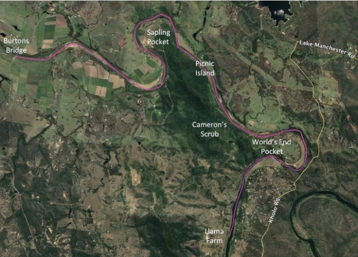
Start walking in most directions in Pine Mountain, and it doesn’t take long before you’ll hit the Brisbane River. Unfortunately, accessing it is not that easy. Most of its banks are privately owned, and those that are part of the council or state reserve systems involve a long, steep walk and require a permit to enter. The best way to experience the Brisbane River at Pine Mountain is definitely by kayak and, thanks to a Christmas gift voucher from my brother, we recently became the proud owners of a couple. Until now, we’ve only found time to do short paddles downstream at Colleges Crossing. However, yesterday we finally set aside a whole day for a longer trip.
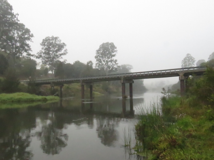
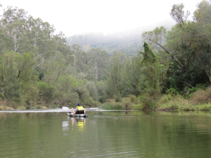
We started our journey just after 7AM at Burtons Bridge, which is where E Summervilles Road crosses the Brisbane River. Our neighbours at the Llama Farm on Riverside Drive kindly offered to pick up our car and bring it to their place, which was to be the final destination for the day. It was to be a 16 km journey, which ended up being the perfect length for a couple of beginner kayakers like Alister and myself.
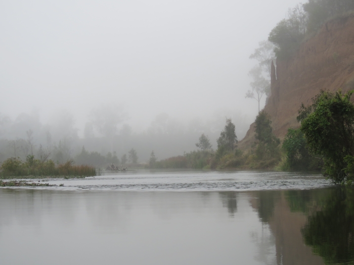
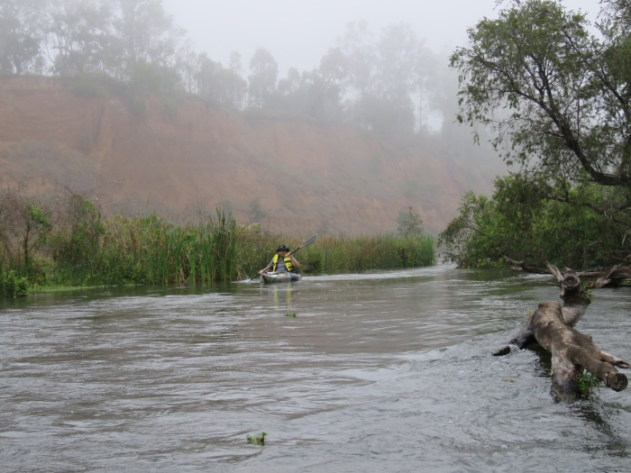
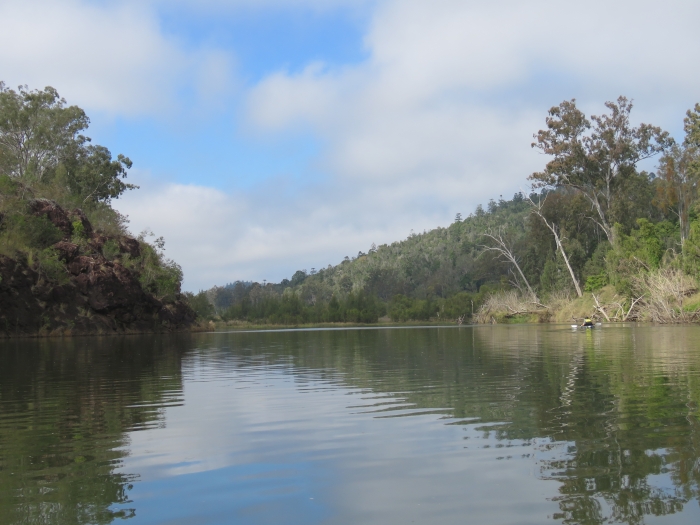
At Burtons Bridge, we were met with the usual Pine Mountain winter fog. Surprisingly, though, this didn’t end up clearing until about 10AM. It certainly added to the atmosphere, but made photography difficult, especially considering I didn’t bring my decent camera for fear of getting it wet. All the photos shown are taken with a small point-and-shoot camera instead.
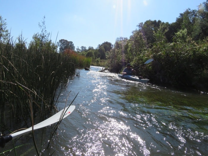
At Burtons Bridge, there is vehicle access right to the water’s edge, so it is a great drop-off point for kayaks. However, the site itself has been completely trashed by people. There is rubbish everywhere, and it is a notorious site for the burning of stolen cars. I wouldn’t risk parking your vehicle here for the day. Within minutes of drifting downstream, though, the rubbish completely disappears and you leave civilisation behind for many hours.
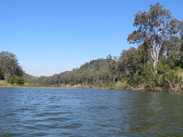
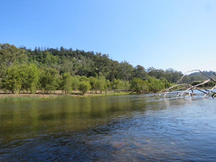
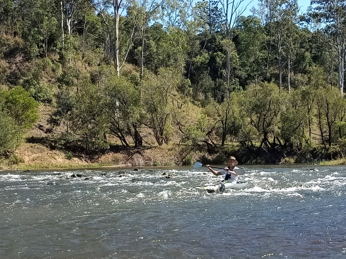
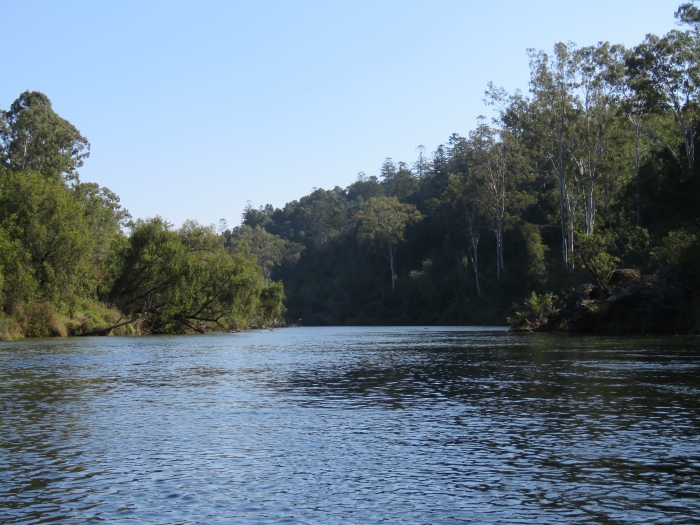
As the Brisbane River snakes its path around Pine Mountain, its character changes drastically and often. There are long stretches of broad, still water, punctuated with sections of class I rapids and sharp, narrow bends. The ever-changing landscape makes this a very interesting paddle. The first of the rapids start not long after Burtons Bridge, where there are also some very impressive earth cliffs.
Then on to the first of many narrow, fast-flowing chutes between reed beds.
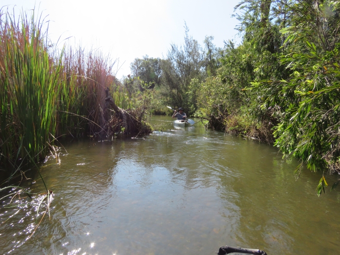
The first part of the journey passes through farmland, although there is plenty of riparian vegetation along the river banks, so it was not obvious that we were paddling through crops and paddocks. It didn’t take long before we found ourselves heading toward the vine-scrub-covered hills south of Sapling Pocket.
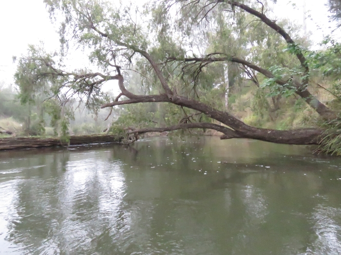
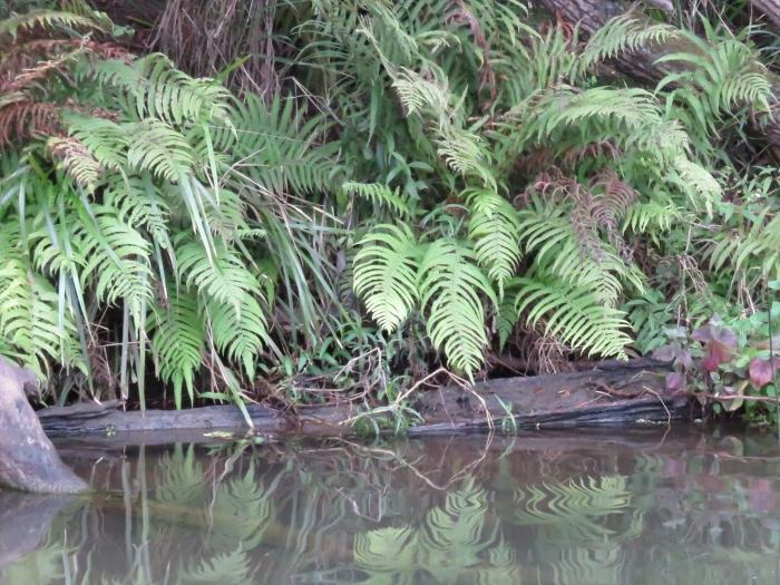
There were stretches here that were narrow and well-forested. There were two spots where huge Weeping Bottlebrushes (Melaleuca viminalis) had fallen completely across the river, requiring some decent limbo skills to slide the kayak underneath.
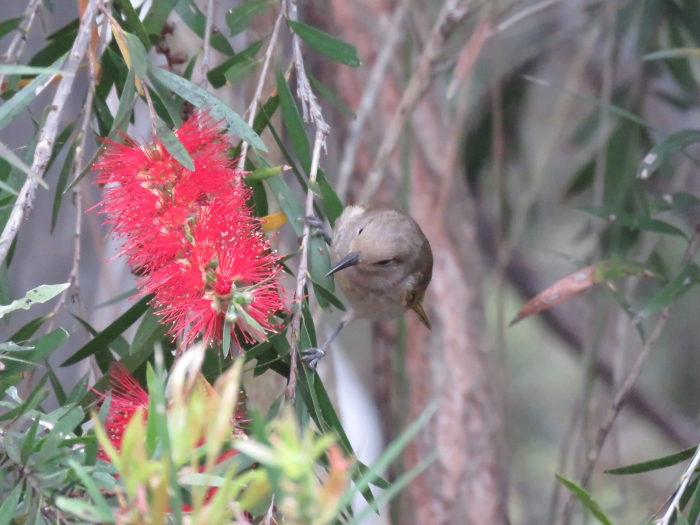
The Weeping Bottlebrushes were in full flower along the first half of the trip. Strangely, they were only just coming into bud further downstream, so there must be subtle differences in temperature between the open farmland and the more hilly terrain downstream, causing differences in flowering time. The blossoms were teaming with Brown Honeyeaters, whose rich songs were definitely the soundtrack to the day.
Weeping Bottlebrushes lined the river banks along the entire route, and dense regrowth of this species had sprung up in numerous stretches that had been scoured out by the 2011 flood. Despite being a tough garden plant, often planted as a street tree, this is a species that naturally only grows on river banks, where its roots have a constant supply of fresh water. They are extremely resilient to floods, and many larger specimens had been warped and contorted into all shapes from decades of floods past.
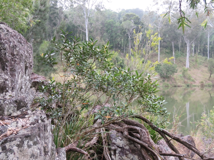
Another plant that is largely confined to the banks of rivers is the Water Gum (Tristaniopsis laurina). Along the Brisbane River, it mostly grew where there were large boulders along the water’s edge.
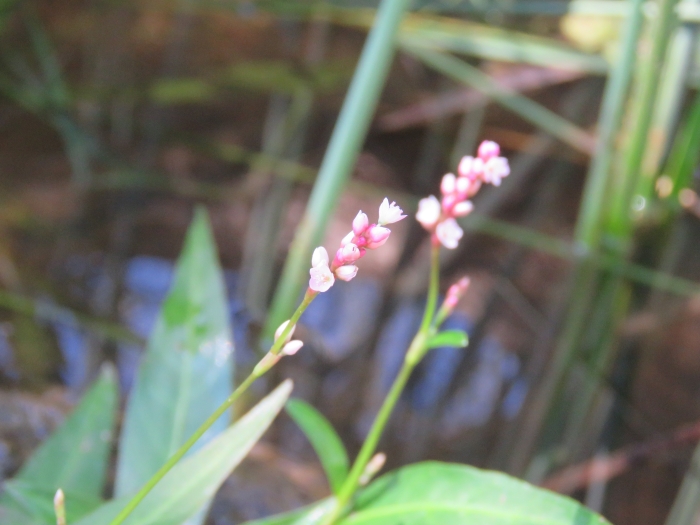
As with all major watercourses in southeast Queensland, most of the grasses and herbage on the banks of the Brisbane River were dominated by weed species such as Green Panic (Megathyrsus maximus). Woody weeds common in Brisbane and Ipswich (Chinese Celtis, Leucaena, Camphor Laurel, Cocksure Coral Trees etc) were, however, mostly absent, which was refreshing. Furthermore, there were small patches where the banks were covered by natives such as Matrush (Lomandra longifolia), Binung Fern (Christella dentata) and Persicaria subsessilis.
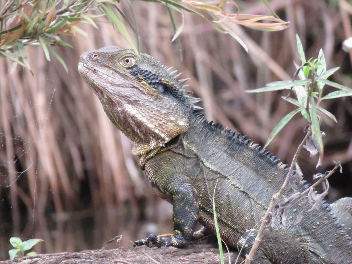
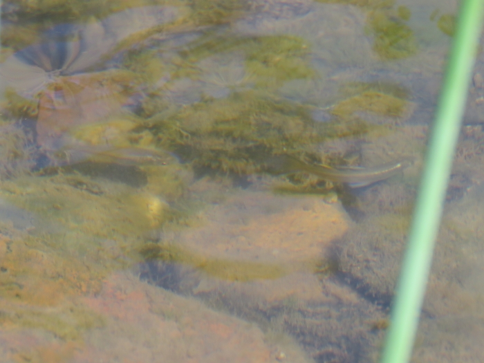
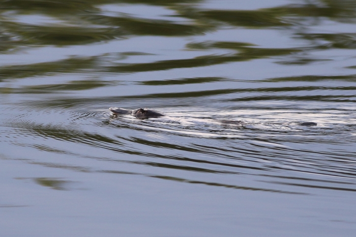
In fact, most of the banks looked like fantastic burrowing habitat for Platypus (Ornithorhynchus anatinus), even those with weeds, and I had been searching intently for this species all morning until this point. The Brisbane River between Wivenhoe Dam and the Mount Crosby Weir is known to support a very important population of this iconic Australian mammal. They are mostly nocturnal, but can also be seen in the early hours of the morning and around dusk. They are very timid, so I don’t know if my failure to find one was because the kayaks scared them off, or whether we simply started too late in the morning. By the time 9AM rolled around, I figured my chance had passed. My consolation prize was a couple of Eastern Water Dragons that were sheltering quietly at the water’s edge.
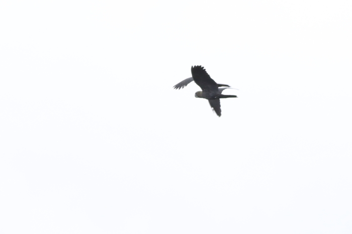
The Platypus has every right to be timid in large waterways like the Brisbane River, as White-bellied Sea-eagles were a regular presence during our journey, and they wouldn’t hesitate to grab a Platypus from the water’s surface.
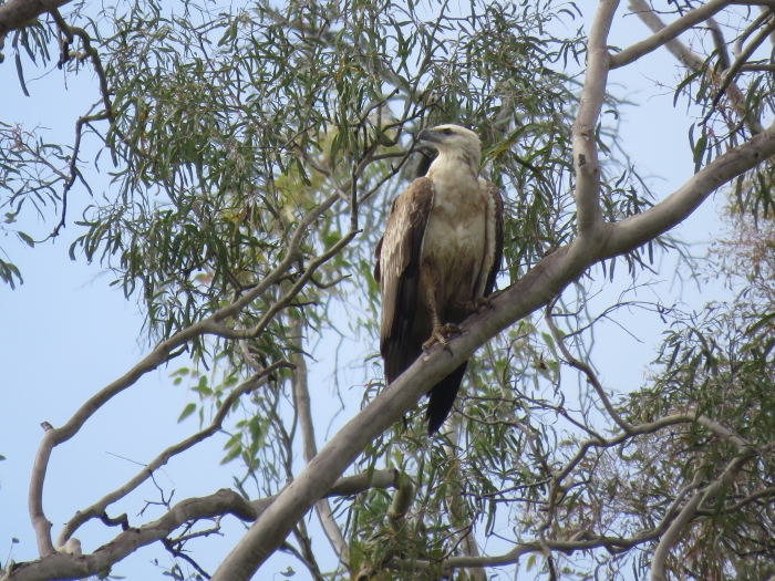
There was even one Eastern Osprey hanging around the stretch of the river just southeast of Sapling Pocket. This is primarily a bird of coastal and estuarine waters, and I rarely see them far into the freshwater stretches of Australian rivers. I have, however, seen them a few times along the river at Kholo Gardens, and have even had them fly over our house, so I suspect there must be a pair that permanently inhabits the Pine Mountain area.

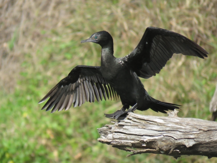
Cormorants and Australasian Darters were a frequent site as they sunned themselves, wings outstretched, on dead branches over the water. They were generally timid, however, and normally flew off before the kayak approached too closely. I did manage a few photos, though, including this Little Black Cormorant.
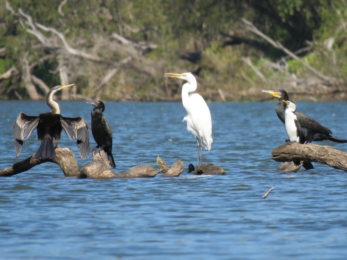
I was also pretty chuffed to get this photo with five different species together.
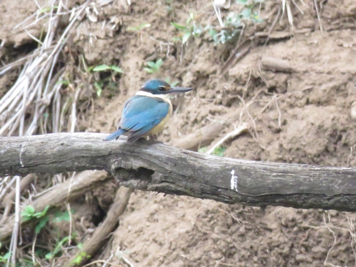
It wasn’t just the waterbirds that were keeping me entertained. The whole stretch through Sapling Pocket was very bird-rich, with numerous kingfishers, honeyeaters, monarchs, fantails, fairywrens, whistlers, shrike-thrushes, trillers, cuckoo-doves and Wonga Pigeons making quite the chorus.
By the time we passed Sapling Pocket, the fog had cleared, and we could see the Hoop Pine-covered hills of Cameron’s Scrub as we drifted downstream.
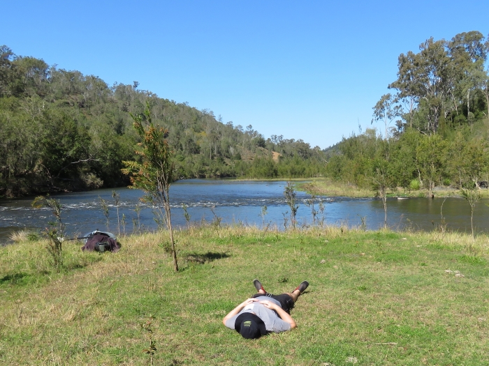
Soon after, we came across what would have to be the most picturesque picnic spot in all of Pine Mountain. A small, flat island less than 10 m diameter, had formed just above some rocky rapids, and cattle had walked through the river from a neighbouring farm to graze the grass into a very comfortable lawn. Surrounded by forest, serenaded by the sound of water rushing over rocks, and with views up and down the river towards rainforest-covered hills, we decided it was the perfect lunch stop. And while Al napped, I explored.
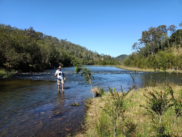
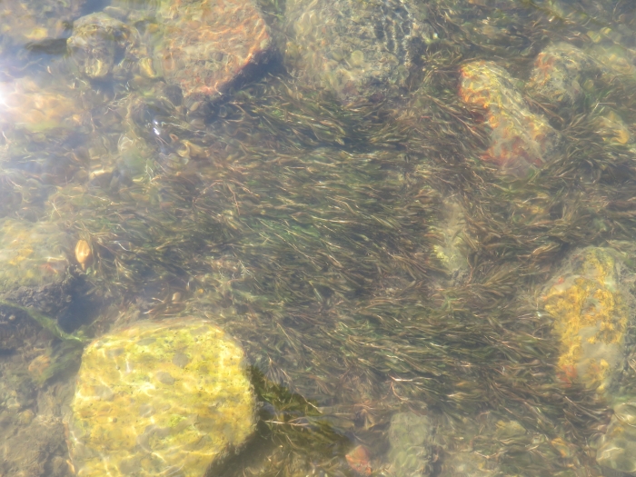
The well-aerated and clear water was full of life, including freshwater mussels, freshwater prawns and native fish like Pacific Blue-eyes. Amazingly, there wasn’t a single introduced Mosquitofish or Guppy in sight.
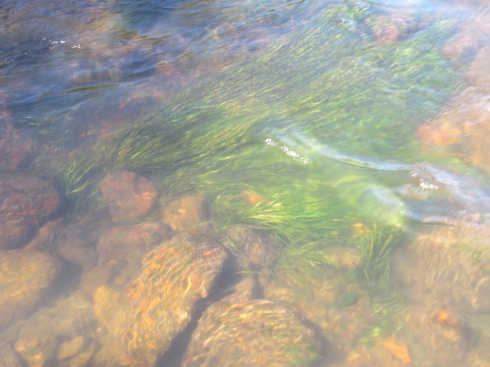
The submerged aquatic plants were, likewise, all native species.
Eventually we had to leave this little piece of paradise and continue on our downstream journey alongside Cameron’s Scrub and towards World’s End Pocket.
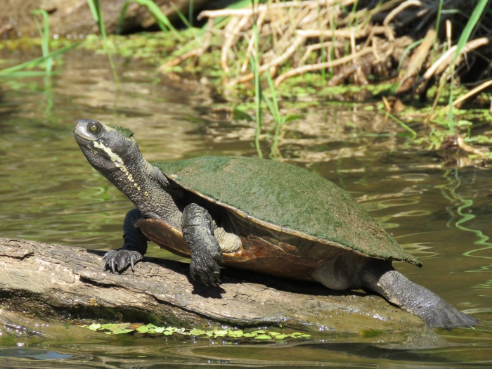
This large Brisbane Short-necked Turtle allowed me to get quite close for a photo. Most others I saw during the day leapt into the water from their logs well before I got anywhere near them.
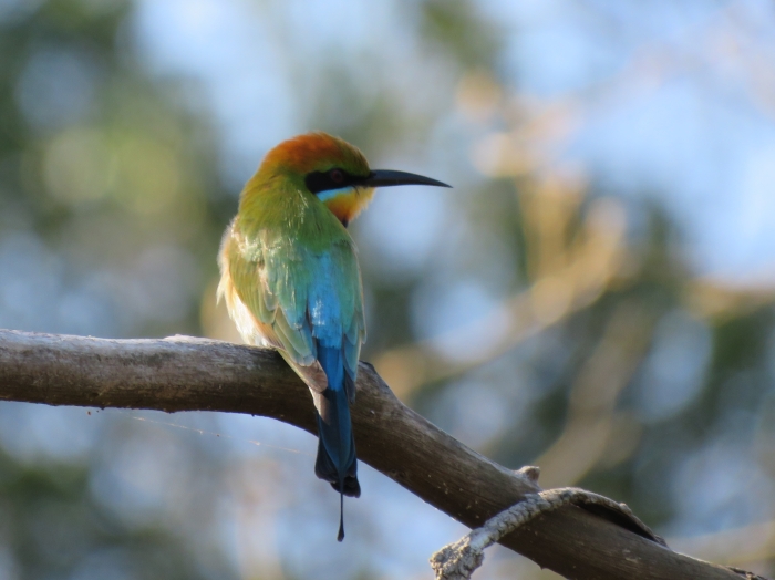
As we began to round World’s End Pocket, there were large flocks of Rainbow Bee-eaters and Welcome Swallows feeding on flying insects above the river.
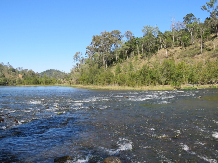
At World’s End Pocket, the river changes quickly from being broad and slow-flowing, to a series of rapids and very narrow braids through reed beds and dense bottlebrushes.
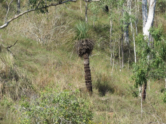
Then it opened up and slowed briefly as we approached the dry, eucalyptus-covered slopes along Kholo Road. Here, I was impressed to see some very old grass-trees (Xanthorrhoea glauca) growing on a fairly barren west-facing slope. I have actually planted some of these in gardens back on our property, not knowing how well they would perform in our dry climate. It is a common species on the foothills of the D’Aguilar Range, but I didn’t realise how close they came to Pine Mountain. I no longer have any concerns for the welfare of my ones, now that I’ve seen that they can tolerate such harsh conditions so close to home.
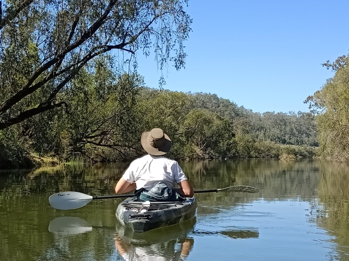
After one last batch of rapids on the southern end of World’s End Pocket, we were on the home straight as we headed south along the long, broad, deep and calm stretch of river that flows between World’s End Pocket and the Kholo Gardens. It was interesting seeing the rainforest along Riverside Drive from a different perspective.
We ended up arriving at the Llama Farm at 3PM, so in total our journey took 8 hours. Truth be told, it would be difficult to imagine doing the trip slower than we did. We mostly coasted along with the current (only paddling on the broader stretches), stopped regularly, and spent quite a bit of time sneaking up on wildlife along the water’s edge. I suspect it could easily be done in 5-6 hours for those who just want to get out for a bit of canoeing.
It truly was an enjoyable day out, and we both agreed that it felt like we’d just had a holiday away, even though we never left our home suburb! My only disappointment was not finding a Platypus, although in hindsight we probably should have started earlier or finished later to increase our chances. With Platypus on my mind, I decided to have one last try at finding one before writing this blog post, so I headed off to Kholo Gardens early this morning to try my luck. It only took five minutes of me sitting on the river bank with my camera before one popped up in the water in front of me! I watched for about half an hour as it swam and dived, and by 7:30AM it had gone. Sometimes the simplest approach is best! It was the perfect end to a 24 h period spent playing on the Brisbane River.
As an epilogue to this post, while I was sitting here at the computer writing, I thought I heard the calls of Glossy Black-cockatoos, a species I have never before seen at home (or elsewhere in Pine Mountain). As I had my camera beside me (I had just downloaded yesterday’s photos), I grabbed it and dashed outside to see if I could see them. Sure enough, four Glossy Black-cockatoos flew past the back patio heading west. This is a threatened species that feeds only on the seeds of casuarina trees, which are not found in the vine scrubs of Pine Mountain, but do occur in small numbers in some of the sandstone areas at Muirlea and along the rail trail. The food supply of casuarinas along Main Range and the Border Ranges (where the main southeast Queensland population of Glossy Black-cockatoos occurs) was completely devastated by last summer’s bushfires, and desperate Glossy Black-cockatoos have been turning up in all sorts of odd places this year (including urban bushland in Brisbane). While it was exciting to see them, it is certainly a bad sign to find them in large tracts of vine-scrub. I only hope they manage to find some fruiting patches of casuarinas nearby. I wouldn’t be surprised if I don’t see any at home again for decades.

FANTASTIC!
>
LikeLike
Really enjoyed this post and photos. How spectacular is that Rainbow Bee-eater! Makes me want to get a canoe and start paddling myself.
LikeLike
Loved every bit of this Chris – felt as if I was there doing it with you and Al!
LikeLike
[…] kayaking down the Brisbane River a few years back, I came upon a small colony of a grass I didn’t recognise. It was a coarse, tussocky thing […]
LikeLike