Today’s visitor to the Colorado Street Bridge—Pasadena’s most iconic—will probably find themselves disappointed. Where once pedestrians crossing the bridge could enjoy a glorious view over the Arroyo Seco, a tall chain-link fence has gone up along the walkways to hinder suicide attempts, obstructing the view and making walking across the bridge feel more like stepping through a chicken coop. Though the city promises a nicer barrier to be installed in the future, progress has been awfully slow.
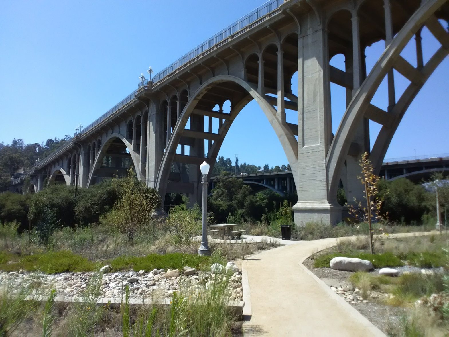
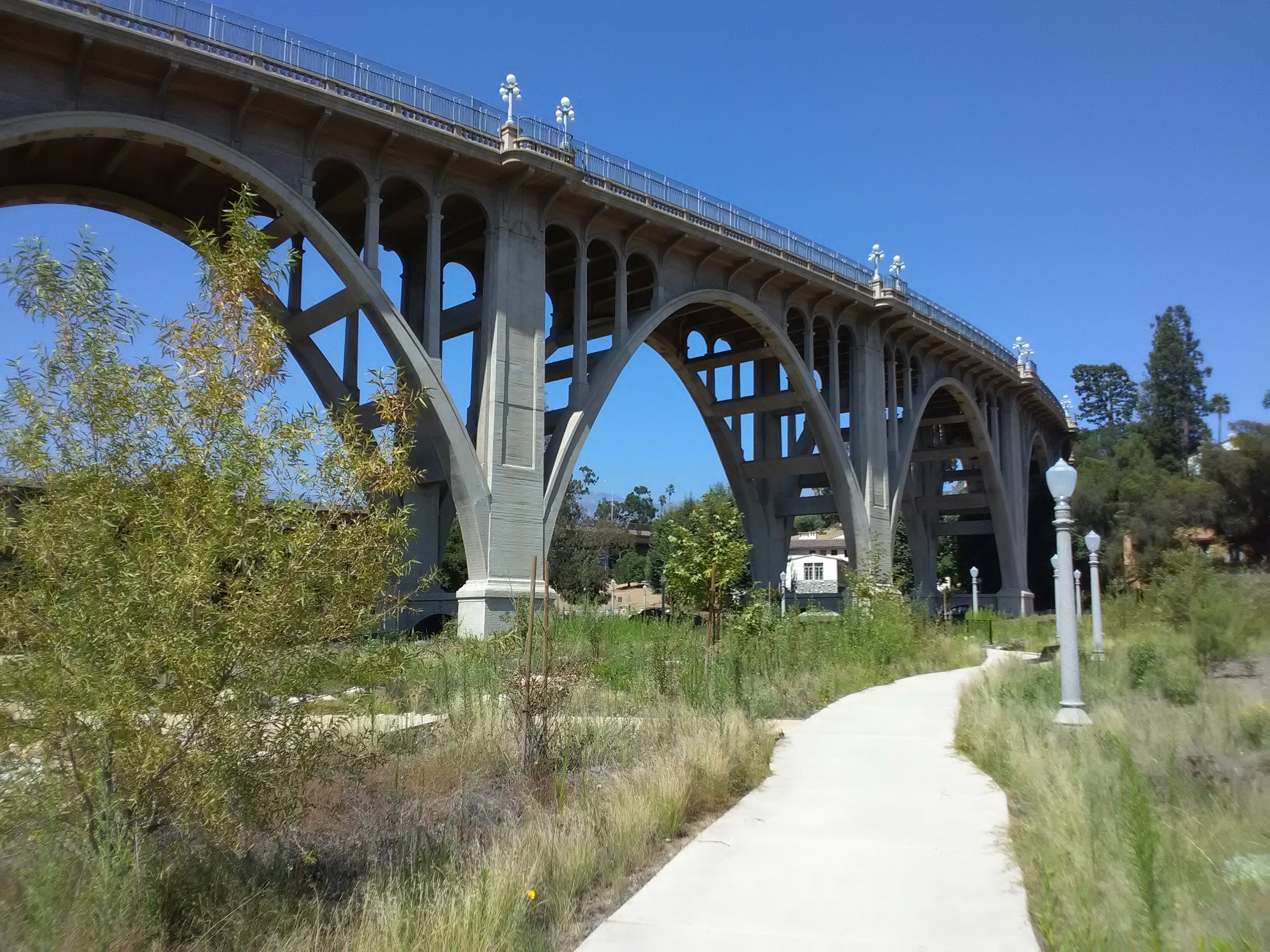
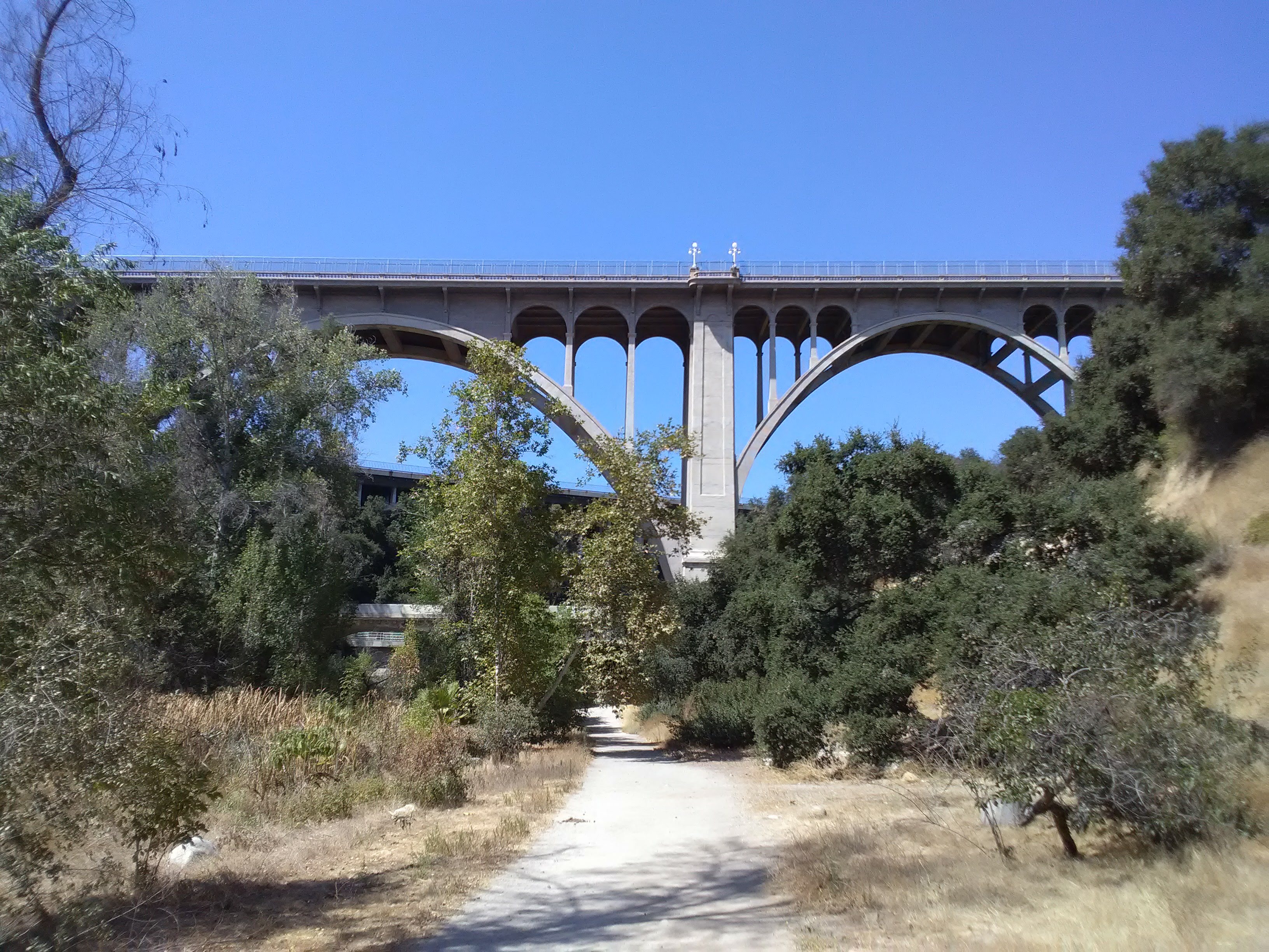
The bridge is far more pretty from below, where its majestic span and graceful arches can be properly admired. Here, the Arroyo Seco has cut a steep canyon through the west side of Pasadena, separating it from the hilly neighborhoods of Northeast Los Angeles. Beneath the many bridges that span the canyon, the wooded canyon offers a lovely and secluded bit of nature close to Old Pasadena.
Yet oddly, Pasadena seems to have largely turned its back on this section of the Arroyo. Just to the north, the Upper Arroyo thrums with activity, as families are regularly drawn to the Rose Bowl, Kidspace Children’s Museum, the aquatics center, or the lush lawns of Brookside Park. But beneath the bridge, things are significantly quieter. Access points have been buried under freeway construction and park infrastructure has slowly deteriorated. Pasadena’s oldest park deserves better.
In the 1880s, Chicago real estate developer James Scoville moved to Pasadena and acquired the land along the Arroyo Seco at the west end of town. Following the trend of many other Southern California landowners at the time, Scoville established an orange grove on the western bank of the stream. He had a dam built to provide water and power to his orchards, as well as a simple wooden trestle bridge so the orchards could be accessed from town. By the 1890s, he was also getting involved in philanthropic efforts, and started investing in amenities that would provide access for walkers and equestrians, turning his land into Pasadena’s first public park.
Scoville’s Park, as it was then known, would be joined by others. Just up the hill at the end of Colorado Street sat the manicured estate of Jeanne Carr, a close friend and mentor to John Muir. After she passed, the grounds became a beloved public garden known as Carmelita Gardens. With Holly Street acting as a grand axis to city hall, Pasadena created a chain of park spaces that linked the center of town to the arroyo.

As Pasadena grew, the Arroyo Seco canyon posed a daunting obstacle to accessing the neighborhoods to the west, one that would be bridged over many times to link both sides of the canyon. The construction of the freeways would sever Holly Street and many of the old park spaces, with Carmelita Gardens divided and effectively destroyed (what remained was transformed into the Norton Simon Museum). The stream itself would be confined to a narrow concrete channel for most of its length through Pasadena, although the adjoining landscape is still far more naturalistic than that along the Los Angeles River.
Today, Lower Arroyo Park encompasses the entirety of the canyon between the Holly Street Bridge (just north of the 134 Freeway Bridge) and the southern city limits of Pasadena. The closest transit access is the bus stop in front of the Norton Simon Museum at Colorado St/Orange Grove Blvd, which is served by the Metro #180 between Pasadena and Hollywood and Pasadena Transit #10. The Metro A Line stops at the Memorial Park and Del Mar stations near Old Pasadena just to the east, a short bus ride or just under a mile’s walk away.
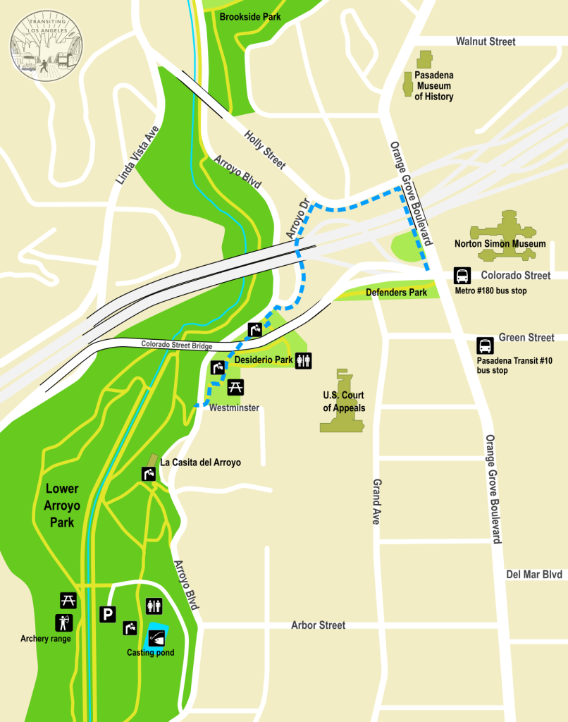
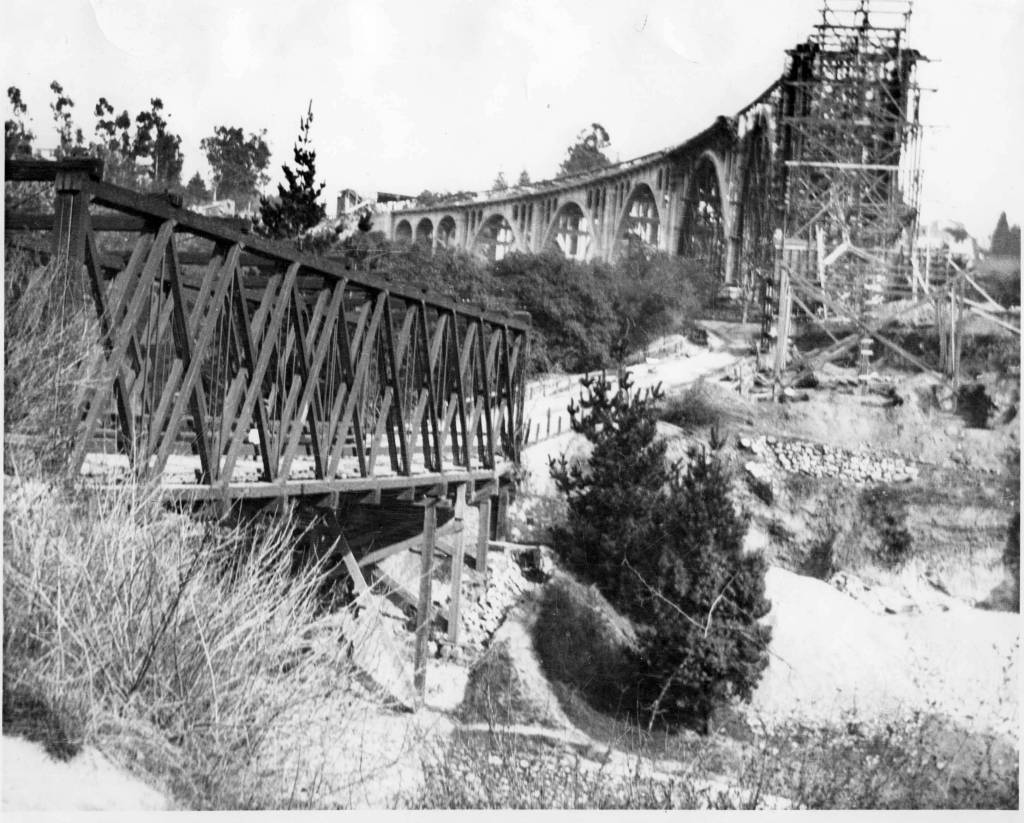
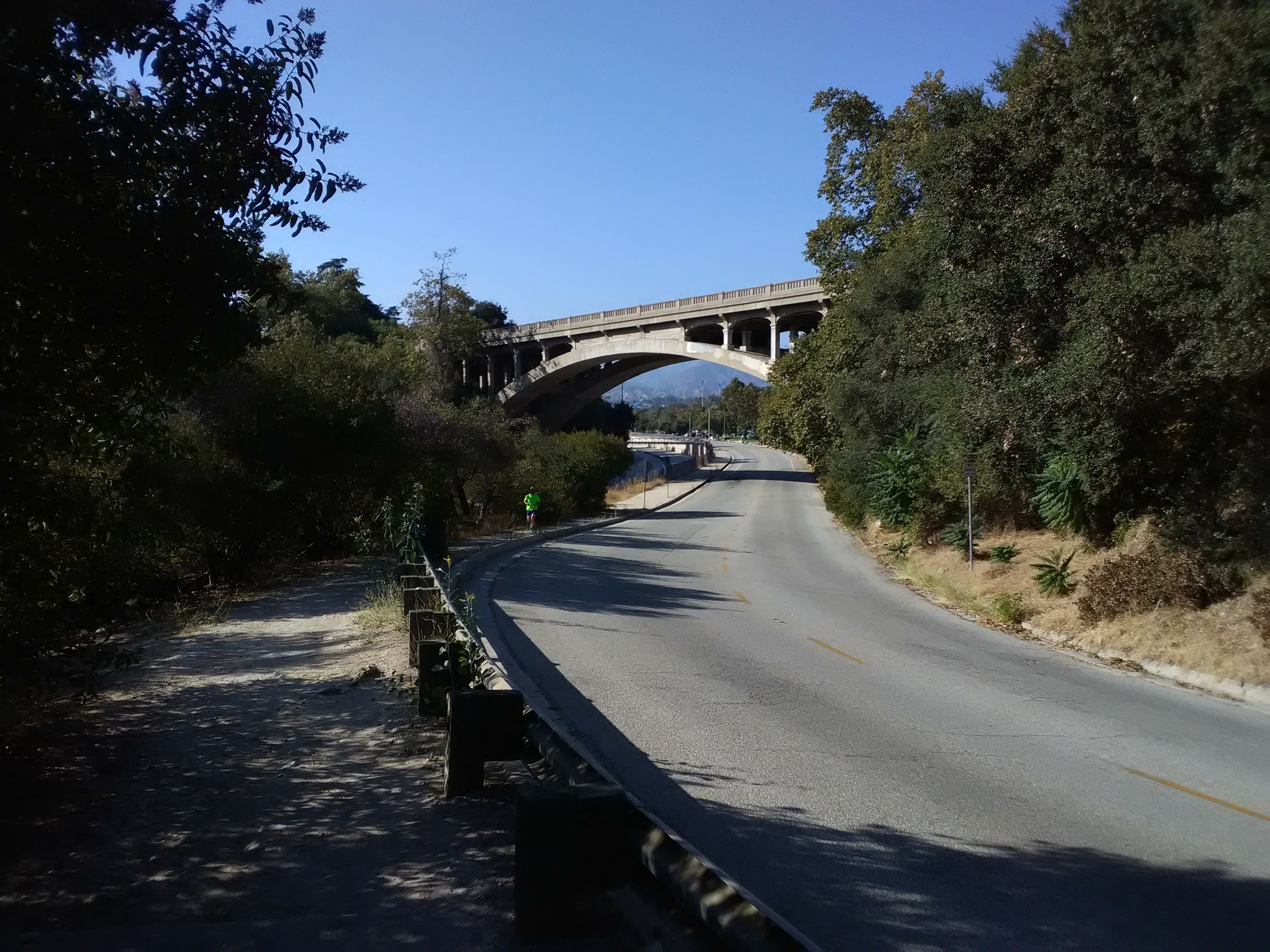
At first glance, it’s not at all clear how to get from Colorado Boulevard down to the Arroyo Seco. Defenders Park, a small green space lined with war memorials, funnels you onto the bridge with no access into the canyon. But it’s a short—if slightly roundabout—walk to reach the canyon. Don’t walk towards the bridge. Instead, walk north on Orange Grove across the freeway and make the first left onto Holly Street. Walk downhill and make the next left, which will take you onto Arroyo Drive and underneath the 134 freeway. As you pass under the freeway, the span of the majestic Colorado Street Bridge reveals itself to you, arcing gracefully across the canyon. Sitting in the shadow of the bridge is a lavish condo building, with tile work depicting the arches of the bridge that are visible just beyond.
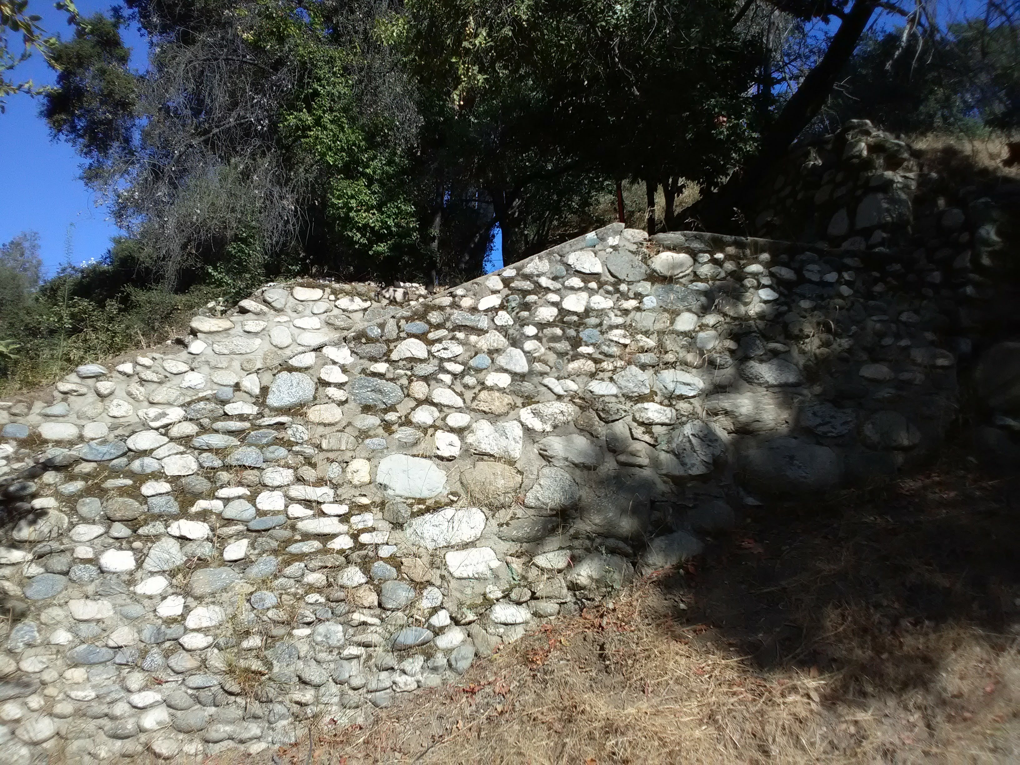
The bare hillside above you, wedged between the freeway and the Colorado Street Bridge, holds a significant artifact of the original park. This is where “Scoville’s Path” was located, a zig-zagging path that gradually descended the slope, constructed in the 1890s to provide access from town to the arroyo below. The path remained in use for many decades until construction of the freeway cut it off, isolating it and rendering it inaccessible. However, a couple of the walls of the old path are still visible up at the top of the slope, and there is now an exciting proposal, the Arroyo Link, to revitalize Scoville’s Path and connect it with a new trail that will offer a safe connection between Old Pasadena and the Arroyo.
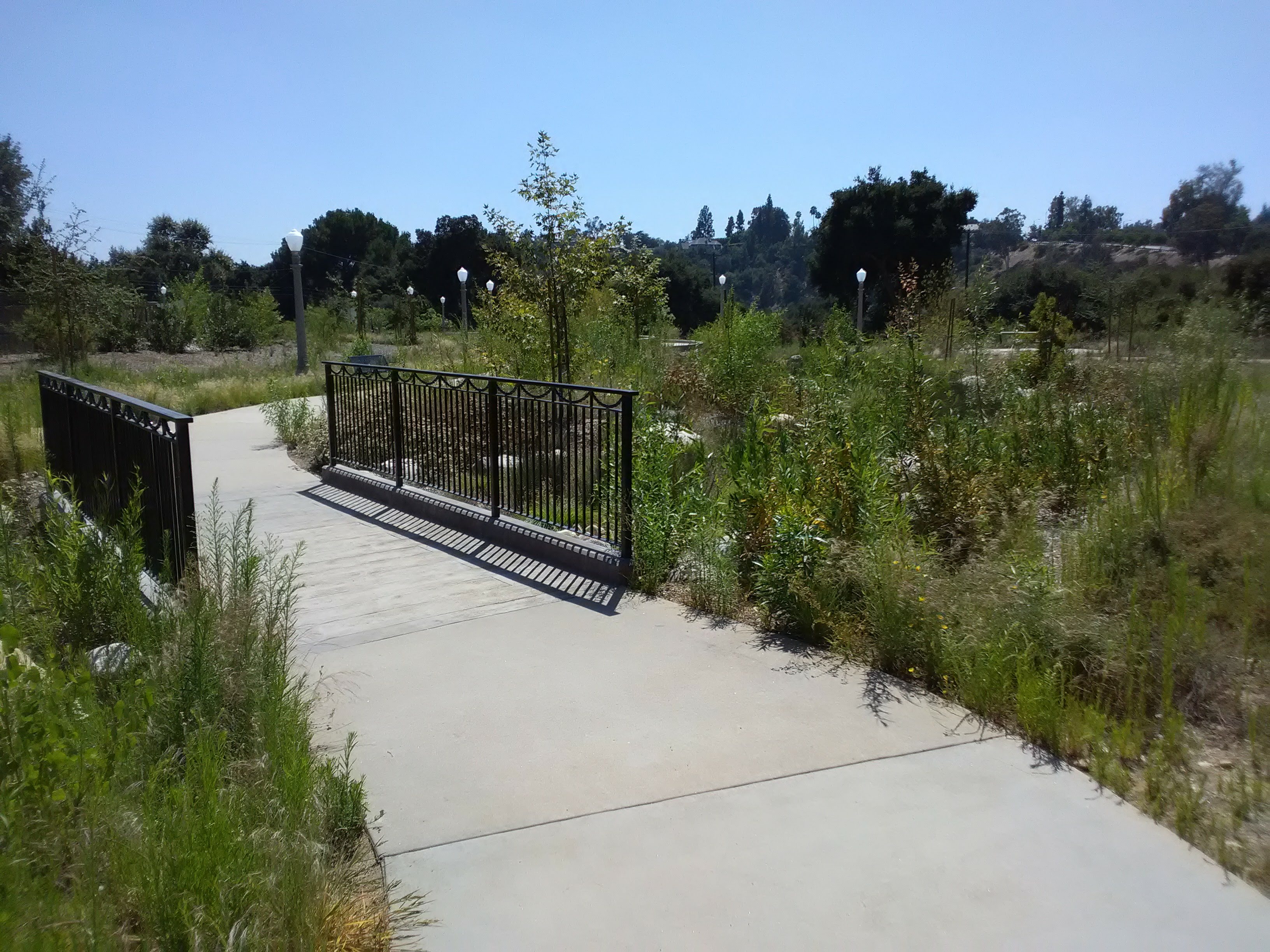
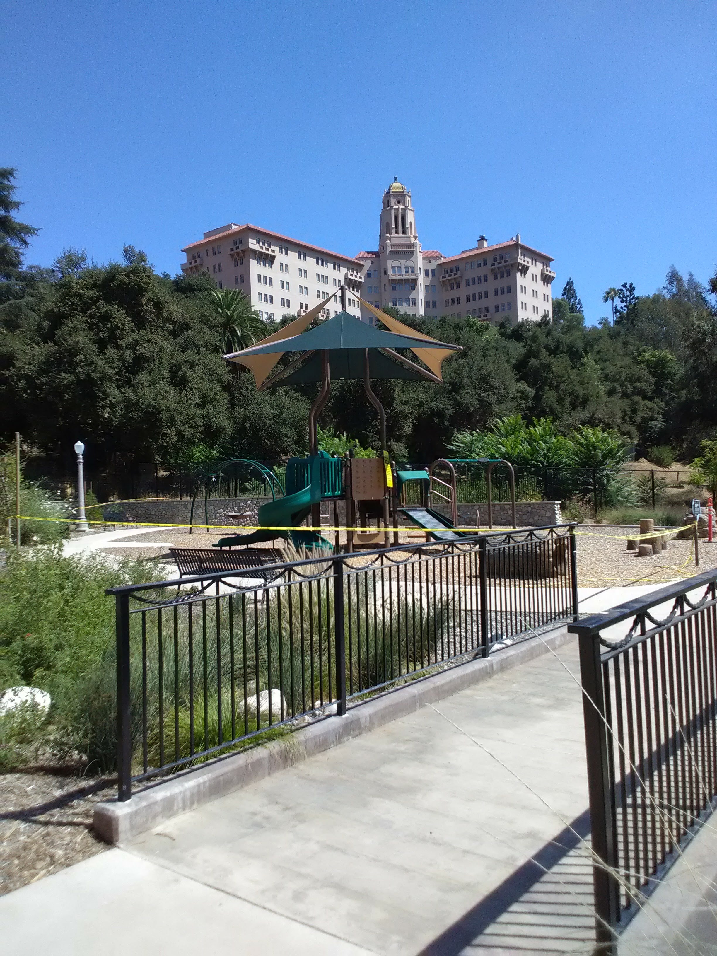
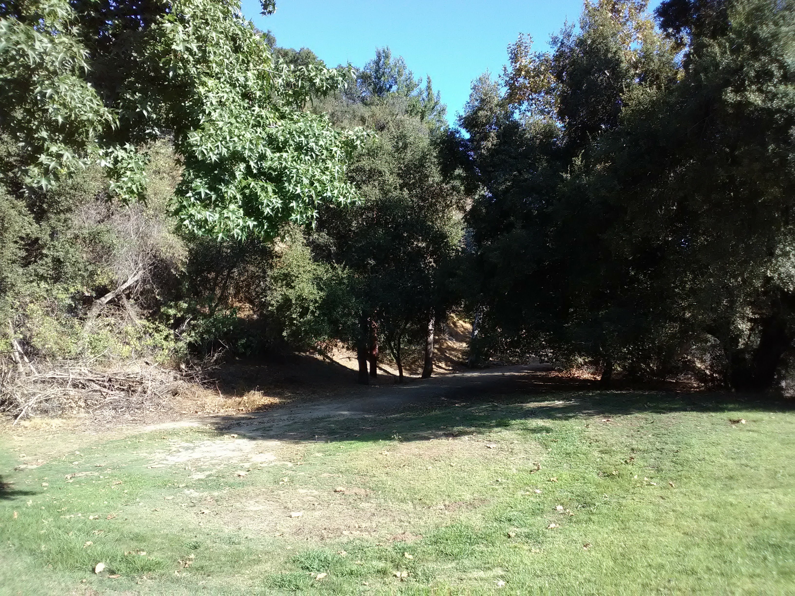
At the bottom of the street, where Arroyo Drive meets Arroyo Blvd, you’ll come across a wonderful new park spread out beneath the Colorado Street Bridge. This is Desiderio Neighborhood Park, one of the city’s newest parks and sitting on a small plateau between Pasadena and the canyon proper. It really is a beautiful park, blending together the natural habitat below with the urban landscape above. Winding pathways take you through a native landscape made to mimic the arroyo habitat, with a dry creek bed filled with colorful wildflowers. Amidst the bright orange poppies adorning the park are many picnic tables, making this a delightful place to enjoy a meal. Intricate street lamps dot the park, bathing it in a warm yellow glow in the evening. A brand new playground and restrooms stand in the back corner. And it all sits under the stately aura of the Colorado Street Bridge, casting long arching shadows over the park while the bell tower of the Richard H. Chambers U.S. Court of Appeals building (originally built in the 1920s as a lavish hotel) looms over the hillside.
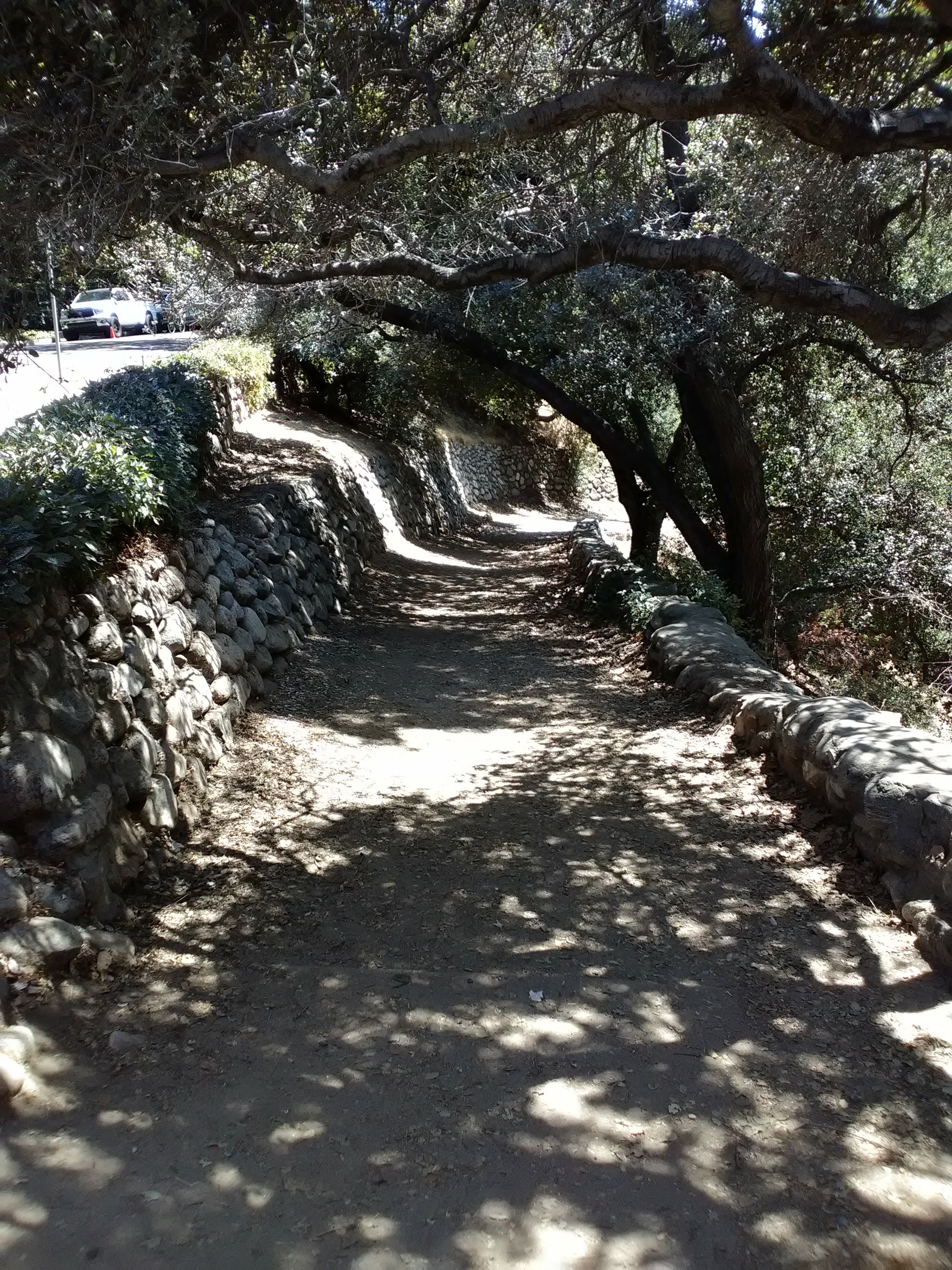
Continue to the other end of the park, to the intersection of Arroyo Blvd and Westminster Drive, and cross Arroyo. From here, there are multiple ways downhill to the Arroyo Seco. The quickest one is a shady trail directly next to this intersection, lined with rustic stone walls built in the Park Style common of New Deal conservation projects. Or you can walk south down Arroyo Blvd for a block to La Casita del Arroyo, a meeting hall that dates back to the 1930s and run by the Pasadena Garden Club, which cultivates a small but beautiful set of gardens surrounding the meeting hall. From the south side of the building, a few trails lead downhill to the Arroyo Seco.

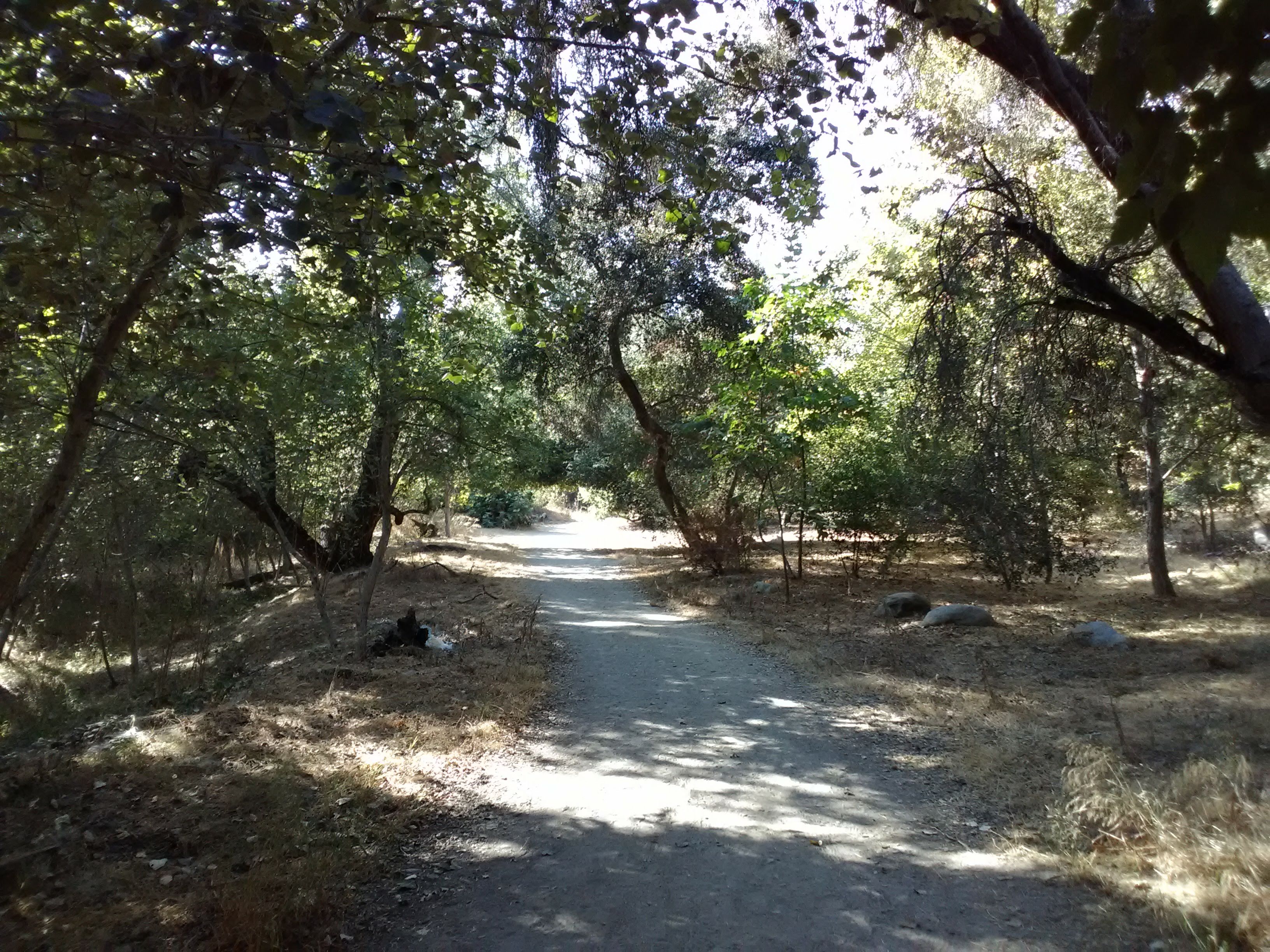
Lower Arroyo Park is a minimally developed park. None of the trails are marked with signs, nor are there any trail maps, but finding your way around is simple enough. There are really only three directions you can go: uphill, downhill, or along the bottom. Lizards constantly dart across the dirt trails of the canyon, and rabbits, squirrels, and chipmunks are also common.
As you walk through the park, you’ll find the aging remnants of old park infrastructure: a crumbling stone wall here, an old bench there. The cliff face on the west side of the canyon holds numerous staircases that seem to vanish into the overgrowth, while castle-like mansions poke out on the ridge above, aloof and disconnected from the nature beneath them. Some trails feel more like worn foot paths as the dry vegetation encroaches on them. Aside from the regular joggers and hikers (and the occasional equestrian trotting up from a stable in South Pasadena) you’ll encounter along the Arroyo Seco channel, the trails are very quiet.


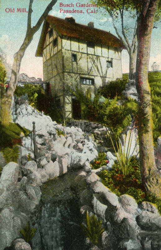
Postcards of the original Busch Gardens (Source 1, 2, 3)
Ironically, the Lower Arroyo was once home to a major tourist attraction. In the 1900s, Adolphus Busch (of the Anheuser-Busch brewing company) turned his summer home at the southern end of the park into an elaborate garden filled with statues, picturesque buildings, and waterfalls. This was the original “Busch Gardens,” long before it turned into a chain of amusement parks, and it stayed opened until the 1930s before it was closed and replaced with a residential neighborhood, with few traces of the gardens remaining.
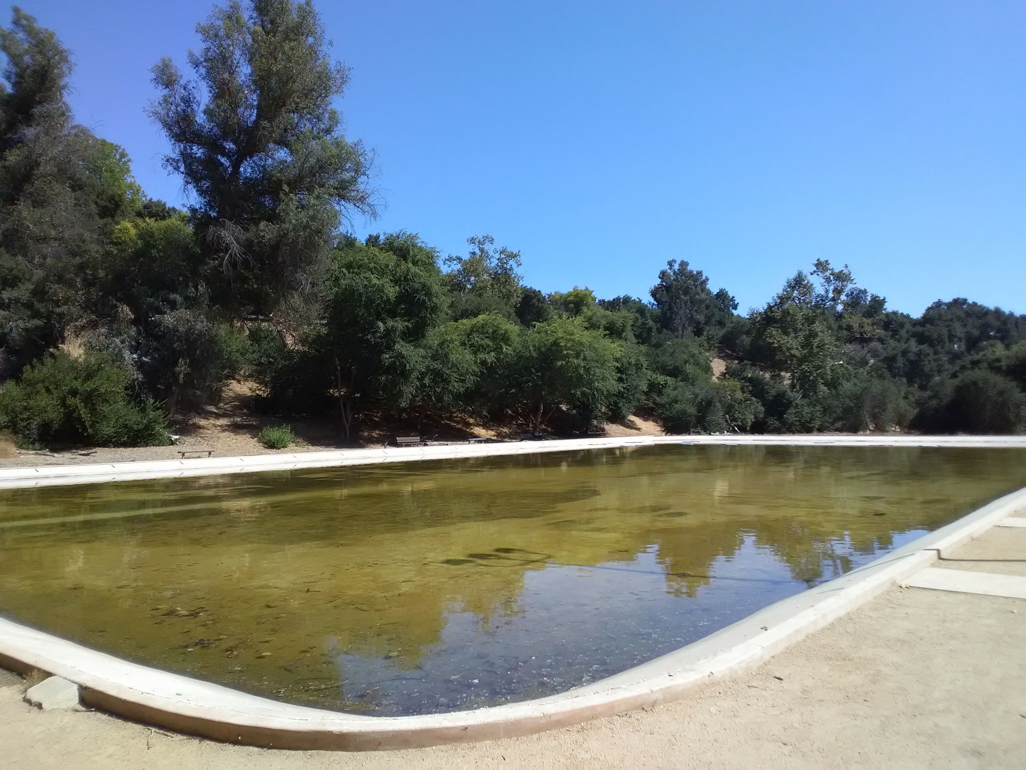
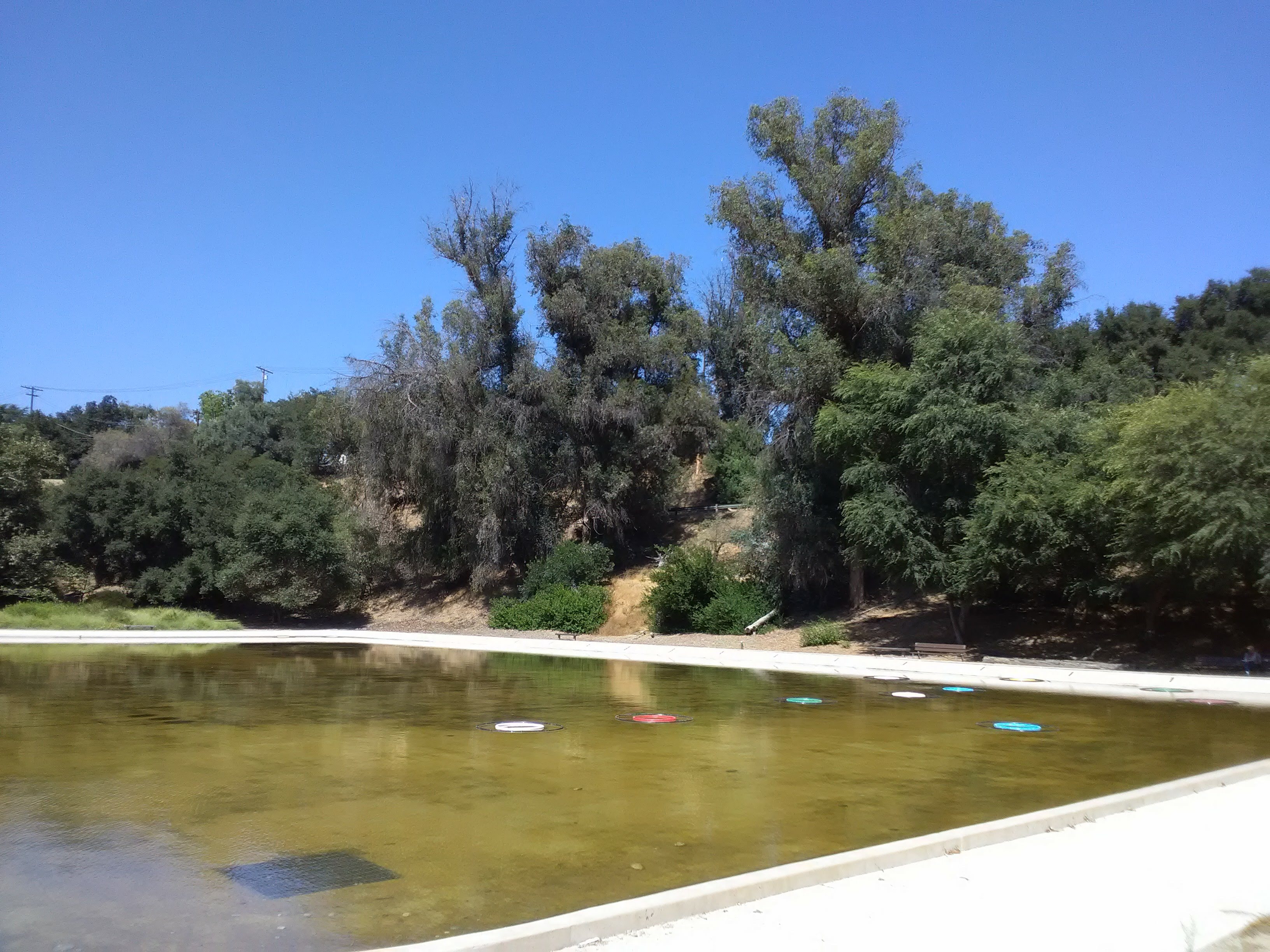
After you make it down to the bottom of the canyon, head south on any of the trails and you’ll soon come across the small parking area for Lower Arroyo Park. Here is one of the few pedestrian bridges over the Arroyo Seco channel, some restrooms, a water fountain, and two rather unique recreational areas. Behind the restrooms is a large casting pond, essentially just a bare, rectangular concrete pool with a few pool rings floating on the water, acting as targets for people to practice their casting skills. A local casting club uses the pond for classes, although a more common use I’ve seen for the pond is dogwalkers letting their pets take a bath and playing fetch in the water.
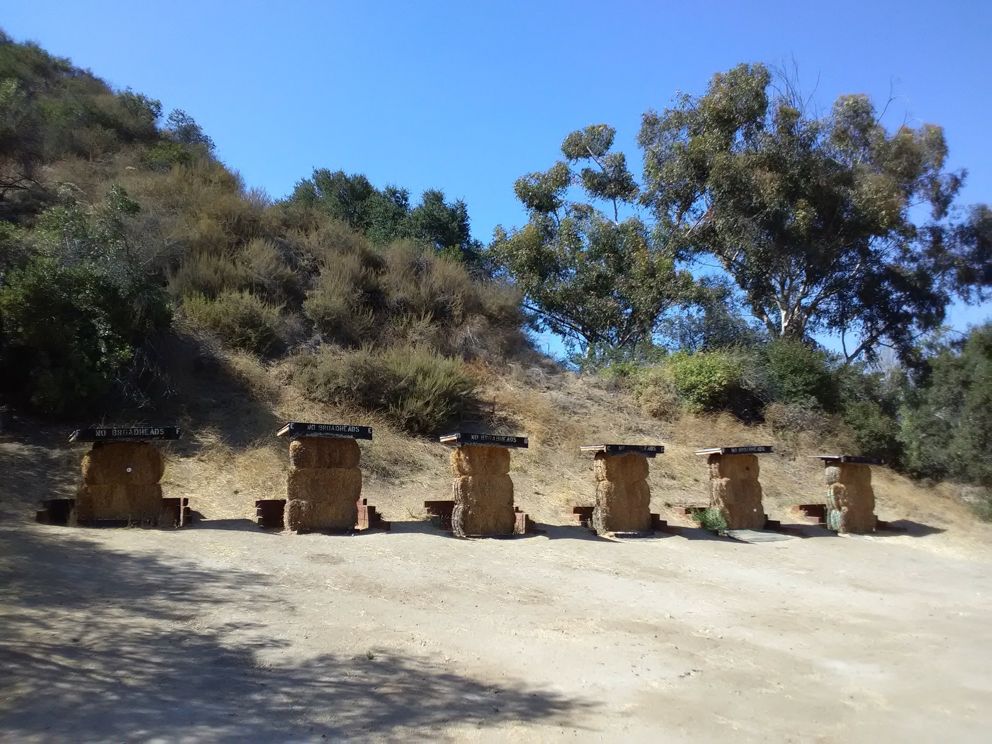
Across the Arroyo Seco channel from the parking lot is an archery range, and you do regularly see archers honing their skills here. Stacks of straw bale sit against the hillside, sometimes with targets mounted on them, while triangular posts serve as racks to mount your bows. The largest range, with a good half-dozen bales, sits just south of the little pedestrian bridge (and it’s fun to watch if you’re lucky enough to catch a group of friends doing a tournament here) but you’ll find plenty of individual bales scattered along the base of the hillside, where archers hone their craft.
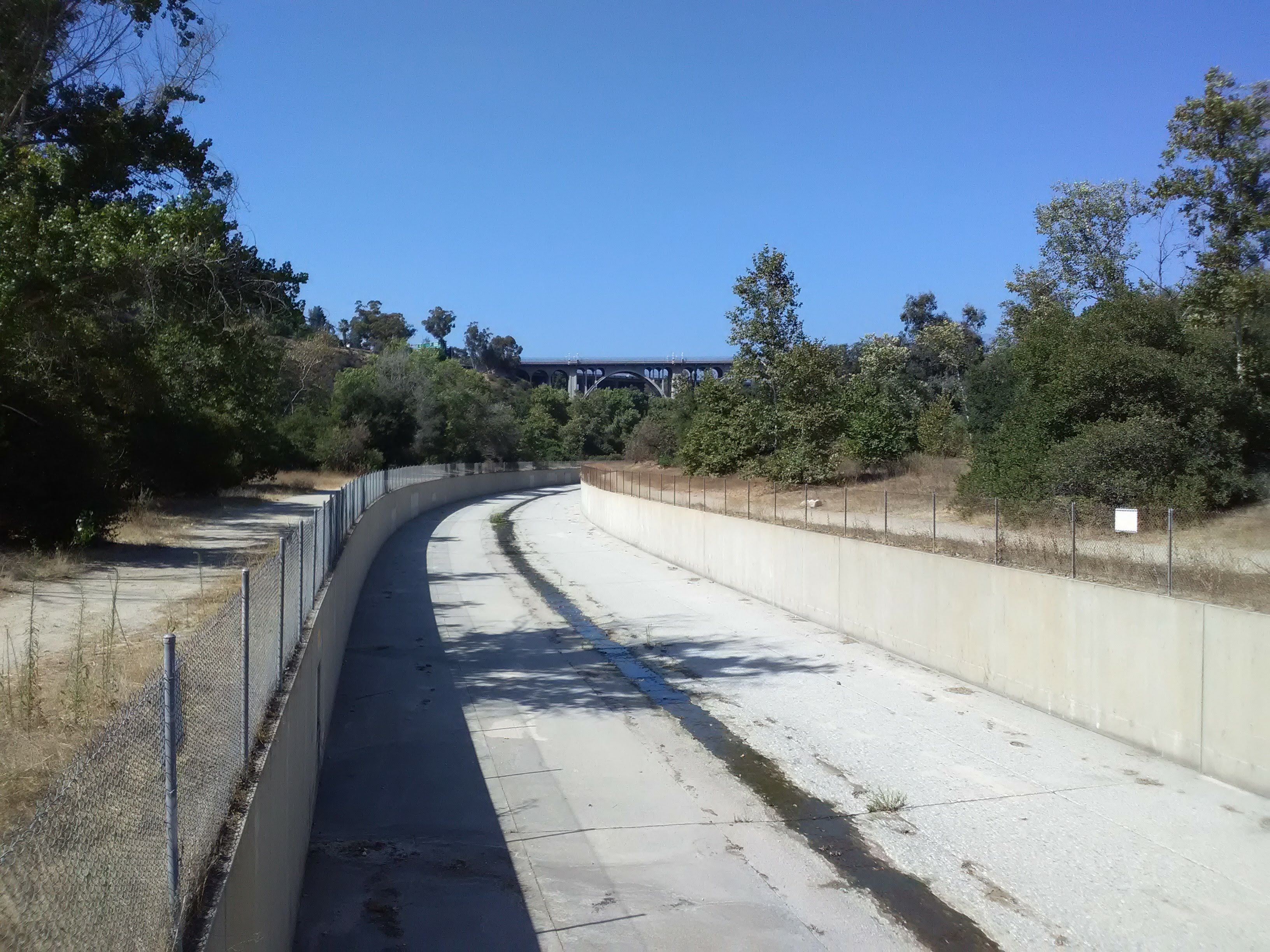
But it’s the views from beneath the Colorado Street Bridge that are the best feature of this park. Feel free to take any of the trails north, it doesn’t really matter whether you follow the Arroyo Seco channel (the most straightforward path) or one of the trails through the woods (which provide more shade). Along the west bank, some water from the stream has been diverted through the woods to create a riparian habitat. Just shy of the Colorado Street Bridge is a little footbridge that connects the trails along both sides of the Arroyo Seco channel, which is crucial because the trail on the east bank (the Pasadena side) is the only one that continues up the canyon past the bridge.
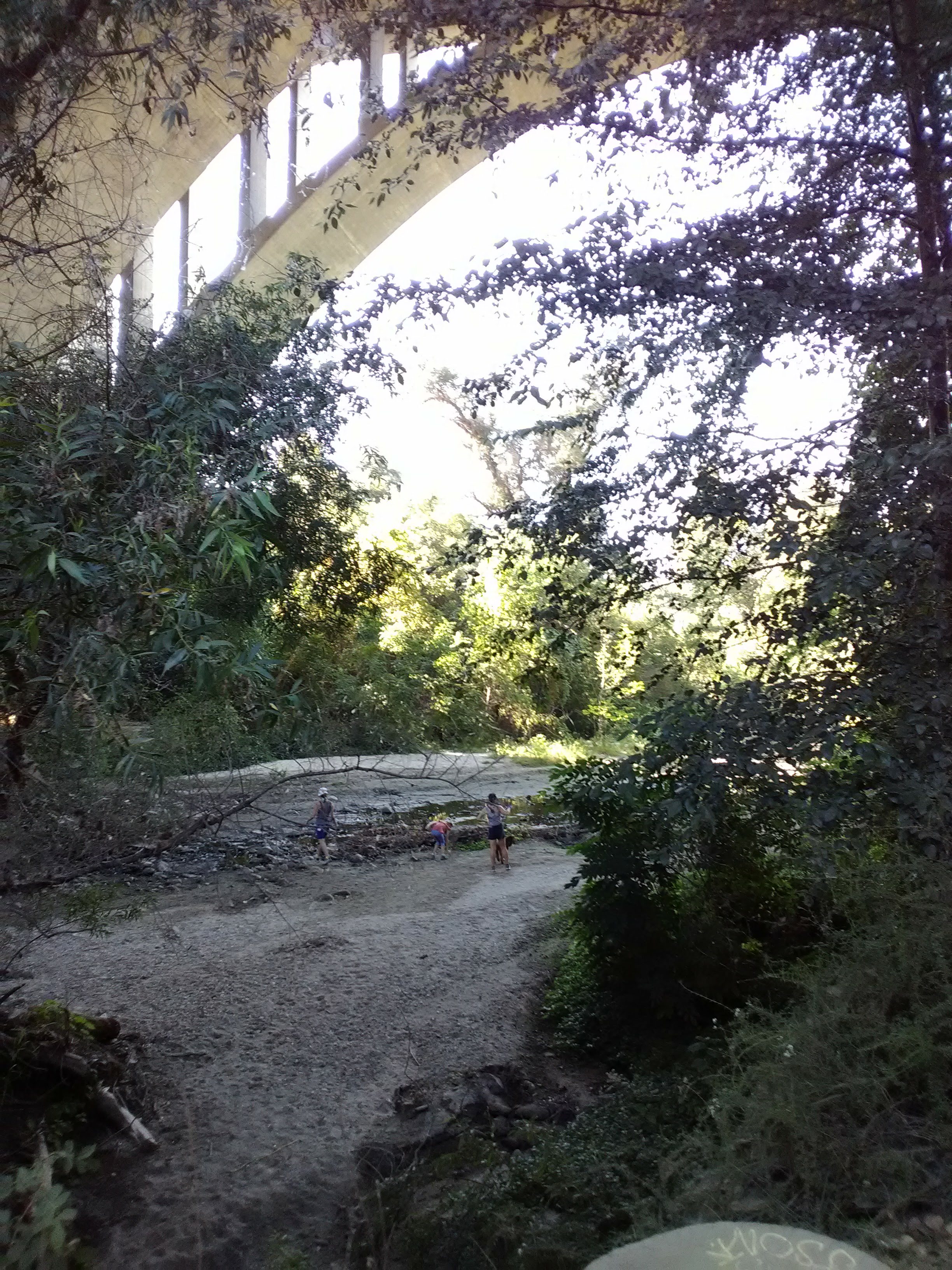
As you approach the Colorado Street Bridge, the canyon narrows and the vegetation grows thicker. From below, you can admire the intricate details of the bridge and the massive arches swooping high above your head. A grove of eucalyptus trees sits beneath the bridge, filling the air with their fragrant scent. Unlike the constant rumble of traffic over the nearby freeway bridge, the traffic on the slender Colorado Street Bridge seems so far away as to be almost inaudible.

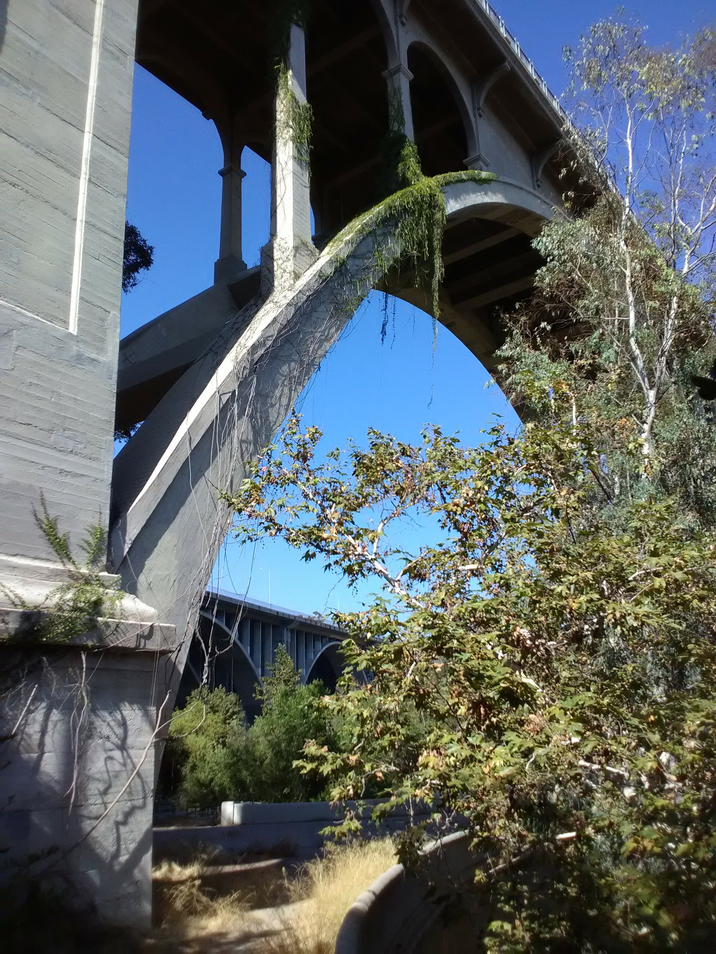
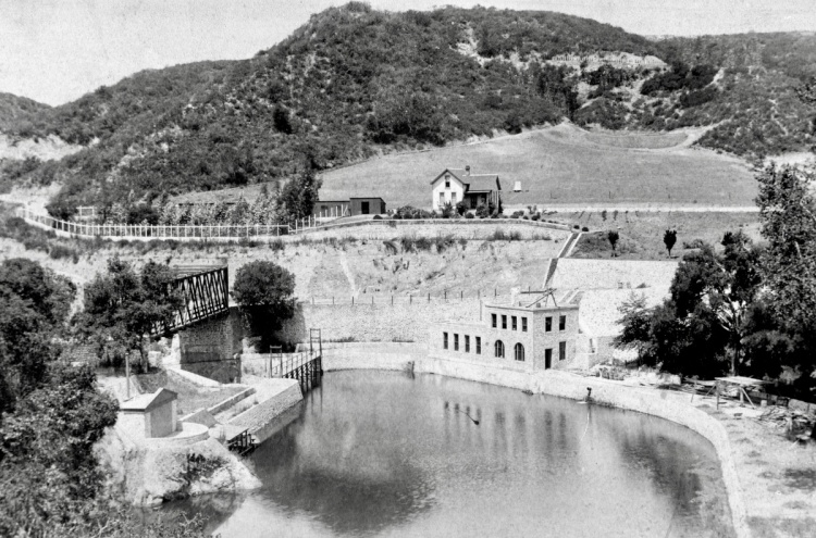
Directly beneath the bridge is an interesting feature totally hidden from above. The concrete channel of the Arroyo Seco comes to an abrupt halt at a tall spillway that marks a dam below the bridge. Also hidden from above but clearly visible from the path is a lower level bridge attached to the bottom of the Colorado Street Bridge, dwarfed by the larger structure. This is the Parker-Mayberry Bridge, built in the 1910s to replace the original Scoville Bridge after it washed out in a flood, and constructed to mimic the style of the larger bridge above it.
Originally it was built to provide access to orchards on the west bank of the Arroyo, just like the original Scoville Bridge, but today it’s closed to vehicles and all approaches to it are fenced off. However, you can get onto it from the path with just a little bit of work. Just go up the trail under the bridge and look for the short, crumbling stone staircase to your right just past the bridge. This will take you up to a patch of ground next to the bridge. An easy hop over a short wall and you’ll be on the bridge, where you can admire the massive structure towering over you and the dam beneath you.


From here, you can either retrace your path back uphill to Desiderio Neighborhood Park and back to the bus stop, or continue north up the path and enjoy one of the few natural stretches of the Arroyo Seco. Behind the dam, the stream trickles through a lush landscape beneath the bridges. Water fowl can often be seen wading in the shallow stream, while squirrels and lizards dart through the trees and bushes. Here, beneath the roar of the freeway traffic, a shady oasis sits.
Speaking of the freeway, you’ll be passing under that next. Although the 134 freeway bridge lacks the grace of the Colorado Street Bridge, it still impresses by its sheer size. Beneath the freeway is a dirt clearing next to the trail that offers unobstructed access to the Arroyo Seco stream, which burbles over a set of boulders. Here you can enjoy wading in the stream, skip stones across the water, or just enjoy the shade under the dull rumble of the traffic passing overhead.

Carry along the trail and you’ll rejoin Arroyo Blvd. Unfortunately, this stretch of Arroyo Blvd lacks sidewalks, making returning to Desiderio Park along the street from here a dicey prospect. Instead, continue on the path heading north towards the Rose Bowl, which will become visible in the distance as you round the bend. The next bridge you’ll pass under will be the Holly Street Bridge, and when you reach the first lawn on your right, next to the aquatics center, cross the street and look for a trail that will take you back up the hillside to the Holly Street Bridge (you’ll actually be able to see traces of it from Arroyo Blvd—just look for the little stone walls up on the hill after you pass under Holly Street). Once you reach Holly Street, you just have to walk back uphill to Orange Grove Blvd to return to the start.

Please take a moment to check out and support the Arroyo Link proposal! The e-book on the website offers a fantastic overview of the history of the area and a detailed proposal to rebuild a safe pedestrian linkage to the Arroyo Seco.

🎈🎈🎈You are both doing a great service to LA-also my home away from home.
I want to suggest that you explore Arcadia (Gold line stop) next. Maybe visit the Arboretum/Botanical Garden (next to Santa Anita racetrack) and see very early morning training as well. They have a small cafe with good breakfast, open very early.
My Husband and I used to simply go to Union Station, looked at the schedule and took whatever Amtrak came first: North or South?
You dont have to be rich to explore and to learn something new, meeting many good people along the way. Cheers from Regina😷vaccinated 🎈🎈🎈
PS-I also have a great idea for an interesting, classy and not so expensive wedding !?!?
LikeLiked by 1 person
I have 7 black and white photos of the Arroyo Secco bridge collapse in the 1940’s.. I used to have the negatives but lost them.but it’s strange that I cannot find anything about it online..
LikeLike
Thank you for this history. OneArroyo Foundation says it hopes to revitalize the area of the Parker Mayberry Bridge. Instead of walking around the gate on the eastern side of El Centro (the closed street crossing the bridge) and hopping over the low bridge wall, a new access would be provided by opening a gap in the wall of the bridge from an old Works Project Administration path coming down from South Arroyo Blvd. This would lead across the little river, past the ladder down to the stream, and on to the ten-lock gate closing El Centro on the east side to isolate the residential development connected to Linda Vista Ave. The pavement would continue to lead to the open area under the 134 Freeway Bridge down to the stream itself and to the paths along the stream leading back to the Parker Mayberry Bridge. But the historic Scoville Park could be further improved and revitalized as a walking path and tribute to local natural history by cleaning up the stream itself, removing the gutter trash that washes down from the street water runoff pipes going into the flood control channel and the stream bed and from Rose Bowl crowds and by removing the metal projections and other objects left over from the construction of the 134 Freeway Bridge itself.
LikeLike
Thank you for the update! It’s good that there’s finally movement on improving all these wonderful park spaces
LikeLike