Blog Archives
An easy walk on the dorsal ridge to enjoy the views and the flowers

The national park sign at the start of the path, describing the walk
This walk would not be enjoyable if you chose the wrong day, but on a warm sunny day with clear views, and only light wind, it is a real pleasure and very easy. So check the weather forecast before you go. I did it as a linear walk from the Roque de Mal Abrigo to the Mirador Chipique. However, I am not going to write about that as the middle bit was certainly not easy. I am just going to write about the first 2.5 km, and suggest doing it as a there and back walk.

Roque de Mal Abrigo which is on the opposite side of the road to the start of the walk
The Roque de Mal Abrigo (which literally means Bad Overcoat Rock) is at about km 34.8 on the TF-24 road which runs from La Esperanza to El Portillo. It is in the Teide National Park, which encompasses this strip of ridge as well as its main area in the caldera. You will find there are several places you can park off the road near to the start of the path.

The view to Mt Teide from the start of the walk, with Shrubby Scabious (Pterocephalus lasiospermus) in the foreground
The path goes towards the east, passing between bushes of Retama del Teide (Spartocytisus supranubius), Shrubby Scabious (Pterocephalus lasiospermus) and Tenerife Flixweed (Descourainia bourgaeana). There is a fork in the path early on, with signposts, take the right fork which continues roughly level, not downhill. There are fine views to Teide, and down the Orotava valley, and even the island of La Palma, clouds permitting.

Plants growing among the rocks on Montana la Negrita, including the yellow-flowered Flor de malpais (Tolpis webbii)
The path climbs gently over a red-coloured gravelly rise, Montaña Yegua Blanca, and then descends the other side to meet the road. You will have walked 1.29 km and climbed gently about 60m. If you want you can retrace your steps from here, or arrange a car to pick you up. Otherwise you can go across the road and continue for a further 1.2 km with a short climb of about 30m before returning. This will get you to the top of Montaña la Negrita to enjoy the fine views down the ridge, and down to the coast of the Güimar valley and across to the island of Gran Canaria if it is not blocked by cloud or haze.
The path does continue on down from the top of Montaña la Negrita and is well defined and easily negotiated by adventurous and well-equipped walkers. It is, however, a steep descent requiring excellent footwear, surefootedness and, preferably, two sticks to negotiate safely. There is then a rise to Montaña Colorado followed by an equally steep, though longer, descent to the road at La Crucita (around km 30). I am therefore not recommending it as an easy walk!
The recommended walk to the top of Montaña la Negrita and back is just over 5 km / 3.25 miles, with around 100 m / 325 ft of ascent and descent. It took my friends and I 1 hr and 40 minutes to do it.
Another circular walk above the Barranco de Tagara

Teide wallflower (Erysimum scoparium)
We did this walk last Saturday, starting from the Mirador below Pico Viejo, (rather confusingly called the Mirador de Chio) near km 3 of the TF-38, in the National Park. The first half followed the route taken by our walk on July 4th, but when we reached our lowest point, instead of turning right as we did then, to complete a circle, we turned left. I was introducing my winter walking friends to the new path down from near the El Cedro firepower, which we had discovered on the July walk.

Malpica del cumbre (Carlina xeranthemoides) a Tenerife endemic thistle common in the drier parts of the island.
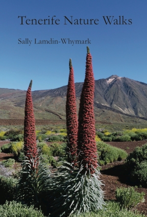
The new path had been further improved since we had used it before, and the lower part was much clearer and easier to walk. We all enjoyed the excellent views into the dramatic and beautiful Barranco de Tagara. The barranco was the worst-affected area during the forest fire in 2012, and was like a war zone after it – see my blog at the time. It was lovely to see that the barranco is recovering its natural beauty. Most of the trees, which are Canary Pines (Pinus canariensis), are recovering well, with green sprouts appearing all up the badly burnt trunks. So instead of a broad green canopy, there are lots of green lollipop sticks! However, that lets more light reach the forest floor and the ground herbs are making the most of it, growing up and even flowering at this time of year.

A view down into the Barranco de Tagara, recovering from the 2012 forest fire
I was amazed at the number of different flowers, which I had not expected at this time of year. We have had a little rain recently, and it has been quite warm, so some flowers we would see in spring have already started flowering.

Flor de malpais (Tolpis webbii), a Canary endemic of the high mountain area.
On the north side of the El Cedro mountain there are a couple of water springs. They have been tunnelled in a little to increase the flow. Because there is always water there, there are always birds around too. And there are a wide variety of plants too, including the Tenerife endemic Night-scented campion (Silene nocteolens), which I did not get a good picture of, Mountain parsley (Pimpenella cumbrae), which was not in flower, and the Moralito (Rhamnus integrifolia) an evergreen shrub which is a Tenerife endemic also. Before the fire there were a few of these shrubs but yesterday I could only see one small one, but that is better than none.

One of the water springs on the north side of El Cedro mountain
We descended on the path past the firetower, and a few metres after passing it on our left we reached a cairned path on the right which we took for a short while, till we reached the new path going left marked by cairns and white paint spots, which crosses above the Barranco Tagara, with fantastic views down into it.
When we reached the track we crossed it, found the yellow/white way marked path from Boca de Tauce to Guia de Isora, the PR TF 70. Initially we went a few metres straight along it to have lunch at the lovely viewpoint on the top of the small hill called Mt Tafosaya (point 8 on walk 9 in the book ‘Tenerife Nature Walks”.

A small specimen of the evergreen Tenerife endemic shrub Moralito (Rhamnus integrifolia) on top of a rock near the water spring
It was warm and sunny and the view was great, although clouds were beginning to gather below us. We sat chatting and lunching and enjoying the scenery and ended up spending 30 minutes at the viewpoint!
After lunch we returned back to where we joined the PR TF 70 and continued in a southerly direction, back towards Boca de Tauce, and followed it until we came to the track on the bend with a fine view of Pico Viejo and Teide (see the last photo below), which is point 3 on walk 9 in the book.
Canary mountain figwort (Scrophularia glabrata) on Mt Cedro
From this bend we took the track descending gently on the Teide side of the caldera wall, and stayed on it till it reached the main road TF-38 near Km 3.
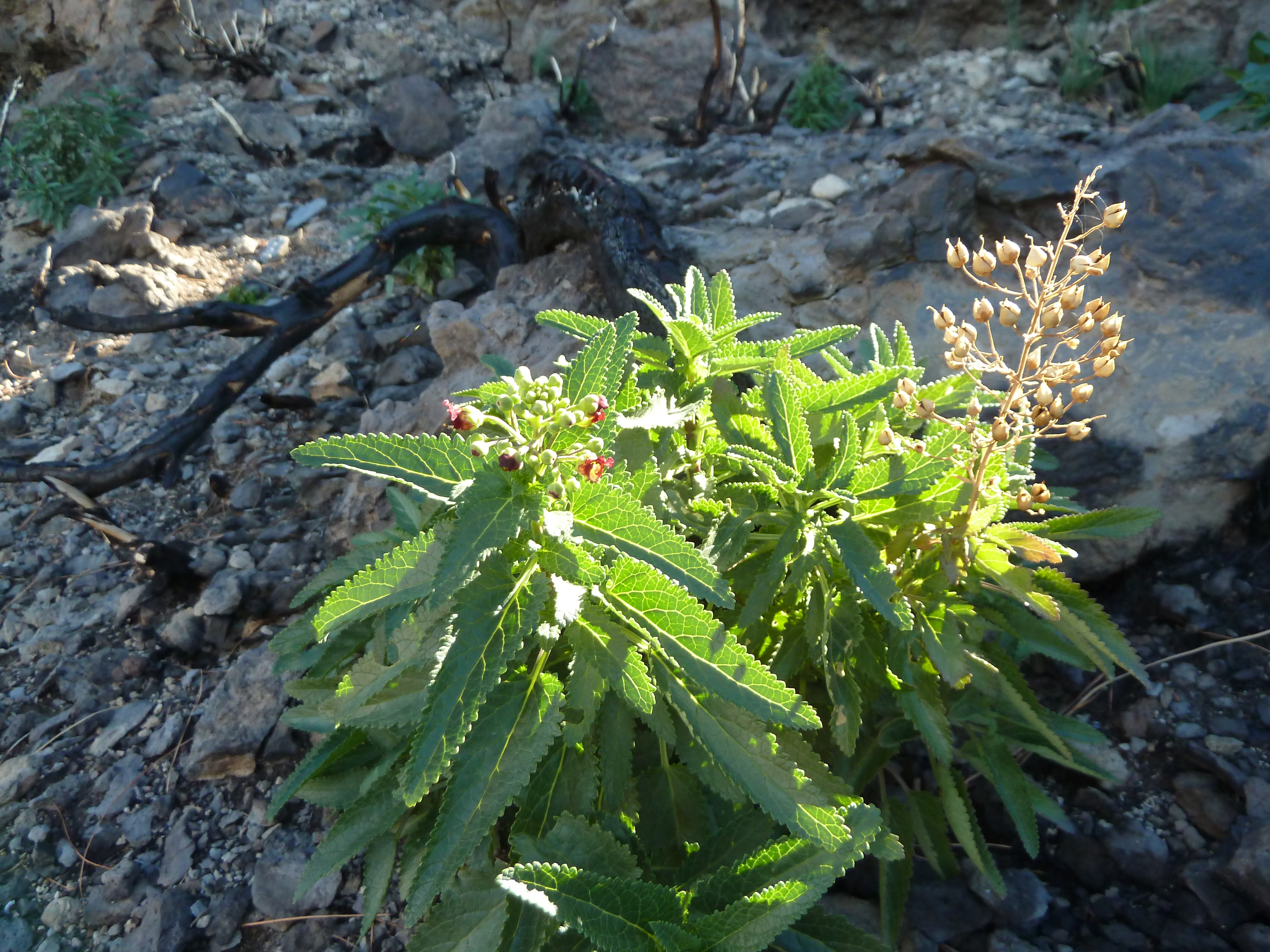
I noticed that on the left of the track as it ran next to the caldera wall the National park had clearly cut down some burnt shrubs and a few pines, and consequently a vast number of native plants had sprung up, including many of the iconic Teide Vipers bugloss (Echium wildpretii). In a year or two when these come to flowering there will be a lovely show there in May/June.

A Teide marguerite (Argyranthemum teneriffae) flowering in a sheltered position
Despite our long lunch break, the walk only took a group of 8 fit walkers 3hrs 40m. It was around 10 km/6.25 ml long, with only 420m /1379 ft of ascent, although quite a lot of it does come at the end of the walk.

An unknown caterpillar we saw on the ground beneath pines near the firetower.
This very hairy caterpillar was seen, on its own, on the ground below pines near the firetower. I tried looking it up, and thought I had cracked it as the Pine processionary moth (Thaumetopoea pityocampa), so called (the english name) because the caterpillars tend to follow each other walking in long processions. However, I looked up the list of species for the Canary Islands and that moth is not found here. So has anyone any ideas?
Further research on this caterpillar leads me to think it is probably Calliteara fortunata which is a Canary endemic species whose caterpillars feed on Canary pine trees (Pinus canariensis), Retama (Spartocytisus supranubius) and escobon (Chaemacytisus proliferus).
An easy linear walk to El Portillo in the Teide National Park

The start of the path at the Minas de San Jose
This walk is a good one to do at this time of year, when the flowers are out in the National Park. This year, however, due to a largely dry winter, there is not a profusion of flower as in some years, but there is still a lot to see, mostly endemic species that you will not see elsewhere in the world. It is on good surfaces, mainly downhill or level, so is quite easy walking. It is a linear walk, so requires two vehicles, one at each end. The length is 11.2 km and descent of about 300m/985ft, and ascent of about 150m. It took us 3 hours. Some of the descent, which is near the beginning, is fairly steep, but all our group managed it well, as the path was in good condition and easy to follow.

Canary endemic Flixweed (Descourainia bourgeauana)
The walk starts at the Minas de San Jose, and area of white pumice between the Teide cable car and El Portillo, on the main road. There is a parking area there, on both sides of the road, and the path starts on the south side. There is a sign describing the initial path, which is called Las Valles (the valleys), and is national park path no 30. The path is clearly delineated with two rows of stones.

Tenerife endemic, the pink-flowered Shrubby scabious (Pterocephalus lasiospermus) next to Canary endemic, Teide sticky broom (with yellow flowers) (Adenocarpus viscous)
The Minas de San Jose is an area where the blue viper’s bugloss (tajinaste azul in Spanish) (Echium auberianum) grows and I have seen it there in the past, so I was hopeful we would see some. However, it is a very rare Tenerife endemic, and this year is more difficult to see than usual, so I only saw on the walk one specimen in flower, and that was very stunted, not a good 60cm/2ft high spike. However, when I got into the car and began the drive home from the Minas de San Jose I saw a delightful specimen by the side of the road. Unfortunately I could not stop to take a photo of it. So if you want to see one this year, park your car in the parking area and walk a short way down the road in the direction of the Teide cable car and you will see one on the north side. Be careful of the road, though, it is narrow, and cars do come past quite fast.
A stunted specimen of the rare Tenerife endemic, Dwarf Teide bugloss or tajinaste azul (Echium auberianum)
At first the path wanders through a pleasant valley with flowers and rocks either side. Many of the rocks in this area have shiny black stripes in them, which is obsidian or volcanic glass. You pass two trees which look like Christmas trees (Norway spruce), but I don’t believe they are. The foliage looks very like the cedro, the high mountain form of Juniper (Juniperus cedrus) which is a Macronesian (Atlantic Island) endemic, but the shape is far from typical.

A view of the caldera wall, with Teide white broom (Spartocytisus supranubius) in the foreground
Then the path turns back towards the road and meets a T-junction where you turn right, continuing downhill. Shortly the steep part of the descent begins, but take time to stop and look at the views of the caldera wall ahead, as well as the rocks and plants. In addition to the white-flowered Teide broom or Retama (Spartocytisus supranubius)with its heady scent, there were the yellow flowers of Flixweed (Descurainia bourgeauana) and Teide sticky broom (Adenocarpus viscosus), pink flowers of the Shrubby scabious (Pterocephalus lasiospermus) and the odd purple Teide catmint (Nepeta teydea).

Mountain wall lettuce (Tolpis webbii) in clumps on the rocks.
Gradually the path becomes less steep and finally is on the level on a good pumice surface, approaching the caldera wall we first saw at the top of the descent, where we joined a wider track.

A view to Mt Teide as we got near to El Portillo
The track is known as the Pista Siete Cañadas. It runs along the base of the caldera wall (mostly) all the way from El Portillo to near the Parador. We turned left to go to El Portillo and followed it for the rest of the walk, enjoying the changing views of Mt Teide as we walked. On this stretch we saw two more Canary endemic species with yellow flowers, the Mountain wall lettuce (Tolpis webbii), and the Canary fennel (Ferula linkii). We also saw a few of the large and impressive red Teide bugloss (Echium wildpretii), but they were high up a rocky slope to our right, and we had to wait till we got to El Portillo to see them nearby.

Canary endemic Teide vipers bugloss (Echium wildpretii), near El Portillo
A walk exploring a new path up to the Sombrero de Chasna from Vilaflor, Tenerife

The path ascending onto a rocky ridge from the track near the start. Lots of cairns marked the way.
On Wednesday we were unable to complete our planned walk from Vilaflor as the track we intended to follow from near the firetower above the town was cordoned off. So we had to turn around and find another route. We had climbed to there on the Camino Pino Enano (Dwarf Pine path) from near the football pitch by the Hotel Villalba. So we explored a point where a track leaves the road just above km63 on the road from Vilaflor to Boca de Tauce, where I had discovered there was a path going up to the Sombrero de Chasna, thanks to Tico Acoran’s contribution to Wikiloc.

A shepherd’s shelter on the ridge
We went up the track which forked, took the left fork and soon saw some cairns and a faint path leading up onto a rocky ridge. It zig-zagged a bit on the way to the top of the ridge and then turned to the right to head straight up. We noticed a small galvanized pipe in an old water channel, partially covered with stones, was to our right when we were on the ridge, and this channel was key to not getting lost! This was as far as we went on Wednesday as we did not want to climb further that day, but decided to return on Saturday to start our walk there.

The view up to the Sombrero de Chasna from the first flat area on the ridge
On Saturday we parked one car at the Las Lajas barbeque park and one at km 63, and walking from there we followed the same route up to the first level bit. We noticed the cairns on this flatter stretch led us over to the right of the ridge so we could enjoy the view over the forest, looking down onto the Pista Agua Agria which leaves the main road a little down from where we started. Those who suffer vertigo, however, might prefer to stay with the water channel as the path is on the edge of a precipitous slope. The path then rejoined the water channel until it reached the foot of a steeper slope where the cairns led us round to the left up a zig-zag easier route than the water pipe. On the next flatter part we passed a ruin of an old shepherd shelter.

View to Vilaflor and the south coast from the valley to the west of the Sombrero
We followed cairns where they were there, often diverting from the water channel for an easier path, and where there were no cairns we stayed near the water channel, till we reached a wide open space, where we could see no onward cairns, only a very large cairn which appeared to be one of a series we had seen that appeared to be in a straight line, perhaps marking a boundary. We should have stuck to the channel, as from the left of it a path went across the barranco on the left and then another brance of the barranco. We then followed cairns up a slope till we reached a well-worn path. However, when we looked from above we saw another path which stayed on the right bank of the second barranco until reaching a dark cliff which the water channel disappears into, where it crosses in front of the cliff to join the path we had joined lower down.

Teide knapweed (Cheirolophus teydis)
We were now in the valley to the western side of the Sombrero, and we began to see the occasional flowers, mainly Malpica del cumbre (Carlina xeranthemoides), with a few Flor de malpais (Tolpis webbii). Higher up we saw some of the Teide knapweed (Cheirolophus teydis). All of these are Canarian endemics, so great treasures, even though common in the area.
We continued up the valley past the Sombrero and on up to the edge of the caldera where we got a great view of Mt Teide and Las Canadas for an excellent lunch stop. We then made our way to National park path no. 31 which descends a little west of the way we came up, and followed that path down as that comes out on the main road near to Las Lajas. It is a pleasant walk through pine woods, going gently downhill.

A view to Mt Teide from our lunch spot on the opposite side of the caldera
As we came nearer the road we found ourselves walking through an area of pine forest affected by the fire in July. However, the fire had clearly swept through quickly, burning the pine-needle carpet (pinoche) and singeing the trees but not damaging them badly. The undergrowth shrubs such as the sticky broom (Adenocarpus viscosus) and the Escobon (Chamaecytisus proliferus) had been burnt and killed where the fire had hit them, but others a few metres away had been missed by the fire. We had noticed higher up some more severe damage to trees high up next to the rocky crags of the caldera rim. There the fire had lingered and burned rather than rushing through, and some of those pines will not revive.

The Sombrero de Chasna from its north side as we started our descent
Arriving at the Las Lajas barbeque park, we were able to take the car down to the other one parked below. It would have been possible to walk this part to make a circle, but we tend to like a shorter walk on Saturdays. The walk took us 3.5 hrs, was 8.63 km / 5.39 ml and involved 550m / 1806ft of climbing.

A section of the National Park path no 31 passing through recently burned forest