Covering an area of 100 Sq. Km. Murlen National Park was notified as a National Park in 2003. It is located in the Champhai district of the Indian state of Mizoram, and lies in close proximity to the Indo-Myanmar border and approximately 245 km to the east of Aizawl, the state capital. The geographic coordinates of the park are 23°34’ – 23°39’ North and 93°14’ – 93°21’ East, with an altitude ranging from 400 meters to 1850 meters in the southward direction. This park is characterized by large expanses of relatively subtropical evergreen and semi-montane forests.
Murlen National Park is significant due to its proximity to the Chin Hills, a mountain range in Chin State, northwestern Myanmar which extends northward into India’s Manipur state. The park is rich in wildlife and is one of the important bird areas in India supporting several threatened species. The Hoolock gibbon, which is an endemic and endangered species, is still quite abundant. Wild orchids and Rhododendron species are also abundant in Murlen National Park.
The Boundary of Murlen National Park
1. North:
The boundary begins at the meeting point of Tumkhuailui and River Pumpet lui. It then follows Tumkhuailui upstream to Kawlhrakawn. From Kawlhrakawn, it follows the source of River Tuithing lui and then downstream to where Tualpui village approach road crosses River Tuithing lui.
2. East:
From the point where Tualpui village approach road crosses River Tuithing lui, the boundary follows the village approach road to River Khuai lui. It then follows River Khuailui downstream until it meets River Khamkeh lui, then continues downstream to River Tuikhuai lui.
3. South:
The boundary follows River Tuikhuai lui downstream until it meets River Tuipui lui. From there, it continues downstream along River Tuipui lui until it reaches the outlet of River Pumpet lui.
4. West:
From the outlet of River Pumpet lui, the boundary follows River Pumpet lui upstream to the point where it meets Tuikhuailui, which marks the starting point of the North boundary.
Murlen National Park Map
Murlen is the name of a village after which the national park has been named, and it is situated at the very center of the park. Murlen is located right in the core area of the forest. The map shows the area of Murlen National Park.
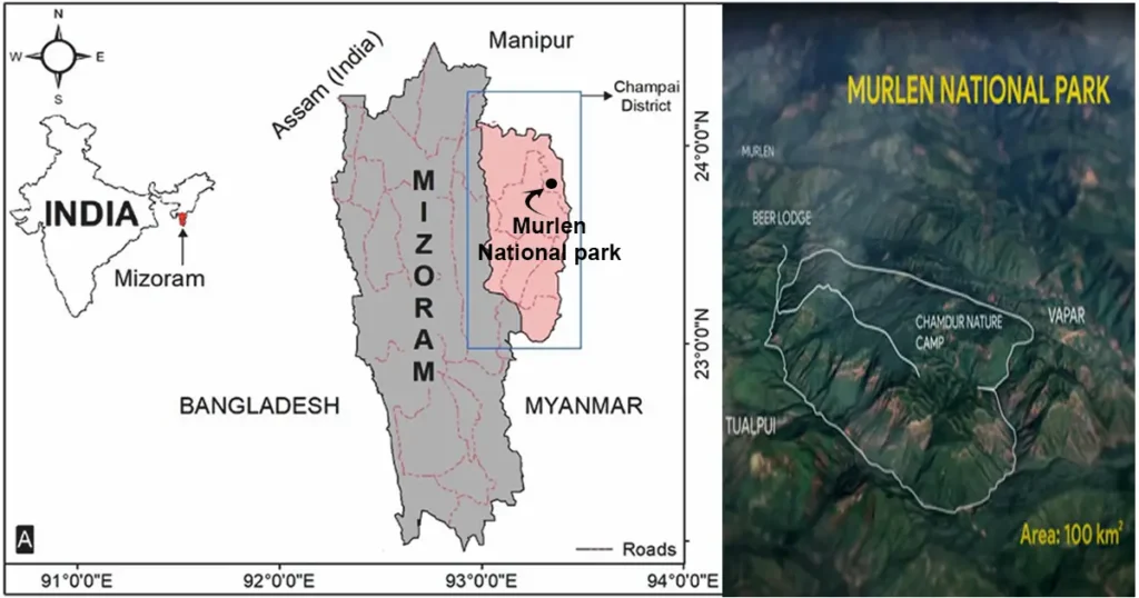 Murlen National Park location map
History of Murlen National Park
- The name ‘Murlen’ comes from the words ‘Mur,’ which means house swift (local name: Vamur), and ‘Len,’ which means roaming. So, ‘Murlen’ means ‘the place where swifts roam.
- Before becoming Murlen National Park, the area used to be a local community forest known as Chamdur Ngaw, which was famous for hunting. The local community didn’t use the land for farming because of its high altitude. Later, the Environment & Forests Department proposed the area as a Wildlife Sanctuary for conservation and development. Eventually, it was declared a National Park.
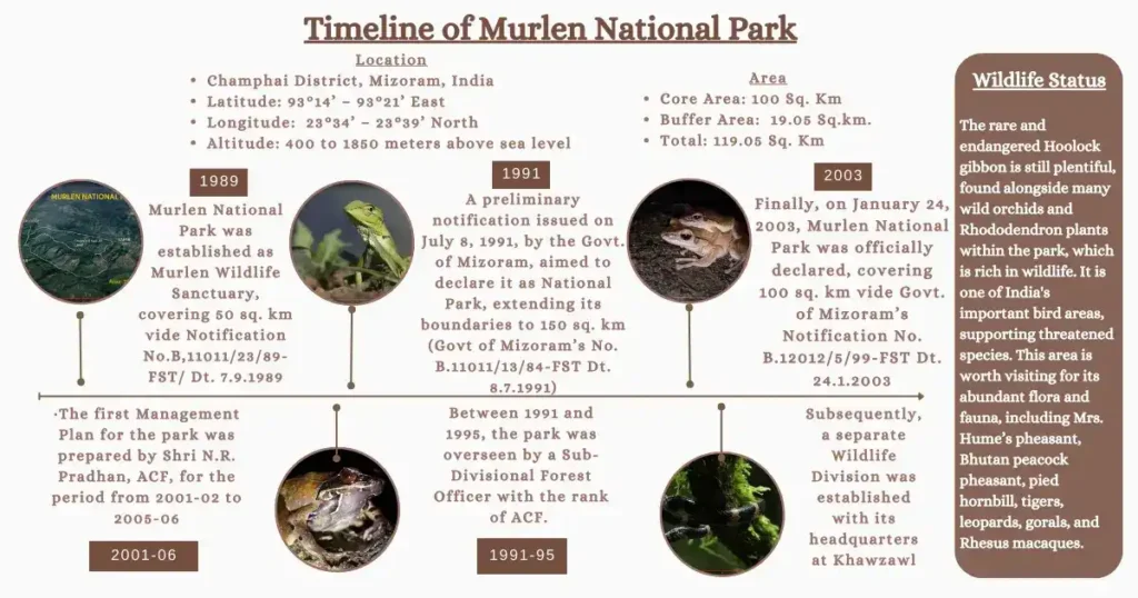
- Initially in 1989, Murlen National Park was established as Murlen Wildlife Sanctuary, covering 50 sq. km, vide Government of Mizoram, Notification No.B,11011/23/89-FST/ Dt. 7.9.1989.
- A preliminary notification issued on July 8, 1991, by the Government of Mizoram, aimed to declare it as Murlen National Park, extending its boundaries to 150 square kilometers (Government of Mizoram’s No. B.11011/13/84-FST Dt. 8.7.1991).
- Finally, on January 24, 2003, Murlen National Park was officially declared, encompassing 100 square kilometers, under Government of Mizoram’s Notification No. B.12012/5/99-FST Dt. 24.1.2003.
- The first Management Plan for the park was prepared by Shri N.R. Pradhan, ACF, for the period from 2001-02 to 2005-06. This management plan marked the first concrete effort to implement scientific management practices within the National Park.
- Between 1991 and 1995, the park was overseen by a Sub-Divisional Forest Officer with the rank of ACF. They operated from a temporary headquarters at N.Khawbung and managed a limited field staff under the supervision of the DFO Wildlife Division, Aizawl.
- Subsequently, a separate Wildlife Division was established with its headquarters at Khawzawl. This division was led by a Divisional Forest Officer and was responsible for the administrative control of both Murlen National Park and Lengteng Wildlife Sanctuary.
 Murlen National Park photos : Frog
Murlen National Park Geography
1. Geology:
The geology of Murlen National Park consists of sedimentary rocks and slightly sandy loam soil, which contains a mixture of humus and loamy soil. River beds mostly have sandstone, clay, siltstone and pebbles. The hills have deep, moist and fertile sandy loam soil, with humus staining the upper layer.
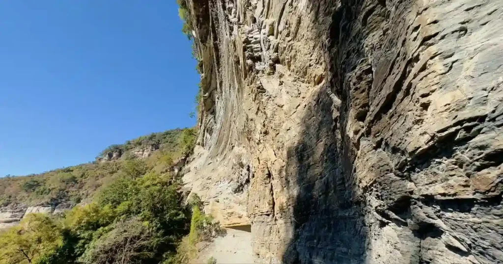
Topography:
The terrain is mostly hilly, except for valleys and foothills. The hill slopes are often very steep and are crossed by many streams. In some areas, there are steep hills and rolling hillsides, with tall cliffs and low points in between.
2. Climate:
Murlen National Park is in a sub-tropical region with a sub-tropical climate. Summers are warm and wet, while winters are cool and dry. Rain comes before the monsoon season in April-May, with the main monsoon rains starting in June and lasting till September. The annual rainfall in the park ranges between 1700mm to 3900mm each year, spread out over a period of seven to eight months.
3. Temperature:
The average temperature of Murlen National Park usually ranges from 8°C to 20°C in winter and from 19°C to 29°C in summer.
4. Humidity and Wind Speed:
During summer, the park area is quite humid, but humidity is low in March and April. The prevailing winds are usually moderate, although occasionally there are cyclonic storms in March and April.
5. Water Resources in Murlen National Park:
The main water sources in the park are Lungkeh lui, Khuai lui, Pumphet lui, Mau lui, Tuithiang lui, Khamkeh lui, Tuipui lui, and Khawthlahlian lui. These sources also provide water to nearby villages like Rabung, Vapar, Hnahlan, Ngur, etc., for drinking. Inside the park, some artificial waterholes have been made where water is scarce during the dry season.
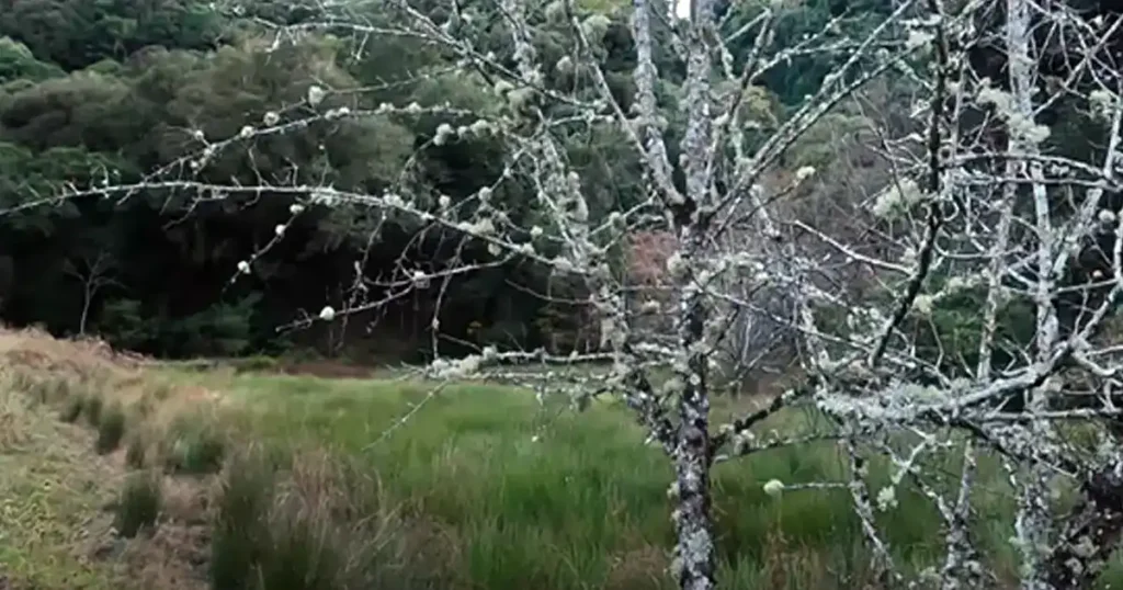
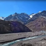
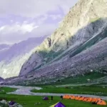
 Murlen National Park photos : Landscape
Flora, Fauna and Avifauna in Murlen National Park
1. Flora:
The flora of Murlen National Park area includes a various range of vegetation types, primarily falling under two main forest types:
A.) Khasi Sub-Tropical Wet Hill Forests (Type 8B/C2):
- Found in the hill areas of the Eastern and Central regions of the park, ranging from 1300 meters to 1800 meters altitude.
- Dominated by tree species such as Quercus polystachya, Q. leocotrichophora, Schima wallichii, Castanopsis tribuloides, and Betula spp.
- Bamboo species like Arundinaria callosa and Bambusa khasiana are also present.
 Murlen National Park photos : Forests
B.) Assam Sub-Tropical Pine Forest (Type 9/C2):
- Occupies hill areas ranging from 800 meters to 1600 meters altitude.
- Key tree species include Quercus polystachya, Q. leocotrichophora, Lithocarpus dialbata, Schima wallichii, Castanopsis tribuloides, Persea villosa, Terminalia myriocarpa, Lithocarpus elegans, Pinus Khasia, Rhododendron Arboreum, and Prunus domestica.
- Shrubs such as Measa montana, Melastoma malabathricum, Clerodendron viscosum, and Hedychium coronarium are also notable.
In addition to forests and shrubs, the area supports diverse flora at the field and ground levels:
- Field-level flora includes Chromolaena odorata, Arisaema spp., Solanum torvum, and Lycianther spp.
- Ground-level flora comprises Ageratum conyzoides, Saccharum longisetosum, and Eryngium foetidum.
2. Avifauna:
The commonly birds found in the park are Partridges, Hume’s pheasants, Red jungle fowl, Kaleej pheasants, Woodpeckers, Cuckoos, Barbets, Bhutan peacock pheasant, Parakeets, Eagles, Brown wood owls, Doves, Pittas, Minivets, Leafbirds, Magpies, and Warblers.
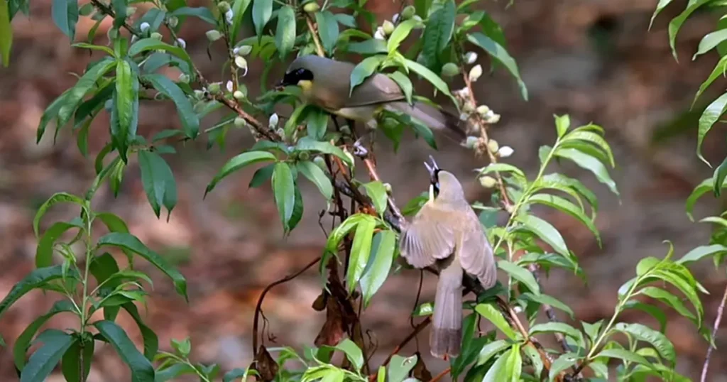 Murlen National Park photos : Yellow-throated-laughing thrush bird
3. Fish, Amphibians and Reptiles:
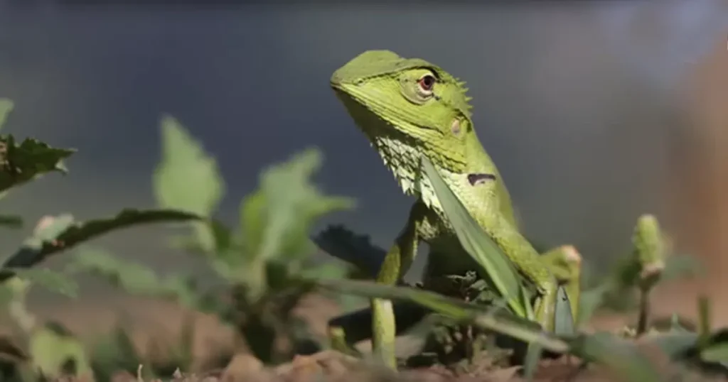
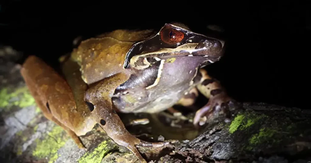
The lower form of fauna found in this park are – Eel, Flat fish, Cricket frog, Common Asian toad, Common Indian Rat snake, Green Lizards, etc.
Eco-Tourism
The park has not yet developed proper infrastructure except a few nature trails and watchtowers, due to lack of funding in the State Plan. The development of a proper eco-tourist zone and minimum basic lodging and boarding facilities, such as tourist huts, machans, and tents with essential components, is needed in the park.
Exploring Murlen National Park
The range office in Rong serves as the entry point to Murlen National Park. There are two ways to enter the park: one through Vapar via Champai, and the other through Rabung, the official entry gate. To reach the park boundary and entry gate from Murlen Village, you’ll need to trek approximately 3.5 to 4 kilometers. Located in the remote southeast region of Mizoram, Murlen National Park requires visitors to register at the entry register in Murlen Village to obtain permits.
Major Attractions of the Park:
The main attractions of Murlen National Park include many plants and animals that are found only in this area. One such animal is the Hoolock gibbon, which is endangered but still quite abundant here. The park also has beautiful forests, especially in the Chamdur area, where you can see many different plants that are only found here.
There are also lots of wild orchids and Rhododendron flowers, birds like Mrs. Hume’s pheasant, Kaleej pheasant, Bhutan peacock pheasant, red jungle fowl, pied hornbill, imperial pigeon, crested serpent eagle, brown wood owl, wild animals like tigers, leopards, gorals, serows, sambars, barking deer, wild boars, and Rhesus macaques which make this area worth visiting.
 Murlen National Park photos : Forests
Best time to visit Murlen National Park
The best season to visit Murlen National Park is October to May.
How to reach the Park
Murlen National Park, situated 245 kilometers from Aizawl, is accessible by various means:
By Air: The nearest major airport is in Shillong, with Alliance Air Service offering daily flights from Aizawl to Kolkata (1 hour 45 minutes), Guwahati (40 minutes), and Imphal (30 minutes). Indian Airlines connects Aizawl to the rest of India via Guwahati, Imphal, and Kolkata. Lengpui Airport in Aizawl also connects with Guwahati, Silchar, and Kolkata, offering connections to all northeastern state capitals.
By Rail: The nearest rail station is in Silchar, 185 kilometers from Aizawl. Travelers can reach Silchar from Guwahati by trains like Barak Valley Express, Cachar Express, or Tripura Passenger.
By Road: National Highway number 54 links Aizwal with the rest of the country through Silchar. Buses and taxis ply between Silchar and Aizwal, with 24-hour bus services available. Aizawl is also accessible by road from Shillong and Guwahati, with taxis readily available throughout Mizoram.
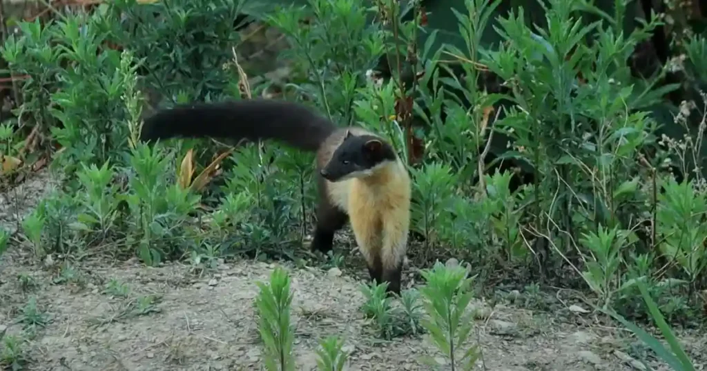 Murlen National Park photos : Yellow-throated marten
Conclusion:
Located in Mizoram’s Champhai district near the Indo-Myanmar border, Murlen National Park is significant for its proximity to the Chin Hills, which extend into Manipur, India. The park has vast stretches of subtropical evergreen and semi-montane forests. The rare and endangered Hoolock gibbon is still plentiful, found alongside many wild orchids and Rhododendron plants within the park, which is rich in wildlife. It is one of India’s important bird areas, supporting threatened species. This area is worth visiting for its abundant flora and fauna, including Mrs. Hume’s pheasant, Bhutan peacock pheasant, pied hornbill, tigers, leopards, gorals, and Rhesus macaques. The best time to visit the park is from October to May.
FAQ
a) Which animal is famous in Murlen National Park?
Murlen National Park is famous for animals that are found only in this area. One such animal is the Hoolock gibbon (Hauhuk), which is endangered but still quite abundant here. There are also lots of wild birds like Mrs. Hume’s pheasant, Kaleej pheasant, and Bhutan peacock pheasant.
b) Which river passes through Murlen National Park?
The Murlen National Park’s main water sources include Lungkeh lui, Khuai lui, Pumphet lui, Mau lui, Tuithiang lui, Khamkeh lui, Tuipui lui, and Khawthlahlian lui. These sources also supply water to nearby villages like Rabung, Vapar, Hnahlan, Ngur, etc., for drinking. Artificial waterholes have been created within the park to address water scarcity during the dry season.
c) On which hills is Murlen National Park?
Murlen National Park is situated in the hilly terrain of the Mizo Hills, adjacent to the Chin Hills—a mountain range in Chin State, northwestern Myanmar, which extends northward into India’s Manipur state. It is characterized by dense forests, steep slopes, and beautiful landscapes.
d) The relevance of Murlen National Park UPSC examinations
Covering an area of 100 Sq. Km., Murlen National Park is located in the Champhai district of the Indian state of Mizoram, and lies in close proximity to the Indo-Myanmar border and approximately 245 km to the east of Aizawl. It was notified as a National Park in 2003.
You May Also Like
- Phawngpui National Park
- Nameri National Park
- Raimona National Park
- Dibru Saikhowa National Park
- Orang National Park


3 thoughts on “Murlen National Park”