Ghost pipes

Monotropa uniflora (ghost pipes, Indian pipes) in mature white oak forest.

I’m always on the lookout for cool plants and critters during my daily walk with Beau and Madam, and today we saw one of the coolest plants ever — Monotropa uniflora (ghost pipes, Indian pipes).

Monotropa uniflora (ghost pipes, Indian pipes) in mature white oak forest.

This bizarre plant, a member of the blueberry family (Ericaceae), occurs throughout much of Missouri, but the plants seem to pop up sporadically and unpredictably and are difficult to locate intentionally. The common name derives from their unique shape, the nodding flowers — one atop each stem — giving the plant a pipe-shaped appearance, and their pure white coloration — a consequence of the complete absence of any chlorophyll in their tissues. As such, the plants are unable to photosynthesize and must obtain nutrition from decaying organic material on and in the soil, which they do with the aid of soil-inhabiting fungi that digest the matter into basic compounds that the plant can absorb.

Monotropa uniflora (ghost pipes, Indian pipes) in mature white oak forest.

The nodding flowers will eventually turn upwards as the fruits form and mature, so I am anxious to keep an eye on these plants as that happens over the next couple of weeks.

Monotropa uniflora (ghost pipes, Indian pipes) in mature white oak forest.

©️ Ted C. MacRae 2022

Lewis Ocean Bay Heritage Preserve & Wildlife Management Area

The pine flatlands of the southeastern Coastal Plain offer an interesting contrast to the upland forests of my home state of Missouri. Closed canopies of oak and hickory are replaced by open canopies of pond and longleaf pine. Dry glades—islands of prairie dotting the forests—are replaced by bogs and bays—oases of wetland punctuating the sandy scrub. In both places, however, fire plays an important role in shaping and preserving these unique habitats. In this ~10,000-acre preserve, prescribed burns spare the heat-tolerant pines—their trunks blackened and scorched but the living branches high above unharmed—and prevent woody shrubs from choking out herbaceous plants, including famously insectivorous plants such as Venus fly traps, sundews, and pitcher plants. I had yet to have seen any of these plants in their native habitats, and after learning of this place and their presence here from a local resident, Madam and I made a beeline to the preserve for an afternoon of botanical hiking.

Pine flatlands at Lewis Ocean Bay Heritage Preserve & Wildlife Management Area.

Almost immediately after starting down the road from the parking lot, I noticed white blossoms dotting the forest floor. Approaching closer revealed them to be wild azaleas—in this case Rhododendron viscosum (swamp azalea). Individually, the petite plants with their crowns of oversized blooms were quaintly beautiful. En masse, clustered on the forest floor, they were an amazing sight to see.

Rhododendron viscosum (swamp azalea) in pine flatland.
Rhododendron viscosum (swamp azalea).

The going was slow in the beginning, with something new to me at every turn. A species of Nuttallanthus (toadflax)—either N. texanus (Texas toadflax) or N. canadensis (Canada toadflax), depending on details of flower dimensions—bloomed abundantly in the sunny openings. A small purple flower was at first assumed to be a species of Tradescantia (spidorwort) but proved to be the related Callisia graminea (grassleaf roseling)—a new genus for me. A bit further down the road we encountered orange flowers that proved to be Polygala lutea (orange milkwort). This genus is represented in Missouri by several species, all having flowers of pink, yellow, or white.

Nuttallanthus (toadflax)—either N. texanus (Texas toadflax) or N. canadensis (Canada toadflax).
Callisia ornata (scrub roseling).
Polygala lutea (orange milkwort).

Flowers were not limited to herbaceous plants. The evergreen woody shrub layer was just coming back to life with new growth, a few of which bore distinctive blossoms identifying them as members of the genus Vaccinium (blueberry). There are several potential species that could be here.

Vaccinium sp. (blueberry).

At one point, Madam called me to the other side of the road, pointing to a strange plant at the edge of a wet area and asking “What’s that?” Bingo—I recognized it instantly as one of the so-called “pitcher plants” (genus Sarracenia), among the most dramatically charismatic of the insectivorous plants. Pitcher plants trap insects using a rolled leaf with downward pointing hairs on the inside and the uppermost part of the leaf flared into a lid (or operculum) to prevent rain from diluting the digestive secretions pooled at the bottom of the leaf. Though a bit past bloom, it was easily identifiable as S. flava (yellow pitcher plant). We were thrilled to have seen our first pitcher plant in the wild, and we looked forward to seeing more (hopefully in full bloom).

Sarracenia flava (yellow pitcher plant).

As we scanned the edge of the wetland looking for more pitcher plants, I noticed tiny white flowers on the small shrubs underfoot. They looked rather “hollyish” to me, and indeed they proved to be Ilex glabra (gallberry), a species of evergreen holly native to the coastal plain of eastern North America and most commonly found in sandy woods and peripheries of swamps and bogs.

Ilex glabra (gallberry).

At this time of season, I was expecting to see insects well active, and this was certainly the case with butterflies—the most common being a species of swallowtail that oxymoronically reminded me of a small giant swallowtail (Papilio cresphontes) but in reality were Papilio palamedes (Palamedes swallowtail). I’m a beetle guy, however, so I was happy to find a few Acmaeodera tubulus jewel beetles on flowers of Erigeron sp. (fleabane), and when I saw a standing recently-dead pine beyond the wet drainage I decided to check it for other jewel beetles on its trunk. As I started to step across the water, a small purplish plant on a piece of wood in the water caught my eye, and I immediately recognized it as one of the sundews (genus Drosera), another genus of insectivorous plants that capture and digest insects using stalked mucilaginous glands that cover their leaf surfaces. This is one of the largest genera of insectivorous plants, but I take this one to be D. intermedia (spoonleaf sundew).

Drosera intermedia (spoonleaf sundew).

About a mile and a half from the car, we finally found what we had been hoping to see since soon after we arrived—Sarracenia flava (yellow pitcher plant) in full bloom. A rather large patch of them was visible from afar, their yellow blooms glowing in the sunlight, but sadly most of them were slightly or greatly past peak bloom. A bit further back, however, on the other side of the water, I spotted two single plants in perfect bloom, their petals fresh and intact and making the effort to find a way across the water well worth the effort. Other plants without blooms but with fresh, brightly colored “pitchers” were also seen along the water’s edge.

Sarracenia flava (yellow pitcher plant).

As we admired the spectacle in front of us, I noticed a clump of red within the vegetation at water’s edge and realized we were looking at another species of pitcher plant—Sarracenia purpurea (purple pitcher plant)! How fortunate we were to see this clump—the only one we saw—which was in perfect bloom and with colorful, freshly-formed pitchers whose squat form contrasted notably from the tall, slender, graceful pitchers of S. flava right next to it.

Sarracenia purpurea (purple pitcher plant).

By now, the April heat had taken a noticeable toll on the conditioning of these two recently-escaped-from-winter Midwesterners. Having found the Holy Grail for the day, we began the long, tired slog back to the car—our legs dragging but our spirits soaring.

©️ Ted C. MacRae 2022

Botanizing at Hawn State Park

Pinus echinata (shortleaf pine) woodland at Hawn State Park.

Nestled in the northern foothills of the St. Francois Mountains lies one of Missouri’s most remarkable of places—Hawn State Park. I have written about this place on several occasions and visited even more often, yet I never tire of exploring its sandstone canyons, rhyolite shut-ins, and stately pine forests. As such, I was happy to see it as the selected destination for the WGNSS Botany Group Monday Walk.

A partially frozen Pickle Creek meanders through Hawn State Park.

It was a chilly winter morning when the group met at the picnic area parking lot, and after a bit of discussion to orient ourselves on the plants we might see, we crossed the foot bridge over Pickle Creek to explore the habitats off the Whispering Pines Trail. Almost immediately (in fact, even before completely crossing the bridge), we noticed Alnus serrulata (smooth alder) lining the edges of the creek banks. Unlike many trees, A. serrulata is easy to recognize during winter by virtue of its persistent female cones and newly-formed male catkins. Alnus serrulata is one of five species in Missouri belonging to the family Betulaceae—all five of which occur together here in Hawn State Park (and, in fact, can be found within feet of each other). In the case of this species, the female cones are unique, the male catkins are green and red and occur during winter in clumps, and the winter buds are red with two scales.

Alnus serrulata (smooth alder) – persistent female cones.
Alnus serrulata (smooth alder) – newly-emerged male catkins.
Alnus serrulata (smooth alder) – winter buds.

Immediately after crossing the bridge, we saw the second betulaceous species on slightly higher ground—Corylus americana (American hazelnut). Like A. serrulata, this species is usually a small tree, but it lacks the persistent cones during winter, has more brownish male catkins that may be clumped, especially at the branch tips, but also tend to occur singly along the length of the branch, and has brownish, rounded winter buds and noticeably fuzzy twigs.

Corylus americana (American hazelnut) – male catkins.
Corylus americana (American hazelnut) – winter bud.
Corylus americana (American hazelnut) – male catkins.

Entering the mixed pine-oak forest (and pondering Fr. Sullivan’s oak ID quiz—which turned out to be Quercus coccinea, or scarlet oak), Kathy noticed the persistent fruiting stalks of one of our native terrestrial orchids—Goodyera pubescens (downy rattlesnake plantain). Normally, this orchid is noticed during winter by virtue of its striking white-veined green leaves, but in this case they were completely hidden under leaf litter. Had it not been for the fruiting stalk, we would never have noticed its presence. Hawn State Park has a healthy population of these orchids, and hopefully the fruits of this individual will bear an abundance of its tiny (spore-sized) seeds.

Goodyera pubescens (downy rattlesnake plantain) – last season’s fruiting stalk.

Continuing our off-trail bushwhacking, we eventually reached a series of sandstone canyons that promised not only spectacular ice formations from their constant moisture drip, but the potential for seeing plants that rely on the cool, shaded, moist, acidic nooks and crannies they offer.

Sandstone ledges.

Two fern species were seen. The first was Asplenium platyneuron (ebony spleenwort)—not uncommon and distinguished by the dark, reddish-brown, glossy stipe and rachis (on fertile fronds) with simple pinnate leaves and alternately-arranged leaflets with a basal auricle (ear-lobe). Two columns of elongated sori (spore-bearing structures) oriented diagonally to the central veins can be found on their lower surface of the leaflets. Dryopteris marginalis (marginal wood fern) was also found on the sandstone ledges. This fern is most easily identified by the location of its sori on fertile fronds, which occur along the margins of its subleaflets (some other less common species will have the sori placed more interiorly).

Asplenium platyneuron (ebony spleenwort) – lower leaf surface of fertile frond.
Dryopteris marginalis (marginal wood fern) – lower leaves of fertile frond.
Dryopteris marginalis (marginal wood fern) – lower surface of lower leaves of fertile frond.

The most exciting find on the sandstone ledges was Mitchella repens (partridge berry). This member of the Rubiaceae (same family as coffee) is characteristic of sandstone canyons and ledges and occurs in Missouri only in a few counties in the southeastern part of the state where this habitat exists. The plant is unmistakable and easily identified, especially when in fruit. Interestingly, each of its bright red berries is actually a fusion of two fruits, as evidenced by the pair of minute, persistent calyces at the tip.

Mitchella repens (partridge berry).
Mitchella repens (partridge berry) – fruit showing paired calyces.

Back on-trail, the group focused on identifying the many different tree species along the trail (Quercus coccinea was dominant). One small “tree” had us stumped, however, it’s giant terminal bud with small lateral buds clustered nearby seemingly suggesting oak—until we noted the curious whorl at the branch node and, on a subsequently-seen individual, persistent fruit capsules that immediately identified it as Rhododendron prinophyllum (early azalea). Another lover of acidic pine woodlands, this species is restricted in Missouri to high-quality habitats in the Ozark Plateau, and Hawn State Park has some of the finest populations to be found.

Rhododendron prinophyllum (early azalea) – winter bud.
Rhododendron prinophyllum (early azalea) – branch node.
Rhododendron prinophyllum (early azalea) – last season’s fruiting capsules.

As the group ascended the trail and began pondering whether to turn around, the characteristic leaves of a small saxifrage were seen at the base of an oak tree. Micranthes virginiensis (early saxifrage, Virginia saxifrage) shows a preference for rocky acid soils and reaches the western limit of its distribution in Missouri, where it is limited to a few counties in the Ozarks. A similar but much smaller species, Micranthes texana (Texas saxifrage) can be found in sandstone glades in western Missouri.

Micranthes virginiensis (early saxifrage, Virginia saxifrage).
Micranthes virginiensis (early saxifrage, Virginia saxifrage) – last season’s fruiting stalk.

Returning to Pickle Creek, the group focused on the remaining three species of Betulaceae found in Missouri—and Hawn State Park, all growing in the immediate vicinity of the foot bridge. The three species—Betula nigra (river birch), Carpinus caroliniana (American hornbeam, musclewood, blue beech), and Ostrya virginiana (American hophornbeam), all have numerous subtle characters that distinguish them from the other two members of the family (Alnus and Corylus), but in winter they are most easily recognized by their bark. The flaky, peeling, cinnamon-brown bark of B. nigra is the most distinctive and cannot be mistaken for anything else. This contrasts completely with the smooth, gray, sinuous look of C. caroliniana (which I can’t help but stroke whenever I see it—should I be admitting that!?). In between is the rough, shredded, brownish appearance of O. virginiana (which is further distinguished from C. americana by its pointed rather than rounded buds).

Betula nigra (river birch) – bark.
Carpinus caroliniana (American hornbeam, musclewood, blue beech) – bark.
Ostrya virginiana (American hophornbeam) – bark.

©️ Ted C. MacRae 2022

Botanizing at Elephant Rocks State Park

Granite “elephants” at Elephant Rocks State Park.

After missing the past three weeks, I was finally able to rejoin the Webster Groves Nature Study Society Botany Group for their weekly Monday outing. It was a good outing for making my return, as the group visited one of Missouri’s most famous and unusual landmarks—Elephant Rocks State Park—on what turned out to be a sunny day with unseasonably balmy conditions. Located in Acadia Valley in the heart of the St. Francois Mountains, the park is named for its main feature—one of the mid-continent’s best examples of an unusual geological feature known as a “tor.” These piles of rounded, weathered granite boulders sitting atop a bedrock mass of the same rock resemble groups of elephants lumbering across the landscape. First shaped underground in 1.5-billion-year-old granite as vertical and horizontal fractures developed in the rock and percolating water softened and degraded the rock adjacent to the cracks, the “core stones” were eventually exposed as erosion removed the overlying layers and the disintegrated rock surround the fractures, exposing the giant boulders at the surface.

Granite boulder-strewn dry-mesic upland deciduous forest.

The group explored the area along the Braille Trail, which passes through dry-mesic upland deciduous forest as it circumnavigates the tor. Oaks and hickories—primarily Quercus alba (white oak), post oak (Q. stellata), blackjack oak (Q. marilandica), Carya ovata (shagbark hickory), and C. glabra (pignut hickory)—dominate the canopy, while the understory featured Viburnum rufidulum (rusty blackhaw), Cornus florida (flowering dogwood), Prunus serotina (black cherry). Unusually abundant also was Nyssa sylvatica (black or sour gum). This small tree reaches its northern limit of distribution near St. Louis, Missouri but is more common further south. Winter bud skills are necessary to recognize the species at this time of year, which can be recognized by their alternate arrangement with three reddish-brown scales and three bundle scars. The leaves of this tree turn a brilliant red in the fall, making them desirable for landscape planting.

Nyssa sylvatica (black gum) winter buds.

Like Nyssa sylvatica, Viburnum rufidulum (rusty blackhaw) is also most common south of the Missouri River. However, in contrast to the former, the winter buds of the latter are immediately recognizable by their dark rusty-colored “velvety” buds and opposite arrangement. The tree we saw at the beginning of today’s outing was also heavily laden with fruits, a dark blue-black pruinose drupe.

Viburnum rufidulum (rusty blackhaw) winter bud.
Viburnum rufidulum (rusty blackhaw) fruits.

As we examined the blackhaw tree, we noticed a robust vine entwining its trunk and ascending high into the canopy above. Heavily laden along its length was a crop of fruits that immediately identified the vine as Celastrus scandens (American bittersweet). This native species can be distinguished from the introduced C. orbiculatus (Oriental bittersweet) at this time of year by its terminal fruits with orange instead of yellow dehiscing valves.

Celastrus scandens (American bittersweet) vine climbing Viburnum rufidulum (rusty blackhaw).
Celastrus scandens (American bittersweet) fruits.

The “fruit” theme of the day continued as we veered off the path to look at a rather magnificent specimen of Quercus marilandica (blackjack oak) and saw yet another vine bearing fruit inside its canopy. The opposite leaf remnants had us quickly thinking of some type of honeysuckle (genus Lonicera), and we arrived at Lonicera sempervirens (trumpet honeysuckle) once we noticed the fused perfoliate leaf pairs directly behind the fruits. This native honeysuckle is a desirable species and not to be confused with any of the several invasive introduced species of honeysuckle that can now be found in Missouri.

Lonicera sempervirens (trumpet honeysuckle) fruits.

Another honeysuckle relative, Symphoricarpos orbiculatus (coralberry), was heavily laden with fruit in the shrub layer. Like Lonicera sempervirens, this species is also native to Missouri and should not be confused with the invasive introduced species—especially Lonicera mackii (bush honeysuckle), which it superficially resembles but can be immediately distinguished from during this time of year by its uniquely coral-colored fruits.

Symphoricarpos orbiculatus (coralberry) fruits.

As the Braille Trail wrapped around the eastern side of its loop, we passed by a pile of granite boulders—obvious rubble fragments from the quarrying days of the area’s earlier history due to their sharp, angular shapes. Drill holes could be seen in and around the margins of some of the fragments, providing more evidence of their provenance from rock splitting operations before their eventual abandonment, perhaps not being of sufficient quality to warrant further cutting and shaping into building blocks or paving stones before shipment to St. Louis. Lichens growing sparingly on the cut faces indicated that some amount of time had passed since the stone had been cut, but it was a mere fraction of time compared to the densely colonized original exposed surfaces.

Granite rubble showing drill holes along margins.
Drill hole in granite bolder from quarrying.

Lichens were not the only forms of life taking advantage of new habitat created by past quarrying activities. Two species of ferns were found growing in protected crevices between the boulders, especially those where water was able to collect or seep from. The first was Asplenium platyneuron (ebony spleenwort), with only sterile fronds present but distinguished by the shiny dark rachis (stem) and stipe (stem base) and alternate, basally auriculate (lobed) pinnae (leaflets). The second was at first thought to be another species of Asplenium, possibly A. trichomanes (maidenhair spleenwort), but later determined to be Woodsia obtusa (common woodsia) by virtue of its all green rachis and stipe and much more highly dissected pinnae arranged very nearly opposite on the rachis. We later found the two species again growing close to each other right along the trail—completely unnoticed despite the group having passed them three times already (i.e., 25 person passes!).

Asplenium platyneuron (ebony spleenwort) sterile fronds.
Woodsia obtusa (common woodsia) sterile fronds.

A short spur took us to the Engine House ruin—originally built to repair train engines and cars; its granite skeleton still in good condition—before passing by the park’s main geological attraction: the central tor with its famous “elephants”! Standing atop the exposed granite and boulders, I try to let my mind go back half a billion years—an utterly incomprehensible span of time—when the boulders before me are still part of a giant submerged batholith underneath volcanic peaks soaring 15,000 above the Precambrian ocean lapping at their feet; life already a billion years old and dizzyingly diverse yet still confined to those salty waters.

Engine House ruin.
Exposed granite bedrock.
This formation—a stack or pile of rounded, weathered granite boulders sitting atop a bedrock mass of the same rock—is called a “tor.”
Vertical cracks in the bedrock erode into narrow gaps once exposed by erosion.

The landscape atop the tor seems sterile and barren, but like the rubble piles below it’s cracks and crevices abound with life. An especially fruticose stand of Vaccinium arboreum (farkleberry) found refuge in a protected area among some of the bigger boulders, their dark blue fruits continuing the “berry” theme of the day and providing an opportunity for the group to sample their flavor and compare to its cultivated blueberry cousins (I found their flavor to be quite pleasing, if somewhat subdued compared to what is my favorite fruit of all). Vaccinium arboreum is the largest of the three species in the genus occurring in Missouri, and the woody stems of larger plants make it quite unmistakable. Smaller plants, however, can be difficult to distinguish from the two other species, in which case the leaf venation can be used—that of V. arboreum being very open. This is another species that finds itself at the northwestern limit of its distribution in the craggy hills of the Ozark Highlands, where it shows a distinct preference for the dry acidic soils found in upland forests overlying igneous or sandstone bedrocks.

Vaccinium arboreum (farkleberry) fruits.
Vaccinium arboreum (farkleberry) leaf.

Despite this being a botany group outing, I rarely manage to go the entire time go by without finding and pointing out at least one interesting insect. Today, it was an adult Chilocorus stigma (twice-stabbed ladybird beetle) sitting on a Nyssa sylvatica trunk. This is a native ladybird, not to be confused with the introduced and now notorious Harmonia axyridis (Asian ladybird beetle), that lives primarily in forest habitats and is generally considered to be a beneficial species (although not sold for commercial use in orchards or on farms).

Chilocorus stigma (twice-stabbed ladybird beetle).

©️ Ted C. MacRae 2021

Botanizing at Pickle Creek Natural Area

View atop a sandstone hoodoo.

Our destination for this week’s Monday field trip with the Webster Groves Nature Study Society (WGNSS) Botany Group was Pickle Creek Natural Area. This gem of a site has one of the most natural history action-packed 2.5 miles of trail in Missouri, featuring moist sandstone canyons, fascinating sandstone “hoodoos,” and unique sandstone glades. Fr. Sullivan got there early to beat the heat and had a few interesting things to show us in the small sandstone glade (more correctly called a xeric sandstone prairie) near the trailhead. These included two new-to-me glade specialists: Hypericum gentianoides (pineweed), and Trichostema dichotomum (blue curls).

Hypericum gentianoides (pineweed).

Beginning along the trail we saw two species of aster still not quite ready to bloom: Symphyotrichum anomalum (many-rayed aster), with its distinctively reflexed phyllaries, and S. patens (spreading aster), distinctive by its strongly clasping leaves with rounded basal auricles. Two species of goldenrod were also present: the very common Solidago nemoralis (old-field goldenrod) in early bloom, and the very conservative (CC value = 8) S. buckleyi (Buckley’s goldenrod), its buds still growing for bloom in early September. Passing through the first of many deep cuts through the sandstone, we saw a small Aralia racemosa (American spikenard)—cousin to the devil’s walking sticks (A. spinosa) that we saw last week in southeastern Missouri. The plant was already past bloom and sporting bright red-purple berries.

Aralia racemosa (American spikenard).

Further down into one of the moist valleys, we found one of our objectives: Goodyera pubescens (downy rattlesnake plantain). I have seen this native orchid many times, as it’s distinctive white-veined leaves are a prominent winter sight in this area; however, this was the first time that I’ve seen them in bloom. Most of those with flower stalks were a bit past peak bloom, but we found at least a couple of plants still with good flowers for photographs. There were also many more basal leaf rosettes in the area without flower stalks, indicating a good population.

Goodyera pubescens (downy rattlesnake plantain).

The sandstone hoodoos of the area are among its most unique feature, and John showed us a spot on one of them where all three Missouri species of Vaccinium (a genus of plants in the blueberry family) can be found growing right next to each other: V. arboreum (farkleberry), V. pallidum (lowbush blueberry), and V. stramineum (deerberry).

All three Missouri Vaccinium species can be seen in this photo: V. arboreum (farkleberry) at upper right, V. pallidum (lowbush blueberry) at right-center, and V. stramineum (deerberry) at lower left.

The last mile of the hike was more difficult due to the heat, but the deep, sandstone canyons and moist north-facing bluff still provided visual interest and a bit of cool relief. At the end of the hike, John almost tripped over a Geotrupes splendidus (splendid earth-boring beetle) lumbering across the trail.

©️ Ted C. MacRae 2021

Ozark Trail – Marble Creek Section

If you know wilderness in the way that you know love, you would be unwilling to let it go…. This is the story of our past and it will be the story of our future. – Terry Tempest Williams


During the past several years that Rich and I have been hiking the Ozark Trail, most of our hikes have taken place in the fall and winter months. From a hiker’s perspective, I really enjoy these off-season hikes – the foliage-free canopy affords unobstructed views of the terrain and vistas, the cool (even cold) temperatures are more comfortable under exertion (provided one has properly layered), and there are no mosquitos to swat, ticks to pick, or gnats to incessantly annoy. I also enjoy them as a naturalist, for the world is quiet and still, allowing me to focus on things I may not notice amidst the cacophany of life during the warmer months. By the end of winter, however, the biologist in me yearns to once again see bugs and flowers and the great interplay of life. Unfortunately, this makes something as simple as hiking from point A to point B rather difficult – too many distractions! Nevertheless, each spring Rich and I try to hike a small leg of the Ozark Trail before the crush of summer activities fills our calenders. Last week, we chose the Marble Creek Section, an orphan stretch (for the time being) in the rugged St. Francois Mountains that eventually will connect to the famed Taum Sauk Section. It would be our first return visit to the St. Francois Mountains since we first embarked on our goal to hike the entirety of the Ozark Trail.

The St. Francois Mountains are the geologic heart of the Ozark Highlands. Since their primordial birth 1.5 billion years ago, recurring cycles of erosion and deposition have worn them down and covered them up, only to see them reemerge once again as the younger rocks covering them were themselves stripped away. The Ozarks are an ancient landscape with ancient hills, and none are older than those of the St. Francois Mountains. It’s as if the Earth itself began in these mountains. We began our hike at Crane Lake, a clear, blue 100-acre lake built in the 1970s by the Youth Conservation Corps. The trail surrounding the lake was built in 1975 and is, in its own right, a National Recreation Trail. It meanders along the lakeshore and through hillside igneous glades and descends into a deep ravine below the dam where Crane Pond Creek cascades through spectacular rhyolite shut-ins. East of the lake the trail connects to the Ozark Trail proper and continues to Marble Creek campground. All told, we would be hiking a 9-mile stretch.

I knew we were in a special place almost from the beginning when I noticed a small flowering plant growing next to the trail under the mixed pine/oak canopy. I’m not a very good botanist, but I instantly recognized the plant as dwarf spiderwort (Tradescantia longipes), an Ozark endemic known from only a handful of counties in Missouri and Arkansas. I knew this only because I had just the night before read about this wonderful plant on Ozark Highlands of Missouri, a superb natural history blog focused on my beloved Ozarks. Reading about this lovely, diminutive member of the genus, I wondered if I might encounter it on my own hike the next day. As we searched off the trail and near the lakeshore we encountered dozens of the plants, each with one or two exquisite blue flowers. Our excitement at seeing a true Ozark endemic increased with each plant we encountered, giving us confidence that its future, at least in this area, appears secure. Of the numerous photographs I took, I share two that show its short, squat habit and filament-covered stamens. Eventually we decided we needed to move on – we had spent 20 minutes and only hiked 100 ft!

Looping around the south side of the lake, the trail traversed mesic to dry-mesic upland forest and afforded spectacular views of the lake and rugged north shore. The spring ephemerals had already come and gone, replaced by such classic woodland denizens as birdfoot violet (Viola pedata, pictured), fire pink (Silene virginica), cream wild indigo (Baptisia leucophaea), four-leaved milkweed (Asclepias quadrifolia), Pursh’s phacelia (Phacelia purshii), and shooting star (Dodecatheon meadia). Insect life was abundant, however, the only species seen in one of my chosen specialties, metallic wood boring beetles (family Buprestidae), were early spring species of Acmaeodera – pictured here is A. ornata on a dewberry (Rubus sp.) flower. This pretty little beetle occurs throughout eastern North America in early spring on a variety of flowers, where adults feed on pollen and mate. Eggs are laid on dead branches of certain hardwood trees, through which the larvae tunnel as they develop. Dry, dead wood contains little nutritional value, and the larvae cannot digest the cellulose. As a result, they eat considerable volumes of wood, extracting whatever nutrients they can for growth and ejecting the bulk as sawdust, which they pack tightly in their tunnels behind them. A year or more might be required before they have grown sufficiently to transform into the adult and emerge from the wood. A smaller relative, Acmaeodera tubulus, was also seen on flowers of native dwarf dandelion (Krigia biflora).

We stopped for lunch on a little point extending out towards the lake. The forest overstory was dominated by an open mixture of white oak (Quercus alba) and shortleaf pine (Pinus echinata). Thickets of highbush huckleberry (Vaccinium stramineum) and carpets of reindeer moss in the open areas belied the acidic nature of the igneous substrate. Stands of bastard toad flax (Comandra richardsiana) in full bloom were found at the tip’s dry, rocky tip. These interesting plants feed parasitically on neighboring plants, attaching to the roots of their hosts by means of their long, thin rhizomes. Resuming our hike, we descended down into a shaded, moist draw feeding the lake and saw a huge royal fern (Osmunda regalis var. spectabilis) bush. I had never seen this aptly named fern before, but it was immediately recognizeable by its large size (~5 ft in height) and presence of distinctive, fertile leaflets on some of its upper branches – a very striking and handsome fern, indeed. Nearby was a smaller, but no less attractive species of fern that I take to be marginal sheild fern (Dryopteris marginalis) – another species I have not seen before (or at least made the effort to notice).

Soon, we reached the dam and for the first time saw the spectacular rhyolite shut-ins. While perhaps not quite as impressive as the nearby and much more famous Johnson’s Shut-Ins, Rich and I nonetheless watched entranced as the water roared over the smooth igneous rock exposure, forming elegant cascades, rushing through narrow chutes, and swirling into small pools. Steep canyon walls rose sharply on each side of the shut-ins, as if standing guard. Clambering amidst the pines and cedars that cloaked them, we found this maidenhair spleenwort (Asplenium trichomanes) nestled within a crack on a vertical rock face under continuous deep shade. Reaching the top of the bluffs, we were greated by one of my favorite of all Ozark habitats – the igneous glade. Glades are natural island communities surrounded by a sea of forest. Their shallow, dry, rocky soil conditions support plants and animals more adapted to prairie or desert habitats. Specific communities are influenced by the type of rock below – igneous and sandstone substrates support lichens, mosses, and other acid soil-loving plants, while limestone and dolomite substrates support a more calcareous flora. The photo here shows the massive boulder outcroppings typical of igneous glades and their weather-resistant bedrock. We hoped to see a collared lizard (Crotaphytus collaris), perhaps Missouri’s finest saurian reptile, but today was not the day. We did, however, see adults of the beautiful and aptly named splendid tiger beetle (Cicindela splendida) sunning themselves on the bare rock surfaces – flashing brilliant green and clay-red. The adults we saw had spent the winter deep inside tunnels dug into the rocky soil the previous fall and were now looking for mates. Male tiger beetles grab females by the neck, their jagged, toothy jaws fitting precisely in grooves on the female neck designed specifically for such. As I looked upon this prairie island within the forest, I thought about how the St. Francois Mountains were once themselves islands. I realized the landscape we were exploring today was itself a fossil – with rhyolitic ‘islands’ amidst a ‘sea’ of cherty dolomite laid down a half billion years ago in the warm, tropical, Cambrian waters that surrounded the St. Francois Islands, by then already a billion years old themselves. Yes, the Earth itself seems to have begun here.

Leaving the glade and once again entering the acid pine forest, we came upon one of the most striking floral displays that either of us have ever witnessed – wild azalea (Rhododendron prinophyllum) in the midst of full bloom! I have known about several colonies of this plant for many years now but had only seen them at the very end of the bloom period, with just a few, pitiful, limply hanging flowers still attached. Today, the plants were absolutely dazzling. The blossoms were not only visually attractive, a deep pink color, but also unexpectedly fragrant. We stood amongst several specimen plants as tall as ourselves, taking picture after picture amidst the clovelike aroma wafting around us.

We checked our watches – we were now 3 hours into our hike and had traversed just 2 miles. Clearly, this was not a sustainable pace, so we put our heads down and focused on covering ground. Once leaving the vicinity of Crane Lake, the trail became rather difficult to follow – it obviously receives little use, and in one stretch some logging activities had obliterated the trail completely. Were it not for the sporadic pieces of orange flagging tape tied just within sight of the previous, we would not have know where to go. At one point, we got completely off-track and had to backtrack a full half mile before we found the proper trail. The day put our contour map reading skills to their greatest test yet. It was difficult and strenuous terrain, with steep up and down grades and few long ridgetop stretches until (thankfully) the final 2 miles, which terminated in a long descent (more thankfully) to Marble Creek Campground. Despite the difficulties in following the trail and our not bringing enough water, I would have to rank this section a close second to the Taum Sauk stretch for its ruggedness, spectacular vistas, and unique plant communities. Yes, the St. Francois Mountains are truly the heart of the Ozarks.

Muir Woods National Monument

This is the best tree-lovers monument that could possibly be found in all the forests of the world. – John Muir

Coastal redwood (Sequoia sempervirens) is the tallest type of tree in the world, with maximum recorded heights approaching 380 feet. This majestic conifer grows only along the Pacific Coast in a narrow strip from Monterey to Oregon. Most of the estimated 2 million acres of original redwood forest are now gone — victims of the saw! One of the small groves that managed to escape this fate due to its relative inaccessibility grows along Redwood Creek and adjacent slopes in what is now Muir Woods National Monument. At heights approaching 260 feet, the redwoods growing here are not the tallest to be found; however, their proximity to San Francisco (just 15 miles from the Golden Gate Bridge) makes them the most heavily viewed examples of this ancient tree. Lynne and I visited Muir Woods a few times in the 90’s after moving to Sacramento — today (3/20) was our first visit since then, and the first ever for Mollie and Madison. In addition to getting to see these marvelous trees once again, we were also treated to a spectacular display of spring wildflowers.

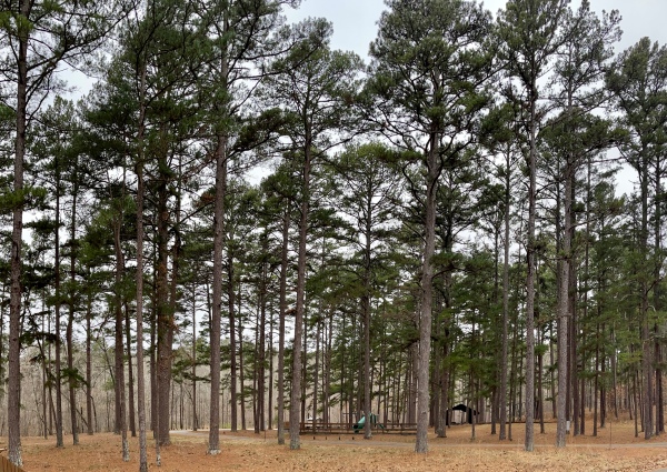
We began our hike on the main paved trail. This is where most visitors confine themselves during a visit to this place, so the picture here documents a rare sight — no people! I apologize for its lack of focus, a consequence of the limitations of my little point-and-shoot camera in the limited amount of light that makes it through these towering trees during late afternoon.

Standing beneath one of these trees and looking up is a lesson in insignificance — the feeling one gets looking straight up the trunk of one of these giants cannot be adequately captured on film (er… microchip).

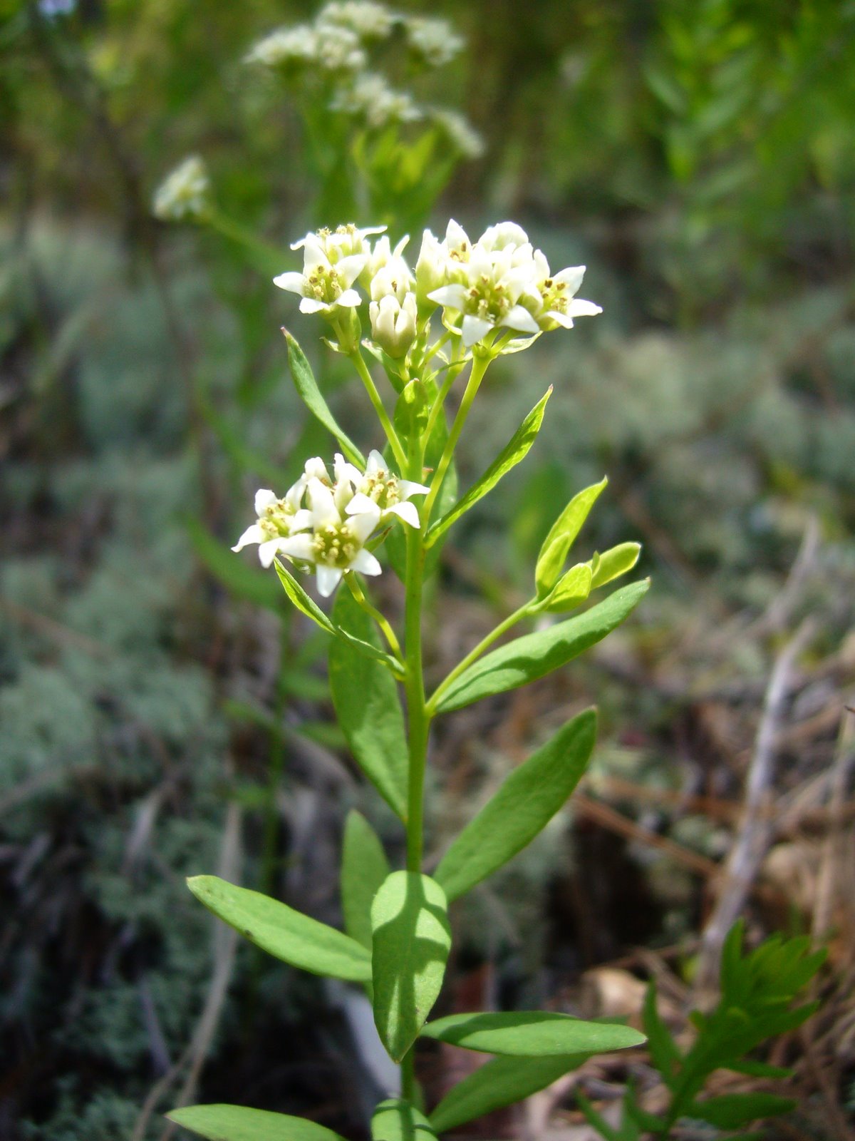
We quickly tired of the crowds and decided to hike up the Ocean View Trail, which climbs quite steeply up the east side of the valley. This marvelous trail was nearly devoid of people, and we found ourselves winding through thick, dark, cool forest with numerous side ravines. The lower elevations of the trail were dominated by redwood trees and a spectacular array of spring wildflowers. Among the most common was California toothwort (Cardamine  californica [=Dentaria californica]), a member of the mustard family (Brassicaceae). I noticed that the leaves at the base of the plant were broad and oval, while those arising from the flower stalk were slender and lanceolate, often divided into 3 leaflets.

Wake robins (genus Trillium), belonging to the lily family (Liliaceae, sometimes separated into the lily-of-the-valley family, Convallariaceae), are among my favorite wildflowers. We soon noticed Western wake robin (Trillium ovatum) growing commonly in shaded areas along the trail. We were also seeing some purple-flowered wake robins — at first I thought they were a different species, but it soon became apparent that these were older Western wake robin flowers, which change color from white to purple as they age.

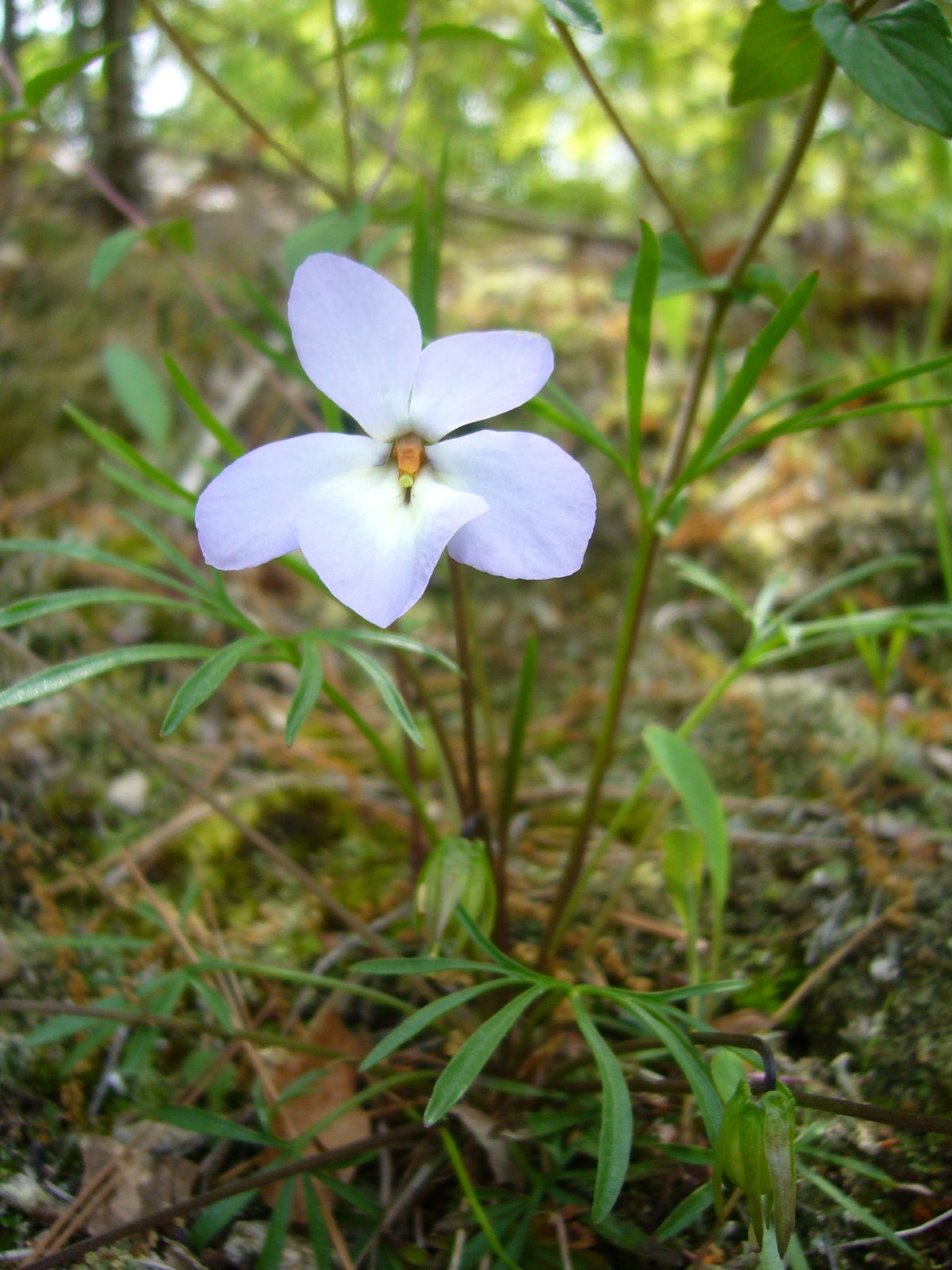
A little further up the trail we began encountering small patches of Mountain iris (Iris douglasiana, family Iridaceae). Flower color for this native species ranges from cream-white to lavender, but all of the flowers we saw were of the white variety.

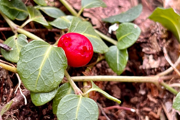
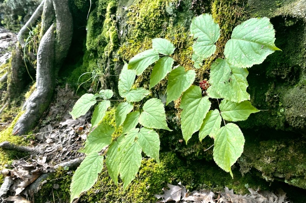
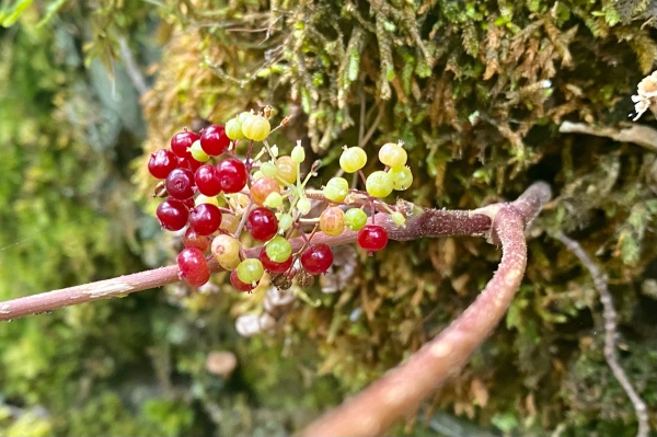
We saw this fat Solomon’s seal (Maianthemum racemosum ssp. amplexicaule [=Smilacina racemosa var. amplexicaulis]) growing in one of the cool, moist, side ravines. This is another member of the Liliaceae (sometimes separated into the Convallariaceae). The large, oval leaves clasping around the distinct, unbranched stem were almost as attractive as the flowers, which apparently give rise to bright scarlet berries in the summer.

In the middle elevations the redwood forest transitioned to drier oak woodland containing a mixture of Douglas-fir (Pseudotsuga menziesii), Pacific madrone (Arbutus menziesii), bigleaf maple (Acer macrophyllum), and tan oak (Lithocarpus densiflorus). Some of the Douglas-firs were enormous.


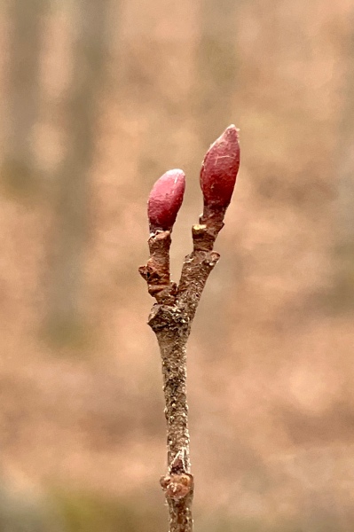
Indian warrior (Pedicularis densiflora) is a member of the figwort family (Scrophulariaceae, sometimes separated into the Orobanchaceae). This plant, with its striking bright red flowers and finely divided, fern-like leaves, is a facultative parasite on the roots of other plants. Apparently, the genus name refers to an old superstition that sheep could become infested with lice if they ate this plant.


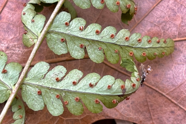
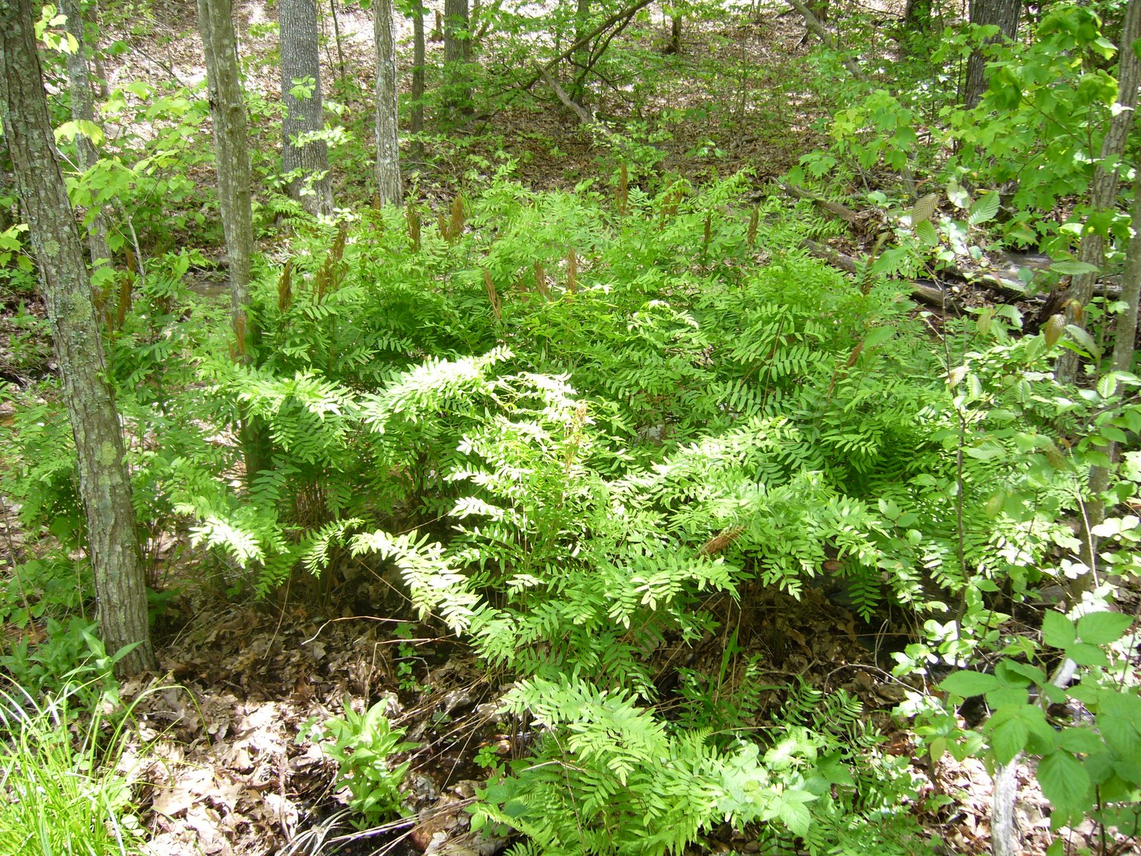
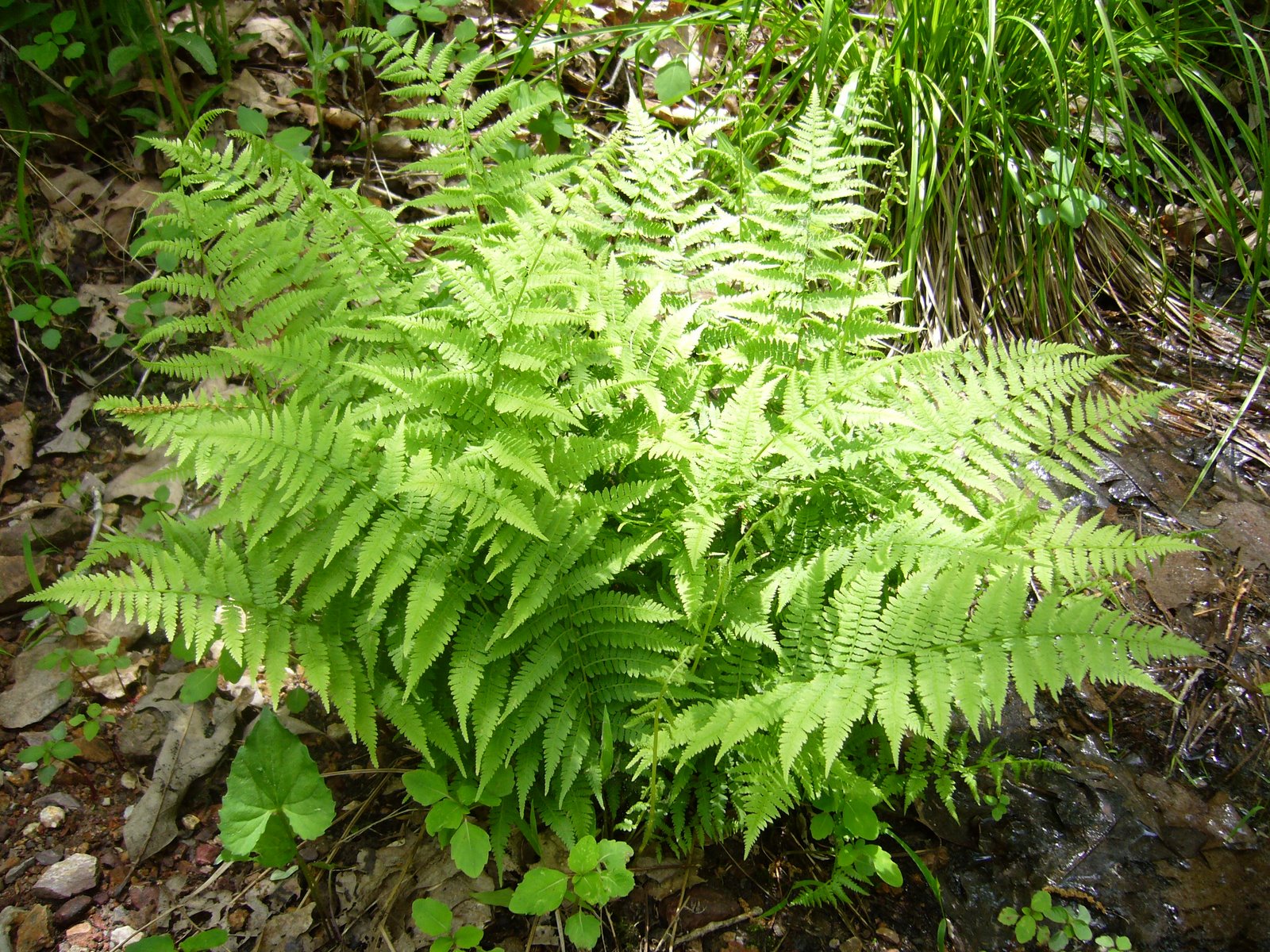
The juncture of the Ocean View Trail with the Lost Trail was closed, so we backtracked down the 1+ miles back to the main paved trail. By now it was fairly late in the afternoon, and the crowds had thinned considerably. Having gotten lots of good views of the giant trees, we began turning our attention downwards to the smaller understory flora. Ferns, of course, are a dominant component of this understory, especially along Redwood Creek. This large specimen may represent Western sword fern (Polystichum munitum) (family Dryopteridaceae), which can apparently be distinguished by small hilt-like projections from the base of the pinnae (leaflets), but I couldn’t get close enough to see for sure.


Abundant on the ground in the valley was redwood sorrell (Oxalis oregana), a member of the family Oxalidaceae. In places this plant covered the ground in thick carpets.


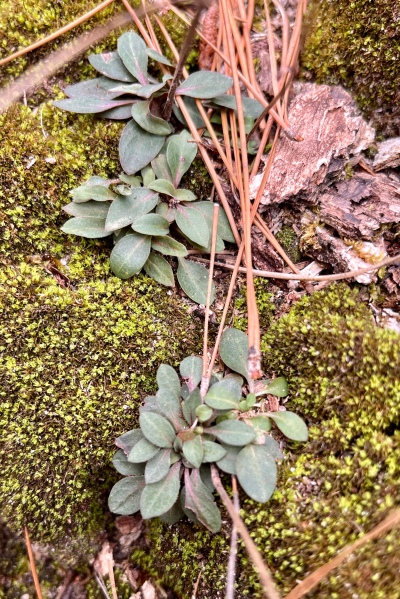
Among the more interesting plants we saw in the valley was California fetid adder’s tongue (Scoliopus bigelovii), yet another member of the Liliaceae or Convallariaceae. I wasn’t sure what this plant was at first, despite its highly distinctive, glossy, mottled foliage. We were too late to see the blooms, which apparently have a fetid odor to attract flies for pollination, but did find the maturing pods on their slender, drooping stems.


Close to the creek’s edge we saw this colony of horsetails (Equisetum sp.), primitive plants in the family Equisetaceae. Members of this group belong to one of the most ancient lineages of vascular plants, dating back to the Devonian period (416-359 million years ago). Their Paleozoic ancestors (Calamitaceae and Archaeocalamitaceae) were giants, reaching heights of 50 ft or more, and were major components of the Carboniferous swamplands. Along with lycopod trees (Lepidodendrales), they were important contributors to coal formation and, like the lycopods, became extinct by the mid-Permian (~270 million years ago). The genus Equisetum represents the only surviving descendants of this lineage. Unlike their extinct progenitors, these small, herbaceous plants rarely exceed 4 ft in height; however, they share many of the same characters such as articulate stems with microphylls arranged in whorls. Recent phylogenetic studies, using both molecular and morphological characters, suggest that horsetails, together with ferns, form a clade representing one of the three major lineages of vascular plants (Pryer et al. 2001).


Nearby we saw a patch of Giant wake robin (Trillium chloropetalum) in flower. These were taller than the California wake robins we saw on the slopes of the Ocean View Trail but similarly characterized by a whorl of 3 leaves and flowers composed of 3 erect petals. Mature flowers darken to a deep red purple, so it seems these plants had just begun flowering. Muir Woods appears to be a good place for observing a diversity of Convallariaceae!


Also along Redwood Creek we found this bigleaf maple (Acer macrophyllum) in full bloom. As its specific epithet suggests, this maple has the largest leaves of any member of the genus — in this example the newly-expanded leaves were distinctly purplish. The picture below shows the greenish-yellow flowers (petals inconspicuous) produced on long, pendulous racemes.


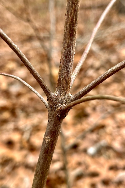
Interpretive signs along the paved main trail pointed out a redwood “family group,” formed by sprouts growing from the base of a larger tree. Eventually, the central “mother” tree died and decayed away, leaving a ring of offspring that mature into an enormous, characteristic circle of trees. This apparently also happens with other types of trees, though on a smaller scale, as demonstrated in this picture of an oak (Quercus sp.) family group.


As the day drew to a close we found ourselves back in the parking lot, where this California icon, a clump of Coast live oak (Quercus agrifolia), was spreading its wide, majestic crown from multiple, twisted trunks and gnarled branches.


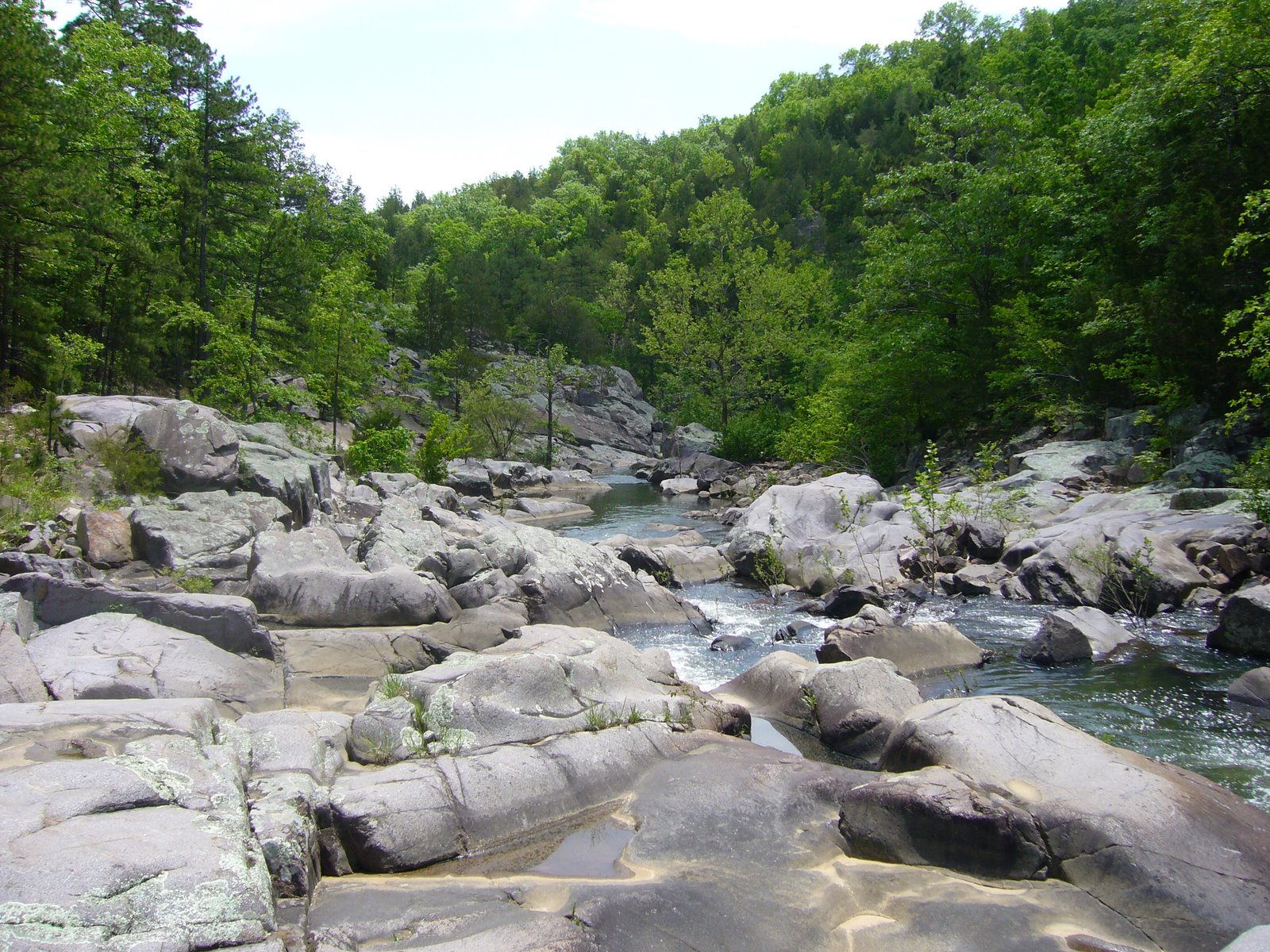
Much too soon, it was time to leave this beautiful valley, but before heading back to Sacramento we stopped to take one last look down towards the valley and out to the Pacific Ocean from the Panoramic Highway.

Pickle Springs Natural Area

Pickle Springs Natural Area lies in Ste. Genevieve County, about an hour south of St. Louis. Like Hawn State Park, the geology of this area and its effect on the flora have resulted in a unique collection of geologic features and plants found in few other places. The Lamotte sandstone outcrops that dot the landscape were formed nearly half a billion years ago when sand deposited in an extensive maze of braided river channels was cemented and buried under younger layers of limestone and dolomite formed from deposits on the floors of ancient seas that covered the interior of the continent. Later, the periods of uplift that created the St. Francois Mountains and resulting erosion of overlying strata once again exposed the sandstones at the surface. Millions of years of water, ice, rain, wind, and plants have further shaped the exposed sandstones, creating fanstastic shapes and formations and cool, deep canyons. The weathered sandstone created acid soils which support many unique plants. During the ice ages, northern plants and animals moved into the area ahead of the advancing glaciers. Mammoths roamed the landscape grazing on the northern vegetation supported by the area’s acid soils. Eventually the ice retreated, and so did the mammoths. But many of the plants remained – able to hang on in the cool, moist canyons long after the mammoths that once roamed these canyons disappeared. Because of this unique concentration of rare plants and geologic features, the area has been designated a Missouri Natural Area and a National Natural Landmark.

Yesterday I hiked the aptly-named ‘Trail Through Time’ with my family. This 2-mile trail is one of the most “feature-packed” trails in the state, with something to look at around almost every bend. Almost immediately the trail leads to the Slot, the result of a vertical fracture in the Lamotte sandstone that was loosened by leaching and then widened by erosion. The unique partridge berry (Mitchella repens) was seen on the moist, vertical walls of the rock, growing among strange holes, pockets, and ridges that formed as a result of the sand grains being variably cemented.


A short distance from The Slot lie Cauliflower Rocks – large moundlike formations (also called hoodoos or rock pillars) formed from jointed or fractured sandstone that undergoes deep solutional weathering followed by erosion and weather-mediated shaping. Hoodoos occur primarily in this type of rock due to its granular, variably cemented and cross-bedded matrix.


On the south side of Cauliflower Rocks lies a special type of buttress arch called Double Arch. It occurs at almost a right angle to the adjacent rock outrcrops, suggesting formation along a set of fractures running perpendicular to the main fracture trend of the area, but the precise details of its formation remain a mystery.


After leaving Cauliflower Rocks the trail descends steeply into a deep valley, at the bottom of which lies Pickle Creek just below its origin in a box canyon south of the Natural Area. Lush vegetation in this cool, moist valley contrasts with the stark rocks seen earlier.


The creek is fed by a series of seeps, allowing the valley to remain moist even during the dry summer months, and along with the acid soils support a unique plant community. Lush colonies of ferns (I believe this is Polypodium virginianum L.) covered the rocks adjacent to the creek…


…while this rattlesnake plantain orchid (Goodyera pubescens) was seen in a colony growing at the base of a black oak tree (Quercus velutina) just above the creek.


Mosses and lichens were also abundant in the valley. This little hair cap moss (Polytrichum sp.) with its distinctive fruiting structures was growing in a colony at the base of another black oak tree. The members of this genus prefer acidic environments.


Further ahead, along Bone Creek, several colonies of wooly aphids (family Aphididae) were seen on the branches of a small hop hornbeam tree (Ostrya virginiana).


The highlight of the hike had to be in Spirit Canyon at Owl’s Den Bluff. The horizontal layers of sandstone, each deposited on the steep downstream slopes of sandbars, are clearly visible in the towering bluff face. At the bottom lie bluff shelters – formed where lower sandstone layers collapse due to weathering or leaching, and where native Americans almost surely camped out. The sun never reaches parts of these shelters, providing ideal conditions for a variety of mosses and liverworts – many of which are known only from this area. Fallen boulders and collapsed portions of the bluff face provided photo opps for the daring…


…and good exploring for the nimble.


By now, the trail has passed the halfway point and is looping back to the west, where it ascends to Dome Rock Overlook. Along the way, a fascinating variety of lichens, including reindeer lichen, covers the forest floor where they are supported by the acid soils.


Dome Rock Overlook is a the largest hoodoo complex in the Natural Area. The thin soils and exposed conditions create a harsh, dry, windswept environment that only the hardiest of plants can withstand. Only a few small blackjack oaks (Quercus marilandica), shortleaf pines (Pinus echinata), and farkleberry (Vaccinium arboreum) survive here. Despite their small size, some of the trees growing here are at least 150 years old.


The trail descends from Dome Rock Overlook and passes underneath, providing spectacular views of the sheer rock face below the overlook. The trail completes its descent back into Pickle Creek Valley, where Pickle Spring can be seen. This small, permanent spring – an unusual feature in sandstone where seeps are more common – was an important source of water for early settlers.


Further along the trail lies one of the areas most unusual features – Rockpile Canyon – formed some 50 years ago (a fraction of a second in geologic time) when part of a sandstone bluff collapsed in a rumble, leaving behind a sheer bluff face and a jumbled pile of large boulders. A short spur in the trail leads to the head of a small box canyon, where some of the 20+ ice age relict plant species can be seen growing in the acid soils and cool, moist canyon walls.

Near the end of the loop lies Piney Glade, an area where the exposed sandstone bedrock once again creates a dry, harsh environment. Poverty grass and little bluestem grow in small, shallow pockets of soil scattered amongst stunted shortleaf pines and blackjack oaks – creating a small prairie surrounded by a sea of forest. All three forms of lichens can be found on the rocks and soils of the glade – the aptly named crustose lichens cling tightly to rock surfaces amongst foliose (leafy) and fruticose (branched) lichens.